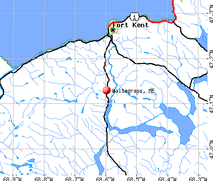
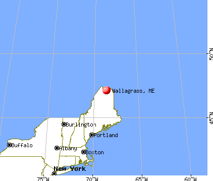
Wallagrass, Maine
Submit your own pictures of this town and show them to the world
- OSM Map
- General Map
- Google Map
- MSN Map
Population change since 2000: -2.7%
 |
| Males: 283 | |
| Females: 263 |
| Median resident age: | 47.3 years |
| Maine median age: | 43.0 years |
Zip codes: 04781.
| Wallagrass: | $52,512 |
| ME: | $69,543 |
Estimated per capita income in 2022: $28,484 (it was $13,802 in 2000)
Wallagrass town income, earnings, and wages data
Estimated median house or condo value in 2022: $153,990 (it was $63,600 in 2000)
| Wallagrass: | $153,990 |
| ME: | $290,600 |
Mean prices in 2022: all housing units: $179,108; detached houses: $185,023; townhouses or other attached units: $218,327; in 2-unit structures: $262,505; in 3-to-4-unit structures: $121,406; in 5-or-more-unit structures: $185,084; mobile homes: $117,009; occupied boats, rvs, vans, etc.: $12,682
Detailed information about poverty and poor residents in Wallagrass, ME


- 53097.1%White alone
- 61.1%Two or more races
- 50.9%Black alone
- 30.5%Hispanic
- 20.4%American Indian alone

Races in Wallagrass detailed stats: ancestries, foreign born residents, place of birth
 Recent articles from our blog. Our writers, many of them Ph.D. graduates or candidates, create easy-to-read articles on a wide variety of topics.

 | Maine Demographics (36 replies) |
| Best French-Canadian flavor towns in Maine? (19 replies) |
| small town/villages to relocate to - no military presence (30 replies) |
| Considering Maine (54 replies) |
| Anyone from Saint Francis Maine (18 replies) |
| Moving to Aroostook County but working in Madawaska, where to live??? (12 replies) |
Latest news from Wallagrass, ME collected exclusively by city-data.com from local newspapers, TV, and radio stations
Ancestries: French (63.5%), United States (10.9%), French Canadian (7.3%), German (4.6%), Irish (4.1%), English (3.6%).
Current Local Time: EST time zone
Incorporated on 06/04/1979
Elevation: 881 feet
Land area: 39.8 square miles.
Population density: 14 people per square mile (very low).
18 residents are foreign born (3.2% North America).
| This town: | 3.2% |
| Maine: | 2.9% |
| Wallagrass town: | 1.0% ($627) |
| Maine: | 1.5% ($1,417) |
Nearest city with pop. 50,000+: Portland, ME  (254.0 miles , pop. 64,249).
Nearest city with pop. 200,000+: Boston, MA (355.3 miles , pop. 589,141).
Nearest city with pop. 1,000,000+: Bronx, NY (508.1 miles , pop. 1,332,650).
Nearest cities:
), ), ), Latitude: 47.15 N, Longitude: 68.61 W
Area code commonly used in this area: 207


Single-family new house construction building permits:
- 2021: 1 building, cost: $92,800
- 2017: 3 buildings, average cost: $173,300
- 2016: 2 buildings, average cost: $162,500
- 2015: 4 buildings, average cost: $118,300
- 2014: 1 building, cost: $250,000
- 2013: 4 buildings, average cost: $106,000
- 2011: 2 buildings, average cost: $130,000
- 2010: 1 building, cost: $150,000
- 2008: 1 building, cost: $300,000
- 2007: 8 buildings, average cost: $141,900
- 2006: 4 buildings, average cost: $143,000
- 2003: 4 buildings, average cost: $132,800
- 2002: 3 buildings, average cost: $130,700
- 2001: 2 buildings, average cost: $121,400
- 2000: 2 buildings, average cost: $90,500


| Here: | 3.8% |
| Maine: | 3.4% |


- Health care (17.4%)
- Educational services (15.7%)
- Agriculture, forestry, fishing & hunting (8.5%)
- Wood products (8.5%)
- Apparel (4.7%)
- Motor vehicle & parts dealers (4.2%)
- Construction (3.8%)

- Agriculture, forestry, fishing & hunting (16.1%)
- Wood products (14.5%)
- Health care (8.9%)
- Construction (7.3%)
- Truck transportation (7.3%)
- Motor vehicle & parts dealers (6.5%)
- Educational services (6.5%)

- Health care (26.8%)
- Educational services (25.9%)
- Apparel (8.0%)
- Social assistance (6.2%)
- Food (4.5%)
- Food & beverage stores (4.5%)
- Broadcasting & telecommunications (4.5%)

- Other production occupations, including supervisors (7.6%)
- Nursing, psychiatric, and home health aides (5.9%)
- Other management occupations, except farmers and farm managers (4.7%)
- Driver/sales workers and truck drivers (4.2%)
- Preschool, kindergarten, elementary, and middle school teachers (3.8%)
- Fishing, hunting, and forestry occupations (3.8%)
- Textile, apparel, and furnishings workers (3.4%)

- Other production occupations, including supervisors (13.7%)
- Driver/sales workers and truck drivers (8.1%)
- Fishing, hunting, and forestry occupations (7.3%)
- Building and grounds cleaning and maintenance occupations (5.6%)
- Agricultural workers, including supervisors (5.6%)
- Vehicle and mobile equipment mechanics, installers, and repairers (5.6%)
- Retail sales workers, except cashiers (4.8%)

- Preschool, kindergarten, elementary, and middle school teachers (8.0%)
- Other management occupations, except farmers and farm managers (8.0%)
- Nursing, psychiatric, and home health aides (8.0%)
- Counselors, social workers, and other community and social service specialists (7.1%)
- Secretaries and administrative assistants (7.1%)
- Textile, apparel, and furnishings workers (7.1%)
- Child care workers (6.2%)
Average climate in Wallagrass, Maine
Based on data reported by over 4,000 weather stations


(lower is better)

Air Quality Index (AQI) level in 2022 was 27.1. This is significantly better than average.
| City: | 27.1 |
| U.S.: | 72.6 |

Particulate Matter (PM10) [µg/m3] level in 2022 was 10.6. This is significantly better than average. Closest monitor was 19.8 miles away from the city center.
| City: | 10.6 |
| U.S.: | 19.2 |
Earthquake activity:
Wallagrass-area historical earthquake activity is above Maine state average. It is 87% smaller than the overall U.S. average.On 7/14/2006 at 09:34:48, a magnitude 3.9 (3.9 MD, Depth: 8.6 mi, Class: Light, Intensity: II - III) earthquake occurred 19.2 miles away from Wallagrass center
On 4/20/2002 at 10:50:47, a magnitude 5.3 (5.3 ML, Depth: 3.0 mi, Class: Moderate, Intensity: VI - VII) earthquake occurred 305.3 miles away from the city center
On 4/20/2002 at 10:50:47, a magnitude 5.2 (5.2 MB, 4.2 MS, 5.2 MW, 5.0 MW) earthquake occurred 307.2 miles away from Wallagrass center
On 10/7/1983 at 10:18:46, a magnitude 5.3 (5.1 MB, 5.3 LG, 5.1 ML) earthquake occurred 354.6 miles away from Wallagrass center
On 10/16/2012 at 23:12:25, a magnitude 4.7 (4.7 ML, Depth: 10.0 mi, Class: Light, Intensity: IV - V) earthquake occurred 264.9 miles away from Wallagrass center
On 1/19/1982 at 00:14:42, a magnitude 4.7 (4.5 MB, 4.7 MD, 4.5 LG) earthquake occurred 291.1 miles away from the city center
Magnitude types: regional Lg-wave magnitude (LG), body-wave magnitude (MB), duration magnitude (MD), local magnitude (ML), surface-wave magnitude (MS), moment magnitude (MW)
Natural disasters:
The number of natural disasters in Aroostook County (22) is greater than the US average (15).Major Disasters (Presidential) Declared: 13
Emergencies Declared: 9
Causes of natural disasters: Floods: 10, Storms: 8, Snows: 7, Heavy Rains: 2, Blizzard: 1, Hurricane: 1, Ice Storm: 1, Snowfall: 1, Snowstorm: 1, Wind: 1, Winter Storm: 1, Other: 2 (Note: some incidents may be assigned to more than one category).

Colleges/universities with over 2000 students nearest to Wallagrass:
- University of Maine (about 156 miles; Orono, ME; Full-time enrollment: 8,931)
- Husson University (about 161 miles; Bangor, ME; FT enrollment: 2,421)
- University of Maine at Farmington (about 187 miles; Farmington, ME; FT enrollment: 2,036)
- University of Maine at Augusta (about 203 miles; Augusta, ME; FT enrollment: 3,204)
- Saint Joseph's College of Maine (about 248 miles; Standish, ME; FT enrollment: 2,010)
- University of Southern Maine (about 255 miles; Portland, ME; FT enrollment: 6,647)
- Southern Maine Community College (about 255 miles; South Portland, ME; FT enrollment: 4,666)
Public elementary/middle school in Wallagrass:
- WALLAGRASS ELEMENTARY SCHOOL (Location: 45 CHURCH ST 9, Grades: PK-5)
Points of interest:
Notable locations in Wallagrass: Fire Wardens Camp (A), Fort Kent Pit (B), Wallagrass Station (C), Labby (D), Michaud Siding (E), Belanger Settlement (F), Belanger Sugar Camp (G). Display/hide their locations on the map
Church in Wallagrass: Saint Josephs Church (A). Display/hide its location on the map
Cemeteries: Saint Josephs Cemetery (1), Saint Josephs the Helper Cemetery (2). Display/hide their locations on the map
Lakes and swamps: Ben Lake (A), First Lake (B), Labbe Pond (C), Marcial Lake (D), Spaulding Ponds (E), Mud Lake (F). Display/hide their locations on the map
Streams, rivers, and creeks: Spaulding Brook (A), Wallagrass Stream (B), Saint Almond Brook (C), Martin Brook (D), Drake Brook (E), Carter Brook (F), Buggy Brook (G). Display/hide their locations on the map
Drinking water stations with addresses in Wallagrass and their reported violations in the past:
TRACK DOWN KENNELS & LODGE (Population served: 25, Groundwater):Past health violations:Past monitoring violations:
- MCL, Acute (TCR) - In OCT-2007, Contaminant: Coliform. Follow-up actions: St Tech Assistance Visit (NOV-02-2007), St Compliance Meeting conducted (NOV-02-2007), St Boil Water Order (NOV-02-2007), St Public Notif requested (NOV-02-2007), St Formal NOV issued (NOV-02-2007), St Public Notif received (NOV-30-2007), St Compliance achieved (MAY-07-2008)
- MCL, Monthly (TCR) - In SEP-2007, Contaminant: Coliform. Follow-up actions: St Formal NOV issued (SEP-17-2007), St Public Notif requested (SEP-17-2007), St Compliance achieved (MAY-07-2008), St Intentional no-action (SEP-15-2011)
- MCL, Monthly (TCR) - In AUG-2007, Contaminant: Coliform. Follow-up actions: St Formal NOV issued (SEP-10-2007), St Public Notif requested (SEP-10-2007), St Public Notif received (SEP-26-2007), St Compliance achieved (MAY-07-2008)
- MCL, Monthly (TCR) - In JAN-2007, Contaminant: Coliform. Follow-up actions: St Public Notif requested (JAN-08-2007), St Violation/Reminder Notice (JAN-08-2007), St Compliance achieved (MAY-07-2008), St Intentional no-action (SEP-15-2011)
- 3 routine major monitoring violations
- One minor monitoring violation
- 2 regular monitoring violations
| This town: | 2.2 people |
| Maine: | 2.3 people |
| This town: | 66.4% |
| Whole state: | 62.9% |
| This town: | 9.0% |
| Whole state: | 9.4% |
Likely homosexual households (counted as self-reported same-sex unmarried-partner households)
- Lesbian couples: 0.8% of all households
- Gay men: 0.0% of all households
| This town: | 11.5% |
| Whole state: | 10.9% |
| This town: | 2.4% |
| Whole state: | 4.1% |
For population 15 years and over in Wallagrass:

- Never married: 22.2%
- Now married: 65.7%
- Separated: 0.0%
- Widowed: 5.6%
- Divorced: 6.5%
For population 25 years and over in Wallagrass:
- High school or higher: 75.1%
- Bachelor's degree or higher: 17.5%
- Graduate or professional degree: 3.9%
- Unemployed: 6.0%
- Mean travel time to work (commute): 24.0 minutes


| Here: | 13.1 |
| Maine average: | 11.2 |


Graphs represent county-level data. Detailed 2008 Election Results
Religion statistics for Wallagrass, ME (based on Aroostook County data)


| Religion | Adherents | Congregations |
|---|---|---|
| Catholic | 22,200 | 27 |
| Mainline Protestant | 5,845 | 40 |
| Evangelical Protestant | 4,411 | 51 |
| Other | 957 | 7 |
| Orthodox | 10 | 1 |
| None | 38,447 | - |
Food Environment Statistics:
| Aroostook County: | 4.03 / 10,000 pop. |
| Maine: | 2.80 / 10,000 pop. |
| Aroostook County: | 0.14 / 10,000 pop. |
| Maine: | 0.14 / 10,000 pop. |
| This county: | 2.22 / 10,000 pop. |
| Maine: | 2.20 / 10,000 pop. |
| Aroostook County: | 7.78 / 10,000 pop. |
| Maine: | 5.75 / 10,000 pop. |
| Here: | 9.17 / 10,000 pop. |
| Maine: | 11.02 / 10,000 pop. |
| Here: | 11.7% |
| Maine: | 8.2% |
| Here: | 27.6% |
| Maine: | 25.0% |
Strongest AM radio stations in Wallagrass:
- WFST (600 AM; 5 kW; CARIBOU, ME; Owner: NORTHERN BROADCAST MINISTRIES, INC.)
- WEGP (1390 AM; 5 kW; PRESQUE ISLE, ME; Owner: DECELLES/SMITH MEDIA, INC.)
- WREM (710 AM; daytime; 5 kW; MONTICELLO, ME; Owner: ALLAN H WEINER)
- WRKO (680 AM; 50 kW; BOSTON, MA; Owner: ENTERCOM BOSTON LICENSE, LLC)
- WCHP (760 AM; 35 kW; CHAMPLAIN, NY; Owner: CHAMPLAIN RADIO, INC.)
- WNNZ (640 AM; 50 kW; WESTFIELD, MA; Owner: CLEAR CHANNEL BROADCASTING LICENSES, INC.)
- WEEI (850 AM; 50 kW; BOSTON, MA; Owner: ENTERCOM BOSTON LICENSE, LLC)
- WCRN (830 AM; 50 kW; WORCESTER, MA; Owner: CARTER BROADCASTING CORPORATION)
- WBZ (1030 AM; 50 kW; BOSTON, MA; Owner: INFINITY BROADCASTING OPERATIONS, INC.)
- WGY (810 AM; 50 kW; SCHENECTADY, NY; Owner: CLEAR CHANNEL BROADCASTING LICENSES, INC.)
- WICY (1490 AM; 50 kW; MALONE, NY; Owner: CARTIER COMMUNICATIONS INC.)
- WALE (990 AM; 50 kW; GREENVILLE, RI; Owner: NORTH AMERICAN BROADCASTING CO., INC.)
- WKOX (1200 AM; 50 kW; FRAMINGHAM, MA; Owner: CAPSTAR TX LIMITED PARTNERSHIP)
Strongest FM radio stations in Wallagrass:
- WMEF (106.5 FM; FORT KENT, ME; Owner: MAINE PUBLIC BROADCASTING CORP)
- WBPW (96.9 FM; PRESQUE ISLE, ME; Owner: CITADEL BROADCASTING COMPANY)
- WCXX (102.3 FM; MADAWASKA, ME; Owner: THE CANXUS BROADCASTING CORPORATION)
- WUFK (92.1 FM; FORT KENT, ME; Owner: UNIVERSITY OF MAINE SYSTEM)
TV broadcast stations around Wallagrass:
- W11AY (Channel 11; ST. JOHN PLANTATION, ME; Owner: TOWN OF SAINT JOHN)
- National Bridge Inventory (NBI) Statistics
- 3Number of bridges
- 30ft / 9.4mTotal length
- 3,920Total average daily traffic
- 196Total average daily truck traffic
- 5,880Total future (year 2036) average daily traffic
FCC Registered Cell Phone Towers:
2 (See the full list of FCC Registered Cell Phone Towers in Wallagrass)FCC Registered Antenna Towers:
10 (See the full list of FCC Registered Antenna Towers)FCC Registered Microwave Towers:
1- WALLAGRASS, 1639 Aroostook Rd (Lat: 47.150278 Lon: -68.601889), Type: Gtower, Structure height: 121.9 m, Overall height: 125.6 m, Call Sign: WPON663,
Assigned Frequencies: 6034.15 MHz, 6034.15 MHz, 6034.15 MHz, 6034.15 MHz, Grant Date: 03/10/2020, Expiration Date: 04/14/2030, Certifier: H. Donald Nelson, Registrant: Wilkinson Barker Knauer, LLP, 1800 M Street Nw, Suite 800n, Washington, DC 20036, Phone: (202) 383-3420, Fax: (202) 783-5851, Email:
Wallagrass compared to Maine state average:
- Median house value below state average.
- Unemployed percentage below state average.
- Black race population percentage below state average.
- Hispanic race population percentage significantly below state average.
- Median age above state average.
- Renting percentage below state average.
- Length of stay since moving in significantly above state average.
- Number of rooms per house significantly below state average.
- House age significantly below state average.
- Percentage of population with a bachelor's degree or higher below state average.