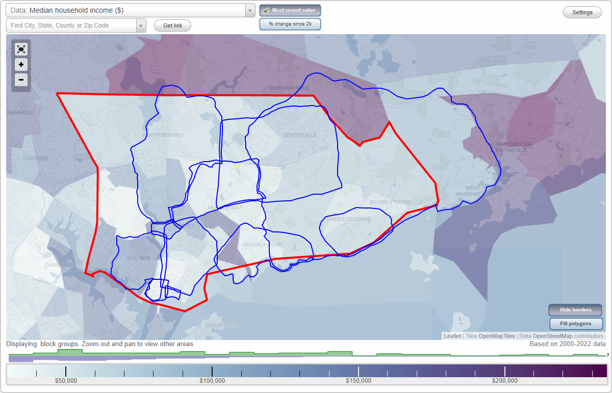
Beverly, Massachusetts Neighborhood Map - Income, House Prices, Occupations, Boundaries
Settings
X

- City boundary
- Neighborhood boundaries
Business Search - 14 Million verified businesses
Neighborhoods:
Beverly Farms, Centerville, Downtown, Fish Flake Hill, Gloucester Crossing, Goat Hill, Montserrat, North Beverly, Prides Crossing, Rial Side, The CoveBeverly Farms neighborhood in Beverly statistics: (Find on map)
Area: 9.631 square miles
Population: 23,156
Population density:
Median household income in 2021:
Median rent in in 2021:
Male vs Females
Median age
Most popular occupations of males: management occupations (except farmers) (30.0%); business and financial operations occupations (19.8%); sales and office occupations (14.5%); education, training, and library occupations (10.4%); healthcare practitioners and technical occupations (8.1%); service occupations (7.7%); architecture and engineering occupations (6.6%)
Most popular occupations of females: sales and office occupations (21.0%); healthcare practitioners and technical occupations (14.6%); management occupations (except farmers) (14.4%); business and financial operations occupations (11.6%); service occupations (11.2%); education, training, and library occupations (8.8%); architecture and engineering occupations (4.6%)
Highways in this neighborhood: Yankee Division Hwy (State Hwy 128); Hale St (State Hwy 127); Bridge St (State Hwy 127); State Hwy 22 (Essex St); State Hwy 127 (West St); State Hwy 127 (Central St).
Roads and streets: Pine St (Pipeline Line Rd); Grapevine Rd; Hull St; Common Ln; Greenwood Ave; Hart St; Walker Rd; Middlebury Ln; Forster Rd; Thoreau Cir; Pole Swamp Ln; Standley St; Valley St; Preston Pl; Boardman Ave; Paine Ave; Wood Ln; Woodholm Rd; Jersey Ln; Grover St; Second Ave; Boyles St; Thissell St; Harbor St; Hathaway Ave; Haskell St; Norton's Point Rd; Crooked Ln; Juniper St; Kennell Hill Dr; Parsons Hill Rd; Holly Ln; Rockwood Heights Rd; Wedgemere Rd; Millbrook Rd; Branch Ln; Sunnyvale St; Old Town Rd; Leather Ln; Wentworth Dr; Avalon Ave; Landers Dr; Cogswell Ave; Brookwood Rd; Tucks Point Rd; Highwood Rd; Oak St; Forty Five West St (Haven Way); Prince St; Foster St; Fern St; Temi Rd; Indian Hill; Noble Hill Rd; Bennett St; Ancient Rubbly Way; Deer Haven Rd; Cherry Rd; Everett St; Old Rubbly Rd; Webster Ave; Gussett Rd; Woodcrest Rd; Cobblers Ln; High St; Connor Rd; Hillcrest Rd; Driscoll Ln; Ashland Ave; Rezza Rd (Pvt Anthony Rezza Rd); Brookhead Ave; Harwood St; Gateway Ln; Hull Ln; Scenna Rd; Goodwin Rd; Beach St; Vine St; Highland Ave; Pillowlace Ln; Cross Ln; Arbella Dr; Ox Pasture Rd; Grove St; Eagle Ln; Patti Rd; Miller Rd; Robinson Rd; Pine Knoll Dr; Tall Tree Dr; Dondi Rd; Curtis Pt; Farms Ln; Morgan's Island Rd; Shannon Ln; Cole St; Onion River Rd; Adeline Rd; Boulder Ln; Old Standley St; Hickory Ln; Stone Ridge Rd; Robin Rd; Independence Cir; Dyer Rd; Emerson Cir; Whitman Pl; Aricia Ln; Brandt Cir; Fieldstone Ln; Sunday Dr; Wadsworth Pl; Charles Davis Dr; Converse Ct; Chapel Hill Rd; Piper Dr; Hemlock St; Dix Way; Marshall Rd; Thomas Rd; Essex Ave; Running Ridge Rd; Alcann Rd; Thackery Way; Crafts Ct; Deer Hill Rd; Tanglewood Rd; Witch Ln; Boyden St; Horse Hill Ln; Old Wenham Way; Pinewood Rd; Chubbs Brook Ln; Pickett Ct; Old Essex St; Arrowhead Ln; Bridle Path Ln; Woodholm Cir; Nicole Ave; Alcott Way; Forest St; Lafayette Ln; Parsons Ln; Sheehan's Way; Chanticleer Dr; Burley St; Greenleaf Dr; Anthony Ave; Orchard Ln; Boxwood Ln; Gavin Cir; Groce St; Sherwood Ln; Balsam Dr; Morse Ct; Alpine Rd; Atherton St; Ash St; Holworthy Way; York Ter; Toppan Ln; Stockwell Ln; Desmond Rd; Prides Park Ave; Connolly Pl; Canterbury Cir; Princemere Ln; Dexter Ln; Brooks Cir; Haskell Ave; Moses Hill Rd; Fox Hill Ct; Dickinson Way; Juniper Valley Ct; Stoneridge Rd; Woodholm Ln; Brice Ln.
Railroad features: Boston and Maine RR.
Other features: Chubb Crk; Curtis Brk; Plum Brk.
Beverly Farms neighborhood detailed profile
Area: 9.631 square miles
Population: 23,156
Population density:
| Beverly Farms: | 2,404 people per square mile |
| Beverly: | 2,557 people per square mile |
Median household income in 2021:
| Beverly Farms: | $175,539 |
| Beverly: | $89,882 |
Median rent in in 2021:
| Beverly Farms: | $1,766 |
| Beverly: | $1,332 |
Male vs Females
| Males: | 10,851 |
| Females: | 12,305 |
Median age
| Males: | 44.9 years |
| Females: | 49.9 years |
Most popular occupations of males: management occupations (except farmers) (30.0%); business and financial operations occupations (19.8%); sales and office occupations (14.5%); education, training, and library occupations (10.4%); healthcare practitioners and technical occupations (8.1%); service occupations (7.7%); architecture and engineering occupations (6.6%)
Most popular occupations of females: sales and office occupations (21.0%); healthcare practitioners and technical occupations (14.6%); management occupations (except farmers) (14.4%); business and financial operations occupations (11.6%); service occupations (11.2%); education, training, and library occupations (8.8%); architecture and engineering occupations (4.6%)
Highways in this neighborhood: Yankee Division Hwy (State Hwy 128); Hale St (State Hwy 127); Bridge St (State Hwy 127); State Hwy 22 (Essex St); State Hwy 127 (West St); State Hwy 127 (Central St).
Roads and streets: Pine St (Pipeline Line Rd); Grapevine Rd; Hull St; Common Ln; Greenwood Ave; Hart St; Walker Rd; Middlebury Ln; Forster Rd; Thoreau Cir; Pole Swamp Ln; Standley St; Valley St; Preston Pl; Boardman Ave; Paine Ave; Wood Ln; Woodholm Rd; Jersey Ln; Grover St; Second Ave; Boyles St; Thissell St; Harbor St; Hathaway Ave; Haskell St; Norton's Point Rd; Crooked Ln; Juniper St; Kennell Hill Dr; Parsons Hill Rd; Holly Ln; Rockwood Heights Rd; Wedgemere Rd; Millbrook Rd; Branch Ln; Sunnyvale St; Old Town Rd; Leather Ln; Wentworth Dr; Avalon Ave; Landers Dr; Cogswell Ave; Brookwood Rd; Tucks Point Rd; Highwood Rd; Oak St; Forty Five West St (Haven Way); Prince St; Foster St; Fern St; Temi Rd; Indian Hill; Noble Hill Rd; Bennett St; Ancient Rubbly Way; Deer Haven Rd; Cherry Rd; Everett St; Old Rubbly Rd; Webster Ave; Gussett Rd; Woodcrest Rd; Cobblers Ln; High St; Connor Rd; Hillcrest Rd; Driscoll Ln; Ashland Ave; Rezza Rd (Pvt Anthony Rezza Rd); Brookhead Ave; Harwood St; Gateway Ln; Hull Ln; Scenna Rd; Goodwin Rd; Beach St; Vine St; Highland Ave; Pillowlace Ln; Cross Ln; Arbella Dr; Ox Pasture Rd; Grove St; Eagle Ln; Patti Rd; Miller Rd; Robinson Rd; Pine Knoll Dr; Tall Tree Dr; Dondi Rd; Curtis Pt; Farms Ln; Morgan's Island Rd; Shannon Ln; Cole St; Onion River Rd; Adeline Rd; Boulder Ln; Old Standley St; Hickory Ln; Stone Ridge Rd; Robin Rd; Independence Cir; Dyer Rd; Emerson Cir; Whitman Pl; Aricia Ln; Brandt Cir; Fieldstone Ln; Sunday Dr; Wadsworth Pl; Charles Davis Dr; Converse Ct; Chapel Hill Rd; Piper Dr; Hemlock St; Dix Way; Marshall Rd; Thomas Rd; Essex Ave; Running Ridge Rd; Alcann Rd; Thackery Way; Crafts Ct; Deer Hill Rd; Tanglewood Rd; Witch Ln; Boyden St; Horse Hill Ln; Old Wenham Way; Pinewood Rd; Chubbs Brook Ln; Pickett Ct; Old Essex St; Arrowhead Ln; Bridle Path Ln; Woodholm Cir; Nicole Ave; Alcott Way; Forest St; Lafayette Ln; Parsons Ln; Sheehan's Way; Chanticleer Dr; Burley St; Greenleaf Dr; Anthony Ave; Orchard Ln; Boxwood Ln; Gavin Cir; Groce St; Sherwood Ln; Balsam Dr; Morse Ct; Alpine Rd; Atherton St; Ash St; Holworthy Way; York Ter; Toppan Ln; Stockwell Ln; Desmond Rd; Prides Park Ave; Connolly Pl; Canterbury Cir; Princemere Ln; Dexter Ln; Brooks Cir; Haskell Ave; Moses Hill Rd; Fox Hill Ct; Dickinson Way; Juniper Valley Ct; Stoneridge Rd; Woodholm Ln; Brice Ln.
Railroad features: Boston and Maine RR.
Other features: Chubb Crk; Curtis Brk; Plum Brk.
Beverly Farms neighborhood detailed profile
Centerville neighborhood in Beverly statistics: (Find on map)
Area: 3.018 square miles
Population: 3,005
Population density:
Median household income in 2021:
Male vs Females
Median age
Most popular occupations of males: management occupations (except farmers) (27.8%); sales and office occupations (16.1%); service occupations (8.3%); business and financial operations occupations (7.9%); education, training, and library occupations (7.2%); computer and mathematical occupations (7.0%); arts, design, entertainment, sports, and media occupations (5.0%)
Most popular occupations of females: sales and office occupations (37.0%); service occupations (17.6%); education, training, and library occupations (13.7%); management occupations (except farmers) (9.2%); healthcare practitioners and technical occupations (6.4%); business and financial operations occupations (4.4%); arts, design, entertainment, sports, and media occupations (4.2%)
Highways in this neighborhood: State Hwy 128 (Yankee Division Hwy); Essex St (State Hwy 22).
Roads and streets: Middlebury Ln; Hull St; Beaver Pond Rd; Thoreau Cir; Standley St; Wood Ln; Grover St; Cole St; Hathaway Ave; Kennell Hill Dr; Holly Ln; Wedgemere Rd; Millbrook Rd; Branch Ln; Sunnyvale St; Old Essex St; Walker Rd; Wentworth Dr; Meadow Rd; Landers Dr; Cogswell Ave; Foster St; Fern St; Temi Rd; Noble Hill Rd; Cherry Rd; Cobblers Ln; Connor Rd; Common Ln; Driscoll Ln; Old Essex Rd; Harwood St; Gateway Ln; Scenna Rd; Kelleher Rd; Pillowlace Ln; Arbella Dr; Eagle Ln; Patti Rd; Miller Rd; Robinson Rd; Pine Knoll Dr; Dondi Rd; Colon St; Old Standley St; Hickory Ln; Independence Cir; Emerson Cir; Whitman Pl; Aricia Ln; Brandt Cir; Fieldstone Ln; Thompson's Farm Way; Wadsworth Pl; Meeting Place Cir; Paradise Rd; Chapel Hill Rd; Piper Dr; Evelyn Rd; Marshall Rd; Thomas Rd; Essex Ave; Old Rubbly Rd; Alcann Rd; Thackery Way; Shannon Ln; Boyden St; Ice House Ln; Brimbal Ave; Cross Ln; Alcott Way; Forest St; Burley St; Greenleaf Dr; Boxwood Ln; Gavin Cir; Yankee Way; Groce St; Balsam Dr; Atherton St; Clipper Way; Ash St; Holworthy Way; York Ter; Desmond Rd; Marjorie Way; Canterbury Cir; Haskell Ave; Aston Way; Dickinson Way.
Railroad features: Boston and Maine RR.
Other features: Curtis Brk; Mackerel Riv.
Centerville neighborhood detailed profile
Area: 3.018 square miles
Population: 3,005
Population density:
| Centerville: | 996 people per square mile |
| Beverly: | 2,557 people per square mile |
Median household income in 2021:
| Centerville: | $154,375 |
| Beverly: | $89,882 |
Male vs Females
| Males: | 1,347 |
| Females: | 1,658 |
Median age
| Males: | 31.5 years |
| Females: | 21.6 years |
Most popular occupations of males: management occupations (except farmers) (27.8%); sales and office occupations (16.1%); service occupations (8.3%); business and financial operations occupations (7.9%); education, training, and library occupations (7.2%); computer and mathematical occupations (7.0%); arts, design, entertainment, sports, and media occupations (5.0%)
Most popular occupations of females: sales and office occupations (37.0%); service occupations (17.6%); education, training, and library occupations (13.7%); management occupations (except farmers) (9.2%); healthcare practitioners and technical occupations (6.4%); business and financial operations occupations (4.4%); arts, design, entertainment, sports, and media occupations (4.2%)
Highways in this neighborhood: State Hwy 128 (Yankee Division Hwy); Essex St (State Hwy 22).
Roads and streets: Middlebury Ln; Hull St; Beaver Pond Rd; Thoreau Cir; Standley St; Wood Ln; Grover St; Cole St; Hathaway Ave; Kennell Hill Dr; Holly Ln; Wedgemere Rd; Millbrook Rd; Branch Ln; Sunnyvale St; Old Essex St; Walker Rd; Wentworth Dr; Meadow Rd; Landers Dr; Cogswell Ave; Foster St; Fern St; Temi Rd; Noble Hill Rd; Cherry Rd; Cobblers Ln; Connor Rd; Common Ln; Driscoll Ln; Old Essex Rd; Harwood St; Gateway Ln; Scenna Rd; Kelleher Rd; Pillowlace Ln; Arbella Dr; Eagle Ln; Patti Rd; Miller Rd; Robinson Rd; Pine Knoll Dr; Dondi Rd; Colon St; Old Standley St; Hickory Ln; Independence Cir; Emerson Cir; Whitman Pl; Aricia Ln; Brandt Cir; Fieldstone Ln; Thompson's Farm Way; Wadsworth Pl; Meeting Place Cir; Paradise Rd; Chapel Hill Rd; Piper Dr; Evelyn Rd; Marshall Rd; Thomas Rd; Essex Ave; Old Rubbly Rd; Alcann Rd; Thackery Way; Shannon Ln; Boyden St; Ice House Ln; Brimbal Ave; Cross Ln; Alcott Way; Forest St; Burley St; Greenleaf Dr; Boxwood Ln; Gavin Cir; Yankee Way; Groce St; Balsam Dr; Atherton St; Clipper Way; Ash St; Holworthy Way; York Ter; Desmond Rd; Marjorie Way; Canterbury Cir; Haskell Ave; Aston Way; Dickinson Way.
Railroad features: Boston and Maine RR.
Other features: Curtis Brk; Mackerel Riv.
Centerville neighborhood detailed profile
Downtown neighborhood in Beverly statistics: (Find on map)
Area: 0.957 square miles
Population: 9,104
Population density:
Median household income in 2021:
Median rent in in 2021:
Male vs Females
Median age
Housing prices:
Average estimated value of detached houses in 2021 (35.9% of all units):
Average estimated value of housing units in 2-unit structures in 2021 (13.8% of all units):
Most popular occupations of males: sales and office occupations (17.2%); management occupations (except farmers) (13.2%); business and financial operations occupations (10.1%); education, training, and library occupations (9.5%); computer and mathematical occupations (8.7%); architecture and engineering occupations (7.6%); service occupations (6.8%)
Most popular occupations of females: sales and office occupations (19.3%); education, training, and library occupations (16.9%); service occupations (13.3%); management occupations (except farmers) (12.1%); healthcare practitioners and technical occupations (9.4%); transportation occupations (7.5%); business and financial operations occupations (6.0%)
Highways in this neighborhood: Rantoul St (US Hwy 1 Alt); Lothrop St (State Hwy 127); State Hwy 22 (Essex St); Elliott St (State Hwy 62).
Roads and streets: Cabot St; Lovett St; Hale St; Park St; Dane St; Baker Ave; Federal St; River St; Whitney Ave; W Dane St; Chase St; Abbott St; Bow St; Broadway; Wallis St; Pleasant St; Butman St; Railroad Ave; Mc Pherson Dr; Stone St; Pond St; Bisson St; Colon St; Washington St; Thorndike St; Charnock St; Roundy St; Central St; Pratt Ave; Odell Ave; Atlantic Ave; Beckford St; Pickett St; James St; Cedar St; Judson St; Ocean St; School St; Chestnut St; Appleton Ave; Home St; Bancroft Ave; Columbus Ave; Fayette St; Simon St; Larcom Ave; Summer St; Prospect St; Grant St; Pierce Ave; McKinley Ave; Mulberry St; Arthur St; Mill St; Myrtle St; Bartlett St; Madison Ave; Bennett St; Highland Ave; Gage St; Quincy Park; Vestry St; Chapman St; Charles St; Lenox St; Edwards St; Harrison Ave; Mechanic St; Brown St; Munroe St; Franklin Pl; Sargent Ave; Locust St; Union St; Creek St; Knowlton St; Clark Ave; Winter St; Lefavour Ave; Peabody Ave; Sohier Rd; Wentzell Ave; Giddings Ave; Central Ct; May St; Hopkins Ave; Burton Ave; Willow St; Hancock St; Ives St; Dock Ln; Jackson St; Moulton Ct; Riverside St; Bay St; Boyden Ave; Fossa Ter; Panther Pass; Milton St; Ropes St; Galloupe Ave; Phillips St; Margin St; Powder House Ln; Endicott St; Bridge St; Clifford Ave; Chapman Ter; Wilson Ave; Watch Hill Ln; Hardy St; Church St; Fielder Rd; Monument Sq; S Hardy St; Briscoe St; Highland Ter; Ashland St; Smith St; Arthur Ct; Lovett Ct; Court St; Cox Ct; Elm St; Ellis Sq; Vestry Ter.
Railroad features: Boston and Maine RR.
Downtown neighborhood detailed profile
Area: 0.957 square miles
Population: 9,104
Population density:
| Downtown: | 9,516 people per square mile |
| Beverly: | 2,557 people per square mile |
Median household income in 2021:
| Downtown: | $103,428 |
| Beverly: | $89,882 |
Median rent in in 2021:
| Downtown: | $1,246 |
| Beverly: | $1,332 |
Male vs Females
| Males: | 4,046 |
| Females: | 5,057 |
Median age
| Males: | 39.2 years |
| Females: | 45.8 years |
Housing prices:
Average estimated value of detached houses in 2021 (35.9% of all units):
| Downtown: | $495,838 |
| Beverly: | $576,350 |
Average estimated value of housing units in 2-unit structures in 2021 (13.8% of all units):
| This neighborhood: | $406,203 |
| Beverly: | $417,664 |
Most popular occupations of males: sales and office occupations (17.2%); management occupations (except farmers) (13.2%); business and financial operations occupations (10.1%); education, training, and library occupations (9.5%); computer and mathematical occupations (8.7%); architecture and engineering occupations (7.6%); service occupations (6.8%)
Most popular occupations of females: sales and office occupations (19.3%); education, training, and library occupations (16.9%); service occupations (13.3%); management occupations (except farmers) (12.1%); healthcare practitioners and technical occupations (9.4%); transportation occupations (7.5%); business and financial operations occupations (6.0%)
Highways in this neighborhood: Rantoul St (US Hwy 1 Alt); Lothrop St (State Hwy 127); State Hwy 22 (Essex St); Elliott St (State Hwy 62).
Roads and streets: Cabot St; Lovett St; Hale St; Park St; Dane St; Baker Ave; Federal St; River St; Whitney Ave; W Dane St; Chase St; Abbott St; Bow St; Broadway; Wallis St; Pleasant St; Butman St; Railroad Ave; Mc Pherson Dr; Stone St; Pond St; Bisson St; Colon St; Washington St; Thorndike St; Charnock St; Roundy St; Central St; Pratt Ave; Odell Ave; Atlantic Ave; Beckford St; Pickett St; James St; Cedar St; Judson St; Ocean St; School St; Chestnut St; Appleton Ave; Home St; Bancroft Ave; Columbus Ave; Fayette St; Simon St; Larcom Ave; Summer St; Prospect St; Grant St; Pierce Ave; McKinley Ave; Mulberry St; Arthur St; Mill St; Myrtle St; Bartlett St; Madison Ave; Bennett St; Highland Ave; Gage St; Quincy Park; Vestry St; Chapman St; Charles St; Lenox St; Edwards St; Harrison Ave; Mechanic St; Brown St; Munroe St; Franklin Pl; Sargent Ave; Locust St; Union St; Creek St; Knowlton St; Clark Ave; Winter St; Lefavour Ave; Peabody Ave; Sohier Rd; Wentzell Ave; Giddings Ave; Central Ct; May St; Hopkins Ave; Burton Ave; Willow St; Hancock St; Ives St; Dock Ln; Jackson St; Moulton Ct; Riverside St; Bay St; Boyden Ave; Fossa Ter; Panther Pass; Milton St; Ropes St; Galloupe Ave; Phillips St; Margin St; Powder House Ln; Endicott St; Bridge St; Clifford Ave; Chapman Ter; Wilson Ave; Watch Hill Ln; Hardy St; Church St; Fielder Rd; Monument Sq; S Hardy St; Briscoe St; Highland Ter; Ashland St; Smith St; Arthur Ct; Lovett Ct; Court St; Cox Ct; Elm St; Ellis Sq; Vestry Ter.
Railroad features: Boston and Maine RR.
Downtown neighborhood detailed profile
Fish Flake Hill neighborhood in Beverly statistics: (Find on map)
Area: 0.042 square miles
Highways in this neighborhood: Water St (State Hwy 127); US Hwy 1 Alt (Cabot St); US Hwy 1 Alt (Rantoul St).
Roads and streets: Front St; Stone St; Cottage Ln; School St; Davis St; South St; Bartlett St.
Fish Flake Hill neighborhood detailed profile
Area: 0.042 square miles
Highways in this neighborhood: Water St (State Hwy 127); US Hwy 1 Alt (Cabot St); US Hwy 1 Alt (Rantoul St).
Roads and streets: Front St; Stone St; Cottage Ln; School St; Davis St; South St; Bartlett St.
Fish Flake Hill neighborhood detailed profile
Gloucester Crossing neighborhood in Beverly statistics: (Find on map)
Area: 0.113 square miles
Population: 714
Population density:
Median household income in 2021:
Median rent in in 2021:
Male vs Females
Median age
Housing prices:
Average estimated value of detached houses in 2021 (34.2% of all units):
Average estimated value of housing units in 2-unit structures in 2021 (21.1% of all units):
Most popular occupations of males: sales and office occupations (16.7%); service occupations (14.6%); transportation occupations (13.7%); computer and mathematical occupations (11.8%); construction, extraction, and maintenance occupations (10.4%); management occupations (except farmers) (8.5%); community and social services occupations (4.9%)
Most popular occupations of females: sales and office occupations (26.5%); management occupations (except farmers) (25.2%); service occupations (13.2%); education, training, and library occupations (13.0%); business and financial operations occupations (11.9%); community and social services occupations (5.9%); healthcare practitioners and technical occupations (3.8%)
Highways in this neighborhood: State Hwy 62 (Elliott St); US Hwy 1 Alt (Cabot St).
Roads and streets: Beckford St; Simon St; Grant St; Mill St; McKay St; Bennett St; Gage St; Glidden St; Ropes St; Blake St.
Railroad features: Boston and Maine RR.
Gloucester Crossing neighborhood detailed profile
Area: 0.113 square miles
Population: 714
Population density:
| Gloucester Crossing: | 6,294 people per square mile |
| Beverly: | 2,557 people per square mile |
Median household income in 2021:
| Gloucester Crossing: | $102,268 |
| Beverly: | $89,882 |
Median rent in in 2021:
| Gloucester Crossing: | $657 |
| Beverly: | $1,332 |
Male vs Females
| Males: | 347 |
| Females: | 367 |
Median age
| Males: | 33.0 years |
| Females: | 42.4 years |
Housing prices:
Average estimated value of detached houses in 2021 (34.2% of all units):
| Gloucester Crossing: | $466,154 |
| Beverly: | $576,350 |
Average estimated value of housing units in 2-unit structures in 2021 (21.1% of all units):
| This neighborhood: | $438,132 |
| Beverly: | $417,664 |
Most popular occupations of males: sales and office occupations (16.7%); service occupations (14.6%); transportation occupations (13.7%); computer and mathematical occupations (11.8%); construction, extraction, and maintenance occupations (10.4%); management occupations (except farmers) (8.5%); community and social services occupations (4.9%)
Most popular occupations of females: sales and office occupations (26.5%); management occupations (except farmers) (25.2%); service occupations (13.2%); education, training, and library occupations (13.0%); business and financial operations occupations (11.9%); community and social services occupations (5.9%); healthcare practitioners and technical occupations (3.8%)
Highways in this neighborhood: State Hwy 62 (Elliott St); US Hwy 1 Alt (Cabot St).
Roads and streets: Beckford St; Simon St; Grant St; Mill St; McKay St; Bennett St; Gage St; Glidden St; Ropes St; Blake St.
Railroad features: Boston and Maine RR.
Gloucester Crossing neighborhood detailed profile
Goat Hill neighborhood in Beverly statistics: (Find on map)
Area: 0.116 square miles
Population: 323
Population density:
Median household income in 2021:
Median rent in in 2021:
Male vs Females
Median age
Most popular occupations of males: management occupations (except farmers) (25.9%); education, training, and library occupations (25.9%); architecture and engineering occupations (14.2%); service occupations (12.3%); computer and mathematical occupations (11.1%); construction, extraction, and maintenance occupations (6.8%); material moving occupations (3.7%)
Most popular occupations of females: healthcare practitioners and technical occupations (32.8%); sales and office occupations (21.3%); service occupations (15.3%); business and financial operations occupations (12.0%); education, training, and library occupations (9.8%); computer and mathematical occupations (4.9%); architecture and engineering occupations (3.8%)
Highways in this neighborhood: US Hwy 1 Alt (Rantoul St); Cabot St (US Hwy 1 Alt).
Roads and streets: Linden Ave; School St; Congress St; Wellman St; Webber Ave; Summit Ave; Cox Ct; Porter St; Ellingwood Ct; Cliff St; River St; Agate St; Jasper St; Goat Hill Ln; Warren Ct; Porter St Exn; Marshall Ct; Arlington Ct.
Railroad features: Boston and Maine RR.
Goat Hill neighborhood detailed profile
Area: 0.116 square miles
Population: 323
Population density:
| Goat Hill: | 2,783 people per square mile |
| Beverly: | 2,557 people per square mile |
Median household income in 2021:
| Goat Hill: | $81,250 |
| Beverly: | $89,882 |
Median rent in in 2021:
| Goat Hill: | $1,399 |
| Beverly: | $1,332 |
Male vs Females
| Males: | 132 |
| Females: | 190 |
Median age
| Males: | 43.4 years |
| Females: | 32.5 years |
Most popular occupations of males: management occupations (except farmers) (25.9%); education, training, and library occupations (25.9%); architecture and engineering occupations (14.2%); service occupations (12.3%); computer and mathematical occupations (11.1%); construction, extraction, and maintenance occupations (6.8%); material moving occupations (3.7%)
Most popular occupations of females: healthcare practitioners and technical occupations (32.8%); sales and office occupations (21.3%); service occupations (15.3%); business and financial operations occupations (12.0%); education, training, and library occupations (9.8%); computer and mathematical occupations (4.9%); architecture and engineering occupations (3.8%)
Highways in this neighborhood: US Hwy 1 Alt (Rantoul St); Cabot St (US Hwy 1 Alt).
Roads and streets: Linden Ave; School St; Congress St; Wellman St; Webber Ave; Summit Ave; Cox Ct; Porter St; Ellingwood Ct; Cliff St; River St; Agate St; Jasper St; Goat Hill Ln; Warren Ct; Porter St Exn; Marshall Ct; Arlington Ct.
Railroad features: Boston and Maine RR.
Goat Hill neighborhood detailed profile
Montserrat neighborhood in Beverly statistics: (Find on map)
Area: 1.079 square miles
Population: 9,070
Population density:
Median household income in 2021:
Median rent in in 2021:
Male vs Females
Median age
Housing prices:
Average estimated value of detached houses in 2021 (48.6% of all units):
Average estimated value of housing units in 2-unit structures in 2021 (32.9% of all units):
Most popular occupations of males: service occupations (24.4%); transportation occupations (20.1%); community and social services occupations (18.6%); construction, extraction, and maintenance occupations (11.0%); sales and office occupations (10.9%); education, training, and library occupations (3.6%); management occupations (except farmers) (2.9%)
Most popular occupations of females: sales and office occupations (35.7%); management occupations (except farmers) (27.7%); service occupations (19.0%); arts, design, entertainment, sports, and media occupations (7.9%); healthcare practitioners and technical occupations (4.9%); production occupations (1.8%)
Highways in this neighborhood: State Hwy 128 (Yankee Division Hwy); State Hwy 22 (Essex St); US Hwy 1 Alt (Cabot St).
Roads and streets: Colon St; Brimbal Ave; Herrick St; Cole St; Blueberry Hill Healthcare; Montserrat Rd; Old Essex St; Broughton Dr; Meadow Rd; Sohier Rd; Heather St; Story Ave; Lyman St; Palmer Rd; Mason St; Herrick St Exd; Swan St; Old Essex Rd; Thompson Rd; Dearborn Ave; Kelleher Rd; Woodland Rd; Gove Ave; Charles St; Nelwood Ter; Powers St; Ridgewood Ter; Thompson's Farm Way; Bresnahan Ct; Meeting Place Cir; Paradise Rd; Wayland Rd; Westerly Rd; Ames St; Evelyn Rd; Pinewood Ave; Henderson Ave; Otis Rd; Northfield Rd; Ice House Ln; Yankee Way; Beaver St; Clipper Way; Conant Ct; Big Rock Ln; Fielder Rd; Hannah Ct; Spring St; Marjorie Way; Aston Way; Balch Ct; Baker Ct; Hale Ct.
Railroad features: Boston and Maine RR.
Other features: Mackerel Riv.
Montserrat neighborhood detailed profile
Area: 1.079 square miles
Population: 9,070
Population density:
| Montserrat (Montserat): | 8,402 people per square mile |
| Beverly: | 2,557 people per square mile |
Median household income in 2021:
| Montserrat (Montserat): | $91,621 |
| Beverly: | $89,882 |
Median rent in in 2021:
| Montserrat (Montserat): | $355 |
| Beverly: | $1,332 |
Male vs Females
| Males: | 5,043 |
| Females: | 4,027 |
Median age
| Males: | 35.9 years |
| Females: | 41.1 years |
Housing prices:
Average estimated value of detached houses in 2021 (48.6% of all units):
| Montserrat (Montserat): | $496,491 |
| Beverly: | $576,350 |
Average estimated value of housing units in 2-unit structures in 2021 (32.9% of all units):
| This neighborhood: | $405,814 |
| Beverly: | $417,664 |
Most popular occupations of males: service occupations (24.4%); transportation occupations (20.1%); community and social services occupations (18.6%); construction, extraction, and maintenance occupations (11.0%); sales and office occupations (10.9%); education, training, and library occupations (3.6%); management occupations (except farmers) (2.9%)
Most popular occupations of females: sales and office occupations (35.7%); management occupations (except farmers) (27.7%); service occupations (19.0%); arts, design, entertainment, sports, and media occupations (7.9%); healthcare practitioners and technical occupations (4.9%); production occupations (1.8%)
Highways in this neighborhood: State Hwy 128 (Yankee Division Hwy); State Hwy 22 (Essex St); US Hwy 1 Alt (Cabot St).
Roads and streets: Colon St; Brimbal Ave; Herrick St; Cole St; Blueberry Hill Healthcare; Montserrat Rd; Old Essex St; Broughton Dr; Meadow Rd; Sohier Rd; Heather St; Story Ave; Lyman St; Palmer Rd; Mason St; Herrick St Exd; Swan St; Old Essex Rd; Thompson Rd; Dearborn Ave; Kelleher Rd; Woodland Rd; Gove Ave; Charles St; Nelwood Ter; Powers St; Ridgewood Ter; Thompson's Farm Way; Bresnahan Ct; Meeting Place Cir; Paradise Rd; Wayland Rd; Westerly Rd; Ames St; Evelyn Rd; Pinewood Ave; Henderson Ave; Otis Rd; Northfield Rd; Ice House Ln; Yankee Way; Beaver St; Clipper Way; Conant Ct; Big Rock Ln; Fielder Rd; Hannah Ct; Spring St; Marjorie Way; Aston Way; Balch Ct; Baker Ct; Hale Ct.
Railroad features: Boston and Maine RR.
Other features: Mackerel Riv.
Montserrat neighborhood detailed profile
North Beverly neighborhood in Beverly statistics: (Find on map)
Area: 2.371 square miles
Population: 6,764
Population density:
Median household income in 2021:
Median rent in in 2021:
Male vs Females
Median age
Housing prices:
Average estimated value of detached houses in 2021 (120.2% of all units):
Average estimated value of housing units in 2-unit structures in 2021 (8.4% of all units):
Most popular occupations of males: service occupations (23.9%); management occupations (except farmers) (23.0%); sales and office occupations (11.7%); business and financial operations occupations (10.9%); construction, extraction, and maintenance occupations (9.6%); computer and mathematical occupations (8.2%); architecture and engineering occupations (2.5%)
Most popular occupations of females: management occupations (except farmers) (19.6%); production occupations (13.7%); sales and office occupations (13.6%); service occupations (12.0%); business and financial operations occupations (10.8%); community and social services occupations (8.2%); education, training, and library occupations (6.0%)
Highways in this neighborhood: Yankee Division Hwy (State Hwy 128); Dodge St (US Hwy 1 Alt); State Hwy 97 (Cabot St); US Hwy 1 Alt (Enon St); US Hwy 1 Alt (Main St).
Roads and streets: Tozer Rd; McKay St; Dunham Rd; Brimbal Ave; Balch St; Sonning Rd; Longmeadow Rd; Sohier Rd; New Balch St; Putnam St; Brimbal Hills Dr; Great Pond Rd; Nelson Ave; Northridge Rd; Laurel St; Moringside Dr; Wirling Dr; Salem Rd; Hill St; Chipman Rd; Berrywood Ln; Conant St; Arlington Ave; Longview Dr; Lexington Dr; Otis Rd; Beverly Commons Dr; Country Dr; Jordan St; Hellard Rd; Michael Rd; Shortmeadow Rd; Windsor Rd; Robb Rd; Gary Ct; Kittredge St; Oakhurst Rd; Sargent St; Pershing Ave; Puritan Rd; Russell St; Longham Rd; Walnut Ave; Wilson St; Red Rock Ln; Fillmore St; Gary Ave; Butterworth Rd; Devon Ave; Raymond Ave; Courtney Dr; Albany Cir; Lincoln St; Crosby Ave; Prescott St; Budleigh Ave; King Ter; Hilltop Dr; Elnew Ave; Presidential Cir; Lakeview Ave; Walden St; Bosworth St; Blaine Ave; Somerset Ave; Colonial Rd; Bayberry Ln; Columbia Rd; Roosevelt Ave; Steward Ln; Mark Rd; Richards Rd; Frankwood Ave; Oakmont Rd; County Way Exd; Beatrice Rd; College Ln; Jenness St; Reservoir Rd; Auburn Rd; Access Rd; Snell Rd; Kinsman St; Northwood Rd; Longview Ter; Roy Ave; Longwood Ave; Scott St; Hoover Ave; Fitzgerald Way; Memorial Dr; Lakeside Ave; Whitaker Way; Trafalgar Dr; Medford St; Norge Rd; Dipalma Ct; Berkley Ave; Dipalma Rd; Tudor Rd; Ellsworth Ave; Concord Ter; Bradford Rd; Pilgrim Rd; Edgewood Rd; Wilkins Ter; Gray Rd; Wendgail Ct.
Railroad features: Boston and Maine RR.
Other features: Bass Riv; Miles Riv.
North Beverly neighborhood detailed profile
Area: 2.371 square miles
Population: 6,764
Population density:
| North Beverly: | 2,853 people per square mile |
| Beverly: | 2,557 people per square mile |
Median household income in 2021:
| North Beverly: | $123,877 |
| Beverly: | $89,882 |
Median rent in in 2021:
| North Beverly: | $1,262 |
| Beverly: | $1,332 |
Male vs Females
| Males: | 2,855 |
| Females: | 3,908 |
Median age
| Males: | 41.7 years |
| Females: | 43.5 years |
Housing prices:
Average estimated value of detached houses in 2021 (120.2% of all units):
| North Beverly: | $552,003 |
| Beverly: | $576,350 |
Average estimated value of housing units in 2-unit structures in 2021 (8.4% of all units):
| This neighborhood: | $423,220 |
| Beverly: | $417,664 |
Most popular occupations of males: service occupations (23.9%); management occupations (except farmers) (23.0%); sales and office occupations (11.7%); business and financial operations occupations (10.9%); construction, extraction, and maintenance occupations (9.6%); computer and mathematical occupations (8.2%); architecture and engineering occupations (2.5%)
Most popular occupations of females: management occupations (except farmers) (19.6%); production occupations (13.7%); sales and office occupations (13.6%); service occupations (12.0%); business and financial operations occupations (10.8%); community and social services occupations (8.2%); education, training, and library occupations (6.0%)
Highways in this neighborhood: Yankee Division Hwy (State Hwy 128); Dodge St (US Hwy 1 Alt); State Hwy 97 (Cabot St); US Hwy 1 Alt (Enon St); US Hwy 1 Alt (Main St).
Roads and streets: Tozer Rd; McKay St; Dunham Rd; Brimbal Ave; Balch St; Sonning Rd; Longmeadow Rd; Sohier Rd; New Balch St; Putnam St; Brimbal Hills Dr; Great Pond Rd; Nelson Ave; Northridge Rd; Laurel St; Moringside Dr; Wirling Dr; Salem Rd; Hill St; Chipman Rd; Berrywood Ln; Conant St; Arlington Ave; Longview Dr; Lexington Dr; Otis Rd; Beverly Commons Dr; Country Dr; Jordan St; Hellard Rd; Michael Rd; Shortmeadow Rd; Windsor Rd; Robb Rd; Gary Ct; Kittredge St; Oakhurst Rd; Sargent St; Pershing Ave; Puritan Rd; Russell St; Longham Rd; Walnut Ave; Wilson St; Red Rock Ln; Fillmore St; Gary Ave; Butterworth Rd; Devon Ave; Raymond Ave; Courtney Dr; Albany Cir; Lincoln St; Crosby Ave; Prescott St; Budleigh Ave; King Ter; Hilltop Dr; Elnew Ave; Presidential Cir; Lakeview Ave; Walden St; Bosworth St; Blaine Ave; Somerset Ave; Colonial Rd; Bayberry Ln; Columbia Rd; Roosevelt Ave; Steward Ln; Mark Rd; Richards Rd; Frankwood Ave; Oakmont Rd; County Way Exd; Beatrice Rd; College Ln; Jenness St; Reservoir Rd; Auburn Rd; Access Rd; Snell Rd; Kinsman St; Northwood Rd; Longview Ter; Roy Ave; Longwood Ave; Scott St; Hoover Ave; Fitzgerald Way; Memorial Dr; Lakeside Ave; Whitaker Way; Trafalgar Dr; Medford St; Norge Rd; Dipalma Ct; Berkley Ave; Dipalma Rd; Tudor Rd; Ellsworth Ave; Concord Ter; Bradford Rd; Pilgrim Rd; Edgewood Rd; Wilkins Ter; Gray Rd; Wendgail Ct.
Railroad features: Boston and Maine RR.
Other features: Bass Riv; Miles Riv.
North Beverly neighborhood detailed profile
Prides Crossing neighborhood in Beverly statistics: (Find on map)
Area: 0.741 square miles
Highways in this neighborhood: State Hwy 127 (Hale St); State Hwy 127 (West St).
Roads and streets: Paine Ave; Second Ave; Thissell St; Avalon Ave; Forty Five West St (Haven Way); Hillcrest Rd; Converse Ct; Indian Hill; Prides Park Ave; Haskell St.
Railroad features: Boston and Maine RR.
Other features: Plum Brk.
Prides Crossing neighborhood detailed profile
Rial Side neighborhood in Beverly statistics: (Find on map)
Area: 0.812 square miles
Population: 3,736
Population density:
Median household income in 2021:
Median rent in in 2021:
Male vs Females
Median age
Housing prices:
Average estimated value of detached houses in 2021 (68.2% of all units):
Average estimated value of housing units in 2-unit structures in 2021 (12.5% of all units):
Most popular occupations of males: service occupations (15.3%); management occupations (except farmers) (13.4%); computer and mathematical occupations (10.8%); sales and office occupations (10.0%); architecture and engineering occupations (8.1%); education, training, and library occupations (8.0%); construction, extraction, and maintenance occupations (6.6%)
Most popular occupations of females: sales and office occupations (27.2%); management occupations (except farmers) (17.1%); business and financial operations occupations (13.4%); education, training, and library occupations (12.8%); service occupations (11.8%); healthcare practitioners and technical occupations (9.8%); arts, design, entertainment, sports, and media occupations (3.1%)
Highways in this neighborhood: Elliott St (State Hwy 62).
Roads and streets: Bridge St; Kernwood Ave; Livingston Ave (Livingstone Ave); Winthrop Ave; River St; Ashton St; Hillside Ave; Mc Pherson Dr; Rowell Ave; Hillcrest Ave; Roderick Ave; Northern Ave; Greene St; Woodland Ave; County Way; Linden Ave; Eastern Ave; Carver St; Bates Park Ave; Crescent Ave; Dolloff Ave; Wellman St; Upland Rd; Webber Ave; Porter Ter; Leech St; Folger Ave; Kernwood Hts; Fairview Ave; Porter St; Marsh Ave; School St; Livingstone Ave; Congress St; Gregg St; Cliff St; Marion Ave; Riverview St; Ellingwood Ct; Harris St; Cove Ave; Sylvester Ave; Lee St; Whittier St; Longfellow St; Hobart Ave; Pilgrim Hts; Doane Ave; Holmes St; Federal St; Upton Ave; Agate St; Margin St; Jasper St; Garden St; Bass St; Salters Ave; Shore Ave; Porter St Exn; Parkview Ave; Chase Ter; Carleton Ave; Hersey Ave; Bouchard Ave; Bathing Beach Rd; Summit St; Hooper Ave; Pleasant St; Jacobs Ave; Winchester Ter; Marshall Ct; Arlington Ct; Crescent Ct.
Railroad features: Boston and Maine RR.
Rial Side neighborhood detailed profile
Area: 0.812 square miles
Population: 3,736
Population density:
| Rial Side (Ryal Side): | 4,603 people per square mile |
| Beverly: | 2,557 people per square mile |
Median household income in 2021:
| Rial Side (Ryal Side): | $108,127 |
| Beverly: | $89,882 |
Median rent in in 2021:
| Rial Side (Ryal Side): | $848 |
| Beverly: | $1,332 |
Male vs Females
| Males: | 1,758 |
| Females: | 1,978 |
Median age
| Males: | 43.2 years |
| Females: | 42.4 years |
Housing prices:
Average estimated value of detached houses in 2021 (68.2% of all units):
| Rial Side (Ryal Side): | $427,937 |
| Beverly: | $576,350 |
Average estimated value of housing units in 2-unit structures in 2021 (12.5% of all units):
| This neighborhood: | $468,571 |
| Beverly: | $417,664 |
Most popular occupations of males: service occupations (15.3%); management occupations (except farmers) (13.4%); computer and mathematical occupations (10.8%); sales and office occupations (10.0%); architecture and engineering occupations (8.1%); education, training, and library occupations (8.0%); construction, extraction, and maintenance occupations (6.6%)
Most popular occupations of females: sales and office occupations (27.2%); management occupations (except farmers) (17.1%); business and financial operations occupations (13.4%); education, training, and library occupations (12.8%); service occupations (11.8%); healthcare practitioners and technical occupations (9.8%); arts, design, entertainment, sports, and media occupations (3.1%)
Highways in this neighborhood: Elliott St (State Hwy 62).
Roads and streets: Bridge St; Kernwood Ave; Livingston Ave (Livingstone Ave); Winthrop Ave; River St; Ashton St; Hillside Ave; Mc Pherson Dr; Rowell Ave; Hillcrest Ave; Roderick Ave; Northern Ave; Greene St; Woodland Ave; County Way; Linden Ave; Eastern Ave; Carver St; Bates Park Ave; Crescent Ave; Dolloff Ave; Wellman St; Upland Rd; Webber Ave; Porter Ter; Leech St; Folger Ave; Kernwood Hts; Fairview Ave; Porter St; Marsh Ave; School St; Livingstone Ave; Congress St; Gregg St; Cliff St; Marion Ave; Riverview St; Ellingwood Ct; Harris St; Cove Ave; Sylvester Ave; Lee St; Whittier St; Longfellow St; Hobart Ave; Pilgrim Hts; Doane Ave; Holmes St; Federal St; Upton Ave; Agate St; Margin St; Jasper St; Garden St; Bass St; Salters Ave; Shore Ave; Porter St Exn; Parkview Ave; Chase Ter; Carleton Ave; Hersey Ave; Bouchard Ave; Bathing Beach Rd; Summit St; Hooper Ave; Pleasant St; Jacobs Ave; Winchester Ter; Marshall Ct; Arlington Ct; Crescent Ct.
Railroad features: Boston and Maine RR.
Rial Side neighborhood detailed profile
The Cove neighborhood in Beverly statistics: (Find on map)
Area: 1.025 square miles
Population: 4,633
Population density:
Median household income in 2021:
Median rent in in 2021:
Male vs Females
Median age
Most popular occupations of males: management occupations (except farmers) (39.5%); business and financial operations occupations (9.4%); transportation occupations (9.0%); production occupations (7.6%); sales and office occupations (7.4%); construction, extraction, and maintenance occupations (6.7%); healthcare practitioners and technical occupations (4.8%)
Most popular occupations of females: management occupations (except farmers) (29.4%); service occupations (18.1%); arts, design, entertainment, sports, and media occupations (17.1%); healthcare practitioners and technical occupations (10.8%); education, training, and library occupations (8.3%); transportation occupations (7.4%); sales and office occupations (7.1%)
Highways in this neighborhood: Hale St (State Hwy 127).
Roads and streets: E Lothrop St (Lothrop St); Neptune St; Ober St; Pickman Rd; Lynch Park; Cross St; E Corning St; Woodbury St; Tyler Rd; Prince St; Brackenbury Ln; Crestline Cir; Bayview Ave; Corning St; Oceanside Dr; Bisson St; Orchard St; Smithson Dr; Eisenhower Ave; Parsons Dr; Seward Ave; Curtis Pt; Boden St; Lawrence St; Pasture Rd; Hale Park Ave; Evergreen Dr; Morgan Rd; Elm Top Ln; Cross Ln; Ray St; Woodbury Dr; Lawnbank Rd; Morrison Ave; Museum Rd; Witch Ln; Waldemar Ave; Hugh Hill Ln; Alden Rd; Lanthorn Ln; Ober Ln; Hidden Rd; Boyles St; Penny Ln; Hussey Ave; Neptune Ct.
Other features: Curtis Brk; Mackerel Riv.
The Cove neighborhood detailed profile
Area: 1.025 square miles
Population: 4,633
Population density:
| The Cove (Cove Village): | 4,518 people per square mile |
| Beverly: | 2,557 people per square mile |
Median household income in 2021:
| The Cove (Cove Village): | $117,423 |
| Beverly: | $89,882 |
Median rent in in 2021:
| The Cove (Cove Village): | $1,273 |
| Beverly: | $1,332 |
Male vs Females
| Males: | 2,447 |
| Females: | 2,186 |
Median age
| Males: | 44.1 years |
| Females: | 48.2 years |
Most popular occupations of males: management occupations (except farmers) (39.5%); business and financial operations occupations (9.4%); transportation occupations (9.0%); production occupations (7.6%); sales and office occupations (7.4%); construction, extraction, and maintenance occupations (6.7%); healthcare practitioners and technical occupations (4.8%)
Most popular occupations of females: management occupations (except farmers) (29.4%); service occupations (18.1%); arts, design, entertainment, sports, and media occupations (17.1%); healthcare practitioners and technical occupations (10.8%); education, training, and library occupations (8.3%); transportation occupations (7.4%); sales and office occupations (7.1%)
Highways in this neighborhood: Hale St (State Hwy 127).
Roads and streets: E Lothrop St (Lothrop St); Neptune St; Ober St; Pickman Rd; Lynch Park; Cross St; E Corning St; Woodbury St; Tyler Rd; Prince St; Brackenbury Ln; Crestline Cir; Bayview Ave; Corning St; Oceanside Dr; Bisson St; Orchard St; Smithson Dr; Eisenhower Ave; Parsons Dr; Seward Ave; Curtis Pt; Boden St; Lawrence St; Pasture Rd; Hale Park Ave; Evergreen Dr; Morgan Rd; Elm Top Ln; Cross Ln; Ray St; Woodbury Dr; Lawnbank Rd; Morrison Ave; Museum Rd; Witch Ln; Waldemar Ave; Hugh Hill Ln; Alden Rd; Lanthorn Ln; Ober Ln; Hidden Rd; Boyles St; Penny Ln; Hussey Ave; Neptune Ct.
Other features: Curtis Brk; Mackerel Riv.
The Cove neighborhood detailed profile