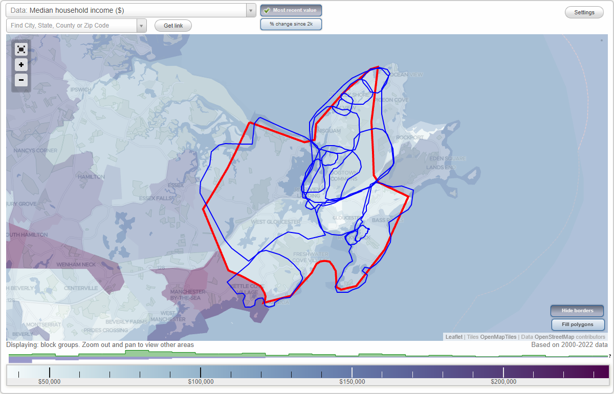
Gloucester, Massachusetts Neighborhood Map - Income, House Prices, Occupations, Boundaries
Settings
X

- City boundary
- Neighborhood boundaries
Business Search - 14 Million verified businesses
Neighborhoods:
Annisquam, Bay View, Dogtown Common, Downtown Gloucester, East Gloucester, East Gloucester Historic Distric, Folly Cove, Lanesville, Magnolia, North Gloucester, Riverdale, Riverdale Station, Riverview, Rocky Neck, West GloucesterAnnisquam neighborhood in Gloucester statistics: (Find on map)
Area: 2.132 square miles
Population: 963
Population density:
Median household income in 2021:
Median rent in in 2021:
Male vs Females
Median age
Most popular occupations of males: management occupations (except farmers) (17.6%); sales and office occupations (14.7%); business and financial operations occupations (12.9%); construction, extraction, and maintenance occupations (11.0%); service occupations (9.6%); education, training, and library occupations (8.1%); production occupations (6.5%)
Most popular occupations of females: service occupations (20.6%); sales and office occupations (20.1%); healthcare practitioners and technical occupations (20.0%); management occupations (except farmers) (12.0%); education, training, and library occupations (9.4%); business and financial operations occupations (4.2%); production occupations (3.2%)
Highways in this neighborhood: Washington St (State Hwy 127).
Roads and streets: Norwood Hts; Revere St; Leonard St; Dennison St; Quarry St; Adams Hill Rd; Bennett St N; Cart Track Dr; Nashua Ave; Norrock Rd; Homestead Dr; River Rd; Rockholm Rd; Colburn St; Brierwood St; Bennett St S; Holly St; Squam Rock Rd; Walnut St; N Kilby St; Chester Sq; Bridgewater St; Hutchins Ct; Barberry Hts Rd; S Kilby St; Cardinal Ln; Ames Dr; Stone House Ln; Youngs Rd; Arlington St; Annisquam Hts; Brierwood Ct; Bittersweet Rd; Cambridge Ave; Planters Neck Rd; Tufts Ln; Cushing Ln; Costa Dr; Butternut Ln; Diamond Ave; Goose Cove Ln; Days Ave; Dorset Dr; Burns Way; Dennis Ct; Lane Rd; Lindberg Dr; Driftwood Ln; Pigeon Ln; Ciaramitaro Ct; Arbor St; Adams Ave; Albion Ct; Norwood Hts (Wigwam Rd); Parkhurst Ave; Rogers Ln; Mechanics Pl; Pierce Ave; Squam Rock Ln; Union Ct.
Other features: Atlantic Ocean.
Annisquam neighborhood detailed profile
Area: 2.132 square miles
Population: 963
Population density:
| Annisquam: | 452 people per square mile |
| Gloucester: | 1,148 people per square mile |
Median household income in 2021:
| Annisquam: | $96,437 |
| Gloucester: | $82,984 |
Median rent in in 2021:
| Annisquam: | $1,240 |
| Gloucester: | $1,120 |
Male vs Females
| Males: | 486 |
| Females: | 476 |
Median age
| Males: | 54.9 years |
| Females: | 55.8 years |
Most popular occupations of males: management occupations (except farmers) (17.6%); sales and office occupations (14.7%); business and financial operations occupations (12.9%); construction, extraction, and maintenance occupations (11.0%); service occupations (9.6%); education, training, and library occupations (8.1%); production occupations (6.5%)
Most popular occupations of females: service occupations (20.6%); sales and office occupations (20.1%); healthcare practitioners and technical occupations (20.0%); management occupations (except farmers) (12.0%); education, training, and library occupations (9.4%); business and financial operations occupations (4.2%); production occupations (3.2%)
Highways in this neighborhood: Washington St (State Hwy 127).
Roads and streets: Norwood Hts; Revere St; Leonard St; Dennison St; Quarry St; Adams Hill Rd; Bennett St N; Cart Track Dr; Nashua Ave; Norrock Rd; Homestead Dr; River Rd; Rockholm Rd; Colburn St; Brierwood St; Bennett St S; Holly St; Squam Rock Rd; Walnut St; N Kilby St; Chester Sq; Bridgewater St; Hutchins Ct; Barberry Hts Rd; S Kilby St; Cardinal Ln; Ames Dr; Stone House Ln; Youngs Rd; Arlington St; Annisquam Hts; Brierwood Ct; Bittersweet Rd; Cambridge Ave; Planters Neck Rd; Tufts Ln; Cushing Ln; Costa Dr; Butternut Ln; Diamond Ave; Goose Cove Ln; Days Ave; Dorset Dr; Burns Way; Dennis Ct; Lane Rd; Lindberg Dr; Driftwood Ln; Pigeon Ln; Ciaramitaro Ct; Arbor St; Adams Ave; Albion Ct; Norwood Hts (Wigwam Rd); Parkhurst Ave; Rogers Ln; Mechanics Pl; Pierce Ave; Squam Rock Ln; Union Ct.
Other features: Atlantic Ocean.
Annisquam neighborhood detailed profile
Bay View neighborhood in Gloucester statistics: (Find on map)
Area: 0.310 square miles
Population: 141
Population density:
Median household income in 2021:
Median rent in in 2021:
Male vs Females
Median age
Most popular occupations of males: service occupations (13.5%); computer and mathematical occupations (12.0%); sales and office occupations (10.7%); production occupations (10.7%); business and financial operations occupations (10.5%); construction, extraction, and maintenance occupations (9.2%); management occupations (except farmers) (7.4%)
Most popular occupations of females: sales and office occupations (26.8%); management occupations (except farmers) (17.7%); healthcare practitioners and technical occupations (14.5%); service occupations (13.2%); education, training, and library occupations (8.1%); production occupations (6.5%); business and financial operations occupations (6.1%)
Highways in this neighborhood: Washington St (State Hwy 127).
Roads and streets: Rowley Shore; Colburn St; N Kilby St; Hickory St; Linwood Pl; Hillside Ct; High St; Mount Locust Pl; Bayview Ln; Sawyer Ave; Plum Ct; Sanderson Ct; Compass Way; High Street Pl.
Bay View neighborhood detailed profile
Area: 0.310 square miles
Population: 141
Population density:
| Bay View: | 455 people per square mile |
| Gloucester: | 1,148 people per square mile |
Median household income in 2021:
| Bay View: | $89,643 |
| Gloucester: | $82,984 |
Median rent in in 2021:
| Bay View: | $1,210 |
| Gloucester: | $1,120 |
Male vs Females
| Males: | 68 |
| Females: | 73 |
Median age
| Males: | 48.9 years |
| Females: | 50.0 years |
Most popular occupations of males: service occupations (13.5%); computer and mathematical occupations (12.0%); sales and office occupations (10.7%); production occupations (10.7%); business and financial operations occupations (10.5%); construction, extraction, and maintenance occupations (9.2%); management occupations (except farmers) (7.4%)
Most popular occupations of females: sales and office occupations (26.8%); management occupations (except farmers) (17.7%); healthcare practitioners and technical occupations (14.5%); service occupations (13.2%); education, training, and library occupations (8.1%); production occupations (6.5%); business and financial operations occupations (6.1%)
Highways in this neighborhood: Washington St (State Hwy 127).
Roads and streets: Rowley Shore; Colburn St; N Kilby St; Hickory St; Linwood Pl; Hillside Ct; High St; Mount Locust Pl; Bayview Ln; Sawyer Ave; Plum Ct; Sanderson Ct; Compass Way; High Street Pl.
Bay View neighborhood detailed profile
Dogtown Common neighborhood in Gloucester statistics: (Find on map)
Area: 3.351 square miles
Population: 1,920
Population density:
Median household income in 2021:
Median rent in in 2021:
Male vs Females
Median age
Housing prices:
Average estimated value of detached houses in 2021 (63.9% of all units):
Average estimated value of townhouses or other attached units in 2021 (76.9% of all units):
Average estimated value of housing units in 2-unit structures in 2021 (11.0% of all units):
Average estimated '21 value of housing units in 3-to-4-unit structures (19.4% of all units):
Most popular occupations of males: architecture and engineering occupations (18.0%); management occupations (except farmers) (13.5%); sales and office occupations (13.4%); production occupations (8.8%); construction, extraction, and maintenance occupations (8.3%); healthcare practitioners and technical occupations (6.6%); service occupations (5.8%)
Most popular occupations of females: sales and office occupations (32.4%); healthcare practitioners and technical occupations (20.2%); service occupations (19.1%); management occupations (except farmers) (9.0%); education, training, and library occupations (8.9%); legal occupations (2.0%); arts, design, entertainment, sports, and media occupations (2.0%)
Highways in this neighborhood: Main St (State Hwy 127).
Roads and streets: Common Rd; Cherry St; Dogtown Rd; Reservoir Rd; Hodgkins Rd; Macomber Rd; Poplar St; Ellery St; Old Rockport Rd; Evergreen Rd; Reynard St; Finch Ln; Wildon Hts; Great Hill Ln; Goodwin Rd; Cherry Hill Rd; Sheehan Ter; Mollies Ln; Hilltop Ln; Rocky Rd; Dr Osman Babson Rd; Poplar Pk; Sunset Ln; Spruce Rd.
Railroad features: Boston and Maine RR.
Other features: Alewife Brk.
Other features: Jeeptrail.
Dogtown Common neighborhood detailed profile
Area: 3.351 square miles
Population: 1,920
Population density:
| Dogtown Common (Dogtown Commons): | 573 people per square mile |
| Gloucester: | 1,148 people per square mile |
Median household income in 2021:
| Dogtown Common (Dogtown Commons): | $93,200 |
| Gloucester: | $82,984 |
Median rent in in 2021:
| Dogtown Common (Dogtown Commons): | $1,065 |
| Gloucester: | $1,120 |
Male vs Females
| Males: | 973 |
| Females: | 946 |
Median age
| Males: | 50.2 years |
| Females: | 53.6 years |
Housing prices:
Average estimated value of detached houses in 2021 (63.9% of all units):
| Dogtown Common (Dogtown Commons): | $1,738,220 |
| Massachusetts: | $512,170 |
Average estimated value of townhouses or other attached units in 2021 (76.9% of all units):
| This neighborhood: | $618,092 |
| Massachusetts: | $446,467 |
Average estimated value of housing units in 2-unit structures in 2021 (11.0% of all units):
| This neighborhood: | $248,541 |
| Massachusetts: | $492,911 |
Average estimated '21 value of housing units in 3-to-4-unit structures (19.4% of all units):
| Dogtown Common (Dogtown Commons): | $1,705,672 |
| Massachusetts: | $520,726 |
Most popular occupations of males: architecture and engineering occupations (18.0%); management occupations (except farmers) (13.5%); sales and office occupations (13.4%); production occupations (8.8%); construction, extraction, and maintenance occupations (8.3%); healthcare practitioners and technical occupations (6.6%); service occupations (5.8%)
Most popular occupations of females: sales and office occupations (32.4%); healthcare practitioners and technical occupations (20.2%); service occupations (19.1%); management occupations (except farmers) (9.0%); education, training, and library occupations (8.9%); legal occupations (2.0%); arts, design, entertainment, sports, and media occupations (2.0%)
Highways in this neighborhood: Main St (State Hwy 127).
Roads and streets: Common Rd; Cherry St; Dogtown Rd; Reservoir Rd; Hodgkins Rd; Macomber Rd; Poplar St; Ellery St; Old Rockport Rd; Evergreen Rd; Reynard St; Finch Ln; Wildon Hts; Great Hill Ln; Goodwin Rd; Cherry Hill Rd; Sheehan Ter; Mollies Ln; Hilltop Ln; Rocky Rd; Dr Osman Babson Rd; Poplar Pk; Sunset Ln; Spruce Rd.
Railroad features: Boston and Maine RR.
Other features: Alewife Brk.
Other features: Jeeptrail.
Dogtown Common neighborhood detailed profile
Downtown Gloucester neighborhood in Gloucester statistics: (Find on map)
Area: 1.927 square miles
Population: 15,266
Population density:
Median household income in 2021:
Median rent in in 2021:
Male vs Females
Median age
Housing prices:
Average estimated value of detached houses in 2021 (21.2% of all units):
Average estimated value of townhouses or other attached units in 2021 (5.2% of all units):
Average estimated value of housing units in 2-unit structures in 2021 (28.5% of all units):
Average estimated '21 value of housing units in 3-to-4-unit structures (28.2% of all units):
Most popular occupations of males: construction, extraction, and maintenance occupations (16.6%); sales and office occupations (16.4%); service occupations (12.5%); production occupations (9.7%); management occupations (except farmers) (7.3%); architecture and engineering occupations (6.1%); transportation occupations (5.3%)
Most popular occupations of females: service occupations (31.9%); sales and office occupations (26.7%); education, training, and library occupations (10.2%); healthcare practitioners and technical occupations (10.0%); management occupations (except farmers) (5.7%); business and financial operations occupations (3.4%); life, physical, and social science occupations (3.2%)
Highways in this neighborhood: Yankee Division Hwy (State Hwy 128); Main St (State Hwy 127); Western Ave (State Hwy 127); Eastern Ave (State Hwy 127); State Hwy 127 Bus (E Main St); State Hwy 133.
Roads and streets: Washington St; Gloucester Ave; Prospect St; Dory Rd; Rogers St; Maplewood Ave; Centennial Ave; Old Rockport Rd; Grove St; Middle St; Sargent St; Friend St; Perkins St; Pleasant St; Warner St; Blackburn Cir; Commercial St; Granite St; Commonwealth Ave; Railroad Ave; Beacon St; Taylor St; Blynman Ave; Mount Vernon St; Madison Ave; Whittemore St; Harrison Ave; Fort Sq; Cleveland St; School House Rd; Mansfield St; Webster St; Burnham St; Harbor Loop; Exchange St; School St; Grant Cir; Summer St; Poplar St; Trask St; Orchard St; Derby St; Green St; Emerson Ave; Riverside Ave; Millett St; Leslie O Johnson Rd; Rockland St; Addison St; Willow St; Myrtle Sq; Hawthorne Rd; Pearl St; Liberty St; Washington Sq; Lookout St; Elm St; Lincoln Ave; Willowood Rd; Church St; Chestnut St; Lincoln Park; Acacia St; Shepherd St; Dodge St; Mason St; Prospect Sq; Dale Ave; Summit St; Silva Ct; Forest St; Spring St; Pine St; Fair St; Mystic Ave; Riggs St; Harold Ave; Essex St; Sadler St; Hampden St; Carlisle St; Beckford St; Herrick Ct; Rider's Rd; Harvard St; Arthur St; Proctor St; Knowlton Sq; Allen St; Oak St; Skywood Ter; Cedar St; Perkins Rd; Madison Ct; Beauport Ave; Lloyd St; Blackburn Center; Wells St; Gaffney St; Ledgemont Ave; Gloucester Pl; Columbia St; Hovey St; Bertoni Rd; Winchester Ct; Gould Ct; Smith St; Cleveland Pl; Maple St; Crestview Ter; Hancock St; Harrison Ter; Springfield St; Bellevue Ave; Foster St; Rowe Sq; Elwell St; Marchant St; Curtis Sq; Warren St; York Rd; Franklin Sq; Haven Ter; Conant Ave; Beach Ct; Babson St; Mt Vernon St; Angle St; Colonial St; Sylvan St; Russell Ave; King Rd; Sadler St Exd; Madison Sq; Luzitania Ave; Blackburn Dr; Pew; Duncan St; Mansfield Ct; Sibley St; Morton Pl; Stone Ct; Staten St; Baker St; Federal St; Hayward Rd; Perkins Peak; Common Way; Manuel F Lewis St; Gale Rd; Derby Ct; Arcadia Ct; Pascucci Ct; Neptune Pl; Short St; Bradford Rd; Scott St; Alpine Ct; Parsons St; Porter St; Sargent St Exd; Maplewood Ct; Griffin Ct; Mason Ct; Center St; Spring Ct; Prospect Ct; Linnett Pl; Clifford Ct; Granite Ct; Madison Ct Exd; Fears Ct; Babson Ct; Foley Rd; Leighton Ct; Monroe Ct; Friend Ct; Gilbert Ct; Loring Ct; Ivy Ct; Thomas Ct; Cross St; Puritan Ct; Sylvan Ct; Poplar Ct; Harold Ct; Arthur Ct; Lewis Ct; Dexter Pl.
Railroad features: Boston and Maine RR.
Downtown Gloucester neighborhood detailed profile
Area: 1.927 square miles
Population: 15,266
Population density:
| Downtown Gloucester (the Core): | 7,922 people per square mile |
| Gloucester: | 1,148 people per square mile |
Median household income in 2021:
| Downtown Gloucester (the Core): | $76,805 |
| Gloucester: | $82,984 |
Median rent in in 2021:
| Downtown Gloucester (the Core): | $1,128 |
| Gloucester: | $1,120 |
Male vs Females
| Males: | 7,517 |
| Females: | 7,748 |
Median age
| Males: | 43.7 years |
| Females: | 47.0 years |
Housing prices:
Average estimated value of detached houses in 2021 (21.2% of all units):
| Downtown Gloucester (the Core): | $336,796 |
| Massachusetts: | $512,170 |
Average estimated value of townhouses or other attached units in 2021 (5.2% of all units):
| This neighborhood: | $386,176 |
| Massachusetts: | $446,467 |
Average estimated value of housing units in 2-unit structures in 2021 (28.5% of all units):
| This neighborhood: | $330,279 |
| Massachusetts: | $492,911 |
Average estimated '21 value of housing units in 3-to-4-unit structures (28.2% of all units):
| Downtown Gloucester (the Core): | $45,875 |
| Massachusetts: | $520,726 |
Most popular occupations of males: construction, extraction, and maintenance occupations (16.6%); sales and office occupations (16.4%); service occupations (12.5%); production occupations (9.7%); management occupations (except farmers) (7.3%); architecture and engineering occupations (6.1%); transportation occupations (5.3%)
Most popular occupations of females: service occupations (31.9%); sales and office occupations (26.7%); education, training, and library occupations (10.2%); healthcare practitioners and technical occupations (10.0%); management occupations (except farmers) (5.7%); business and financial operations occupations (3.4%); life, physical, and social science occupations (3.2%)
Highways in this neighborhood: Yankee Division Hwy (State Hwy 128); Main St (State Hwy 127); Western Ave (State Hwy 127); Eastern Ave (State Hwy 127); State Hwy 127 Bus (E Main St); State Hwy 133.
Roads and streets: Washington St; Gloucester Ave; Prospect St; Dory Rd; Rogers St; Maplewood Ave; Centennial Ave; Old Rockport Rd; Grove St; Middle St; Sargent St; Friend St; Perkins St; Pleasant St; Warner St; Blackburn Cir; Commercial St; Granite St; Commonwealth Ave; Railroad Ave; Beacon St; Taylor St; Blynman Ave; Mount Vernon St; Madison Ave; Whittemore St; Harrison Ave; Fort Sq; Cleveland St; School House Rd; Mansfield St; Webster St; Burnham St; Harbor Loop; Exchange St; School St; Grant Cir; Summer St; Poplar St; Trask St; Orchard St; Derby St; Green St; Emerson Ave; Riverside Ave; Millett St; Leslie O Johnson Rd; Rockland St; Addison St; Willow St; Myrtle Sq; Hawthorne Rd; Pearl St; Liberty St; Washington Sq; Lookout St; Elm St; Lincoln Ave; Willowood Rd; Church St; Chestnut St; Lincoln Park; Acacia St; Shepherd St; Dodge St; Mason St; Prospect Sq; Dale Ave; Summit St; Silva Ct; Forest St; Spring St; Pine St; Fair St; Mystic Ave; Riggs St; Harold Ave; Essex St; Sadler St; Hampden St; Carlisle St; Beckford St; Herrick Ct; Rider's Rd; Harvard St; Arthur St; Proctor St; Knowlton Sq; Allen St; Oak St; Skywood Ter; Cedar St; Perkins Rd; Madison Ct; Beauport Ave; Lloyd St; Blackburn Center; Wells St; Gaffney St; Ledgemont Ave; Gloucester Pl; Columbia St; Hovey St; Bertoni Rd; Winchester Ct; Gould Ct; Smith St; Cleveland Pl; Maple St; Crestview Ter; Hancock St; Harrison Ter; Springfield St; Bellevue Ave; Foster St; Rowe Sq; Elwell St; Marchant St; Curtis Sq; Warren St; York Rd; Franklin Sq; Haven Ter; Conant Ave; Beach Ct; Babson St; Mt Vernon St; Angle St; Colonial St; Sylvan St; Russell Ave; King Rd; Sadler St Exd; Madison Sq; Luzitania Ave; Blackburn Dr; Pew; Duncan St; Mansfield Ct; Sibley St; Morton Pl; Stone Ct; Staten St; Baker St; Federal St; Hayward Rd; Perkins Peak; Common Way; Manuel F Lewis St; Gale Rd; Derby Ct; Arcadia Ct; Pascucci Ct; Neptune Pl; Short St; Bradford Rd; Scott St; Alpine Ct; Parsons St; Porter St; Sargent St Exd; Maplewood Ct; Griffin Ct; Mason Ct; Center St; Spring Ct; Prospect Ct; Linnett Pl; Clifford Ct; Granite Ct; Madison Ct Exd; Fears Ct; Babson Ct; Foley Rd; Leighton Ct; Monroe Ct; Friend Ct; Gilbert Ct; Loring Ct; Ivy Ct; Thomas Ct; Cross St; Puritan Ct; Sylvan Ct; Poplar Ct; Harold Ct; Arthur Ct; Lewis Ct; Dexter Pl.
Railroad features: Boston and Maine RR.
Downtown Gloucester neighborhood detailed profile
East Gloucester neighborhood in Gloucester statistics: (Find on map)
Area: 4.365 square miles
Population: 4,814
Population density:
Median household income in 2021:
Median rent in in 2021:
Male vs Females
Median age
Housing prices:
Average estimated value of detached houses in 2021 (63.1% of all units):
Average estimated value of townhouses or other attached units in 2021 (8.3% of all units):
Average estimated value of housing units in 2-unit structures in 2021 (6.6% of all units):
Average estimated '21 value of housing units in 3-to-4-unit structures (13.8% of all units):
Most popular occupations of males: construction, extraction, and maintenance occupations (19.0%); management occupations (except farmers) (18.8%); service occupations (13.9%); sales and office occupations (10.0%); material moving occupations (10.0%); business and financial operations occupations (5.3%); computer and mathematical occupations (4.8%)
Most popular occupations of females: sales and office occupations (28.1%); service occupations (23.7%); management occupations (except farmers) (11.9%); healthcare practitioners and technical occupations (11.4%); education, training, and library occupations (11.1%); business and financial operations occupations (5.0%); community and social services occupations (2.6%)
Highways in this neighborhood: State Hwy 127 Bus (Thatcher Rd); Eastern Ave (State Hwy 127); State Hwy 127 Bus (Bass Ave); State Hwy 128 (Yankee Division Hwy).
Roads and streets: Atlantic Rd; Eastern Point Blvd W; E Main St; Grapevine Rd; Mount Pleasant Ave; Witham St; High Popples Rd; Marble Rd; Farrington Ave; Ledge Rd; Beach Rd; Fort Hill Ave; Moorland Rd; Salt Island Rd; Way Rd; Starknaught Hts; Niles Pond Rd; Old Nugent Farm Rd; Rocky Neck Ave; Haskell St; Cliff Rd; Harriett Rd; Decatur St; Links Rd; Rockport Rd; Old County Rd; Bass Rocks Rd; Brace Cove; Souther Rd; Pond Rd; Brightside Ave; Eastern Point Rd; Nautilus Rd; Edgemoor Rd; Parker St; Marina Dr; Marble St; Saint Louis Ave; Chapel St; Toronto Ave; Page St; Horton St; Orchard Rd; Hartz St; State Fish Pier; Ramparts Field Rd; Beachcroft Rd; Saint Anthonys Ln (St Anthonys Ln); Wonson St; Drumhack Rd; Tarrs Rd; Traverse St; Rocky Pasture Rd; Starknaught Rd; Oxford Rd; Harrison Ave; Highland St; Sayward St; Rouse Rd; Barn Ln; Brier Rd; Lands End Ln; Long Beach Rd; Fremont St; High Rock Ter; Hammond St; Prentiss Rd; Raven Ln; Shapley Rd; Calder St; Seaview Rd; Jacques Ln; Stewart Ave; Long Beach; Plum St; Harbor Rd; Palfrey Rd; Hillside Rd; Ledge Ln; Gilbert Rd; Elm Ave; Williams Ct; Arnold Way; Lendall St; Lake Ave; Tragabigazanda Rd; Eagle Rd; Clarendon St; Elizabeth Rd; Abbott Rd; Mondello Sq; Graystone Rd; Highland Ct; Barberry Way; Gerring Rd; Wall St; Warwick Rd; Locust Ln; Fairmount Rd; Old Rd County (Long Beach); Adams Pl; Arland Ter; Rackliffe St; Hinckley Rd; Haskell Ct; Lighthouse Way; Lantern Ln; Pilots Hill; Twilight Ave; Megan Way; Davis St; Blake Ct; Harrison Ter; Prospect Ter; Rio Dr; Amero Ct; Josephs Way; Pirates Ln; Beachland Ave; Glenmere Rd; Island Rock Ln; Hawthorne Ln; Wiley St; Brier Neck Rd; Norwood Ct; Ocean View Dr; Puerto Dr; Loma Dr; Sumac Ln; Stanley Ct; Beacon Hill; Naiomi Dr; Nautical Hts; Montgomery Pl (Montgomery Ct); Mayflower Ln; Mount Pleasant Way; Bemo Ave; Barberry Ln; Cabo Dr; Windward Pt; Banner Hill Way; Brier Neck Ave; Avon Ct; Michaels Ln; Tolman St; Neptune Pl; Mallard Way; Terrace Ln; Cape Ter; Dove Ln; Clay Ct; Davis St Exn; Sunrise Ct; Lasley Pl; Sunset Rd; Powell Ct; Marion Way; Highland Pl; Hillier Rd; Birch Rd; Wise Pl; Stevens Ln; Harbor View Ct; Caledonia Pl; Stanwood Ter; Valatie St; Bickford Way; Salt Island Ln; Parker Ct; Aileen Ter; Swinson Way; Eden Ln; Brewsters Ln.
East Gloucester neighborhood detailed profile
Area: 4.365 square miles
Population: 4,814
Population density:
| East Gloucester: | 1,103 people per square mile |
| Gloucester: | 1,148 people per square mile |
Median household income in 2021:
| East Gloucester: | $93,843 |
| Gloucester: | $82,984 |
Median rent in in 2021:
| East Gloucester: | $1,126 |
| Gloucester: | $1,120 |
Male vs Females
| Males: | 2,456 |
| Females: | 2,358 |
Median age
| Males: | 47.7 years |
| Females: | 49.8 years |
Housing prices:
Average estimated value of detached houses in 2021 (63.1% of all units):
| East Gloucester: | $732,113 |
| Massachusetts: | $512,170 |
Average estimated value of townhouses or other attached units in 2021 (8.3% of all units):
| This neighborhood: | $1,208,348 |
| Massachusetts: | $446,467 |
Average estimated value of housing units in 2-unit structures in 2021 (6.6% of all units):
| This neighborhood: | $483,800 |
| Massachusetts: | $492,911 |
Average estimated '21 value of housing units in 3-to-4-unit structures (13.8% of all units):
| East Gloucester: | $417,298 |
| Massachusetts: | $520,726 |
Most popular occupations of males: construction, extraction, and maintenance occupations (19.0%); management occupations (except farmers) (18.8%); service occupations (13.9%); sales and office occupations (10.0%); material moving occupations (10.0%); business and financial operations occupations (5.3%); computer and mathematical occupations (4.8%)
Most popular occupations of females: sales and office occupations (28.1%); service occupations (23.7%); management occupations (except farmers) (11.9%); healthcare practitioners and technical occupations (11.4%); education, training, and library occupations (11.1%); business and financial operations occupations (5.0%); community and social services occupations (2.6%)
Highways in this neighborhood: State Hwy 127 Bus (Thatcher Rd); Eastern Ave (State Hwy 127); State Hwy 127 Bus (Bass Ave); State Hwy 128 (Yankee Division Hwy).
Roads and streets: Atlantic Rd; Eastern Point Blvd W; E Main St; Grapevine Rd; Mount Pleasant Ave; Witham St; High Popples Rd; Marble Rd; Farrington Ave; Ledge Rd; Beach Rd; Fort Hill Ave; Moorland Rd; Salt Island Rd; Way Rd; Starknaught Hts; Niles Pond Rd; Old Nugent Farm Rd; Rocky Neck Ave; Haskell St; Cliff Rd; Harriett Rd; Decatur St; Links Rd; Rockport Rd; Old County Rd; Bass Rocks Rd; Brace Cove; Souther Rd; Pond Rd; Brightside Ave; Eastern Point Rd; Nautilus Rd; Edgemoor Rd; Parker St; Marina Dr; Marble St; Saint Louis Ave; Chapel St; Toronto Ave; Page St; Horton St; Orchard Rd; Hartz St; State Fish Pier; Ramparts Field Rd; Beachcroft Rd; Saint Anthonys Ln (St Anthonys Ln); Wonson St; Drumhack Rd; Tarrs Rd; Traverse St; Rocky Pasture Rd; Starknaught Rd; Oxford Rd; Harrison Ave; Highland St; Sayward St; Rouse Rd; Barn Ln; Brier Rd; Lands End Ln; Long Beach Rd; Fremont St; High Rock Ter; Hammond St; Prentiss Rd; Raven Ln; Shapley Rd; Calder St; Seaview Rd; Jacques Ln; Stewart Ave; Long Beach; Plum St; Harbor Rd; Palfrey Rd; Hillside Rd; Ledge Ln; Gilbert Rd; Elm Ave; Williams Ct; Arnold Way; Lendall St; Lake Ave; Tragabigazanda Rd; Eagle Rd; Clarendon St; Elizabeth Rd; Abbott Rd; Mondello Sq; Graystone Rd; Highland Ct; Barberry Way; Gerring Rd; Wall St; Warwick Rd; Locust Ln; Fairmount Rd; Old Rd County (Long Beach); Adams Pl; Arland Ter; Rackliffe St; Hinckley Rd; Haskell Ct; Lighthouse Way; Lantern Ln; Pilots Hill; Twilight Ave; Megan Way; Davis St; Blake Ct; Harrison Ter; Prospect Ter; Rio Dr; Amero Ct; Josephs Way; Pirates Ln; Beachland Ave; Glenmere Rd; Island Rock Ln; Hawthorne Ln; Wiley St; Brier Neck Rd; Norwood Ct; Ocean View Dr; Puerto Dr; Loma Dr; Sumac Ln; Stanley Ct; Beacon Hill; Naiomi Dr; Nautical Hts; Montgomery Pl (Montgomery Ct); Mayflower Ln; Mount Pleasant Way; Bemo Ave; Barberry Ln; Cabo Dr; Windward Pt; Banner Hill Way; Brier Neck Ave; Avon Ct; Michaels Ln; Tolman St; Neptune Pl; Mallard Way; Terrace Ln; Cape Ter; Dove Ln; Clay Ct; Davis St Exn; Sunrise Ct; Lasley Pl; Sunset Rd; Powell Ct; Marion Way; Highland Pl; Hillier Rd; Birch Rd; Wise Pl; Stevens Ln; Harbor View Ct; Caledonia Pl; Stanwood Ter; Valatie St; Bickford Way; Salt Island Ln; Parker Ct; Aileen Ter; Swinson Way; Eden Ln; Brewsters Ln.
East Gloucester neighborhood detailed profile
East Gloucester Historic Distric neighborhood in Gloucester statistics: (Find on map)
Area: 0.140 square miles
Population: 120
Population density:
Median household income in 2021:
Median rent in in 2021:
Male vs Females
Median age
Housing prices:
Average estimated value of detached houses in 2021 (54.8% of all units):
Average estimated value of townhouses or other attached units in 2021 (12.3% of all units):
Average estimated value of housing units in 2-unit structures in 2021 (2.7% of all units):
Average estimated '21 value of housing units in 3-to-4-unit structures (1.4% of all units):
Most popular occupations of males: material moving occupations (23.7%); service occupations (20.4%); management occupations (except farmers) (18.4%); business and financial operations occupations (7.8%); community and social services occupations (7.0%); construction, extraction, and maintenance occupations (6.9%); education, training, and library occupations (5.7%)
Most popular occupations of females: sales and office occupations (32.6%); healthcare practitioners and technical occupations (31.3%); education, training, and library occupations (14.4%); management occupations (except farmers) (8.4%); material moving occupations (8.3%); business and financial operations occupations (7.3%); computer and mathematical occupations (4.9%)
Roads and streets: E Main St; Mount Pleasant Ave; Highland St; Chapel St; Plum St; Highland Ct; Gerring Rd; Davis St; Pirates Ln; Norwood Ct; Montgomery Pl (Montgomery Ct); Barberry Ln; Banner Hill Way; Avon Ct; Davis St Exn; Highland Pl; Caledonia Pl.
East Gloucester Historic Distric neighborhood detailed profile
Area: 0.140 square miles
Population: 120
Population density:
| East Gloucester Historic Distric: | 857 people per square mile |
| Gloucester: | 1,148 people per square mile |
Median household income in 2021:
| East Gloucester Historic Distric: | $114,991 |
| Gloucester: | $82,984 |
Median rent in in 2021:
| East Gloucester Historic Distric: | $1,101 |
| Gloucester: | $1,120 |
Male vs Females
| Males: | 63 |
| Females: | 57 |
Median age
| Males: | 58.9 years |
| Females: | 58.0 years |
Housing prices:
Average estimated value of detached houses in 2021 (54.8% of all units):
| East Gloucester Historic Distric: | $1,032,753 |
| Massachusetts: | $512,170 |
Average estimated value of townhouses or other attached units in 2021 (12.3% of all units):
| This neighborhood: | $342,403 |
| Massachusetts: | $446,467 |
Average estimated value of housing units in 2-unit structures in 2021 (2.7% of all units):
| This neighborhood: | $234,863 |
| Massachusetts: | $492,911 |
Average estimated '21 value of housing units in 3-to-4-unit structures (1.4% of all units):
| East Gloucester Historic Distric: | $286,307 |
| Massachusetts: | $520,726 |
Most popular occupations of males: material moving occupations (23.7%); service occupations (20.4%); management occupations (except farmers) (18.4%); business and financial operations occupations (7.8%); community and social services occupations (7.0%); construction, extraction, and maintenance occupations (6.9%); education, training, and library occupations (5.7%)
Most popular occupations of females: sales and office occupations (32.6%); healthcare practitioners and technical occupations (31.3%); education, training, and library occupations (14.4%); management occupations (except farmers) (8.4%); material moving occupations (8.3%); business and financial operations occupations (7.3%); computer and mathematical occupations (4.9%)
Roads and streets: E Main St; Mount Pleasant Ave; Highland St; Chapel St; Plum St; Highland Ct; Gerring Rd; Davis St; Pirates Ln; Norwood Ct; Montgomery Pl (Montgomery Ct); Barberry Ln; Banner Hill Way; Avon Ct; Davis St Exn; Highland Pl; Caledonia Pl.
East Gloucester Historic Distric neighborhood detailed profile
Folly Cove neighborhood in Gloucester statistics: (Find on map)
Area: 0.528 square miles
Population: 207
Population density:
Median household income in 2021:
Median rent in in 2021:
Male vs Females
Median age
Most popular occupations of males: management occupations (except farmers) (11.5%); service occupations (11.5%); sales and office occupations (11.2%); production occupations (10.6%); construction, extraction, and maintenance occupations (9.5%); computer and mathematical occupations (9.3%); business and financial operations occupations (9.0%)
Most popular occupations of females: sales and office occupations (30.7%); management occupations (except farmers) (15.8%); service occupations (14.9%); healthcare practitioners and technical occupations (11.4%); education, training, and library occupations (8.2%); production occupations (5.5%); business and financial operations occupations (4.3%)
Highways in this neighborhood: State Hwy 127 (Granite St); Washington St (State Hwy 127).
Roads and streets: Folly Point Rd; Woodbury St; Woodbury Hill; Langsford Way; Langsford St; Woodbury Ln; Marchant St; Bayview Ave; Mason Sq.
Folly Cove neighborhood detailed profile
Area: 0.528 square miles
Population: 207
Population density:
| Folly Cove: | 392 people per square mile |
| Gloucester: | 1,148 people per square mile |
Median household income in 2021:
| Folly Cove: | $82,776 |
| Gloucester: | $82,984 |
Median rent in in 2021:
| Folly Cove: | $1,189 |
| Gloucester: | $1,120 |
Male vs Females
| Males: | 98 |
| Females: | 109 |
Median age
| Males: | 51.8 years |
| Females: | 53.7 years |
Most popular occupations of males: management occupations (except farmers) (11.5%); service occupations (11.5%); sales and office occupations (11.2%); production occupations (10.6%); construction, extraction, and maintenance occupations (9.5%); computer and mathematical occupations (9.3%); business and financial operations occupations (9.0%)
Most popular occupations of females: sales and office occupations (30.7%); management occupations (except farmers) (15.8%); service occupations (14.9%); healthcare practitioners and technical occupations (11.4%); education, training, and library occupations (8.2%); production occupations (5.5%); business and financial operations occupations (4.3%)
Highways in this neighborhood: State Hwy 127 (Granite St); Washington St (State Hwy 127).
Roads and streets: Folly Point Rd; Woodbury St; Woodbury Hill; Langsford Way; Langsford St; Woodbury Ln; Marchant St; Bayview Ave; Mason Sq.
Folly Cove neighborhood detailed profile
Lanesville neighborhood in Gloucester statistics: (Find on map)
Area: 0.634 square miles
Population: 256
Population density:
Median household income in 2021:
Median rent in in 2021:
Male vs Females
Median age
Most popular occupations of males: service occupations (11.8%); sales and office occupations (11.1%); management occupations (except farmers) (10.8%); production occupations (10.6%); computer and mathematical occupations (9.8%); construction, extraction, and maintenance occupations (9.4%); business and financial operations occupations (9.3%)
Most popular occupations of females: sales and office occupations (30.0%); management occupations (except farmers) (16.1%); service occupations (14.6%); healthcare practitioners and technical occupations (12.0%); education, training, and library occupations (8.2%); production occupations (5.6%); business and financial operations occupations (4.6%)
Highways in this neighborhood: State Hwy 127 (Washington St).
Roads and streets: High St; Langsford St; Rowley Shore; Leverett St; Rockwood Ln; Andrews St; Coggeshall Rd; Hickory St; Leverett Ln; Norseman Ave; Emerald St; Morgan Ave; Ships Bell Rd; Sunset Point Rd; Butman Ave; Nikolane Way; Bianchini Rd; Langsford Way; Duley St; Barker Ave; Vulcan St; Wishart Rd; Lanes Cove Rd; Viking St; Gurdon's Ln; Sawyer Ave; McLellan St; Young Ave; Day Ave; Munsey Ln; Bayfield Rd; Tucker St; Old Farm Ln; High Street Pl.
Lanesville neighborhood detailed profile
Area: 0.634 square miles
Population: 256
Population density:
| Lanesville: | 404 people per square mile |
| Gloucester: | 1,148 people per square mile |
Median household income in 2021:
| Lanesville: | $82,776 |
| Gloucester: | $82,984 |
Median rent in in 2021:
| Lanesville: | $1,193 |
| Gloucester: | $1,120 |
Male vs Females
| Males: | 121 |
| Females: | 134 |
Median age
| Males: | 51.8 years |
| Females: | 53.7 years |
Most popular occupations of males: service occupations (11.8%); sales and office occupations (11.1%); management occupations (except farmers) (10.8%); production occupations (10.6%); computer and mathematical occupations (9.8%); construction, extraction, and maintenance occupations (9.4%); business and financial operations occupations (9.3%)
Most popular occupations of females: sales and office occupations (30.0%); management occupations (except farmers) (16.1%); service occupations (14.6%); healthcare practitioners and technical occupations (12.0%); education, training, and library occupations (8.2%); production occupations (5.6%); business and financial operations occupations (4.6%)
Highways in this neighborhood: State Hwy 127 (Washington St).
Roads and streets: High St; Langsford St; Rowley Shore; Leverett St; Rockwood Ln; Andrews St; Coggeshall Rd; Hickory St; Leverett Ln; Norseman Ave; Emerald St; Morgan Ave; Ships Bell Rd; Sunset Point Rd; Butman Ave; Nikolane Way; Bianchini Rd; Langsford Way; Duley St; Barker Ave; Vulcan St; Wishart Rd; Lanes Cove Rd; Viking St; Gurdon's Ln; Sawyer Ave; McLellan St; Young Ave; Day Ave; Munsey Ln; Bayfield Rd; Tucker St; Old Farm Ln; High Street Pl.
Lanesville neighborhood detailed profile
Magnolia neighborhood in Gloucester statistics: (Find on map)
Area: 3.095 square miles
Population: 264
Population density:
Median household income in 2021:
Median rent in in 2021:
Male vs Females
Median age
Most popular occupations of males: management occupations (except farmers) (41.3%); service occupations (14.9%); business and financial operations occupations (10.1%); architecture and engineering occupations (10.1%); arts, design, entertainment, sports, and media occupations (9.0%); healthcare practitioners and technical occupations (9.0%); sales and office occupations (8.7%)
Most popular occupations of females: business and financial operations occupations (23.2%); sales and office occupations (22.0%); service occupations (19.7%); arts, design, entertainment, sports, and media occupations (19.6%); healthcare practitioners and technical occupations (14.7%); education, training, and library occupations (12.0%); architecture and engineering occupations (9.1%)
Highways in this neighborhood: State Hwy 127 (Western Ave); Summer St (State Hwy 127).
Roads and streets: Magnolia Ave; Hesperus Ave; Coolidge Pt; Kondelin Rd; Shore Rd; University Ln; Raymond St; Englewood Rd; Norman Ave; Lawndale Cir; Ocean Highlands; Carter Hill Rd; Ocean Ave; Lake Rd; Overledge Rd; Lexington Ave; Fuller St; Flume Rd; Ocean St; Butler Ave; Oakes Ave; Ryan Rd; Long Hill Rd; Story Rd; Emily Ln; Castle Hill Rd; Old Salem Path; Village Rd; Lowe Dr; Linden Ave; Cliff Ave; Hesperus Cir; Chateau Hts; Newton Rd; Big Rock Rd; Strawberry Cove; Fuller Ln; Kettle Cove Ln; Maple Rd; Field Rd; Dalton Ave; Lobster Ln; Blossom Ln; Edmunds Way; Tower Rd; Pinecrest Ave; Park Ln; Cove Ledge Ln; Saint Peters Ln; Rockmoor Ter; St Joseph Ln; Sandpiper Ln; Treetop Ln; Boulder Ave.
Other features: Wolf Trap Brk; Blossom.
Magnolia neighborhood detailed profile
Area: 3.095 square miles
Population: 264
Population density:
| Magnolia: | 85 people per square mile |
| Gloucester: | 1,148 people per square mile |
Median household income in 2021:
| Magnolia: | $193,996 |
| Gloucester: | $82,984 |
Median rent in in 2021:
| Magnolia: | $1,449 |
| Gloucester: | $1,120 |
Male vs Females
| Males: | 129 |
| Females: | 134 |
Median age
| Males: | 46.4 years |
| Females: | 49.5 years |
Most popular occupations of males: management occupations (except farmers) (41.3%); service occupations (14.9%); business and financial operations occupations (10.1%); architecture and engineering occupations (10.1%); arts, design, entertainment, sports, and media occupations (9.0%); healthcare practitioners and technical occupations (9.0%); sales and office occupations (8.7%)
Most popular occupations of females: business and financial operations occupations (23.2%); sales and office occupations (22.0%); service occupations (19.7%); arts, design, entertainment, sports, and media occupations (19.6%); healthcare practitioners and technical occupations (14.7%); education, training, and library occupations (12.0%); architecture and engineering occupations (9.1%)
Highways in this neighborhood: State Hwy 127 (Western Ave); Summer St (State Hwy 127).
Roads and streets: Magnolia Ave; Hesperus Ave; Coolidge Pt; Kondelin Rd; Shore Rd; University Ln; Raymond St; Englewood Rd; Norman Ave; Lawndale Cir; Ocean Highlands; Carter Hill Rd; Ocean Ave; Lake Rd; Overledge Rd; Lexington Ave; Fuller St; Flume Rd; Ocean St; Butler Ave; Oakes Ave; Ryan Rd; Long Hill Rd; Story Rd; Emily Ln; Castle Hill Rd; Old Salem Path; Village Rd; Lowe Dr; Linden Ave; Cliff Ave; Hesperus Cir; Chateau Hts; Newton Rd; Big Rock Rd; Strawberry Cove; Fuller Ln; Kettle Cove Ln; Maple Rd; Field Rd; Dalton Ave; Lobster Ln; Blossom Ln; Edmunds Way; Tower Rd; Pinecrest Ave; Park Ln; Cove Ledge Ln; Saint Peters Ln; Rockmoor Ter; St Joseph Ln; Sandpiper Ln; Treetop Ln; Boulder Ave.
Other features: Wolf Trap Brk; Blossom.
Magnolia neighborhood detailed profile
North Gloucester neighborhood in Gloucester statistics: (Find on map)
Area: 9.654 square miles
Population: 6,542
Population density:
Median household income in 2021:
Median rent in in 2021:
Male vs Females
Median age
Housing prices:
Average estimated value of detached houses in 2021 (81.9% of all units):
Average estimated value of townhouses or other attached units in 2021 (5.4% of all units):
Average estimated value of housing units in 2-unit structures in 2021 (7.9% of all units):
Average estimated '21 value of housing units in 3-to-4-unit structures (9.6% of all units):
Most popular occupations of males: sales and office occupations (14.7%); management occupations (except farmers) (14.4%); service occupations (8.8%); architecture and engineering occupations (8.7%); construction, extraction, and maintenance occupations (8.7%); production occupations (7.7%); farming, fishing, and forestry occupations (7.0%)
Most popular occupations of females: sales and office occupations (25.0%); service occupations (19.0%); healthcare practitioners and technical occupations (16.5%); management occupations (except farmers) (12.9%); education, training, and library occupations (9.5%); community and social services occupations (3.9%); business and financial operations occupations (3.6%)
Highways in this neighborhood: Washington St (State Hwy 127); Main St (State Hwy 127); State Hwy 127 (Granite St); State Hwy 128 (Yankee Division Hwy).
Roads and streets: Norwood Hts; Common Rd; Cherry St; High St; Wheeler St; Revere St; Leonard St; Dogtown Rd; Riverview Rd; Dennison St; Langsford St; Holly St; Quarry St; Rowley Shore; Thurston Point Rd; Adams Hill Rd; Dr Osman Babson Rd; Gee Ave; Barker Ave; Poplar St; Johnson Rd; Bennett St N; Cart Track Dr; Leverett St; Sunset Hill Rd; Blueberry Ln; Reynard St; Folly Point Rd; Nashua Ave; Woodbury St; Vine St; Norrock Rd; Reservoir Rd; Homestead Dr; Hodgkins Rd; Ferry St; River Rd; Hodgkins St; Rockholm Rd; Colburn St; Honeysuckle Rd; Brierwood St; Ferry Hill Rd; Langsford Way; Woodbury Hill; Rockwood Ln; Apple St; Bennett St S; Andrews St; Squam Rock Rd; Corliss Ave; Coggeshall Rd; Walnut St; Veterans Way; Perrywinkle Ln; N Kilby St; Macomber Rd; Hickory St; Linden Rd; Chester Sq; Leverett Ln; Wesley St; Bridgewater St; Shore Hill Rd; Hutchins Ct; Patriots Cir; Gurdon's Ln; Norseman Ave; Ellery St; Goose Cove Ln; Barberry Hts Rd; Evergreen Rd; S Kilby St; Nally Ave; Emerald St; Larady Rd; Morgan Ave; Cardinal Ln; Ships Bell Rd; Ames Dr; Echo Ave; Stanwood St; Linwood Pl; Hillside Ct; Old Ford Rd; Sunset Point Rd; Stone House Ln; Riverside Rd; Butman Ave; Youngs Rd; Arlington St; Annisquam Hts; Mount Locust Pl; Nikolane Way; Lindy Ln; Brierwood Ct; Doanne Rd; Thornhill Way; Tidal Cove Way; Bianchini Rd; Bittersweet Rd; Gardner Ter; Squam Ln; Duley St; Cambridge Ave; Seall St; Planters Neck Rd; Vulcan St; Riggs Point Rd; Bayview Ave; Wishart Rd; Marsh St; Woodbury Ln; Juniper Rd; Marchant St; Tufts Ln; Cushing Ln; Costa Dr; Samuel Riggs Cir; Butternut Ln; Harvey Pl; Armstrong Way; Finch Ln; Diamond Ave; Wildon Hts; Lanes Cove Rd; Ronna Rd; Days Ave; Rainbow Ln; Rose Ln; Orchard Way; Ferry St S; Riverdale Pl; Bayview Ln; Great Hill Ln; Goodwin Rd; Cedar Ln; Mason Sq; Wheelers Point Rd; Cherry Hill Rd; Mako Dr; Viking St; Collins Ave; Grandview Rd; Sheehan Ter; Sawyer Ave; Kirk Rd; Riverview Way; Piraino Ln; Mollies Ln; Aiden Rd; Montvale Ave; Dorset Dr; York Rd; Autumn Ln; Burns Way; McLellan St; Dennis Ct; Milne Way; Lane Rd; Young Ave; Howard Rd; Day Ave; Munsey Ln; Leadgewood Rd; Smoky Way; Reef Knot Way; Lindberg Dr; Driftwood Ln; Pigeon Ln; Rocky Rd; Bayfield Rd; Ciaramitaro Ct; Arbor St; Hudson Rd; Adams Ave; Plum Ct; Foley Rd; Bertoni Rd; Albion Ct; Clam Aly; Tucker St; Norwood Hts (Wigwam Rd); Hills Rd; Parkhurst Ave; Sanderson Ct; Maplewood Ct; Poplar Pk; Rogers Ln; Sunset Ln; B Rd; Hilltop Ln; Breezy Point Rd; Mechanics Pl; Meadow Ln; Gaffield Ave; Pierce Ave; Spruce Rd; Compass Way; Squam Rock Ln; West Lndg; Thurston Ln; Old Farm Ln; Union Ct; Maplewood Ave; High Street Pl; William Rd; Poplar Ct; Gilson Way.
Railroad features: Boston and Maine RR.
Other features: Alewife Brk; Atlantic Ocean.
Other features: Jeeptrail.
North Gloucester neighborhood detailed profile
Area: 9.654 square miles
Population: 6,542
Population density:
| North Gloucester: | 678 people per square mile |
| Gloucester: | 1,148 people per square mile |
Median household income in 2021:
| North Gloucester: | $96,488 |
| Gloucester: | $82,984 |
Median rent in in 2021:
| North Gloucester: | $1,176 |
| Gloucester: | $1,120 |
Male vs Females
| Males: | 3,204 |
| Females: | 3,338 |
Median age
| Males: | 51.5 years |
| Females: | 54.1 years |
Housing prices:
Average estimated value of detached houses in 2021 (81.9% of all units):
| North Gloucester: | $647,875 |
| Massachusetts: | $512,170 |
Average estimated value of townhouses or other attached units in 2021 (5.4% of all units):
| This neighborhood: | $618,092 |
| Massachusetts: | $446,467 |
Average estimated value of housing units in 2-unit structures in 2021 (7.9% of all units):
| This neighborhood: | $524,063 |
| Massachusetts: | $492,911 |
Average estimated '21 value of housing units in 3-to-4-unit structures (9.6% of all units):
| North Gloucester: | $417,298 |
| Massachusetts: | $520,726 |
Most popular occupations of males: sales and office occupations (14.7%); management occupations (except farmers) (14.4%); service occupations (8.8%); architecture and engineering occupations (8.7%); construction, extraction, and maintenance occupations (8.7%); production occupations (7.7%); farming, fishing, and forestry occupations (7.0%)
Most popular occupations of females: sales and office occupations (25.0%); service occupations (19.0%); healthcare practitioners and technical occupations (16.5%); management occupations (except farmers) (12.9%); education, training, and library occupations (9.5%); community and social services occupations (3.9%); business and financial operations occupations (3.6%)
Highways in this neighborhood: Washington St (State Hwy 127); Main St (State Hwy 127); State Hwy 127 (Granite St); State Hwy 128 (Yankee Division Hwy).
Roads and streets: Norwood Hts; Common Rd; Cherry St; High St; Wheeler St; Revere St; Leonard St; Dogtown Rd; Riverview Rd; Dennison St; Langsford St; Holly St; Quarry St; Rowley Shore; Thurston Point Rd; Adams Hill Rd; Dr Osman Babson Rd; Gee Ave; Barker Ave; Poplar St; Johnson Rd; Bennett St N; Cart Track Dr; Leverett St; Sunset Hill Rd; Blueberry Ln; Reynard St; Folly Point Rd; Nashua Ave; Woodbury St; Vine St; Norrock Rd; Reservoir Rd; Homestead Dr; Hodgkins Rd; Ferry St; River Rd; Hodgkins St; Rockholm Rd; Colburn St; Honeysuckle Rd; Brierwood St; Ferry Hill Rd; Langsford Way; Woodbury Hill; Rockwood Ln; Apple St; Bennett St S; Andrews St; Squam Rock Rd; Corliss Ave; Coggeshall Rd; Walnut St; Veterans Way; Perrywinkle Ln; N Kilby St; Macomber Rd; Hickory St; Linden Rd; Chester Sq; Leverett Ln; Wesley St; Bridgewater St; Shore Hill Rd; Hutchins Ct; Patriots Cir; Gurdon's Ln; Norseman Ave; Ellery St; Goose Cove Ln; Barberry Hts Rd; Evergreen Rd; S Kilby St; Nally Ave; Emerald St; Larady Rd; Morgan Ave; Cardinal Ln; Ships Bell Rd; Ames Dr; Echo Ave; Stanwood St; Linwood Pl; Hillside Ct; Old Ford Rd; Sunset Point Rd; Stone House Ln; Riverside Rd; Butman Ave; Youngs Rd; Arlington St; Annisquam Hts; Mount Locust Pl; Nikolane Way; Lindy Ln; Brierwood Ct; Doanne Rd; Thornhill Way; Tidal Cove Way; Bianchini Rd; Bittersweet Rd; Gardner Ter; Squam Ln; Duley St; Cambridge Ave; Seall St; Planters Neck Rd; Vulcan St; Riggs Point Rd; Bayview Ave; Wishart Rd; Marsh St; Woodbury Ln; Juniper Rd; Marchant St; Tufts Ln; Cushing Ln; Costa Dr; Samuel Riggs Cir; Butternut Ln; Harvey Pl; Armstrong Way; Finch Ln; Diamond Ave; Wildon Hts; Lanes Cove Rd; Ronna Rd; Days Ave; Rainbow Ln; Rose Ln; Orchard Way; Ferry St S; Riverdale Pl; Bayview Ln; Great Hill Ln; Goodwin Rd; Cedar Ln; Mason Sq; Wheelers Point Rd; Cherry Hill Rd; Mako Dr; Viking St; Collins Ave; Grandview Rd; Sheehan Ter; Sawyer Ave; Kirk Rd; Riverview Way; Piraino Ln; Mollies Ln; Aiden Rd; Montvale Ave; Dorset Dr; York Rd; Autumn Ln; Burns Way; McLellan St; Dennis Ct; Milne Way; Lane Rd; Young Ave; Howard Rd; Day Ave; Munsey Ln; Leadgewood Rd; Smoky Way; Reef Knot Way; Lindberg Dr; Driftwood Ln; Pigeon Ln; Rocky Rd; Bayfield Rd; Ciaramitaro Ct; Arbor St; Hudson Rd; Adams Ave; Plum Ct; Foley Rd; Bertoni Rd; Albion Ct; Clam Aly; Tucker St; Norwood Hts (Wigwam Rd); Hills Rd; Parkhurst Ave; Sanderson Ct; Maplewood Ct; Poplar Pk; Rogers Ln; Sunset Ln; B Rd; Hilltop Ln; Breezy Point Rd; Mechanics Pl; Meadow Ln; Gaffield Ave; Pierce Ave; Spruce Rd; Compass Way; Squam Rock Ln; West Lndg; Thurston Ln; Old Farm Ln; Union Ct; Maplewood Ave; High Street Pl; William Rd; Poplar Ct; Gilson Way.
Railroad features: Boston and Maine RR.
Other features: Alewife Brk; Atlantic Ocean.
Other features: Jeeptrail.
North Gloucester neighborhood detailed profile
Riverdale neighborhood in Gloucester statistics: (Find on map)
Area: 2.774 square miles
Population: 3,614
Population density:
Median household income in 2021:
Median rent in in 2021:
Male vs Females
Median age
Housing prices:
Average estimated value of detached houses in 2021 (78.4% of all units):
Average estimated value of townhouses or other attached units in 2021 (8.7% of all units):
Average estimated value of housing units in 2-unit structures in 2021 (9.1% of all units):
Average estimated '21 value of housing units in 3-to-4-unit structures (16.8% of all units):
Most popular occupations of males: sales and office occupations (16.8%); management occupations (except farmers) (13.8%); architecture and engineering occupations (10.0%); farming, fishing, and forestry occupations (9.3%); service occupations (8.8%); construction, extraction, and maintenance occupations (7.5%); production occupations (6.9%)
Most popular occupations of females: sales and office occupations (22.9%); service occupations (20.1%); healthcare practitioners and technical occupations (15.8%); management occupations (except farmers) (13.5%); education, training, and library occupations (9.8%); community and social services occupations (5.5%); business and financial operations occupations (4.2%)
Highways in this neighborhood: Washington St (State Hwy 127); Yankee Division Hwy (State Hwy 128).
Roads and streets: Cherry St; Wheeler St; Dogtown Rd; Riverview Rd; Poplar St; Holly St; Thurston Point Rd; Dr Osman Babson Rd; Gee Ave; Wolf Hill Ln; Sunset Hill Rd; Veterans Way; Reynard St; Vine St; Ferry Hill Rd; Reservoir Rd; Ferry St; Hodgkins St; Honeysuckle Rd; Wolf Hill Rd; Apple St; Corliss Ave; Wolf Hill Way; Perrywinkle Ln; Macomber Rd; Linden Rd; Wesley St; Shore Hill Rd; Marsh St; Cunningham Rd; Patriots Cir; Ellery St; Goose Cove Ln; Glenmere Ave; Evergreen Rd; Nally Ave; Larady Rd; Echo Ave; Stanwood St; Old Ford Rd; Riverside Rd; Ashland Pl; Doanne Rd; Thornhill Way; Tidal Cove Way; Gardner Ter; Squam Ln; Seall St; Riggs Point Rd; Juniper Rd; Samuel Riggs Cir; Harvey Pl; Armstrong Way; Finch Ln; Glenmere Way; Blueberry Ln; Ronna Rd; Rainbow Ln; Rose Ln; Orchard Way; Ferry St S; Bertoni Rd; Riverdale Pl; Grant Cir; Goodwin Rd; Cedar Ln; Wheelers Point Rd; Cherry Hill Rd; Foley Rd; Mako Dr; Collins Ave; Grandview Rd; Kirk Rd; Riverview Way; Piraino Ln; Mollies Ln; Aiden Rd; Montvale Ave; York Rd; Autumn Ln; Milne Way; Howard Rd; Maplewood Ave; Russell Ave; Smoky Way; Reef Knot Way; Lindberg Dr; King Rd; Hudson Rd; Clam Aly; Dennison St; Hills Rd; Trenel Cove Rd; Maplewood Ct; Poplar Pk; Trenel Way; B Rd; Breezy Point Rd; Wolf Hill Summit; Meadow Ln; Daniel Roy Rd; Spruce Rd; West Lndg; Thurston Ln; William Rd; Poplar Ct; Gilson Way.
Other features: Atlantic Ocean.
Riverdale neighborhood detailed profile
Area: 2.774 square miles
Population: 3,614
Population density:
| Riverdale: | 1,303 people per square mile |
| Gloucester: | 1,148 people per square mile |
Median household income in 2021:
| Riverdale: | $89,072 |
| Gloucester: | $82,984 |
Median rent in in 2021:
| Riverdale: | $1,162 |
| Gloucester: | $1,120 |
Male vs Females
| Males: | 1,753 |
| Females: | 1,861 |
Median age
| Males: | 48.3 years |
| Females: | 50.2 years |
Housing prices:
Average estimated value of detached houses in 2021 (78.4% of all units):
| Riverdale: | $636,727 |
| Massachusetts: | $512,170 |
Average estimated value of townhouses or other attached units in 2021 (8.7% of all units):
| This neighborhood: | $386,176 |
| Massachusetts: | $446,467 |
Average estimated value of housing units in 2-unit structures in 2021 (9.1% of all units):
| This neighborhood: | $488,905 |
| Massachusetts: | $492,911 |
Average estimated '21 value of housing units in 3-to-4-unit structures (16.8% of all units):
| Riverdale: | $45,875 |
| Massachusetts: | $520,726 |
Most popular occupations of males: sales and office occupations (16.8%); management occupations (except farmers) (13.8%); architecture and engineering occupations (10.0%); farming, fishing, and forestry occupations (9.3%); service occupations (8.8%); construction, extraction, and maintenance occupations (7.5%); production occupations (6.9%)
Most popular occupations of females: sales and office occupations (22.9%); service occupations (20.1%); healthcare practitioners and technical occupations (15.8%); management occupations (except farmers) (13.5%); education, training, and library occupations (9.8%); community and social services occupations (5.5%); business and financial operations occupations (4.2%)
Highways in this neighborhood: Washington St (State Hwy 127); Yankee Division Hwy (State Hwy 128).
Roads and streets: Cherry St; Wheeler St; Dogtown Rd; Riverview Rd; Poplar St; Holly St; Thurston Point Rd; Dr Osman Babson Rd; Gee Ave; Wolf Hill Ln; Sunset Hill Rd; Veterans Way; Reynard St; Vine St; Ferry Hill Rd; Reservoir Rd; Ferry St; Hodgkins St; Honeysuckle Rd; Wolf Hill Rd; Apple St; Corliss Ave; Wolf Hill Way; Perrywinkle Ln; Macomber Rd; Linden Rd; Wesley St; Shore Hill Rd; Marsh St; Cunningham Rd; Patriots Cir; Ellery St; Goose Cove Ln; Glenmere Ave; Evergreen Rd; Nally Ave; Larady Rd; Echo Ave; Stanwood St; Old Ford Rd; Riverside Rd; Ashland Pl; Doanne Rd; Thornhill Way; Tidal Cove Way; Gardner Ter; Squam Ln; Seall St; Riggs Point Rd; Juniper Rd; Samuel Riggs Cir; Harvey Pl; Armstrong Way; Finch Ln; Glenmere Way; Blueberry Ln; Ronna Rd; Rainbow Ln; Rose Ln; Orchard Way; Ferry St S; Bertoni Rd; Riverdale Pl; Grant Cir; Goodwin Rd; Cedar Ln; Wheelers Point Rd; Cherry Hill Rd; Foley Rd; Mako Dr; Collins Ave; Grandview Rd; Kirk Rd; Riverview Way; Piraino Ln; Mollies Ln; Aiden Rd; Montvale Ave; York Rd; Autumn Ln; Milne Way; Howard Rd; Maplewood Ave; Russell Ave; Smoky Way; Reef Knot Way; Lindberg Dr; King Rd; Hudson Rd; Clam Aly; Dennison St; Hills Rd; Trenel Cove Rd; Maplewood Ct; Poplar Pk; Trenel Way; B Rd; Breezy Point Rd; Wolf Hill Summit; Meadow Ln; Daniel Roy Rd; Spruce Rd; West Lndg; Thurston Ln; William Rd; Poplar Ct; Gilson Way.
Other features: Atlantic Ocean.
Riverdale neighborhood detailed profile
Riverdale Station neighborhood in Gloucester statistics: (Find on map)
Area: 0.202 square miles
Population: 118
Population density:
Median household income in 2021:
Median rent in in 2021:
Male vs Females
Median age
Most popular occupations of males: management occupations (except farmers) (17.3%); sales and office occupations (16.0%); business and financial operations occupations (15.6%); construction, extraction, and maintenance occupations (11.5%); service occupations (10.3%); education, training, and library occupations (10.1%); architecture and engineering occupations (6.8%)
Most popular occupations of females: healthcare practitioners and technical occupations (26.2%); service occupations (22.5%); sales and office occupations (12.4%); management occupations (except farmers) (11.3%); education, training, and library occupations (10.1%); business and financial operations occupations (5.4%); production occupations (2.7%)
Highways in this neighborhood: State Hwy 127 (Washington St).
Roads and streets: Vine St; Riggs Point Rd; Samuel Riggs Cir; Autumn Ln; Holly St.
Riverdale Station neighborhood detailed profile
Area: 0.202 square miles
Population: 118
Population density:
| Riverdale Station: | 583 people per square mile |
| Gloucester: | 1,148 people per square mile |
Median household income in 2021:
| Riverdale Station: | $100,915 |
| Gloucester: | $82,984 |
Median rent in in 2021:
| Riverdale Station: | $1,275 |
| Gloucester: | $1,120 |
Male vs Females
| Males: | 62 |
| Females: | 55 |
Median age
| Males: | 56.8 years |
| Females: | 57.7 years |
Most popular occupations of males: management occupations (except farmers) (17.3%); sales and office occupations (16.0%); business and financial operations occupations (15.6%); construction, extraction, and maintenance occupations (11.5%); service occupations (10.3%); education, training, and library occupations (10.1%); architecture and engineering occupations (6.8%)
Most popular occupations of females: healthcare practitioners and technical occupations (26.2%); service occupations (22.5%); sales and office occupations (12.4%); management occupations (except farmers) (11.3%); education, training, and library occupations (10.1%); business and financial operations occupations (5.4%); production occupations (2.7%)
Highways in this neighborhood: State Hwy 127 (Washington St).
Roads and streets: Vine St; Riggs Point Rd; Samuel Riggs Cir; Autumn Ln; Holly St.
Riverdale Station neighborhood detailed profile
Riverview neighborhood in Gloucester statistics: (Find on map)
Area: 0.668 square miles
Population: 1,672
Population density:
Median household income in 2021:
Median rent in in 2021:
Male vs Females
Median age
Housing prices:
Average estimated value of detached houses in 2021 (94.1% of all units):
Average estimated value of housing units in 2-unit structures in 2021 (4.5% of all units):
Most popular occupations of males: farming, fishing, and forestry occupations (20.9%); sales and office occupations (16.5%); management occupations (except farmers) (13.0%); service occupations (9.4%); production occupations (7.3%); healthcare practitioners and technical occupations (6.8%); construction, extraction, and maintenance occupations (6.5%)
Most popular occupations of females: sales and office occupations (23.8%); service occupations (17.4%); management occupations (except farmers) (15.3%); education, training, and library occupations (11.4%); community and social services occupations (10.1%); healthcare practitioners and technical occupations (9.1%); business and financial operations occupations (5.6%)
Highways in this neighborhood: Washington St (State Hwy 127).
Roads and streets: Riverview Rd; Wheeler St; Thurston Point Rd; Hodgkins St; Honeysuckle Rd; Apple St; Corliss Ave; Linden Rd; Wesley St; Shore Hill Rd; Nally Ave; Larady Rd; Riverside Rd; Doanne Rd; Tidal Cove Way; Sunset Hill Rd; Juniper Rd; Blueberry Ln; Ronna Rd; Rainbow Ln; Rose Ln; Orchard Way; Riverdale Pl; Cedar Ln; Wheelers Point Rd; Mako Dr; Collins Ave; Grandview Rd; Kirk Rd; Riverview Way; Aiden Rd; Howard Rd; Smoky Way; Hudson Rd; Hills Rd; B Rd; Breezy Point Rd; Meadow Ln; West Lndg; Thurston Ln; William Rd; Reynard St; Gilson Way.
Riverview neighborhood detailed profile
Area: 0.668 square miles
Population: 1,672
Population density:
| Riverview: | 2,503 people per square mile |
| Gloucester: | 1,148 people per square mile |
Median household income in 2021:
| Riverview: | $102,597 |
| Gloucester: | $82,984 |
Median rent in in 2021:
| Riverview: | $1,280 |
| Gloucester: | $1,120 |
Male vs Females
| Males: | 775 |
| Females: | 897 |
Median age
| Males: | 57.0 years |
| Females: | 58.1 years |
Housing prices:
Average estimated value of detached houses in 2021 (94.1% of all units):
| Riverview: | $647,875 |
| Massachusetts: | $512,170 |
Average estimated value of housing units in 2-unit structures in 2021 (4.5% of all units):
| This neighborhood: | $524,063 |
| Massachusetts: | $492,911 |
Most popular occupations of males: farming, fishing, and forestry occupations (20.9%); sales and office occupations (16.5%); management occupations (except farmers) (13.0%); service occupations (9.4%); production occupations (7.3%); healthcare practitioners and technical occupations (6.8%); construction, extraction, and maintenance occupations (6.5%)
Most popular occupations of females: sales and office occupations (23.8%); service occupations (17.4%); management occupations (except farmers) (15.3%); education, training, and library occupations (11.4%); community and social services occupations (10.1%); healthcare practitioners and technical occupations (9.1%); business and financial operations occupations (5.6%)
Highways in this neighborhood: Washington St (State Hwy 127).
Roads and streets: Riverview Rd; Wheeler St; Thurston Point Rd; Hodgkins St; Honeysuckle Rd; Apple St; Corliss Ave; Linden Rd; Wesley St; Shore Hill Rd; Nally Ave; Larady Rd; Riverside Rd; Doanne Rd; Tidal Cove Way; Sunset Hill Rd; Juniper Rd; Blueberry Ln; Ronna Rd; Rainbow Ln; Rose Ln; Orchard Way; Riverdale Pl; Cedar Ln; Wheelers Point Rd; Mako Dr; Collins Ave; Grandview Rd; Kirk Rd; Riverview Way; Aiden Rd; Howard Rd; Smoky Way; Hudson Rd; Hills Rd; B Rd; Breezy Point Rd; Meadow Ln; West Lndg; Thurston Ln; William Rd; Reynard St; Gilson Way.
Riverview neighborhood detailed profile
Rocky Neck neighborhood in Gloucester statistics: (Find on map)
Area: 0.132 square miles
Population: 65
Population density:
Median household income in 2021:
Median rent in in 2021:
Male vs Females
Median age
Housing prices:
Average estimated value of detached houses in 2021 (86.1% of all units):
Average estimated value of townhouses or other attached units in 2021 (2.8% of all units):
Average estimated value of housing units in 2-unit structures in 2021 (5.6% of all units):
Most popular occupations of males: sales and office occupations (19.7%); construction, extraction, and maintenance occupations (17.2%); management occupations (except farmers) (16.1%); computer and mathematical occupations (9.2%); service occupations (8.8%); education, training, and library occupations (7.3%); business and financial operations occupations (5.0%)
Most popular occupations of females: sales and office occupations (39.9%); education, training, and library occupations (20.9%); healthcare practitioners and technical occupations (14.5%); management occupations (except farmers) (11.1%); service occupations (7.2%); community and social services occupations (6.3%); business and financial operations occupations (3.4%)
Roads and streets: Rocky Neck Ave; Horton St; Wonson St; Fremont St; Clarendon St; Rackliffe St; Wiley St; Sumac Ln; Terrace Ln; Stevens Ln; Valatie St; Bickford Way.
Rocky Neck neighborhood detailed profile
Area: 0.132 square miles
Population: 65
Population density:
| Rocky Neck: | 491 people per square mile |
| Gloucester: | 1,148 people per square mile |
Median household income in 2021:
| Rocky Neck: | $114,991 |
| Gloucester: | $82,984 |
Median rent in in 2021:
| Rocky Neck: | $1,186 |
| Gloucester: | $1,120 |
Male vs Females
| Males: | 35 |
| Females: | 30 |
Median age
| Males: | 58.9 years |
| Females: | 58.0 years |
Housing prices:
Average estimated value of detached houses in 2021 (86.1% of all units):
| Rocky Neck: | $254,566 |
| Massachusetts: | $512,170 |
Average estimated value of townhouses or other attached units in 2021 (2.8% of all units):
| This neighborhood: | $84,400 |
| Massachusetts: | $446,467 |
Average estimated value of housing units in 2-unit structures in 2021 (5.6% of all units):
| This neighborhood: | $57,892 |
| Massachusetts: | $492,911 |
Most popular occupations of males: sales and office occupations (19.7%); construction, extraction, and maintenance occupations (17.2%); management occupations (except farmers) (16.1%); computer and mathematical occupations (9.2%); service occupations (8.8%); education, training, and library occupations (7.3%); business and financial operations occupations (5.0%)
Most popular occupations of females: sales and office occupations (39.9%); education, training, and library occupations (20.9%); healthcare practitioners and technical occupations (14.5%); management occupations (except farmers) (11.1%); service occupations (7.2%); community and social services occupations (6.3%); business and financial operations occupations (3.4%)
Roads and streets: Rocky Neck Ave; Horton St; Wonson St; Fremont St; Clarendon St; Rackliffe St; Wiley St; Sumac Ln; Terrace Ln; Stevens Ln; Valatie St; Bickford Way.
Rocky Neck neighborhood detailed profile
West Gloucester neighborhood in Gloucester statistics: (Find on map)
Area: 13.377 square miles
Population: 7,990
Population density:
Median household income in 2021:
Median rent in in 2021:
Male vs Females
Median age
Housing prices:
Average estimated value of detached houses in 2021 (88.2% of all units):
Average estimated value of townhouses or other attached units in 2021 (2.5% of all units):
Average estimated value of housing units in 2-unit structures in 2021 (6.9% of all units):
Most popular occupations of males: management occupations (except farmers) (17.6%); sales and office occupations (17.1%); farming, fishing, and forestry occupations (12.6%); service occupations (11.1%); construction, extraction, and maintenance occupations (7.5%); production occupations (5.9%); computer and mathematical occupations (5.4%)
Most popular occupations of females: sales and office occupations (20.6%); management occupations (except farmers) (17.8%); service occupations (17.3%); education, training, and library occupations (13.8%); community and social services occupations (7.9%); healthcare practitioners and technical occupations (6.4%); business and financial operations occupations (5.6%)
Highways in this neighborhood: Eastern Ave (State Hwy 133); State Hwy 128 (Yankee Division Hwy); Western Ave (State Hwy 127).
Roads and streets: Concord St; Bray St; Atlantic St; Wingaersheek Rd; Conomo Point Rd; Forest Ln; Coles Island Rd; Sumner St; Castle View Dr; Laurel St; Fernald St; Causeway St; Woodman St; Bond St; Woodward Ave; Heights at Cape Ann; Lufkin St; Harlow St; New Way Ln; Crafts Rd; Atlantic Ave; Overlook Ave; Ye Old County Rd; Totten Ln; Cogswell Rd; Lufkin Point Rd; Sea Fox Ln; Magnolia Ave; Walker St; Winthrop Ave; Two Penny Ln; Lincoln St; Stanwood Ave; Jebeka Ln; Bungalow Rd; Becker Cir; Fernwood Lake Ave; Skipper Way; Biskie Head Pt; Kent Rd; King Philip Rd; Waterman Rd; Massachusetts Ave; Lebaron Rd; Birch Grove Hts; Rust Island Rd; Keystone Rd; Lyndale Ave; Long Wharf; Massasoit Rd; Andrews Ct; Robbins Island Rd; Valley Rd; Lawrence Mountain Rd; Schooner Ridge; Salt Marsh Ln; Uncas Rd; Brooks Rd; White Mountain Rd; Walker Ct; Riverview Rd; Elmo Ln; Wheeler St; Marshfield St; Middle Rd; Edgewood Rd; Thurston Point Rd; Wyoma Rd; Landing Rd; Lufkin Pt Ln; Clearview Ave; Digby Ln; Malcolm Rd; Larose Ave; Sleepy Hollow Rd; Wolf Hill Way; Ralston Dr; Presson Point Rd; Whale Rocks Rd; Cedarwood Rd; Great Hill Rd; Haskell Ct; Cononicus Rd; Dune Ln; Pew Ave; Lawrence Ct; Anderson Way; Bayberry Ln; Old Bray St; Saville Rd; Homans Ct; Whipple Woods Rd; Hill Top Rd; Becker Ln; Heath Hts; Ram Is; Stanwood Pt; Bayle Ln; Winterhaven Rd; Stage Fort Ave; Town Farm Rd; Wauketa Rd; Samoset Rd; Pine Rd (Fernwood Hts); Shore Hill Rd; Cove Way; Cottage Ln; Welch Ln; Great Ledge Ln; Brooks Ln; W Parish Ln; Fenley Rd; Mathieu Hill Rd; Gibbs Hill Rd; Carrie Ln; Eveleth Rd; Roberts Ct; Point Rd; Ferncliff Hts; Orchard Way; Cole Ave; Cabot Ln; Stella Maris Ln; Gull Ln; Cedar Ln; Wheelers Point Rd; Anchor Ln; Esperanto Ave; Fleetwood Dr; Sumac Dr; Mako Dr; Leaman Dr; Riverview Way; Gibbs Hill Dr; Beach Cir; Skipper Way Ter; Stuart Rd; N Landing Way; Winiahden Rd; Wolf Hill Rd; Tidal Cove Way; Crane Way; Elva Rd; Boynton Is; Sandy Way; Lynwood Ave; Banjo Way; Julian Rd; Sand Dollar Cir; Conomo Pt Ln; Chickadee Rd; Ellis Dr; Mt Ann Rd; Longview Rd; Clover Ln; Hidden Way; Brookfield Dr; Lookout Rd; Dune Cir; Russ Rd; Abbey Rd; Lily Rd; Pebble Path; Hunter Rd; Trenel Way; Wilson Rd; B Rd; Breezy Point Rd; Timberview Dr; Wolf Hill Summit; Conomo Ln; Jerjean Cir; Julie Ct; Longview Ter; Wallace Ct; West Lndg; Thurston Ln; Windsor Ln; Day Ct; Gilson Way.
Railroad features: Boston and Maine RR.
Other features: Walker Crk; Jones Riv.
Other features: Thompson St.
Other features: Lufkin Crk; Farm Crk; Lanes Crk; Little Riv; Atlantic Ocean.
West Gloucester neighborhood detailed profile
Area: 13.377 square miles
Population: 7,990
Population density:
| West Gloucester: | 597 people per square mile |
| Gloucester: | 1,148 people per square mile |
Median household income in 2021:
| West Gloucester: | $113,802 |
| Gloucester: | $82,984 |
Median rent in in 2021:
| West Gloucester: | $1,412 |
| Gloucester: | $1,120 |
Male vs Females
| Males: | 3,651 |
| Females: | 4,338 |
Median age
| Males: | 53.0 years |
| Females: | 54.8 years |
Housing prices:
Average estimated value of detached houses in 2021 (88.2% of all units):
| West Gloucester: | $647,979 |
| Massachusetts: | $512,170 |
Average estimated value of townhouses or other attached units in 2021 (2.5% of all units):
| This neighborhood: | $577,273 |
| Massachusetts: | $446,467 |
Average estimated value of housing units in 2-unit structures in 2021 (6.9% of all units):
| This neighborhood: | $527,687 |
| Massachusetts: | $492,911 |
Most popular occupations of males: management occupations (except farmers) (17.6%); sales and office occupations (17.1%); farming, fishing, and forestry occupations (12.6%); service occupations (11.1%); construction, extraction, and maintenance occupations (7.5%); production occupations (5.9%); computer and mathematical occupations (5.4%)
Most popular occupations of females: sales and office occupations (20.6%); management occupations (except farmers) (17.8%); service occupations (17.3%); education, training, and library occupations (13.8%); community and social services occupations (7.9%); healthcare practitioners and technical occupations (6.4%); business and financial operations occupations (5.6%)
Highways in this neighborhood: Eastern Ave (State Hwy 133); State Hwy 128 (Yankee Division Hwy); Western Ave (State Hwy 127).
Roads and streets: Concord St; Bray St; Atlantic St; Wingaersheek Rd; Conomo Point Rd; Forest Ln; Coles Island Rd; Sumner St; Castle View Dr; Laurel St; Fernald St; Causeway St; Woodman St; Bond St; Woodward Ave; Heights at Cape Ann; Lufkin St; Harlow St; New Way Ln; Crafts Rd; Atlantic Ave; Overlook Ave; Ye Old County Rd; Totten Ln; Cogswell Rd; Lufkin Point Rd; Sea Fox Ln; Magnolia Ave; Walker St; Winthrop Ave; Two Penny Ln; Lincoln St; Stanwood Ave; Jebeka Ln; Bungalow Rd; Becker Cir; Fernwood Lake Ave; Skipper Way; Biskie Head Pt; Kent Rd; King Philip Rd; Waterman Rd; Massachusetts Ave; Lebaron Rd; Birch Grove Hts; Rust Island Rd; Keystone Rd; Lyndale Ave; Long Wharf; Massasoit Rd; Andrews Ct; Robbins Island Rd; Valley Rd; Lawrence Mountain Rd; Schooner Ridge; Salt Marsh Ln; Uncas Rd; Brooks Rd; White Mountain Rd; Walker Ct; Riverview Rd; Elmo Ln; Wheeler St; Marshfield St; Middle Rd; Edgewood Rd; Thurston Point Rd; Wyoma Rd; Landing Rd; Lufkin Pt Ln; Clearview Ave; Digby Ln; Malcolm Rd; Larose Ave; Sleepy Hollow Rd; Wolf Hill Way; Ralston Dr; Presson Point Rd; Whale Rocks Rd; Cedarwood Rd; Great Hill Rd; Haskell Ct; Cononicus Rd; Dune Ln; Pew Ave; Lawrence Ct; Anderson Way; Bayberry Ln; Old Bray St; Saville Rd; Homans Ct; Whipple Woods Rd; Hill Top Rd; Becker Ln; Heath Hts; Ram Is; Stanwood Pt; Bayle Ln; Winterhaven Rd; Stage Fort Ave; Town Farm Rd; Wauketa Rd; Samoset Rd; Pine Rd (Fernwood Hts); Shore Hill Rd; Cove Way; Cottage Ln; Welch Ln; Great Ledge Ln; Brooks Ln; W Parish Ln; Fenley Rd; Mathieu Hill Rd; Gibbs Hill Rd; Carrie Ln; Eveleth Rd; Roberts Ct; Point Rd; Ferncliff Hts; Orchard Way; Cole Ave; Cabot Ln; Stella Maris Ln; Gull Ln; Cedar Ln; Wheelers Point Rd; Anchor Ln; Esperanto Ave; Fleetwood Dr; Sumac Dr; Mako Dr; Leaman Dr; Riverview Way; Gibbs Hill Dr; Beach Cir; Skipper Way Ter; Stuart Rd; N Landing Way; Winiahden Rd; Wolf Hill Rd; Tidal Cove Way; Crane Way; Elva Rd; Boynton Is; Sandy Way; Lynwood Ave; Banjo Way; Julian Rd; Sand Dollar Cir; Conomo Pt Ln; Chickadee Rd; Ellis Dr; Mt Ann Rd; Longview Rd; Clover Ln; Hidden Way; Brookfield Dr; Lookout Rd; Dune Cir; Russ Rd; Abbey Rd; Lily Rd; Pebble Path; Hunter Rd; Trenel Way; Wilson Rd; B Rd; Breezy Point Rd; Timberview Dr; Wolf Hill Summit; Conomo Ln; Jerjean Cir; Julie Ct; Longview Ter; Wallace Ct; West Lndg; Thurston Ln; Windsor Ln; Day Ct; Gilson Way.
Railroad features: Boston and Maine RR.
Other features: Walker Crk; Jones Riv.
Other features: Thompson St.
Other features: Lufkin Crk; Farm Crk; Lanes Crk; Little Riv; Atlantic Ocean.
West Gloucester neighborhood detailed profile