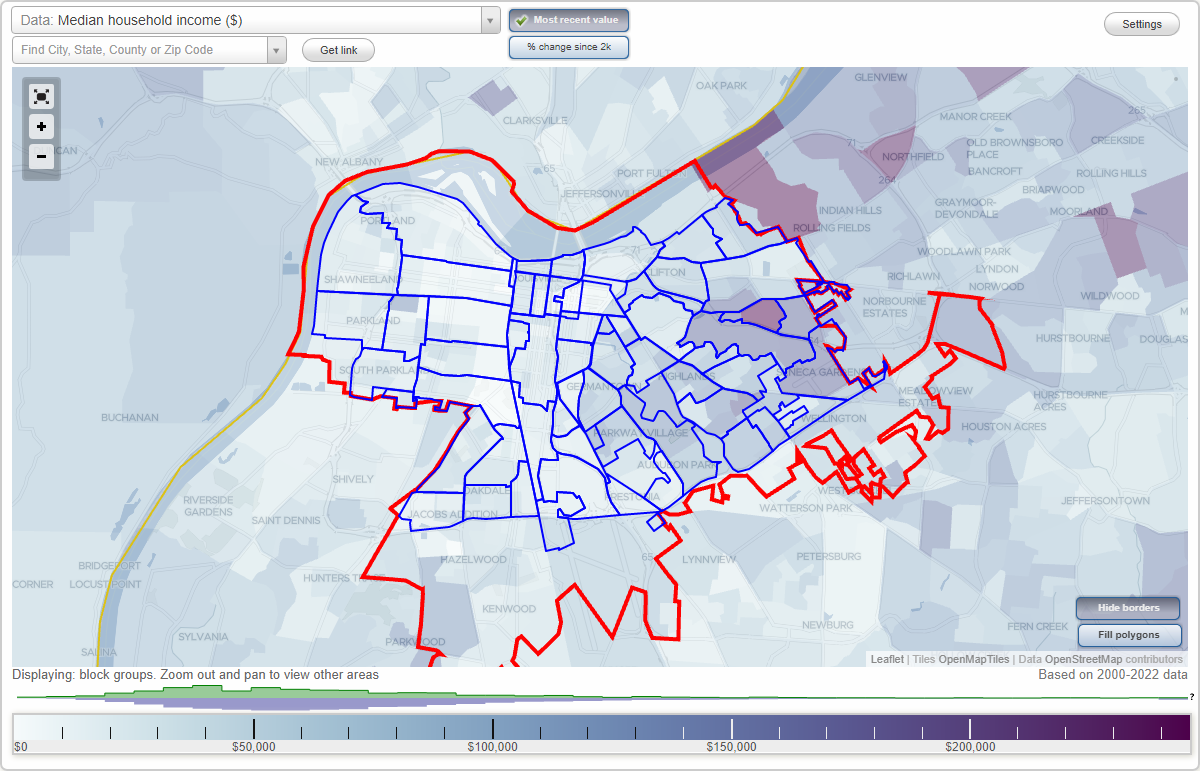
Louisville, Kentucky Neighborhood Map - Income, House Prices, Occupations, Boundaries
Settings
X

- City boundary
- Neighborhood boundaries
Business Search - 14 Million verified businesses
Neighborhoods:
Algonquin, Audubon, Belknap, Bonnycastle, Bowman, Bradley, Brownsboro Zorn, Butchertown, California, Camp Taylor, Cherokee Gardens, Cherokee Seneca, Cherokee Triangle, Chickasaw, Civic Center, Clifton, Clifton Heights, Crescent Hill, Deer Park, Downtown Louisville, East Main, Fairgrounds, Fourth Street, Gardiner Lane, Germantown, Hallmark, Hawthorne, Hayfield Dundee, Highland Park, Highlands Douglass, Irish Hill, Jackson-Smoketown, Jacobs, Limerick, Medical Center, Merriwether, Old Louisville, Paristown Pointe, Park Duvall, Park Hill, Parkland, Phoenix Hill, Poplar Level, Portland, Prestonia, Rockcreek Lexington Road, Russell, Saint Joseph, Schnitzelburg, Shawnee, Shelby Park, South Louisville, Taylor Berry, The Highlands, Tyler Park, University, West Main, Wilder Park, WyandotteAlgonquin neighborhood in Louisville statistics: (Find on map)
Area: 1.193 square miles
Population: 6,001
Population density:
Median household income in 2021:
Median rent in in 2021:
Male vs Females
Median age
Average estimated value of detached houses in 2021 (76.3% of all units):
Most popular occupations of males: material moving occupations (37.4%); service occupations (21.0%); sales and office occupations (11.2%); production occupations (11.1%); healthcare practitioners and technical occupations (4.1%); architecture and engineering occupations (3.3%); construction, extraction, and maintenance occupations (3.3%)
Most popular occupations of females: service occupations (31.6%); sales and office occupations (27.7%); material moving occupations (9.3%); healthcare practitioners and technical occupations (8.4%); production occupations (4.9%); transportation occupations (4.3%); business and financial operations occupations (3.9%)
Highways in this neighborhood: S 7th St (State Hwy 1931); US Hwy 60 (S 22nd St, US Hwy 31W); 7th Street Rd (State Hwy 1931).
Roads and streets: Algonquin Pkwy; Bernheim Ln; W Lee St; Dixdale Ave; Industry Rd; W Gaulbert Ave; McCloskey Ave; Burwell Ave; Dixie Hwy; S 23rd St; Vorster Ave; Colorado Ave; S 13th St; S 16th St; S 9th St; Patton Ct; Brashear Dr; W Shipp Ave; Moore Ct; S 11th St (Gnelda Ct); S 25th St; Mix Ave; Davies Ave; Gregg Ave; S 24th St; Wallie Ann Ct; S Rear St; Wingfield Ave; Commerce Rd; S 10th St; Wilart Dr; Herr Ave; S 20th St; S 4th St; 6th Ave; Jordan Ave; de Soto Ter; Magellan Ct; S 17th St; la Salle Pl; Rodman St; Harrod Ct; S 15th St; S 6th St; S 5th St.
Railroad features: Norfolk Southern RR; Southern Rlwy; Kentucky and Indiana RR; Csx RR; Louisville and Nashville RR; Seaboard System RR; Abandoned RR; Paducah Louisville RR.
Algonquin neighborhood detailed profile
Area: 1.193 square miles
Population: 6,001
Population density:
| Algonquin: | 5,029 people per square mile |
| Louisville: | 4,125 people per square mile |
Median household income in 2021:
| Algonquin: | $40,658 |
| Kentucky: | $55,573 |
Median rent in in 2021:
| Algonquin: | $620 |
| Kentucky: | $659 |
Male vs Females
| Males: | 2,670 |
| Females: | 3,331 |
Median age
| Males: | 36.0 years |
| Females: | 40.2 years |
Average estimated value of detached houses in 2021 (76.3% of all units):
| Algonquin: | $95,127 |
| Kentucky: | $230,536 |
Most popular occupations of males: material moving occupations (37.4%); service occupations (21.0%); sales and office occupations (11.2%); production occupations (11.1%); healthcare practitioners and technical occupations (4.1%); architecture and engineering occupations (3.3%); construction, extraction, and maintenance occupations (3.3%)
Most popular occupations of females: service occupations (31.6%); sales and office occupations (27.7%); material moving occupations (9.3%); healthcare practitioners and technical occupations (8.4%); production occupations (4.9%); transportation occupations (4.3%); business and financial operations occupations (3.9%)
Highways in this neighborhood: S 7th St (State Hwy 1931); US Hwy 60 (S 22nd St, US Hwy 31W); 7th Street Rd (State Hwy 1931).
Roads and streets: Algonquin Pkwy; Bernheim Ln; W Lee St; Dixdale Ave; Industry Rd; W Gaulbert Ave; McCloskey Ave; Burwell Ave; Dixie Hwy; S 23rd St; Vorster Ave; Colorado Ave; S 13th St; S 16th St; S 9th St; Patton Ct; Brashear Dr; W Shipp Ave; Moore Ct; S 11th St (Gnelda Ct); S 25th St; Mix Ave; Davies Ave; Gregg Ave; S 24th St; Wallie Ann Ct; S Rear St; Wingfield Ave; Commerce Rd; S 10th St; Wilart Dr; Herr Ave; S 20th St; S 4th St; 6th Ave; Jordan Ave; de Soto Ter; Magellan Ct; S 17th St; la Salle Pl; Rodman St; Harrod Ct; S 15th St; S 6th St; S 5th St.
Railroad features: Norfolk Southern RR; Southern Rlwy; Kentucky and Indiana RR; Csx RR; Louisville and Nashville RR; Seaboard System RR; Abandoned RR; Paducah Louisville RR.
Algonquin neighborhood detailed profile
Audubon neighborhood in Louisville statistics: (Find on map)
Area: 0.622 square miles
Population: 2,751
Population density:
Median household income in 2021:
Median rent in in 2021:
Male vs Females
Median age
Average estimated value of detached houses in 2021 (91.8% of all units):
Most popular occupations of males: service occupations (24.7%); sales and office occupations (14.6%); material moving occupations (9.6%); business and financial operations occupations (8.8%); computer and mathematical occupations (8.7%); education, training, and library occupations (5.1%); architecture and engineering occupations (4.9%)
Most popular occupations of females: sales and office occupations (24.8%); arts, design, entertainment, sports, and media occupations (18.2%); management occupations (except farmers) (8.8%); business and financial operations occupations (7.7%); education, training, and library occupations (7.7%); service occupations (7.6%); healthcare practitioners and technical occupations (7.2%)
Highways in this neighborhood: Poplar Level Rd (State Hwy 864).
Roads and streets: Hess Ln; McKinley Ave; Thruston Ave; Parkway Dr; Delor Ave; Pindell Ave; Ardmore Dr; Greenup Rd; Bobolink Rd; Rosemary Dr; Greenleaf Rd; Parklawn Dr; Colin Ave; E Burnett Ave; French Ave; Audubon Pkwy; Filson Ave; English Ave; Meade Ave; Plover Rd; Glenafton Ln; Harrison Ave; Eagle Pass; Louisa Ave; Stone St; Dixie St; Packard Ave; Osprey Rd; Molter Ave; Wirth Ave; Illinois Ave; Ivy Rd; Fern Dr; Harmon Ct; Locust Ln; Ashview Ter; Valley Dr; Falcon Dr; Perennial Dr; Molter Ct; Piper Ct; Nightingale Rd.
Audubon neighborhood detailed profile
Area: 0.622 square miles
Population: 2,751
Population density:
| Audubon: | 4,420 people per square mile |
| Louisville: | 4,125 people per square mile |
Median household income in 2021:
| Audubon: | $72,517 |
| Kentucky: | $55,573 |
Median rent in in 2021:
| Audubon: | $994 |
| Kentucky: | $659 |
Male vs Females
| Males: | 1,221 |
| Females: | 1,529 |
Median age
| Males: | 41.5 years |
| Females: | 46.4 years |
Average estimated value of detached houses in 2021 (91.8% of all units):
| Audubon: | $177,167 |
| Kentucky: | $230,536 |
Most popular occupations of males: service occupations (24.7%); sales and office occupations (14.6%); material moving occupations (9.6%); business and financial operations occupations (8.8%); computer and mathematical occupations (8.7%); education, training, and library occupations (5.1%); architecture and engineering occupations (4.9%)
Most popular occupations of females: sales and office occupations (24.8%); arts, design, entertainment, sports, and media occupations (18.2%); management occupations (except farmers) (8.8%); business and financial operations occupations (7.7%); education, training, and library occupations (7.7%); service occupations (7.6%); healthcare practitioners and technical occupations (7.2%)
Highways in this neighborhood: Poplar Level Rd (State Hwy 864).
Roads and streets: Hess Ln; McKinley Ave; Thruston Ave; Parkway Dr; Delor Ave; Pindell Ave; Ardmore Dr; Greenup Rd; Bobolink Rd; Rosemary Dr; Greenleaf Rd; Parklawn Dr; Colin Ave; E Burnett Ave; French Ave; Audubon Pkwy; Filson Ave; English Ave; Meade Ave; Plover Rd; Glenafton Ln; Harrison Ave; Eagle Pass; Louisa Ave; Stone St; Dixie St; Packard Ave; Osprey Rd; Molter Ave; Wirth Ave; Illinois Ave; Ivy Rd; Fern Dr; Harmon Ct; Locust Ln; Ashview Ter; Valley Dr; Falcon Dr; Perennial Dr; Molter Ct; Piper Ct; Nightingale Rd.
Audubon neighborhood detailed profile
Belknap neighborhood in Louisville statistics: (Find on map)
Area: 0.790 square miles
Population: 4,806
Population density:
Median household income in 2021:
Median rent in in 2021:
Male vs Females
Median age
Average estimated value of detached houses in 2021 (87.4% of all units):
Most popular occupations of males: sales and office occupations (21.2%); management occupations (except farmers) (18.6%); business and financial operations occupations (11.4%); education, training, and library occupations (11.4%); architecture and engineering occupations (9.7%); service occupations (5.4%); transportation occupations (4.9%)
Most popular occupations of females: education, training, and library occupations (23.5%); sales and office occupations (21.9%); healthcare practitioners and technical occupations (13.0%); service occupations (12.7%); management occupations (except farmers) (11.8%); business and financial operations occupations (4.2%); material moving occupations (3.6%)
Highways in this neighborhood: State Hwy 1703 (Newburg Rd).
Roads and streets: Trevilian Way; Dundee Rd; Saratoga Dr; Valley Vista Rd; Yale Dr; Ashwood Dr; Harvard Dr; Gresham Rd; Blvd Napoleon; Fleming Rd; Lakeside Dr; Dundee Way; Overlook Ter; Merton Ln; Clayton Rd; Carlton Ter; Woodfill Way; Wibben Ave; Page Ave; Eastview Ave; Lowell Ave; Strathmoor Blvd; Emerson Ave; Norris Pl; Bellarmine Blvd; Sylvan Way; Aberdeen Dr; Walterdale Ter; Ridge Rd; Ursuline Rd; Trough Spring Ln; Wrocklage Ave; Sils Ave; Woodbourne Ave; Ravinia Ave; Forest Hill Dr; Overlook Hill Ct; Thomas Merton Ln.
Belknap neighborhood detailed profile
Area: 0.790 square miles
Population: 4,806
Population density:
| Belknap: | 6,087 people per square mile |
| Louisville: | 4,125 people per square mile |
Median household income in 2021:
| Belknap: | $90,888 |
| Kentucky: | $55,573 |
Median rent in in 2021:
| Belknap: | $1,011 |
| Kentucky: | $659 |
Male vs Females
| Males: | 2,166 |
| Females: | 2,640 |
Median age
| Males: | 39.4 years |
| Females: | 43.8 years |
Average estimated value of detached houses in 2021 (87.4% of all units):
| Belknap: | $311,594 |
| Kentucky: | $230,536 |
Most popular occupations of males: sales and office occupations (21.2%); management occupations (except farmers) (18.6%); business and financial operations occupations (11.4%); education, training, and library occupations (11.4%); architecture and engineering occupations (9.7%); service occupations (5.4%); transportation occupations (4.9%)
Most popular occupations of females: education, training, and library occupations (23.5%); sales and office occupations (21.9%); healthcare practitioners and technical occupations (13.0%); service occupations (12.7%); management occupations (except farmers) (11.8%); business and financial operations occupations (4.2%); material moving occupations (3.6%)
Highways in this neighborhood: State Hwy 1703 (Newburg Rd).
Roads and streets: Trevilian Way; Dundee Rd; Saratoga Dr; Valley Vista Rd; Yale Dr; Ashwood Dr; Harvard Dr; Gresham Rd; Blvd Napoleon; Fleming Rd; Lakeside Dr; Dundee Way; Overlook Ter; Merton Ln; Clayton Rd; Carlton Ter; Woodfill Way; Wibben Ave; Page Ave; Eastview Ave; Lowell Ave; Strathmoor Blvd; Emerson Ave; Norris Pl; Bellarmine Blvd; Sylvan Way; Aberdeen Dr; Walterdale Ter; Ridge Rd; Ursuline Rd; Trough Spring Ln; Wrocklage Ave; Sils Ave; Woodbourne Ave; Ravinia Ave; Forest Hill Dr; Overlook Hill Ct; Thomas Merton Ln.
Belknap neighborhood detailed profile
Bonnycastle neighborhood in Louisville statistics: (Find on map)
Area: 0.326 square miles
Population: 2,212
Population density:
Median household income in 2021:
Median rent in in 2021:
Male vs Females
Median age
Housing prices:
Average estimated value of detached houses in 2021 (43.2% of all units):
Average estimated value of housing units in 2-unit structures in 2021 (11.8% of all units):
Average estimated '21 value of housing units in 5-or-more-unit structures (4.4% of all units):
Most popular occupations of males: sales and office occupations (17.1%); healthcare practitioners and technical occupations (10.4%); management occupations (except farmers) (10.2%); education, training, and library occupations (9.5%); computer and mathematical occupations (7.1%); production occupations (6.6%); business and financial operations occupations (6.4%)
Most popular occupations of females: sales and office occupations (31.1%); service occupations (17.2%); healthcare practitioners and technical occupations (9.9%); business and financial operations occupations (8.8%); education, training, and library occupations (8.1%); management occupations (except farmers) (7.3%); community and social services occupations (6.4%)
Highways in this neighborhood: Bardstown Rd (US Hwy 150, US Hwy 31E).
Roads and streets: Speed Ave; Bonnycastle Ave; Alta Ave; Maryland Ave; Cowling Ave; Murray Ave; Bonnycastle Ter; Chichester Ave; Spring Dr; Spring Valley Ln; Sulgrave Rd; Barney St; Gray Fox Rd; Park Boundary Rd; Cherokee Rd; Parsons Pl; Edgewood Pl.
Bonnycastle neighborhood detailed profile
Area: 0.326 square miles
Population: 2,212
Population density:
| Bonnycastle: | 6,777 people per square mile |
| Louisville: | 4,125 people per square mile |
Median household income in 2021:
| Bonnycastle: | $86,057 |
| Kentucky: | $55,573 |
Median rent in in 2021:
| Bonnycastle: | $852 |
| Kentucky: | $659 |
Male vs Females
| Males: | 1,064 |
| Females: | 1,148 |
Median age
| Males: | 36.2 years |
| Females: | 38.2 years |
Housing prices:
Average estimated value of detached houses in 2021 (43.2% of all units):
| Bonnycastle: | $405,070 |
| Kentucky: | $230,536 |
Average estimated value of housing units in 2-unit structures in 2021 (11.8% of all units):
| This neighborhood: | $305,000 |
| Kentucky: | $186,615 |
Average estimated '21 value of housing units in 5-or-more-unit structures (4.4% of all units):
| Bonnycastle: | $214,286 |
| Kentucky: | $176,226 |
Most popular occupations of males: sales and office occupations (17.1%); healthcare practitioners and technical occupations (10.4%); management occupations (except farmers) (10.2%); education, training, and library occupations (9.5%); computer and mathematical occupations (7.1%); production occupations (6.6%); business and financial operations occupations (6.4%)
Most popular occupations of females: sales and office occupations (31.1%); service occupations (17.2%); healthcare practitioners and technical occupations (9.9%); business and financial operations occupations (8.8%); education, training, and library occupations (8.1%); management occupations (except farmers) (7.3%); community and social services occupations (6.4%)
Highways in this neighborhood: Bardstown Rd (US Hwy 150, US Hwy 31E).
Roads and streets: Speed Ave; Bonnycastle Ave; Alta Ave; Maryland Ave; Cowling Ave; Murray Ave; Bonnycastle Ter; Chichester Ave; Spring Dr; Spring Valley Ln; Sulgrave Rd; Barney St; Gray Fox Rd; Park Boundary Rd; Cherokee Rd; Parsons Pl; Edgewood Pl.
Bonnycastle neighborhood detailed profile
Bowman neighborhood in Louisville statistics: (Find on map)
Area: 1.259 square miles
Population: 2,064
Population density:
Median household income in 2021:
Median rent in in 2021:
Male vs Females
Median age
Average estimated value of detached houses in 2021 (81.2% of all units):
Most popular occupations of males: management occupations (except farmers) (20.8%); sales and office occupations (17.5%); computer and mathematical occupations (10.3%); business and financial operations occupations (9.3%); service occupations (7.6%); architecture and engineering occupations (5.6%); healthcare practitioners and technical occupations (5.5%)
Most popular occupations of females: healthcare practitioners and technical occupations (36.0%); sales and office occupations (23.8%); business and financial operations occupations (11.0%); education, training, and library occupations (9.2%); service occupations (8.2%); production occupations (3.1%); management occupations (except farmers) (2.7%)
Limited-access highways (interstate or state) in this neighborhood: I- 64; I- 264 (Henry Watterson Expy).
Highways in this neighborhood: State Hwy 155 (Taylorsville Rd).
Roads and streets: Cannons Ln; Broadfields Dr; Dutchmans Ln; Roger E Schupp St; Winchester Rd; Pee Wee Reese Rd; Gast Blvd; Iola Rd; Vivian Ln; Dargue Blvd; Chamberry Cir; Drayton Dr; Hanover Rd; Bowman Ave; McCoy Way; Sidney Park Dr; Woodluck Ave; Landor Ave; Hughes Rd; Graham Rd; Ephraim McDowell Dr; Denham Rd; St Germaine Ct; Ridge Line Dr; Forest Brook Dr; Albert H Near St; Mulloy St; Abigail Dr; Tinker Blvd; Moran Ave; Century Division Way; Barrington Ct; Gladstone Ave; Hanover Ct; Norbourne Blvd; Alvarado Way; Plymouth Rd; Stonehaven Ct.
Other features: Middle Fork Beargrass Crk; Middle Frk.
Bowman neighborhood detailed profile
Area: 1.259 square miles
Population: 2,064
Population density:
| Bowman: | 1,640 people per square mile |
| Louisville: | 4,125 people per square mile |
Median household income in 2021:
| Bowman: | $89,735 |
| Kentucky: | $55,573 |
Median rent in in 2021:
| Bowman: | $894 |
| Kentucky: | $659 |
Male vs Females
| Males: | 1,003 |
| Females: | 1,060 |
Median age
| Males: | 46.0 years |
| Females: | 48.1 years |
Average estimated value of detached houses in 2021 (81.2% of all units):
| Bowman: | $372,701 |
| Kentucky: | $230,536 |
Most popular occupations of males: management occupations (except farmers) (20.8%); sales and office occupations (17.5%); computer and mathematical occupations (10.3%); business and financial operations occupations (9.3%); service occupations (7.6%); architecture and engineering occupations (5.6%); healthcare practitioners and technical occupations (5.5%)
Most popular occupations of females: healthcare practitioners and technical occupations (36.0%); sales and office occupations (23.8%); business and financial operations occupations (11.0%); education, training, and library occupations (9.2%); service occupations (8.2%); production occupations (3.1%); management occupations (except farmers) (2.7%)
Limited-access highways (interstate or state) in this neighborhood: I- 64; I- 264 (Henry Watterson Expy).
Highways in this neighborhood: State Hwy 155 (Taylorsville Rd).
Roads and streets: Cannons Ln; Broadfields Dr; Dutchmans Ln; Roger E Schupp St; Winchester Rd; Pee Wee Reese Rd; Gast Blvd; Iola Rd; Vivian Ln; Dargue Blvd; Chamberry Cir; Drayton Dr; Hanover Rd; Bowman Ave; McCoy Way; Sidney Park Dr; Woodluck Ave; Landor Ave; Hughes Rd; Graham Rd; Ephraim McDowell Dr; Denham Rd; St Germaine Ct; Ridge Line Dr; Forest Brook Dr; Albert H Near St; Mulloy St; Abigail Dr; Tinker Blvd; Moran Ave; Century Division Way; Barrington Ct; Gladstone Ave; Hanover Ct; Norbourne Blvd; Alvarado Way; Plymouth Rd; Stonehaven Ct.
Other features: Middle Fork Beargrass Crk; Middle Frk.
Bowman neighborhood detailed profile
Bradley neighborhood in Louisville statistics: (Find on map)
Area: 0.388 square miles
Population: 341
Population density:
Median household income in 2021:
Median rent in in 2021:
Male vs Females
Median age
Average estimated value of mobile home in 2021 (87.2% of all units):
Most popular occupations of males: construction, extraction, and maintenance occupations (34.8%); service occupations (23.7%); material moving occupations (23.1%); production occupations (18.4%)
Most popular occupations of females: production occupations (37.3%); management occupations (except farmers) (31.9%); material moving occupations (13.3%); service occupations (12.0%); legal occupations (3.0%); sales and office occupations (2.4%)
Limited-access highways (interstate or state) in this neighborhood: I- 65.
Highways in this neighborhood: State Hwy 61 (Preston Hwy); US Hwy 60 Alt (Eastern Pkwy); S Preston St (State Hwy 61).
Roads and streets: Maylawn Ave; Locust Ln; Tokay Trl; Bradley Ave; Harrison Ave; Crittenden Dr; Concord Dr; Ellsworth Ave; Emil Ave; Jefferson Ct; Merwin Ave; Merhoff St; Ervay Ave; Parkway Dr; Miller Ave; Perennial Dr; Bowman Ave; Penguin St; Duvall St; Mount Clair Ave; Ridgewood Ave; Fairgrounds Rd; Reed St; Catawba Ln; Sherry Rd; Larue Ct; Herbert Ave.
Railroad features: Southern Rlwy; Norfolk Southern RR.
Bradley neighborhood detailed profile
Area: 0.388 square miles
Population: 341
Population density:
| Bradley: | 879 people per square mile |
| Louisville: | 4,125 people per square mile |
Median household income in 2021:
| Bradley: | $29,116 |
| Kentucky: | $55,573 |
Median rent in in 2021:
| Bradley: | $477 |
| Kentucky: | $659 |
Male vs Females
| Males: | 184 |
| Females: | 157 |
Median age
| Males: | 26.2 years |
| Females: | 34.4 years |
Average estimated value of mobile home in 2021 (87.2% of all units):
| Bradley: | $11,309 |
| Kentucky: | $73,276 |
Most popular occupations of males: construction, extraction, and maintenance occupations (34.8%); service occupations (23.7%); material moving occupations (23.1%); production occupations (18.4%)
Most popular occupations of females: production occupations (37.3%); management occupations (except farmers) (31.9%); material moving occupations (13.3%); service occupations (12.0%); legal occupations (3.0%); sales and office occupations (2.4%)
Limited-access highways (interstate or state) in this neighborhood: I- 65.
Highways in this neighborhood: State Hwy 61 (Preston Hwy); US Hwy 60 Alt (Eastern Pkwy); S Preston St (State Hwy 61).
Roads and streets: Maylawn Ave; Locust Ln; Tokay Trl; Bradley Ave; Harrison Ave; Crittenden Dr; Concord Dr; Ellsworth Ave; Emil Ave; Jefferson Ct; Merwin Ave; Merhoff St; Ervay Ave; Parkway Dr; Miller Ave; Perennial Dr; Bowman Ave; Penguin St; Duvall St; Mount Clair Ave; Ridgewood Ave; Fairgrounds Rd; Reed St; Catawba Ln; Sherry Rd; Larue Ct; Herbert Ave.
Railroad features: Southern Rlwy; Norfolk Southern RR.
Bradley neighborhood detailed profile
Brownsboro Zorn neighborhood in Louisville statistics: (Find on map)
Area: 0.781 square miles
Population: 2,614
Population density:
Median household income in 2021:
Median rent in in 2021:
Male vs Females
Median age
Housing prices:
Average estimated value of detached houses in 2021 (42.1% of all units):
Average estimated value of townhouses or other attached units in 2021 (24.2% of all units):
Average estimated '21 value of housing units in 3-to-4-unit structures (7.9% of all units):
Average estimated '21 value of housing units in 5-or-more-unit structures (18.9% of all units):
Most popular occupations of males: sales and office occupations (22.6%); production occupations (20.6%); management occupations (except farmers) (9.7%); business and financial operations occupations (7.4%); service occupations (6.5%); computer and mathematical occupations (6.2%); material moving occupations (5.3%)
Most popular occupations of females: business and financial operations occupations (23.6%); healthcare practitioners and technical occupations (20.4%); sales and office occupations (19.7%); education, training, and library occupations (10.9%); service occupations (6.5%); management occupations (except farmers) (4.9%); legal occupations (3.9%)
Highways in this neighborhood: US Hwy 42.
Roads and streets: Zorn Ave; Jarvis Ln; Greenridge Ln; Ridgewood Rd; Country Club Rd; University Rd; University Ave; Lightfoot Rd; Fairhill Dr; Mockingbird Valley Rd; Brownsboro Ter; Cleveland Blvd; Riverwood Dr; Riedling Dr; Greenhill Ln; Brandon Rd; Madelle Ave; Penruth Ave; Mockingbird Hill Rd; Winton Ave; Belvar Ave; Mockingbird Ln; Hillcrest Ave; Emery Rd; Fleming Ave; Riverwood Pl; Knightsbridge Rd; Glen Ct; Jarvis Woods Ter; Wynfield Close Ct; Rebel Rd; Regan Rd; Basswood Ln; Jarvis Woods Ct; Zorn Pl; Greenspur Ln; Winton Ln; Wynfield Mews Ln; Birchway Ct; Parkway Ave.
Brownsboro Zorn neighborhood detailed profile
Area: 0.781 square miles
Population: 2,614
Population density:
| Brownsboro Zorn: | 3,345 people per square mile |
| Louisville: | 4,125 people per square mile |
Median household income in 2021:
| Brownsboro Zorn: | $78,084 |
| Kentucky: | $55,573 |
Median rent in in 2021:
| Brownsboro Zorn: | $904 |
| Kentucky: | $659 |
Male vs Females
| Males: | 1,166 |
| Females: | 1,447 |
Median age
| Males: | 41.4 years |
| Females: | 44.2 years |
Housing prices:
Average estimated value of detached houses in 2021 (42.1% of all units):
| Brownsboro Zorn: | $288,223 |
| Kentucky: | $230,536 |
Average estimated value of townhouses or other attached units in 2021 (24.2% of all units):
| This neighborhood: | $1,167,820 |
| Kentucky: | $242,261 |
Average estimated '21 value of housing units in 3-to-4-unit structures (7.9% of all units):
| Brownsboro Zorn: | $195,855 |
| Kentucky: | $166,253 |
Average estimated '21 value of housing units in 5-or-more-unit structures (18.9% of all units):
| Brownsboro Zorn: | $460,890 |
| Kentucky: | $176,226 |
Most popular occupations of males: sales and office occupations (22.6%); production occupations (20.6%); management occupations (except farmers) (9.7%); business and financial operations occupations (7.4%); service occupations (6.5%); computer and mathematical occupations (6.2%); material moving occupations (5.3%)
Most popular occupations of females: business and financial operations occupations (23.6%); healthcare practitioners and technical occupations (20.4%); sales and office occupations (19.7%); education, training, and library occupations (10.9%); service occupations (6.5%); management occupations (except farmers) (4.9%); legal occupations (3.9%)
Highways in this neighborhood: US Hwy 42.
Roads and streets: Zorn Ave; Jarvis Ln; Greenridge Ln; Ridgewood Rd; Country Club Rd; University Rd; University Ave; Lightfoot Rd; Fairhill Dr; Mockingbird Valley Rd; Brownsboro Ter; Cleveland Blvd; Riverwood Dr; Riedling Dr; Greenhill Ln; Brandon Rd; Madelle Ave; Penruth Ave; Mockingbird Hill Rd; Winton Ave; Belvar Ave; Mockingbird Ln; Hillcrest Ave; Emery Rd; Fleming Ave; Riverwood Pl; Knightsbridge Rd; Glen Ct; Jarvis Woods Ter; Wynfield Close Ct; Rebel Rd; Regan Rd; Basswood Ln; Jarvis Woods Ct; Zorn Pl; Greenspur Ln; Winton Ln; Wynfield Mews Ln; Birchway Ct; Parkway Ave.
Brownsboro Zorn neighborhood detailed profile
Butchertown neighborhood in Louisville statistics: (Find on map)
Area: 0.924 square miles
Population: 634
Population density:
Median household income in 2021:
Median rent in in 2021:
Male vs Females
Median age
Most popular occupations of males: sales and office occupations (19.8%); transportation occupations (13.1%); service occupations (10.2%); healthcare practitioners and technical occupations (8.1%); computer and mathematical occupations (7.8%); material moving occupations (7.3%); construction, extraction, and maintenance occupations (4.8%)
Most popular occupations of females: sales and office occupations (23.2%); education, training, and library occupations (17.3%); healthcare practitioners and technical occupations (16.2%); management occupations (except farmers) (11.2%); service occupations (10.4%); community and social services occupations (7.5%); business and financial operations occupations (7.2%)
Limited-access highways (interstate or state) in this neighborhood: I- 64; I- 71; I- 65.
Highways in this neighborhood: US Hwy 60 (E Main St, US Hwy 31E); US Hwy 60 (Story Ave, US Hwy 42); Mellwood Ave (US Hwy 42, US Hwy 60); US Hwy 42.
Roads and streets: River Rd; E Washington St; Adams St; Franklin St; Frankfort Ave; Fulton St; E Witherspoon St; N Campbell St; Cabel St; E Water St; Quincy St; N Shelby St; N Spring St; Bowles Ave; N Clay St; N Wenzel St; Webster St; Litterle Rd; Mill St; Stoecker Ave; Buchanan St; N Hancock St; N Johnson St; Geiger St; Bickel Ave; Blue Horse Ave; Lloyd St.
Railroad features: Kentucky and Indiana RR; Csx RR; Penn Central RR.
Other features: South Fork Beargrass Crk; Beargrass Crk; Muddy Frk; Muddy Fork Beargrass Crk; Ohio Riv.
Butchertown neighborhood detailed profile
Area: 0.924 square miles
Population: 634
Population density:
| Butchertown: | 686 people per square mile |
| Louisville: | 4,125 people per square mile |
Median household income in 2021:
| Butchertown: | $52,135 |
| Kentucky: | $55,573 |
Median rent in in 2021:
| Butchertown: | $854 |
| Kentucky: | $659 |
Male vs Females
| Males: | 300 |
| Females: | 334 |
Median age
| Males: | 40.1 years |
| Females: | 39.5 years |
Most popular occupations of males: sales and office occupations (19.8%); transportation occupations (13.1%); service occupations (10.2%); healthcare practitioners and technical occupations (8.1%); computer and mathematical occupations (7.8%); material moving occupations (7.3%); construction, extraction, and maintenance occupations (4.8%)
Most popular occupations of females: sales and office occupations (23.2%); education, training, and library occupations (17.3%); healthcare practitioners and technical occupations (16.2%); management occupations (except farmers) (11.2%); service occupations (10.4%); community and social services occupations (7.5%); business and financial operations occupations (7.2%)
Limited-access highways (interstate or state) in this neighborhood: I- 64; I- 71; I- 65.
Highways in this neighborhood: US Hwy 60 (E Main St, US Hwy 31E); US Hwy 60 (Story Ave, US Hwy 42); Mellwood Ave (US Hwy 42, US Hwy 60); US Hwy 42.
Roads and streets: River Rd; E Washington St; Adams St; Franklin St; Frankfort Ave; Fulton St; E Witherspoon St; N Campbell St; Cabel St; E Water St; Quincy St; N Shelby St; N Spring St; Bowles Ave; N Clay St; N Wenzel St; Webster St; Litterle Rd; Mill St; Stoecker Ave; Buchanan St; N Hancock St; N Johnson St; Geiger St; Bickel Ave; Blue Horse Ave; Lloyd St.
Railroad features: Kentucky and Indiana RR; Csx RR; Penn Central RR.
Other features: South Fork Beargrass Crk; Beargrass Crk; Muddy Frk; Muddy Fork Beargrass Crk; Ohio Riv.
Butchertown neighborhood detailed profile
California neighborhood in Louisville statistics: (Find on map)
Area: 1.230 square miles
Population: 5,958
Population density:
Median household income in 2021:
Median rent in in 2021:
Male vs Females
Median age
Housing prices:
Average estimated value of detached houses in 2021 (74.8% of all units):
Average estimated '21 value of housing units in 5-or-more-unit structures (8.4% of all units):
Most popular occupations of males: sales and office occupations (17.5%); material moving occupations (16.3%); production occupations (16.2%); service occupations (15.2%); transportation occupations (14.7%); construction, extraction, and maintenance occupations (5.6%); business and financial operations occupations (3.1%)
Most popular occupations of females: service occupations (47.0%); sales and office occupations (23.0%); production occupations (10.5%); material moving occupations (5.4%); management occupations (except farmers) (5.3%); business and financial operations occupations (4.3%); education, training, and library occupations (4.0%)
Highways in this neighborhood: US Hwy 31W (US Hwy 60, Doctor W J Hodge St); US Hwy 60 (S 22nd St, US Hwy 31W).
Roads and streets: W Oak St; W Kentucky St; Garland Ave; Hale Ave; Maple St; W Breckinridge St; S 23rd St; Dixie Hwy; Anderson St; S 12th St; S 17th St; S 15th St; S 25th St; Date St; W Saint Catherine St; Greenwood Ave; Grand Ave; Howard St; Osage Ave; S 16th St; Gallagher St; Prentice St; S 9th St; S 13th St; S 11th St; Zane St; S 24th St; Pal Rd; Quality Choice Pl (Oldham St); Midway Ave; Humler St; Salem Ave; S 20th St; W St Catherine St; McKendree Ct; Kendall Ct; Saunders Ct.
Railroad features: Paducah Louisville RR; Louisville and Nashville RR; Louisville Indiana RR; Seaboard System RR; Csx RR; Illinois Central RR.
California neighborhood detailed profile
Area: 1.230 square miles
Population: 5,958
Population density:
| California: | 4,843 people per square mile |
| Louisville: | 4,125 people per square mile |
Median household income in 2021:
| California: | $24,781 |
| Kentucky: | $55,573 |
Median rent in in 2021:
| California: | $598 |
| Kentucky: | $659 |
Male vs Females
| Males: | 2,730 |
| Females: | 3,228 |
Median age
| Males: | 31.4 years |
| Females: | 33.7 years |
Housing prices:
Average estimated value of detached houses in 2021 (74.8% of all units):
| California: | $49,590 |
| Kentucky: | $230,536 |
Average estimated '21 value of housing units in 5-or-more-unit structures (8.4% of all units):
| California: | $432,939 |
| Kentucky: | $176,226 |
Most popular occupations of males: sales and office occupations (17.5%); material moving occupations (16.3%); production occupations (16.2%); service occupations (15.2%); transportation occupations (14.7%); construction, extraction, and maintenance occupations (5.6%); business and financial operations occupations (3.1%)
Most popular occupations of females: service occupations (47.0%); sales and office occupations (23.0%); production occupations (10.5%); material moving occupations (5.4%); management occupations (except farmers) (5.3%); business and financial operations occupations (4.3%); education, training, and library occupations (4.0%)
Highways in this neighborhood: US Hwy 31W (US Hwy 60, Doctor W J Hodge St); US Hwy 60 (S 22nd St, US Hwy 31W).
Roads and streets: W Oak St; W Kentucky St; Garland Ave; Hale Ave; Maple St; W Breckinridge St; S 23rd St; Dixie Hwy; Anderson St; S 12th St; S 17th St; S 15th St; S 25th St; Date St; W Saint Catherine St; Greenwood Ave; Grand Ave; Howard St; Osage Ave; S 16th St; Gallagher St; Prentice St; S 9th St; S 13th St; S 11th St; Zane St; S 24th St; Pal Rd; Quality Choice Pl (Oldham St); Midway Ave; Humler St; Salem Ave; S 20th St; W St Catherine St; McKendree Ct; Kendall Ct; Saunders Ct.
Railroad features: Paducah Louisville RR; Louisville and Nashville RR; Louisville Indiana RR; Seaboard System RR; Csx RR; Illinois Central RR.
California neighborhood detailed profile
Camp Taylor neighborhood in Louisville statistics: (Find on map)
Area: 0.415 square miles
Population: 367
Population density:
Median household income in 2021:
Median rent in in 2021:
Male vs Females
Median age
Average estimated value of detached houses in 2021 (94.7% of all units):
Most popular occupations of males: construction, extraction, and maintenance occupations (17.9%); sales and office occupations (13.8%); service occupations (11.7%); material moving occupations (11.2%); management occupations (except farmers) (8.7%); business and financial operations occupations (8.2%); transportation occupations (6.1%)
Most popular occupations of females: service occupations (37.3%); sales and office occupations (21.5%); healthcare practitioners and technical occupations (14.6%); education, training, and library occupations (12.0%); transportation occupations (11.3%); management occupations (except farmers) (3.4%); business and financial operations occupations (2.6%)
Limited-access highways (interstate or state) in this neighborhood: Henry Watterson Expy (I- 264).
Highways in this neighborhood: Poplar Level Rd (State Hwy 864).
Roads and streets: Taylor Ave; Indiana Ave; Durrett Ln; Lincoln Ave; Sherman Ave; Lee Ave; Belmar Dr; Reservoir Ave; McKay Ave; Redwood Dr; Cheak St; Orchard Ave; Boone St; Grove Ave; Trigg St; Clark St; Warren St; Kenton Ave; Mercer Ave; Cheak Ct; Todd Ave; Union St; Reid Ave; Larue Ave; Linda House Way.
Railroad features: Southern Rlwy.
Camp Taylor neighborhood detailed profile
Area: 0.415 square miles
Population: 367
Population density:
| Camp Taylor: | 884 people per square mile |
| Louisville: | 4,125 people per square mile |
Median household income in 2021:
| Camp Taylor: | $41,319 |
| Kentucky: | $55,573 |
Median rent in in 2021:
| Camp Taylor: | $820 |
| Kentucky: | $659 |
Male vs Females
| Males: | 177 |
| Females: | 190 |
Median age
| Males: | 36.7 years |
| Females: | 36.4 years |
Average estimated value of detached houses in 2021 (94.7% of all units):
| Camp Taylor: | $109,250 |
| Kentucky: | $230,536 |
Most popular occupations of males: construction, extraction, and maintenance occupations (17.9%); sales and office occupations (13.8%); service occupations (11.7%); material moving occupations (11.2%); management occupations (except farmers) (8.7%); business and financial operations occupations (8.2%); transportation occupations (6.1%)
Most popular occupations of females: service occupations (37.3%); sales and office occupations (21.5%); healthcare practitioners and technical occupations (14.6%); education, training, and library occupations (12.0%); transportation occupations (11.3%); management occupations (except farmers) (3.4%); business and financial operations occupations (2.6%)
Limited-access highways (interstate or state) in this neighborhood: Henry Watterson Expy (I- 264).
Highways in this neighborhood: Poplar Level Rd (State Hwy 864).
Roads and streets: Taylor Ave; Indiana Ave; Durrett Ln; Lincoln Ave; Sherman Ave; Lee Ave; Belmar Dr; Reservoir Ave; McKay Ave; Redwood Dr; Cheak St; Orchard Ave; Boone St; Grove Ave; Trigg St; Clark St; Warren St; Kenton Ave; Mercer Ave; Cheak Ct; Todd Ave; Union St; Reid Ave; Larue Ave; Linda House Way.
Railroad features: Southern Rlwy.
Camp Taylor neighborhood detailed profile
Cherokee Gardens neighborhood in Louisville statistics: (Find on map)
Area: 0.399 square miles
Population: 825
Population density:
Median household income in 2021:
Median rent in in 2021:
Male vs Females
Median age
Average estimated value of detached houses in 2021 (96.6% of all units):
Most popular occupations of males: management occupations (except farmers) (29.8%); sales and office occupations (21.4%); healthcare practitioners and technical occupations (13.0%); computer and mathematical occupations (12.6%); architecture and engineering occupations (6.9%); service occupations (4.7%); transportation occupations (4.5%)
Most popular occupations of females: healthcare practitioners and technical occupations (25.0%); sales and office occupations (24.2%); management occupations (except farmers) (16.1%); service occupations (15.4%); community and social services occupations (5.3%); computer and mathematical occupations (4.7%); life, physical, and social science occupations (3.8%)
Limited-access highways (interstate or state) in this neighborhood: I- 64.
Roads and streets: Sunnyside Dr; Garden Dr; Primrose Way; Alta Vista Ct; Juniper Hill Rd; Rainbow Dr; Barberry Ln; Beals Branch Rd; Beals Branch Dr; Sunset Rd; Fairfield Dr; Middle Way; Cressbrook Dr; Cherokee Woods Rd; Danes Hall Dr; Poppy Way; Pee Wee Reese Rd; Fehr Rd; Altagate Rd; Juniper Hill Ct; Braeview Rd; Lilac Way; Alta Vista Rd; Alta Vista Pl; Circlewood Ct; Tan Oak Ct; Alta Vista Way; Altagate Ct; Danes Hall Ct.
Cherokee Gardens neighborhood detailed profile
Area: 0.399 square miles
Population: 825
Population density:
| Cherokee Gardens: | 2,066 people per square mile |
| Louisville: | 4,125 people per square mile |
Median household income in 2021:
| Cherokee Gardens: | $156,500 |
| Kentucky: | $55,573 |
Median rent in in 2021:
| Cherokee Gardens: | $848 |
| Kentucky: | $659 |
Male vs Females
| Males: | 412 |
| Females: | 413 |
Median age
| Males: | 37.1 years |
| Females: | 37.9 years |
Average estimated value of detached houses in 2021 (96.6% of all units):
| Cherokee Gardens: | $727,969 |
| Kentucky: | $230,536 |
Most popular occupations of males: management occupations (except farmers) (29.8%); sales and office occupations (21.4%); healthcare practitioners and technical occupations (13.0%); computer and mathematical occupations (12.6%); architecture and engineering occupations (6.9%); service occupations (4.7%); transportation occupations (4.5%)
Most popular occupations of females: healthcare practitioners and technical occupations (25.0%); sales and office occupations (24.2%); management occupations (except farmers) (16.1%); service occupations (15.4%); community and social services occupations (5.3%); computer and mathematical occupations (4.7%); life, physical, and social science occupations (3.8%)
Limited-access highways (interstate or state) in this neighborhood: I- 64.
Roads and streets: Sunnyside Dr; Garden Dr; Primrose Way; Alta Vista Ct; Juniper Hill Rd; Rainbow Dr; Barberry Ln; Beals Branch Rd; Beals Branch Dr; Sunset Rd; Fairfield Dr; Middle Way; Cressbrook Dr; Cherokee Woods Rd; Danes Hall Dr; Poppy Way; Pee Wee Reese Rd; Fehr Rd; Altagate Rd; Juniper Hill Ct; Braeview Rd; Lilac Way; Alta Vista Rd; Alta Vista Pl; Circlewood Ct; Tan Oak Ct; Alta Vista Way; Altagate Ct; Danes Hall Ct.
Cherokee Gardens neighborhood detailed profile
Cherokee Seneca neighborhood in Louisville statistics: (Find on map)
Area: 1.309 square miles
Population: 1,604
Population density:
Median household income in 2021:
Median rent in in 2021:
Male vs Females
Median age
Housing prices:
Average estimated value of detached houses in 2021 (88.4% of all units):
Average estimated value of housing units in 2-unit structures in 2021 (2.1% of all units):
Average estimated '21 value of housing units in 5-or-more-unit structures (1.5% of all units):
Most popular occupations of males: sales and office occupations (20.9%); management occupations (except farmers) (13.9%); material moving occupations (13.2%); service occupations (9.7%); production occupations (8.6%); transportation occupations (5.5%); legal occupations (4.9%)
Most popular occupations of females: healthcare practitioners and technical occupations (29.0%); sales and office occupations (21.1%); service occupations (16.7%); management occupations (except farmers) (9.5%); education, training, and library occupations (8.5%); business and financial operations occupations (5.0%); arts, design, entertainment, sports, and media occupations (2.6%)
Limited-access highways (interstate or state) in this neighborhood: I- 64.
Roads and streets: Cherokee Park Rd; Seneca Park Rd; Alta Vista Rd; Pee Wee Reese Rd; Beargrass Rd; Cherokee Rd; Maple Rd; Rostrevor Cir; Barret Hill Rd; Alexander Rd; Red Fox Rd; Old Cannons Ln; Park Hills Dr; Park Boundary Rd; Alta Cir; Five Oaks Pl; Doric Cir; Park Hills Ct; Beals Branch Rd; Trevilian Way.
Other features: Middle Fork Beargrass Crk; Beargrass Crk.
Cherokee Seneca neighborhood detailed profile
Area: 1.309 square miles
Population: 1,604
Population density:
| Cherokee Seneca: | 1,225 people per square mile |
| Louisville: | 4,125 people per square mile |
Median household income in 2021:
| Cherokee Seneca: | $112,249 |
| Kentucky: | $55,573 |
Median rent in in 2021:
| Cherokee Seneca: | $856 |
| Kentucky: | $659 |
Male vs Females
| Males: | 921 |
| Females: | 682 |
Median age
| Males: | 40.9 years |
| Females: | 44.7 years |
Housing prices:
Average estimated value of detached houses in 2021 (88.4% of all units):
| Cherokee Seneca: | $622,750 |
| Kentucky: | $230,536 |
Average estimated value of housing units in 2-unit structures in 2021 (2.1% of all units):
| This neighborhood: | $305,000 |
| Kentucky: | $186,615 |
Average estimated '21 value of housing units in 5-or-more-unit structures (1.5% of all units):
| Cherokee Seneca: | $214,286 |
| Kentucky: | $176,226 |
Most popular occupations of males: sales and office occupations (20.9%); management occupations (except farmers) (13.9%); material moving occupations (13.2%); service occupations (9.7%); production occupations (8.6%); transportation occupations (5.5%); legal occupations (4.9%)
Most popular occupations of females: healthcare practitioners and technical occupations (29.0%); sales and office occupations (21.1%); service occupations (16.7%); management occupations (except farmers) (9.5%); education, training, and library occupations (8.5%); business and financial operations occupations (5.0%); arts, design, entertainment, sports, and media occupations (2.6%)
Limited-access highways (interstate or state) in this neighborhood: I- 64.
Roads and streets: Cherokee Park Rd; Seneca Park Rd; Alta Vista Rd; Pee Wee Reese Rd; Beargrass Rd; Cherokee Rd; Maple Rd; Rostrevor Cir; Barret Hill Rd; Alexander Rd; Red Fox Rd; Old Cannons Ln; Park Hills Dr; Park Boundary Rd; Alta Cir; Five Oaks Pl; Doric Cir; Park Hills Ct; Beals Branch Rd; Trevilian Way.
Other features: Middle Fork Beargrass Crk; Beargrass Crk.
Cherokee Seneca neighborhood detailed profile
Cherokee Triangle neighborhood in Louisville statistics: (Find on map)
Area: 0.979 square miles
Population: 4,274
Population density:
Median household income in 2021:
Median rent in in 2021:
Male vs Females
Median age
Housing prices:
Average estimated value of detached houses in 2021 (58.8% of all units):
Average estimated value of housing units in 2-unit structures in 2021 (10.7% of all units):
Average estimated '21 value of housing units in 5-or-more-unit structures (17.3% of all units):
Most popular occupations of males: service occupations (15.0%); business and financial operations occupations (10.3%); computer and mathematical occupations (9.8%); education, training, and library occupations (9.2%); management occupations (except farmers) (8.7%); sales and office occupations (6.6%); healthcare practitioners and technical occupations (6.4%)
Most popular occupations of females: healthcare practitioners and technical occupations (20.9%); service occupations (20.9%); sales and office occupations (16.8%); education, training, and library occupations (12.2%); arts, design, entertainment, sports, and media occupations (11.4%); management occupations (except farmers) (11.3%); production occupations (2.3%)
Highways in this neighborhood: US Hwy 60 Alt (Cherokee Pkwy); US Hwy 60 Alt (US Hwy 150, US Hwy 31E, Bardstown Rd).
Roads and streets: Grinstead Dr; Cherokee Rd; Everett Ave; Longest Ave; Willow Ave; Glenmary Ave; Baringer Ave; Eastern Pkwy; Ransdell Ave; Patterson Ave; Ray Ave; Ridgeway Ave; Edgeland Ave; Bassett Ave; Highland Ave; Hilliard Ave; Eastern Star Ct; Midland Ave; Dearing Ct; Everett Ter; Dudley Ave; Grinstead Ct; Eastern Star Dr.
Cherokee Triangle neighborhood detailed profile
Area: 0.979 square miles
Population: 4,274
Population density:
| Cherokee Triangle: | 4,366 people per square mile |
| Louisville: | 4,125 people per square mile |
Median household income in 2021:
| Cherokee Triangle: | $77,939 |
| Kentucky: | $55,573 |
Median rent in in 2021:
| Cherokee Triangle: | $1,188 |
| Kentucky: | $659 |
Male vs Females
| Males: | 1,931 |
| Females: | 2,342 |
Median age
| Males: | 34.6 years |
| Females: | 33.2 years |
Housing prices:
Average estimated value of detached houses in 2021 (58.8% of all units):
| Cherokee Triangle: | $384,323 |
| Kentucky: | $230,536 |
Average estimated value of housing units in 2-unit structures in 2021 (10.7% of all units):
| This neighborhood: | $305,000 |
| Kentucky: | $186,615 |
Average estimated '21 value of housing units in 5-or-more-unit structures (17.3% of all units):
| Cherokee Triangle: | $201,765 |
| Kentucky: | $176,226 |
Most popular occupations of males: service occupations (15.0%); business and financial operations occupations (10.3%); computer and mathematical occupations (9.8%); education, training, and library occupations (9.2%); management occupations (except farmers) (8.7%); sales and office occupations (6.6%); healthcare practitioners and technical occupations (6.4%)
Most popular occupations of females: healthcare practitioners and technical occupations (20.9%); service occupations (20.9%); sales and office occupations (16.8%); education, training, and library occupations (12.2%); arts, design, entertainment, sports, and media occupations (11.4%); management occupations (except farmers) (11.3%); production occupations (2.3%)
Highways in this neighborhood: US Hwy 60 Alt (Cherokee Pkwy); US Hwy 60 Alt (US Hwy 150, US Hwy 31E, Bardstown Rd).
Roads and streets: Grinstead Dr; Cherokee Rd; Everett Ave; Longest Ave; Willow Ave; Glenmary Ave; Baringer Ave; Eastern Pkwy; Ransdell Ave; Patterson Ave; Ray Ave; Ridgeway Ave; Edgeland Ave; Bassett Ave; Highland Ave; Hilliard Ave; Eastern Star Ct; Midland Ave; Dearing Ct; Everett Ter; Dudley Ave; Grinstead Ct; Eastern Star Dr.
Cherokee Triangle neighborhood detailed profile
Chickasaw neighborhood in Louisville statistics: (Find on map)
Area: 1.217 square miles
Population: 6,142
Population density:
Median household income in 2021:
Median rent in in 2021:
Male vs Females
Median age
Average estimated value of detached houses in 2021 (88.1% of all units):
Most popular occupations of males: service occupations (23.9%); production occupations (19.3%); material moving occupations (17.8%); sales and office occupations (9.8%); transportation occupations (8.4%); construction, extraction, and maintenance occupations (5.2%); computer and mathematical occupations (4.9%)
Most popular occupations of females: service occupations (35.2%); sales and office occupations (23.2%); management occupations (except farmers) (9.9%); education, training, and library occupations (8.0%); production occupations (7.4%); healthcare practitioners and technical occupations (5.4%); material moving occupations (4.7%)
Limited-access highways (interstate or state) in this neighborhood: I- 264.
Roads and streets: Garland Ave; Greenwood Ave; Hale Ave; W Kentucky St; Doerhoefer Ave; Virginia Ave; Grand Ave; Sunset Ave; S 34th St; S 36th St; S 45th St; Chickasaw Park Rd; S 41st St; S 43rd St; Southwestern Pkwy; Cecil Ave; S 38th St; Dumesnil St; S 40th St; Winnrose Way; S 42nd St; Brewster Ave; Regatta Way; Westchester Ave; Fordson Way; Riverview Ave; Varble Ave; Colmar Dr; S 39th St; S 47th St; Kaiser Ct; S 44th St; Loretto Ave; Plato Ter; Sutcliffe Ave; S 37th St; Garrs Ln; Dearborn Ave; Fairland Pl; Exley Ct; Woodway Ln; N Kentucky St; Rosewell Ave; Chickasaw Loop Rd; Kirby Ave; S 35th St; Ellerholt Ct; Colmar Cir; Canopy Ct; Challis Cir; Regatta Cir.
Other features: Ohio Riv.
Chickasaw neighborhood detailed profile
Area: 1.217 square miles
Population: 6,142
Population density:
| Chickasaw: | 5,046 people per square mile |
| Louisville: | 4,125 people per square mile |
Median household income in 2021:
| Chickasaw: | $44,532 |
| Kentucky: | $55,573 |
Median rent in in 2021:
| Chickasaw: | $564 |
| Kentucky: | $659 |
Male vs Females
| Males: | 2,847 |
| Females: | 3,294 |
Median age
| Males: | 37.3 years |
| Females: | 48.8 years |
Average estimated value of detached houses in 2021 (88.1% of all units):
| Chickasaw: | $78,507 |
| Kentucky: | $230,536 |
Most popular occupations of males: service occupations (23.9%); production occupations (19.3%); material moving occupations (17.8%); sales and office occupations (9.8%); transportation occupations (8.4%); construction, extraction, and maintenance occupations (5.2%); computer and mathematical occupations (4.9%)
Most popular occupations of females: service occupations (35.2%); sales and office occupations (23.2%); management occupations (except farmers) (9.9%); education, training, and library occupations (8.0%); production occupations (7.4%); healthcare practitioners and technical occupations (5.4%); material moving occupations (4.7%)
Limited-access highways (interstate or state) in this neighborhood: I- 264.
Roads and streets: Garland Ave; Greenwood Ave; Hale Ave; W Kentucky St; Doerhoefer Ave; Virginia Ave; Grand Ave; Sunset Ave; S 34th St; S 36th St; S 45th St; Chickasaw Park Rd; S 41st St; S 43rd St; Southwestern Pkwy; Cecil Ave; S 38th St; Dumesnil St; S 40th St; Winnrose Way; S 42nd St; Brewster Ave; Regatta Way; Westchester Ave; Fordson Way; Riverview Ave; Varble Ave; Colmar Dr; S 39th St; S 47th St; Kaiser Ct; S 44th St; Loretto Ave; Plato Ter; Sutcliffe Ave; S 37th St; Garrs Ln; Dearborn Ave; Fairland Pl; Exley Ct; Woodway Ln; N Kentucky St; Rosewell Ave; Chickasaw Loop Rd; Kirby Ave; S 35th St; Ellerholt Ct; Colmar Cir; Canopy Ct; Challis Cir; Regatta Cir.
Other features: Ohio Riv.
Chickasaw neighborhood detailed profile
Civic Center neighborhood in Louisville statistics: (Find on map)
Area: 0.275 square miles
Population: 2,524
Population density:
Median household income in 2021:
Median rent in in 2021:
Male vs Females
Median age
Average estimated '21 value of housing units in 5-or-more-unit structures (52.5% of all units):
Most popular occupations of males: computer and mathematical occupations (28.4%); management occupations (except farmers) (25.4%); sales and office occupations (15.4%); legal occupations (9.4%); education, training, and library occupations (5.3%); healthcare practitioners and technical occupations (4.4%); service occupations (3.9%)
Most popular occupations of females: management occupations (except farmers) (24.6%); sales and office occupations (20.3%); healthcare practitioners and technical occupations (14.0%); legal occupations (12.1%); business and financial operations occupations (8.0%); community and social services occupations (6.8%); service occupations (5.9%)
Highways in this neighborhood: State Hwy 1931 (S 7th St); US Hwy 150 (W Broadway); US Hwy 31W (US Hwy 60, W Jefferson St).
Roads and streets: S 8th St; S 6th St; S 5th St; Armory Pl; Congress Aly; W Liberty St; W Chestnut St; York St; W Muhammad Ali Blvd; Magazine St; Cedar St; Dr Martin Luther King Pl; Mary J Robb Ct.
Civic Center neighborhood detailed profile
Area: 0.275 square miles
Population: 2,524
Population density:
| Civic Center: | 9,168 people per square mile |
| Louisville: | 4,125 people per square mile |
Median household income in 2021:
| Civic Center: | $32,671 |
| Kentucky: | $55,573 |
Median rent in in 2021:
| Civic Center: | $940 |
| Kentucky: | $659 |
Male vs Females
| Males: | 1,953 |
| Females: | 571 |
Median age
| Males: | 36.6 years |
| Females: | 31.6 years |
Average estimated '21 value of housing units in 5-or-more-unit structures (52.5% of all units):
| Civic Center: | $432,939 |
| Kentucky: | $176,226 |
Most popular occupations of males: computer and mathematical occupations (28.4%); management occupations (except farmers) (25.4%); sales and office occupations (15.4%); legal occupations (9.4%); education, training, and library occupations (5.3%); healthcare practitioners and technical occupations (4.4%); service occupations (3.9%)
Most popular occupations of females: management occupations (except farmers) (24.6%); sales and office occupations (20.3%); healthcare practitioners and technical occupations (14.0%); legal occupations (12.1%); business and financial operations occupations (8.0%); community and social services occupations (6.8%); service occupations (5.9%)
Highways in this neighborhood: State Hwy 1931 (S 7th St); US Hwy 150 (W Broadway); US Hwy 31W (US Hwy 60, W Jefferson St).
Roads and streets: S 8th St; S 6th St; S 5th St; Armory Pl; Congress Aly; W Liberty St; W Chestnut St; York St; W Muhammad Ali Blvd; Magazine St; Cedar St; Dr Martin Luther King Pl; Mary J Robb Ct.
Civic Center neighborhood detailed profile
Clifton neighborhood in Louisville statistics: (Find on map)
Area: 0.689 square miles
Population: 2,953
Population density:
Median household income in 2021:
Median rent in in 2021:
Male vs Females
Median age
Housing prices:
Average estimated value of detached houses in 2021 (43.6% of all units):
Average estimated value of townhouses or other attached units in 2021 (1.4% of all units):
Average estimated '21 value of housing units in 3-to-4-unit structures (10.8% of all units):
Average estimated '21 value of housing units in 5-or-more-unit structures (26.8% of all units):
Most popular occupations of males: sales and office occupations (14.8%); computer and mathematical occupations (11.5%); service occupations (11.5%); material moving occupations (10.7%); healthcare practitioners and technical occupations (10.3%); arts, design, entertainment, sports, and media occupations (7.1%); business and financial operations occupations (6.6%)
Most popular occupations of females: sales and office occupations (23.0%); service occupations (20.1%); education, training, and library occupations (13.7%); management occupations (except farmers) (12.1%); arts, design, entertainment, sports, and media occupations (7.2%); healthcare practitioners and technical occupations (7.2%); business and financial operations occupations (6.2%)
Limited-access highways (interstate or state) in this neighborhood: I- 64.
Highways in this neighborhood: US Hwy 60 (Frankfort Ave); US Hwy 42.
Roads and streets: Payne St; Quarry St; Arlington Ave; Sycamore Ave; N Bellaire Ave; N Jane St; Pope St; New Main St; Vernon Ave; N Clifton Ave; Coral Ave; Stoll Ave; N Keats Ave; S Clifton Ave; State St; Saunders Ave; William St; S Jane St; Weikel Ave; S Keats Ave; Emerald Ave; S Bellaire Ave; Albany Ave; Crescent Springs Dr; Grinstead Dr; Haldeman Ave; S Charlton St; Bickel Rd; N Charlton St; Crescent Hill Pl; Waverly Ct; Angora Ct; Embry Ave; S Rastetter Ave; Vernon Ct; Brauner Way; Parliament Sq; N Rastetter Ave; Onyx Ave; Ledgeview Park Dr; Ledgeview Ct; Coral Ct; Weist Pl; Sturgis St.
Railroad features: Louisville and Nashville RR; Csx RR.
Clifton neighborhood detailed profile
Area: 0.689 square miles
Population: 2,953
Population density:
| Clifton: | 4,283 people per square mile |
| Louisville: | 4,125 people per square mile |
Median household income in 2021:
| Clifton: | $65,032 |
| Kentucky: | $55,573 |
Median rent in in 2021:
| Clifton: | $857 |
| Kentucky: | $659 |
Male vs Females
| Males: | 1,482 |
| Females: | 1,471 |
Median age
| Males: | 35.5 years |
| Females: | 37.2 years |
Housing prices:
Average estimated value of detached houses in 2021 (43.6% of all units):
| Clifton: | $206,325 |
| Kentucky: | $230,536 |
Average estimated value of townhouses or other attached units in 2021 (1.4% of all units):
| This neighborhood: | $119,323 |
| Kentucky: | $242,261 |
Average estimated '21 value of housing units in 3-to-4-unit structures (10.8% of all units):
| Clifton: | $111,935 |
| Kentucky: | $166,253 |
Average estimated '21 value of housing units in 5-or-more-unit structures (26.8% of all units):
| Clifton: | $121,278 |
| Kentucky: | $176,226 |
Most popular occupations of males: sales and office occupations (14.8%); computer and mathematical occupations (11.5%); service occupations (11.5%); material moving occupations (10.7%); healthcare practitioners and technical occupations (10.3%); arts, design, entertainment, sports, and media occupations (7.1%); business and financial operations occupations (6.6%)
Most popular occupations of females: sales and office occupations (23.0%); service occupations (20.1%); education, training, and library occupations (13.7%); management occupations (except farmers) (12.1%); arts, design, entertainment, sports, and media occupations (7.2%); healthcare practitioners and technical occupations (7.2%); business and financial operations occupations (6.2%)
Limited-access highways (interstate or state) in this neighborhood: I- 64.
Highways in this neighborhood: US Hwy 60 (Frankfort Ave); US Hwy 42.
Roads and streets: Payne St; Quarry St; Arlington Ave; Sycamore Ave; N Bellaire Ave; N Jane St; Pope St; New Main St; Vernon Ave; N Clifton Ave; Coral Ave; Stoll Ave; N Keats Ave; S Clifton Ave; State St; Saunders Ave; William St; S Jane St; Weikel Ave; S Keats Ave; Emerald Ave; S Bellaire Ave; Albany Ave; Crescent Springs Dr; Grinstead Dr; Haldeman Ave; S Charlton St; Bickel Rd; N Charlton St; Crescent Hill Pl; Waverly Ct; Angora Ct; Embry Ave; S Rastetter Ave; Vernon Ct; Brauner Way; Parliament Sq; N Rastetter Ave; Onyx Ave; Ledgeview Park Dr; Ledgeview Ct; Coral Ct; Weist Pl; Sturgis St.
Railroad features: Louisville and Nashville RR; Csx RR.
Clifton neighborhood detailed profile
Clifton Heights neighborhood in Louisville statistics: (Find on map)
Area: 0.645 square miles
Population: 5,117
Population density:
Median household income in 2021:
Median rent in in 2021:
Male vs Females
Median age
Housing prices:
Average estimated value of detached houses in 2021 (21.5% of all units):
Average estimated value of townhouses or other attached units in 2021 (6.9% of all units):
Average estimated '21 value of housing units in 3-to-4-unit structures (22.5% of all units):
Average estimated '21 value of housing units in 5-or-more-unit structures (4.1% of all units):
Most popular occupations of males: sales and office occupations (26.2%); service occupations (14.4%); construction, extraction, and maintenance occupations (11.3%); management occupations (except farmers) (8.7%); production occupations (6.7%); business and financial operations occupations (4.5%); arts, design, entertainment, sports, and media occupations (4.4%)
Most popular occupations of females: sales and office occupations (24.5%); service occupations (19.7%); healthcare practitioners and technical occupations (13.8%); business and financial operations occupations (12.6%); material moving occupations (8.6%); life, physical, and social science occupations (4.7%); arts, design, entertainment, sports, and media occupations (4.0%)
Highways in this neighborhood: US Hwy 42.
Roads and streets: Lindsay Ave; N Birchwood Ave; Cleveland Blvd; Kenilworth Rd; N Hite Ave; Edith Rd; Lake Ave; Mellwood Ave; Bertie Ave; Fleming Ave; Winifrede Ln; Thompson Ave; Emily Rd; Kenil Ct; Warren Rd; Delmont Ave; Drescher Bridge Ave; Riedling Dr; Pryor Ave; Mount Holly Ave; Nob Hill Ln; Thistlewood Dr; Chickasaw Ave; Ridgedale Rd; River Dell Dr; Cross Hill Ct; James Rd; Callabell Rd; River Crest Dr; Coleen Ct; Idlewylde Dr; Country Club Rd; Pauline Rd; Edna Rd; River Crest Ct; Biljana Dr; Lindsay Ct; River Oaks Dr; Highwood Dr; Bexley Ct; River Dell Ct; Bontressa Dr; Moran Pl; Audley Dr; River Bend Dr; Dunlop Ln; Rivermont Ct; Le Blanc Ct; Highwood Pl; Edith Ct.
Other features: Muddy Fork Beargrass Crk.
Clifton Heights neighborhood detailed profile
Area: 0.645 square miles
Population: 5,117
Population density:
| Clifton Heights: | 7,928 people per square mile |
| Louisville: | 4,125 people per square mile |
Median household income in 2021:
| Clifton Heights: | $56,416 |
| Kentucky: | $55,573 |
Median rent in in 2021:
| Clifton Heights: | $817 |
| Kentucky: | $659 |
Male vs Females
| Males: | 2,340 |
| Females: | 2,776 |
Median age
| Males: | 38.1 years |
| Females: | 37.9 years |
Housing prices:
Average estimated value of detached houses in 2021 (21.5% of all units):
| Clifton Heights: | $148,697 |
| Kentucky: | $230,536 |
Average estimated value of townhouses or other attached units in 2021 (6.9% of all units):
| This neighborhood: | $119,323 |
| Kentucky: | $242,261 |
Average estimated '21 value of housing units in 3-to-4-unit structures (22.5% of all units):
| Clifton Heights: | $111,935 |
| Kentucky: | $166,253 |
Average estimated '21 value of housing units in 5-or-more-unit structures (4.1% of all units):
| Clifton Heights: | $112,677 |
| Kentucky: | $176,226 |
Most popular occupations of males: sales and office occupations (26.2%); service occupations (14.4%); construction, extraction, and maintenance occupations (11.3%); management occupations (except farmers) (8.7%); production occupations (6.7%); business and financial operations occupations (4.5%); arts, design, entertainment, sports, and media occupations (4.4%)
Most popular occupations of females: sales and office occupations (24.5%); service occupations (19.7%); healthcare practitioners and technical occupations (13.8%); business and financial operations occupations (12.6%); material moving occupations (8.6%); life, physical, and social science occupations (4.7%); arts, design, entertainment, sports, and media occupations (4.0%)
Highways in this neighborhood: US Hwy 42.
Roads and streets: Lindsay Ave; N Birchwood Ave; Cleveland Blvd; Kenilworth Rd; N Hite Ave; Edith Rd; Lake Ave; Mellwood Ave; Bertie Ave; Fleming Ave; Winifrede Ln; Thompson Ave; Emily Rd; Kenil Ct; Warren Rd; Delmont Ave; Drescher Bridge Ave; Riedling Dr; Pryor Ave; Mount Holly Ave; Nob Hill Ln; Thistlewood Dr; Chickasaw Ave; Ridgedale Rd; River Dell Dr; Cross Hill Ct; James Rd; Callabell Rd; River Crest Dr; Coleen Ct; Idlewylde Dr; Country Club Rd; Pauline Rd; Edna Rd; River Crest Ct; Biljana Dr; Lindsay Ct; River Oaks Dr; Highwood Dr; Bexley Ct; River Dell Ct; Bontressa Dr; Moran Pl; Audley Dr; River Bend Dr; Dunlop Ln; Rivermont Ct; Le Blanc Ct; Highwood Pl; Edith Ct.
Other features: Muddy Fork Beargrass Crk.
Clifton Heights neighborhood detailed profile
Crescent Hill neighborhood in Louisville statistics: (Find on map)
Area: 1.906 square miles
Population: 8,127
Population density:
Median household income in 2021:
Median rent in in 2021:
Male vs Females
Median age
Housing prices:
Average estimated value of detached houses in 2021 (52.9% of all units):
Average estimated value of townhouses or other attached units in 2021 (2.5% of all units):
Average estimated '21 value of housing units in 3-to-4-unit structures (19.2% of all units):
Average estimated '21 value of housing units in 5-or-more-unit structures (1.4% of all units):
Most popular occupations of males: sales and office occupations (26.5%); arts, design, entertainment, sports, and media occupations (7.8%); production occupations (7.3%); management occupations (except farmers) (6.8%); computer and mathematical occupations (6.5%); architecture and engineering occupations (6.3%); material moving occupations (5.9%)
Most popular occupations of females: sales and office occupations (17.1%); education, training, and library occupations (15.5%); service occupations (14.5%); healthcare practitioners and technical occupations (14.2%); business and financial operations occupations (12.4%); management occupations (except farmers) (6.9%); production occupations (4.1%)
Limited-access highways (interstate or state) in this neighborhood: I- 64.
Highways in this neighborhood: Frankfort Ave (US Hwy 60); Lexington Rd (US Hwy 60 Alt); US Hwy 42.
Roads and streets: Grinstead Dr; Masonic Home Dr; Field Ave; Seminary Rd; Mockingbird Gardens Dr; Cross Hill Rd; Upland Rd; Stilz Ave; S Bayly Ave; Crabbs Ln; McCready Ave; Top Hill Rd; S Galt Ave; Fenley Ave; Eastover Ct; N Hite Ave; S Hite Ave; Cannons Ln; Pleasantview Ave; S Peterson Ave; Wentworth Ave; Aubert Ave; Claremont Ave; Blackburn Ave; Franck Ave; Arterburn Ave; S Birchwood Ave; Winterberry Cir; Coralberry Rd; Crescent Ave; Richard Ave; N Galt Ave; Reservoir Ave; Pennsylvania Ave; English Ave; Kennedy Ave; N Bayly Ave; Hillcrest Ave; S Crestmoor Ave; Linden Ln; Ingle Ave; N Peterson Ave; N Crestmoor Ave; Godfrey Ave; Cherry Ln; Sacred Heart Ln; Pepperbush Rd; Randolph Ave; Meadowlark Ave; Seminary Village Rd; Eline Ave; Weisser Ave; Wataga Dr; Seminary Village; Crescent Ct; Seminary Ct; N Ewing Ave; N Birchwood Ave; Cochran Hill Rd; Winterleaf Dr; Waterleaf Way; Shippen Ave; Calvin Ave; Waterleaf Ct; Idlewylde Dr; Springdale Rd; S Ewing Ave; Royer Ct; Hollywood Ter; Wildwood Pl; Norbourne Way; Macmore Pl; Kennedy Ct; Loganberry Ct; George Rogers Clark Pl; Crestwood Ave; Westminster Ct; Lexington Ave; Idlewylde Ct; Longview Ave; Cliffwood Hill Way; Eagles Eyrie Ct; Graham Ave; Payne St; Eastbourne Ave; Hermany Ct; Raleigh Ln; Forest Ct; Victor Pl; Cliffwood Ave; Hillside Ter; Marion Ct; N Peterson Ct; Maple Crest Ct; Johnson Hall Dr; Fayette Ave; Caledonia Ave; Rowland Ave; Kent Rd; Avon Ct.
Railroad features: Louisville and Nashville RR; Csx RR.
Other features: Middle Fork Beargrass Crk.
Crescent Hill neighborhood detailed profile
Area: 1.906 square miles
Population: 8,127
Population density:
| Crescent Hill: | 4,264 people per square mile |
| Louisville: | 4,125 people per square mile |
Median household income in 2021:
| Crescent Hill: | $80,531 |
| Kentucky: | $55,573 |
Median rent in in 2021:
| Crescent Hill: | $766 |
| Kentucky: | $659 |
Male vs Females
| Males: | 4,335 |
| Females: | 3,791 |
Median age
| Males: | 38.0 years |
| Females: | 41.4 years |
Housing prices:
Average estimated value of detached houses in 2021 (52.9% of all units):
| Crescent Hill: | $353,617 |
| Kentucky: | $230,536 |
Average estimated value of townhouses or other attached units in 2021 (2.5% of all units):
| This neighborhood: | $126,376 |
| Kentucky: | $242,261 |
Average estimated '21 value of housing units in 3-to-4-unit structures (19.2% of all units):
| Crescent Hill: | $105,080 |
| Kentucky: | $166,253 |
Average estimated '21 value of housing units in 5-or-more-unit structures (1.4% of all units):
| Crescent Hill: | $99,148 |
| Kentucky: | $176,226 |
Most popular occupations of males: sales and office occupations (26.5%); arts, design, entertainment, sports, and media occupations (7.8%); production occupations (7.3%); management occupations (except farmers) (6.8%); computer and mathematical occupations (6.5%); architecture and engineering occupations (6.3%); material moving occupations (5.9%)
Most popular occupations of females: sales and office occupations (17.1%); education, training, and library occupations (15.5%); service occupations (14.5%); healthcare practitioners and technical occupations (14.2%); business and financial operations occupations (12.4%); management occupations (except farmers) (6.9%); production occupations (4.1%)
Limited-access highways (interstate or state) in this neighborhood: I- 64.
Highways in this neighborhood: Frankfort Ave (US Hwy 60); Lexington Rd (US Hwy 60 Alt); US Hwy 42.
Roads and streets: Grinstead Dr; Masonic Home Dr; Field Ave; Seminary Rd; Mockingbird Gardens Dr; Cross Hill Rd; Upland Rd; Stilz Ave; S Bayly Ave; Crabbs Ln; McCready Ave; Top Hill Rd; S Galt Ave; Fenley Ave; Eastover Ct; N Hite Ave; S Hite Ave; Cannons Ln; Pleasantview Ave; S Peterson Ave; Wentworth Ave; Aubert Ave; Claremont Ave; Blackburn Ave; Franck Ave; Arterburn Ave; S Birchwood Ave; Winterberry Cir; Coralberry Rd; Crescent Ave; Richard Ave; N Galt Ave; Reservoir Ave; Pennsylvania Ave; English Ave; Kennedy Ave; N Bayly Ave; Hillcrest Ave; S Crestmoor Ave; Linden Ln; Ingle Ave; N Peterson Ave; N Crestmoor Ave; Godfrey Ave; Cherry Ln; Sacred Heart Ln; Pepperbush Rd; Randolph Ave; Meadowlark Ave; Seminary Village Rd; Eline Ave; Weisser Ave; Wataga Dr; Seminary Village; Crescent Ct; Seminary Ct; N Ewing Ave; N Birchwood Ave; Cochran Hill Rd; Winterleaf Dr; Waterleaf Way; Shippen Ave; Calvin Ave; Waterleaf Ct; Idlewylde Dr; Springdale Rd; S Ewing Ave; Royer Ct; Hollywood Ter; Wildwood Pl; Norbourne Way; Macmore Pl; Kennedy Ct; Loganberry Ct; George Rogers Clark Pl; Crestwood Ave; Westminster Ct; Lexington Ave; Idlewylde Ct; Longview Ave; Cliffwood Hill Way; Eagles Eyrie Ct; Graham Ave; Payne St; Eastbourne Ave; Hermany Ct; Raleigh Ln; Forest Ct; Victor Pl; Cliffwood Ave; Hillside Ter; Marion Ct; N Peterson Ct; Maple Crest Ct; Johnson Hall Dr; Fayette Ave; Caledonia Ave; Rowland Ave; Kent Rd; Avon Ct.
Railroad features: Louisville and Nashville RR; Csx RR.
Other features: Middle Fork Beargrass Crk.
Crescent Hill neighborhood detailed profile
Deer Park neighborhood in Louisville statistics: (Find on map)
Area: 0.491 square miles
Population: 4,285
Population density:
Median household income in 2021:
Median rent in in 2021:
Male vs Females
Median age
Housing prices:
Average estimated value of detached houses in 2021 (75.4% of all units):
Average estimated value of housing units in 2-unit structures in 2021 (4.7% of all units):
Average estimated '21 value of housing units in 5-or-more-unit structures (8.5% of all units):
Most popular occupations of males: management occupations (except farmers) (23.6%); sales and office occupations (12.8%); computer and mathematical occupations (10.2%); service occupations (9.7%); education, training, and library occupations (8.6%); business and financial operations occupations (7.7%); healthcare practitioners and technical occupations (5.6%)
Most popular occupations of females: healthcare practitioners and technical occupations (18.5%); sales and office occupations (15.3%); service occupations (12.9%); education, training, and library occupations (9.9%); business and financial operations occupations (9.5%); management occupations (except farmers) (6.7%); legal occupations (6.1%)
Highways in this neighborhood: US Hwy 150 (Bardstown Rd, US Hwy 31E).
Roads and streets: Speed Ave; Norris Pl; Deer Park Ave; Fernwood Ave; Hartman Ave; Richmond Dr; Roanoke Ave; Douglass Blvd; Deerwood Ave; Rutherford Ave; Alfresco Pl; Stevens Ave; Rosedale Ave; Princeton Dr; Shady Ln; Bonnycastle Ave; Deer Ln; Sewanee Dr; Ivanhoe Ct; Sherwood Ave; Blvd Napoleon; Maplewood Pl; Ruth Ave; Radnor Ave; Strand Ave; Jaeger Ave; Saratoga Dr; Quadrant Ave; Bullock Aly.
Deer Park neighborhood detailed profile
Area: 0.491 square miles
Population: 4,285
Population density:
| Deer Park: | 8,721 people per square mile |
| Louisville: | 4,125 people per square mile |
Median household income in 2021:
| Deer Park: | $85,719 |
| Kentucky: | $55,573 |
Median rent in in 2021:
| Deer Park: | $936 |
| Kentucky: | $659 |
Male vs Females
| Males: | 2,174 |
| Females: | 2,111 |
Median age
| Males: | 40.8 years |
| Females: | 41.1 years |
Housing prices:
Average estimated value of detached houses in 2021 (75.4% of all units):
| Deer Park: | $282,835 |
| Kentucky: | $230,536 |
Average estimated value of housing units in 2-unit structures in 2021 (4.7% of all units):
| This neighborhood: | $277,609 |
| Kentucky: | $186,615 |
Average estimated '21 value of housing units in 5-or-more-unit structures (8.5% of all units):
| Deer Park: | $179,060 |
| Kentucky: | $176,226 |
Most popular occupations of males: management occupations (except farmers) (23.6%); sales and office occupations (12.8%); computer and mathematical occupations (10.2%); service occupations (9.7%); education, training, and library occupations (8.6%); business and financial operations occupations (7.7%); healthcare practitioners and technical occupations (5.6%)
Most popular occupations of females: healthcare practitioners and technical occupations (18.5%); sales and office occupations (15.3%); service occupations (12.9%); education, training, and library occupations (9.9%); business and financial operations occupations (9.5%); management occupations (except farmers) (6.7%); legal occupations (6.1%)
Highways in this neighborhood: US Hwy 150 (Bardstown Rd, US Hwy 31E).
Roads and streets: Speed Ave; Norris Pl; Deer Park Ave; Fernwood Ave; Hartman Ave; Richmond Dr; Roanoke Ave; Douglass Blvd; Deerwood Ave; Rutherford Ave; Alfresco Pl; Stevens Ave; Rosedale Ave; Princeton Dr; Shady Ln; Bonnycastle Ave; Deer Ln; Sewanee Dr; Ivanhoe Ct; Sherwood Ave; Blvd Napoleon; Maplewood Pl; Ruth Ave; Radnor Ave; Strand Ave; Jaeger Ave; Saratoga Dr; Quadrant Ave; Bullock Aly.
Deer Park neighborhood detailed profile
Downtown Louisville neighborhood in Louisville statistics: (Find on map)
Area: 1.183 square miles
Population: 4,598
Population density:
Median household income in 2021:
Median rent in in 2021:
Male vs Females
Median age
Housing prices:
Average estimated value of detached houses in 2021 (2.1% of all units):
Average estimated '21 value of housing units in 5-or-more-unit structures (55.2% of all units):
Most popular occupations of males: computer and mathematical occupations (19.1%); management occupations (except farmers) (17.4%); sales and office occupations (17.4%); service occupations (11.7%); education, training, and library occupations (9.0%); legal occupations (4.9%); healthcare practitioners and technical occupations (4.7%)
Most popular occupations of females: sales and office occupations (22.2%); management occupations (except farmers) (20.4%); service occupations (16.0%); healthcare practitioners and technical occupations (13.0%); community and social services occupations (5.7%); business and financial operations occupations (5.5%); legal occupations (4.6%)
Limited-access highways (interstate or state) in this neighborhood: I- 64; I- 65.
Highways in this neighborhood: W Jefferson St (US Hwy 31W, US Hwy 60); W Main St (US Hwy 60, US Hwy 31W); S 2nd St (State Hwy 1020); State Hwy 1931 (S 7th St); S 3rd St (State Hwy 1020); US Hwy 150 (W Broadway); US Hwy 31E (US Hwy 60, E Main St); US Hwy 31 (Clark Memorial Brg, N 2nd St); US Hwy 31E (E Liberty St, US Hwy 60); E Broadway (US Hwy 150); S Preston St (State Hwy 61); S Jackson St (State Hwy 61); US Hwy 31 (Clark Memorial Brg).
Roads and streets: W Market St; W Muhammad Ali Blvd; W Liberty St; S 8th St; S 6th St; S 5th St; S 1st St; W Chestnut St; S Brook St; S 4th Ave (S 4th St); York St; S Floyd St; W River Rd; E Market St; E Witherspoon St; W Washington St; Congress Aly; Armory Pl; E Jefferson St; E Washington St; Produce Plz; S 9th St (Roy Wilkins Ave); River Rd; E Gray St; E Jacob St; N Preston St; Abraham Flexner Way; Witherspoon St; Pin Aly; Guthrie St; E Muhammad Ali Blvd; N 3rd St; N 4th St; N Floyd St; S 4th St; N 6th St; Library Pl; N 1st St; W Jacob St; Pike St; Magazine St; Cedar St; Dr Martin Luther King Pl; N 7th St; Bingham Way; E Walnut St; W 5th St; E Chestnut St; Cedar Ct; Cathedral School Ct; Mary J Robb Ct; Cathedral Way; N 5th St; N Brook St; N 8th St; N 9th St; Post Office Aly; Washington St; Theatre Sq; Claver Ct.
Railroad features: Kentucky and Indiana RR; Penn Central RR.
Downtown Louisville neighborhood detailed profile
Area: 1.183 square miles
Population: 4,598
Population density:
| Downtown Louisville (Downtown): | 3,888 people per square mile |
| Louisville: | 4,125 people per square mile |
Median household income in 2021:
| Downtown Louisville (Downtown): | $37,677 |
| Kentucky: | $55,573 |
Median rent in in 2021:
| Downtown Louisville (Downtown): | $533 |
| Kentucky: | $659 |
Male vs Females
| Males: | 3,185 |
| Females: | 1,413 |
Median age
| Males: | 37.1 years |
| Females: | 34.7 years |
Housing prices:
Average estimated value of detached houses in 2021 (2.1% of all units):
| Downtown Louisville (Downtown): | $168,562 |
| Kentucky: | $230,536 |
Average estimated '21 value of housing units in 5-or-more-unit structures (55.2% of all units):
| Downtown Louisville (Downtown): | $432,939 |
| Kentucky: | $176,226 |
Most popular occupations of males: computer and mathematical occupations (19.1%); management occupations (except farmers) (17.4%); sales and office occupations (17.4%); service occupations (11.7%); education, training, and library occupations (9.0%); legal occupations (4.9%); healthcare practitioners and technical occupations (4.7%)
Most popular occupations of females: sales and office occupations (22.2%); management occupations (except farmers) (20.4%); service occupations (16.0%); healthcare practitioners and technical occupations (13.0%); community and social services occupations (5.7%); business and financial operations occupations (5.5%); legal occupations (4.6%)
Limited-access highways (interstate or state) in this neighborhood: I- 64; I- 65.
Highways in this neighborhood: W Jefferson St (US Hwy 31W, US Hwy 60); W Main St (US Hwy 60, US Hwy 31W); S 2nd St (State Hwy 1020); State Hwy 1931 (S 7th St); S 3rd St (State Hwy 1020); US Hwy 150 (W Broadway); US Hwy 31E (US Hwy 60, E Main St); US Hwy 31 (Clark Memorial Brg, N 2nd St); US Hwy 31E (E Liberty St, US Hwy 60); E Broadway (US Hwy 150); S Preston St (State Hwy 61); S Jackson St (State Hwy 61); US Hwy 31 (Clark Memorial Brg).
Roads and streets: W Market St; W Muhammad Ali Blvd; W Liberty St; S 8th St; S 6th St; S 5th St; S 1st St; W Chestnut St; S Brook St; S 4th Ave (S 4th St); York St; S Floyd St; W River Rd; E Market St; E Witherspoon St; W Washington St; Congress Aly; Armory Pl; E Jefferson St; E Washington St; Produce Plz; S 9th St (Roy Wilkins Ave); River Rd; E Gray St; E Jacob St; N Preston St; Abraham Flexner Way; Witherspoon St; Pin Aly; Guthrie St; E Muhammad Ali Blvd; N 3rd St; N 4th St; N Floyd St; S 4th St; N 6th St; Library Pl; N 1st St; W Jacob St; Pike St; Magazine St; Cedar St; Dr Martin Luther King Pl; N 7th St; Bingham Way; E Walnut St; W 5th St; E Chestnut St; Cedar Ct; Cathedral School Ct; Mary J Robb Ct; Cathedral Way; N 5th St; N Brook St; N 8th St; N 9th St; Post Office Aly; Washington St; Theatre Sq; Claver Ct.
Railroad features: Kentucky and Indiana RR; Penn Central RR.
Downtown Louisville neighborhood detailed profile
East Main neighborhood in Louisville statistics: (Find on map)
Area: 0.264 square miles
Population: 190
Population density:
Median household income in 2021:
Median rent in in 2021:
Male vs Females
Median age
Most popular occupations of males: service occupations (34.6%); sales and office occupations (16.3%); computer and mathematical occupations (15.4%); management occupations (except farmers) (14.2%); arts, design, entertainment, sports, and media occupations (7.3%); education, training, and library occupations (4.9%); business and financial operations occupations (3.2%)
Most popular occupations of females: sales and office occupations (31.7%); management occupations (except farmers) (28.8%); service occupations (22.7%); healthcare practitioners and technical occupations (7.6%); production occupations (2.5%); business and financial operations occupations (2.2%); education, training, and library occupations (2.2%)
Limited-access highways (interstate or state) in this neighborhood: I- 64; I- 65.
Highways in this neighborhood: US Hwy 31E (US Hwy 60, E Main St); S Jackson St (State Hwy 61); S Preston St (State Hwy 61).
Roads and streets: E Market St; E Witherspoon St; E Washington St; River Rd; N Preston St; N Floyd St; N 1st St; W Market St; Bingham Way; S 1st St; S Floyd St; S Brook St; Witherspoon St; W Washington St; N Brook St; W River Rd.
Railroad features: Kentucky and Indiana RR; Penn Central RR.
East Main neighborhood detailed profile
Area: 0.264 square miles
Population: 190
Population density:
| East Main (eMain USA): | 719 people per square mile |
| Louisville: | 4,125 people per square mile |
Median household income in 2021:
| East Main (eMain USA): | $49,738 |
| Kentucky: | $55,573 |
Median rent in in 2021:
| East Main (eMain USA): | $995 |
| Kentucky: | $659 |
Male vs Females
| Males: | 83 |
| Females: | 106 |
Median age
| Males: | 41.0 years |
| Females: | 37.2 years |
Most popular occupations of males: service occupations (34.6%); sales and office occupations (16.3%); computer and mathematical occupations (15.4%); management occupations (except farmers) (14.2%); arts, design, entertainment, sports, and media occupations (7.3%); education, training, and library occupations (4.9%); business and financial operations occupations (3.2%)
Most popular occupations of females: sales and office occupations (31.7%); management occupations (except farmers) (28.8%); service occupations (22.7%); healthcare practitioners and technical occupations (7.6%); production occupations (2.5%); business and financial operations occupations (2.2%); education, training, and library occupations (2.2%)
Limited-access highways (interstate or state) in this neighborhood: I- 64; I- 65.
Highways in this neighborhood: US Hwy 31E (US Hwy 60, E Main St); S Jackson St (State Hwy 61); S Preston St (State Hwy 61).
Roads and streets: E Market St; E Witherspoon St; E Washington St; River Rd; N Preston St; N Floyd St; N 1st St; W Market St; Bingham Way; S 1st St; S Floyd St; S Brook St; Witherspoon St; W Washington St; N Brook St; W River Rd.
Railroad features: Kentucky and Indiana RR; Penn Central RR.
East Main neighborhood detailed profile
Fairgrounds neighborhood in Louisville statistics: (Find on map)
Area: 1.088 square miles
Population: 958
Population density:
Median household income in 2021:
Median rent in in 2021:
Male vs Females
Median age
Average estimated value of mobile home in 2021 (86.9% of all units):
Most popular occupations of males: construction, extraction, and maintenance occupations (34.8%); service occupations (23.7%); material moving occupations (23.1%); production occupations (18.4%)
Most popular occupations of females: production occupations (37.3%); management occupations (except farmers) (31.9%); material moving occupations (13.3%); service occupations (12.0%); legal occupations (3.0%); sales and office occupations (2.4%)
Limited-access highways (interstate or state) in this neighborhood: Henry Watterson Expy (I- 264); I- 65.
Roads and streets: Fairgrounds Rd; Circle of Champions; Crittenden Dr; E Wing Dr; Phillips Ln; Kfec Gate4 Dr; Pikeview Dr; Farmington Ave; Central Ave; Barton Ave; Fontaine Ave; Standiford Field; Huron Ave; Broadbent Dr; New High St; Weyer Ct; Cheyenne Ave; Curry Dr; Helm St; Ashton Ave; Industrial Ave; Mission Dr; Manning Rd; Whitewood Ave.
Railroad features: Louisville and Nashville RR; Csx RR.
Fairgrounds neighborhood detailed profile
Area: 1.088 square miles
Population: 958
Population density:
| Fairgrounds: | 881 people per square mile |
| Louisville: | 4,125 people per square mile |
Median household income in 2021:
| Fairgrounds: | $29,116 |
| Kentucky: | $55,573 |
Median rent in in 2021:
| Fairgrounds: | $477 |
| Kentucky: | $659 |
Male vs Females
| Males: | 516 |
| Females: | 441 |
Median age
| Males: | 26.2 years |
| Females: | 34.4 years |
Average estimated value of mobile home in 2021 (86.9% of all units):
| Fairgrounds: | $11,309 |
| Kentucky: | $73,276 |
Most popular occupations of males: construction, extraction, and maintenance occupations (34.8%); service occupations (23.7%); material moving occupations (23.1%); production occupations (18.4%)
Most popular occupations of females: production occupations (37.3%); management occupations (except farmers) (31.9%); material moving occupations (13.3%); service occupations (12.0%); legal occupations (3.0%); sales and office occupations (2.4%)
Limited-access highways (interstate or state) in this neighborhood: Henry Watterson Expy (I- 264); I- 65.
Roads and streets: Fairgrounds Rd; Circle of Champions; Crittenden Dr; E Wing Dr; Phillips Ln; Kfec Gate4 Dr; Pikeview Dr; Farmington Ave; Central Ave; Barton Ave; Fontaine Ave; Standiford Field; Huron Ave; Broadbent Dr; New High St; Weyer Ct; Cheyenne Ave; Curry Dr; Helm St; Ashton Ave; Industrial Ave; Mission Dr; Manning Rd; Whitewood Ave.
Railroad features: Louisville and Nashville RR; Csx RR.
Fairgrounds neighborhood detailed profile
Fourth Street neighborhood in Louisville statistics: (Find on map)
Area: 0.208 square miles
Population: 956
Population density:
Median household income in 2021:
Median rent in in 2021:
Male vs Females
Median age
Average estimated '21 value of housing units in 5-or-more-unit structures (58.3% of all units):
Most popular occupations of males: sales and office occupations (23.5%); education, training, and library occupations (19.7%); computer and mathematical occupations (15.4%); management occupations (except farmers) (13.8%); healthcare practitioners and technical occupations (7.2%); service occupations (5.6%); architecture and engineering occupations (4.8%)
Most popular occupations of females: healthcare practitioners and technical occupations (18.4%); management occupations (except farmers) (14.3%); service occupations (13.8%); material moving occupations (13.7%); sales and office occupations (13.3%); business and financial operations occupations (9.0%); community and social services occupations (9.0%)
Highways in this neighborhood: S 2nd St (State Hwy 1020); S 3rd St (State Hwy 1020); W Broadway (US Hwy 150); US Hwy 60 (W Jefferson St, US Hwy 31W).
Roads and streets: S 4th Ave (S 4th St); York St; W Chestnut St; W Muhammad Ali Blvd; W Liberty St; Guthrie St; S 4th St; Library Pl; Cathedral Way; Post Office Aly; Theatre Sq; Pin Aly.
Fourth Street neighborhood detailed profile
Area: 0.208 square miles
Population: 956
Population density:
| Fourth Street (Fourth St.): | 4,605 people per square mile |
| Louisville: | 4,125 people per square mile |
Median household income in 2021:
| Fourth Street (Fourth St.): | $39,652 |
| Kentucky: | $55,573 |
Median rent in in 2021:
| Fourth Street (Fourth St.): | $464 |
| Kentucky: | $659 |
Male vs Females
| Males: | 643 |
| Females: | 312 |
Median age
| Males: | 36.8 years |
| Females: | 37.6 years |
Average estimated '21 value of housing units in 5-or-more-unit structures (58.3% of all units):
| Fourth Street (Fourth St.): | $432,939 |
| Kentucky: | $176,226 |
Most popular occupations of males: sales and office occupations (23.5%); education, training, and library occupations (19.7%); computer and mathematical occupations (15.4%); management occupations (except farmers) (13.8%); healthcare practitioners and technical occupations (7.2%); service occupations (5.6%); architecture and engineering occupations (4.8%)
Most popular occupations of females: healthcare practitioners and technical occupations (18.4%); management occupations (except farmers) (14.3%); service occupations (13.8%); material moving occupations (13.7%); sales and office occupations (13.3%); business and financial operations occupations (9.0%); community and social services occupations (9.0%)
Highways in this neighborhood: S 2nd St (State Hwy 1020); S 3rd St (State Hwy 1020); W Broadway (US Hwy 150); US Hwy 60 (W Jefferson St, US Hwy 31W).
Roads and streets: S 4th Ave (S 4th St); York St; W Chestnut St; W Muhammad Ali Blvd; W Liberty St; Guthrie St; S 4th St; Library Pl; Cathedral Way; Post Office Aly; Theatre Sq; Pin Aly.
Fourth Street neighborhood detailed profile
Gardiner Lane neighborhood in Louisville statistics: (Find on map)
Area: 0.297 square miles
Population: 1,991
Population density:
Median household income in 2021:
Median rent in in 2021:
Male vs Females
Median age
Average estimated value of detached houses in 2021 (74.9% of all units):
Most popular occupations of males: service occupations (23.9%); construction, extraction, and maintenance occupations (17.9%); management occupations (except farmers) (14.4%); business and financial operations occupations (12.9%); material moving occupations (10.8%); sales and office occupations (10.4%); education, training, and library occupations (3.9%)
Most popular occupations of females: sales and office occupations (19.8%); business and financial operations occupations (17.2%); service occupations (14.8%); management occupations (except farmers) (12.5%); education, training, and library occupations (9.7%); production occupations (8.4%); healthcare practitioners and technical occupations (8.2%)
Limited-access highways (interstate or state) in this neighborhood: Henry Watterson Expy (I- 264).
Highways in this neighborhood: US Hwy 150 (Bardstown Rd, US Hwy 31E).
Roads and streets: Eleanor Ave; Tyler Ln; Whiteway Ave; Gardiner Ln; Lancashire Ave; Sherbrooke Rd; Dahlia Ave; Winston Ave; Gladstone Ave; Wellbrooke Rd; Hoock Ave; Diemer Ln; Shelley Ave; Evergreen Ave.
Gardiner Lane neighborhood detailed profile
Area: 0.297 square miles
Population: 1,991
Population density:
| Gardiner Lane: | 6,705 people per square mile |
| Louisville: | 4,125 people per square mile |
Median household income in 2021:
| Gardiner Lane: | $77,918 |
| Kentucky: | $55,573 |
Median rent in in 2021:
| Gardiner Lane: | $705 |
| Kentucky: | $659 |
Male vs Females
| Males: | 992 |
| Females: | 999 |
Median age
| Males: | 40.0 years |
| Females: | 47.4 years |
Average estimated value of detached houses in 2021 (74.9% of all units):
| Gardiner Lane: | $297,677 |
| Kentucky: | $230,536 |
Most popular occupations of males: service occupations (23.9%); construction, extraction, and maintenance occupations (17.9%); management occupations (except farmers) (14.4%); business and financial operations occupations (12.9%); material moving occupations (10.8%); sales and office occupations (10.4%); education, training, and library occupations (3.9%)
Most popular occupations of females: sales and office occupations (19.8%); business and financial operations occupations (17.2%); service occupations (14.8%); management occupations (except farmers) (12.5%); education, training, and library occupations (9.7%); production occupations (8.4%); healthcare practitioners and technical occupations (8.2%)
Limited-access highways (interstate or state) in this neighborhood: Henry Watterson Expy (I- 264).
Highways in this neighborhood: US Hwy 150 (Bardstown Rd, US Hwy 31E).
Roads and streets: Eleanor Ave; Tyler Ln; Whiteway Ave; Gardiner Ln; Lancashire Ave; Sherbrooke Rd; Dahlia Ave; Winston Ave; Gladstone Ave; Wellbrooke Rd; Hoock Ave; Diemer Ln; Shelley Ave; Evergreen Ave.
Gardiner Lane neighborhood detailed profile
Germantown neighborhood in Louisville statistics: (Find on map)
Area: 0.602 square miles
Population: 3,538
Population density:
Median household income in 2021:
Median rent in in 2021:
Male vs Females
Median age
Average estimated value of detached houses in 2021 (69.8% of all units):
Most popular occupations of males: sales and office occupations (19.9%); service occupations (14.3%); business and financial operations occupations (9.9%); construction, extraction, and maintenance occupations (9.1%); management occupations (except farmers) (8.6%); healthcare practitioners and technical occupations (6.9%); education, training, and library occupations (6.0%)
Most popular occupations of females: healthcare practitioners and technical occupations (20.2%); sales and office occupations (18.0%); service occupations (16.3%); business and financial operations occupations (11.9%); management occupations (except farmers) (9.3%); education, training, and library occupations (9.3%); arts, design, entertainment, sports, and media occupations (6.3%)
Highways in this neighborhood: US Hwy 60 Alt (Eastern Pkwy); State Hwy 864 (Goss Ave).
Roads and streets: Ellison Ave; Barret Ave; E Oak St; E Kentucky St; Schiller Ave; Charles St; Samuel St; Highland Ave; Rufer Ave; Swan St; E St Catherine St; Vine St; Rammers Ave; Fischer Ave; Brent St; Parkway Gardens Ct; Reutlinger Ave; Mary St; E Caldwell St; Julia Ave; Schiller Ct; Spratt St; Krieger St; St Michael St; Wetterau Ave; Crown Ave; Texas Ave; Innis Ct; Dandridge Ave; Boyle St; Castlewood Ave; Castlewood Dell.
Other features: South Fork Beargrass Crk; Beargrass Crk.
Germantown neighborhood detailed profile
Area: 0.602 square miles
Population: 3,538
Population density:
| Germantown: | 5,879 people per square mile |
| Louisville: | 4,125 people per square mile |
Median household income in 2021:
| Germantown: | $54,975 |
| Kentucky: | $55,573 |
Median rent in in 2021:
| Germantown: | $788 |
| Kentucky: | $659 |
Male vs Females
| Males: | 1,662 |
| Females: | 1,875 |
Median age
| Males: | 38.8 years |
| Females: | 39.5 years |
Average estimated value of detached houses in 2021 (69.8% of all units):
| Germantown: | $173,678 |
| Kentucky: | $230,536 |
Most popular occupations of males: sales and office occupations (19.9%); service occupations (14.3%); business and financial operations occupations (9.9%); construction, extraction, and maintenance occupations (9.1%); management occupations (except farmers) (8.6%); healthcare practitioners and technical occupations (6.9%); education, training, and library occupations (6.0%)
Most popular occupations of females: healthcare practitioners and technical occupations (20.2%); sales and office occupations (18.0%); service occupations (16.3%); business and financial operations occupations (11.9%); management occupations (except farmers) (9.3%); education, training, and library occupations (9.3%); arts, design, entertainment, sports, and media occupations (6.3%)
Highways in this neighborhood: US Hwy 60 Alt (Eastern Pkwy); State Hwy 864 (Goss Ave).
Roads and streets: Ellison Ave; Barret Ave; E Oak St; E Kentucky St; Schiller Ave; Charles St; Samuel St; Highland Ave; Rufer Ave; Swan St; E St Catherine St; Vine St; Rammers Ave; Fischer Ave; Brent St; Parkway Gardens Ct; Reutlinger Ave; Mary St; E Caldwell St; Julia Ave; Schiller Ct; Spratt St; Krieger St; St Michael St; Wetterau Ave; Crown Ave; Texas Ave; Innis Ct; Dandridge Ave; Boyle St; Castlewood Ave; Castlewood Dell.
Other features: South Fork Beargrass Crk; Beargrass Crk.
Germantown neighborhood detailed profile
Hallmark neighborhood in Louisville statistics: (Find on map)
Area: 0.141 square miles
Population: 339
Population density:
Median household income in 2021:
Median rent in in 2021:
Male vs Females
Median age
Average estimated value of detached houses in 2021 (83.2% of all units):
Most popular occupations of males: service occupations (27.1%); production occupations (16.2%); material moving occupations (14.4%); management occupations (except farmers) (13.0%); transportation occupations (9.4%); sales and office occupations (8.1%); education, training, and library occupations (4.4%)
Most popular occupations of females: sales and office occupations (28.4%); service occupations (25.4%); education, training, and library occupations (20.0%); production occupations (15.9%); material moving occupations (3.4%); arts, design, entertainment, sports, and media occupations (2.5%); healthcare practitioners and technical occupations (2.5%)
Roads and streets: Wingfield Ln; Allston Ave; Oregon Ave; Dixdale Ave; Olive St; Cypress St; Penway Ave; S 28th St; Linwood Ave; Beech St; S 30th St; Ratcliffe Ave.
Hallmark neighborhood detailed profile
Area: 0.141 square miles
Population: 339
Population density:
| Hallmark: | 2,406 people per square mile |
| Louisville: | 4,125 people per square mile |
Median household income in 2021:
| Hallmark: | $33,022 |
| Kentucky: | $55,573 |
Median rent in in 2021:
| Hallmark: | $530 |
| Kentucky: | $659 |
Male vs Females
| Males: | 178 |
| Females: | 161 |
Median age
| Males: | 29.4 years |
| Females: | 43.5 years |
Average estimated value of detached houses in 2021 (83.2% of all units):
| Hallmark: | $63,074 |
| Kentucky: | $230,536 |
Most popular occupations of males: service occupations (27.1%); production occupations (16.2%); material moving occupations (14.4%); management occupations (except farmers) (13.0%); transportation occupations (9.4%); sales and office occupations (8.1%); education, training, and library occupations (4.4%)
Most popular occupations of females: sales and office occupations (28.4%); service occupations (25.4%); education, training, and library occupations (20.0%); production occupations (15.9%); material moving occupations (3.4%); arts, design, entertainment, sports, and media occupations (2.5%); healthcare practitioners and technical occupations (2.5%)
Roads and streets: Wingfield Ln; Allston Ave; Oregon Ave; Dixdale Ave; Olive St; Cypress St; Penway Ave; S 28th St; Linwood Ave; Beech St; S 30th St; Ratcliffe Ave.
Hallmark neighborhood detailed profile
Hawthorne neighborhood in Louisville statistics: (Find on map)
Area: 0.431 square miles
Population: 1,071
Population density:
Median household income in 2021:
Median rent in in 2021:
Male vs Females
Median age
Housing prices:
Average estimated value of detached houses in 2021 (68.3% of all units):
Average estimated '21 value of housing units in 5-or-more-unit structures (37.7% of all units):
Most popular occupations of males: sales and office occupations (25.6%); business and financial operations occupations (18.6%); architecture and engineering occupations (15.2%); service occupations (13.3%); material moving occupations (5.8%); transportation occupations (5.4%); management occupations (except farmers) (3.2%)
Most popular occupations of females: sales and office occupations (38.8%); business and financial operations occupations (20.0%); education, training, and library occupations (15.6%); healthcare practitioners and technical occupations (5.0%); computer and mathematical occupations (4.5%); community and social services occupations (4.4%); service occupations (3.5%)
Limited-access highways (interstate or state) in this neighborhood: Henry Watterson Expy (I- 264).
Roads and streets: Gardiner Ln; Alanmede Rd; Wendell Ave; Hawthorne Ave; Clarendon Ave; Ribble Rd; Bon Air Ave; Montrose Ave; Beaumont Rd; Joan Ave; Peale Ave; Dartmouth Ave; Curran Rd; Betty Ln; Stratford Ave; Carson Way; Kipling Way; Lowell Ave.
Hawthorne neighborhood detailed profile
Area: 0.431 square miles
Population: 1,071
Population density:
| Hawthorne: | 2,482 people per square mile |
| Louisville: | 4,125 people per square mile |
Median household income in 2021:
| Hawthorne: | $64,746 |
| Kentucky: | $55,573 |
Median rent in in 2021:
| Hawthorne: | $945 |
| Kentucky: | $659 |
Male vs Females
| Males: | 549 |
| Females: | 522 |
Median age
| Males: | 45.8 years |
| Females: | 51.0 years |
Housing prices:
Average estimated value of detached houses in 2021 (68.3% of all units):
| Hawthorne: | $216,432 |
| Kentucky: | $230,536 |
Average estimated '21 value of housing units in 5-or-more-unit structures (37.7% of all units):
| Hawthorne: | $17,227 |
| Kentucky: | $176,226 |
Most popular occupations of males: sales and office occupations (25.6%); business and financial operations occupations (18.6%); architecture and engineering occupations (15.2%); service occupations (13.3%); material moving occupations (5.8%); transportation occupations (5.4%); management occupations (except farmers) (3.2%)
Most popular occupations of females: sales and office occupations (38.8%); business and financial operations occupations (20.0%); education, training, and library occupations (15.6%); healthcare practitioners and technical occupations (5.0%); computer and mathematical occupations (4.5%); community and social services occupations (4.4%); service occupations (3.5%)
Limited-access highways (interstate or state) in this neighborhood: Henry Watterson Expy (I- 264).
Roads and streets: Gardiner Ln; Alanmede Rd; Wendell Ave; Hawthorne Ave; Clarendon Ave; Ribble Rd; Bon Air Ave; Montrose Ave; Beaumont Rd; Joan Ave; Peale Ave; Dartmouth Ave; Curran Rd; Betty Ln; Stratford Ave; Carson Way; Kipling Way; Lowell Ave.
Hawthorne neighborhood detailed profile
Hayfield Dundee neighborhood in Louisville statistics: (Find on map)
Area: 0.584 square miles
Population: 1,940
Population density:
Median household income in 2021:
Median rent in in 2021:
Male vs Females
Median age
Average estimated value of detached houses in 2021 (67.7% of all units):
Most popular occupations of males: sales and office occupations (17.7%); management occupations (except farmers) (15.2%); material moving occupations (13.2%); construction, extraction, and maintenance occupations (11.5%); service occupations (9.4%); business and financial operations occupations (9.3%); computer and mathematical occupations (9.3%)
Most popular occupations of females: education, training, and library occupations (23.0%); business and financial operations occupations (22.0%); sales and office occupations (14.2%); healthcare practitioners and technical occupations (13.4%); community and social services occupations (9.2%); production occupations (5.3%); service occupations (4.8%)
Limited-access highways (interstate or state) in this neighborhood: Henry Watterson Expy (I- 264).
Highways in this neighborhood: State Hwy 1703 (Newburg Rd).
Roads and streets: Gardiner Ln; Sutherland Dr; Wickland Rd; Tyler Ln; Tremont Dr; Sunny Ln; Falmouth Dr; Bunker Hill Dr; Fraser Dr; Dunbarton Wynde; Gardiner Ct; Lamont Rd; Thousand Oaks Dr; Fordyce Ln; Hayfield Dr; Tartan Way; Lakeview Dr; Dillon Dr; Gardiner Lake Rd; Rexford Way; Kline Ct; Gladstone Ave; Winston Ave; Piedmont Dr; Calder Ct; Verne Ct; Paisley Rd; Gambriel Ct; Lakeside Dr; Biloxi Ct; Bunker Hill Ct; Carriage Ct; Cameron Ct; Lancashire Ave; Wickland Ct; Dundee Rd.
Other features: South Fork Beargrass Crk; South Fork Crk.
Hayfield Dundee neighborhood detailed profile
Area: 0.584 square miles
Population: 1,940
Population density:
| Hayfield Dundee: | 3,324 people per square mile |
| Louisville: | 4,125 people per square mile |
Median household income in 2021:
| Hayfield Dundee: | $80,514 |
| Kentucky: | $55,573 |
Median rent in in 2021:
| Hayfield Dundee: | $850 |
| Kentucky: | $659 |
Male vs Females
| Males: | 968 |
| Females: | 971 |
Median age
| Males: | 42.9 years |
| Females: | 51.2 years |
Average estimated value of detached houses in 2021 (67.7% of all units):
| Hayfield Dundee: | $297,692 |
| Kentucky: | $230,536 |
Most popular occupations of males: sales and office occupations (17.7%); management occupations (except farmers) (15.2%); material moving occupations (13.2%); construction, extraction, and maintenance occupations (11.5%); service occupations (9.4%); business and financial operations occupations (9.3%); computer and mathematical occupations (9.3%)
Most popular occupations of females: education, training, and library occupations (23.0%); business and financial operations occupations (22.0%); sales and office occupations (14.2%); healthcare practitioners and technical occupations (13.4%); community and social services occupations (9.2%); production occupations (5.3%); service occupations (4.8%)
Limited-access highways (interstate or state) in this neighborhood: Henry Watterson Expy (I- 264).
Highways in this neighborhood: State Hwy 1703 (Newburg Rd).
Roads and streets: Gardiner Ln; Sutherland Dr; Wickland Rd; Tyler Ln; Tremont Dr; Sunny Ln; Falmouth Dr; Bunker Hill Dr; Fraser Dr; Dunbarton Wynde; Gardiner Ct; Lamont Rd; Thousand Oaks Dr; Fordyce Ln; Hayfield Dr; Tartan Way; Lakeview Dr; Dillon Dr; Gardiner Lake Rd; Rexford Way; Kline Ct; Gladstone Ave; Winston Ave; Piedmont Dr; Calder Ct; Verne Ct; Paisley Rd; Gambriel Ct; Lakeside Dr; Biloxi Ct; Bunker Hill Ct; Carriage Ct; Cameron Ct; Lancashire Ave; Wickland Ct; Dundee Rd.
Other features: South Fork Beargrass Crk; South Fork Crk.
Hayfield Dundee neighborhood detailed profile
Highland Park neighborhood in Louisville statistics: (Find on map)
Area: 0.593 square miles
Population: 647
Population density:
Median household income in 2021:
Median rent in in 2021:
Male vs Females
Median age
Housing prices:
Average estimated value of detached houses in 2021 (17.4% of all units):
Average estimated value of mobile home in 2021 (66.1% of all units):
Most popular occupations of males: construction, extraction, and maintenance occupations (27.8%); service occupations (23.2%); material moving occupations (21.2%); production occupations (15.5%); sales and office occupations (7.2%); transportation occupations (1.4%); education, training, and library occupations (1.1%)
Most popular occupations of females: production occupations (29.4%); management occupations (except farmers) (24.9%); service occupations (17.0%); material moving occupations (12.1%); sales and office occupations (6.4%); education, training, and library occupations (4.9%); legal occupations (2.3%)
Limited-access highways (interstate or state) in this neighborhood: I- 264 (Henry Watterson Expy).
Roads and streets: Louisville Ave; Old Park Blvd; Crittenden Dr; Chicopee Ave; E Southern Heights Ave; Ottawa Ave; E Woodlawn Ave; Mohawk Ave; Park Blvd; E Wampum Ave; Hiawatha Ave; Phillips Ln; Wenona Ave; Tallulah Ave; Saginaw Ave; Martha Moloney Dr; Nevada Ave; Wabasso Ave; Airfreight Dr; Huron Ave; E Adair St; Seneca Ave; Sioux Ave; Emberson Ave; Rice Ave; Airport Rd; James Rd; Dakota St; Hawes Ln; Manning Rd; Schweirman; Ashton Ave.
Railroad features: Louisville and Nashville RR; Csx RR.
Highland Park neighborhood detailed profile
Area: 0.593 square miles
Population: 647
Population density:
| Highland Park: | 1,092 people per square mile |
| Louisville: | 4,125 people per square mile |
Median household income in 2021:
| Highland Park: | $37,088 |
| Kentucky: | $55,573 |
Median rent in in 2021:
| Highland Park: | $547 |
| Kentucky: | $659 |
Male vs Females
| Males: | 361 |
| Females: | 285 |
Median age
| Males: | 24.8 years |
| Females: | 30.2 years |
Housing prices:
Average estimated value of detached houses in 2021 (17.4% of all units):
| Highland Park: | $138,123 |
| Kentucky: | $230,536 |
Average estimated value of mobile home in 2021 (66.1% of all units):
| Highland Park: | $11,309 |
| Kentucky: | $73,276 |
Most popular occupations of males: construction, extraction, and maintenance occupations (27.8%); service occupations (23.2%); material moving occupations (21.2%); production occupations (15.5%); sales and office occupations (7.2%); transportation occupations (1.4%); education, training, and library occupations (1.1%)
Most popular occupations of females: production occupations (29.4%); management occupations (except farmers) (24.9%); service occupations (17.0%); material moving occupations (12.1%); sales and office occupations (6.4%); education, training, and library occupations (4.9%); legal occupations (2.3%)
Limited-access highways (interstate or state) in this neighborhood: I- 264 (Henry Watterson Expy).
Roads and streets: Louisville Ave; Old Park Blvd; Crittenden Dr; Chicopee Ave; E Southern Heights Ave; Ottawa Ave; E Woodlawn Ave; Mohawk Ave; Park Blvd; E Wampum Ave; Hiawatha Ave; Phillips Ln; Wenona Ave; Tallulah Ave; Saginaw Ave; Martha Moloney Dr; Nevada Ave; Wabasso Ave; Airfreight Dr; Huron Ave; E Adair St; Seneca Ave; Sioux Ave; Emberson Ave; Rice Ave; Airport Rd; James Rd; Dakota St; Hawes Ln; Manning Rd; Schweirman; Ashton Ave.
Railroad features: Louisville and Nashville RR; Csx RR.
Highland Park neighborhood detailed profile
Highlands Douglass neighborhood in Louisville statistics: (Find on map)
Area: 0.644 square miles
Population: 2,762
Population density:
Median household income in 2021:
Median rent in in 2021:
Male vs Females
Median age
Average estimated value of detached houses in 2021 (57.3% of all units):
Most popular occupations of males: management occupations (except farmers) (16.8%); sales and office occupations (13.7%); service occupations (11.9%); computer and mathematical occupations (10.3%); legal occupations (8.6%); business and financial operations occupations (6.0%); material moving occupations (5.6%)
Most popular occupations of females: healthcare practitioners and technical occupations (19.1%); management occupations (except farmers) (14.6%); service occupations (11.5%); sales and office occupations (10.2%); education, training, and library occupations (9.7%); community and social services occupations (8.3%); material moving occupations (7.3%)
Highways in this neighborhood: Bardstown Rd (US Hwy 150, US Hwy 31E); Taylorsville Rd (State Hwy 155).
Roads and streets: Woodbourne Ave; Village Dr; Douglass Blvd; Woodford Pl; Dorothy Ave; Carolina Ave; Eleanor Ave; Wrocklage Ave; Four Courts Aly; Edgehill Rd; Talbott Ave; Lauderdale Rd; Wallace Ave; Millvale Rd; Cherosen Rd; Ellerbe Ave; Weber Ave; Valletta Ln; Wetstein Ave; Ingleside Dr; Rutherford Wynde; Spring Dr; Brookside Dr; Grasmere Dr; Kaelin Ave; Doup Ave; Eastview Ave; Hampden Ct; Walnut Pl; Kenilworth Pl; Trevilian Way; Grasmere Ter; Veenia Ave; Normandie Village; Seneca Valley Rd; Meadow Rd.
Other features: Beargrass Crk.
Highlands Douglass neighborhood detailed profile
Area: 0.644 square miles
Population: 2,762
Population density:
| Highlands Douglass: | 4,291 people per square mile |
| Louisville: | 4,125 people per square mile |
Median household income in 2021:
| Highlands Douglass: | $99,594 |
| Kentucky: | $55,573 |
Median rent in in 2021:
| Highlands Douglass: | $889 |
| Kentucky: | $659 |
Male vs Females
| Males: | 1,405 |
| Females: | 1,356 |
Median age
| Males: | 37.8 years |
| Females: | 40.8 years |
Average estimated value of detached houses in 2021 (57.3% of all units):
| Highlands Douglass: | $322,638 |
| Kentucky: | $230,536 |
Most popular occupations of males: management occupations (except farmers) (16.8%); sales and office occupations (13.7%); service occupations (11.9%); computer and mathematical occupations (10.3%); legal occupations (8.6%); business and financial operations occupations (6.0%); material moving occupations (5.6%)
Most popular occupations of females: healthcare practitioners and technical occupations (19.1%); management occupations (except farmers) (14.6%); service occupations (11.5%); sales and office occupations (10.2%); education, training, and library occupations (9.7%); community and social services occupations (8.3%); material moving occupations (7.3%)
Highways in this neighborhood: Bardstown Rd (US Hwy 150, US Hwy 31E); Taylorsville Rd (State Hwy 155).
Roads and streets: Woodbourne Ave; Village Dr; Douglass Blvd; Woodford Pl; Dorothy Ave; Carolina Ave; Eleanor Ave; Wrocklage Ave; Four Courts Aly; Edgehill Rd; Talbott Ave; Lauderdale Rd; Wallace Ave; Millvale Rd; Cherosen Rd; Ellerbe Ave; Weber Ave; Valletta Ln; Wetstein Ave; Ingleside Dr; Rutherford Wynde; Spring Dr; Brookside Dr; Grasmere Dr; Kaelin Ave; Doup Ave; Eastview Ave; Hampden Ct; Walnut Pl; Kenilworth Pl; Trevilian Way; Grasmere Ter; Veenia Ave; Normandie Village; Seneca Valley Rd; Meadow Rd.
Other features: Beargrass Crk.
Highlands Douglass neighborhood detailed profile
Irish Hill neighborhood in Louisville statistics: (Find on map)
Area: 0.385 square miles
Population: 2,504
Population density:
Median household income in 2021:
Median rent in in 2021:
Male vs Females
Median age
Average estimated value of detached houses in 2021 (32.0% of all units):
Most popular occupations of males: service occupations (26.1%); business and financial operations occupations (11.5%); healthcare practitioners and technical occupations (9.2%); life, physical, and social science occupations (8.7%); architecture and engineering occupations (6.0%); material moving occupations (5.9%); arts, design, entertainment, sports, and media occupations (5.6%)
Most popular occupations of females: education, training, and library occupations (21.6%); healthcare practitioners and technical occupations (19.3%); service occupations (16.9%); management occupations (except farmers) (14.5%); arts, design, entertainment, sports, and media occupations (10.0%); sales and office occupations (8.5%); community and social services occupations (4.4%)
Limited-access highways (interstate or state) in this neighborhood: I- 64.
Roads and streets: Lexington Rd; Payne St; Hull St; S Spring St; Cooper St; Bishop St; Pine St; Grinstead Dr; Rogers St; Lexington Cir; Locust St; Neon Way; Fern St; Quill St; Quarry St; N Spring St; Lobdell Aly; Arlington Ave; Mellwood Ave; Lexington Ct.
Railroad features: Csx RR; Louisville and Nashville RR.
Other features: Middle Fork Beargrass Crk; Middle Frk; Beargrass Crk.
Irish Hill neighborhood detailed profile
Area: 0.385 square miles
Population: 2,504
Population density:
| Irish Hill: | 6,505 people per square mile |
| Louisville: | 4,125 people per square mile |
Median household income in 2021:
| Irish Hill: | $76,507 |
| Kentucky: | $55,573 |
Median rent in in 2021:
| Irish Hill: | $1,178 |
| Kentucky: | $659 |
Male vs Females
| Males: | 1,158 |
| Females: | 1,345 |
Median age
| Males: | 29.9 years |
| Females: | 33.6 years |
Average estimated value of detached houses in 2021 (32.0% of all units):
| Irish Hill: | $727,969 |
| Kentucky: | $230,536 |
Most popular occupations of males: service occupations (26.1%); business and financial operations occupations (11.5%); healthcare practitioners and technical occupations (9.2%); life, physical, and social science occupations (8.7%); architecture and engineering occupations (6.0%); material moving occupations (5.9%); arts, design, entertainment, sports, and media occupations (5.6%)
Most popular occupations of females: education, training, and library occupations (21.6%); healthcare practitioners and technical occupations (19.3%); service occupations (16.9%); management occupations (except farmers) (14.5%); arts, design, entertainment, sports, and media occupations (10.0%); sales and office occupations (8.5%); community and social services occupations (4.4%)
Limited-access highways (interstate or state) in this neighborhood: I- 64.
Roads and streets: Lexington Rd; Payne St; Hull St; S Spring St; Cooper St; Bishop St; Pine St; Grinstead Dr; Rogers St; Lexington Cir; Locust St; Neon Way; Fern St; Quill St; Quarry St; N Spring St; Lobdell Aly; Arlington Ave; Mellwood Ave; Lexington Ct.
Railroad features: Csx RR; Louisville and Nashville RR.
Other features: Middle Fork Beargrass Crk; Middle Frk; Beargrass Crk.
Irish Hill neighborhood detailed profile
Jackson-Smoketown neighborhood in Louisville statistics: (Find on map)
Area: 0.395 square miles
Population: 2,142
Population density:
Median household income in 2021:
Median rent in in 2021:
Male vs Females
Median age
Average estimated value of detached houses in 2021 (47.6% of all units):
Most popular occupations of males: architecture and engineering occupations (25.7%); production occupations (18.3%); service occupations (16.1%); material moving occupations (9.0%); transportation occupations (8.5%); management occupations (except farmers) (7.4%); computer and mathematical occupations (4.7%)
Most popular occupations of females: service occupations (21.1%); healthcare practitioners and technical occupations (16.2%); production occupations (14.5%); arts, design, entertainment, sports, and media occupations (13.0%); sales and office occupations (10.9%); education, training, and library occupations (9.5%); management occupations (except farmers) (8.5%)
Highways in this neighborhood: S Preston St (State Hwy 61); State Hwy 61 (S Jackson St).
Roads and streets: E Breckinridge St; Lampton St; E Kentucky St; E Caldwell St; Finzer St; E Jacob St; S Clay St; S Hancock St; Logan St; S Shelby St; Coke St; Roselane Ct; Mason Ave; Watermann Aly; Simon Aly; Kahn Aly; Lyles Aly; Columbus Ave; Strater Aly; Roselane St; Baker Aly; Henry Firpo Aly; Gaddie Ct; Waterbury St; Russell Aly; Speckert Ct; Conrad St; Merchant Ct; Glenn Aly; St Paul Ct; Pierce Aly; Spradling Ct; Nugent Ct.
Railroad features: Csx RR; Louisville and Nashville RR.
Other features: South Fork Beargrass Crk; Beargrass Crk.
Jackson-Smoketown neighborhood detailed profile
Area: 0.395 square miles
Population: 2,142
Population density:
| Jackson-Smoketown (Smoketown): | 5,420 people per square mile |
| Louisville: | 4,125 people per square mile |
Median household income in 2021:
| Jackson-Smoketown (Smoketown): | $41,803 |
| Kentucky: | $55,573 |
Median rent in in 2021:
| Jackson-Smoketown (Smoketown): | $644 |
| Kentucky: | $659 |
Male vs Females
| Males: | 1,012 |
| Females: | 1,129 |
Median age
| Males: | 37.5 years |
| Females: | 33.6 years |
Average estimated value of detached houses in 2021 (47.6% of all units):
| Jackson-Smoketown (Smoketown): | $168,537 |
| Kentucky: | $230,536 |
Most popular occupations of males: architecture and engineering occupations (25.7%); production occupations (18.3%); service occupations (16.1%); material moving occupations (9.0%); transportation occupations (8.5%); management occupations (except farmers) (7.4%); computer and mathematical occupations (4.7%)
Most popular occupations of females: service occupations (21.1%); healthcare practitioners and technical occupations (16.2%); production occupations (14.5%); arts, design, entertainment, sports, and media occupations (13.0%); sales and office occupations (10.9%); education, training, and library occupations (9.5%); management occupations (except farmers) (8.5%)
Highways in this neighborhood: S Preston St (State Hwy 61); State Hwy 61 (S Jackson St).
Roads and streets: E Breckinridge St; Lampton St; E Kentucky St; E Caldwell St; Finzer St; E Jacob St; S Clay St; S Hancock St; Logan St; S Shelby St; Coke St; Roselane Ct; Mason Ave; Watermann Aly; Simon Aly; Kahn Aly; Lyles Aly; Columbus Ave; Strater Aly; Roselane St; Baker Aly; Henry Firpo Aly; Gaddie Ct; Waterbury St; Russell Aly; Speckert Ct; Conrad St; Merchant Ct; Glenn Aly; St Paul Ct; Pierce Aly; Spradling Ct; Nugent Ct.
Railroad features: Csx RR; Louisville and Nashville RR.
Other features: South Fork Beargrass Crk; Beargrass Crk.
Jackson-Smoketown neighborhood detailed profile
Jacobs neighborhood in Louisville statistics: (Find on map)
Area: 0.699 square miles
Population: 3,352
Population density:
Median household income in 2021:
Median rent in in 2021:
Male vs Females
Median age
Average estimated value of detached houses in 2021 (73.8% of all units):
Most popular occupations of males: production occupations (27.2%); service occupations (23.1%); material moving occupations (15.8%); transportation occupations (10.8%); management occupations (except farmers) (9.7%); business and financial operations occupations (2.7%); sales and office occupations (2.0%)
Most popular occupations of females: service occupations (32.0%); sales and office occupations (26.9%); healthcare practitioners and technical occupations (17.4%); production occupations (8.5%); management occupations (except farmers) (6.7%); material moving occupations (2.7%); transportation occupations (2.3%)
Limited-access highways (interstate or state) in this neighborhood: Henry Watterson Expy (I- 264).
Highways in this neighborhood: Manslick Rd (State Hwy 1931).
Roads and streets: Conn St; Strader Ave; Camden Ave; Carlisle Ave; Parthenia Ave; W Southern Heights Ave; Powell Ave; Craig Ave; Kahlert Ave; Wheeler Ave; Lentz Ave; State Hwy 1865 (Taylor Blvd); Woodruff Ave; Seelbach Ave; Nichols Meadow Cir; Georgetown Cir; Nichols Dr; March Blvd; E Wheatmore Dr; Georgetown Pl; W Wheatmore Dr; Elderwood Way; Old Manslick Rd; Nichols View Ct; Cloverbrook Dr; Dena Dr; Colsterworth Ln; S Wheatmore Dr; Carl Ct; Pikeview Ct; Lafayette Dr; Liberty Bell Way; Valley Forge Way; Woodgreen Ct; Manslick Ct; Old Manrick Rd; Corvair Ct.
Other features: Mill Crk.
Jacobs neighborhood detailed profile
Area: 0.699 square miles
Population: 3,352
Population density:
| Jacobs: | 4,794 people per square mile |
| Louisville: | 4,125 people per square mile |
Median household income in 2021:
| Jacobs: | $41,839 |
| Kentucky: | $55,573 |
Median rent in in 2021:
| Jacobs: | $616 |
| Kentucky: | $659 |
Male vs Females
| Males: | 1,741 |
| Females: | 1,610 |
Median age
| Males: | 35.7 years |
| Females: | 31.2 years |
Average estimated value of detached houses in 2021 (73.8% of all units):
| Jacobs: | $78,283 |
| Kentucky: | $230,536 |
Most popular occupations of males: production occupations (27.2%); service occupations (23.1%); material moving occupations (15.8%); transportation occupations (10.8%); management occupations (except farmers) (9.7%); business and financial operations occupations (2.7%); sales and office occupations (2.0%)
Most popular occupations of females: service occupations (32.0%); sales and office occupations (26.9%); healthcare practitioners and technical occupations (17.4%); production occupations (8.5%); management occupations (except farmers) (6.7%); material moving occupations (2.7%); transportation occupations (2.3%)
Limited-access highways (interstate or state) in this neighborhood: Henry Watterson Expy (I- 264).
Highways in this neighborhood: Manslick Rd (State Hwy 1931).
Roads and streets: Conn St; Strader Ave; Camden Ave; Carlisle Ave; Parthenia Ave; W Southern Heights Ave; Powell Ave; Craig Ave; Kahlert Ave; Wheeler Ave; Lentz Ave; State Hwy 1865 (Taylor Blvd); Woodruff Ave; Seelbach Ave; Nichols Meadow Cir; Georgetown Cir; Nichols Dr; March Blvd; E Wheatmore Dr; Georgetown Pl; W Wheatmore Dr; Elderwood Way; Old Manslick Rd; Nichols View Ct; Cloverbrook Dr; Dena Dr; Colsterworth Ln; S Wheatmore Dr; Carl Ct; Pikeview Ct; Lafayette Dr; Liberty Bell Way; Valley Forge Way; Woodgreen Ct; Manslick Ct; Old Manrick Rd; Corvair Ct.
Other features: Mill Crk.
Jacobs neighborhood detailed profile
Limerick neighborhood in Louisville statistics: (Find on map)
Area: 0.220 square miles
Population: 1,510
Population density:
Median household income in 2021:
Median rent in in 2021:
Male vs Females
Median age
Most popular occupations of males: sales and office occupations (28.1%); production occupations (16.8%); service occupations (13.5%); construction, extraction, and maintenance occupations (6.6%); business and financial operations occupations (5.8%); community and social services occupations (5.1%); management occupations (except farmers) (5.0%)
Most popular occupations of females: service occupations (36.5%); education, training, and library occupations (22.0%); sales and office occupations (17.1%); management occupations (except farmers) (6.1%); legal occupations (4.9%); production occupations (3.9%); business and financial operations occupations (3.4%)
Highways in this neighborhood: S 7th St (State Hwy 1931).
Roads and streets: S 9th St; S 8th St; S 6th St; Zane St; W Oak St; W Kentucky St; W Saint Catherine St; S 5th St; Garvin Pl; Garland Ave; Oldham St; Bertrand St; Dumesnil St; College Ct; W Ormsby Ave; W St Catherine St; Pearson Ct; Baseball Aly.
Limerick neighborhood detailed profile
Area: 0.220 square miles
Population: 1,510
Population density:
| Limerick: | 6,869 people per square mile |
| Louisville: | 4,125 people per square mile |
Median household income in 2021:
| Limerick: | $29,820 |
| Kentucky: | $55,573 |
Median rent in in 2021:
| Limerick: | $682 |
| Kentucky: | $659 |
Male vs Females
| Males: | 816 |
| Females: | 694 |
Median age
| Males: | 40.8 years |
| Females: | 36.7 years |
Most popular occupations of males: sales and office occupations (28.1%); production occupations (16.8%); service occupations (13.5%); construction, extraction, and maintenance occupations (6.6%); business and financial operations occupations (5.8%); community and social services occupations (5.1%); management occupations (except farmers) (5.0%)
Most popular occupations of females: service occupations (36.5%); education, training, and library occupations (22.0%); sales and office occupations (17.1%); management occupations (except farmers) (6.1%); legal occupations (4.9%); production occupations (3.9%); business and financial operations occupations (3.4%)
Highways in this neighborhood: S 7th St (State Hwy 1931).
Roads and streets: S 9th St; S 8th St; S 6th St; Zane St; W Oak St; W Kentucky St; W Saint Catherine St; S 5th St; Garvin Pl; Garland Ave; Oldham St; Bertrand St; Dumesnil St; College Ct; W Ormsby Ave; W St Catherine St; Pearson Ct; Baseball Aly.
Limerick neighborhood detailed profile
Medical Center neighborhood in Louisville statistics: (Find on map)
Area: 0.452 square miles
Population: 1,348
Population density:
Median household income in 2021:
Median rent in in 2021:
Male vs Females
Median age
Average estimated value of detached houses in 2021 (15.3% of all units):
Most popular occupations of males: architecture and engineering occupations (22.9%); service occupations (12.9%); sales and office occupations (10.1%); transportation occupations (10.1%); management occupations (except farmers) (9.9%); education, training, and library occupations (8.9%); computer and mathematical occupations (7.8%)
Most popular occupations of females: service occupations (19.2%); sales and office occupations (16.7%); healthcare practitioners and technical occupations (16.3%); arts, design, entertainment, sports, and media occupations (12.2%); education, training, and library occupations (8.8%); production occupations (7.0%); management occupations (except farmers) (6.1%)
Limited-access highways (interstate or state) in this neighborhood: I- 65.
Highways in this neighborhood: S Jackson St (State Hwy 61); US Hwy 31E (E Liberty St, US Hwy 60); E Broadway (US Hwy 150); State Hwy 61 (S Preston St).
Roads and streets: S Hancock St; S 1st St; E Chestnut St; E Gray St; E Jefferson St; S Floyd St; S Brook St; E Muhammad Ali Blvd; E Jacob St; Springer Aly; Produce Plz; E Pin Aly; Finzer St; Abraham Flexner Way; Pin Aly; Marshall Ct; Ballard Ct; E Walnut St; E Madison St.
Medical Center neighborhood detailed profile
Area: 0.452 square miles
Population: 1,348
Population density:
| Medical Center: | 2,981 people per square mile |
| Louisville: | 4,125 people per square mile |
Median household income in 2021:
| Medical Center: | $42,317 |
| Kentucky: | $55,573 |
Median rent in in 2021:
| Medical Center: | $531 |
| Kentucky: | $659 |
Male vs Females
| Males: | 646 |
| Females: | 702 |
Median age
| Males: | 35.0 years |
| Females: | 36.0 years |
Average estimated value of detached houses in 2021 (15.3% of all units):
| Medical Center: | $168,562 |
| Kentucky: | $230,536 |
Most popular occupations of males: architecture and engineering occupations (22.9%); service occupations (12.9%); sales and office occupations (10.1%); transportation occupations (10.1%); management occupations (except farmers) (9.9%); education, training, and library occupations (8.9%); computer and mathematical occupations (7.8%)
Most popular occupations of females: service occupations (19.2%); sales and office occupations (16.7%); healthcare practitioners and technical occupations (16.3%); arts, design, entertainment, sports, and media occupations (12.2%); education, training, and library occupations (8.8%); production occupations (7.0%); management occupations (except farmers) (6.1%)
Limited-access highways (interstate or state) in this neighborhood: I- 65.
Highways in this neighborhood: S Jackson St (State Hwy 61); US Hwy 31E (E Liberty St, US Hwy 60); E Broadway (US Hwy 150); State Hwy 61 (S Preston St).
Roads and streets: S Hancock St; S 1st St; E Chestnut St; E Gray St; E Jefferson St; S Floyd St; S Brook St; E Muhammad Ali Blvd; E Jacob St; Springer Aly; Produce Plz; E Pin Aly; Finzer St; Abraham Flexner Way; Pin Aly; Marshall Ct; Ballard Ct; E Walnut St; E Madison St.
Medical Center neighborhood detailed profile
Merriwether neighborhood in Louisville statistics: (Find on map)
Area: 0.265 square miles
Population: 1,996
Population density:
Median household income in 2021:
Median rent in in 2021:
Male vs Females
Median age
Average estimated value of detached houses in 2021 (76.2% of all units):
Most popular occupations of males: service occupations (17.4%); sales and office occupations (14.4%); material moving occupations (12.7%); construction, extraction, and maintenance occupations (10.7%); business and financial operations occupations (10.1%); computer and mathematical occupations (9.8%); community and social services occupations (5.8%)
Most popular occupations of females: sales and office occupations (29.9%); education, training, and library occupations (15.5%); management occupations (except farmers) (14.8%); service occupations (11.3%); healthcare practitioners and technical occupations (8.4%); business and financial operations occupations (8.1%); arts, design, entertainment, sports, and media occupations (4.1%)
Roads and streets: S Shelby St; E Burnett Ave; Meriwether Ave; Bland St; S Hancock St; S Clay St; N Barbee Way; E Hill St; S Barbee Way; E Brandeis Ave; Cardwell St; Ziegler St; Lee Ct; Morgan St; Taylor Ct; E Lee St.
Merriwether neighborhood detailed profile
Area: 0.265 square miles
Population: 1,996
Population density:
| Merriwether: | 7,538 people per square mile |
| Louisville: | 4,125 people per square mile |
Median household income in 2021:
| Merriwether: | $67,876 |
| Kentucky: | $55,573 |
Median rent in in 2021:
| Merriwether: | $881 |
| Kentucky: | $659 |
Male vs Females
| Males: | 1,163 |
| Females: | 832 |
Median age
| Males: | 35.7 years |
| Females: | 35.0 years |
Average estimated value of detached houses in 2021 (76.2% of all units):
| Merriwether: | $152,207 |
| Kentucky: | $230,536 |
Most popular occupations of males: service occupations (17.4%); sales and office occupations (14.4%); material moving occupations (12.7%); construction, extraction, and maintenance occupations (10.7%); business and financial operations occupations (10.1%); computer and mathematical occupations (9.8%); community and social services occupations (5.8%)
Most popular occupations of females: sales and office occupations (29.9%); education, training, and library occupations (15.5%); management occupations (except farmers) (14.8%); service occupations (11.3%); healthcare practitioners and technical occupations (8.4%); business and financial operations occupations (8.1%); arts, design, entertainment, sports, and media occupations (4.1%)
Roads and streets: S Shelby St; E Burnett Ave; Meriwether Ave; Bland St; S Hancock St; S Clay St; N Barbee Way; E Hill St; S Barbee Way; E Brandeis Ave; Cardwell St; Ziegler St; Lee Ct; Morgan St; Taylor Ct; E Lee St.
Merriwether neighborhood detailed profile
Old Louisville neighborhood in Louisville statistics: (Find on map)
Area: 1.189 square miles
Population: 12,033
Population density:
Median household income in 2021:
Median rent in in 2021:
Male vs Females
Median age
Housing prices:
Average estimated value of detached houses in 2021 (16.7% of all units):
Average estimated '21 value of housing units in 5-or-more-unit structures (23.5% of all units):
Most popular occupations of males: sales and office occupations (23.5%); service occupations (16.8%); material moving occupations (8.8%); education, training, and library occupations (7.4%); production occupations (7.1%); management occupations (except farmers) (6.4%); business and financial operations occupations (4.8%)
Most popular occupations of females: sales and office occupations (32.7%); service occupations (20.9%); education, training, and library occupations (11.7%); arts, design, entertainment, sports, and media occupations (6.7%); healthcare practitioners and technical occupations (6.0%); production occupations (5.0%); business and financial operations occupations (4.3%)
Limited-access highways (interstate or state) in this neighborhood: I- 65.
Highways in this neighborhood: State Hwy 1020 (S 2nd St); State Hwy 1020 (S 3rd St); S 7th St (State Hwy 1931).
Roads and streets: S 1st St; S Brook St; S Floyd St; S 4th St; W Breckinridge St; W Magnolia Ave; W Ormsby Ave; W Hill St; S 6th St; E Lee St; W Lee St; E Hill St; E Burnett Ave; W Oak St; W Saint Catherine St; W Kentucky St; Park Ave; E Ormsby Ave; E Bloom St; E Oak St; W Bloom St; W Gaulbert Ave; E Magnolia Ave; E Breckinridge St; E Kentucky St; E Caldwell St; E St Catherine St; R Chin Aly; E College St; Woodbine St; Belgravia Ct; W Burnett Ave; W Cardinal Blvd; Saint James Ct; Levering Aly; Arthur St; E Gaulbert Ave; Arthur Kling Way; Riley Ave; Airmont Ct; Ardella Ct; Levering St; Garvin Pl; W College St; Cawthon St; Hillbend Pl; Howard Poole Aly; Saint Joseph St; Evans St; Ouerbacker Ct; Marie St; S 8th St; E Cardinal Blvd; Altmoor Ct; Fountain Ct; Camp St; Rose Ct; Ormsby Ct; Reeser Pl; Eutropia Ct.
Railroad features: Csx RR; Louisville and Nashville RR.
Old Louisville neighborhood detailed profile
Area: 1.189 square miles
Population: 12,033
Population density:
| Old Louisville: | 10,123 people per square mile |
| Louisville: | 4,125 people per square mile |
Median household income in 2021:
| Old Louisville: | $31,335 |
| Kentucky: | $55,573 |
Median rent in in 2021:
| Old Louisville: | $666 |
| Kentucky: | $659 |
Male vs Females
| Males: | 6,218 |
| Females: | 5,814 |
Median age
| Males: | 36.6 years |
| Females: | 33.8 years |
Housing prices:
Average estimated value of detached houses in 2021 (16.7% of all units):
| Old Louisville: | $255,637 |
| Kentucky: | $230,536 |
Average estimated '21 value of housing units in 5-or-more-unit structures (23.5% of all units):
| Old Louisville: | $82,070 |
| Kentucky: | $176,226 |
Most popular occupations of males: sales and office occupations (23.5%); service occupations (16.8%); material moving occupations (8.8%); education, training, and library occupations (7.4%); production occupations (7.1%); management occupations (except farmers) (6.4%); business and financial operations occupations (4.8%)
Most popular occupations of females: sales and office occupations (32.7%); service occupations (20.9%); education, training, and library occupations (11.7%); arts, design, entertainment, sports, and media occupations (6.7%); healthcare practitioners and technical occupations (6.0%); production occupations (5.0%); business and financial operations occupations (4.3%)
Limited-access highways (interstate or state) in this neighborhood: I- 65.
Highways in this neighborhood: State Hwy 1020 (S 2nd St); State Hwy 1020 (S 3rd St); S 7th St (State Hwy 1931).
Roads and streets: S 1st St; S Brook St; S Floyd St; S 4th St; W Breckinridge St; W Magnolia Ave; W Ormsby Ave; W Hill St; S 6th St; E Lee St; W Lee St; E Hill St; E Burnett Ave; W Oak St; W Saint Catherine St; W Kentucky St; Park Ave; E Ormsby Ave; E Bloom St; E Oak St; W Bloom St; W Gaulbert Ave; E Magnolia Ave; E Breckinridge St; E Kentucky St; E Caldwell St; E St Catherine St; R Chin Aly; E College St; Woodbine St; Belgravia Ct; W Burnett Ave; W Cardinal Blvd; Saint James Ct; Levering Aly; Arthur St; E Gaulbert Ave; Arthur Kling Way; Riley Ave; Airmont Ct; Ardella Ct; Levering St; Garvin Pl; W College St; Cawthon St; Hillbend Pl; Howard Poole Aly; Saint Joseph St; Evans St; Ouerbacker Ct; Marie St; S 8th St; E Cardinal Blvd; Altmoor Ct; Fountain Ct; Camp St; Rose Ct; Ormsby Ct; Reeser Pl; Eutropia Ct.
Railroad features: Csx RR; Louisville and Nashville RR.
Old Louisville neighborhood detailed profile
Paristown Pointe neighborhood in Louisville statistics: (Find on map)
Area: 0.070 square miles
Population: 431
Population density:
Median household income in 2021:
Median rent in in 2021:
Male vs Females
Median age
Most popular occupations of males: sales and office occupations (34.3%); service occupations (21.6%); healthcare practitioners and technical occupations (9.7%); production occupations (6.5%); computer and mathematical occupations (6.4%); construction, extraction, and maintenance occupations (6.4%); business and financial operations occupations (4.8%)
Most popular occupations of females: healthcare practitioners and technical occupations (35.6%); sales and office occupations (29.0%); service occupations (11.1%); management occupations (except farmers) (6.6%); education, training, and library occupations (6.5%); arts, design, entertainment, sports, and media occupations (4.2%); business and financial operations occupations (3.0%)
Roads and streets: E Breckinridge St; Vine St; Barret Ave; Swan St; Brent St; Lampton St; Dupuy Ct; Stoneware Aly; Goullon Ct.
Paristown Pointe neighborhood detailed profile
Area: 0.070 square miles
Population: 431
Population density:
| Paristown Pointe: | 6,195 people per square mile |
| Louisville: | 4,125 people per square mile |
Median household income in 2021:
| Paristown Pointe: | $42,619 |
| Kentucky: | $55,573 |
Median rent in in 2021:
| Paristown Pointe: | $749 |
| Kentucky: | $659 |
Male vs Females
| Males: | 205 |
| Females: | 226 |
Median age
| Males: | 37.0 years |
| Females: | 33.3 years |
Most popular occupations of males: sales and office occupations (34.3%); service occupations (21.6%); healthcare practitioners and technical occupations (9.7%); production occupations (6.5%); computer and mathematical occupations (6.4%); construction, extraction, and maintenance occupations (6.4%); business and financial operations occupations (4.8%)
Most popular occupations of females: healthcare practitioners and technical occupations (35.6%); sales and office occupations (29.0%); service occupations (11.1%); management occupations (except farmers) (6.6%); education, training, and library occupations (6.5%); arts, design, entertainment, sports, and media occupations (4.2%); business and financial operations occupations (3.0%)
Roads and streets: E Breckinridge St; Vine St; Barret Ave; Swan St; Brent St; Lampton St; Dupuy Ct; Stoneware Aly; Goullon Ct.
Paristown Pointe neighborhood detailed profile
Park Duvall neighborhood in Louisville statistics: (Find on map)
Area: 0.899 square miles
Population: 5,227
Population density:
Median household income in 2021:
Median rent in in 2021:
Male vs Females
Median age
Housing prices:
Average estimated value of detached houses in 2021 (51.8% of all units):
Average estimated value of townhouses or other attached units in 2021 (21.7% of all units):
Average estimated value of mobile home in 2021 (7.2% of all units):
Most popular occupations of males: material moving occupations (25.2%); production occupations (24.2%); service occupations (21.0%); transportation occupations (10.8%); sales and office occupations (6.2%); construction, extraction, and maintenance occupations (5.8%); management occupations (except farmers) (4.5%)
Most popular occupations of females: sales and office occupations (42.7%); service occupations (19.4%); healthcare practitioners and technical occupations (11.4%); production occupations (7.4%); material moving occupations (5.5%); business and financial operations occupations (4.2%); community and social services occupations (3.2%)
Limited-access highways (interstate or state) in this neighborhood: I- 264.
Highways in this neighborhood: Wilson Ave (State Hwy 1934).
Roads and streets: Southern Ave; Young Ave; S 35th St; Cypress St; W Magnolia Ave; Stratton Ave; Russell Lee Dr; Dr William G Weathers Dr; Beech St; Chauncey Ave; Algonquin Pkwy; S 34th St; Wyandotte Ave; Penway Ave; Bohne Ave; S 32nd St; S 36th St; W Gaulbert Ave; Conestoga Ave; Bells Ln; S 31st St; W Hill St; S 38th St; S 30th St; Narragansett Dr; Shadyside Dr; Cotter Dr; S 39th St; Duvalle Dr; Olive St; Belquin Rd; Von Spiegel St; Hemlock St; Mae Street Kidd Ave; William E Summers III Ave; Catalpa St; Hudson Ave; Lyman Johnson Dr; Grady Ave; Lois Morris Dr; S 28th St; S 37th St; Peony Dr; Sherrill Ave; Annie Ave; W Burnett Ave; Bolling Ave; Hazel St; Russell Lee Ct; Pacific Ct; Wenatchee Pl; Addison Ave; Burwell Ave; William Beckett Dr; Cunningham Ct; Wills Ct; Belquin Ct; Weaver Ct; Pawtuxet Ct; Nantucket Ct; Hemlock Ct; Mae Street Kidd Ct; Lang Ct; Frank Stanley Sr Ct; Durfee Ct; Swansea Ct; Belquin Pl; William E Summers III Ct; Young Ct; Copley Ct; Stratton Ct; Niantic Ct.
Railroad features: Kentucky and Indiana RR.
Park Duvall neighborhood detailed profile
Area: 0.899 square miles
Population: 5,227
Population density:
| Park Duvall (Park Duvalle): | 5,813 people per square mile |
| Louisville: | 4,125 people per square mile |
Median household income in 2021:
| Park Duvall (Park Duvalle): | $38,751 |
| Kentucky: | $55,573 |
Median rent in in 2021:
| Park Duvall (Park Duvalle): | $648 |
| Kentucky: | $659 |
Male vs Females
| Males: | 2,066 |
| Females: | 3,160 |
Median age
| Males: | 22.3 years |
| Females: | 33.0 years |
Housing prices:
Average estimated value of detached houses in 2021 (51.8% of all units):
| Park Duvall (Park Duvalle): | $112,234 |
| Kentucky: | $230,536 |
Average estimated value of townhouses or other attached units in 2021 (21.7% of all units):
| This neighborhood: | $69,886 |
| Kentucky: | $242,261 |
Average estimated value of mobile home in 2021 (7.2% of all units):
| Park Duvall (Park Duvalle): | $18,081 |
| Kentucky: | $73,276 |
Most popular occupations of males: material moving occupations (25.2%); production occupations (24.2%); service occupations (21.0%); transportation occupations (10.8%); sales and office occupations (6.2%); construction, extraction, and maintenance occupations (5.8%); management occupations (except farmers) (4.5%)
Most popular occupations of females: sales and office occupations (42.7%); service occupations (19.4%); healthcare practitioners and technical occupations (11.4%); production occupations (7.4%); material moving occupations (5.5%); business and financial operations occupations (4.2%); community and social services occupations (3.2%)
Limited-access highways (interstate or state) in this neighborhood: I- 264.
Highways in this neighborhood: Wilson Ave (State Hwy 1934).
Roads and streets: Southern Ave; Young Ave; S 35th St; Cypress St; W Magnolia Ave; Stratton Ave; Russell Lee Dr; Dr William G Weathers Dr; Beech St; Chauncey Ave; Algonquin Pkwy; S 34th St; Wyandotte Ave; Penway Ave; Bohne Ave; S 32nd St; S 36th St; W Gaulbert Ave; Conestoga Ave; Bells Ln; S 31st St; W Hill St; S 38th St; S 30th St; Narragansett Dr; Shadyside Dr; Cotter Dr; S 39th St; Duvalle Dr; Olive St; Belquin Rd; Von Spiegel St; Hemlock St; Mae Street Kidd Ave; William E Summers III Ave; Catalpa St; Hudson Ave; Lyman Johnson Dr; Grady Ave; Lois Morris Dr; S 28th St; S 37th St; Peony Dr; Sherrill Ave; Annie Ave; W Burnett Ave; Bolling Ave; Hazel St; Russell Lee Ct; Pacific Ct; Wenatchee Pl; Addison Ave; Burwell Ave; William Beckett Dr; Cunningham Ct; Wills Ct; Belquin Ct; Weaver Ct; Pawtuxet Ct; Nantucket Ct; Hemlock Ct; Mae Street Kidd Ct; Lang Ct; Frank Stanley Sr Ct; Durfee Ct; Swansea Ct; Belquin Pl; William E Summers III Ct; Young Ct; Copley Ct; Stratton Ct; Niantic Ct.
Railroad features: Kentucky and Indiana RR.
Park Duvall neighborhood detailed profile
Park Hill neighborhood in Louisville statistics: (Find on map)
Area: 1.016 square miles
Population: 7,477
Population density:
Median household income in 2021:
Median rent in in 2021:
Male vs Females
Median age
Average estimated value of detached houses in 2021 (91.5% of all units):
Most popular occupations of males: sales and office occupations (18.8%); service occupations (18.3%); material moving occupations (18.3%); transportation occupations (17.6%); production occupations (8.5%); construction, extraction, and maintenance occupations (5.5%); management occupations (except farmers) (3.7%)
Most popular occupations of females: sales and office occupations (39.5%); service occupations (25.5%); production occupations (15.7%); education, training, and library occupations (7.1%); material moving occupations (4.6%); healthcare practitioners and technical occupations (2.1%); business and financial operations occupations (1.7%)
Highways in this neighborhood: State Hwy 1934 (Dumesnil St); Wilson Ave (State Hwy 1934); US Hwy 31W (US Hwy 60, S 22nd St); State Hwy 1931 (S 7th St).
Roads and streets: W Hill St; W Ormsby Ave; W Burnett Ave; Bolling Ave; Saint Louis Ave; Dixie Hwy; St Louis Ave; S 15th St; S 12th St; S 13th St; S 23rd St; Woodland Ave; S 11th St; Standard Ave; W Magnolia Ave; S 25th St; S 10th St; Baldwin Ct; S 17th St; Oakland Ave; S 9th St; S 16th St; S 20th St; Standard Village Cir; Temple St; S 8th St; Baldwin St; McCloskey Ave; Burghard St; Peerless Ct.
Railroad features: Norfolk Southern RR; Csx RR; Paducah Louisville RR; Kentucky and Indiana RR; Louisville and Nashville RR; Seaboard System RR; Southern Rlwy; Norfolk Souther RR.
Park Hill neighborhood detailed profile
Area: 1.016 square miles
Population: 7,477
Population density:
| Park Hill: | 7,359 people per square mile |
| Louisville: | 4,125 people per square mile |
Median household income in 2021:
| Park Hill: | $36,991 |
| Kentucky: | $55,573 |
Median rent in in 2021:
| Park Hill: | $654 |
| Kentucky: | $659 |
Male vs Females
| Males: | 2,633 |
| Females: | 4,843 |
Median age
| Males: | 35.0 years |
| Females: | 32.5 years |
Average estimated value of detached houses in 2021 (91.5% of all units):
| Park Hill: | $71,301 |
| Kentucky: | $230,536 |
Most popular occupations of males: sales and office occupations (18.8%); service occupations (18.3%); material moving occupations (18.3%); transportation occupations (17.6%); production occupations (8.5%); construction, extraction, and maintenance occupations (5.5%); management occupations (except farmers) (3.7%)
Most popular occupations of females: sales and office occupations (39.5%); service occupations (25.5%); production occupations (15.7%); education, training, and library occupations (7.1%); material moving occupations (4.6%); healthcare practitioners and technical occupations (2.1%); business and financial operations occupations (1.7%)
Highways in this neighborhood: State Hwy 1934 (Dumesnil St); Wilson Ave (State Hwy 1934); US Hwy 31W (US Hwy 60, S 22nd St); State Hwy 1931 (S 7th St).
Roads and streets: W Hill St; W Ormsby Ave; W Burnett Ave; Bolling Ave; Saint Louis Ave; Dixie Hwy; St Louis Ave; S 15th St; S 12th St; S 13th St; S 23rd St; Woodland Ave; S 11th St; Standard Ave; W Magnolia Ave; S 25th St; S 10th St; Baldwin Ct; S 17th St; Oakland Ave; S 9th St; S 16th St; S 20th St; Standard Village Cir; Temple St; S 8th St; Baldwin St; McCloskey Ave; Burghard St; Peerless Ct.
Railroad features: Norfolk Southern RR; Csx RR; Paducah Louisville RR; Kentucky and Indiana RR; Louisville and Nashville RR; Seaboard System RR; Southern Rlwy; Norfolk Souther RR.
Park Hill neighborhood detailed profile
Parkland neighborhood in Louisville statistics: (Find on map)
Area: 0.815 square miles
Population: 4,561
Population density:
Median household income in 2021:
Median rent in in 2021:
Male vs Females
Median age
Average estimated value of detached houses in 2021 (84.8% of all units):
Most popular occupations of males: service occupations (40.3%); sales and office occupations (11.5%); transportation occupations (11.3%); production occupations (6.9%); construction, extraction, and maintenance occupations (3.5%); material moving occupations (3.4%); management occupations (except farmers) (1.3%)
Most popular occupations of females: business and financial operations occupations (28.6%); sales and office occupations (25.5%); service occupations (23.3%); education, training, and library occupations (6.4%); production occupations (6.1%); healthcare practitioners and technical occupations (5.3%); material moving occupations (4.2%)
Highways in this neighborhood: Wilson Ave (State Hwy 1934).
Roads and streets: S 28th St; S 32nd St; Hale Ave; Garland Ave; S 26th St; Dumesnil St; Virginia Ave; Greenwood Ave; Woodland Ave; W Kentucky St; Grand Ave; Catalpa St; Cypress St; Hazel St; Beech St; Olive St; Howard St; S 33rd St; Hemlock St; S 31st St; Isaac Aly; Whitman Way; Divinity Ln; Maple St; S 29th St; Grand Avenue Ct; Kirby Ave; Isaac Pl; Catalpa Ct; Southern Ave.
Railroad features: Kentucky and Indiana RR; Norfolk Southern RR.
Parkland neighborhood detailed profile
Area: 0.815 square miles
Population: 4,561
Population density:
| Parkland: | 5,596 people per square mile |
| Louisville: | 4,125 people per square mile |
Median household income in 2021:
| Parkland: | $34,600 |
| Kentucky: | $55,573 |
Median rent in in 2021:
| Parkland: | $619 |
| Kentucky: | $659 |
Male vs Females
| Males: | 2,056 |
| Females: | 2,504 |
Median age
| Males: | 36.0 years |
| Females: | 42.8 years |
Average estimated value of detached houses in 2021 (84.8% of all units):
| Parkland: | $71,096 |
| Kentucky: | $230,536 |
Most popular occupations of males: service occupations (40.3%); sales and office occupations (11.5%); transportation occupations (11.3%); production occupations (6.9%); construction, extraction, and maintenance occupations (3.5%); material moving occupations (3.4%); management occupations (except farmers) (1.3%)
Most popular occupations of females: business and financial operations occupations (28.6%); sales and office occupations (25.5%); service occupations (23.3%); education, training, and library occupations (6.4%); production occupations (6.1%); healthcare practitioners and technical occupations (5.3%); material moving occupations (4.2%)
Highways in this neighborhood: Wilson Ave (State Hwy 1934).
Roads and streets: S 28th St; S 32nd St; Hale Ave; Garland Ave; S 26th St; Dumesnil St; Virginia Ave; Greenwood Ave; Woodland Ave; W Kentucky St; Grand Ave; Catalpa St; Cypress St; Hazel St; Beech St; Olive St; Howard St; S 33rd St; Hemlock St; S 31st St; Isaac Aly; Whitman Way; Divinity Ln; Maple St; S 29th St; Grand Avenue Ct; Kirby Ave; Isaac Pl; Catalpa Ct; Southern Ave.
Railroad features: Kentucky and Indiana RR; Norfolk Southern RR.
Parkland neighborhood detailed profile
Phoenix Hill neighborhood in Louisville statistics: (Find on map)
Area: 0.585 square miles
Population: 6,596
Population density:
Median household income in 2021:
Median rent in in 2021:
Male vs Females
Median age
Most popular occupations of males: service occupations (22.9%); healthcare practitioners and technical occupations (11.4%); business and financial operations occupations (10.5%); sales and office occupations (10.2%); architecture and engineering occupations (10.0%); life, physical, and social science occupations (8.9%); arts, design, entertainment, sports, and media occupations (5.2%)
Most popular occupations of females: life, physical, and social science occupations (228.7%); education, training, and library occupations (23.4%); healthcare practitioners and technical occupations (22.9%); management occupations (except farmers) (15.9%); service occupations (13.5%); arts, design, entertainment, sports, and media occupations (10.7%); community and social services occupations (4.6%)
Limited-access highways (interstate or state) in this neighborhood: I- 65.
Highways in this neighborhood: US Hwy 150 (E Broadway); US Hwy 60 (US Hwy 31E, E Liberty St); S Jackson St (State Hwy 61); US Hwy 31E (Baxter Ave); State Hwy 61 (S Preston St).
Roads and streets: E Chestnut St; E Muhammad Ali Blvd; E Jefferson St; E Gray St; Springer Aly; E Madison St; Nanny Goat Strut; S Hancock St; S Clay St; S Shelby St; S Campbell St; E Pin Aly; Marshall Ct; Marshall St; Barret Ave; S Wenzel St; Ballard Ct; Rubel Ave; Ballard St; Lexington Rd; Ballard Aly; Clarksdale St; Payne St; Rogers St; Chestnut St Con; Hull St; Hamilton Ave.
Railroad features: Csx RR; Louisville and Nashville RR.
Other features: South Fork Beargrass Crk; Beargrass Crk.
Phoenix Hill neighborhood detailed profile
Area: 0.585 square miles
Population: 6,596
Population density:
| Phoenix Hill: | 11,284 people per square mile |
| Louisville: | 4,125 people per square mile |
Median household income in 2021:
| Phoenix Hill: | $40,669 |
| Kentucky: | $55,573 |
Median rent in in 2021:
| Phoenix Hill: | $1,181 |
| Kentucky: | $659 |
Male vs Females
| Males: | 3,362 |
| Females: | 3,233 |
Median age
| Males: | 35.0 years |
| Females: | 30.8 years |
Most popular occupations of males: service occupations (22.9%); healthcare practitioners and technical occupations (11.4%); business and financial operations occupations (10.5%); sales and office occupations (10.2%); architecture and engineering occupations (10.0%); life, physical, and social science occupations (8.9%); arts, design, entertainment, sports, and media occupations (5.2%)
Most popular occupations of females: life, physical, and social science occupations (228.7%); education, training, and library occupations (23.4%); healthcare practitioners and technical occupations (22.9%); management occupations (except farmers) (15.9%); service occupations (13.5%); arts, design, entertainment, sports, and media occupations (10.7%); community and social services occupations (4.6%)
Limited-access highways (interstate or state) in this neighborhood: I- 65.
Highways in this neighborhood: US Hwy 150 (E Broadway); US Hwy 60 (US Hwy 31E, E Liberty St); S Jackson St (State Hwy 61); US Hwy 31E (Baxter Ave); State Hwy 61 (S Preston St).
Roads and streets: E Chestnut St; E Muhammad Ali Blvd; E Jefferson St; E Gray St; Springer Aly; E Madison St; Nanny Goat Strut; S Hancock St; S Clay St; S Shelby St; S Campbell St; E Pin Aly; Marshall Ct; Marshall St; Barret Ave; S Wenzel St; Ballard Ct; Rubel Ave; Ballard St; Lexington Rd; Ballard Aly; Clarksdale St; Payne St; Rogers St; Chestnut St Con; Hull St; Hamilton Ave.
Railroad features: Csx RR; Louisville and Nashville RR.
Other features: South Fork Beargrass Crk; Beargrass Crk.
Phoenix Hill neighborhood detailed profile
Poplar Level neighborhood in Louisville statistics: (Find on map)
Area: 1.219 square miles
Population: 2,032
Population density:
Median household income in 2021:
Median rent in in 2021:
Male vs Females
Median age
Average estimated value of detached houses in 2021 (62.6% of all units):
Most popular occupations of males: production occupations (23.5%); service occupations (16.5%); transportation occupations (15.8%); management occupations (except farmers) (10.8%); business and financial operations occupations (6.0%); healthcare practitioners and technical occupations (6.0%); sales and office occupations (6.0%)
Most popular occupations of females: healthcare practitioners and technical occupations (28.2%); production occupations (21.0%); community and social services occupations (12.6%); sales and office occupations (11.5%); management occupations (except farmers) (9.3%); education, training, and library occupations (6.8%); service occupations (5.1%)
Limited-access highways (interstate or state) in this neighborhood: Henry Watterson Expy (I- 264).
Roads and streets: Illinois Ave; Trevilian Way; Taylor Ave; Whippoorwill Rd; Kensington Place Ln; Lincoln Ave; Nightingale Rd; Tycoon Way; Jackson Ave; Sheridan Ave; Griffin Gate Rd; Ehrler Dr; Oak Hill Rd; Audubon Ridge Dr; Shelby Rd; Quarry Hill Rd; Audubon Ridge Ct; O Daniel Ave; Grenade Ave; Grantswood Ct; Ridgefield Rd; Glenside Pl; Cadillac Ct; Schuff Ln; Bayswater Way; Bremer Way; Illinois Ct; Spencer St; Lincoln Ct; Nightingale Ct.
Other features: South Fork Beargrass Crk; South Fork Crk.
Poplar Level neighborhood detailed profile
Area: 1.219 square miles
Population: 2,032
Population density:
| Poplar Level: | 1,667 people per square mile |
| Louisville: | 4,125 people per square mile |
Median household income in 2021:
| Poplar Level: | $76,982 |
| Kentucky: | $55,573 |
Median rent in in 2021:
| Poplar Level: | $767 |
| Kentucky: | $659 |
Male vs Females
| Males: | 1,078 |
| Females: | 954 |
Median age
| Males: | 43.5 years |
| Females: | 53.8 years |
Average estimated value of detached houses in 2021 (62.6% of all units):
| Poplar Level: | $159,675 |
| Kentucky: | $230,536 |
Most popular occupations of males: production occupations (23.5%); service occupations (16.5%); transportation occupations (15.8%); management occupations (except farmers) (10.8%); business and financial operations occupations (6.0%); healthcare practitioners and technical occupations (6.0%); sales and office occupations (6.0%)
Most popular occupations of females: healthcare practitioners and technical occupations (28.2%); production occupations (21.0%); community and social services occupations (12.6%); sales and office occupations (11.5%); management occupations (except farmers) (9.3%); education, training, and library occupations (6.8%); service occupations (5.1%)
Limited-access highways (interstate or state) in this neighborhood: Henry Watterson Expy (I- 264).
Roads and streets: Illinois Ave; Trevilian Way; Taylor Ave; Whippoorwill Rd; Kensington Place Ln; Lincoln Ave; Nightingale Rd; Tycoon Way; Jackson Ave; Sheridan Ave; Griffin Gate Rd; Ehrler Dr; Oak Hill Rd; Audubon Ridge Dr; Shelby Rd; Quarry Hill Rd; Audubon Ridge Ct; O Daniel Ave; Grenade Ave; Grantswood Ct; Ridgefield Rd; Glenside Pl; Cadillac Ct; Schuff Ln; Bayswater Way; Bremer Way; Illinois Ct; Spencer St; Lincoln Ct; Nightingale Ct.
Other features: South Fork Beargrass Crk; South Fork Crk.
Poplar Level neighborhood detailed profile
Portland neighborhood in Louisville statistics: (Find on map)
Area: 2.515 square miles
Population: 11,917
Population density:
Median household income in 2021:
Median rent in in 2021:
Male vs Females
Median age
Housing prices:
Average estimated value of detached houses in 2021 (68.8% of all units):
Average estimated value of housing units in 2-unit structures in 2021 (7.5% of all units):
Most popular occupations of males: material moving occupations (21.4%); service occupations (17.6%); construction, extraction, and maintenance occupations (17.3%); production occupations (15.8%); transportation occupations (6.6%); management occupations (except farmers) (5.0%); education, training, and library occupations (4.5%)
Most popular occupations of females: service occupations (28.2%); sales and office occupations (26.0%); healthcare practitioners and technical occupations (9.5%); material moving occupations (8.3%); management occupations (except farmers) (6.7%); education, training, and library occupations (5.5%); community and social services occupations (4.6%)
Limited-access highways (interstate or state) in this neighborhood: I- 64 (US Hwy 150); I- 264.
Highways in this neighborhood: US Hwy 31W (US Hwy 150, N 22nd St); US Hwy 150 (N 21st St); US Hwy 50 (US Hwy 31W, US Hwy 60, Doctor W J Hodge St); S 22nd St (US Hwy 60, US Hwy 31W, US Hwy 150).
Roads and streets: Northwestern Pkwy; Bank St; W Main St; Rowan St; W Market St; Portland Ave; Pirtle St; Duncan St; Columbia St; Crop St; Lytle St; Gilligan St; Griffiths Ave; N 26th St; N 29th St; Tyler Ave; Owen St; N 24th St; Montgomery St; Slevin St; N 28th St; N 25th St; Pflanz Ave; Garfield Ave; N 30th St; N 27th St; Rudd Ave; Cleveland Ave; St Xavier St; N 18th St; Alford Ave; N 19th St; N 20th St; Nelligan Ave; N 23rd St; Cornwall St; Saint Xavier St; N 35th St; N 17th St; N 33rd St; Marine St; Miami Ave; Lannan Park Rd; N 31st St; N 34th St; Baird St; N 32nd St; N 16th St; 3rd Aly; N 15th St; Portland Plz; N 12th St; St Cecilia St; N 37th St; N 38th St; N 39th St; N 36th St; Cedar Grove Ter; N 42nd St; Jewell Ave; Carter St; Parker Ave; Locher Aly; Cedar Grove Ct; S 20th St; S 19th St; S 13th St; S 17th St; S 18th St; S 15th St; S 12th St; S 23rd St; Monon Ave; S 11th St; S 10th St; S 16th St; Chapel St; Ackerman Ct; N 13th St; N 11th St; N 10th St; S 30th St; S 29th St; S 28th St; S 26th St; Hardin St; N 23rd Aly; S 25th St; S 24th St; Short St; Pirtle Ter; Bank Ct; High St.
Railroad features: Norfolk Southern RR; Kentucky and Indiana RR; Seaboard System RR; Louisville Indiana RR.
Other features: Ohio Riv.
Portland neighborhood detailed profile
Area: 2.515 square miles
Population: 11,917
Population density:
| Portland: | 4,739 people per square mile |
| Louisville: | 4,125 people per square mile |
Median household income in 2021:
| Portland: | $30,196 |
| Kentucky: | $55,573 |
Median rent in in 2021:
| Portland: | $530 |
| Kentucky: | $659 |
Male vs Females
| Males: | 5,631 |
| Females: | 6,286 |
Median age
| Males: | 38.4 years |
| Females: | 37.7 years |
Housing prices:
Average estimated value of detached houses in 2021 (68.8% of all units):
| Portland: | $61,347 |
| Kentucky: | $230,536 |
Average estimated value of housing units in 2-unit structures in 2021 (7.5% of all units):
| This neighborhood: | $82,279 |
| Kentucky: | $186,615 |
Most popular occupations of males: material moving occupations (21.4%); service occupations (17.6%); construction, extraction, and maintenance occupations (17.3%); production occupations (15.8%); transportation occupations (6.6%); management occupations (except farmers) (5.0%); education, training, and library occupations (4.5%)
Most popular occupations of females: service occupations (28.2%); sales and office occupations (26.0%); healthcare practitioners and technical occupations (9.5%); material moving occupations (8.3%); management occupations (except farmers) (6.7%); education, training, and library occupations (5.5%); community and social services occupations (4.6%)
Limited-access highways (interstate or state) in this neighborhood: I- 64 (US Hwy 150); I- 264.
Highways in this neighborhood: US Hwy 31W (US Hwy 150, N 22nd St); US Hwy 150 (N 21st St); US Hwy 50 (US Hwy 31W, US Hwy 60, Doctor W J Hodge St); S 22nd St (US Hwy 60, US Hwy 31W, US Hwy 150).
Roads and streets: Northwestern Pkwy; Bank St; W Main St; Rowan St; W Market St; Portland Ave; Pirtle St; Duncan St; Columbia St; Crop St; Lytle St; Gilligan St; Griffiths Ave; N 26th St; N 29th St; Tyler Ave; Owen St; N 24th St; Montgomery St; Slevin St; N 28th St; N 25th St; Pflanz Ave; Garfield Ave; N 30th St; N 27th St; Rudd Ave; Cleveland Ave; St Xavier St; N 18th St; Alford Ave; N 19th St; N 20th St; Nelligan Ave; N 23rd St; Cornwall St; Saint Xavier St; N 35th St; N 17th St; N 33rd St; Marine St; Miami Ave; Lannan Park Rd; N 31st St; N 34th St; Baird St; N 32nd St; N 16th St; 3rd Aly; N 15th St; Portland Plz; N 12th St; St Cecilia St; N 37th St; N 38th St; N 39th St; N 36th St; Cedar Grove Ter; N 42nd St; Jewell Ave; Carter St; Parker Ave; Locher Aly; Cedar Grove Ct; S 20th St; S 19th St; S 13th St; S 17th St; S 18th St; S 15th St; S 12th St; S 23rd St; Monon Ave; S 11th St; S 10th St; S 16th St; Chapel St; Ackerman Ct; N 13th St; N 11th St; N 10th St; S 30th St; S 29th St; S 28th St; S 26th St; Hardin St; N 23rd Aly; S 25th St; S 24th St; Short St; Pirtle Ter; Bank Ct; High St.
Railroad features: Norfolk Southern RR; Kentucky and Indiana RR; Seaboard System RR; Louisville Indiana RR.
Other features: Ohio Riv.
Portland neighborhood detailed profile
Prestonia neighborhood in Louisville statistics: (Find on map)
Area: 0.411 square miles
Population: 363
Population density:
Median household income in 2021:
Median rent in in 2021:
Male vs Females
Median age
Average estimated value of detached houses in 2021 (94.6% of all units):
Most popular occupations of males: construction, extraction, and maintenance occupations (17.9%); sales and office occupations (13.8%); service occupations (11.7%); material moving occupations (11.2%); management occupations (except farmers) (8.7%); business and financial operations occupations (8.2%); transportation occupations (6.1%)
Most popular occupations of females: service occupations (37.3%); sales and office occupations (21.5%); healthcare practitioners and technical occupations (14.6%); education, training, and library occupations (12.0%); transportation occupations (3.7%); management occupations (except farmers) (3.4%); business and financial operations occupations (2.6%)
Limited-access highways (interstate or state) in this neighborhood: I- 264 (Henry Watterson Expy); I- 65.
Highways in this neighborhood: Preston Hwy (State Hwy 61).
Roads and streets: Fayette Ave; Trinity Park Dr; Morgan Ave; Springdale Dr; Franklin Ave; Lucas Ave; Farmdale Ave; Curtis Ave; Roosevelt Ave; Belmar Dr; Bourbon Ave; Durrett Ln; Wolfe Ave; Larue Ave; Short St; Keller Ave; Phillips Ln; Henderson Ave; Union Ave; Manning Rd; Lupino Rd; Monarch Dr; Howard St; Briden Ave; Trinity Cir; Lucas Ct.
Railroad features: Norfolk Southern RR.
Prestonia neighborhood detailed profile
Area: 0.411 square miles
Population: 363
Population density:
| Prestonia: | 884 people per square mile |
| Louisville: | 4,125 people per square mile |
Median household income in 2021:
| Prestonia: | $41,319 |
| Kentucky: | $55,573 |
Median rent in in 2021:
| Prestonia: | $820 |
| Kentucky: | $659 |
Male vs Females
| Males: | 175 |
| Females: | 188 |
Median age
| Males: | 36.7 years |
| Females: | 36.4 years |
Average estimated value of detached houses in 2021 (94.6% of all units):
| Prestonia: | $109,250 |
| Kentucky: | $230,536 |
Most popular occupations of males: construction, extraction, and maintenance occupations (17.9%); sales and office occupations (13.8%); service occupations (11.7%); material moving occupations (11.2%); management occupations (except farmers) (8.7%); business and financial operations occupations (8.2%); transportation occupations (6.1%)
Most popular occupations of females: service occupations (37.3%); sales and office occupations (21.5%); healthcare practitioners and technical occupations (14.6%); education, training, and library occupations (12.0%); transportation occupations (3.7%); management occupations (except farmers) (3.4%); business and financial operations occupations (2.6%)
Limited-access highways (interstate or state) in this neighborhood: I- 264 (Henry Watterson Expy); I- 65.
Highways in this neighborhood: Preston Hwy (State Hwy 61).
Roads and streets: Fayette Ave; Trinity Park Dr; Morgan Ave; Springdale Dr; Franklin Ave; Lucas Ave; Farmdale Ave; Curtis Ave; Roosevelt Ave; Belmar Dr; Bourbon Ave; Durrett Ln; Wolfe Ave; Larue Ave; Short St; Keller Ave; Phillips Ln; Henderson Ave; Union Ave; Manning Rd; Lupino Rd; Monarch Dr; Howard St; Briden Ave; Trinity Cir; Lucas Ct.
Railroad features: Norfolk Southern RR.
Prestonia neighborhood detailed profile
Rockcreek Lexington Road neighborhood in Louisville statistics: (Find on map)
Area: 0.606 square miles
Population: 1,179
Population density:
Median household income in 2021:
Median rent in in 2021:
Male vs Females
Median age
Average estimated value of detached houses in 2021 (90.5% of all units):
Most popular occupations of males: sales and office occupations (37.4%); management occupations (except farmers) (15.6%); legal occupations (8.5%); service occupations (7.6%); transportation occupations (7.3%); arts, design, entertainment, sports, and media occupations (6.5%); business and financial operations occupations (5.5%)
Most popular occupations of females: sales and office occupations (34.1%); healthcare practitioners and technical occupations (16.7%); business and financial operations occupations (11.9%); service occupations (11.5%); management occupations (except farmers) (10.4%); arts, design, entertainment, sports, and media occupations (3.2%); community and social services occupations (3.1%)
Limited-access highways (interstate or state) in this neighborhood: I- 64.
Highways in this neighborhood: Lexington Rd (US Hwy 60 Alt); US Hwy 60 (Frankfort Ave); Breckenridge Ln (State Hwy 1932); US Hwy 60 (Shelbyville Rd).
Roads and streets: Rock Creek Dr; Pee Wee Reese Rd; Circle Hill Rd; Cannons Ln; Nanz Ave; Trinity Rd; Beals Branch Rd; Old Cannons Ln; Huntington Rd; Chamberry Dr; Canterbury Ln; Natchez Ln; Meridian Ave; Dayton Ave; Homestead Blvd; Wilmington Ave; Willis Ave; Samoa Way; Alden Rd; Starlite Dr; McCready Ave; Cloverlea Rd; Iola Rd; Bauer Ave; Macon Ave; Wiltshire Ave; Dublin Ln; Starlite Ct; Wendover Ave; Whimpleton Pl; Grandview Ave; Cannonside Dr; Cornell Pl; Waitfield Pl; Oxford Pl; Fairlawn Rd; Alden Dell; Dover Rd.
Rockcreek Lexington Road neighborhood detailed profile
Area: 0.606 square miles
Population: 1,179
Population density:
| Rockcreek Lexington Road: | 1,947 people per square mile |
| Louisville: | 4,125 people per square mile |
Median household income in 2021:
| Rockcreek Lexington Road: | $90,890 |
| Kentucky: | $55,573 |
Median rent in in 2021:
| Rockcreek Lexington Road: | $1,130 |
| Kentucky: | $659 |
Male vs Females
| Males: | 526 |
| Females: | 652 |
Median age
| Males: | 42.4 years |
| Females: | 44.7 years |
Average estimated value of detached houses in 2021 (90.5% of all units):
| Rockcreek Lexington Road: | $314,097 |
| Kentucky: | $230,536 |
Most popular occupations of males: sales and office occupations (37.4%); management occupations (except farmers) (15.6%); legal occupations (8.5%); service occupations (7.6%); transportation occupations (7.3%); arts, design, entertainment, sports, and media occupations (6.5%); business and financial operations occupations (5.5%)
Most popular occupations of females: sales and office occupations (34.1%); healthcare practitioners and technical occupations (16.7%); business and financial operations occupations (11.9%); service occupations (11.5%); management occupations (except farmers) (10.4%); arts, design, entertainment, sports, and media occupations (3.2%); community and social services occupations (3.1%)
Limited-access highways (interstate or state) in this neighborhood: I- 64.
Highways in this neighborhood: Lexington Rd (US Hwy 60 Alt); US Hwy 60 (Frankfort Ave); Breckenridge Ln (State Hwy 1932); US Hwy 60 (Shelbyville Rd).
Roads and streets: Rock Creek Dr; Pee Wee Reese Rd; Circle Hill Rd; Cannons Ln; Nanz Ave; Trinity Rd; Beals Branch Rd; Old Cannons Ln; Huntington Rd; Chamberry Dr; Canterbury Ln; Natchez Ln; Meridian Ave; Dayton Ave; Homestead Blvd; Wilmington Ave; Willis Ave; Samoa Way; Alden Rd; Starlite Dr; McCready Ave; Cloverlea Rd; Iola Rd; Bauer Ave; Macon Ave; Wiltshire Ave; Dublin Ln; Starlite Ct; Wendover Ave; Whimpleton Pl; Grandview Ave; Cannonside Dr; Cornell Pl; Waitfield Pl; Oxford Pl; Fairlawn Rd; Alden Dell; Dover Rd.
Rockcreek Lexington Road neighborhood detailed profile
Russell neighborhood in Louisville statistics: (Find on map)
Area: 1.406 square miles
Population: 7,622
Population density:
Median household income in 2021:
Median rent in in 2021:
Male vs Females
Median age
Housing prices:
Average estimated value of detached houses in 2021 (34.1% of all units):
Average estimated value of housing units in 2-unit structures in 2021 (4.5% of all units):
Most popular occupations of males: production occupations (34.6%); material moving occupations (21.8%); education, training, and library occupations (12.6%); construction, extraction, and maintenance occupations (12.1%); community and social services occupations (9.9%); sales and office occupations (4.7%); service occupations (1.5%)
Most popular occupations of females: sales and office occupations (38.5%); healthcare practitioners and technical occupations (26.7%); service occupations (12.8%); material moving occupations (8.3%); transportation occupations (5.8%); production occupations (3.5%); business and financial operations occupations (3.0%)
Highways in this neighborhood: US Hwy 150 (US Hwy 31W, S 22nd St, US Hwy 60); Doctor W J Hodge St (US Hwy 31W, US Hwy 50, US Hwy 60).
Roads and streets: W Broadway; W Muhammad Ali Blvd; W Chestnut St; W Jefferson St; Magazine St; W Madison St; Cedar St; Stone Aly; Eddy St; Congress St; Esquire Aly; Plymouth Ct; Green Aly; S 30th St; S 28th St; S 26th St; S 24th St; Elliott Ave; S 11th St; S 20th St; S 15th St; S 16th St; S 19th St; S 18th St; S 23rd St; S 29th St; S 17th St; S 27th St; S 13th St; S 10th St; Cedar Ct; Congress Aly; S 31st St; Liberty Ct; S 9th St (Roy Wilkins Ave); Fisk Ct; River Park Dr; S 12th St; Karlsruhe Ave; 12th St; Esquire Ave; Read Aly; Quest Dr; Village Dr W; McAtee Ave; Place Janue; Village West Dr; 13th St; W Liberty St; Graves End Dr; Place Bleu; Place Vert; Place Blanc; Place Rouge; Place Noir; Place Argente; Place D'Or; S 25th St; Wilberforce Ct; Eastlawn St; Grunder Ave; Prosperity Ct; Simmons Ct; Chase Ct; del Park Ter; Cadbury Ct.
Railroad features: Norfolk Southern RR; Louisville Indiana RR; Kentucky and Indiana RR; Seaboard System RR; Csx RR.
Russell neighborhood detailed profile
Area: 1.406 square miles
Population: 7,622
Population density:
| Russell: | 5,422 people per square mile |
| Louisville: | 4,125 people per square mile |
Median household income in 2021:
| Russell: | $25,688 |
| Kentucky: | $55,573 |
Median rent in in 2021:
| Russell: | $471 |
| Kentucky: | $659 |
Male vs Females
| Males: | 2,888 |
| Females: | 4,733 |
Median age
| Males: | 33.0 years |
| Females: | 39.3 years |
Housing prices:
Average estimated value of detached houses in 2021 (34.1% of all units):
| Russell: | $60,784 |
| Kentucky: | $230,536 |
Average estimated value of housing units in 2-unit structures in 2021 (4.5% of all units):
| This neighborhood: | $82,279 |
| Kentucky: | $186,615 |
Most popular occupations of males: production occupations (34.6%); material moving occupations (21.8%); education, training, and library occupations (12.6%); construction, extraction, and maintenance occupations (12.1%); community and social services occupations (9.9%); sales and office occupations (4.7%); service occupations (1.5%)
Most popular occupations of females: sales and office occupations (38.5%); healthcare practitioners and technical occupations (26.7%); service occupations (12.8%); material moving occupations (8.3%); transportation occupations (5.8%); production occupations (3.5%); business and financial operations occupations (3.0%)
Highways in this neighborhood: US Hwy 150 (US Hwy 31W, S 22nd St, US Hwy 60); Doctor W J Hodge St (US Hwy 31W, US Hwy 50, US Hwy 60).
Roads and streets: W Broadway; W Muhammad Ali Blvd; W Chestnut St; W Jefferson St; Magazine St; W Madison St; Cedar St; Stone Aly; Eddy St; Congress St; Esquire Aly; Plymouth Ct; Green Aly; S 30th St; S 28th St; S 26th St; S 24th St; Elliott Ave; S 11th St; S 20th St; S 15th St; S 16th St; S 19th St; S 18th St; S 23rd St; S 29th St; S 17th St; S 27th St; S 13th St; S 10th St; Cedar Ct; Congress Aly; S 31st St; Liberty Ct; S 9th St (Roy Wilkins Ave); Fisk Ct; River Park Dr; S 12th St; Karlsruhe Ave; 12th St; Esquire Ave; Read Aly; Quest Dr; Village Dr W; McAtee Ave; Place Janue; Village West Dr; 13th St; W Liberty St; Graves End Dr; Place Bleu; Place Vert; Place Blanc; Place Rouge; Place Noir; Place Argente; Place D'Or; S 25th St; Wilberforce Ct; Eastlawn St; Grunder Ave; Prosperity Ct; Simmons Ct; Chase Ct; del Park Ter; Cadbury Ct.
Railroad features: Norfolk Southern RR; Louisville Indiana RR; Kentucky and Indiana RR; Seaboard System RR; Csx RR.
Russell neighborhood detailed profile
Saint Joseph neighborhood in Louisville statistics: (Find on map)
Area: 0.235 square miles
Population: 1,647
Population density:
Median household income in 2021:
Median rent in in 2021:
Male vs Females
Median age
Average estimated value of detached houses in 2021 (74.1% of all units):
Most popular occupations of males: construction, extraction, and maintenance occupations (25.3%); service occupations (22.5%); business and financial operations occupations (20.7%); material moving occupations (19.4%); community and social services occupations (14.9%); transportation occupations (14.8%); sales and office occupations (12.2%)
Most popular occupations of females: sales and office occupations (50.4%); healthcare practitioners and technical occupations (20.3%); production occupations (20.1%); service occupations (15.8%); education, training, and library occupations (13.1%); material moving occupations (7.6%); community and social services occupations (7.5%)
Limited-access highways (interstate or state) in this neighborhood: I- 65.
Highways in this neighborhood: S Preston St (State Hwy 61); Eastern Pkwy (US Hwy 60 Alt).
Roads and streets: Bradley Ave; Atwood St; E Barbee Ave; Presidents Blvd; Crittenden Dr; Lynn St; E Brandeis Ave; Wainwright Ave; Fort St; Lilly Ave; E Warnock St; Arthur Ford Ct; Raymond Kent Ct; Theodore Burnett Ct; James Pirtle Ct; James Guthrie Ct; Warnock St; Emmett Ave; May Ave; Allene Ave; Frederick Stamm Ct; Isaac Caldwell Way; David Fairleigh Ct.
Saint Joseph neighborhood detailed profile
Area: 0.235 square miles
Population: 1,647
Population density:
| Saint Joseph (St. Joseph): | 7,023 people per square mile |
| Louisville: | 4,125 people per square mile |
Median household income in 2021:
| Saint Joseph (St. Joseph): | $36,862 |
| Kentucky: | $55,573 |
Median rent in in 2021:
| Saint Joseph (St. Joseph): | $818 |
| Kentucky: | $659 |
Male vs Females
| Males: | 1,058 |
| Females: | 588 |
Median age
| Males: | 40.1 years |
| Females: | 43.6 years |
Average estimated value of detached houses in 2021 (74.1% of all units):
| Saint Joseph (St. Joseph): | $137,191 |
| Kentucky: | $230,536 |
Most popular occupations of males: construction, extraction, and maintenance occupations (25.3%); service occupations (22.5%); business and financial operations occupations (20.7%); material moving occupations (19.4%); community and social services occupations (14.9%); transportation occupations (14.8%); sales and office occupations (12.2%)
Most popular occupations of females: sales and office occupations (50.4%); healthcare practitioners and technical occupations (20.3%); production occupations (20.1%); service occupations (15.8%); education, training, and library occupations (13.1%); material moving occupations (7.6%); community and social services occupations (7.5%)
Limited-access highways (interstate or state) in this neighborhood: I- 65.
Highways in this neighborhood: S Preston St (State Hwy 61); Eastern Pkwy (US Hwy 60 Alt).
Roads and streets: Bradley Ave; Atwood St; E Barbee Ave; Presidents Blvd; Crittenden Dr; Lynn St; E Brandeis Ave; Wainwright Ave; Fort St; Lilly Ave; E Warnock St; Arthur Ford Ct; Raymond Kent Ct; Theodore Burnett Ct; James Pirtle Ct; James Guthrie Ct; Warnock St; Emmett Ave; May Ave; Allene Ave; Frederick Stamm Ct; Isaac Caldwell Way; David Fairleigh Ct.
Saint Joseph neighborhood detailed profile
Schnitzelburg neighborhood in Louisville statistics: (Find on map)
Area: 0.578 square miles
Population: 4,102
Population density:
Median household income in 2021:
Median rent in in 2021:
Male vs Females
Median age
Average estimated value of detached houses in 2021 (84.4% of all units):
Most popular occupations of males: service occupations (12.9%); sales and office occupations (11.7%); construction, extraction, and maintenance occupations (10.6%); management occupations (except farmers) (9.6%); computer and mathematical occupations (9.5%); production occupations (8.5%); material moving occupations (7.5%)
Most popular occupations of females: sales and office occupations (22.3%); education, training, and library occupations (17.2%); service occupations (15.0%); management occupations (except farmers) (12.7%); business and financial operations occupations (7.2%); healthcare practitioners and technical occupations (6.8%); arts, design, entertainment, sports, and media occupations (6.0%)
Highways in this neighborhood: US Hwy 60 Alt (Eastern Pkwy); State Hwy 864 (Goss Ave); State Hwy 864 (Poplar Level Rd).
Roads and streets: Clarks Ln; Lydia St; Texas Ave; Ash St; Hoertz Ave; Hickory St; E Burnett Ave; Minoma Ave; Milton St; Delor Ave; Alexander Ave; Keswick Blvd; Mulberry St; Pindell Ave; Reasor Ave; Fetter Ave; Wagner Ave; Mc Henry St; Sylvia St; Dixon Ave; Eigelbach Ave; Forrest St; Morgan St; Mayer Ave; Wetterau Ave; Fetter Ct; George Ernst Way; Dorma Ave; Lansdowne Ave; Fleet Ave; S Shelby St; Brick Aly; Slate St.
Schnitzelburg neighborhood detailed profile
Area: 0.578 square miles
Population: 4,102
Population density:
| Schnitzelburg: | 7,095 people per square mile |
| Louisville: | 4,125 people per square mile |
Median household income in 2021:
| Schnitzelburg: | $70,578 |
| Kentucky: | $55,573 |
Median rent in in 2021:
| Schnitzelburg: | $922 |
| Kentucky: | $659 |
Male vs Females
| Males: | 2,131 |
| Females: | 1,970 |
Median age
| Males: | 36.8 years |
| Females: | 42.0 years |
Average estimated value of detached houses in 2021 (84.4% of all units):
| Schnitzelburg: | $172,818 |
| Kentucky: | $230,536 |
Most popular occupations of males: service occupations (12.9%); sales and office occupations (11.7%); construction, extraction, and maintenance occupations (10.6%); management occupations (except farmers) (9.6%); computer and mathematical occupations (9.5%); production occupations (8.5%); material moving occupations (7.5%)
Most popular occupations of females: sales and office occupations (22.3%); education, training, and library occupations (17.2%); service occupations (15.0%); management occupations (except farmers) (12.7%); business and financial operations occupations (7.2%); healthcare practitioners and technical occupations (6.8%); arts, design, entertainment, sports, and media occupations (6.0%)
Highways in this neighborhood: US Hwy 60 Alt (Eastern Pkwy); State Hwy 864 (Goss Ave); State Hwy 864 (Poplar Level Rd).
Roads and streets: Clarks Ln; Lydia St; Texas Ave; Ash St; Hoertz Ave; Hickory St; E Burnett Ave; Minoma Ave; Milton St; Delor Ave; Alexander Ave; Keswick Blvd; Mulberry St; Pindell Ave; Reasor Ave; Fetter Ave; Wagner Ave; Mc Henry St; Sylvia St; Dixon Ave; Eigelbach Ave; Forrest St; Morgan St; Mayer Ave; Wetterau Ave; Fetter Ct; George Ernst Way; Dorma Ave; Lansdowne Ave; Fleet Ave; S Shelby St; Brick Aly; Slate St.
Schnitzelburg neighborhood detailed profile
Shawnee neighborhood in Louisville statistics: (Find on map)
Area: 2.133 square miles
Population: 17,374
Population density:
Median household income in 2021:
Median rent in in 2021:
Male vs Females
Median age
Average estimated value of detached houses in 2021 (82.5% of all units):
Most popular occupations of males: service occupations (28.0%); material moving occupations (14.9%); production occupations (13.3%); sales and office occupations (12.7%); construction, extraction, and maintenance occupations (6.5%); management occupations (except farmers) (6.4%); transportation occupations (5.5%)
Most popular occupations of females: service occupations (28.2%); sales and office occupations (23.8%); healthcare practitioners and technical occupations (11.2%); production occupations (8.2%); material moving occupations (8.1%); management occupations (except farmers) (7.7%); education, training, and library occupations (5.0%)
Limited-access highways (interstate or state) in this neighborhood: I- 264.
Roads and streets: Shawnee Park Rd; W Broadway; W Market St; River Park Dr; Vermont Ave; Southwestern Pkwy; Herman St; W Muhammad Ali Blvd; Larkwood Ave; Duncan St; S 32nd St; S 43rd St; S 41st St; W Main St; S 34th St; S 42nd St; S 39th St; S 38th St; Elliott Ave; S 40th St; Parker Ave; Cecil Ave; Jewell Ave; Northwestern Pkwy; S 35th St; del Park Ter; S 44th St; N 38th St; N 41st St; W Jefferson St; S 36th St; N 39th St; N 42nd St; N 43rd St; S 37th St; Amy Ave; S Shawnee Ter; Glendora Ave; Hecks Ln; N 36th St; Alford Ave; Shawnee Dr; N 37th St; N 44th St; Rowan St; S 46th St; N 35th St; N 34th St; N Longworth Ave; Lindell Ave; Garfield Ave; S 33rd St; Madelon Ct; N 45th St; N Shawnee Ter; Wewoka Ave; N 40th St; Boone Ln; N 46th St; Shawnee Park Cir; Fontaine Landing Ct; Curry Ct; Shawnee Loop Rd; Tait Pl; S Longworth Ave; Sandra Ct; Shamrock Wynd Dr; Boston Ct; N 32nd St; S 45th St; Shawnee Park Ct; Westlawn St; N 33rd St.
Shawnee neighborhood detailed profile
Area: 2.133 square miles
Population: 17,374
Population density:
| Shawnee: | 8,146 people per square mile |
| Louisville: | 4,125 people per square mile |
Median household income in 2021:
| Shawnee: | $35,989 |
| Kentucky: | $55,573 |
Median rent in in 2021:
| Shawnee: | $591 |
| Kentucky: | $659 |
Male vs Females
| Males: | 7,614 |
| Females: | 9,760 |
Median age
| Males: | 37.6 years |
| Females: | 45.8 years |
Average estimated value of detached houses in 2021 (82.5% of all units):
| Shawnee: | $128,811 |
| Kentucky: | $230,536 |
Most popular occupations of males: service occupations (28.0%); material moving occupations (14.9%); production occupations (13.3%); sales and office occupations (12.7%); construction, extraction, and maintenance occupations (6.5%); management occupations (except farmers) (6.4%); transportation occupations (5.5%)
Most popular occupations of females: service occupations (28.2%); sales and office occupations (23.8%); healthcare practitioners and technical occupations (11.2%); production occupations (8.2%); material moving occupations (8.1%); management occupations (except farmers) (7.7%); education, training, and library occupations (5.0%)
Limited-access highways (interstate or state) in this neighborhood: I- 264.
Roads and streets: Shawnee Park Rd; W Broadway; W Market St; River Park Dr; Vermont Ave; Southwestern Pkwy; Herman St; W Muhammad Ali Blvd; Larkwood Ave; Duncan St; S 32nd St; S 43rd St; S 41st St; W Main St; S 34th St; S 42nd St; S 39th St; S 38th St; Elliott Ave; S 40th St; Parker Ave; Cecil Ave; Jewell Ave; Northwestern Pkwy; S 35th St; del Park Ter; S 44th St; N 38th St; N 41st St; W Jefferson St; S 36th St; N 39th St; N 42nd St; N 43rd St; S 37th St; Amy Ave; S Shawnee Ter; Glendora Ave; Hecks Ln; N 36th St; Alford Ave; Shawnee Dr; N 37th St; N 44th St; Rowan St; S 46th St; N 35th St; N 34th St; N Longworth Ave; Lindell Ave; Garfield Ave; S 33rd St; Madelon Ct; N 45th St; N Shawnee Ter; Wewoka Ave; N 40th St; Boone Ln; N 46th St; Shawnee Park Cir; Fontaine Landing Ct; Curry Ct; Shawnee Loop Rd; Tait Pl; S Longworth Ave; Sandra Ct; Shamrock Wynd Dr; Boston Ct; N 32nd St; S 45th St; Shawnee Park Ct; Westlawn St; N 33rd St.
Shawnee neighborhood detailed profile
Shelby Park neighborhood in Louisville statistics: (Find on map)
Area: 0.410 square miles
Population: 2,708
Population density:
Median household income in 2021:
Median rent in in 2021:
Male vs Females
Median age
Average estimated value of detached houses in 2021 (63.5% of all units):
Most popular occupations of males: sales and office occupations (14.8%); service occupations (13.2%); construction, extraction, and maintenance occupations (13.1%); material moving occupations (12.4%); business and financial operations occupations (10.6%); transportation occupations (7.4%); community and social services occupations (5.9%)
Most popular occupations of females: sales and office occupations (51.7%); service occupations (14.2%); healthcare practitioners and technical occupations (10.0%); production occupations (8.9%); education, training, and library occupations (6.0%); material moving occupations (3.1%); community and social services occupations (2.3%)
Limited-access highways (interstate or state) in this neighborhood: I- 65.
Highways in this neighborhood: S Preston St (State Hwy 61); S Jackson St (State Hwy 61); State Hwy 864 (Camp St); Goss Ave (State Hwy 864).
Roads and streets: E St Catherine St; E Oak St; E Ormsby Ave; S Shelby St; Shelby Pkwy; Logan St; Chester Ave; S Clay St; Marret Ave; Bergman St; Woodbine St; Gwendolyn St; Mary St; S Hancock St; Baroness Ave; E Kentucky St; Dandridge Ave; Stein Ct.
Railroad features: Csx RR; Louisville and Nashville RR.
Shelby Park neighborhood detailed profile
Area: 0.410 square miles
Population: 2,708
Population density:
| Shelby Park: | 6,606 people per square mile |
| Louisville: | 4,125 people per square mile |
Median household income in 2021:
| Shelby Park: | $31,849 |
| Kentucky: | $55,573 |
Median rent in in 2021:
| Shelby Park: | $579 |
| Kentucky: | $659 |
Male vs Females
| Males: | 1,623 |
| Females: | 1,085 |
Median age
| Males: | 39.1 years |
| Females: | 34.3 years |
Average estimated value of detached houses in 2021 (63.5% of all units):
| Shelby Park: | $128,345 |
| Kentucky: | $230,536 |
Most popular occupations of males: sales and office occupations (14.8%); service occupations (13.2%); construction, extraction, and maintenance occupations (13.1%); material moving occupations (12.4%); business and financial operations occupations (10.6%); transportation occupations (7.4%); community and social services occupations (5.9%)
Most popular occupations of females: sales and office occupations (51.7%); service occupations (14.2%); healthcare practitioners and technical occupations (10.0%); production occupations (8.9%); education, training, and library occupations (6.0%); material moving occupations (3.1%); community and social services occupations (2.3%)
Limited-access highways (interstate or state) in this neighborhood: I- 65.
Highways in this neighborhood: S Preston St (State Hwy 61); S Jackson St (State Hwy 61); State Hwy 864 (Camp St); Goss Ave (State Hwy 864).
Roads and streets: E St Catherine St; E Oak St; E Ormsby Ave; S Shelby St; Shelby Pkwy; Logan St; Chester Ave; S Clay St; Marret Ave; Bergman St; Woodbine St; Gwendolyn St; Mary St; S Hancock St; Baroness Ave; E Kentucky St; Dandridge Ave; Stein Ct.
Railroad features: Csx RR; Louisville and Nashville RR.
Shelby Park neighborhood detailed profile
South Louisville neighborhood in Louisville statistics: (Find on map)
Area: 0.781 square miles
Population: 2,794
Population density:
Median household income in 2021:
Median rent in in 2021:
Male vs Females
Median age
Average estimated value of detached houses in 2021 (60.0% of all units):
Most popular occupations of males: service occupations (27.7%); sales and office occupations (15.8%); transportation occupations (12.2%); material moving occupations (10.2%); production occupations (7.4%); education, training, and library occupations (4.9%); computer and mathematical occupations (4.1%)
Most popular occupations of females: sales and office occupations (29.3%); education, training, and library occupations (20.4%); service occupations (17.7%); production occupations (13.3%); business and financial operations occupations (5.1%); healthcare practitioners and technical occupations (4.2%); management occupations (except farmers) (3.8%)
Highways in this neighborhood: State Hwy 1020 (S 3rd St); US Hwy 60 Alt (Winkler Ave); State Hwy 1020 (Southern Pkwy).
Roads and streets: S 4th St; Longfield Ave; Central Ave; Iowa Ave; Heywood Ave; S 5th St; M St; Rodman St; Creel Ave; Bohannon Ave; S 6th St; Compton St; Montana Ave; Oleanda Ave; Queen Ave; S 9th St; Oakdale Ave; Warren Ave; Bruce Ave; Dearcy Ave; Wizard Ave; Homeview Dr; Peachtree Ave; Vetter Ave; Finn Ave; Burton Ave; Thornberry Ave; Racine Ave; S 2nd St; Allen Ave; Winn Ave; Algonquin Pkwy; Kleier Ave.
Railroad features: Csx RR; Louisville and Nashville RR.
South Louisville neighborhood detailed profile
Area: 0.781 square miles
Population: 2,794
Population density:
| South Louisville: | 3,578 people per square mile |
| Louisville: | 4,125 people per square mile |
Median household income in 2021:
| South Louisville: | $37,956 |
| Kentucky: | $55,573 |
Median rent in in 2021:
| South Louisville: | $585 |
| Kentucky: | $659 |
Male vs Females
| Males: | 1,408 |
| Females: | 1,386 |
Median age
| Males: | 38.7 years |
| Females: | 35.9 years |
Average estimated value of detached houses in 2021 (60.0% of all units):
| South Louisville: | $131,624 |
| Kentucky: | $230,536 |
Most popular occupations of males: service occupations (27.7%); sales and office occupations (15.8%); transportation occupations (12.2%); material moving occupations (10.2%); production occupations (7.4%); education, training, and library occupations (4.9%); computer and mathematical occupations (4.1%)
Most popular occupations of females: sales and office occupations (29.3%); education, training, and library occupations (20.4%); service occupations (17.7%); production occupations (13.3%); business and financial operations occupations (5.1%); healthcare practitioners and technical occupations (4.2%); management occupations (except farmers) (3.8%)
Highways in this neighborhood: State Hwy 1020 (S 3rd St); US Hwy 60 Alt (Winkler Ave); State Hwy 1020 (Southern Pkwy).
Roads and streets: S 4th St; Longfield Ave; Central Ave; Iowa Ave; Heywood Ave; S 5th St; M St; Rodman St; Creel Ave; Bohannon Ave; S 6th St; Compton St; Montana Ave; Oleanda Ave; Queen Ave; S 9th St; Oakdale Ave; Warren Ave; Bruce Ave; Dearcy Ave; Wizard Ave; Homeview Dr; Peachtree Ave; Vetter Ave; Finn Ave; Burton Ave; Thornberry Ave; Racine Ave; S 2nd St; Allen Ave; Winn Ave; Algonquin Pkwy; Kleier Ave.
Railroad features: Csx RR; Louisville and Nashville RR.
South Louisville neighborhood detailed profile
Taylor Berry neighborhood in Louisville statistics: (Find on map)
Area: 1.044 square miles
Population: 5,174
Population density:
Median household income in 2021:
Median rent in in 2021:
Male vs Females
Median age
Average estimated value of detached houses in 2021 (74.1% of all units):
Most popular occupations of males: sales and office occupations (18.6%); service occupations (17.3%); construction, extraction, and maintenance occupations (16.2%); transportation occupations (10.7%); management occupations (except farmers) (8.2%); production occupations (8.2%); material moving occupations (5.4%)
Most popular occupations of females: sales and office occupations (32.7%); service occupations (25.1%); production occupations (18.4%); management occupations (except farmers) (6.6%); business and financial operations occupations (4.3%); healthcare practitioners and technical occupations (3.5%); legal occupations (2.1%)
Highways in this neighborhood: US Hwy 60 Alt (Taylor Blvd); Berry Blvd (US Hwy 60 Alt); Winkler Ave (US Hwy 60 Alt); State Hwy 1931 (7th Street Rd).
Roads and streets: Utah Ave; Colorado Ave; Montana Ave; Euclid Ave; Lincoln Ave; Lindbergh Dr; Clara Ave; Longfield Ave; Sale Ave; Lillian Ave; Earl Ave; Weller Ave; Tennessee Ave; Larchmont Ave; Central Ave; Lester Ave; Thornberry Ave; Homeview Dr; Phyllis Ave; Algonquin Pkwy; Oleanda Ave; Arcade Ave; Sharp Ave; Southgate Ave; Schneiter Ave; Weyler Ave; Powell Ave; Roadway Ave; Wurtele Ave; Glendale Ave; Faywood Way; Oleanda Ct; South St; Fairview Ave; Paul Ave; Mc Coy Ave; Dale Ave; Lawrence Dr.
Taylor Berry neighborhood detailed profile
Area: 1.044 square miles
Population: 5,174
Population density:
| Taylor Berry: | 4,956 people per square mile |
| Louisville: | 4,125 people per square mile |
Median household income in 2021:
| Taylor Berry: | $43,853 |
| Kentucky: | $55,573 |
Median rent in in 2021:
| Taylor Berry: | $713 |
| Kentucky: | $659 |
Male vs Females
| Males: | 2,651 |
| Females: | 2,523 |
Median age
| Males: | 37.8 years |
| Females: | 38.4 years |
Average estimated value of detached houses in 2021 (74.1% of all units):
| Taylor Berry: | $87,238 |
| Kentucky: | $230,536 |
Most popular occupations of males: sales and office occupations (18.6%); service occupations (17.3%); construction, extraction, and maintenance occupations (16.2%); transportation occupations (10.7%); management occupations (except farmers) (8.2%); production occupations (8.2%); material moving occupations (5.4%)
Most popular occupations of females: sales and office occupations (32.7%); service occupations (25.1%); production occupations (18.4%); management occupations (except farmers) (6.6%); business and financial operations occupations (4.3%); healthcare practitioners and technical occupations (3.5%); legal occupations (2.1%)
Highways in this neighborhood: US Hwy 60 Alt (Taylor Blvd); Berry Blvd (US Hwy 60 Alt); Winkler Ave (US Hwy 60 Alt); State Hwy 1931 (7th Street Rd).
Roads and streets: Utah Ave; Colorado Ave; Montana Ave; Euclid Ave; Lincoln Ave; Lindbergh Dr; Clara Ave; Longfield Ave; Sale Ave; Lillian Ave; Earl Ave; Weller Ave; Tennessee Ave; Larchmont Ave; Central Ave; Lester Ave; Thornberry Ave; Homeview Dr; Phyllis Ave; Algonquin Pkwy; Oleanda Ave; Arcade Ave; Sharp Ave; Southgate Ave; Schneiter Ave; Weyler Ave; Powell Ave; Roadway Ave; Wurtele Ave; Glendale Ave; Faywood Way; Oleanda Ct; South St; Fairview Ave; Paul Ave; Mc Coy Ave; Dale Ave; Lawrence Dr.
Taylor Berry neighborhood detailed profile
The Highlands neighborhood in Louisville statistics: (Find on map)
Area: 0.182 square miles
Population: 1,680
Population density:
Median household income in 2021:
Median rent in in 2021:
Male vs Females
Median age
Average estimated value of detached houses in 2021 (38.2% of all units):
Most popular occupations of males: sales and office occupations (21.7%); service occupations (12.7%); architecture and engineering occupations (12.4%); computer and mathematical occupations (10.4%); management occupations (except farmers) (9.4%); healthcare practitioners and technical occupations (9.0%); material moving occupations (3.7%)
Most popular occupations of females: education, training, and library occupations (16.9%); service occupations (15.8%); sales and office occupations (15.3%); arts, design, entertainment, sports, and media occupations (14.5%); healthcare practitioners and technical occupations (13.6%); management occupations (except farmers) (8.4%); life, physical, and social science occupations (3.9%)
Highways in this neighborhood: State Hwy 1703 (Baxter Ave).
Roads and streets: Edward St; Rubel Ave; Highland Ave; E Breckinridge St; Morton Ave; Christy Ave; Hepburn Ave; Winter Ave; Debarr St; Benton Ave; Saint Anthony Pl.
The Highlands neighborhood detailed profile
Area: 0.182 square miles
Population: 1,680
Population density:
| The Highlands (Highlands): | 9,208 people per square mile |
| Louisville: | 4,125 people per square mile |
Median household income in 2021:
| The Highlands (Highlands): | $71,916 |
| Kentucky: | $55,573 |
Median rent in in 2021:
| The Highlands (Highlands): | $833 |
| Kentucky: | $659 |
Male vs Females
| Males: | 985 |
| Females: | 694 |
Median age
| Males: | 38.8 years |
| Females: | 35.0 years |
Average estimated value of detached houses in 2021 (38.2% of all units):
| The Highlands (Highlands): | $350,344 |
| Kentucky: | $230,536 |
Most popular occupations of males: sales and office occupations (21.7%); service occupations (12.7%); architecture and engineering occupations (12.4%); computer and mathematical occupations (10.4%); management occupations (except farmers) (9.4%); healthcare practitioners and technical occupations (9.0%); material moving occupations (3.7%)
Most popular occupations of females: education, training, and library occupations (16.9%); service occupations (15.8%); sales and office occupations (15.3%); arts, design, entertainment, sports, and media occupations (14.5%); healthcare practitioners and technical occupations (13.6%); management occupations (except farmers) (8.4%); life, physical, and social science occupations (3.9%)
Highways in this neighborhood: State Hwy 1703 (Baxter Ave).
Roads and streets: Edward St; Rubel Ave; Highland Ave; E Breckinridge St; Morton Ave; Christy Ave; Hepburn Ave; Winter Ave; Debarr St; Benton Ave; Saint Anthony Pl.
The Highlands neighborhood detailed profile
Tyler Park neighborhood in Louisville statistics: (Find on map)
Area: 0.522 square miles
Population: 2,552
Population density:
Median household income in 2021:
Median rent in in 2021:
Male vs Females
Median age
Average estimated value of detached houses in 2021 (56.1% of all units):
Most popular occupations of males: management occupations (except farmers) (20.5%); education, training, and library occupations (15.1%); production occupations (11.1%); business and financial operations occupations (10.5%); computer and mathematical occupations (7.6%); sales and office occupations (7.1%); service occupations (6.6%)
Most popular occupations of females: service occupations (20.7%); sales and office occupations (15.3%); management occupations (except farmers) (12.3%); education, training, and library occupations (12.3%); healthcare practitioners and technical occupations (12.0%); arts, design, entertainment, sports, and media occupations (10.5%); business and financial operations occupations (4.4%)
Highways in this neighborhood: US Hwy 60 Alt (Eastern Pkwy); State Hwy 1703 (Baxter Ave); Bardstown Rd (US Hwy 150, US Hwy 31E).
Roads and streets: Castlewood Ave; Barret Ave; Rosewood Ave; Valley Rd; Tyler Park Dr; Hill Rd; Royal Ave; Windsor Pl; Edenside Ave; Cross Rd; Rufer Ave; Summit Ave; Hawthorn Hill; Beechwood Ave; Lucia Ave; Ellwood Ave; Dahlia Dr; Bellwood Ave; Bates Ct; Mossrose Ave; Quadrant Ave; Norris Pl; Beverly Rd; Hill Road Ct.
Tyler Park neighborhood detailed profile
Area: 0.522 square miles
Population: 2,552
Population density:
| Tyler Park: | 4,893 people per square mile |
| Louisville: | 4,125 people per square mile |
Median household income in 2021:
| Tyler Park: | $75,430 |
| Kentucky: | $55,573 |
Median rent in in 2021:
| Tyler Park: | $908 |
| Kentucky: | $659 |
Male vs Females
| Males: | 1,289 |
| Females: | 1,262 |
Median age
| Males: | 42.3 years |
| Females: | 45.2 years |
Average estimated value of detached houses in 2021 (56.1% of all units):
| Tyler Park: | $350,331 |
| Kentucky: | $230,536 |
Most popular occupations of males: management occupations (except farmers) (20.5%); education, training, and library occupations (15.1%); production occupations (11.1%); business and financial operations occupations (10.5%); computer and mathematical occupations (7.6%); sales and office occupations (7.1%); service occupations (6.6%)
Most popular occupations of females: service occupations (20.7%); sales and office occupations (15.3%); management occupations (except farmers) (12.3%); education, training, and library occupations (12.3%); healthcare practitioners and technical occupations (12.0%); arts, design, entertainment, sports, and media occupations (10.5%); business and financial operations occupations (4.4%)
Highways in this neighborhood: US Hwy 60 Alt (Eastern Pkwy); State Hwy 1703 (Baxter Ave); Bardstown Rd (US Hwy 150, US Hwy 31E).
Roads and streets: Castlewood Ave; Barret Ave; Rosewood Ave; Valley Rd; Tyler Park Dr; Hill Rd; Royal Ave; Windsor Pl; Edenside Ave; Cross Rd; Rufer Ave; Summit Ave; Hawthorn Hill; Beechwood Ave; Lucia Ave; Ellwood Ave; Dahlia Dr; Bellwood Ave; Bates Ct; Mossrose Ave; Quadrant Ave; Norris Pl; Beverly Rd; Hill Road Ct.
Tyler Park neighborhood detailed profile
University neighborhood in Louisville statistics: (Find on map)
Area: 0.788 square miles
Population: 2,217
Population density:
Median household income in 2021:
Median rent in in 2021:
Male vs Females
Median age
Housing prices:
Average estimated value of detached houses in 2021 (10.1% of all units):
Average estimated value of mobile home in 2021 (21.0% of all units):
Most popular occupations of males: sales and office occupations (24.8%); service occupations (17.9%); material moving occupations (13.2%); management occupations (except farmers) (8.8%); construction, extraction, and maintenance occupations (7.4%); production occupations (5.9%); architecture and engineering occupations (3.5%)
Most popular occupations of females: sales and office occupations (44.4%); service occupations (27.8%); education, training, and library occupations (6.6%); management occupations (except farmers) (5.9%); material moving occupations (5.1%); arts, design, entertainment, sports, and media occupations (2.8%); production occupations (2.1%)
Limited-access highways (interstate or state) in this neighborhood: I- 65.
Highways in this neighborhood: US Hwy 60 Alt (Eastern Pkwy); S 3rd St (State Hwy 1020); State Hwy 1020 (S 2nd St).
Roads and streets: S Floyd St; S Brook St; Arthur St; Boxley Ave; Warnock St; Hahn St; E Brandeis Ave; Park Blvd; S 5th St; E Barbee Ave; Byrne Ave; Atwood St; W Gaulbert Ave; Old Eastern Pkwy; Crittenden Dr; W Brandeis Ave; W Barbee Ave; W Lee St; Dakota St; W Cardinal Blvd; Unity Pl; S 4th St; E Shipp Ave; Helm St.
Railroad features: Csx RR; Louisville and Nashville RR; Southern Rlwy; Norfolk Southern RR.
University neighborhood detailed profile
Area: 0.788 square miles
Population: 2,217
Population density:
| University: | 2,815 people per square mile |
| Louisville: | 4,125 people per square mile |
Median household income in 2021:
| University: | $28,324 |
| Kentucky: | $55,573 |
Median rent in in 2021:
| University: | $645 |
| Kentucky: | $659 |
Male vs Females
| Males: | 1,069 |
| Females: | 1,148 |
Median age
| Males: | 28.6 years |
| Females: | 27.3 years |
Housing prices:
Average estimated value of detached houses in 2021 (10.1% of all units):
| University: | $399,666 |
| Kentucky: | $230,536 |
Average estimated value of mobile home in 2021 (21.0% of all units):
| University: | $11,309 |
| Kentucky: | $73,276 |
Most popular occupations of males: sales and office occupations (24.8%); service occupations (17.9%); material moving occupations (13.2%); management occupations (except farmers) (8.8%); construction, extraction, and maintenance occupations (7.4%); production occupations (5.9%); architecture and engineering occupations (3.5%)
Most popular occupations of females: sales and office occupations (44.4%); service occupations (27.8%); education, training, and library occupations (6.6%); management occupations (except farmers) (5.9%); material moving occupations (5.1%); arts, design, entertainment, sports, and media occupations (2.8%); production occupations (2.1%)
Limited-access highways (interstate or state) in this neighborhood: I- 65.
Highways in this neighborhood: US Hwy 60 Alt (Eastern Pkwy); S 3rd St (State Hwy 1020); State Hwy 1020 (S 2nd St).
Roads and streets: S Floyd St; S Brook St; Arthur St; Boxley Ave; Warnock St; Hahn St; E Brandeis Ave; Park Blvd; S 5th St; E Barbee Ave; Byrne Ave; Atwood St; W Gaulbert Ave; Old Eastern Pkwy; Crittenden Dr; W Brandeis Ave; W Barbee Ave; W Lee St; Dakota St; W Cardinal Blvd; Unity Pl; S 4th St; E Shipp Ave; Helm St.
Railroad features: Csx RR; Louisville and Nashville RR; Southern Rlwy; Norfolk Southern RR.
University neighborhood detailed profile
West Main neighborhood in Louisville statistics: (Find on map)
Area: 0.160 square miles
Population: 121
Population density:
Median household income in 2021:
Median rent in in 2021:
Male vs Females
Median age
Most popular occupations of males: service occupations (34.2%); sales and office occupations (16.1%); computer and mathematical occupations (15.2%); management occupations (except farmers) (14.1%); arts, design, entertainment, sports, and media occupations (7.2%); education, training, and library occupations (5.0%); transportation occupations (3.3%)
Most popular occupations of females: sales and office occupations (31.8%); management occupations (except farmers) (28.6%); service occupations (22.8%); healthcare practitioners and technical occupations (7.5%); production occupations (2.5%); business and financial operations occupations (2.1%); education, training, and library occupations (2.1%)
Limited-access highways (interstate or state) in this neighborhood: I- 64.
Highways in this neighborhood: US Hwy 60 (US Hwy 31W, W Main St); US Hwy 31 (Clark Memorial Brg, N 2nd St); S 2nd St (US Hwy 31); S 7th St (State Hwy 1931).
Roads and streets: W Market St; W River Rd; W Washington St; N 3rd St; N 4th St; N 6th St; Pike St; N 7th St; S 3rd St; S 6th St; S 5th St; S 4th St (S 4th Ave); S 8th St; W 5th St; N 5th St; N 8th St; Washington St.
Railroad features: Kentucky and Indiana RR.
West Main neighborhood detailed profile
Area: 0.160 square miles
Population: 121
Population density:
| West Main: | 754 people per square mile |
| Louisville: | 4,125 people per square mile |
Median household income in 2021:
| West Main: | $29,710 |
| Kentucky: | $55,573 |
Median rent in in 2021:
| West Main: | $949 |
| Kentucky: | $659 |
Male vs Females
| Males: | 53 |
| Females: | 67 |
Median age
| Males: | 38.7 years |
| Females: | 31.5 years |
Most popular occupations of males: service occupations (34.2%); sales and office occupations (16.1%); computer and mathematical occupations (15.2%); management occupations (except farmers) (14.1%); arts, design, entertainment, sports, and media occupations (7.2%); education, training, and library occupations (5.0%); transportation occupations (3.3%)
Most popular occupations of females: sales and office occupations (31.8%); management occupations (except farmers) (28.6%); service occupations (22.8%); healthcare practitioners and technical occupations (7.5%); production occupations (2.5%); business and financial operations occupations (2.1%); education, training, and library occupations (2.1%)
Limited-access highways (interstate or state) in this neighborhood: I- 64.
Highways in this neighborhood: US Hwy 60 (US Hwy 31W, W Main St); US Hwy 31 (Clark Memorial Brg, N 2nd St); S 2nd St (US Hwy 31); S 7th St (State Hwy 1931).
Roads and streets: W Market St; W River Rd; W Washington St; N 3rd St; N 4th St; N 6th St; Pike St; N 7th St; S 3rd St; S 6th St; S 5th St; S 4th St (S 4th Ave); S 8th St; W 5th St; N 5th St; N 8th St; Washington St.
Railroad features: Kentucky and Indiana RR.
West Main neighborhood detailed profile
Wilder Park neighborhood in Louisville statistics: (Find on map)
Area: 0.383 square miles
Population: 2,218
Population density:
Median household income in 2021:
Median rent in in 2021:
Male vs Females
Median age
Housing prices:
Average estimated value of detached houses in 2021 (49.3% of all units):
Average estimated value of mobile home in 2021 (5.0% of all units):
Most popular occupations of males: service occupations (17.8%); transportation occupations (16.4%); sales and office occupations (11.9%); construction, extraction, and maintenance occupations (10.7%); production occupations (8.7%); healthcare practitioners and technical occupations (8.1%); material moving occupations (7.2%)
Most popular occupations of females: service occupations (38.6%); sales and office occupations (24.3%); construction, extraction, and maintenance occupations (8.8%); education, training, and library occupations (7.0%); transportation occupations (5.4%); material moving occupations (5.3%); management occupations (except farmers) (3.8%)
Limited-access highways (interstate or state) in this neighborhood: Henry Watterson Expy (I- 264).
Roads and streets: S Brook St; S 2nd St; S 3rd St; S 1st St; Louisville Ave; E Adair St; E Florence Ave; Allmond Ave; W Fairmont Ave; W Whitney Ave; W Evelyn Ave; W Kenton St; W Collins Ct; W Lansing Ave; Harlan Ave; W Florence Ave; E Whitney Ave; E Fairmont Ave; Grant Ave; E Kenton St; W Garrett St; E Garrett St; E Evelyn Ave; E Collins Ct; Central Ave; Tulane Ave; Rankin St; Scanlon St; W Adair St; E Lansing Ave; Denny Crum Opas.
Railroad features: Csx RR; Louisville and Nashville RR.
Wilder Park neighborhood detailed profile
Area: 0.383 square miles
Population: 2,218
Population density:
| Wilder Park: | 5,787 people per square mile |
| Louisville: | 4,125 people per square mile |
Median household income in 2021:
| Wilder Park: | $37,396 |
| Kentucky: | $55,573 |
Median rent in in 2021:
| Wilder Park: | $584 |
| Kentucky: | $659 |
Male vs Females
| Males: | 1,077 |
| Females: | 1,141 |
Median age
| Males: | 26.4 years |
| Females: | 29.8 years |
Housing prices:
Average estimated value of detached houses in 2021 (49.3% of all units):
| Wilder Park: | $137,575 |
| Kentucky: | $230,536 |
Average estimated value of mobile home in 2021 (5.0% of all units):
| Wilder Park: | $11,309 |
| Kentucky: | $73,276 |
Most popular occupations of males: service occupations (17.8%); transportation occupations (16.4%); sales and office occupations (11.9%); construction, extraction, and maintenance occupations (10.7%); production occupations (8.7%); healthcare practitioners and technical occupations (8.1%); material moving occupations (7.2%)
Most popular occupations of females: service occupations (38.6%); sales and office occupations (24.3%); construction, extraction, and maintenance occupations (8.8%); education, training, and library occupations (7.0%); transportation occupations (5.4%); material moving occupations (5.3%); management occupations (except farmers) (3.8%)
Limited-access highways (interstate or state) in this neighborhood: Henry Watterson Expy (I- 264).
Roads and streets: S Brook St; S 2nd St; S 3rd St; S 1st St; Louisville Ave; E Adair St; E Florence Ave; Allmond Ave; W Fairmont Ave; W Whitney Ave; W Evelyn Ave; W Kenton St; W Collins Ct; W Lansing Ave; Harlan Ave; W Florence Ave; E Whitney Ave; E Fairmont Ave; Grant Ave; E Kenton St; W Garrett St; E Garrett St; E Evelyn Ave; E Collins Ct; Central Ave; Tulane Ave; Rankin St; Scanlon St; W Adair St; E Lansing Ave; Denny Crum Opas.
Railroad features: Csx RR; Louisville and Nashville RR.
Wilder Park neighborhood detailed profile
Wyandotte neighborhood in Louisville statistics: (Find on map)
Area: 0.551 square miles
Population: 4,254
Population density:
Median household income in 2021:
Median rent in in 2021:
Male vs Females
Median age
Average estimated value of detached houses in 2021 (86.7% of all units):
Most popular occupations of males: service occupations (20.6%); construction, extraction, and maintenance occupations (19.3%); material moving occupations (15.0%); production occupations (12.5%); sales and office occupations (9.0%); management occupations (except farmers) (6.3%); transportation occupations (5.4%)
Most popular occupations of females: sales and office occupations (29.6%); service occupations (25.5%); material moving occupations (16.5%); production occupations (9.3%); education, training, and library occupations (6.0%); transportation occupations (4.1%); business and financial operations occupations (3.7%)
Limited-access highways (interstate or state) in this neighborhood: I- 264 (Henry Watterson Expy).
Highways in this neighborhood: Southern Pkwy (State Hwy 1020).
Roads and streets: W Whitney Ave; Beecher St; Camden Ave; Dresden Ave; W Florence Ave; W Evelyn Ave; Brentwood Ave; Denmark St; Expressway Ave; Cliff Ave; S 5th St; Warren Ave; Bellevue Ave; Peachtree Ave; Hathaway Ave; Carlisle Ave; Henry Ave; Sale Ave; Berry Blvd; Peck Ave; W Fairmont Ave; W Lansing Ave; Center St; S 8th St; Gatewood Ave; S 6th St.
Wyandotte neighborhood detailed profile
Area: 0.551 square miles
Population: 4,254
Population density:
| Wyandotte: | 7,722 people per square mile |
| Louisville: | 4,125 people per square mile |
Median household income in 2021:
| Wyandotte: | $43,174 |
| Kentucky: | $55,573 |
Median rent in in 2021:
| Wyandotte: | $640 |
| Kentucky: | $659 |
Male vs Females
| Males: | 2,254 |
| Females: | 1,999 |
Median age
| Males: | 38.0 years |
| Females: | 34.7 years |
Average estimated value of detached houses in 2021 (86.7% of all units):
| Wyandotte: | $98,444 |
| Kentucky: | $230,536 |
Most popular occupations of males: service occupations (20.6%); construction, extraction, and maintenance occupations (19.3%); material moving occupations (15.0%); production occupations (12.5%); sales and office occupations (9.0%); management occupations (except farmers) (6.3%); transportation occupations (5.4%)
Most popular occupations of females: sales and office occupations (29.6%); service occupations (25.5%); material moving occupations (16.5%); production occupations (9.3%); education, training, and library occupations (6.0%); transportation occupations (4.1%); business and financial operations occupations (3.7%)
Limited-access highways (interstate or state) in this neighborhood: I- 264 (Henry Watterson Expy).
Highways in this neighborhood: Southern Pkwy (State Hwy 1020).
Roads and streets: W Whitney Ave; Beecher St; Camden Ave; Dresden Ave; W Florence Ave; W Evelyn Ave; Brentwood Ave; Denmark St; Expressway Ave; Cliff Ave; S 5th St; Warren Ave; Bellevue Ave; Peachtree Ave; Hathaway Ave; Carlisle Ave; Henry Ave; Sale Ave; Berry Blvd; Peck Ave; W Fairmont Ave; W Lansing Ave; Center St; S 8th St; Gatewood Ave; S 6th St.
Wyandotte neighborhood detailed profile