Mamaroneck, New York Neighborhood Map - Income, House Prices, Occupations, Boundaries
Settings
X

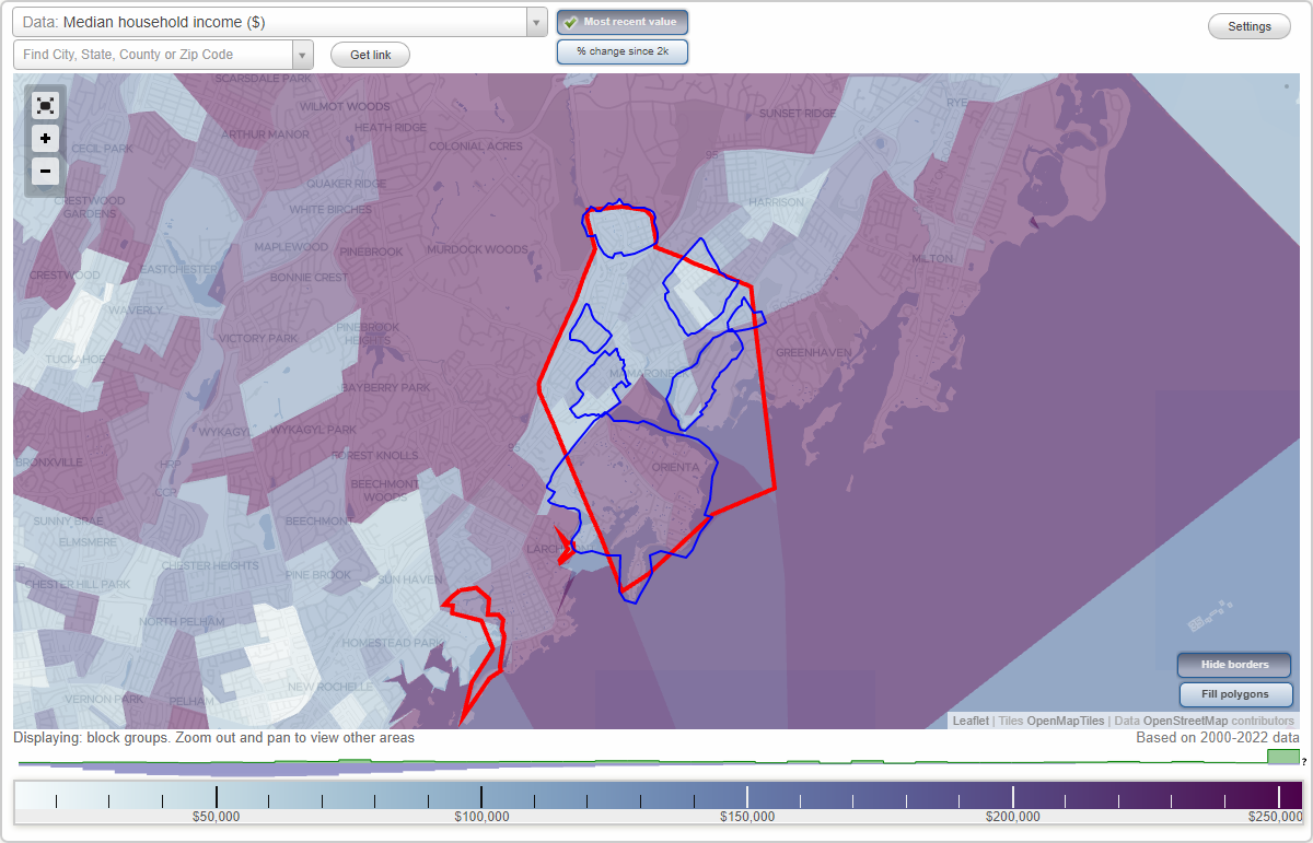
- City boundary
- Neighborhood boundaries
Business Search - 14 Million verified businesses
Neighborhoods:
Harbor Heights, Heathcote Hill, Mamaroneck Line Business District, Old Rye Neck, Orienta, Shore Acres, WashingtonvilleHarbor Heights neighborhood in Mamaroneck statistics: (Find on map)
Area: 0.200 square miles
Population: 6,952
Population density:
Median household income in 2021:
Median rent in in 2021:
Male vs Females
Median age
Average estimated value of detached houses in 2021 (23.0% of all units):
Most popular occupations of males: service occupations (29.4%); construction, extraction, and maintenance occupations (14.1%); farming, fishing, and forestry occupations (13.7%); business and financial operations occupations (6.9%); sales and office occupations (6.3%); transportation occupations (4.4%); arts, design, entertainment, sports, and media occupations (3.0%)
Most popular occupations of females: sales and office occupations (33.3%); service occupations (26.5%); production occupations (22.4%); arts, design, entertainment, sports, and media occupations (6.5%); education, training, and library occupations (5.6%); computer and mathematical occupations (3.4%); community and social services occupations (3.2%)
Limited-access highways (interstate or state) in this neighborhood: New England Thruway (I- 95).
Roads and streets: Mamaroneck Ave (8); Raleigh Rd; Knollwood Ave; Warren Ave; James St; Soundview Ave; Travers Ave; Grant Ter; Arlington St; Lawrence Ave; Birch Hill Ln; Chestnut Ave; Sunset Rd; Saxon Dr; Urban St; Villa Ave; Knickerbocker Ave; Bryant Cir; Girard St; Teresa Ln; Nelson St; Crown Ct; Beechwood Dr; Langdon Ln; Drury Dr; Ellis Pl; Arthur St.
Other features: Mamaroneck Riv.
Harbor Heights neighborhood detailed profile
Area: 0.200 square miles
Population: 6,952
Population density:
| Harbor Heights (The Heights): | 34,701 people per square mile |
| Mamaroneck: | 6,182 people per square mile |
Median household income in 2021:
| Harbor Heights (The Heights): | $169,645 |
| Mamaroneck: | $118,440 |
Median rent in in 2021:
| Harbor Heights (The Heights): | $1,801 |
| Mamaroneck: | $1,835 |
Male vs Females
| Males: | 3,795 |
| Females: | 3,157 |
Median age
| Males: | 35.5 years |
| Females: | 38.6 years |
Average estimated value of detached houses in 2021 (23.0% of all units):
| Harbor Heights (The Heights): | $1,586,218 |
| Mamaroneck: | $988,524 |
Most popular occupations of males: service occupations (29.4%); construction, extraction, and maintenance occupations (14.1%); farming, fishing, and forestry occupations (13.7%); business and financial operations occupations (6.9%); sales and office occupations (6.3%); transportation occupations (4.4%); arts, design, entertainment, sports, and media occupations (3.0%)
Most popular occupations of females: sales and office occupations (33.3%); service occupations (26.5%); production occupations (22.4%); arts, design, entertainment, sports, and media occupations (6.5%); education, training, and library occupations (5.6%); computer and mathematical occupations (3.4%); community and social services occupations (3.2%)
Limited-access highways (interstate or state) in this neighborhood: New England Thruway (I- 95).
Roads and streets: Mamaroneck Ave (8); Raleigh Rd; Knollwood Ave; Warren Ave; James St; Soundview Ave; Travers Ave; Grant Ter; Arlington St; Lawrence Ave; Birch Hill Ln; Chestnut Ave; Sunset Rd; Saxon Dr; Urban St; Villa Ave; Knickerbocker Ave; Bryant Cir; Girard St; Teresa Ln; Nelson St; Crown Ct; Beechwood Dr; Langdon Ln; Drury Dr; Ellis Pl; Arthur St.
Other features: Mamaroneck Riv.
Harbor Heights neighborhood detailed profile
Heathcote Hill neighborhood in Mamaroneck statistics: (Find on map)
Area: 0.151 square miles
Population: 1,176
Population density:
Median household income in 2021:
Median rent in in 2021:
Male vs Females
Median age
Housing prices:
Average estimated value of detached houses in 2021 (18.3% of all units):
Average estimated value of townhouses or other attached units in 2021 (1.5% of all units):
Average estimated value of housing units in 2-unit structures in 2021 (11.6% of all units):
Average estimated '21 value of housing units in 3-to-4-unit structures (17.0% of all units):
Average estimated '21 value of housing units in 5-or-more-unit structures (17.0% of all units):
Most popular occupations of males: service occupations (36.6%); production occupations (36.6%); management occupations (except farmers) (33.4%); transportation occupations (30.2%); construction, extraction, and maintenance occupations (14.5%); education, training, and library occupations (9.7%); life, physical, and social science occupations (8.4%)
Most popular occupations of females: management occupations (except farmers) (28.5%); education, training, and library occupations (22.3%); business and financial operations occupations (17.9%); service occupations (14.5%); sales and office occupations (10.8%); arts, design, entertainment, sports, and media occupations (5.5%); legal occupations (5.0%)
Highways in this neighborhood: W Boston Post Rd (US Hwy 1).
Roads and streets: Prospect Ave; 44 (Palmer Ave); Delancey Ave; Munro Ave; Cortland Ave; Fenimore Rd; Heathcote Ave; Stanley Ave; Maple Ave; Mount Pleasant Ave; Rockland Ave; Highland Dr; Livingston Ave; Palmer Ave.
Heathcote Hill neighborhood detailed profile
Area: 0.151 square miles
Population: 1,176
Population density:
| Heathcote Hill: | 7,762 people per square mile |
| Mamaroneck: | 6,182 people per square mile |
Median household income in 2021:
| Heathcote Hill: | $146,613 |
| Mamaroneck: | $118,440 |
Median rent in in 2021:
| Heathcote Hill: | $1,661 |
| Mamaroneck: | $1,835 |
Male vs Females
| Males: | 568 |
| Females: | 608 |
Median age
| Males: | 38.7 years |
| Females: | 47.7 years |
Housing prices:
Average estimated value of detached houses in 2021 (18.3% of all units):
| Heathcote Hill: | $3,907,350 |
| Mamaroneck: | $988,524 |
Average estimated value of townhouses or other attached units in 2021 (1.5% of all units):
| This neighborhood: | $783,208 |
| village: | $601,230 |
Average estimated value of housing units in 2-unit structures in 2021 (11.6% of all units):
| This neighborhood: | $627,284 |
| Mamaroneck: | $673,623 |
Average estimated '21 value of housing units in 3-to-4-unit structures (17.0% of all units):
| Heathcote Hill: | $63,168 |
| village: | $193,515 |
Average estimated '21 value of housing units in 5-or-more-unit structures (17.0% of all units):
| Heathcote Hill: | $408,475 |
| Mamaroneck: | $422,836 |
Most popular occupations of males: service occupations (36.6%); production occupations (36.6%); management occupations (except farmers) (33.4%); transportation occupations (30.2%); construction, extraction, and maintenance occupations (14.5%); education, training, and library occupations (9.7%); life, physical, and social science occupations (8.4%)
Most popular occupations of females: management occupations (except farmers) (28.5%); education, training, and library occupations (22.3%); business and financial operations occupations (17.9%); service occupations (14.5%); sales and office occupations (10.8%); arts, design, entertainment, sports, and media occupations (5.5%); legal occupations (5.0%)
Highways in this neighborhood: W Boston Post Rd (US Hwy 1).
Roads and streets: Prospect Ave; 44 (Palmer Ave); Delancey Ave; Munro Ave; Cortland Ave; Fenimore Rd; Heathcote Ave; Stanley Ave; Maple Ave; Mount Pleasant Ave; Rockland Ave; Highland Dr; Livingston Ave; Palmer Ave.
Heathcote Hill neighborhood detailed profile
Mamaroneck Line Business District neighborhood in Mamaroneck statistics: (Find on map)
Area: 0.047 square miles
Population: 684
Population density:
Median household income in 2021:
Median rent in in 2021:
Male vs Females
Median age
Housing prices:
Average estimated value of detached houses in 2021 (55.1% of all units):
Average estimated value of townhouses or other attached units in 2021 (50.7% of all units):
Average estimated value of housing units in 2-unit structures in 2021 (25.1% of all units):
Average estimated '21 value of housing units in 5-or-more-unit structures (2.6% of all units):
Most popular occupations of males: management occupations (except farmers) (34.0%); sales and office occupations (19.2%); business and financial operations occupations (12.2%); arts, design, entertainment, sports, and media occupations (4.6%); legal occupations (3.4%); service occupations (2.5%); education, training, and library occupations (1.9%)
Most popular occupations of females: healthcare practitioners and technical occupations (23.4%); sales and office occupations (16.7%); computer and mathematical occupations (16.2%); management occupations (except farmers) (11.3%); service occupations (11.1%); education, training, and library occupations (9.7%); community and social services occupations (6.7%)
Highways in this neighborhood: E Boston Post Rd (US Hwy 1); US Hwy 1 (Boston Post Rd).
Roads and streets: Hornidge Rd; Sunnyside Ave; Shelburne Ave; Sterling Ave.
Mamaroneck Line Business District neighborhood detailed profile
Area: 0.047 square miles
Population: 684
Population density:
| Mamaroneck Line Business District (Mamaroneck Line): | 14,505 people per square mile |
| Mamaroneck: | 6,182 people per square mile |
Median household income in 2021:
| Mamaroneck Line Business District (Mamaroneck Line): | $172,820 |
| Mamaroneck: | $118,440 |
Median rent in in 2021:
| Mamaroneck Line Business District (Mamaroneck Line): | $1,527 |
| Mamaroneck: | $1,835 |
Male vs Females
| Males: | 378 |
| Females: | 305 |
Median age
| Males: | 38.9 years |
| Females: | 44.1 years |
Housing prices:
Average estimated value of detached houses in 2021 (55.1% of all units):
| Mamaroneck Line Business District (Mamaroneck Line): | $750,813 |
| Mamaroneck: | $988,524 |
Average estimated value of townhouses or other attached units in 2021 (50.7% of all units):
| This neighborhood: | $554,878 |
| village: | $601,230 |
Average estimated value of housing units in 2-unit structures in 2021 (25.1% of all units):
| This neighborhood: | $691,639 |
| Mamaroneck: | $673,623 |
Average estimated '21 value of housing units in 5-or-more-unit structures (2.6% of all units):
| Mamaroneck Line Business District (Mamaroneck Line): | $360,132 |
| Mamaroneck: | $422,836 |
Most popular occupations of males: management occupations (except farmers) (34.0%); sales and office occupations (19.2%); business and financial operations occupations (12.2%); arts, design, entertainment, sports, and media occupations (4.6%); legal occupations (3.4%); service occupations (2.5%); education, training, and library occupations (1.9%)
Most popular occupations of females: healthcare practitioners and technical occupations (23.4%); sales and office occupations (16.7%); computer and mathematical occupations (16.2%); management occupations (except farmers) (11.3%); service occupations (11.1%); education, training, and library occupations (9.7%); community and social services occupations (6.7%)
Highways in this neighborhood: E Boston Post Rd (US Hwy 1); US Hwy 1 (Boston Post Rd).
Roads and streets: Hornidge Rd; Sunnyside Ave; Shelburne Ave; Sterling Ave.
Mamaroneck Line Business District neighborhood detailed profile
Old Rye Neck neighborhood in Mamaroneck statistics: (Find on map)
Area: 0.267 square miles
Population: 2,571
Population density:
Median household income in 2021:
Median rent in in 2021:
Male vs Females
Median age
Housing prices:
Average estimated value of detached houses in 2021 (36.7% of all units):
Average estimated value of townhouses or other attached units in 2021 (13.4% of all units):
Average estimated value of housing units in 2-unit structures in 2021 (49.7% of all units):
Average estimated '21 value of housing units in 5-or-more-unit structures (12.0% of all units):
Most popular occupations of males: management occupations (except farmers) (17.1%); sales and office occupations (14.8%); education, training, and library occupations (7.7%); legal occupations (6.1%); service occupations (5.9%); life, physical, and social science occupations (5.6%); arts, design, entertainment, sports, and media occupations (5.4%)
Most popular occupations of females: service occupations (20.1%); sales and office occupations (17.4%); education, training, and library occupations (12.9%); business and financial operations occupations (10.4%); management occupations (except farmers) (9.1%); healthcare practitioners and technical occupations (9.1%); arts, design, entertainment, sports, and media occupations (8.4%)
Highways in this neighborhood: Harrison Ave (State Hwy 127); State Hwy 127 (Keeler Ave); US Hwy 1 (E Boston Post Rd).
Roads and streets: Florence St; Halstead Ave; West St; Wagner Ave; 5th St; 4th St; Park Ave; Hunter St; Frank Ave; Franklin Ave; Henry Ave; English Pl; N Wagner Ave; Pine Knoll Ln; Jensen Ave; Rose Ln; Lorena St; Edward Pl; Harrington Pl; Laura Joy Cir; Barbara Ln; Standish Pl; Ryewood Farm Dr.
Old Rye Neck neighborhood detailed profile
Area: 0.267 square miles
Population: 2,571
Population density:
| Old Rye Neck: | 9,626 people per square mile |
| Mamaroneck: | 6,182 people per square mile |
Median household income in 2021:
| Old Rye Neck: | $115,657 |
| Mamaroneck: | $118,440 |
Median rent in in 2021:
| Old Rye Neck: | $1,857 |
| Mamaroneck: | $1,835 |
Male vs Females
| Males: | 1,037 |
| Females: | 1,533 |
Median age
| Males: | 38.4 years |
| Females: | 34.7 years |
Housing prices:
Average estimated value of detached houses in 2021 (36.7% of all units):
| Old Rye Neck: | $587,528 |
| Mamaroneck: | $988,524 |
Average estimated value of townhouses or other attached units in 2021 (13.4% of all units):
| This neighborhood: | $493,215 |
| village: | $601,230 |
Average estimated value of housing units in 2-unit structures in 2021 (49.7% of all units):
| This neighborhood: | $727,771 |
| Mamaroneck: | $673,623 |
Average estimated '21 value of housing units in 5-or-more-unit structures (12.0% of all units):
| Old Rye Neck: | $29,678 |
| Mamaroneck: | $422,836 |
Most popular occupations of males: management occupations (except farmers) (17.1%); sales and office occupations (14.8%); education, training, and library occupations (7.7%); legal occupations (6.1%); service occupations (5.9%); life, physical, and social science occupations (5.6%); arts, design, entertainment, sports, and media occupations (5.4%)
Most popular occupations of females: service occupations (20.1%); sales and office occupations (17.4%); education, training, and library occupations (12.9%); business and financial operations occupations (10.4%); management occupations (except farmers) (9.1%); healthcare practitioners and technical occupations (9.1%); arts, design, entertainment, sports, and media occupations (8.4%)
Highways in this neighborhood: Harrison Ave (State Hwy 127); State Hwy 127 (Keeler Ave); US Hwy 1 (E Boston Post Rd).
Roads and streets: Florence St; Halstead Ave; West St; Wagner Ave; 5th St; 4th St; Park Ave; Hunter St; Frank Ave; Franklin Ave; Henry Ave; English Pl; N Wagner Ave; Pine Knoll Ln; Jensen Ave; Rose Ln; Lorena St; Edward Pl; Harrington Pl; Laura Joy Cir; Barbara Ln; Standish Pl; Ryewood Farm Dr.
Old Rye Neck neighborhood detailed profile
Orienta neighborhood in Mamaroneck statistics: (Find on map)
Area: 1.277 square miles
Population: 2,758
Population density:
Median household income in 2021:
Median rent in in 2021:
Male vs Females
Median age
Housing prices:
Average estimated value of detached houses in 2021 (48.5% of all units):
Average estimated value of townhouses or other attached units in 2021 (4.0% of all units):
Average estimated value of housing units in 2-unit structures in 2021 (18.4% of all units):
Average estimated '21 value of housing units in 3-to-4-unit structures (8.3% of all units):
Average estimated '21 value of housing units in 5-or-more-unit structures (12.6% of all units):
Most popular occupations of males: management occupations (except farmers) (20.3%); business and financial operations occupations (16.0%); construction, extraction, and maintenance occupations (13.4%); sales and office occupations (12.8%); service occupations (7.1%); arts, design, entertainment, sports, and media occupations (5.3%); transportation occupations (5.2%)
Most popular occupations of females: management occupations (except farmers) (19.4%); service occupations (18.5%); sales and office occupations (16.3%); education, training, and library occupations (15.9%); healthcare practitioners and technical occupations (11.9%); business and financial operations occupations (6.8%); arts, design, entertainment, sports, and media occupations (5.7%)
Highways in this neighborhood: Boston Post Rd (US Hwy 1).
Roads and streets: Orienta Ave; Rushmore Ave; Hommocks Rd; Cove Rd; Walton Ave; Flagler Dr; Claflin Ave; Greacen Point Rd; Eagle Knolls Rd; Bleeker Ave; 4th St; Old Post Rd; Constable Dr; Seney Ave; Fairway Ave; Skibo Ln; Forest Ave; Seven Oaks Ln; Nine Acres Ln; Hall St; Sylvan Ln; Sylvan Ave; Beach Point Club; Rockridge Rd; Fairway Green; Old Post Ln (Cooper Ave); W Flagler Dr; Oak Ln; Harbor Rd; The Crescent; Seahaven Dr; W Fairway Green; Pirates Cove (Pirates Cove Ln); Fairway Ln; Greacen Ln; Stiles Ave; Protano Ln; Nautilus Ln; Port Dr; Royal Pl; Bloomdale Ave; Oakwood Rd; Cove Rd E; Fairway Grn; Green Meadow Ln; Bayhead Dr; Indian Cove (Indian Cove Rd); Bay Head; Cove Island; Toni Ln; Old Hommocks Rd; Indian Cove Rd; Fairway Grn N; Club Way.
Orienta neighborhood detailed profile
Area: 1.277 square miles
Population: 2,758
Population density:
| Orienta: | 2,160 people per square mile |
| Mamaroneck: | 6,182 people per square mile |
Median household income in 2021:
| Orienta: | $192,646 |
| Mamaroneck: | $118,440 |
Median rent in in 2021:
| Orienta: | $2,751 |
| Mamaroneck: | $1,835 |
Male vs Females
| Males: | 1,530 |
| Females: | 1,228 |
Median age
| Males: | 40.4 years |
| Females: | 45.9 years |
Housing prices:
Average estimated value of detached houses in 2021 (48.5% of all units):
| Orienta: | $1,080,319 |
| Mamaroneck: | $988,524 |
Average estimated value of townhouses or other attached units in 2021 (4.0% of all units):
| This neighborhood: | $389,725 |
| village: | $601,230 |
Average estimated value of housing units in 2-unit structures in 2021 (18.4% of all units):
| This neighborhood: | $133,443 |
| Mamaroneck: | $673,623 |
Average estimated '21 value of housing units in 3-to-4-unit structures (8.3% of all units):
| Orienta: | $13,419 |
| village: | $193,515 |
Average estimated '21 value of housing units in 5-or-more-unit structures (12.6% of all units):
| Orienta: | $360,132 |
| Mamaroneck: | $422,836 |
Most popular occupations of males: management occupations (except farmers) (20.3%); business and financial operations occupations (16.0%); construction, extraction, and maintenance occupations (13.4%); sales and office occupations (12.8%); service occupations (7.1%); arts, design, entertainment, sports, and media occupations (5.3%); transportation occupations (5.2%)
Most popular occupations of females: management occupations (except farmers) (19.4%); service occupations (18.5%); sales and office occupations (16.3%); education, training, and library occupations (15.9%); healthcare practitioners and technical occupations (11.9%); business and financial operations occupations (6.8%); arts, design, entertainment, sports, and media occupations (5.7%)
Highways in this neighborhood: Boston Post Rd (US Hwy 1).
Roads and streets: Orienta Ave; Rushmore Ave; Hommocks Rd; Cove Rd; Walton Ave; Flagler Dr; Claflin Ave; Greacen Point Rd; Eagle Knolls Rd; Bleeker Ave; 4th St; Old Post Rd; Constable Dr; Seney Ave; Fairway Ave; Skibo Ln; Forest Ave; Seven Oaks Ln; Nine Acres Ln; Hall St; Sylvan Ln; Sylvan Ave; Beach Point Club; Rockridge Rd; Fairway Green; Old Post Ln (Cooper Ave); W Flagler Dr; Oak Ln; Harbor Rd; The Crescent; Seahaven Dr; W Fairway Green; Pirates Cove (Pirates Cove Ln); Fairway Ln; Greacen Ln; Stiles Ave; Protano Ln; Nautilus Ln; Port Dr; Royal Pl; Bloomdale Ave; Oakwood Rd; Cove Rd E; Fairway Grn; Green Meadow Ln; Bayhead Dr; Indian Cove (Indian Cove Rd); Bay Head; Cove Island; Toni Ln; Old Hommocks Rd; Indian Cove Rd; Fairway Grn N; Club Way.
Orienta neighborhood detailed profile
Shore Acres neighborhood in Mamaroneck statistics: (Find on map)
Area: 0.221 square miles
Population: 410
Population density:
Median household income in 2021:
Median rent in in 2021:
Male vs Females
Median age
Housing prices:
Average estimated value of detached houses in 2021 (67.6% of all units):
Average estimated value of townhouses or other attached units in 2021 (6.5% of all units):
Average estimated value of housing units in 2-unit structures in 2021 (12.9% of all units):
Average estimated '21 value of housing units in 3-to-4-unit structures (7.9% of all units):
Average estimated '21 value of housing units in 5-or-more-unit structures (28.8% of all units):
Most popular occupations of males: management occupations (except farmers) (25.5%); sales and office occupations (23.6%); community and social services occupations (15.0%); business and financial operations occupations (12.7%); arts, design, entertainment, sports, and media occupations (10.8%); production occupations (8.5%); service occupations (7.3%)
Most popular occupations of females: management occupations (except farmers) (29.1%); sales and office occupations (15.3%); computer and mathematical occupations (14.8%); business and financial operations occupations (14.7%); legal occupations (11.8%); community and social services occupations (8.0%); life, physical, and social science occupations (6.7%)
Roads and streets: The Parkway; Shore Acres Dr; Soundview Dr; Creek Rd; S Barry Ave; Oakhurst Rd; Alda Rd; Garden Rd; Kassel Ct.
Other features: Otter Crk.
Shore Acres neighborhood detailed profile
Area: 0.221 square miles
Population: 410
Population density:
| Shore Acres (Shore Acres Point Corporation): | 1,854 people per square mile |
| Mamaroneck: | 6,182 people per square mile |
Median household income in 2021:
| Shore Acres (Shore Acres Point Corporation): | $232,564 |
| Mamaroneck: | $118,440 |
Median rent in in 2021:
| Shore Acres (Shore Acres Point Corporation): | $3,000 |
| Mamaroneck: | $1,835 |
Male vs Females
| Males: | 224 |
| Females: | 185 |
Median age
| Males: | 37.3 years |
| Females: | 47.5 years |
Housing prices:
Average estimated value of detached houses in 2021 (67.6% of all units):
| Shore Acres (Shore Acres Point Corporation): | $934,669 |
| Mamaroneck: | $988,524 |
Average estimated value of townhouses or other attached units in 2021 (6.5% of all units):
| This neighborhood: | $2,285,668 |
| village: | $601,230 |
Average estimated value of housing units in 2-unit structures in 2021 (12.9% of all units):
| This neighborhood: | $689,641 |
| Mamaroneck: | $673,623 |
Average estimated '21 value of housing units in 3-to-4-unit structures (7.9% of all units):
| Shore Acres (Shore Acres Point Corporation): | $191,603 |
| village: | $193,515 |
Average estimated '21 value of housing units in 5-or-more-unit structures (28.8% of all units):
| Shore Acres (Shore Acres Point Corporation): | $325,399 |
| Mamaroneck: | $422,836 |
Most popular occupations of males: management occupations (except farmers) (25.5%); sales and office occupations (23.6%); community and social services occupations (15.0%); business and financial operations occupations (12.7%); arts, design, entertainment, sports, and media occupations (10.8%); production occupations (8.5%); service occupations (7.3%)
Most popular occupations of females: management occupations (except farmers) (29.1%); sales and office occupations (15.3%); computer and mathematical occupations (14.8%); business and financial operations occupations (14.7%); legal occupations (11.8%); community and social services occupations (8.0%); life, physical, and social science occupations (6.7%)
Roads and streets: The Parkway; Shore Acres Dr; Soundview Dr; Creek Rd; S Barry Ave; Oakhurst Rd; Alda Rd; Garden Rd; Kassel Ct.
Other features: Otter Crk.
Shore Acres neighborhood detailed profile
Washingtonville neighborhood in Mamaroneck statistics: (Find on map)
Area: 0.068 square miles
Population: 821
Population density:
Median household income in 2021:
Median rent in in 2021:
Male vs Females
Median age
Housing prices:
Average estimated value of detached houses in 2021 (77.5% of all units):
Average estimated value of townhouses or other attached units in 2021 (1.4% of all units):
Average estimated value of housing units in 2-unit structures in 2021 (8.8% of all units):
Average estimated '21 value of housing units in 3-to-4-unit structures (30.6% of all units):
Average estimated '21 value of housing units in 5-or-more-unit structures (5.3% of all units):
Most popular occupations of males: management occupations (except farmers) (20.7%); sales and office occupations (19.6%); farming, fishing, and forestry occupations (16.2%); business and financial operations occupations (11.7%); production occupations (11.2%); computer and mathematical occupations (7.8%); service occupations (6.0%)
Most popular occupations of females: education, training, and library occupations (23.3%); healthcare practitioners and technical occupations (22.0%); arts, design, entertainment, sports, and media occupations (10.9%); management occupations (except farmers) (10.8%); production occupations (10.4%); sales and office occupations (10.0%); service occupations (8.7%)
Roads and streets: Plaza Ave; Grand St; Washington St; Waverly Ave; Center Ave; Madison St; Old White Plains Rd; Mamaroneck Ave; Pelham St; Alling St.
Other features: Sheldrake Riv.
Washingtonville neighborhood detailed profile
Area: 0.068 square miles
Population: 821
Population density:
| Washingtonville (The Flats): | 12,117 people per square mile |
| Mamaroneck: | 6,182 people per square mile |
Median household income in 2021:
| Washingtonville (The Flats): | $125,348 |
| Mamaroneck: | $118,440 |
Median rent in in 2021:
| Washingtonville (The Flats): | $2,517 |
| Mamaroneck: | $1,835 |
Male vs Females
| Males: | 374 |
| Females: | 446 |
Median age
| Males: | 32.8 years |
| Females: | 43.3 years |
Housing prices:
Average estimated value of detached houses in 2021 (77.5% of all units):
| Washingtonville (The Flats): | $89,603 |
| Mamaroneck: | $988,524 |
Average estimated value of townhouses or other attached units in 2021 (1.4% of all units):
| This neighborhood: | $783,208 |
| village: | $601,230 |
Average estimated value of housing units in 2-unit structures in 2021 (8.8% of all units):
| This neighborhood: | $123,202 |
| Mamaroneck: | $673,623 |
Average estimated '21 value of housing units in 3-to-4-unit structures (30.6% of all units):
| Washingtonville (The Flats): | $191,603 |
| village: | $193,515 |
Average estimated '21 value of housing units in 5-or-more-unit structures (5.3% of all units):
| Washingtonville (The Flats): | $442,624 |
| Mamaroneck: | $422,836 |
Most popular occupations of males: management occupations (except farmers) (20.7%); sales and office occupations (19.6%); farming, fishing, and forestry occupations (16.2%); business and financial operations occupations (11.7%); production occupations (11.2%); computer and mathematical occupations (7.8%); service occupations (6.0%)
Most popular occupations of females: education, training, and library occupations (23.3%); healthcare practitioners and technical occupations (22.0%); arts, design, entertainment, sports, and media occupations (10.9%); management occupations (except farmers) (10.8%); production occupations (10.4%); sales and office occupations (10.0%); service occupations (8.7%)
Roads and streets: Plaza Ave; Grand St; Washington St; Waverly Ave; Center Ave; Madison St; Old White Plains Rd; Mamaroneck Ave; Pelham St; Alling St.
Other features: Sheldrake Riv.
Washingtonville neighborhood detailed profile