Saugus, Massachusetts Neighborhood Map - Income, House Prices, Occupations, Boundaries
Settings
X

- City boundary
- Neighborhood boundaries
Business Search - 14 Million verified businesses
Neighborhoods:
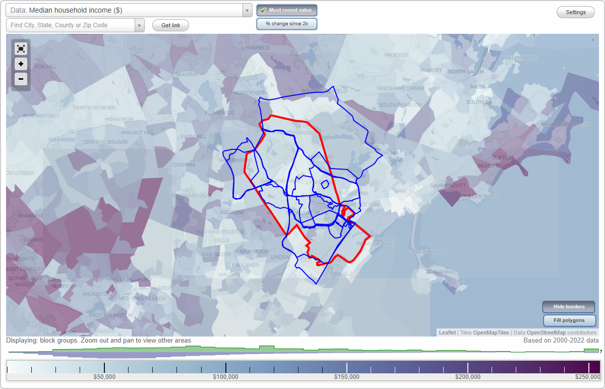
Bristow, Cliftondale, Dudley Street, East Saugus, Golden Hills, Hammersmith Village, Horace Mann, Lynnhurst, North Revere, North Saugus, Oaklandvale, Pleasant Hills, Saugus Center, Stonecliffe HeightsBristow neighborhood in Saugus statistics: (Find on map)
Area: 0.190 square miles
Population: 446
Population density:
Median household income in 2021:
Median rent in in 2021:
Male vs Females
Median age
Housing prices:
Average estimated value of detached houses in 2021 (66.1% of all units):
Average estimated value of townhouses or other attached units in 2021 (2.9% of all units):
Average estimated value of housing units in 2-unit structures in 2021 (22.8% of all units):
Most popular occupations of males: sales and office occupations (18.5%); service occupations (13.7%); construction, extraction, and maintenance occupations (12.4%); management occupations (except farmers) (11.9%); transportation occupations (9.8%); healthcare practitioners and technical occupations (5.6%); material moving occupations (5.6%)
Most popular occupations of females: sales and office occupations (40.5%); service occupations (14.1%); business and financial operations occupations (10.6%); education, training, and library occupations (7.9%); healthcare practitioners and technical occupations (7.7%); management occupations (except farmers) (7.1%); community and social services occupations (3.9%)
Roads and streets: Bristow St; Gates Rd; Carr Rd; Seagirt Ave; Pevwell Dr; Eastern Ave; Serino Way; Wickford St; Lincoln Ave; Venice Ave; Beachview Ave; Piedmont St; Harlow St; Sussex St; Thistle Rd; Atlas Ave; Genoa Ave; Guild Rd; Edgemere St; Tuscan Ave; Milan Ave; Naples Ave; Ciampa Dr; Perullo Ln; Lindsell St; Lewis Ln; Halstead St; Piedmont Ave; Belair St; Mersea St; Barressi Ln; Althorn St; Richard St; Pierpont St; Anjo Ln; Hewlett St; Winston St; Clement Rd.
Other features: Pines Riv.
Bristow neighborhood detailed profile
Area: 0.190 square miles
Population: 446
Population density:
| Bristow (Bristow Street): | 2,349 people per square mile |
| Saugus: | 2,596 people per square mile |
Median household income in 2021:
| Bristow (Bristow Street): | $92,659 |
| Saugus: | $93,737 |
Median rent in in 2021:
| Bristow (Bristow Street): | $1,517 |
| Saugus: | $955 |
Male vs Females
| Males: | 228 |
| Females: | 218 |
Median age
| Males: | 41.7 years |
| Females: | 46.0 years |
Housing prices:
Average estimated value of detached houses in 2021 (66.1% of all units):
| Bristow (Bristow Street): | $635,101 |
| Massachusetts: | $512,170 |
Average estimated value of townhouses or other attached units in 2021 (2.9% of all units):
| This neighborhood: | $421,538 |
| Massachusetts: | $446,467 |
Average estimated value of housing units in 2-unit structures in 2021 (22.8% of all units):
| This neighborhood: | $435,073 |
| Massachusetts: | $492,911 |
Most popular occupations of males: sales and office occupations (18.5%); service occupations (13.7%); construction, extraction, and maintenance occupations (12.4%); management occupations (except farmers) (11.9%); transportation occupations (9.8%); healthcare practitioners and technical occupations (5.6%); material moving occupations (5.6%)
Most popular occupations of females: sales and office occupations (40.5%); service occupations (14.1%); business and financial operations occupations (10.6%); education, training, and library occupations (7.9%); healthcare practitioners and technical occupations (7.7%); management occupations (except farmers) (7.1%); community and social services occupations (3.9%)
Roads and streets: Bristow St; Gates Rd; Carr Rd; Seagirt Ave; Pevwell Dr; Eastern Ave; Serino Way; Wickford St; Lincoln Ave; Venice Ave; Beachview Ave; Piedmont St; Harlow St; Sussex St; Thistle Rd; Atlas Ave; Genoa Ave; Guild Rd; Edgemere St; Tuscan Ave; Milan Ave; Naples Ave; Ciampa Dr; Perullo Ln; Lindsell St; Lewis Ln; Halstead St; Piedmont Ave; Belair St; Mersea St; Barressi Ln; Althorn St; Richard St; Pierpont St; Anjo Ln; Hewlett St; Winston St; Clement Rd.
Other features: Pines Riv.
Bristow neighborhood detailed profile
Cliftondale neighborhood in Saugus statistics: (Find on map)
Area: 2.353 square miles
Population: 8,849
Population density:
Median household income in 2021:
Median rent in in 2021:
Male vs Females
Median age
Housing prices:
Average estimated value of detached houses in 2021 (80.1% of all units):
Average estimated value of townhouses or other attached units in 2021 (5.5% of all units):
Average estimated value of housing units in 2-unit structures in 2021 (11.4% of all units):
Average estimated '21 value of housing units in 5-or-more-unit structures (3.3% of all units):
Most popular occupations of males: sales and office occupations (29.8%); material moving occupations (15.3%); transportation occupations (10.0%); construction, extraction, and maintenance occupations (9.6%); business and financial operations occupations (8.2%); management occupations (except farmers) (7.3%); service occupations (7.1%)
Most popular occupations of females: sales and office occupations (57.9%); service occupations (14.4%); education, training, and library occupations (9.3%); management occupations (except farmers) (6.3%); life, physical, and social science occupations (5.2%); legal occupations (3.1%); healthcare practitioners and technical occupations (2.8%)
Highways in this neighborhood: Salem Tpke (State Hwy 107); Bennett Hwy (Frank P Bennett Hwy, US Hwy 1); Newburyport Tpke (US Hwy 1, Broadway).
Roads and streets: Rumney Marsh Ter (Saugus Ave); Essex St; Basswood Ave; Ballard St; Lincoln Ave; Eastern Ave; Bristow St; Clifton Ave; Western Ave; Aberdeen Ave; Dudley St; Standish Ave; Gates Rd; Acadia Ave; Carr Rd; Seagirt Ave; Richard St; Old Marsh Rd; Pevwell Dr; Summit Ave; Morton Ave; Serino Way; Wickford St; Felton St; Myrtle St; Treher St; Eagle Rd; Waverly Ave; Bayview Rd; Lewis Ln; Pleasant Ave; Venice Ave; Beacham Ave; Beachview Ave; Eustis St; Mount Vernon St; Endicott St; Mildred St; Piedmont St; Banfield Ave; Felmont Ave; Oceanview Ave; Dale St; Sunnyside Park; Henry St; Avon St; Goldie St; Whitney St; Wamesit Ave; Fairview Ave; Anawan Ave; Harlow St; Elmont Ave; Prospect Ave; Park St; Hood St; Dustin St; Hampton St; Laurel St; Linwood St; Greenwood Ave; Curtis Rd; Horace St; Park Ave; Palmer Ave; Ashford St; Sussex St; Alna Ave; Thistle Rd; Emerald Rd; Bryer St; Felton Ct; Warden St; Atlas Ave; Sim Rd; Genoa Ave; Guild Rd; Edgemere St; Tuscan Ave; Smith Rd; Wolcott Rd; Morris St; Garnet Ct; Bayfield Rd; Warren Rd; Pierpont St; Cottage St; Norman Rd; Alban Ave; Milan Ave; Naples Ave; Aldworth Ave; Chester St; Hayden Rd; Griswold St; Kent St; Robins Rd; Charmwood Rd; Bristol St; Belford Ave; Sapphire Rd; Ruby Rd; Ciampa Dr; Perullo Ln; Lindsell St; Adelaide Ave; Cherry St; Connolly Ave; Ernest St; Douglas Rd; Athea Ave; Downey St; Felsmere Ave; Lincoln Ct; Enmore Rd; Bagnall Ave; Fauci Dr; Halstead St; Tuttle Ln; Piedmont Ave; Aspen Ave; Belair St; Mersea St; Nason Rd; Barressi Ln; Alaric Ave; Althorn St; Rumney Marsh Ter; Nocturne Way; Hemlock Rd; Alberta Dr; Pasquale Dr; Yvonne Dr; Trull Cir; Anjo Ln; Hewlett St; Lincoln Ter; Winston St; Lonsdale Ter; Wren St; Ekstrand Rd; Clement Rd; Picariello Dr; Thresher St; Curtis St; Baker St; Lark Ave; Clifton St; Charlotte Rd; Kent Ter.
Railroad features: Boston and Maine RR.
Other features: Pines Riv.
Highways in this neighborhood: Bennett Hwy (US Hwy 1, Frank P Bennett Hwy).
Roads and streets: Salem St; Ricker St; Fenwick St; Vining St; Linehurst Rd.
Highways in this neighborhood: US Hwy 1 (Northeast Expy, Adamski Memorial Hwy); State Hwy 107 (Broadway).
Roads and streets: Grand View Ave; Salem St; Walnut St; Franklin St; Morris St; Breedens Ln; Maple St; N Marshall St; Grand View Cir; Liberty Ave; Ossen St; Brookline St; Hale St; Park Ave; Hysun St; Vittoria St; Bennet St; Cliff St; Genoa St; Stephen St; Waitt Park; Concord St; Clifton St; Stone St; Columbia St; Yuill St; Agatha St; Fenwick St; Marshview Ter; Ravena St; Hywood St; Robert St; Bowman St; N Salem St; Linehurst St; Lynn St; Valley St; Green Rd; Oak Tree Ln; Cooper Ter; Grand View Ter; Waitt Ct; Argenta St; Theresa Ave; Richard St; Paul St; Branch Rd; Genoa Path; Stephen Ter; View St; Linehurst Rd.
Railroad features: Boston and Maine RR.
Other features: Pines Riv.
Cliftondale neighborhood detailed profile
Area: 2.353 square miles
Population: 8,849
Population density:
| Cliftondale: | 3,761 people per square mile |
| Saugus: | 2,596 people per square mile |
Median household income in 2021:
| Cliftondale: | $101,357 |
| Saugus: | $93,737 |
Median rent in in 2021:
| Cliftondale: | $2,079 |
| Saugus: | $955 |
Male vs Females
| Males: | 4,660 |
| Females: | 4,188 |
Median age
| Males: | 42.4 years |
| Females: | 43.5 years |
Housing prices:
Average estimated value of detached houses in 2021 (80.1% of all units):
| Cliftondale: | $434,849 |
| Massachusetts: | $512,170 |
Average estimated value of townhouses or other attached units in 2021 (5.5% of all units):
| This neighborhood: | $124,143 |
| Massachusetts: | $446,467 |
Average estimated value of housing units in 2-unit structures in 2021 (11.4% of all units):
| This neighborhood: | $541,875 |
| Massachusetts: | $492,911 |
Average estimated '21 value of housing units in 5-or-more-unit structures (3.3% of all units):
| Cliftondale: | $330,776 |
| Massachusetts: | $484,981 |
Most popular occupations of males: sales and office occupations (29.8%); material moving occupations (15.3%); transportation occupations (10.0%); construction, extraction, and maintenance occupations (9.6%); business and financial operations occupations (8.2%); management occupations (except farmers) (7.3%); service occupations (7.1%)
Most popular occupations of females: sales and office occupations (57.9%); service occupations (14.4%); education, training, and library occupations (9.3%); management occupations (except farmers) (6.3%); life, physical, and social science occupations (5.2%); legal occupations (3.1%); healthcare practitioners and technical occupations (2.8%)
Highways in this neighborhood: Salem Tpke (State Hwy 107); Bennett Hwy (Frank P Bennett Hwy, US Hwy 1); Newburyport Tpke (US Hwy 1, Broadway).
Roads and streets: Rumney Marsh Ter (Saugus Ave); Essex St; Basswood Ave; Ballard St; Lincoln Ave; Eastern Ave; Bristow St; Clifton Ave; Western Ave; Aberdeen Ave; Dudley St; Standish Ave; Gates Rd; Acadia Ave; Carr Rd; Seagirt Ave; Richard St; Old Marsh Rd; Pevwell Dr; Summit Ave; Morton Ave; Serino Way; Wickford St; Felton St; Myrtle St; Treher St; Eagle Rd; Waverly Ave; Bayview Rd; Lewis Ln; Pleasant Ave; Venice Ave; Beacham Ave; Beachview Ave; Eustis St; Mount Vernon St; Endicott St; Mildred St; Piedmont St; Banfield Ave; Felmont Ave; Oceanview Ave; Dale St; Sunnyside Park; Henry St; Avon St; Goldie St; Whitney St; Wamesit Ave; Fairview Ave; Anawan Ave; Harlow St; Elmont Ave; Prospect Ave; Park St; Hood St; Dustin St; Hampton St; Laurel St; Linwood St; Greenwood Ave; Curtis Rd; Horace St; Park Ave; Palmer Ave; Ashford St; Sussex St; Alna Ave; Thistle Rd; Emerald Rd; Bryer St; Felton Ct; Warden St; Atlas Ave; Sim Rd; Genoa Ave; Guild Rd; Edgemere St; Tuscan Ave; Smith Rd; Wolcott Rd; Morris St; Garnet Ct; Bayfield Rd; Warren Rd; Pierpont St; Cottage St; Norman Rd; Alban Ave; Milan Ave; Naples Ave; Aldworth Ave; Chester St; Hayden Rd; Griswold St; Kent St; Robins Rd; Charmwood Rd; Bristol St; Belford Ave; Sapphire Rd; Ruby Rd; Ciampa Dr; Perullo Ln; Lindsell St; Adelaide Ave; Cherry St; Connolly Ave; Ernest St; Douglas Rd; Athea Ave; Downey St; Felsmere Ave; Lincoln Ct; Enmore Rd; Bagnall Ave; Fauci Dr; Halstead St; Tuttle Ln; Piedmont Ave; Aspen Ave; Belair St; Mersea St; Nason Rd; Barressi Ln; Alaric Ave; Althorn St; Rumney Marsh Ter; Nocturne Way; Hemlock Rd; Alberta Dr; Pasquale Dr; Yvonne Dr; Trull Cir; Anjo Ln; Hewlett St; Lincoln Ter; Winston St; Lonsdale Ter; Wren St; Ekstrand Rd; Clement Rd; Picariello Dr; Thresher St; Curtis St; Baker St; Lark Ave; Clifton St; Charlotte Rd; Kent Ter.
Railroad features: Boston and Maine RR.
Other features: Pines Riv.
Highways in this neighborhood: Bennett Hwy (US Hwy 1, Frank P Bennett Hwy).
Roads and streets: Salem St; Ricker St; Fenwick St; Vining St; Linehurst Rd.
Highways in this neighborhood: US Hwy 1 (Northeast Expy, Adamski Memorial Hwy); State Hwy 107 (Broadway).
Roads and streets: Grand View Ave; Salem St; Walnut St; Franklin St; Morris St; Breedens Ln; Maple St; N Marshall St; Grand View Cir; Liberty Ave; Ossen St; Brookline St; Hale St; Park Ave; Hysun St; Vittoria St; Bennet St; Cliff St; Genoa St; Stephen St; Waitt Park; Concord St; Clifton St; Stone St; Columbia St; Yuill St; Agatha St; Fenwick St; Marshview Ter; Ravena St; Hywood St; Robert St; Bowman St; N Salem St; Linehurst St; Lynn St; Valley St; Green Rd; Oak Tree Ln; Cooper Ter; Grand View Ter; Waitt Ct; Argenta St; Theresa Ave; Richard St; Paul St; Branch Rd; Genoa Path; Stephen Ter; View St; Linehurst Rd.
Railroad features: Boston and Maine RR.
Other features: Pines Riv.
Cliftondale neighborhood detailed profile
Dudley Street neighborhood in Saugus statistics: (Find on map)
Area: 0.324 square miles
Population: 729
Population density:
Median household income in 2021:
Median rent in in 2021:
Male vs Females
Median age
Housing prices:
Average estimated value of detached houses in 2021 (47.5% of all units):
Average estimated value of townhouses or other attached units in 2021 (2.8% of all units):
Average estimated value of housing units in 2-unit structures in 2021 (22.2% of all units):
Average estimated '21 value of housing units in 3-to-4-unit structures (4.2% of all units):
Average estimated '21 value of housing units in 5-or-more-unit structures (29.6% of all units):
Most popular occupations of males: service occupations (25.4%); production occupations (23.1%); management occupations (except farmers) (15.3%); arts, design, entertainment, sports, and media occupations (8.9%); sales and office occupations (8.2%); computer and mathematical occupations (4.4%); business and financial operations occupations (3.8%)
Most popular occupations of females: sales and office occupations (51.3%); management occupations (except farmers) (8.6%); computer and mathematical occupations (7.6%); service occupations (7.6%); material moving occupations (5.7%); healthcare practitioners and technical occupations (5.4%); life, physical, and social science occupations (4.2%)
Highways in this neighborhood: State Hwy 107 (Salem Tpke).
Roads and streets: Ballard St; Dudley St; Houston Ave; Eastern Ave; Spencer Ave; Richard St; Gates Rd; Johnson St; Newhall St; Henry St; Dustin St; Hampton St; Greenwood Ave; Guild Rd; Harvard Ave; Wolcott Rd; Milton St; Warren Rd; Vincent Ter; Douglas Rd; Vincent St; Wendell St; Sachem St; Pasquale Dr; Yvonne Dr; Lincoln Ter; Ekstrand Rd; Clement Rd; Tudor Ter; Yale St; Glen St.
Railroad features: Boston and Maine RR.
Other features: Saugus Riv.
Dudley Street neighborhood detailed profile
Area: 0.324 square miles
Population: 729
Population density:
| Dudley Street (Dudley St): | 2,251 people per square mile |
| Saugus: | 2,596 people per square mile |
Median household income in 2021:
| Dudley Street (Dudley St): | $60,743 |
| Saugus: | $93,737 |
Median rent in in 2021:
| Dudley Street (Dudley St): | $1,605 |
| Saugus: | $955 |
Male vs Females
| Males: | 407 |
| Females: | 322 |
Median age
| Males: | 40.4 years |
| Females: | 45.1 years |
Housing prices:
Average estimated value of detached houses in 2021 (47.5% of all units):
| Dudley Street (Dudley St): | $399,233 |
| Massachusetts: | $512,170 |
Average estimated value of townhouses or other attached units in 2021 (2.8% of all units):
| This neighborhood: | $520,345 |
| Massachusetts: | $446,467 |
Average estimated value of housing units in 2-unit structures in 2021 (22.2% of all units):
| This neighborhood: | $493,444 |
| Massachusetts: | $492,911 |
Average estimated '21 value of housing units in 3-to-4-unit structures (4.2% of all units):
| Dudley Street (Dudley St): | $320,000 |
| Massachusetts: | $520,726 |
Average estimated '21 value of housing units in 5-or-more-unit structures (29.6% of all units):
| Dudley Street (Dudley St): | $699,770 |
| Massachusetts: | $484,981 |
Most popular occupations of males: service occupations (25.4%); production occupations (23.1%); management occupations (except farmers) (15.3%); arts, design, entertainment, sports, and media occupations (8.9%); sales and office occupations (8.2%); computer and mathematical occupations (4.4%); business and financial operations occupations (3.8%)
Most popular occupations of females: sales and office occupations (51.3%); management occupations (except farmers) (8.6%); computer and mathematical occupations (7.6%); service occupations (7.6%); material moving occupations (5.7%); healthcare practitioners and technical occupations (5.4%); life, physical, and social science occupations (4.2%)
Highways in this neighborhood: State Hwy 107 (Salem Tpke).
Roads and streets: Ballard St; Dudley St; Houston Ave; Eastern Ave; Spencer Ave; Richard St; Gates Rd; Johnson St; Newhall St; Henry St; Dustin St; Hampton St; Greenwood Ave; Guild Rd; Harvard Ave; Wolcott Rd; Milton St; Warren Rd; Vincent Ter; Douglas Rd; Vincent St; Wendell St; Sachem St; Pasquale Dr; Yvonne Dr; Lincoln Ter; Ekstrand Rd; Clement Rd; Tudor Ter; Yale St; Glen St.
Railroad features: Boston and Maine RR.
Other features: Saugus Riv.
Dudley Street neighborhood detailed profile
East Saugus neighborhood in Saugus statistics: (Find on map)
Area: 3.182 square miles
Population: 20,436
Population density:
Median household income in 2021:
Median rent in in 2021:
Male vs Females
Median age
Housing prices:
Average estimated value of detached houses in 2021 (51.5% of all units):
Average estimated value of townhouses or other attached units in 2021 (13.3% of all units):
Average estimated value of housing units in 2-unit structures in 2021 (18.5% of all units):
Average estimated '21 value of housing units in 3-to-4-unit structures (15.5% of all units):
Average estimated '21 value of housing units in 5-or-more-unit structures (10.1% of all units):
Most popular occupations of males: sales and office occupations (16.0%); service occupations (15.1%); management occupations (except farmers) (13.0%); construction, extraction, and maintenance occupations (10.4%); healthcare practitioners and technical occupations (6.9%); production occupations (6.5%); computer and mathematical occupations (6.2%)
Most popular occupations of females: sales and office occupations (36.7%); service occupations (15.0%); healthcare practitioners and technical occupations (9.4%); production occupations (6.4%); management occupations (except farmers) (6.1%); business and financial operations occupations (5.8%); community and social services occupations (4.9%)
Highways in this neighborhood: State Hwy 107 (Salem Tpke).
Roads and streets: Walnut St; Lincoln Ave; Winter St; Hamilton St; Fairmount Ave; Boston St; Holyoke St; Ballard St; Saville St; Kings Hill Dr; Ocallaghan Way; Hesper St; Riverbank Rd; Springdale Ave; Cleveland Ave; Myrtle St; Curwin Cir; Holland St; Elm St; Hurd Ave; Auburn St; Summer St; Biscayne Ave; Jasper St; Palmetto St; Chestnut St; Harrison Ave; Evergreen St; Central St; Waban St; Winnepurkit Ave; Gardiner St; Wendell St; Purdon Ave; Magnolia St; Ashland St; Menlo Ave; Birch St; Westford St; Clinton Ave; Bailey Ave; Dearborn Ave; Ironworks Way; Stone St; Newcomb Ave; Garfield Ave; Hitching Hill Rd; Washington Ave; Westland Ave; Atlantic Ave; Wonderland Ave; Hilltop Ave; Newcastle St; Churchill St; Blueridge Ave; Keslar Ave; Farrell Rd; Pace Rd; Houston Ave; Intervale Ave; Sterling Ave; Starrett Rd; Stonecrest Dr; Hanson Rd; Spencer Ave; Lawndale Ave; Pearson St; Fairchild Ave; Laurel St; Sterling St; Curran Rd; Glen Ave; Pennybrook Rd; Seminole St; Sunnyside Ave; Desota St; Tranfaglia Ave; Overlea Ave; Williams Ave; Nicholson St; Vinegarhill Dr; Walnut Park; Harmon St; Orcutt Ave; Oakwood Ave; Glen Park Ave; Harwich St; Moffett Rd; Johnson Rd; Gateway Ln; Johnson St; W Sigourney St; Tontaquon Ave; Kenwood Ave; Marshall Ave; Vincent St; Ferndale St; Grandview Park; Old Rd; Webacowitt Ave; Fairmont Ave; McCullough Rd; Fabens St; Ferncliff Ave; Catalina Rd; Newhall St; Jefferson Ave; Willis St; Raddin Grove Ave; Osborne St; Riverview Ave; Belmont Ave; Pinecrest Ave; Pratt St; Lewis St; Lander St; Thorpe Rd; Clark St; Woodbury Ave; Victor St; View St; Reed St; Carson St; Oakland Ave; Deer Park; Burnham Ave; Burrill St; Pemberly Dr; Belle Ave; Rollin Ave; Grandview Ave; Oakridge Dr; Mount Pleasant St; Martin St; Freeman Ave; Laconia Ave; Lothrop St; Riverside Ct; Florence St; Echo Grove Ave; Southside Ave; Holyoke Rd; Stocker St; Austin Sq; Mount Hope St; Sherman St; Safford St; Pirates Glen Rd; Kingswood Ln; Carlton St; Montgomery St; Oak St; Cider Mill Rd; Fenton Ave; Ireson St; Lenox Ave; Hillcrest St; Pelham St; Revere Ave; Sigourney St; Sunset Dr; Elaine Ave; Stevens Ave; Hazel St; Wakefield Ave; Powderkeg Way; Bonavesta St; Social St; Bradford St; Atkinson Dr; Wormstead St; Fairview St; Harvard Ave; Newcastle Ct; Stockade Rd; Glendale Ave; Nottingham Ct; Foliage Dr; Meadow Brook Rd; Edison St; Arthur St; Milton St; Webster Ave; Spruce St; Bisbee Rd; Earlene Dr; Shady Ln; Dreeme St; Bridge St; Alice St; A St; Homesite St; Hillside Ave; Innis St; Safford Rd; Magner Rd; Wright St; Raddin St; Hayes St; Alvah St; Victoria St; Zamora St; Owenee St; Limewoods Dr; Dell Ct; Nowell St; Alder St; Charles St; Belmont St; Mount Ridgeway Rd; Buena Vista St; Border St; Warren Ave; Menlo Ter; Sumner St; Allard St; Judith Way; Northside Ave; Midvale Ave; Houston Pl; Geneva Ave; Floyd St; Hollis St; Vincent Ter; Ames St; Oakcrest St; Reynolds Dr; Morris Pl; Margin St; Fairmount Pl; Clayton Ave; Rhodes St; Seaview Ave; Atherton St; Sparhawk Rd; Eaton Ave; Vintage Dr; Browns Ave; Cliff St; Kingswood Cir; Mildred St; Temple Pl; Madiera St; Ridge Ave; Phillips Ave; Pineview St; Tower Ave; Ernest Ave; Rollin Ter; Midland Ave; Garfield Ter; Caverock Rd; Irving Rd; Stanton St; Houston St; Oakland Ter; Wildwood Ter; Goss Ave; Aldworth St; Vera St; Hudson Ter; Hemingway Rd; Riverside Ln; Morgage Ave; Shute St; O'Neil Way; Milberry St; Pine Ter; Echo Pl; Tranfaglia Rd; Bryant St; Tontoquon Ave; Hemingway Ter; Church St; Sachem St; Glendale Rd; N Ames St; Ella St; Avon St; Bonavesta Ter; Curwin Ter; Twin Springs Dr; Brooks Ter; Dungeon Ave; Short St; Roy Ter; Addison Ave; High Point Ter; Riverside Park (Riverside); Walnut Way; Coyle Rd; Rosalind Ter; Blossom Ave; Isabella St; Biffin Ct; Hamley St; Cross St; Hillside St; Sylvan St; Tudor Ter; Blair Ct; Hilldale Ave; Madeira St; Glen Ter; Coyle Ter; Yale St; Rogers Ln; Norcon Way; Ireson Cir; Evans St; N361; Summerset Ct; Porter Ter; Smilege Ter; Glen Ct; Bellevue St; Allen Pl; Fulton Ave; Glen St; Billmarc Ln; Willis Ct; Ivy St; Wonderland Ter; Reservoir Ave; Rockland Ter; Catalpa St; Stanley Ter; Canterbury Ct; Sterling Way; Springdale Ter; Hilldale Ter.
Railroad features: Boston and Maine RR.
Other features: Saugus Riv; Moores Brk; Beaver Brk; Birch Brk; Fiske Brk; Shute Brk.
East Saugus neighborhood detailed profile
Area: 3.182 square miles
Population: 20,436
Population density:
| East Saugus (E Saugus): | 6,422 people per square mile |
| Saugus: | 2,596 people per square mile |
Median household income in 2021:
| East Saugus (E Saugus): | $76,627 |
| Saugus: | $93,737 |
Median rent in in 2021:
| East Saugus (E Saugus): | $1,354 |
| Saugus: | $955 |
Male vs Females
| Males: | 9,977 |
| Females: | 10,458 |
Median age
| Males: | 40.8 years |
| Females: | 44.5 years |
Housing prices:
Average estimated value of detached houses in 2021 (51.5% of all units):
| East Saugus (E Saugus): | $401,206 |
| Massachusetts: | $512,170 |
Average estimated value of townhouses or other attached units in 2021 (13.3% of all units):
| This neighborhood: | $269,222 |
| Massachusetts: | $446,467 |
Average estimated value of housing units in 2-unit structures in 2021 (18.5% of all units):
| This neighborhood: | $493,899 |
| Massachusetts: | $492,911 |
Average estimated '21 value of housing units in 3-to-4-unit structures (15.5% of all units):
| East Saugus (E Saugus): | $320,000 |
| Massachusetts: | $520,726 |
Average estimated '21 value of housing units in 5-or-more-unit structures (10.1% of all units):
| East Saugus (E Saugus): | $699,770 |
| Massachusetts: | $484,981 |
Most popular occupations of males: sales and office occupations (16.0%); service occupations (15.1%); management occupations (except farmers) (13.0%); construction, extraction, and maintenance occupations (10.4%); healthcare practitioners and technical occupations (6.9%); production occupations (6.5%); computer and mathematical occupations (6.2%)
Most popular occupations of females: sales and office occupations (36.7%); service occupations (15.0%); healthcare practitioners and technical occupations (9.4%); production occupations (6.4%); management occupations (except farmers) (6.1%); business and financial operations occupations (5.8%); community and social services occupations (4.9%)
Highways in this neighborhood: State Hwy 107 (Salem Tpke).
Roads and streets: Walnut St; Lincoln Ave; Winter St; Hamilton St; Fairmount Ave; Boston St; Holyoke St; Ballard St; Saville St; Kings Hill Dr; Ocallaghan Way; Hesper St; Riverbank Rd; Springdale Ave; Cleveland Ave; Myrtle St; Curwin Cir; Holland St; Elm St; Hurd Ave; Auburn St; Summer St; Biscayne Ave; Jasper St; Palmetto St; Chestnut St; Harrison Ave; Evergreen St; Central St; Waban St; Winnepurkit Ave; Gardiner St; Wendell St; Purdon Ave; Magnolia St; Ashland St; Menlo Ave; Birch St; Westford St; Clinton Ave; Bailey Ave; Dearborn Ave; Ironworks Way; Stone St; Newcomb Ave; Garfield Ave; Hitching Hill Rd; Washington Ave; Westland Ave; Atlantic Ave; Wonderland Ave; Hilltop Ave; Newcastle St; Churchill St; Blueridge Ave; Keslar Ave; Farrell Rd; Pace Rd; Houston Ave; Intervale Ave; Sterling Ave; Starrett Rd; Stonecrest Dr; Hanson Rd; Spencer Ave; Lawndale Ave; Pearson St; Fairchild Ave; Laurel St; Sterling St; Curran Rd; Glen Ave; Pennybrook Rd; Seminole St; Sunnyside Ave; Desota St; Tranfaglia Ave; Overlea Ave; Williams Ave; Nicholson St; Vinegarhill Dr; Walnut Park; Harmon St; Orcutt Ave; Oakwood Ave; Glen Park Ave; Harwich St; Moffett Rd; Johnson Rd; Gateway Ln; Johnson St; W Sigourney St; Tontaquon Ave; Kenwood Ave; Marshall Ave; Vincent St; Ferndale St; Grandview Park; Old Rd; Webacowitt Ave; Fairmont Ave; McCullough Rd; Fabens St; Ferncliff Ave; Catalina Rd; Newhall St; Jefferson Ave; Willis St; Raddin Grove Ave; Osborne St; Riverview Ave; Belmont Ave; Pinecrest Ave; Pratt St; Lewis St; Lander St; Thorpe Rd; Clark St; Woodbury Ave; Victor St; View St; Reed St; Carson St; Oakland Ave; Deer Park; Burnham Ave; Burrill St; Pemberly Dr; Belle Ave; Rollin Ave; Grandview Ave; Oakridge Dr; Mount Pleasant St; Martin St; Freeman Ave; Laconia Ave; Lothrop St; Riverside Ct; Florence St; Echo Grove Ave; Southside Ave; Holyoke Rd; Stocker St; Austin Sq; Mount Hope St; Sherman St; Safford St; Pirates Glen Rd; Kingswood Ln; Carlton St; Montgomery St; Oak St; Cider Mill Rd; Fenton Ave; Ireson St; Lenox Ave; Hillcrest St; Pelham St; Revere Ave; Sigourney St; Sunset Dr; Elaine Ave; Stevens Ave; Hazel St; Wakefield Ave; Powderkeg Way; Bonavesta St; Social St; Bradford St; Atkinson Dr; Wormstead St; Fairview St; Harvard Ave; Newcastle Ct; Stockade Rd; Glendale Ave; Nottingham Ct; Foliage Dr; Meadow Brook Rd; Edison St; Arthur St; Milton St; Webster Ave; Spruce St; Bisbee Rd; Earlene Dr; Shady Ln; Dreeme St; Bridge St; Alice St; A St; Homesite St; Hillside Ave; Innis St; Safford Rd; Magner Rd; Wright St; Raddin St; Hayes St; Alvah St; Victoria St; Zamora St; Owenee St; Limewoods Dr; Dell Ct; Nowell St; Alder St; Charles St; Belmont St; Mount Ridgeway Rd; Buena Vista St; Border St; Warren Ave; Menlo Ter; Sumner St; Allard St; Judith Way; Northside Ave; Midvale Ave; Houston Pl; Geneva Ave; Floyd St; Hollis St; Vincent Ter; Ames St; Oakcrest St; Reynolds Dr; Morris Pl; Margin St; Fairmount Pl; Clayton Ave; Rhodes St; Seaview Ave; Atherton St; Sparhawk Rd; Eaton Ave; Vintage Dr; Browns Ave; Cliff St; Kingswood Cir; Mildred St; Temple Pl; Madiera St; Ridge Ave; Phillips Ave; Pineview St; Tower Ave; Ernest Ave; Rollin Ter; Midland Ave; Garfield Ter; Caverock Rd; Irving Rd; Stanton St; Houston St; Oakland Ter; Wildwood Ter; Goss Ave; Aldworth St; Vera St; Hudson Ter; Hemingway Rd; Riverside Ln; Morgage Ave; Shute St; O'Neil Way; Milberry St; Pine Ter; Echo Pl; Tranfaglia Rd; Bryant St; Tontoquon Ave; Hemingway Ter; Church St; Sachem St; Glendale Rd; N Ames St; Ella St; Avon St; Bonavesta Ter; Curwin Ter; Twin Springs Dr; Brooks Ter; Dungeon Ave; Short St; Roy Ter; Addison Ave; High Point Ter; Riverside Park (Riverside); Walnut Way; Coyle Rd; Rosalind Ter; Blossom Ave; Isabella St; Biffin Ct; Hamley St; Cross St; Hillside St; Sylvan St; Tudor Ter; Blair Ct; Hilldale Ave; Madeira St; Glen Ter; Coyle Ter; Yale St; Rogers Ln; Norcon Way; Ireson Cir; Evans St; N361; Summerset Ct; Porter Ter; Smilege Ter; Glen Ct; Bellevue St; Allen Pl; Fulton Ave; Glen St; Billmarc Ln; Willis Ct; Ivy St; Wonderland Ter; Reservoir Ave; Rockland Ter; Catalpa St; Stanley Ter; Canterbury Ct; Sterling Way; Springdale Ter; Hilldale Ter.
Railroad features: Boston and Maine RR.
Other features: Saugus Riv; Moores Brk; Beaver Brk; Birch Brk; Fiske Brk; Shute Brk.
East Saugus neighborhood detailed profile
Golden Hills neighborhood in Saugus statistics: (Find on map)
Area: 1.748 square miles
Population: 9,470
Population density:
Median household income in 2021:
Median rent in in 2021:
Male vs Females
Median age
Housing prices:
Average estimated value of detached houses in 2021 (76.8% of all units):
Average estimated value of housing units in 2-unit structures in 2021 (6.8% of all units):
Average estimated '21 value of housing units in 5-or-more-unit structures (1.0% of all units):
Most popular occupations of males: management occupations (except farmers) (20.5%); sales and office occupations (17.4%); business and financial operations occupations (14.7%); computer and mathematical occupations (8.0%); service occupations (7.4%); arts, design, entertainment, sports, and media occupations (7.0%); construction, extraction, and maintenance occupations (6.4%)
Most popular occupations of females: sales and office occupations (19.6%); management occupations (except farmers) (13.6%); healthcare practitioners and technical occupations (12.3%); education, training, and library occupations (11.8%); business and financial operations occupations (9.6%); computer and mathematical occupations (8.3%); service occupations (8.2%)
Roads and streets: Main St; Juniper Dr; Lynn Fells Pkwy; Howard St; Sweetwater St; Golden Hills Rd; Heritage Ln; South St; Lake Dam Rd; Castle Rock Rd; Upland Rd; Shore Rd; Boulder Rd; Traveler Rd; Granite St; Harmon Rd; Centre St; Richmond Rd; Valley St; Fernwood Rd; Howard Farms Ln; Flushing Rd; Summit Rd; Loring Rd; Sycamore Ln; Edgehill Rd; Claremont Rd; Hickory Ln; Carver St; Ashby Rd (Ashby St); Jamaica Rd; St James Rd; Jaffrey St; Glen Rd; Court St; Granby St; Enfield St; Falmouth St; Becket St; King St; Ridge Rd; Sweetwater St Exd; Dighton St; Griswold Rd; Brook St; Twilight Rd; Ipswich St.
Other features: Bennetts Pond Brk.
Roads and streets: Lynn Fells Pkwy; Main St; Howard St; Harrison Ave; Greenwood Ave; Bay State Rd; Boardman Ave; Damon Ave; Kendrick Rd Exd; Pearl St; Old Nahant Rd; Pine St; Winsor St; Cochrane St; Pitman Ave; Madison Ave; Green St; Heywood Ave; Glendale Ave; Essex St; Clifford St; Grafton St; Montclare Ave; Kendrick Rd; Pheasantwood Dr; Lovell Rd; Reynolds Rd; Farm St; Arundel Ave; Morel Cir; Hesseltine Ave; Hawes Ave; Warren Ave Exd; Sweetwater St; Old Brook Cir; Hawley Rd; Acorn Ave; Albert St; Oak St; High St; Arlington Rd; Warren Ave; Conrad Rd; Elm St; Cranmore Ln; Linden Rd; Reading Hill Ave; Pheasantwood Ter; Farwell Ave; Nelson Rd; Thurston Rd; Atwood St; Fairview Dr; E Highland Ave; Kingmont St; Sunset Rd; Fairview Ave; Castlecare Cir; Hillis Ave; Fell St; Plaza Rd; Frost Ave; Carlida Rd; Francis Ave; Maple Way; Edmunds Pl; Ells Ave; Vale Rd; Adele Cir; Ruggles St; Avon St; Minot St; Coolidge Rd; Stowecroft Rd; Ledge St; Cross St; Babson St; Brandt Cir; Furness Cir; Blueberry Ln; Orchard Cir; Virginia Rd; Short St; Lee St; Orchard Ave; Everett Ave; Holbrook Ct; Ames St; George St; Middle St; Haskell St; Kenmore Rd; Haverhill Pl; Randall Ter; Maple Ave; West St; Galvin Cir; Brig St; Bellevue Ave; Webster Rd; Mount Zion Rd; Stanley St; Findlay St; Corner St; Crest Rd; Norway St.
Other features: Bennetts Pond Brk.
Golden Hills neighborhood detailed profile
Area: 1.748 square miles
Population: 9,470
Population density:
| Golden Hills (the Golden Hills): | 5,419 people per square mile |
| Saugus: | 2,596 people per square mile |
Median household income in 2021:
| Golden Hills (the Golden Hills): | $125,849 |
| Saugus: | $93,737 |
Median rent in in 2021:
| Golden Hills (the Golden Hills): | $1,875 |
| Saugus: | $955 |
Male vs Females
| Males: | 4,882 |
| Females: | 4,588 |
Median age
| Males: | 44.2 years |
| Females: | 45.7 years |
Housing prices:
Average estimated value of detached houses in 2021 (76.8% of all units):
| Golden Hills (the Golden Hills): | $601,761 |
| Massachusetts: | $512,170 |
Average estimated value of housing units in 2-unit structures in 2021 (6.8% of all units):
| This neighborhood: | $726,706 |
| Massachusetts: | $492,911 |
Average estimated '21 value of housing units in 5-or-more-unit structures (1.0% of all units):
| Golden Hills (the Golden Hills): | $415,497 |
| Massachusetts: | $484,981 |
Most popular occupations of males: management occupations (except farmers) (20.5%); sales and office occupations (17.4%); business and financial operations occupations (14.7%); computer and mathematical occupations (8.0%); service occupations (7.4%); arts, design, entertainment, sports, and media occupations (7.0%); construction, extraction, and maintenance occupations (6.4%)
Most popular occupations of females: sales and office occupations (19.6%); management occupations (except farmers) (13.6%); healthcare practitioners and technical occupations (12.3%); education, training, and library occupations (11.8%); business and financial operations occupations (9.6%); computer and mathematical occupations (8.3%); service occupations (8.2%)
Roads and streets: Main St; Juniper Dr; Lynn Fells Pkwy; Howard St; Sweetwater St; Golden Hills Rd; Heritage Ln; South St; Lake Dam Rd; Castle Rock Rd; Upland Rd; Shore Rd; Boulder Rd; Traveler Rd; Granite St; Harmon Rd; Centre St; Richmond Rd; Valley St; Fernwood Rd; Howard Farms Ln; Flushing Rd; Summit Rd; Loring Rd; Sycamore Ln; Edgehill Rd; Claremont Rd; Hickory Ln; Carver St; Ashby Rd (Ashby St); Jamaica Rd; St James Rd; Jaffrey St; Glen Rd; Court St; Granby St; Enfield St; Falmouth St; Becket St; King St; Ridge Rd; Sweetwater St Exd; Dighton St; Griswold Rd; Brook St; Twilight Rd; Ipswich St.
Other features: Bennetts Pond Brk.
Roads and streets: Lynn Fells Pkwy; Main St; Howard St; Harrison Ave; Greenwood Ave; Bay State Rd; Boardman Ave; Damon Ave; Kendrick Rd Exd; Pearl St; Old Nahant Rd; Pine St; Winsor St; Cochrane St; Pitman Ave; Madison Ave; Green St; Heywood Ave; Glendale Ave; Essex St; Clifford St; Grafton St; Montclare Ave; Kendrick Rd; Pheasantwood Dr; Lovell Rd; Reynolds Rd; Farm St; Arundel Ave; Morel Cir; Hesseltine Ave; Hawes Ave; Warren Ave Exd; Sweetwater St; Old Brook Cir; Hawley Rd; Acorn Ave; Albert St; Oak St; High St; Arlington Rd; Warren Ave; Conrad Rd; Elm St; Cranmore Ln; Linden Rd; Reading Hill Ave; Pheasantwood Ter; Farwell Ave; Nelson Rd; Thurston Rd; Atwood St; Fairview Dr; E Highland Ave; Kingmont St; Sunset Rd; Fairview Ave; Castlecare Cir; Hillis Ave; Fell St; Plaza Rd; Frost Ave; Carlida Rd; Francis Ave; Maple Way; Edmunds Pl; Ells Ave; Vale Rd; Adele Cir; Ruggles St; Avon St; Minot St; Coolidge Rd; Stowecroft Rd; Ledge St; Cross St; Babson St; Brandt Cir; Furness Cir; Blueberry Ln; Orchard Cir; Virginia Rd; Short St; Lee St; Orchard Ave; Everett Ave; Holbrook Ct; Ames St; George St; Middle St; Haskell St; Kenmore Rd; Haverhill Pl; Randall Ter; Maple Ave; West St; Galvin Cir; Brig St; Bellevue Ave; Webster Rd; Mount Zion Rd; Stanley St; Findlay St; Corner St; Crest Rd; Norway St.
Other features: Bennetts Pond Brk.
Golden Hills neighborhood detailed profile
Hammersmith Village neighborhood in Saugus statistics: (Find on map)
Area: 0.630 square miles
Population: 2,741
Population density:
Median household income in 2021:
Median rent in in 2021:
Male vs Females
Median age
Housing prices:
Average estimated value of detached houses in 2021 (65.3% of all units):
Average estimated value of townhouses or other attached units in 2021 (5.1% of all units):
Average estimated value of housing units in 2-unit structures in 2021 (12.3% of all units):
Average estimated '21 value of housing units in 5-or-more-unit structures (18.3% of all units):
Most popular occupations of males: sales and office occupations (29.3%); construction, extraction, and maintenance occupations (15.2%); material moving occupations (12.6%); service occupations (12.1%); management occupations (except farmers) (8.1%); business and financial operations occupations (6.7%); computer and mathematical occupations (6.2%)
Most popular occupations of females: sales and office occupations (53.6%); service occupations (17.6%); education, training, and library occupations (12.0%); life, physical, and social science occupations (4.9%); management occupations (except farmers) (4.1%); computer and mathematical occupations (3.4%); legal occupations (3.2%)
Highways in this neighborhood: US Hwy 1 (Newburyport Tpke, Broadway).
Roads and streets: Hammersmith Dr; Founders' Way; Essex St; Blacksmith Way; Lewis O Gray Dr; Sq One Mall; Rockwood Dr; Boardman Ln; Scotts Mill Ct; Lamplighters Way; Main St; Shefield Way; Tanglewood Dr; Bufford St; Stevens Pl; Water Wheel Ln; Candlewood Ct; Chadwick Cir; Heatherwood Cir.
Other features: Penny Brk; Bennetts Pond Brk.
Hammersmith Village neighborhood detailed profile
Area: 0.630 square miles
Population: 2,741
Population density:
| Hammersmith Village: | 4,351 people per square mile |
| Saugus: | 2,596 people per square mile |
Median household income in 2021:
| Hammersmith Village: | $65,234 |
| Saugus: | $93,737 |
Median rent in in 2021:
| Hammersmith Village: | $294 |
| Saugus: | $955 |
Male vs Females
| Males: | 1,409 |
| Females: | 1,332 |
Median age
| Males: | 47.4 years |
| Females: | 55.0 years |
Housing prices:
Average estimated value of detached houses in 2021 (65.3% of all units):
| Hammersmith Village: | $475,115 |
| Massachusetts: | $512,170 |
Average estimated value of townhouses or other attached units in 2021 (5.1% of all units):
| This neighborhood: | $450,136 |
| Massachusetts: | $446,467 |
Average estimated value of housing units in 2-unit structures in 2021 (12.3% of all units):
| This neighborhood: | $812,025 |
| Massachusetts: | $492,911 |
Average estimated '21 value of housing units in 5-or-more-unit structures (18.3% of all units):
| Hammersmith Village: | $280,391 |
| Massachusetts: | $484,981 |
Most popular occupations of males: sales and office occupations (29.3%); construction, extraction, and maintenance occupations (15.2%); material moving occupations (12.6%); service occupations (12.1%); management occupations (except farmers) (8.1%); business and financial operations occupations (6.7%); computer and mathematical occupations (6.2%)
Most popular occupations of females: sales and office occupations (53.6%); service occupations (17.6%); education, training, and library occupations (12.0%); life, physical, and social science occupations (4.9%); management occupations (except farmers) (4.1%); computer and mathematical occupations (3.4%); legal occupations (3.2%)
Highways in this neighborhood: US Hwy 1 (Newburyport Tpke, Broadway).
Roads and streets: Hammersmith Dr; Founders' Way; Essex St; Blacksmith Way; Lewis O Gray Dr; Sq One Mall; Rockwood Dr; Boardman Ln; Scotts Mill Ct; Lamplighters Way; Main St; Shefield Way; Tanglewood Dr; Bufford St; Stevens Pl; Water Wheel Ln; Candlewood Ct; Chadwick Cir; Heatherwood Cir.
Other features: Penny Brk; Bennetts Pond Brk.
Hammersmith Village neighborhood detailed profile
Horace Mann neighborhood in Saugus statistics: (Find on map)
Area: 1.680 square miles
Population: 11,599
Population density:
Median household income in 2021:
Median rent in in 2021:
Male vs Females
Median age
Housing prices:
Average estimated value of detached houses in 2021 (81.7% of all units):
Average estimated value of housing units in 2-unit structures in 2021 (5.4% of all units):
Average estimated '21 value of housing units in 5-or-more-unit structures (0.9% of all units):
Most popular occupations of males: management occupations (except farmers) (20.3%); sales and office occupations (16.3%); business and financial operations occupations (15.5%); computer and mathematical occupations (8.5%); arts, design, entertainment, sports, and media occupations (7.2%); service occupations (7.2%); construction, extraction, and maintenance occupations (6.3%)
Most popular occupations of females: sales and office occupations (17.6%); management occupations (except farmers) (14.2%); education, training, and library occupations (12.7%); healthcare practitioners and technical occupations (12.5%); business and financial operations occupations (9.6%); service occupations (8.8%); computer and mathematical occupations (7.8%)
Roads and streets: Juniper Dr; Sweetwater St; Howard St; Lynn Fells Pkwy; Golden Hills Rd; Heritage Ln; South St; Main St; Lake Dam Rd; Castle Rock Rd; Upland Rd; Shore Rd; Boulder Rd; Traveler Rd; Granite St; Centre St; Richmond Rd; Valley St; Fernwood Rd; Howard Farms Ln; Flushing Rd; Summit Rd; Loring Rd; Sycamore Ln; Edgehill Rd; Claremont Rd; Hickory Ln; Jamaica Rd; St James Rd; Jaffrey St; Glen Rd; Court St; Granby St; King St; Ridge Rd; Enfield St; Sweetwater St Exd; Dighton St; Griswold Rd; Brook St; Twilight Rd; Ipswich St.
Other features: Bennetts Pond Brk.
Roads and streets: Main St; Howard St; Harrison Ave; Lynn Fells Pkwy; Greenwood Ave; Oak St; Bay State Rd; Boardman Ave; Green St; Damon Ave; Kendrick Rd Exd; Pearl St; Pine St; Winsor St; Cochrane St; Pitman Ave; Madison Ave; Heywood Ave; Glendale Ave; Essex St; Clifford St; Grafton St; Kendrick Rd; Lovell Rd; Arundel Ave; Morel Cir; Hesseltine Ave; Hawes Ave; Warren Ave Exd; Sweetwater St; Old Brook Cir; Sherman Rd; Hawley Rd; Albert St; High St; Arlington Rd; Warren Ave; Conrad Rd; Elm St; Francis Ave; Cranmore Ln; Reading Hill Ave; Farwell Ave; Nelson Rd; Thurston Rd; Atwood St; E Highland Ave; Kingmont St; Sunset Rd; Fairview Ave; Hillis Ave; Fell St; Plaza Rd; Frost Ave; Carlida Rd; Crosby Rd; Orchard Ave; Maple Way; Edmunds Pl; Ells Ave; Vale Rd; Adele Cir; Ruggles St; Avon St; Oak Ave; Minot St; Coolidge Rd; Stowecroft Rd; Ledge St; Evans Pl; Cross St; Babson St; Brandt Cir; Furness Cir; Blueberry Ln; Walton Pl; Orchard Cir; Virginia Rd; Lee St; Gerard St; Everett Ave; Holbrook Ct; Ames St; Linden Rd; Flint St; Middle St; Haskell St; Kenmore Rd; Haverhill Pl; Randall Ter; Maple Ave; West St; Galvin Cir; Brig St; Webster Rd; Mount Zion Rd; Stanley St; Harvard Mill Sq; Findlay St; Corner St; Crest Rd; Norway St.
Other features: Bennetts Pond Brk.
Horace Mann neighborhood detailed profile
Area: 1.680 square miles
Population: 11,599
Population density:
| Horace Mann: | 6,905 people per square mile |
| Saugus: | 2,596 people per square mile |
Median household income in 2021:
| Horace Mann: | $125,849 |
| Saugus: | $93,737 |
Median rent in in 2021:
| Horace Mann: | $2,023 |
| Saugus: | $955 |
Male vs Females
| Males: | 5,942 |
| Females: | 5,657 |
Median age
| Males: | 44.2 years |
| Females: | 45.7 years |
Housing prices:
Average estimated value of detached houses in 2021 (81.7% of all units):
| Horace Mann: | $601,761 |
| Massachusetts: | $512,170 |
Average estimated value of housing units in 2-unit structures in 2021 (5.4% of all units):
| This neighborhood: | $726,706 |
| Massachusetts: | $492,911 |
Average estimated '21 value of housing units in 5-or-more-unit structures (0.9% of all units):
| Horace Mann: | $415,497 |
| Massachusetts: | $484,981 |
Most popular occupations of males: management occupations (except farmers) (20.3%); sales and office occupations (16.3%); business and financial operations occupations (15.5%); computer and mathematical occupations (8.5%); arts, design, entertainment, sports, and media occupations (7.2%); service occupations (7.2%); construction, extraction, and maintenance occupations (6.3%)
Most popular occupations of females: sales and office occupations (17.6%); management occupations (except farmers) (14.2%); education, training, and library occupations (12.7%); healthcare practitioners and technical occupations (12.5%); business and financial operations occupations (9.6%); service occupations (8.8%); computer and mathematical occupations (7.8%)
Roads and streets: Juniper Dr; Sweetwater St; Howard St; Lynn Fells Pkwy; Golden Hills Rd; Heritage Ln; South St; Main St; Lake Dam Rd; Castle Rock Rd; Upland Rd; Shore Rd; Boulder Rd; Traveler Rd; Granite St; Centre St; Richmond Rd; Valley St; Fernwood Rd; Howard Farms Ln; Flushing Rd; Summit Rd; Loring Rd; Sycamore Ln; Edgehill Rd; Claremont Rd; Hickory Ln; Jamaica Rd; St James Rd; Jaffrey St; Glen Rd; Court St; Granby St; King St; Ridge Rd; Enfield St; Sweetwater St Exd; Dighton St; Griswold Rd; Brook St; Twilight Rd; Ipswich St.
Other features: Bennetts Pond Brk.
Roads and streets: Main St; Howard St; Harrison Ave; Lynn Fells Pkwy; Greenwood Ave; Oak St; Bay State Rd; Boardman Ave; Green St; Damon Ave; Kendrick Rd Exd; Pearl St; Pine St; Winsor St; Cochrane St; Pitman Ave; Madison Ave; Heywood Ave; Glendale Ave; Essex St; Clifford St; Grafton St; Kendrick Rd; Lovell Rd; Arundel Ave; Morel Cir; Hesseltine Ave; Hawes Ave; Warren Ave Exd; Sweetwater St; Old Brook Cir; Sherman Rd; Hawley Rd; Albert St; High St; Arlington Rd; Warren Ave; Conrad Rd; Elm St; Francis Ave; Cranmore Ln; Reading Hill Ave; Farwell Ave; Nelson Rd; Thurston Rd; Atwood St; E Highland Ave; Kingmont St; Sunset Rd; Fairview Ave; Hillis Ave; Fell St; Plaza Rd; Frost Ave; Carlida Rd; Crosby Rd; Orchard Ave; Maple Way; Edmunds Pl; Ells Ave; Vale Rd; Adele Cir; Ruggles St; Avon St; Oak Ave; Minot St; Coolidge Rd; Stowecroft Rd; Ledge St; Evans Pl; Cross St; Babson St; Brandt Cir; Furness Cir; Blueberry Ln; Walton Pl; Orchard Cir; Virginia Rd; Lee St; Gerard St; Everett Ave; Holbrook Ct; Ames St; Linden Rd; Flint St; Middle St; Haskell St; Kenmore Rd; Haverhill Pl; Randall Ter; Maple Ave; West St; Galvin Cir; Brig St; Webster Rd; Mount Zion Rd; Stanley St; Harvard Mill Sq; Findlay St; Corner St; Crest Rd; Norway St.
Other features: Bennetts Pond Brk.
Horace Mann neighborhood detailed profile
Lynnhurst neighborhood in Saugus statistics: (Find on map)
Area: 2.457 square miles
Population: 19,846
Population density:
Median household income in 2021:
Median rent in in 2021:
Male vs Females
Median age
Housing prices:
Average estimated value of detached houses in 2021 (41.3% of all units):
Average estimated value of townhouses or other attached units in 2021 (19.7% of all units):
Average estimated value of housing units in 2-unit structures in 2021 (11.2% of all units):
Average estimated '21 value of housing units in 3-to-4-unit structures (14.5% of all units):
Average estimated '21 value of housing units in 5-or-more-unit structures (11.9% of all units):
Most popular occupations of males: sales and office occupations (18.9%); construction, extraction, and maintenance occupations (13.2%); management occupations (except farmers) (11.1%); service occupations (10.8%); healthcare practitioners and technical occupations (7.9%); architecture and engineering occupations (6.5%); material moving occupations (6.5%)
Most popular occupations of females: sales and office occupations (34.6%); service occupations (21.2%); healthcare practitioners and technical occupations (8.8%); production occupations (8.1%); community and social services occupations (5.7%); business and financial operations occupations (4.8%); education, training, and library occupations (4.8%)
Highways in this neighborhood: Newburyport Tpke (US Hwy 1, Broadway).
Roads and streets: Walnut St; Central St; Hamilton St; Fairmount Ave; Main St; Boston St; Holyoke St; Saville St; Kings Hill Dr; Ocallaghan Way; Hesper St; Appleton St; Cleveland Ave; Myrtle St; Elm St; Sanders Dr; Curwin Cir; Holland St; Susan Dr; Biscayne Ave; Summer St; Palmetto St; Harrison Ave; Evergreen St; Riverbank Rd; David Dr; Pearl Rd; Winnepurkit Ave; Gardiner St; Purdon Ave; Magnolia St; Summer Dr; Oak Point Rd; Pleasant St; Ironworks Way; Taylor St; Newcomb Ave; Garfield Ave; Hitching Hill Rd; Washington Ave; Wonderland Ave; Hilltop Ave; Blueridge Ave; Keslar Ave; Farrell Rd; Pace Rd; Sterling Ave; Starrett Rd; Stonecrest Dr; Hanson Rd; Birchbrook Ave; Prospect St; Fairchild Ave; Curran Rd; Longwood Ave; Parker St; Seminole St; Desota St; Tranfaglia Ave; Nicholson St; Vinegarhill Dr; Walnut Park; Jane Dr; Lake Cir; Moffett Rd; W Sigourney St; Old County Rd; Ferndale St; Old Rd; Newcastle St; Webacowitt Ave; Fairmont Ave; McCullough Rd; Fabens St; Catalina Rd; Lily Park; Mount Pleasant St; Jefferson Ave; Hull Dr; Jones Dr; Pillings Rd; Osborne St; Sterling St; Lilypond Ave; Greystone Rd; Riverview Ave; Thorpe Rd; Clark St; Carson St; Oakland Ave; Kayla Dr; Burrill St; Rollin Ave; Oakridge Dr; Fiske Rd; Westland St; Lothrop St; Florence St; Holyoke Rd; Mount Hope St; Sherman St; Pirates Glen Rd; Harmon St; Kingswood Ln; Diane Dr; Juliette Rd; Birchwood Ave; Cider Mill Rd; Ireson St; Lenox Ave; Sunset Dr; Cliff Rd; Powderkeg Way; Bonavesta St; Susan Dr Exd; Social St; Fairview St; Newcastle Ct; Stockade Rd; Nottingham Ct; Foliage Dr; Sharon Dr; Edison St; Bisbee Rd; Lake Ave; Nirvana Dr; Bridge St; Alice St; Homesite St; Innis St; Lisa Ln; Summer Ct; Magner Rd; Anderson Way; Hayes St; Alvah St; Owenee St; Somerby Ln; Dell Ct; Newhall Ave; Charles St; Sumner St; Northside Ave; Auburn Ct; Houston Pl; Geneva Ave; Pamela Rd; Hargraves Ct; Lake St; Oakcrest St; Reynolds Dr; Applewood Ln; Marion Rd; Fairmount Pl; Atherton St; Sparhawk Rd; Empire Dr; McIntyre Rd; Kingswood Cir; Ellis St; Eric Dr; Rollin Ter; Sigourney St; Garfield Ter; Caverock Rd; Houston St; Mader St; Oakland Ter; Valeri Dr; Wildwood Ter; Aldworth St; Vera St; Riverside Ln; Pranker Rd; Vintage Dr; Austin St; Wilson St; Pearl St; Appleton Pl; O'Neil Way; Rodgers Rd; Tranfaglia Rd; Bayard St; Woodbury Ave; Cronin Rd; Tontoquon Ave; Diamond St; Austin Sq; Bonavesta Ter; Curwin Ter; Twin Springs Dr; Walnut Way; Main Street Ter; Coyle Rd; Rosalind Ter; Blossom Ave; Carole Dr; Hamley St; Hillside St; Blair Ct; Coyle Ter; Rogers Ln; Wormstead St; Ireson Cir; Oak Point Rd Exd; Summerset Ct; Foster St; Glen Ct; Bellevue St; Aspen Ter; Pond St; Ivy St; Wonderland Ter; Ted James Way; Hammersmith Way; Reservoir Ave; Rockland Ter; Pleasant View Pl; Rose St; Franmar Ln; Canterbury Ct; Sterling Way.
Other features: Saugus Riv; Moores Brk; Beaver Brk; Birch Brk.
Other features: Bennetts Pond Brk.
Lynnhurst neighborhood detailed profile
Area: 2.457 square miles
Population: 19,846
Population density:
| Lynnhurst: | 8,079 people per square mile |
| Saugus: | 2,596 people per square mile |
Median household income in 2021:
| Lynnhurst: | $72,784 |
| Saugus: | $93,737 |
Median rent in in 2021:
| Lynnhurst: | $1,289 |
| Saugus: | $955 |
Male vs Females
| Males: | 8,986 |
| Females: | 10,860 |
Median age
| Males: | 40.1 years |
| Females: | 43.7 years |
Housing prices:
Average estimated value of detached houses in 2021 (41.3% of all units):
| Lynnhurst: | $354,408 |
| Massachusetts: | $512,170 |
Average estimated value of townhouses or other attached units in 2021 (19.7% of all units):
| This neighborhood: | $269,222 |
| Massachusetts: | $446,467 |
Average estimated value of housing units in 2-unit structures in 2021 (11.2% of all units):
| This neighborhood: | $493,444 |
| Massachusetts: | $492,911 |
Average estimated '21 value of housing units in 3-to-4-unit structures (14.5% of all units):
| Lynnhurst: | $320,000 |
| Massachusetts: | $520,726 |
Average estimated '21 value of housing units in 5-or-more-unit structures (11.9% of all units):
| Lynnhurst: | $699,770 |
| Massachusetts: | $484,981 |
Most popular occupations of males: sales and office occupations (18.9%); construction, extraction, and maintenance occupations (13.2%); management occupations (except farmers) (11.1%); service occupations (10.8%); healthcare practitioners and technical occupations (7.9%); architecture and engineering occupations (6.5%); material moving occupations (6.5%)
Most popular occupations of females: sales and office occupations (34.6%); service occupations (21.2%); healthcare practitioners and technical occupations (8.8%); production occupations (8.1%); community and social services occupations (5.7%); business and financial operations occupations (4.8%); education, training, and library occupations (4.8%)
Highways in this neighborhood: Newburyport Tpke (US Hwy 1, Broadway).
Roads and streets: Walnut St; Central St; Hamilton St; Fairmount Ave; Main St; Boston St; Holyoke St; Saville St; Kings Hill Dr; Ocallaghan Way; Hesper St; Appleton St; Cleveland Ave; Myrtle St; Elm St; Sanders Dr; Curwin Cir; Holland St; Susan Dr; Biscayne Ave; Summer St; Palmetto St; Harrison Ave; Evergreen St; Riverbank Rd; David Dr; Pearl Rd; Winnepurkit Ave; Gardiner St; Purdon Ave; Magnolia St; Summer Dr; Oak Point Rd; Pleasant St; Ironworks Way; Taylor St; Newcomb Ave; Garfield Ave; Hitching Hill Rd; Washington Ave; Wonderland Ave; Hilltop Ave; Blueridge Ave; Keslar Ave; Farrell Rd; Pace Rd; Sterling Ave; Starrett Rd; Stonecrest Dr; Hanson Rd; Birchbrook Ave; Prospect St; Fairchild Ave; Curran Rd; Longwood Ave; Parker St; Seminole St; Desota St; Tranfaglia Ave; Nicholson St; Vinegarhill Dr; Walnut Park; Jane Dr; Lake Cir; Moffett Rd; W Sigourney St; Old County Rd; Ferndale St; Old Rd; Newcastle St; Webacowitt Ave; Fairmont Ave; McCullough Rd; Fabens St; Catalina Rd; Lily Park; Mount Pleasant St; Jefferson Ave; Hull Dr; Jones Dr; Pillings Rd; Osborne St; Sterling St; Lilypond Ave; Greystone Rd; Riverview Ave; Thorpe Rd; Clark St; Carson St; Oakland Ave; Kayla Dr; Burrill St; Rollin Ave; Oakridge Dr; Fiske Rd; Westland St; Lothrop St; Florence St; Holyoke Rd; Mount Hope St; Sherman St; Pirates Glen Rd; Harmon St; Kingswood Ln; Diane Dr; Juliette Rd; Birchwood Ave; Cider Mill Rd; Ireson St; Lenox Ave; Sunset Dr; Cliff Rd; Powderkeg Way; Bonavesta St; Susan Dr Exd; Social St; Fairview St; Newcastle Ct; Stockade Rd; Nottingham Ct; Foliage Dr; Sharon Dr; Edison St; Bisbee Rd; Lake Ave; Nirvana Dr; Bridge St; Alice St; Homesite St; Innis St; Lisa Ln; Summer Ct; Magner Rd; Anderson Way; Hayes St; Alvah St; Owenee St; Somerby Ln; Dell Ct; Newhall Ave; Charles St; Sumner St; Northside Ave; Auburn Ct; Houston Pl; Geneva Ave; Pamela Rd; Hargraves Ct; Lake St; Oakcrest St; Reynolds Dr; Applewood Ln; Marion Rd; Fairmount Pl; Atherton St; Sparhawk Rd; Empire Dr; McIntyre Rd; Kingswood Cir; Ellis St; Eric Dr; Rollin Ter; Sigourney St; Garfield Ter; Caverock Rd; Houston St; Mader St; Oakland Ter; Valeri Dr; Wildwood Ter; Aldworth St; Vera St; Riverside Ln; Pranker Rd; Vintage Dr; Austin St; Wilson St; Pearl St; Appleton Pl; O'Neil Way; Rodgers Rd; Tranfaglia Rd; Bayard St; Woodbury Ave; Cronin Rd; Tontoquon Ave; Diamond St; Austin Sq; Bonavesta Ter; Curwin Ter; Twin Springs Dr; Walnut Way; Main Street Ter; Coyle Rd; Rosalind Ter; Blossom Ave; Carole Dr; Hamley St; Hillside St; Blair Ct; Coyle Ter; Rogers Ln; Wormstead St; Ireson Cir; Oak Point Rd Exd; Summerset Ct; Foster St; Glen Ct; Bellevue St; Aspen Ter; Pond St; Ivy St; Wonderland Ter; Ted James Way; Hammersmith Way; Reservoir Ave; Rockland Ter; Pleasant View Pl; Rose St; Franmar Ln; Canterbury Ct; Sterling Way.
Other features: Saugus Riv; Moores Brk; Beaver Brk; Birch Brk.
Other features: Bennetts Pond Brk.
Lynnhurst neighborhood detailed profile
North Revere neighborhood in Saugus statistics: (Find on map)
Area: 3.012 square miles
Population: 11,182
Population density:
Median household income in 2021:
Median rent in in 2021:
Male vs Females
Median age
Housing prices:
Average estimated value of detached houses in 2021 (76.2% of all units):
Average estimated value of townhouses or other attached units in 2021 (4.7% of all units):
Average estimated value of housing units in 2-unit structures in 2021 (12.8% of all units):
Average estimated '21 value of housing units in 5-or-more-unit structures (31.0% of all units):
Most popular occupations of males: sales and office occupations (29.9%); material moving occupations (13.3%); transportation occupations (9.7%); construction, extraction, and maintenance occupations (9.2%); management occupations (except farmers) (8.2%); business and financial operations occupations (7.6%); service occupations (7.6%)
Most popular occupations of females: sales and office occupations (50.1%); service occupations (17.8%); management occupations (except farmers) (10.0%); education, training, and library occupations (7.9%); life, physical, and social science occupations (4.3%); business and financial operations occupations (3.5%); healthcare practitioners and technical occupations (3.1%)
Highways in this neighborhood: Salem Tpke (State Hwy 107); US Hwy 1 (Bennett Hwy, Frank P Bennett Hwy).
Roads and streets: Lincoln Ave; Rumney Marsh Ter (Saugus Ave); Basswood Ave; Bristow St; Eastern Ave; Ballard St; Clifton Ave; Western Ave; Essex St; Dudley St; Aberdeen Ave; Standish Ave; Gates Rd; Acadia Ave; Carr Rd; Seagirt Ave; Richard St; Old Marsh Rd; Pevwell Dr; Summit Ave; Morton Ave; Serino Way; Wickford St; Mount Vernon St; Myrtle St; Treher St; Sunnyside Park; Endicott St; Waverly Ave; Bayview Rd; Lewis Ln; Venice Ave; Beacham Ave; Felton St; Beachview Ave; Eustis St; Mildred St; Piedmont St; Banfield Ave; Guild Rd; Felmont Ave; Oceanview Ave; Eagle Rd; Dale St; Henry St; Avon St; Goldie St; Whitney St; Wamesit Ave; Fairview Ave; Harlow St; Horace St; Elmont Ave; Prospect Ave; Park St; Dustin St; Hampton St; Laurel St; Linwood St; Greenwood Ave; Curtis Rd; Park Ave; Palmer Ave; Ashford St; Sussex St; Alna Ave; Thistle Rd; Emerald Rd; Bryer St; Felton Ct; Warden St; Atlas Ave; Kent St; Sim Rd; Genoa Ave; Baker St; Edgemere St; Tuscan Ave; Smith Rd; Wolcott Rd; Nason Rd; Morris St; Garnet Ct; Bayfield Rd; Warren Rd; Pierpont St; Cottage St; Norman Rd; Alban Ave; Milan Ave; Naples Ave; Aldworth Ave; Chester St; Hayden Rd; Griswold St; Glen Park Ave; Charmwood Rd; Bristol St; Belford Ave; Sapphire Rd; Ruby Rd; Ciampa Dr; Perullo Ln; Lindsell St; Adelaide Ave; Cherry St; Connolly Ave; Ernest St; Douglas Rd; Athea Ave; Downey St; Felsmere Ave; Lincoln Ct; Enmore Rd; Bagnall Ave; Bates St; Halstead St; Tuttle Ln; Piedmont Ave; Charlotte Rd; Aspen Ave; Belair St; Mersea St; Barressi Ln; Alaric Ave; Althorn St; Rumney Marsh Ter; Nocturne Way; Hemlock Rd; Alberta Dr; Pleasant Ave; Pasquale Dr; Yvonne Dr; Trull Cir; Robins Rd; Anjo Ln; Hewlett St; Lincoln Ter; Winston St; Lonsdale Ter; Wren St; Ekstrand Rd; Clement Rd; Thresher St; Curtis St; Lark Ave; Clifton St; Arnold Ter; Kent Ter.
Railroad features: Boston and Maine RR.
Other features: Pines Riv.
Highways in this neighborhood: Bennett Hwy (US Hwy 1, Frank P Bennett Hwy).
Roads and streets: Salem St; Ricker St; Fenwick St; Vining St.
Highways in this neighborhood: Squire Rd (State Hwy 60); US Hwy 1 (Northeast Expy, Adamski Memorial Hwy); Broadway (State Hwy 107); State Hwy 60 (State Hwy 107).
Roads and streets: Grand View Ave; Salem St; Walnut St; Franklin St; Morris St; Breedens Ln; Maple St; N Marshall St; Ward St; Charger St; Grand View Cir; Liberty Ave; Ossen St; Brookline St; Hale St; Park Ave; Hysun St; Vittoria St; Bennet St; Cliff St; Lechmere St; Lantern Rd; Genoa St; Macoba St; Stephen St; Waitt Park; Concord St; Clifton St; Stone St; Columbia St; Yuill St; Graves Rd; Agatha St; Fenwick St; Marshview Ter; Ravena St; Hywood St; Robert St; Bowman St; N Salem St; Linehurst St; Lynn St; Valley St; Green Rd; Oak Tree Ln; Cooper Ter; Grand View Ter; Waitt Ct; Argenta St; Theresa Ave; Richard St; Paul St; Branch Rd; Genoa Path; Stephen Ter; View St; Linehurst Rd.
Railroad features: Boston and Maine RR.
Other features: Pines Riv; Diamond Crk.
North Revere neighborhood detailed profile
Area: 3.012 square miles
Population: 11,182
Population density:
| North Revere (N Revere): | 3,713 people per square mile |
| Saugus: | 2,596 people per square mile |
Median household income in 2021:
| North Revere (N Revere): | $95,006 |
| Saugus: | $93,737 |
Median rent in in 2021:
| North Revere (N Revere): | $1,818 |
| Saugus: | $955 |
Male vs Females
| Males: | 5,824 |
| Females: | 5,357 |
Median age
| Males: | 40.6 years |
| Females: | 39.7 years |
Housing prices:
Average estimated value of detached houses in 2021 (76.2% of all units):
| North Revere (N Revere): | $434,786 |
| Massachusetts: | $512,170 |
Average estimated value of townhouses or other attached units in 2021 (4.7% of all units):
| This neighborhood: | $124,436 |
| Massachusetts: | $446,467 |
Average estimated value of housing units in 2-unit structures in 2021 (12.8% of all units):
| This neighborhood: | $541,875 |
| Massachusetts: | $492,911 |
Average estimated '21 value of housing units in 5-or-more-unit structures (31.0% of all units):
| North Revere (N Revere): | $312,137 |
| Massachusetts: | $484,981 |
Most popular occupations of males: sales and office occupations (29.9%); material moving occupations (13.3%); transportation occupations (9.7%); construction, extraction, and maintenance occupations (9.2%); management occupations (except farmers) (8.2%); business and financial operations occupations (7.6%); service occupations (7.6%)
Most popular occupations of females: sales and office occupations (50.1%); service occupations (17.8%); management occupations (except farmers) (10.0%); education, training, and library occupations (7.9%); life, physical, and social science occupations (4.3%); business and financial operations occupations (3.5%); healthcare practitioners and technical occupations (3.1%)
Highways in this neighborhood: Salem Tpke (State Hwy 107); US Hwy 1 (Bennett Hwy, Frank P Bennett Hwy).
Roads and streets: Lincoln Ave; Rumney Marsh Ter (Saugus Ave); Basswood Ave; Bristow St; Eastern Ave; Ballard St; Clifton Ave; Western Ave; Essex St; Dudley St; Aberdeen Ave; Standish Ave; Gates Rd; Acadia Ave; Carr Rd; Seagirt Ave; Richard St; Old Marsh Rd; Pevwell Dr; Summit Ave; Morton Ave; Serino Way; Wickford St; Mount Vernon St; Myrtle St; Treher St; Sunnyside Park; Endicott St; Waverly Ave; Bayview Rd; Lewis Ln; Venice Ave; Beacham Ave; Felton St; Beachview Ave; Eustis St; Mildred St; Piedmont St; Banfield Ave; Guild Rd; Felmont Ave; Oceanview Ave; Eagle Rd; Dale St; Henry St; Avon St; Goldie St; Whitney St; Wamesit Ave; Fairview Ave; Harlow St; Horace St; Elmont Ave; Prospect Ave; Park St; Dustin St; Hampton St; Laurel St; Linwood St; Greenwood Ave; Curtis Rd; Park Ave; Palmer Ave; Ashford St; Sussex St; Alna Ave; Thistle Rd; Emerald Rd; Bryer St; Felton Ct; Warden St; Atlas Ave; Kent St; Sim Rd; Genoa Ave; Baker St; Edgemere St; Tuscan Ave; Smith Rd; Wolcott Rd; Nason Rd; Morris St; Garnet Ct; Bayfield Rd; Warren Rd; Pierpont St; Cottage St; Norman Rd; Alban Ave; Milan Ave; Naples Ave; Aldworth Ave; Chester St; Hayden Rd; Griswold St; Glen Park Ave; Charmwood Rd; Bristol St; Belford Ave; Sapphire Rd; Ruby Rd; Ciampa Dr; Perullo Ln; Lindsell St; Adelaide Ave; Cherry St; Connolly Ave; Ernest St; Douglas Rd; Athea Ave; Downey St; Felsmere Ave; Lincoln Ct; Enmore Rd; Bagnall Ave; Bates St; Halstead St; Tuttle Ln; Piedmont Ave; Charlotte Rd; Aspen Ave; Belair St; Mersea St; Barressi Ln; Alaric Ave; Althorn St; Rumney Marsh Ter; Nocturne Way; Hemlock Rd; Alberta Dr; Pleasant Ave; Pasquale Dr; Yvonne Dr; Trull Cir; Robins Rd; Anjo Ln; Hewlett St; Lincoln Ter; Winston St; Lonsdale Ter; Wren St; Ekstrand Rd; Clement Rd; Thresher St; Curtis St; Lark Ave; Clifton St; Arnold Ter; Kent Ter.
Railroad features: Boston and Maine RR.
Other features: Pines Riv.
Highways in this neighborhood: Bennett Hwy (US Hwy 1, Frank P Bennett Hwy).
Roads and streets: Salem St; Ricker St; Fenwick St; Vining St.
Highways in this neighborhood: Squire Rd (State Hwy 60); US Hwy 1 (Northeast Expy, Adamski Memorial Hwy); Broadway (State Hwy 107); State Hwy 60 (State Hwy 107).
Roads and streets: Grand View Ave; Salem St; Walnut St; Franklin St; Morris St; Breedens Ln; Maple St; N Marshall St; Ward St; Charger St; Grand View Cir; Liberty Ave; Ossen St; Brookline St; Hale St; Park Ave; Hysun St; Vittoria St; Bennet St; Cliff St; Lechmere St; Lantern Rd; Genoa St; Macoba St; Stephen St; Waitt Park; Concord St; Clifton St; Stone St; Columbia St; Yuill St; Graves Rd; Agatha St; Fenwick St; Marshview Ter; Ravena St; Hywood St; Robert St; Bowman St; N Salem St; Linehurst St; Lynn St; Valley St; Green Rd; Oak Tree Ln; Cooper Ter; Grand View Ter; Waitt Ct; Argenta St; Theresa Ave; Richard St; Paul St; Branch Rd; Genoa Path; Stephen Ter; View St; Linehurst Rd.
Railroad features: Boston and Maine RR.
Other features: Pines Riv; Diamond Crk.
North Revere neighborhood detailed profile
North Saugus neighborhood in Saugus statistics: (Find on map)
Area: 7.498 square miles
Population: 11,796
Population density:
Median household income in 2021:
Median rent in in 2021:
Male vs Females
Median age
Housing prices:
Average estimated value of detached houses in 2021 (80.0% of all units):
Average estimated value of housing units in 2-unit structures in 2021 (35.1% of all units):
Average estimated '21 value of housing units in 3-to-4-unit structures (1.0% of all units):
Average estimated '21 value of housing units in 5-or-more-unit structures (9.4% of all units):
Most popular occupations of males: service occupations (21.5%); sales and office occupations (16.8%); management occupations (except farmers) (14.2%); construction, extraction, and maintenance occupations (6.4%); transportation occupations (5.3%); production occupations (4.9%); business and financial operations occupations (4.8%)
Most popular occupations of females: sales and office occupations (29.0%); healthcare practitioners and technical occupations (15.3%); service occupations (13.3%); education, training, and library occupations (11.3%); business and financial operations occupations (10.9%); management occupations (except farmers) (6.4%); arts, design, entertainment, sports, and media occupations (5.1%)
Limited-access highways (interstate or state) in this neighborhood: State Hwy 128 (Yankee Division Hwy, I- 95).
Highways in this neighborhood: Newburyport Tpke (State Hwy 129, US Hwy 1, Broadway); State Hwy 129 (Lynnfield St); Water St (State Hwy 129).
Roads and streets: Walnut St; Salem St; Great Woods Rd; Parkland Ave; Walden Pond Ave; Pennybrook Rd; Way Cross Rd; Dartmouth St; Hobson St; Bow St; Quinn Rd; Standish Rd; Emerald Dr; Gianna Dr; Dungeon Rd; Hawkes St; Indian Rock Dr; N378; Hidden Valley Farm; Grant Rd; Woodland Ave S; Bluejay Rd; Sheilas Way; Nells Pond Rd; Arrowhead Dr; Woodland Ave N; Birch Pond Dr; Walden Ave; Copeland Rd; Menlo Ave; Park Rd; Sparhawk Dr; Stillings Rd; Tedford Ln; Regina Rd; Hidden Valley Rd; Sylvan Cir; B St; Lookout Ter; Mary Ellen Dr; Stonewood Ln; Colonial Ave; Ledge Rd; Alfred Rd; Judge Rd; Carpenter Rd; Pinehurst Ave; Pine Tree Dr; Horseshoe Dr; Lynnbrook Rd; Clark Rd; Fairview Rd; Bow Ridge Rd; Spring St; Anchor Rd; Grove St; Lansing Rd; Kimball Ln; Verdmont Ave; Clearview Ave; Crooker Dr; Dewey St; Glen Ave; Gateway Ln; Canterbury Rd; Holly Ave; Liberty Ln; Shirley Rd; Homeland Cir; Woodland Ave; Richardson Cir; Winchester Dr; Thistle St; Donnelly Dr; Butterfield Rd; Linwood St; Brook Dr; B Street Pl; Walden Ter; Mansfield Rd; Munroe St; Fairview Ave; Stocker Ave; Dungeon Ave; Locust St; Willowdale Dr; Cowdrey Ave; Laurel Rd; Belmont Ave; Trevett Ave; Birch Pond Dr S; Heath Cir; Bailey St; Witham St; Rossmore Rd; Maple St; Guard St Exn; Stagecoach Rd; Maraia Ln; Jennifer Dr; Allston St; Alison Way; Hempstead St; Parker Hill Ave; Spring Ln; Averill St; Jensen St; Oak St; Basse Rd; Martin Rd; Revere Ave; Walden Pond Cir; Douglas Rd; Upton Ln; Otter Pond Rd; Park St; Great Woods Ter; Joel Cir; Merrill Rd; Floyd Ave; Lebel Rd; Summer St; Arvidson Rd; Fairview Ave E; Gray Ln; Woodbury Ave; Meadow Brook Rd; Spruce St; Pine St; Shady Ln; Hawkes Ln; Mary Lou Ter; Ila Rd; Harvey Park; Chase St; Dambrosio Rd; Split Rock Rd; Conant Rd; Michael Rd; Manter Ct; Cedar Glen Cir; Bradford Rd; Dewing Rd; Ellen Rd; Kirtland St; Bow St Exn; Ingalls Ter; Menlo Ter; Judith Way; Shoemaker Rd; Basse Cir; Sherbrooke Ter; Severance St; Ann Ln; Wood Rd; Ross Dr; Laura Lee Cir; Fall Way; Rita Dr; Rock Spring Rd; Priscilla Way; Winslow Way; Burrill Hill Rd; Avis Rd; Sanger Ave; Woodside Ter; Trefry St; Parsons Ave; Lara Ln; Gallo Rd; Wolcott St; Hollis Ave; Dell Ave; Townsend Ter; Brandee Way; Severance Ter; Bradford Ter; Crestwood Cir; Hycliff Ter; Red Twig Ln; Woodslide Dr; Garden St; Standish Ter; Sylvan Ter; Alan Rd; Greg Rd; Guard St; Parker Hill Ter; Glen Ter; Homeland Ave; Walden Pond Ct; Amero Ln; Sampson St; Ridge Ln; Aldo Dr; Mosher Rd; Dona Rd; Hawkes Brook; Tara Ln; Cranberry Ln; Bria Cir; Short Rd; Calvin Rd; Cropley Ter.
Other features: Hawkes Brk; Cedar Brk; Saugus Riv; Jennifer; Moores Brk; Creek; Beaver Brk; Walden Pond.
Limited-access highways (interstate or state) in this neighborhood: I- 95 (Yankee Division Hwy, State Hwy 128).
Roads and streets: Salem St (Harrison Ln); Walton St; Sunset Dr; Old Colony Dr; Renee Dr; Jessica Ln; Paradise Rd; Pleasure Island Rd.
Other features: Saugus Riv.
North Saugus neighborhood detailed profile
Area: 7.498 square miles
Population: 11,796
Population density:
| North Saugus (N Saugus): | 1,573 people per square mile |
| Saugus: | 2,596 people per square mile |
Median household income in 2021:
| North Saugus (N Saugus): | $104,727 |
| Saugus: | $93,737 |
Median rent in in 2021:
| North Saugus (N Saugus): | $1,532 |
| Saugus: | $955 |
Male vs Females
| Males: | 5,647 |
| Females: | 6,148 |
Median age
| Males: | 38.8 years |
| Females: | 38.1 years |
Housing prices:
Average estimated value of detached houses in 2021 (80.0% of all units):
| North Saugus (N Saugus): | $500,876 |
| Massachusetts: | $512,170 |
Average estimated value of housing units in 2-unit structures in 2021 (35.1% of all units):
| This neighborhood: | $437,501 |
| Massachusetts: | $492,911 |
Average estimated '21 value of housing units in 3-to-4-unit structures (1.0% of all units):
| North Saugus (N Saugus): | $320,000 |
| Massachusetts: | $520,726 |
Average estimated '21 value of housing units in 5-or-more-unit structures (9.4% of all units):
| North Saugus (N Saugus): | $297,552 |
| Massachusetts: | $484,981 |
Most popular occupations of males: service occupations (21.5%); sales and office occupations (16.8%); management occupations (except farmers) (14.2%); construction, extraction, and maintenance occupations (6.4%); transportation occupations (5.3%); production occupations (4.9%); business and financial operations occupations (4.8%)
Most popular occupations of females: sales and office occupations (29.0%); healthcare practitioners and technical occupations (15.3%); service occupations (13.3%); education, training, and library occupations (11.3%); business and financial operations occupations (10.9%); management occupations (except farmers) (6.4%); arts, design, entertainment, sports, and media occupations (5.1%)
Limited-access highways (interstate or state) in this neighborhood: State Hwy 128 (Yankee Division Hwy, I- 95).
Highways in this neighborhood: Newburyport Tpke (State Hwy 129, US Hwy 1, Broadway); State Hwy 129 (Lynnfield St); Water St (State Hwy 129).
Roads and streets: Walnut St; Salem St; Great Woods Rd; Parkland Ave; Walden Pond Ave; Pennybrook Rd; Way Cross Rd; Dartmouth St; Hobson St; Bow St; Quinn Rd; Standish Rd; Emerald Dr; Gianna Dr; Dungeon Rd; Hawkes St; Indian Rock Dr; N378; Hidden Valley Farm; Grant Rd; Woodland Ave S; Bluejay Rd; Sheilas Way; Nells Pond Rd; Arrowhead Dr; Woodland Ave N; Birch Pond Dr; Walden Ave; Copeland Rd; Menlo Ave; Park Rd; Sparhawk Dr; Stillings Rd; Tedford Ln; Regina Rd; Hidden Valley Rd; Sylvan Cir; B St; Lookout Ter; Mary Ellen Dr; Stonewood Ln; Colonial Ave; Ledge Rd; Alfred Rd; Judge Rd; Carpenter Rd; Pinehurst Ave; Pine Tree Dr; Horseshoe Dr; Lynnbrook Rd; Clark Rd; Fairview Rd; Bow Ridge Rd; Spring St; Anchor Rd; Grove St; Lansing Rd; Kimball Ln; Verdmont Ave; Clearview Ave; Crooker Dr; Dewey St; Glen Ave; Gateway Ln; Canterbury Rd; Holly Ave; Liberty Ln; Shirley Rd; Homeland Cir; Woodland Ave; Richardson Cir; Winchester Dr; Thistle St; Donnelly Dr; Butterfield Rd; Linwood St; Brook Dr; B Street Pl; Walden Ter; Mansfield Rd; Munroe St; Fairview Ave; Stocker Ave; Dungeon Ave; Locust St; Willowdale Dr; Cowdrey Ave; Laurel Rd; Belmont Ave; Trevett Ave; Birch Pond Dr S; Heath Cir; Bailey St; Witham St; Rossmore Rd; Maple St; Guard St Exn; Stagecoach Rd; Maraia Ln; Jennifer Dr; Allston St; Alison Way; Hempstead St; Parker Hill Ave; Spring Ln; Averill St; Jensen St; Oak St; Basse Rd; Martin Rd; Revere Ave; Walden Pond Cir; Douglas Rd; Upton Ln; Otter Pond Rd; Park St; Great Woods Ter; Joel Cir; Merrill Rd; Floyd Ave; Lebel Rd; Summer St; Arvidson Rd; Fairview Ave E; Gray Ln; Woodbury Ave; Meadow Brook Rd; Spruce St; Pine St; Shady Ln; Hawkes Ln; Mary Lou Ter; Ila Rd; Harvey Park; Chase St; Dambrosio Rd; Split Rock Rd; Conant Rd; Michael Rd; Manter Ct; Cedar Glen Cir; Bradford Rd; Dewing Rd; Ellen Rd; Kirtland St; Bow St Exn; Ingalls Ter; Menlo Ter; Judith Way; Shoemaker Rd; Basse Cir; Sherbrooke Ter; Severance St; Ann Ln; Wood Rd; Ross Dr; Laura Lee Cir; Fall Way; Rita Dr; Rock Spring Rd; Priscilla Way; Winslow Way; Burrill Hill Rd; Avis Rd; Sanger Ave; Woodside Ter; Trefry St; Parsons Ave; Lara Ln; Gallo Rd; Wolcott St; Hollis Ave; Dell Ave; Townsend Ter; Brandee Way; Severance Ter; Bradford Ter; Crestwood Cir; Hycliff Ter; Red Twig Ln; Woodslide Dr; Garden St; Standish Ter; Sylvan Ter; Alan Rd; Greg Rd; Guard St; Parker Hill Ter; Glen Ter; Homeland Ave; Walden Pond Ct; Amero Ln; Sampson St; Ridge Ln; Aldo Dr; Mosher Rd; Dona Rd; Hawkes Brook; Tara Ln; Cranberry Ln; Bria Cir; Short Rd; Calvin Rd; Cropley Ter.
Other features: Hawkes Brk; Cedar Brk; Saugus Riv; Jennifer; Moores Brk; Creek; Beaver Brk; Walden Pond.
Limited-access highways (interstate or state) in this neighborhood: I- 95 (Yankee Division Hwy, State Hwy 128).
Roads and streets: Salem St (Harrison Ln); Walton St; Sunset Dr; Old Colony Dr; Renee Dr; Jessica Ln; Paradise Rd; Pleasure Island Rd.
Other features: Saugus Riv.
North Saugus neighborhood detailed profile
Oaklandvale neighborhood in Saugus statistics: (Find on map)
Area: 2.437 square miles
Population: 5,828
Population density:
Median household income in 2021:
Median rent in in 2021:
Male vs Females
Median age
Housing prices:
Average estimated value of detached houses in 2021 (48.9% of all units):
Average estimated value of townhouses or other attached units in 2021 (1.8% of all units):
Average estimated value of housing units in 2-unit structures in 2021 (14.7% of all units):
Average estimated '21 value of housing units in 5-or-more-unit structures (2.1% of all units):
Most popular occupations of males: sales and office occupations (24.3%); management occupations (except farmers) (20.7%); architecture and engineering occupations (9.9%); business and financial operations occupations (8.6%); service occupations (7.9%); material moving occupations (7.3%); construction, extraction, and maintenance occupations (7.1%)
Most popular occupations of females: sales and office occupations (32.2%); healthcare practitioners and technical occupations (11.7%); computer and mathematical occupations (11.5%); life, physical, and social science occupations (10.4%); management occupations (except farmers) (9.7%); business and financial operations occupations (9.7%); education, training, and library occupations (5.8%)
Highways in this neighborhood: Newburyport Tpke (US Hwy 1, Broadway); Water St (State Hwy 129); Walnut St (State Hwy 129).
Roads and streets: Main St; Lynn Fells Pkwy; Forest St; Juniper Dr; Howard St; Heritage Ln; Oaklandvale Ave; Gilway St; Milano Dr; Laurine Rd; Athens Dr (Athena Dr); Zito Dr; Bennett Ave; Ledgewood Rd; Donna Rd; Thomas St; Lindsay Ter; Sherwood Forest Ln; Randell Rd; Parkway Dr; McLean Rd; Ashby Rd (Ashby St); Scott Dr; Lock Ln; Enfield St; Fernwood Rd; Howard Farms Ln; Breakheart Rd; Falmouth St; Lodge Ave; Sycamore Ln; Hickory Ln; Carver St; Nickole Cir; Jaffrey St; Fox Hollow Dr; Puritan Rd; Granby St; Norma Ln; Becket St; Kingdom Way; Partridge Ln; Dighton St; Ipswich St.
Other features: Bennetts Pond Brk; Saugus Riv; Hawkes Brk.
Roads and streets: Old Nahant Rd.
Oaklandvale neighborhood detailed profile
Area: 2.437 square miles
Population: 5,828
Population density:
| Oaklandvale (Oakland Vale): | 2,392 people per square mile |
| Saugus: | 2,596 people per square mile |
Median household income in 2021:
| Oaklandvale (Oakland Vale): | $89,779 |
| Saugus: | $93,737 |
Median rent in in 2021:
| Oaklandvale (Oakland Vale): | $1,572 |
| Saugus: | $955 |
Male vs Females
| Males: | 3,095 |
| Females: | 2,732 |
Median age
| Males: | 45.7 years |
| Females: | 50.0 years |
Housing prices:
Average estimated value of detached houses in 2021 (48.9% of all units):
| Oaklandvale (Oakland Vale): | $373,021 |
| Massachusetts: | $512,170 |
Average estimated value of townhouses or other attached units in 2021 (1.8% of all units):
| This neighborhood: | $450,136 |
| Massachusetts: | $446,467 |
Average estimated value of housing units in 2-unit structures in 2021 (14.7% of all units):
| This neighborhood: | $637,535 |
| Massachusetts: | $492,911 |
Average estimated '21 value of housing units in 5-or-more-unit structures (2.1% of all units):
| Oaklandvale (Oakland Vale): | $226,061 |
| Massachusetts: | $484,981 |
Most popular occupations of males: sales and office occupations (24.3%); management occupations (except farmers) (20.7%); architecture and engineering occupations (9.9%); business and financial operations occupations (8.6%); service occupations (7.9%); material moving occupations (7.3%); construction, extraction, and maintenance occupations (7.1%)
Most popular occupations of females: sales and office occupations (32.2%); healthcare practitioners and technical occupations (11.7%); computer and mathematical occupations (11.5%); life, physical, and social science occupations (10.4%); management occupations (except farmers) (9.7%); business and financial operations occupations (9.7%); education, training, and library occupations (5.8%)
Highways in this neighborhood: Newburyport Tpke (US Hwy 1, Broadway); Water St (State Hwy 129); Walnut St (State Hwy 129).
Roads and streets: Main St; Lynn Fells Pkwy; Forest St; Juniper Dr; Howard St; Heritage Ln; Oaklandvale Ave; Gilway St; Milano Dr; Laurine Rd; Athens Dr (Athena Dr); Zito Dr; Bennett Ave; Ledgewood Rd; Donna Rd; Thomas St; Lindsay Ter; Sherwood Forest Ln; Randell Rd; Parkway Dr; McLean Rd; Ashby Rd (Ashby St); Scott Dr; Lock Ln; Enfield St; Fernwood Rd; Howard Farms Ln; Breakheart Rd; Falmouth St; Lodge Ave; Sycamore Ln; Hickory Ln; Carver St; Nickole Cir; Jaffrey St; Fox Hollow Dr; Puritan Rd; Granby St; Norma Ln; Becket St; Kingdom Way; Partridge Ln; Dighton St; Ipswich St.
Other features: Bennetts Pond Brk; Saugus Riv; Hawkes Brk.
Roads and streets: Old Nahant Rd.
Oaklandvale neighborhood detailed profile
Pleasant Hills neighborhood in Saugus statistics: (Find on map)
Area: 1.618 square miles
Population: 9,588
Population density:
Median household income in 2021:
Median rent in in 2021:
Male vs Females
Median age
Housing prices:
Average estimated value of detached houses in 2021 (64.9% of all units):
Average estimated value of townhouses or other attached units in 2021 (5.6% of all units):
Average estimated value of housing units in 2-unit structures in 2021 (19.4% of all units):
Average estimated '21 value of housing units in 3-to-4-unit structures (15.0% of all units):
Average estimated '21 value of housing units in 5-or-more-unit structures (11.0% of all units):
Most popular occupations of males: sales and office occupations (23.1%); construction, extraction, and maintenance occupations (13.2%); service occupations (11.6%); management occupations (except farmers) (8.9%); transportation occupations (8.8%); computer and mathematical occupations (8.2%); business and financial operations occupations (7.7%)
Most popular occupations of females: sales and office occupations (43.4%); service occupations (10.6%); healthcare practitioners and technical occupations (8.5%); management occupations (except farmers) (8.3%); education, training, and library occupations (6.7%); business and financial operations occupations (6.6%); community and social services occupations (3.2%)
Highways in this neighborhood: US Hwy 1 (Newburyport Tpke, Broadway).
Roads and streets: Lincoln Ave; Winter St; Central St; Essex St; Adams Ave; Hamilton St; School St; Denver St; Vine St; Hurd Ave; Jasper St; Springdale Ave; Auburn St; Chestnut St; Pearson St; Waban St; Birch St; Westford St; Jackson St; Clinton Ave; Bailey Ave; Stone St; Glen Park Ave; Westland Ave; Atlantic Ave; Churchill St; Elmwood Ave; Intervale Ave; Laurel Gardens; Crescent Ave; Talbot St; Lawndale Ave; Dow St; Staaf Rd; Forest Ave; Sunnyside Ave; Overlea Ave; Williams Ave; Highland Ave; Columbus Ave; Mountain Ave; Orcutt Ave; Grove St; Oakwood Ave; Harwich St; Johnson Rd; Tuttle St; Emory St; Wendell St; Beech St; Tontaquon Ave; Kenwood Ave; Marden St; Marshall Ave; Grandview Park; Orchard Ave; Ferncliff Ave; Willis St; High St; E Denver St; Riverbank Rd; Cliftondale Ave; Pinecrest Ave; 3rd St; Pratt St; Lewis St; Lander St; Victor St; View St; Brookfield Ln; Granite Rd; Burnham Ave; Makepeace St; Pemberly Dr; Farrington Ave; Grandview Ave; Martin St; Freeman Ave; Laconia Ave; Knowles Ave; Riverside Ct; Rock Way; Stocker St; Raddin Ter; Marr Rd; Yale Ave; Plymouth St; Carlton St; Montgomery St; Central Pl; Putnam St; 1st St; Hillcrest St; Pelham St; Jewett St; Rice St; Elaine Ave; Stevens Ave; Hazel St; Herbert Ave; Horton St; Wakefield Ave; Kennedy Dr; Maple St; Daisy Ave; Bradford St; Atkinson Dr; Pierce Memorial Dr; Castle St; Davis St; Pinehurst Rd; Pennybrook Rd; Main St; Maple Rd; Glendale Ave; Oak St; Webster Ave; Earlene Dr; Davis Ct; Free St; Dreeme St; A St; Hillside Ave; Church St; Holden Ave; Foss Ave; Oak Hill Rd; Victoria St; Zamora St; Newcastle St; Limewoods Dr; Elmer Ave; Oak Hill Ave; Robinson St; Eastside Ave; Nowell St; Meadowbrook Ln; Belmont St; Long Pl; Vermont Ave; Mount Ridgeway Rd; Buena Vista St; Warren Ave; Allard St; Meadowbrook Rd; Bacon Dr; Midvale Ave; Liberty St; Hollis St; Johnston Ter; Cedar St; Wormstead St; Morris Pl; Clayton Ave; Seaview Ave; Walnut Rd; Eaton Ave; Centennial Ave; Vincent St; 2nd St; Cliff St; Madiera St; Danforth Ave; Austin Ct; Phillips Ave; Pineview St; Franklin St; Crimson Ct; Ernest Ave; Midland Ave; Stanton St; Meadow Ln; Apple Ln; Hemingway Rd; Briggs Ct; Assembly Dr; Adams Ct; Rhodes St; Morgage Ave; Shute St; Old Meeting House Rd; Milberry St; Pine Ter; Bryant St; Hemingway Ter; Granite Ct; Glendale Rd; Brooks Ter; Short St; Allison Rd; Addison Ave; High Point Ter; Riverside Park (Riverside); Isabella St; Biffin Ct; Cross St; Joseph St; Highland Park; Sylvan St; Still Dr; Crescent Ter; Hilldale Ave; Madeira St; Webb Pl; Bond Pl; Elizabeth Ct; Daisy Cir; Farmland Rd; Norcon Way; Evans St; N361; Porter Ter; Smilege Ter; Fay Ct; Allen Pl; Wolcott Ter; Penney Dr; Fulton Ave; Billmarc Ln; Glen Ave; Leonor St; Emory Ct; Olive Ave; Catalpa St; Stanley Ter; School Ln; Springdale Ter; Hilldale Ter; Willow Ct.
Railroad features: Boston and Maine RR.
Other features: Fiske Brk; Shute Brk; Saugus Riv; Penny Brk.
Pleasant Hills neighborhood detailed profile
Area: 1.618 square miles
Population: 9,588
Population density:
| Pleasant Hills: | 5,926 people per square mile |
| Saugus: | 2,596 people per square mile |
Median household income in 2021:
| Pleasant Hills: | $84,177 |
| Saugus: | $93,737 |
Median rent in in 2021:
| Pleasant Hills: | $1,087 |
| Saugus: | $955 |
Male vs Females
| Males: | 4,910 |
| Females: | 4,677 |
Median age
| Males: | 43.4 years |
| Females: | 46.7 years |
Housing prices:
Average estimated value of detached houses in 2021 (64.9% of all units):
| Pleasant Hills: | $434,706 |
| Massachusetts: | $512,170 |
Average estimated value of townhouses or other attached units in 2021 (5.6% of all units):
| This neighborhood: | $269,222 |
| Massachusetts: | $446,467 |
Average estimated value of housing units in 2-unit structures in 2021 (19.4% of all units):
| This neighborhood: | $541,846 |
| Massachusetts: | $492,911 |
Average estimated '21 value of housing units in 3-to-4-unit structures (15.0% of all units):
| Pleasant Hills: | $320,000 |
| Massachusetts: | $520,726 |
Average estimated '21 value of housing units in 5-or-more-unit structures (11.0% of all units):
| Pleasant Hills: | $699,770 |
| Massachusetts: | $484,981 |
Most popular occupations of males: sales and office occupations (23.1%); construction, extraction, and maintenance occupations (13.2%); service occupations (11.6%); management occupations (except farmers) (8.9%); transportation occupations (8.8%); computer and mathematical occupations (8.2%); business and financial operations occupations (7.7%)
Most popular occupations of females: sales and office occupations (43.4%); service occupations (10.6%); healthcare practitioners and technical occupations (8.5%); management occupations (except farmers) (8.3%); education, training, and library occupations (6.7%); business and financial operations occupations (6.6%); community and social services occupations (3.2%)
Highways in this neighborhood: US Hwy 1 (Newburyport Tpke, Broadway).
Roads and streets: Lincoln Ave; Winter St; Central St; Essex St; Adams Ave; Hamilton St; School St; Denver St; Vine St; Hurd Ave; Jasper St; Springdale Ave; Auburn St; Chestnut St; Pearson St; Waban St; Birch St; Westford St; Jackson St; Clinton Ave; Bailey Ave; Stone St; Glen Park Ave; Westland Ave; Atlantic Ave; Churchill St; Elmwood Ave; Intervale Ave; Laurel Gardens; Crescent Ave; Talbot St; Lawndale Ave; Dow St; Staaf Rd; Forest Ave; Sunnyside Ave; Overlea Ave; Williams Ave; Highland Ave; Columbus Ave; Mountain Ave; Orcutt Ave; Grove St; Oakwood Ave; Harwich St; Johnson Rd; Tuttle St; Emory St; Wendell St; Beech St; Tontaquon Ave; Kenwood Ave; Marden St; Marshall Ave; Grandview Park; Orchard Ave; Ferncliff Ave; Willis St; High St; E Denver St; Riverbank Rd; Cliftondale Ave; Pinecrest Ave; 3rd St; Pratt St; Lewis St; Lander St; Victor St; View St; Brookfield Ln; Granite Rd; Burnham Ave; Makepeace St; Pemberly Dr; Farrington Ave; Grandview Ave; Martin St; Freeman Ave; Laconia Ave; Knowles Ave; Riverside Ct; Rock Way; Stocker St; Raddin Ter; Marr Rd; Yale Ave; Plymouth St; Carlton St; Montgomery St; Central Pl; Putnam St; 1st St; Hillcrest St; Pelham St; Jewett St; Rice St; Elaine Ave; Stevens Ave; Hazel St; Herbert Ave; Horton St; Wakefield Ave; Kennedy Dr; Maple St; Daisy Ave; Bradford St; Atkinson Dr; Pierce Memorial Dr; Castle St; Davis St; Pinehurst Rd; Pennybrook Rd; Main St; Maple Rd; Glendale Ave; Oak St; Webster Ave; Earlene Dr; Davis Ct; Free St; Dreeme St; A St; Hillside Ave; Church St; Holden Ave; Foss Ave; Oak Hill Rd; Victoria St; Zamora St; Newcastle St; Limewoods Dr; Elmer Ave; Oak Hill Ave; Robinson St; Eastside Ave; Nowell St; Meadowbrook Ln; Belmont St; Long Pl; Vermont Ave; Mount Ridgeway Rd; Buena Vista St; Warren Ave; Allard St; Meadowbrook Rd; Bacon Dr; Midvale Ave; Liberty St; Hollis St; Johnston Ter; Cedar St; Wormstead St; Morris Pl; Clayton Ave; Seaview Ave; Walnut Rd; Eaton Ave; Centennial Ave; Vincent St; 2nd St; Cliff St; Madiera St; Danforth Ave; Austin Ct; Phillips Ave; Pineview St; Franklin St; Crimson Ct; Ernest Ave; Midland Ave; Stanton St; Meadow Ln; Apple Ln; Hemingway Rd; Briggs Ct; Assembly Dr; Adams Ct; Rhodes St; Morgage Ave; Shute St; Old Meeting House Rd; Milberry St; Pine Ter; Bryant St; Hemingway Ter; Granite Ct; Glendale Rd; Brooks Ter; Short St; Allison Rd; Addison Ave; High Point Ter; Riverside Park (Riverside); Isabella St; Biffin Ct; Cross St; Joseph St; Highland Park; Sylvan St; Still Dr; Crescent Ter; Hilldale Ave; Madeira St; Webb Pl; Bond Pl; Elizabeth Ct; Daisy Cir; Farmland Rd; Norcon Way; Evans St; N361; Porter Ter; Smilege Ter; Fay Ct; Allen Pl; Wolcott Ter; Penney Dr; Fulton Ave; Billmarc Ln; Glen Ave; Leonor St; Emory Ct; Olive Ave; Catalpa St; Stanley Ter; School Ln; Springdale Ter; Hilldale Ter; Willow Ct.
Railroad features: Boston and Maine RR.
Other features: Fiske Brk; Shute Brk; Saugus Riv; Penny Brk.
Pleasant Hills neighborhood detailed profile
Saugus Center neighborhood in Saugus statistics: (Find on map)
Area: 1.227 square miles
Population: 6,536
Population density:
Median household income in 2021:
Median rent in in 2021:
Male vs Females
Median age
Housing prices:
Average estimated value of detached houses in 2021 (63.2% of all units):
Average estimated value of townhouses or other attached units in 2021 (7.6% of all units):
Average estimated value of housing units in 2-unit structures in 2021 (20.7% of all units):
Average estimated '21 value of housing units in 5-or-more-unit structures (14.9% of all units):
Most popular occupations of males: sales and office occupations (27.9%); construction, extraction, and maintenance occupations (14.0%); service occupations (10.4%); computer and mathematical occupations (10.3%); transportation occupations (10.0%); business and financial operations occupations (8.3%); education, training, and library occupations (6.6%)
Most popular occupations of females: sales and office occupations (42.3%); healthcare practitioners and technical occupations (11.3%); management occupations (except farmers) (10.3%); service occupations (6.7%); education, training, and library occupations (5.6%); business and financial operations occupations (4.8%); computer and mathematical occupations (4.5%)
Roads and streets: Central St; Winter St; Main St; Hurd Ave; Jasper St; School St; Appleton St; Adams Ave; Auburn St; Denver St; Summer St; Hamilton St; Pearson St; Waban St; Westford St; Summer Dr; Clinton Ave; Pleasant St; Taylor St; Chestnut St; Churchill St; Prospect St; Dow St; Forest Ave; Parker St; Lincoln Ave; Columbus Ave; Orcutt Ave; Harwich St; Johnson Rd; Emory St; Wendell St; Tontaquon Ave; Kenwood Ave; Marden St; Marshall Ave; Westland Ave; Hull Dr; Jones Dr; Pillings Rd; High St; E Denver St; Greystone Rd; Cliftondale Ave; Pinecrest Ave; 3rd St; Brookfield Ln; Burnham Ave; Makepeace St; Pemberly Dr; Fiske Rd; Freeman Ave; Laconia Ave; Knowles Ave; Riverside Ct; Talbot St; Rock Way; Stocker St; Yale Ave; Carlton St; Montgomery St; Juliette Rd; N361; 1st St; Pelham St; Jewett St; Foster St; Stevens Ave; Cliff Rd; Herbert Ave; Horton St; Daisy Ave; Atkinson Dr; Pinehurst Rd; Maple Rd; Oak St; Webster Ave; Church St; Summer Ct; Anderson Way; Round Hill St; Victoria St; Elmer Ave; Robinson St; Eastside Ave; Newhall Ave; Nowell St; Meadowbrook Ln; Belmont St; Long Pl; Vermont Ave; Meadowbrook Rd; Bacon Dr; Auburn Ct; Pamela Rd; Liberty St; Hargraves Ct; Applewood Ln; Marion Rd; Williams Ave; Walnut Rd; Centennial Ave; Vincent St; 2nd St; McIntyre Rd; Cliff St; Austin Ct; Phillips Ave; Pineview St; Franklin St; Crimson Ct; Ernest Ave; Stanton St; Warren St; Pranker Rd; Assembly Dr; Adams Ct; Austin St; Wilson St; Shute St; Appleton Pl; Rodgers Rd; Pine Ter; Cronin Rd; Vine St; Martin St; High Point Ter; Riverside Park (Riverside); Main Street Ter; Carole Dr; Biffin Ct; Cross St; McNaught Ln; Webb Pl; Daisy Cir; Evans St; Porter Ter; Smilege Ter; Allen Pl; Fulton Ave; Leonor St; Emory Ct; Hammersmith Way; Pleasant View Pl; Waldron Pl; Willow Ct.
Railroad features: Boston and Maine RR.
Other features: Shute Brk; Fiske Brk; Saugus Riv.
Saugus Center neighborhood detailed profile
Area: 1.227 square miles
Population: 6,536
Population density:
| Saugus Center (Central): | 5,327 people per square mile |
| Saugus: | 2,596 people per square mile |
Median household income in 2021:
| Saugus Center (Central): | $85,697 |
| Saugus: | $93,737 |
Median rent in in 2021:
| Saugus Center (Central): | $837 |
| Saugus: | $955 |
Male vs Females
| Males: | 3,345 |
| Females: | 3,190 |
Median age
| Males: | 43.7 years |
| Females: | 46.9 years |
Housing prices:
Average estimated value of detached houses in 2021 (63.2% of all units):
| Saugus Center (Central): | $434,786 |
| Massachusetts: | $512,170 |
Average estimated value of townhouses or other attached units in 2021 (7.6% of all units):
| This neighborhood: | $408,295 |
| Massachusetts: | $446,467 |
Average estimated value of housing units in 2-unit structures in 2021 (20.7% of all units):
| This neighborhood: | $541,875 |
| Massachusetts: | $492,911 |
Average estimated '21 value of housing units in 5-or-more-unit structures (14.9% of all units):
| Saugus Center (Central): | $362,234 |
| Massachusetts: | $484,981 |
Most popular occupations of males: sales and office occupations (27.9%); construction, extraction, and maintenance occupations (14.0%); service occupations (10.4%); computer and mathematical occupations (10.3%); transportation occupations (10.0%); business and financial operations occupations (8.3%); education, training, and library occupations (6.6%)
Most popular occupations of females: sales and office occupations (42.3%); healthcare practitioners and technical occupations (11.3%); management occupations (except farmers) (10.3%); service occupations (6.7%); education, training, and library occupations (5.6%); business and financial operations occupations (4.8%); computer and mathematical occupations (4.5%)
Roads and streets: Central St; Winter St; Main St; Hurd Ave; Jasper St; School St; Appleton St; Adams Ave; Auburn St; Denver St; Summer St; Hamilton St; Pearson St; Waban St; Westford St; Summer Dr; Clinton Ave; Pleasant St; Taylor St; Chestnut St; Churchill St; Prospect St; Dow St; Forest Ave; Parker St; Lincoln Ave; Columbus Ave; Orcutt Ave; Harwich St; Johnson Rd; Emory St; Wendell St; Tontaquon Ave; Kenwood Ave; Marden St; Marshall Ave; Westland Ave; Hull Dr; Jones Dr; Pillings Rd; High St; E Denver St; Greystone Rd; Cliftondale Ave; Pinecrest Ave; 3rd St; Brookfield Ln; Burnham Ave; Makepeace St; Pemberly Dr; Fiske Rd; Freeman Ave; Laconia Ave; Knowles Ave; Riverside Ct; Talbot St; Rock Way; Stocker St; Yale Ave; Carlton St; Montgomery St; Juliette Rd; N361; 1st St; Pelham St; Jewett St; Foster St; Stevens Ave; Cliff Rd; Herbert Ave; Horton St; Daisy Ave; Atkinson Dr; Pinehurst Rd; Maple Rd; Oak St; Webster Ave; Church St; Summer Ct; Anderson Way; Round Hill St; Victoria St; Elmer Ave; Robinson St; Eastside Ave; Newhall Ave; Nowell St; Meadowbrook Ln; Belmont St; Long Pl; Vermont Ave; Meadowbrook Rd; Bacon Dr; Auburn Ct; Pamela Rd; Liberty St; Hargraves Ct; Applewood Ln; Marion Rd; Williams Ave; Walnut Rd; Centennial Ave; Vincent St; 2nd St; McIntyre Rd; Cliff St; Austin Ct; Phillips Ave; Pineview St; Franklin St; Crimson Ct; Ernest Ave; Stanton St; Warren St; Pranker Rd; Assembly Dr; Adams Ct; Austin St; Wilson St; Shute St; Appleton Pl; Rodgers Rd; Pine Ter; Cronin Rd; Vine St; Martin St; High Point Ter; Riverside Park (Riverside); Main Street Ter; Carole Dr; Biffin Ct; Cross St; McNaught Ln; Webb Pl; Daisy Cir; Evans St; Porter Ter; Smilege Ter; Allen Pl; Fulton Ave; Leonor St; Emory Ct; Hammersmith Way; Pleasant View Pl; Waldron Pl; Willow Ct.
Railroad features: Boston and Maine RR.
Other features: Shute Brk; Fiske Brk; Saugus Riv.
Saugus Center neighborhood detailed profile
Stonecliffe Heights neighborhood in Saugus statistics: (Find on map)
Area: 0.047 square miles
Roads and streets: Ironworks Way; Powderkeg Way; Vinegarhill Dr.
Stonecliffe Heights neighborhood detailed profile
Area: 0.047 square miles
Roads and streets: Ironworks Way; Powderkeg Way; Vinegarhill Dr.
Stonecliffe Heights neighborhood detailed profile