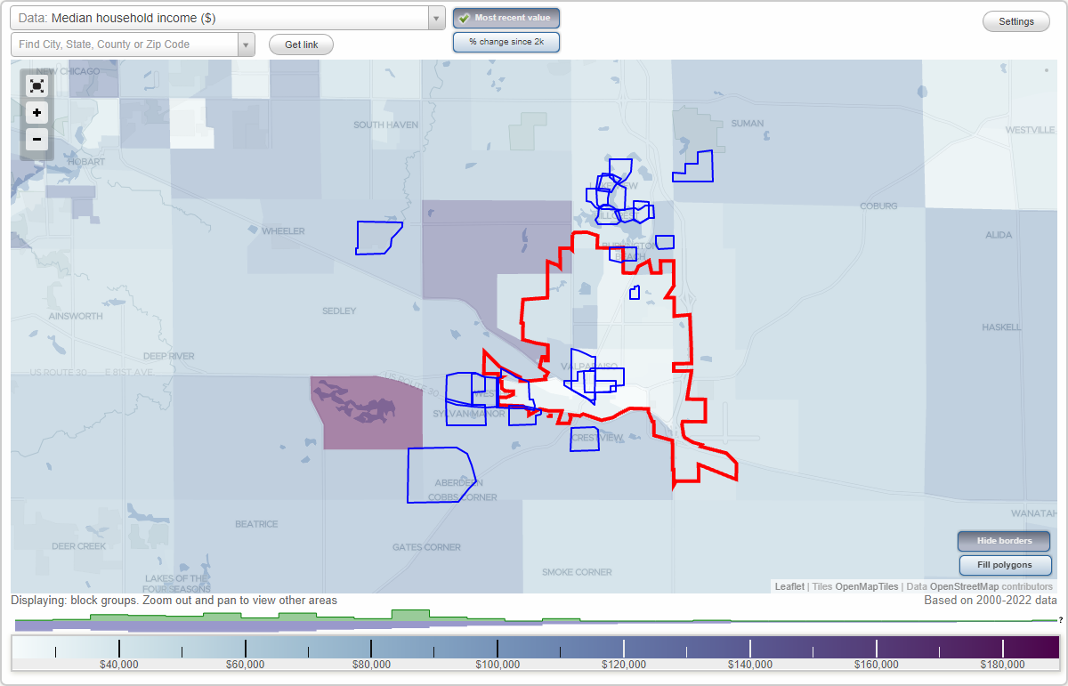
Valparaiso, Indiana Neighborhood Map - Income, House Prices, Occupations, Boundaries
Settings
X

- City boundary
- Neighborhood boundaries
Business Search - 14 Million verified businesses
Neighborhoods:
Aberdeen, Banta, Blackhawk Beach, Burlington Beach, Central, Coolwood Acres, Crestview, Downtown Valparaiso, Edgewater, Harvest Road Estates, Hawthorne, Hillcrest, Lake View, Lakepointe, Lincoln Hills, Long Lake, Marion Manor, Northwood Park, Roble Woods, Salt Creek, Sylvan Manor, WesthillAberdeen neighborhood in Valparaiso statistics: (Find on map)
Area: 1.329 square miles
Highways in this neighborhood: State Hwy 2 (S State Rd 2).
Roads and streets: Division Rd (W Division Rd); 250 W (Tower Rd); N 325 W; W 100 N; Edinburgh St; Larwick Cir; Lockerbie Dr; Turnberry Dr; Aberdeen Dr; Kincraig Dr; Woodruft Dr; Glencoe Dr; Hawkwood Dr; Scotscraig Dr; Hawick Dr; Muirfield Dr; Abington St; Braemar Dr; Westport Rd; Glencarry Ct; Ballantrae St; N 250 W (Tower Rd); Moncrief Dr; Prairie Pkwy; Fentree Dr; Strathaven St; Dundee St; Marcliffe Dr S; N 281 W; Kilmartin Ct; Marcliffe Dr N; Tayside St; Prestwick Dr; Paisley Green; Durness Ct; Edinburgh Ct; Oban Ct; Argyle Dr; W Tower Rd; W Lockerbie Dr; Dornoch St; Turnberry Ct; Dunbar Ct; Fife Ct; Bruntsfield Ct; Lockerbie Green; Whitekirk Green; Kincraig Ct; Prestwick Green.
Aberdeen neighborhood detailed profile
Banta neighborhood in Valparaiso statistics: (Find on map)
Area: 0.342 square miles
Highways in this neighborhood: State Rd 2 (E Lincolnway); Washington St (S Washington St).
Roads and streets: E Chicago St; Institute St; E Jefferson St; Oak St; Monroe St; Indiana Ave; Erie St; Michigan Ave (Michigan St); Valparaiso St; Morgan Blvd; Garfield Ave (Garfield St); Greenwich St; College Ave; Locust St; Franklin St; Wood St; Roosevelt Rd; N Washington St; Library Ln (E Jefferson St); Calumet Ave.
Banta neighborhood detailed profile
Blackhawk Beach neighborhood in Valparaiso statistics: (Find on map)
Area: 0.119 square miles
Population: 157
Population density:
Median household income in 2021:
Median rent in in 2021:
Male vs Females
Median age
Housing prices:
Average estimated value of detached houses in 2021 (62.7% of all units):
Average estimated value of townhouses or other attached units in 2021 (6.0% of all units):
Most popular occupations of males: service occupations (15.3%); sales and office occupations (15.0%); architecture and engineering occupations (14.3%); management occupations (except farmers) (7.9%); construction, extraction, and maintenance occupations (6.9%); production occupations (6.1%); education, training, and library occupations (5.9%)
Most popular occupations of females: service occupations (26.4%); sales and office occupations (18.4%); management occupations (except farmers) (15.2%); education, training, and library occupations (14.7%); business and financial operations occupations (10.0%); legal occupations (6.8%); life, physical, and social science occupations (5.1%)
Roads and streets: Edgewater Beach Rd; Crimson Dr; Agape St; Briam Cir; Crescent Rd; Briam Dr; Waiola Rd; Oakdale Rd; Smilax Ln; Flamingo Dr; Garland Cir; Coryana Dr; Briar Rd; Agape Ln; Sapphire Ln; Magnolia Rd; Briar Ln; Emerald Ln; Jonquill Ln; Thalia Ct; Briam Ct.
Blackhawk Beach neighborhood detailed profile
Area: 0.119 square miles
Population: 157
Population density:
| Blackhawk Beach: | 1,318 people per square mile |
| Valparaiso: | 3,102 people per square mile |
Median household income in 2021:
| Blackhawk Beach: | $48,350 |
| Valparaiso: | $56,465 |
Median rent in in 2021:
| Blackhawk Beach: | $865 |
| Valparaiso: | $865 |
Male vs Females
| Males: | 83 |
| Females: | 73 |
Median age
| Males: | 45.7 years |
| Females: | 51.6 years |
Housing prices:
Average estimated value of detached houses in 2021 (62.7% of all units):
| Blackhawk Beach: | $256,380 |
| Valparaiso: | $232,010 |
Average estimated value of townhouses or other attached units in 2021 (6.0% of all units):
| This neighborhood: | $166,604 |
| city: | $197,533 |
Most popular occupations of males: service occupations (15.3%); sales and office occupations (15.0%); architecture and engineering occupations (14.3%); management occupations (except farmers) (7.9%); construction, extraction, and maintenance occupations (6.9%); production occupations (6.1%); education, training, and library occupations (5.9%)
Most popular occupations of females: service occupations (26.4%); sales and office occupations (18.4%); management occupations (except farmers) (15.2%); education, training, and library occupations (14.7%); business and financial operations occupations (10.0%); legal occupations (6.8%); life, physical, and social science occupations (5.1%)
Roads and streets: Edgewater Beach Rd; Crimson Dr; Agape St; Briam Cir; Crescent Rd; Briam Dr; Waiola Rd; Oakdale Rd; Smilax Ln; Flamingo Dr; Garland Cir; Coryana Dr; Briar Rd; Agape Ln; Sapphire Ln; Magnolia Rd; Briar Ln; Emerald Ln; Jonquill Ln; Thalia Ct; Briam Ct.
Blackhawk Beach neighborhood detailed profile
Burlington Beach neighborhood in Valparaiso statistics: (Find on map)
Area: 0.147 square miles
Population: 525
Population density:
Median household income in 2021:
Median rent in in 2021:
Male vs Females
Median age
Housing prices:
Average estimated value of detached houses in 2021 (71.3% of all units):
Average estimated value of townhouses or other attached units in 2021 (8.3% of all units):
Most popular occupations of males: service occupations (21.7%); construction, extraction, and maintenance occupations (19.8%); material moving occupations (8.4%); sales and office occupations (7.5%); healthcare practitioners and technical occupations (7.0%); production occupations (7.0%); business and financial operations occupations (6.2%)
Most popular occupations of females: service occupations (16.0%); healthcare practitioners and technical occupations (14.0%); material moving occupations (13.9%); education, training, and library occupations (9.2%); sales and office occupations (8.6%); legal occupations (8.3%); management occupations (except farmers) (7.8%)
Roads and streets: Burlington Beach Rd (Co Rd 500 N); Oak Grove Dr; Whip Poor Will Rd; Bobolink Rd; Redwing Rd; Sumac Rd; Cardinal Ln; Robin Rd; Oriole Rd; Wildwood Ave (Wildwood Rd); Chickadee Ln; Oak Grove Ct; Blue Bird Ln; Wilowood Rd; Pheobe Ln; Oak Grove Cir; Meadowlark Dr.
Burlington Beach neighborhood detailed profile
Area: 0.147 square miles
Population: 525
Population density:
| Burlington Beach: | 3,573 people per square mile |
| Valparaiso: | 3,102 people per square mile |
Median household income in 2021:
| Burlington Beach: | $56,079 |
| Valparaiso: | $56,465 |
Median rent in in 2021:
| Burlington Beach: | $704 |
| Valparaiso: | $865 |
Male vs Females
| Males: | 258 |
| Females: | 266 |
Median age
| Males: | 42.4 years |
| Females: | 49.3 years |
Housing prices:
Average estimated value of detached houses in 2021 (71.3% of all units):
| Burlington Beach: | $256,380 |
| Valparaiso: | $232,010 |
Average estimated value of townhouses or other attached units in 2021 (8.3% of all units):
| This neighborhood: | $166,604 |
| city: | $197,533 |
Most popular occupations of males: service occupations (21.7%); construction, extraction, and maintenance occupations (19.8%); material moving occupations (8.4%); sales and office occupations (7.5%); healthcare practitioners and technical occupations (7.0%); production occupations (7.0%); business and financial operations occupations (6.2%)
Most popular occupations of females: service occupations (16.0%); healthcare practitioners and technical occupations (14.0%); material moving occupations (13.9%); education, training, and library occupations (9.2%); sales and office occupations (8.6%); legal occupations (8.3%); management occupations (except farmers) (7.8%)
Roads and streets: Burlington Beach Rd (Co Rd 500 N); Oak Grove Dr; Whip Poor Will Rd; Bobolink Rd; Redwing Rd; Sumac Rd; Cardinal Ln; Robin Rd; Oriole Rd; Wildwood Ave (Wildwood Rd); Chickadee Ln; Oak Grove Ct; Blue Bird Ln; Wilowood Rd; Pheobe Ln; Oak Grove Cir; Meadowlark Dr.
Burlington Beach neighborhood detailed profile
Central neighborhood in Valparaiso statistics: (Find on map)
Area: 0.422 square miles
Highways in this neighborhood: W Lincolnway; State Rd 2 (E Lincolnway); Washington St (S Washington St).
Roads and streets: Franklin St; Lafayette St; Campbell St; Morgan Blvd; Napoleon St; N Washington St; Indiana Ave; Michigan Ave (Michigan St); Erie St; Bush St; Monroe St; Institute St; Academy St; Calumet Ave; W Chicago St; Jefferson St (W Jefferson St); Pine St; Walnut St; Willow St; Brown St; E Chicago St; Library Ln (E Jefferson St); Elm St; E Jefferson St; Park Ave; Haas St; Chestnut St; Hickory St; Oak St; Maple St; Plum St; Lytle St; Beech St; Lincoln Sq.
Railroad features: Grand Trunk Western RR; Norfolk Southern Rlwy.
Central neighborhood detailed profile
Coolwood Acres neighborhood in Valparaiso statistics: (Find on map)
Area: 0.208 square miles
Roads and streets: W Morthland Dr; Coolwood Dr; Millpond Rd (Mill Pond Rd S); Thornapple Way; Vanderburgh Dr; Peterson Dr; Thornapple Cir; Wells St; Clifty Falls Ct.
Coolwood Acres neighborhood detailed profile
Area: 0.208 square miles
Roads and streets: W Morthland Dr; Coolwood Dr; Millpond Rd (Mill Pond Rd S); Thornapple Way; Vanderburgh Dr; Peterson Dr; Thornapple Cir; Wells St; Clifty Falls Ct.
Coolwood Acres neighborhood detailed profile
Crestview neighborhood in Valparaiso statistics: (Find on map)
Area: 0.253 square miles
Roads and streets: City View Dr; Lawndale Dr; Hawthorne Dr; Greenview Ave; Fairview Ave; Smoke Rd (Meridian Rd); Sunset Dr; Woodridge Cir; Crestview Dr; Morningside Dr; Camber Rd; Sager Rd; Chiquia Ct.
Crestview neighborhood detailed profile
Area: 0.253 square miles
Roads and streets: City View Dr; Lawndale Dr; Hawthorne Dr; Greenview Ave; Fairview Ave; Smoke Rd (Meridian Rd); Sunset Dr; Woodridge Cir; Crestview Dr; Morningside Dr; Camber Rd; Sager Rd; Chiquia Ct.
Crestview neighborhood detailed profile
Downtown Valparaiso neighborhood in Valparaiso statistics: (Find on map)
Area: 0.323 square miles
Highways in this neighborhood: State Rd 2 (E Lincolnway); W Lincolnway; Washington St (S Washington St).
Roads and streets: Indiana Ave; Monroe St; E Jefferson St; Morgan Blvd; Franklin St; Jefferson St (W Jefferson St); Lafayette St; Michigan Ave (Michigan St); Erie St; Napoleon St; Institute St; Brown St; E Chicago St; N Washington St; Greenwich St; Locust St; Valparaiso St; College Ave; Garfield Ave (Garfield St); Library Ln (E Jefferson St); W Chicago St; Campbell St; Wayne St; Weston St; Calumet Ave; Lincoln Sq.
Railroad features: Norfolk Southern Rlwy.
Downtown Valparaiso neighborhood detailed profile
Edgewater neighborhood in Valparaiso statistics: (Find on map)
Area: 0.183 square miles
Population: 242
Population density:
Median household income in 2021:
Median rent in in 2021:
Male vs Females
Median age
Housing prices:
Average estimated value of detached houses in 2021 (63.3% of all units):
Average estimated value of townhouses or other attached units in 2021 (6.3% of all units):
Most popular occupations of males: service occupations (15.3%); sales and office occupations (15.0%); architecture and engineering occupations (14.3%); management occupations (except farmers) (7.9%); construction, extraction, and maintenance occupations (6.9%); production occupations (6.1%); education, training, and library occupations (5.9%)
Most popular occupations of females: service occupations (26.4%); sales and office occupations (18.4%); management occupations (except farmers) (15.2%); education, training, and library occupations (14.7%); business and financial operations occupations (10.0%); legal occupations (6.8%); life, physical, and social science occupations (5.1%)
Roads and streets: Edgewater Beach Rd; Crimson Dr; Agape St; Crescent Rd; Waiola Rd; Oakdale Rd; Calumet Ave; Smilax Ln; Flamingo Dr; 2nd Ave; Coryana Dr; Briar Rd; Agape Ln; 4th Ave; Sapphire Ln; 3rd Ave; Magnolia Rd; Briar Ln; Emerald Ln; Jonquill Ln; Thalia Ct; 5th Ave; 6th Ave; Woodland Bluff Dr; Marigold Ln (Bittersweet Ln).
Edgewater neighborhood detailed profile
Area: 0.183 square miles
Population: 242
Population density:
| Edgewater: | 1,320 people per square mile |
| Valparaiso: | 3,102 people per square mile |
Median household income in 2021:
| Edgewater: | $48,350 |
| Valparaiso: | $56,465 |
Median rent in in 2021:
| Edgewater: | $865 |
| Valparaiso: | $865 |
Male vs Females
| Males: | 128 |
| Females: | 113 |
Median age
| Males: | 45.7 years |
| Females: | 51.6 years |
Housing prices:
Average estimated value of detached houses in 2021 (63.3% of all units):
| Edgewater: | $256,380 |
| Valparaiso: | $232,010 |
Average estimated value of townhouses or other attached units in 2021 (6.3% of all units):
| This neighborhood: | $166,604 |
| city: | $197,533 |
Most popular occupations of males: service occupations (15.3%); sales and office occupations (15.0%); architecture and engineering occupations (14.3%); management occupations (except farmers) (7.9%); construction, extraction, and maintenance occupations (6.9%); production occupations (6.1%); education, training, and library occupations (5.9%)
Most popular occupations of females: service occupations (26.4%); sales and office occupations (18.4%); management occupations (except farmers) (15.2%); education, training, and library occupations (14.7%); business and financial operations occupations (10.0%); legal occupations (6.8%); life, physical, and social science occupations (5.1%)
Roads and streets: Edgewater Beach Rd; Crimson Dr; Agape St; Crescent Rd; Waiola Rd; Oakdale Rd; Calumet Ave; Smilax Ln; Flamingo Dr; 2nd Ave; Coryana Dr; Briar Rd; Agape Ln; 4th Ave; Sapphire Ln; 3rd Ave; Magnolia Rd; Briar Ln; Emerald Ln; Jonquill Ln; Thalia Ct; 5th Ave; 6th Ave; Woodland Bluff Dr; Marigold Ln (Bittersweet Ln).
Edgewater neighborhood detailed profile
Harvest Road Estates neighborhood in Valparaiso statistics: (Find on map)
Area: 0.309 square miles
Roads and streets: Co Rd 650 N (E 650 N); Harvest Rd; Covered Wagon Trl.
Harvest Road Estates neighborhood detailed profile
Area: 0.309 square miles
Roads and streets: Co Rd 650 N (E 650 N); Harvest Rd; Covered Wagon Trl.
Harvest Road Estates neighborhood detailed profile
Hawthorne neighborhood in Valparaiso statistics: (Find on map)
Area: 0.087 square miles
Population: 124
Population density:
Median household income in 2021:
Median rent in in 2021:
Male vs Females
Median age
Housing prices:
Average estimated value of detached houses in 2021 (63.1% of all units):
Average estimated value of townhouses or other attached units in 2021 (6.2% of all units):
Most popular occupations of males: service occupations (16.2%); sales and office occupations (13.9%); architecture and engineering occupations (12.4%); construction, extraction, and maintenance occupations (8.8%); management occupations (except farmers) (7.2%); production occupations (6.2%); education, training, and library occupations (5.8%)
Most popular occupations of females: service occupations (24.5%); sales and office occupations (16.6%); management occupations (except farmers) (13.8%); education, training, and library occupations (13.7%); business and financial operations occupations (8.8%); healthcare practitioners and technical occupations (4.8%); material moving occupations (4.1%)
Roads and streets: Burlington Beach Rd; Pennington Pl; Nottingham Dr; Brighton Cir; Silhavy Rd; Stafordshire Ln; Blair Ln; Maplewood Ave.
Hawthorne neighborhood detailed profile
Area: 0.087 square miles
Population: 124
Population density:
| Hawthorne: | 1,426 people per square mile |
| Valparaiso: | 3,102 people per square mile |
Median household income in 2021:
| Hawthorne: | $56,079 |
| Valparaiso: | $56,465 |
Median rent in in 2021:
| Hawthorne: | $849 |
| Valparaiso: | $865 |
Male vs Females
| Males: | 65 |
| Females: | 59 |
Median age
| Males: | 42.4 years |
| Females: | 49.3 years |
Housing prices:
Average estimated value of detached houses in 2021 (63.1% of all units):
| Hawthorne: | $256,380 |
| Valparaiso: | $232,010 |
Average estimated value of townhouses or other attached units in 2021 (6.2% of all units):
| This neighborhood: | $166,604 |
| city: | $197,533 |
Most popular occupations of males: service occupations (16.2%); sales and office occupations (13.9%); architecture and engineering occupations (12.4%); construction, extraction, and maintenance occupations (8.8%); management occupations (except farmers) (7.2%); production occupations (6.2%); education, training, and library occupations (5.8%)
Most popular occupations of females: service occupations (24.5%); sales and office occupations (16.6%); management occupations (except farmers) (13.8%); education, training, and library occupations (13.7%); business and financial operations occupations (8.8%); healthcare practitioners and technical occupations (4.8%); material moving occupations (4.1%)
Roads and streets: Burlington Beach Rd; Pennington Pl; Nottingham Dr; Brighton Cir; Silhavy Rd; Stafordshire Ln; Blair Ln; Maplewood Ave.
Hawthorne neighborhood detailed profile
Hillcrest neighborhood in Valparaiso statistics: (Find on map)
Area: 0.151 square miles
Population: 200
Population density:
Median household income in 2021:
Median rent in in 2021:
Male vs Females
Median age
Housing prices:
Average estimated value of detached houses in 2021 (63.2% of all units):
Average estimated value of townhouses or other attached units in 2021 (5.7% of all units):
Most popular occupations of males: service occupations (15.3%); sales and office occupations (15.0%); architecture and engineering occupations (14.3%); management occupations (except farmers) (7.9%); construction, extraction, and maintenance occupations (6.9%); production occupations (6.1%); education, training, and library occupations (5.9%)
Most popular occupations of females: service occupations (26.4%); sales and office occupations (18.4%); management occupations (except farmers) (15.2%); education, training, and library occupations (14.7%); business and financial operations occupations (10.0%); legal occupations (6.8%); life, physical, and social science occupations (5.1%)
Roads and streets: Grand View Ave; Garden Gateway (Garden Gateway Rd); Grandview Ave; Woodland Ter; Greenwood Rd; Edgewater Beach Rd; Leisure Dr; Easy St; Long Lake Ln; May St; Vale St; Greenland Rd (Groseland Ave); Garden Gtwy.
Hillcrest neighborhood detailed profile
Area: 0.151 square miles
Population: 200
Population density:
| Hillcrest: | 1,321 people per square mile |
| Valparaiso: | 3,102 people per square mile |
Median household income in 2021:
| Hillcrest: | $48,350 |
| Valparaiso: | $56,465 |
Median rent in in 2021:
| Hillcrest: | $865 |
| Valparaiso: | $865 |
Male vs Females
| Males: | 106 |
| Females: | 93 |
Median age
| Males: | 45.7 years |
| Females: | 51.6 years |
Housing prices:
Average estimated value of detached houses in 2021 (63.2% of all units):
| Hillcrest: | $256,380 |
| Valparaiso: | $232,010 |
Average estimated value of townhouses or other attached units in 2021 (5.7% of all units):
| This neighborhood: | $166,604 |
| city: | $197,533 |
Most popular occupations of males: service occupations (15.3%); sales and office occupations (15.0%); architecture and engineering occupations (14.3%); management occupations (except farmers) (7.9%); construction, extraction, and maintenance occupations (6.9%); production occupations (6.1%); education, training, and library occupations (5.9%)
Most popular occupations of females: service occupations (26.4%); sales and office occupations (18.4%); management occupations (except farmers) (15.2%); education, training, and library occupations (14.7%); business and financial operations occupations (10.0%); legal occupations (6.8%); life, physical, and social science occupations (5.1%)
Roads and streets: Grand View Ave; Garden Gateway (Garden Gateway Rd); Grandview Ave; Woodland Ter; Greenwood Rd; Edgewater Beach Rd; Leisure Dr; Easy St; Long Lake Ln; May St; Vale St; Greenland Rd (Groseland Ave); Garden Gtwy.
Hillcrest neighborhood detailed profile
Lake View neighborhood in Valparaiso statistics: (Find on map)
Area: 0.108 square miles
Roads and streets: N 70 E (Center Dr); E Estill Ln; W Long Lake Rd.
Lake View neighborhood detailed profile
Area: 0.108 square miles
Roads and streets: N 70 E (Center Dr); E Estill Ln; W Long Lake Rd.
Lake View neighborhood detailed profile
Lakepointe neighborhood in Valparaiso statistics: (Find on map)
Area: 0.039 square miles
Roads and streets: Lakepointe Dr; Lupine Cir; Aster Ave; Geranium Cir; Gardenia Dr; Columbine Cir.
Lakepointe neighborhood detailed profile
Area: 0.039 square miles
Roads and streets: Lakepointe Dr; Lupine Cir; Aster Ave; Geranium Cir; Gardenia Dr; Columbine Cir.
Lakepointe neighborhood detailed profile
Lincoln Hills neighborhood in Valparaiso statistics: (Find on map)
Area: 0.414 square miles
Highways in this neighborhood: US Hwy 30 (W 250 N, W US Hwy 30).
Roads and streets: Joliet Rd (W Joliet Rd); W US Hwy 30; Skyline Dr; N 250 W (Tower Rd); Lincoln Hills Dr; Webbs Trl; Pauline Dr; Krouser Dr; Akela Dr; Weblos Trl; Neuner Dr; Sylvan Dr.
Lincoln Hills neighborhood detailed profile
Long Lake neighborhood in Valparaiso statistics: (Find on map)
Area: 0.339 square miles
Population: 448
Population density:
Median household income in 2021:
Median rent in in 2021:
Male vs Females
Median age
Housing prices:
Average estimated value of detached houses in 2021 (63.0% of all units):
Average estimated value of townhouses or other attached units in 2021 (5.9% of all units):
Most popular occupations of males: service occupations (15.3%); sales and office occupations (15.0%); architecture and engineering occupations (14.3%); management occupations (except farmers) (7.9%); construction, extraction, and maintenance occupations (6.9%); production occupations (6.1%); education, training, and library occupations (5.9%)
Most popular occupations of females: service occupations (26.4%); sales and office occupations (18.4%); management occupations (except farmers) (15.2%); education, training, and library occupations (14.7%); business and financial operations occupations (10.0%); legal occupations (5.6%); life, physical, and social science occupations (4.3%)
Roads and streets: N 70 E (Center Dr); E 600 N (Co Rd 600); Field Dr; Henrietta Ave; Grand View Ave; N 90 E; Jensen Dr; E Estill Ln; Clay St; Shady Ln; E Scott Dr; W Scott Dr; Long Lake Ln; N Scott Dr; Clay Dr (E Clay St); N Field Dr; E Scott St; E Long Lake Rd; Vale St; W Long Lake Rd.
Long Lake neighborhood detailed profile
Area: 0.339 square miles
Population: 448
Population density:
| Long Lake: | 1,320 people per square mile |
| Valparaiso: | 3,102 people per square mile |
Median household income in 2021:
| Long Lake: | $48,350 |
| Valparaiso: | $56,465 |
Median rent in in 2021:
| Long Lake: | $865 |
| Valparaiso: | $865 |
Male vs Females
| Males: | 237 |
| Females: | 210 |
Median age
| Males: | 45.7 years |
| Females: | 51.6 years |
Housing prices:
Average estimated value of detached houses in 2021 (63.0% of all units):
| Long Lake: | $256,380 |
| Valparaiso: | $232,010 |
Average estimated value of townhouses or other attached units in 2021 (5.9% of all units):
| This neighborhood: | $166,604 |
| city: | $197,533 |
Most popular occupations of males: service occupations (15.3%); sales and office occupations (15.0%); architecture and engineering occupations (14.3%); management occupations (except farmers) (7.9%); construction, extraction, and maintenance occupations (6.9%); production occupations (6.1%); education, training, and library occupations (5.9%)
Most popular occupations of females: service occupations (26.4%); sales and office occupations (18.4%); management occupations (except farmers) (15.2%); education, training, and library occupations (14.7%); business and financial operations occupations (10.0%); legal occupations (5.6%); life, physical, and social science occupations (4.3%)
Roads and streets: N 70 E (Center Dr); E 600 N (Co Rd 600); Field Dr; Henrietta Ave; Grand View Ave; N 90 E; Jensen Dr; E Estill Ln; Clay St; Shady Ln; E Scott Dr; W Scott Dr; Long Lake Ln; N Scott Dr; Clay Dr (E Clay St); N Field Dr; E Scott St; E Long Lake Rd; Vale St; W Long Lake Rd.
Long Lake neighborhood detailed profile
Marion Manor neighborhood in Valparaiso statistics: (Find on map)
Area: 0.436 square miles
Roads and streets: W Morthland Dr; Joliet Rd; Coolwood Dr; Frontage Rd; Marshall Dr; Hayes Leonard Rd; Bogata Ave; St Joseph Ln; High Sierra Dr; Calaveras Dr; Marian Dr; N 150 W (Hayes Leonard Rd); Westside Park Ave; Sonoma Dr; Medera Dr; Un Rd; Tahoe Dr; Thornapple Way.
Marion Manor neighborhood detailed profile
Northwood Park neighborhood in Valparaiso statistics: (Find on map)
Area: 0.180 square miles
Roads and streets: N 70 E; 650 N; E 650 N; E 660 N; E 656 N; 656 N; E 652 N; E 645 N.
Northwood Park neighborhood detailed profile
Area: 0.180 square miles
Roads and streets: N 70 E; 650 N; E 650 N; E 660 N; E 656 N; 656 N; E 652 N; E 645 N.
Northwood Park neighborhood detailed profile
Roble Woods neighborhood in Valparaiso statistics: (Find on map)
Area: 0.145 square miles
Population: 192
Population density:
Median household income in 2021:
Median rent in in 2021:
Male vs Females
Median age
Housing prices:
Average estimated value of detached houses in 2021 (62.7% of all units):
Average estimated value of townhouses or other attached units in 2021 (5.9% of all units):
Most popular occupations of males: service occupations (15.3%); sales and office occupations (15.0%); architecture and engineering occupations (14.3%); management occupations (except farmers) (7.9%); construction, extraction, and maintenance occupations (6.9%); production occupations (6.1%); education, training, and library occupations (5.9%)
Most popular occupations of females: service occupations (26.4%); sales and office occupations (18.4%); management occupations (except farmers) (15.2%); education, training, and library occupations (14.7%); business and financial operations occupations (10.0%); legal occupations (5.6%); arts, design, entertainment, sports, and media occupations (4.3%)
Roads and streets: E 600 N (Co Rd 600); N 70 E (Center Dr); Field Dr; Henrietta Ave; Shady Ln; N Field Dr.
Roble Woods neighborhood detailed profile
Area: 0.145 square miles
Population: 192
Population density:
| Roble Woods: | 1,320 people per square mile |
| Valparaiso: | 3,102 people per square mile |
Median household income in 2021:
| Roble Woods: | $48,350 |
| Valparaiso: | $56,465 |
Median rent in in 2021:
| Roble Woods: | $865 |
| Valparaiso: | $865 |
Male vs Females
| Males: | 101 |
| Females: | 90 |
Median age
| Males: | 45.7 years |
| Females: | 51.6 years |
Housing prices:
Average estimated value of detached houses in 2021 (62.7% of all units):
| Roble Woods: | $256,380 |
| Valparaiso: | $232,010 |
Average estimated value of townhouses or other attached units in 2021 (5.9% of all units):
| This neighborhood: | $166,604 |
| city: | $197,533 |
Most popular occupations of males: service occupations (15.3%); sales and office occupations (15.0%); architecture and engineering occupations (14.3%); management occupations (except farmers) (7.9%); construction, extraction, and maintenance occupations (6.9%); production occupations (6.1%); education, training, and library occupations (5.9%)
Most popular occupations of females: service occupations (26.4%); sales and office occupations (18.4%); management occupations (except farmers) (15.2%); education, training, and library occupations (14.7%); business and financial operations occupations (10.0%); legal occupations (5.6%); arts, design, entertainment, sports, and media occupations (4.3%)
Roads and streets: E 600 N (Co Rd 600); N 70 E (Center Dr); Field Dr; Henrietta Ave; Shady Ln; N Field Dr.
Roble Woods neighborhood detailed profile
Salt Creek neighborhood in Valparaiso statistics: (Find on map)
Area: 0.461 square miles
Roads and streets: Salt Creek Pkwy; W 550 N; W 500 N; Sassafras Dr; Sandalwood Dr; Robin St (Robyn Rd); Mc Cool Rd; Saginaw Dr; Sequoia Dr; Sturgeon Dr; Sherman Dr; Sable Dr; Raven Rd; Sunshine Dr; Rickenbacker Rd; Rainier Rd; Salt Creek Ct; Riviera Rd; Remington Rd; Rainier Ct; Rickenbacker Ct; Riviera Cir; Riviera Ct; Raven Ct; Old Bailey Ct; Raven Cir; Rushmore Dr; Sassafras Ct; Sandalwood Ct; McCool Rd.
Salt Creek neighborhood detailed profile
Sylvan Manor neighborhood in Valparaiso statistics: (Find on map)
Area: 0.356 square miles
Highways in this neighborhood: US Hwy 30 (W 250 N, W US Hwy 30).
Roads and streets: W 150 N (W Horn Rd); W US Hwy 30; Moorland Dr; Meadowridge Rd; N 250 W (Tower Rd); Sylvan Dr; Westgate Dr; Southport Dr; Woodside Ln; Sunland Dr; Oakridge Ct; Woodside Ct; Meadowridge Ct; Southport Ct.
Sylvan Manor neighborhood detailed profile
Westhill neighborhood in Valparaiso statistics: (Find on map)
Area: 0.327 square miles
Highways in this neighborhood: US Hwy 30 (W 250 N, W US Hwy 30).
Roads and streets: Joliet Rd (W Joliet Rd); N West Hills Dr; W US Hwy 30; Hayes Leonard Rd; S West Hills Dr; N 150 W (Hayes Leonard Rd); Morthland; Donovan Dr; Timothy Rd; Dwight Rd; David Rd; Steele Dr; Neff Dr; Moorland Dr.
Westhill neighborhood detailed profile