Wadsworth South (South End Wadsworth) neighborhood in Wadsworth, Ohio (OH), 44230, 44281 detailed profile
Settings
X


Business Search - 14 Million verified businesses
Area: 9.042 square miles
Population: 10,470
Population density:
| Wadsworth South (South End Wadsworth): | 1,158 people per square mile |
| Wadsworth: | 2,534 people per square mile |

- 9,87788.2%White
- 3873.5%Black
- 3883.5%Asian
- 2392.1%Two or more races
- 2252.0%Hispanic or Latino
- 810.7%American Indian

Median household income in 2022:
| Wadsworth South (South End Wadsworth): | $76,617 |
| Wadsworth: | $72,325 |
Distribution of median household income
![Distribution of median household income]()
- 162Less than $10,000
- 2,252$10,000 to $19,999
- 645$20,000 to $29,999
- 481$30,000 to $39,999
- 400$40,000 to $49,999
- 629$50,000 to $59,999
- 309$60,000 to $74,999
- 766$75,000 to $99,999
- 354$100,000 to $124,999
- 237$125,000 to $149,999
- 404$150,000 to $199,999
- 420$200,000 or more

Distribution of owner-occupied house/condo value
![Distribution of owner-occupied house/condo value]()
- 537Less than $50,000
- 2,238$50,000 to $99,999
- 711$100,000 to $149,999
- 715$150,000 to $199,999
- 710$200,000 to $249,999
- 468$250,000 to $299,999
- 431$300,000 to $399,999
- 75$400,000 to $499,999
- 110$500,000 to $749,999
- 80$750,000 to $999,999
- 147$1,000,000 or more

Distribution of rent paid by renters
![Distribution of rent paid by renters]()
- 202$100 to $199
- 1,058$200 to $299
- 688$300 to $399
- 176$400 to $499
- 1,708$500 to $599
- 2,206$600 to $699
- 704$700 to $799
- 284$800 to $899
- 323$900 to $999
- 385$1,000 to $1,249
- 264$1,250 to $1,499
- 131$1,500 to $1,999
- 54$2,000 or more

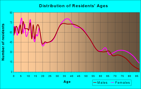
| Males: | 4,881 |
| Females: | 5,589 |
Males:
| This neighborhood: | 39.0 years |
| Whole city: | 37.0 years |
| This neighborhood: | 42.0 years |
| Whole city: | 40.4 years |
Average household size:
| Wadsworth South (South End Wadsworth): | 2.4 people |
| Wadsworth: | 2.4 people |
Percentage of family households:
| Wadsworth South (South End Wadsworth): | 48.5% |
| Wadsworth: | 45.6% |
| Here: | 46.1% |
| Wadsworth: | 49.2% |
Percentage of married-couple families with children (among all households):
| Wadsworth South (South End Wadsworth): | 26.0% |
| Wadsworth: | 30.7% |
Percentage of single-mother households (among all households):
| Wadsworth South (South End Wadsworth): | 13.3% |
| Wadsworth: | 8.5% |
Percentage of never married males 15 years old and over:
Percentage of never married females 15 years old and over:
| Wadsworth South (South End Wadsworth): | 16.8% |
| Wadsworth: | 15.5% |
Percentage of never married females 15 years old and over:
| Wadsworth South (South End Wadsworth): | 20.0% |
| city: | 16.2% |
Percentage of people that speak English not well or not at all:
| Wadsworth South (South End Wadsworth): | 0.0% |
| Wadsworth: | 0.1% |
Percentage of people born in this state:
Percentage of people born in another U.S. state:
Percentage of native residents but born outside the U.S.:
Percentage of foreign born residents:
| Here: | 83.1% |
| Wadsworth: | 81.5% |
Percentage of people born in another U.S. state:
| Wadsworth South (South End Wadsworth): | 15.3% |
| Wadsworth: | 16.2% |
Percentage of native residents but born outside the U.S.:
| Here: | 0.3% |
| city: | 0.3% |
Percentage of foreign born residents:
| Here: | 1.4% |
| Wadsworth: | 2.0% |

Owner-occupied
Renter-occupied


- Rooms in owner-occupied houses and condos in Wadsworth South <
> - 981 room
- 02 rooms
- 3653 rooms
- 3694 rooms
- 3645 rooms
- 5926 rooms
- 5667 rooms
- 4318 rooms
- 6329+ rooms

- Rooms in renter-occupied apartments in Wadsworth South <
> - 1,3221 room
- 5572 rooms
- 6303 rooms
- 1,4174 rooms
- 5855 rooms
- 1936 rooms
- 1867 rooms
- 608 rooms
- 1239+ rooms
Owner-occupied
Renter-occupied

- Bedrooms in owner-occupied houses and condos in Wadsworth South <
> - 98no bedroom
- 01 bedroom
- 3892 bedrooms
- 1,3893 bedrooms
- 9034 bedrooms
- 2625+ bedrooms

- Bedrooms in renter-occupied apartments in Wadsworth South <
> - 2,068no bedroom
- 6081 bedroom
- 1,5282 bedrooms
- 3053 bedrooms
- 6844 bedrooms
- 55+ bedrooms
Average number of cars or other vehicles available in houses/condos:
Average number of cars or other vehicles available in apartments:
| This neighborhood: | 2.3 |
| Wadsworth: | 2.2 |
Average number of cars or other vehicles available in apartments:
| Here: | |
| city: |
Percentage of units with a mortgage:
| Wadsworth South (South End Wadsworth): | 74.8% |
| Wadsworth: | 69.0% |
Average estimated value of detached houses in 2022 (71.7% of all units):
| Wadsworth South (South End Wadsworth): | $155,183 |
| Ohio: | $254,366 |

- Year house built in Wadsworth South <
> - 112020 or later
- 4322010 to 2019
- 6922000 to 2009
- 3991990 to 1999
- 3741980 to 1989
- 7861970 to 1979
- 3371960 to 1969
- 6561950 to 1959
- 1631940 to 1949
- 7271939 or earlier

City-data.com crime index for city in 2020 (higher means more crime):
| City: | 90.1 |
| U.S. average: | 219.5 |
Travel time to work (commute)
![Travel time to work (commute)]()
- 174Less than 5 minutes
- 5885 to 9 minutes
- 80910 to 14 minutes
- 71015 to 19 minutes
- 88420 to 24 minutes
- 60125 to 29 minutes
- 50030 to 34 minutes
- 34735 to 39 minutes
- 18240 to 44 minutes
- 25045 to 59 minutes
- 21560 to 89 minutes
- 6690 or more minutes

Means of transportation to work
![Means of transportation to work]()
- 86.8%5,058Drove a car alone
- 3.5%205Carpooled
- 1.2%67Bus
- 3.2%188Bicycle
- 14.5%846Walked
- 0.5%28Other means
- 7.5%439Worked at home

Time leaving home to go to work
![Time leaving home to go to work]()
- 44212:00 a.m. to 4:59 a.m.
- 875:00 a.m. to 5:29 a.m.
- 1635:30 a.m. to 5:59 a.m.
- 6156:00 a.m. to 6:29 a.m.
- 6286:30 a.m. to 6:59 a.m.
- 6527:00 a.m. to 7:29 a.m.
- 6017:30 a.m. to 7:59 a.m.
- 5058:00 a.m. to 8:29 a.m.
- 3618:30 a.m. to 8:59 a.m.
- 1749:00 a.m. to 9:59 a.m.
- 5510:00 a.m. to 10:59 a.m.
- 9711:00 a.m. to 11:59 a.m.
- 42112:00 p.m. to 3:59 p.m.
- 4514:00 p.m. to 11:59 p.m.

Occupations of males:
- Percentage of males in management occupations (except farmers):
Here: 11.6% city: 13.1%
- Percentage of males in business and financial operations occupations:
Here: 6.1% city: 3.8%
- Percentage of males in computer and mathematical occupations:
Here: 4.9% city: 4.9%
- Percentage of males in architecture and engineering occupations:
Here: 3.6% city: 6.8%
- Percentage of males in legal occupations:
Here: 1.2% city: 1.0%
- Percentage of males in education, training, and library occupations:
Here: 1.8% city: 3.5%
- Percentage of males in arts, design, entertainment, sports, and media occupations:
Here: 3.1% city: 1.5%
- Percentage of males in healthcare practitioners and technical occupations:
Here: 3.4% city: 4.1%
- Percentage of males in service occupations:
Here: 14.4% city: 12.3%
- Percentage of males in sales and office occupations:
Here: 14.9% city: 17.2%
- Percentage of males in construction, extraction, and maintenance occupations:
Here: 6.8% city: 6.0%
- Percentage of males in production occupations:
Here: 9.1% city: 6.6%
- Percentage of males in transportation occupations:
Here: 2.2% city: 3.5%
- Percentage of males in material moving occupations:
Here: 6.1% city: 6.1%
Occupations of females:
- Percentage of females in management occupations (except farmers):
Here: 12.7% city: 9.7%
- Percentage of females in business and financial operations occupations:
Here: 3.9% city: 4.0%
- Percentage of females in computer and mathematical occupations:
Here: 3.3% city: 2.6%
- Percentage of females in community and social services occupations:
Here: 2.3% city: 2.4%
- Percentage of females in education, training, and library occupations:
Here: 7.3% city: 16.0%
- Percentage of females in arts, design, entertainment, sports, and media occupations:
Here: 2.2% city: 2.2%
- Percentage of females in healthcare practitioners and technical occupations:
Here: 13.2% city: 14.2%
- Percentage of females in service occupations:
Here: 21.2% city: 14.8%
- Percentage of females in sales and office occupations:
Here: 21.0% city: 22.7%
- Percentage of females in production occupations:
Here: 1.6% city: 2.5%
- Percentage of females in material moving occupations:
Here: 7.9% city: 4.0%
Percentage of people 16-64 in Armed Forces:
| Wadsworth South (South End Wadsworth): | 0.0% |
| Wadsworth: | 0.0% |
Education in this neighborhood (subdivision or community):
- Percentage of people 3 years and older in K-12 schools:
Wadsworth South (South End Wadsworth): 17.4% Wadsworth: 16.3%
- Percentage of people 3 years and older in undergraduate colleges:
Wadsworth South (South End Wadsworth): 6.7% Wadsworth: 4.2%
- Percentage of people 3 years and older in grad. or professional schools:
Wadsworth South (South End Wadsworth): 3.3% Wadsworth: 1.6%
- Percentage of students K-12 enrolled in private schools:
Wadsworth South (South End Wadsworth): 74.9% Wadsworth: 7.4%
Percentage of population below poverty level:
| Wadsworth South (South End Wadsworth): | 9.0% |
| Wadsworth: | 8.7% |
Median year owner moved in (as recorded in 2022):
| Wadsworth South (South End Wadsworth): | 2008 |
| Wadsworth: | 2009 |
Percentage of married-couple families with both working:
| Wadsworth South (South End Wadsworth): | 75.6% |
| Wadsworth: | 77.8% |

- 72.9%Utility gas
- 12.6%Electricity
- 4.8%Other fuel
- 3.2%Bottled, tank, or LP gas
- 2.8%Fuel oil, kerosene, etc.
- 2.5%No fuel used
- 1.2%Wood
Highways in this neighborhood:
State Rte 94 (Mount Eaton Rd)
Length: 1.29 miles
Direction: N-S
Address range: 9867 to 10499
Direction: N-S
Address range: 9867 to 10499
Wadsworth Rd (State Rte 57)
Length: 1.25 miles
Directions: N-S, SW-NE
Directions: N-S, SW-NE
State Rte 94 (Main St)
Length: 1.19 miles
Direction: N-S
Address range: 150 to 799
Direction: N-S
Address range: 150 to 799
Roads and streets:
Eastern Rd (Twp Rd 150)
Length: 4.89 miles
Direction: E-W
Address range: 2 to 1946
Direction: E-W
Address range: 2 to 1946
Wall Rd (Twp Rd 145)
Length: 4.82 miles
Directions: E-W, N-S, SE-NW
Address range: 1 to 1899
Directions: E-W, N-S, SE-NW
Address range: 1 to 1899
Johnson Rd (Co Hwy 144)
Length: 3.39 miles
Directions: E-W, SE-NW, SW-NE
Address range: 1 to 998
Directions: E-W, SE-NW, SW-NE
Address range: 1 to 998
Co Hwy 59 (Silvercreek Rd)
Length: 2.40 miles
Direction: N-S
Address range: 143 to 10499
Direction: N-S
Address range: 143 to 10499
Co Hwy 233 (Rittman Rd)
Length: 1.66 miles
Directions: N-S, SW-NE
Address range: 600 to 10399
Directions: N-S, SW-NE
Address range: 600 to 10399
Seville Rd
Length: 1.63 miles
Direction: E-W
Address range: 100 to 799
Direction: E-W
Address range: 100 to 799
S Medina Line Rd (Co Hwy 2)
Length: 1.45 miles
Direction: N-S
Address range: 4041 to 4799
Direction: N-S
Address range: 4041 to 4799
Greenwich Rd (College St)
Length: 1.39 miles
Direction: E-W
Address range: 180 to 839
Direction: E-W
Address range: 180 to 839
Trease Rd (Co Hwy 157)
Length: 1.30 miles
Direction: N-S
Address range: 101 to 9799
Direction: N-S
Address range: 101 to 9799
State St
Length: 1.30 miles
Directions: E-W, SW-NE
Address range: 100 to 753
Directions: E-W, SW-NE
Address range: 100 to 753
E Bergey St
Length: 1.17 miles
Directions: E-W, N-S, SE-NW, SW-NE
Address range: 100 to 599
Directions: E-W, N-S, SE-NW, SW-NE
Address range: 100 to 599
Silvercrest Rd (Twp Rd 143)
Length: 0.93 miles
Directions: E-W, SE-NW
Address range: 400 to 692
Directions: E-W, SE-NW
Address range: 400 to 692
S Medina Line Rd (Medina Line Rd)
Length: 0.92 miles
Direction: N-S
Address range: 4786 to 5337
Direction: N-S
Address range: 4786 to 5337
Twp Rd 192 (Durling Dr)
Length: 0.92 miles
Directions: N-S, SE-NW
Address range: 181 to 512
Directions: N-S, SE-NW
Address range: 181 to 512
Longbrook Dr
Length: 0.86 miles
Directions: E-W, SE-NW, SW-NE
Directions: E-W, SE-NW, SW-NE
Chestnut St
Length: 0.79 miles
Direction: E-W
Address range: 100 to 377
Direction: E-W
Address range: 100 to 377
Water St
Length: 0.78 miles
Directions: E-W, N-S
Address range: 100 to 399
Directions: E-W, N-S
Address range: 100 to 399
Meadowcreek Dr
Length: 0.73 miles
Directions: E-W, N-S, SE-NW, SW-NE
Directions: E-W, N-S, SE-NW, SW-NE
Park Dr
Length: 0.71 miles
Directions: E-W, N-S, SE-NW, SW-NE
Directions: E-W, N-S, SE-NW, SW-NE
E Walnut St
Length: 0.63 miles
Direction: E-W
Address range: 100 to 343
Direction: E-W
Address range: 100 to 343
Kings Cross Dr
Length: 0.60 miles
Directions: E-W, N-S, SE-NW
Address range: 800 to 923
Directions: E-W, N-S, SE-NW
Address range: 800 to 923
Woodcrest Dr
Length: 0.58 miles
Directions: E-W, N-S, SE-NW, SW-NE
Address range: 412 to 799
Directions: E-W, N-S, SE-NW, SW-NE
Address range: 412 to 799
Sparrow Way
Length: 0.58 miles
Direction: N-S
Address range: 600 to 799
Direction: N-S
Address range: 600 to 799
Queens Gate Way
Length: 0.56 miles
Directions: N-S, SW-NE
Directions: N-S, SW-NE
Madison Trl (Twp Hwy 791)
Length: 0.54 miles
Directions: E-W, SW-NE
Directions: E-W, SW-NE
Twp Hwy 213 (Homestead Dr, Homestead Rd)
Length: 0.53 miles
Direction: N-S
Address range: 9800 to 10099
Direction: N-S
Address range: 9800 to 10099
Hillsdale Cir
Length: 0.53 miles
Directions: E-W, N-S, SE-NW, SW-NE
Address range: 231 to 398
Directions: E-W, N-S, SE-NW, SW-NE
Address range: 231 to 398
Twp Hwy 190 (Rischel Rd)
Length: 0.52 miles
Directions: N-S, SW-NE
Address range: 10200 to 10499
Directions: N-S, SW-NE
Address range: 10200 to 10499
Twp Hwy 261 (Pifer Rd)
Length: 0.52 miles
Direction: N-S
Address range: 10200 to 10399
Direction: N-S
Address range: 10200 to 10399
East St
Length: 0.51 miles
Direction: N-S
Address range: 150 to 443
Direction: N-S
Address range: 150 to 443
Westwood Ave
Length: 0.50 miles
Directions: E-W, N-S, SE-NW, SW-NE
Address range: 392 to 599
Directions: E-W, N-S, SE-NW, SW-NE
Address range: 392 to 599
South Blvd
Length: 0.49 miles
Directions: E-W, SE-NW
Address range: 414 to 468
Directions: E-W, SE-NW
Address range: 414 to 468
Westview Ave
Length: 0.47 miles
Direction: N-S
Address range: 100 to 339
Direction: N-S
Address range: 100 to 339
Oakcrest Dr
Length: 0.47 miles
Directions: E-W, N-S, SW-NE
Address range: 544 to 799
Directions: E-W, N-S, SW-NE
Address range: 544 to 799
Grandview Ave
Length: 0.46 miles
Direction: N-S
Address range: 100 to 349
Direction: N-S
Address range: 100 to 349
1st St
Length: 0.45 miles
Directions: N-S, SE-NW
Address range: 171 to 399
Directions: N-S, SE-NW
Address range: 171 to 399
Hillcrest Dr
Length: 0.45 miles
Directions: E-W, SE-NW
Address range: 600 to 809
Directions: E-W, SE-NW
Address range: 600 to 809
Barrenwood Dr
Length: 0.45 miles
Directions: E-W, N-S, SE-NW, SW-NE
Address range: 348 to 570
Directions: E-W, N-S, SE-NW, SW-NE
Address range: 348 to 570
Rainbow St
Length: 0.45 miles
Directions: E-W, SW-NE
Address range: 100 to 299
Directions: E-W, SW-NE
Address range: 100 to 299
Mills St
Length: 0.44 miles
Direction: E-W
Address range: 100 to 267
Direction: E-W
Address range: 100 to 267
Red Rose Dr
Length: 0.44 miles
Directions: E-W, N-S, SE-NW
Directions: E-W, N-S, SE-NW
Takacs Dr
Length: 0.43 miles
Directions: E-W, N-S, SE-NW
Address range: 100 to 199
Directions: E-W, N-S, SE-NW
Address range: 100 to 199
Thicket Trl (Twp Hwy 790)
Length: 0.43 miles
Directions: N-S, SW-NE
Directions: N-S, SW-NE
3rd St
Length: 0.42 miles
Direction: N-S
Address range: 219 to 410
Direction: N-S
Address range: 219 to 410
Fairview Ave
Length: 0.41 miles
Directions: E-W, N-S, SW-NE
Address range: 36 to 246
Directions: E-W, N-S, SW-NE
Address range: 36 to 246
Plum Creek Dr
Length: 0.39 miles
Directions: E-W, N-S, SW-NE
Address range: 400 to 609
Directions: E-W, N-S, SW-NE
Address range: 400 to 609
Corporate Pkwy
Length: 0.39 miles
Directions: E-W, N-S
Directions: E-W, N-S
Twp Hwy 248 (Weaverville Rd)
Length: 0.39 miles
Directions: E-W, N-S
Address range: 113 to 142
Directions: E-W, N-S
Address range: 113 to 142
Northpark Dr
Length: 0.39 miles
Directions: E-W, N-S, SW-NE
Address range: 100 to 299
Directions: E-W, N-S, SW-NE
Address range: 100 to 299
Twp Hwy 752 (Silver Fox Dr)
Length: 0.38 miles
Direction: E-W
Direction: E-W
Park St
Length: 0.38 miles
Direction: E-W
Address range: 112 to 249
Direction: E-W
Address range: 112 to 249
Olympic Way
Length: 0.38 miles
Directions: N-S, SW-NE
Address range: 600 to 610
Directions: N-S, SW-NE
Address range: 600 to 610
W Bergey St
Length: 0.36 miles
Direction: E-W
Address range: 100 to 299
Direction: E-W
Address range: 100 to 299
Parkview Ave
Length: 0.36 miles
Directions: E-W, N-S
Address range: 139 to 299
Directions: E-W, N-S
Address range: 139 to 299
Westgate Ave
Length: 0.36 miles
Directions: E-W, N-S
Address range: 148 to 299
Directions: E-W, N-S
Address range: 148 to 299
Rolling Hills Dr
Length: 0.36 miles
Directions: E-W, N-S, SW-NE
Directions: E-W, N-S, SW-NE
Wintergreen Dr
Length: 0.34 miles
Directions: N-S, SE-NW
Address range: 370 to 559
Directions: N-S, SE-NW
Address range: 370 to 559
Twp Hwy 504 (Golden Ridge Dr)
Length: 0.34 miles
Directions: E-W, N-S
Address range: 10300 to 10399
Directions: E-W, N-S
Address range: 10300 to 10399
Twp Rd 288 (Beech Dr)
Length: 0.34 miles
Directions: E-W, N-S, SE-NW
Address range: 9943 to 10044
Directions: E-W, N-S, SE-NW
Address range: 9943 to 10044
Meadow Dr
Length: 0.34 miles
Direction: N-S
Address range: 418 to 555
Direction: N-S
Address range: 418 to 555
Twp Hwy 262 (Peggy Dr)
Length: 0.34 miles
Directions: E-W, SW-NE
Address range: 1000 to 1119
Directions: E-W, SW-NE
Address range: 1000 to 1119
Twp Hwy 699 (Chardoney Dr)
Length: 0.33 miles
Directions: E-W, N-S, SW-NE
Directions: E-W, N-S, SW-NE
Twp Rd 286 (Maple Dr)
Length: 0.33 miles
Directions: E-W, SW-NE
Address range: 1000 to 1119
Directions: E-W, SW-NE
Address range: 1000 to 1119
Southbay Dr
Length: 0.33 miles
Directions: E-W, SE-NW
Directions: E-W, SE-NW
S Lyman St
Length: 0.32 miles
Direction: N-S
Address range: 175 to 343
Direction: N-S
Address range: 175 to 343
Twp Hwy 344 (Ruth Dr)
Length: 0.31 miles
Directions: N-S, SW-NE
Address range: 10066 to 10182
Directions: N-S, SW-NE
Address range: 10066 to 10182
Royal Woods Dr
Length: 0.31 miles
Directions: E-W, SW-NE
Address range: 538 to 655
Directions: E-W, SW-NE
Address range: 538 to 655
Springdale Ave
Length: 0.29 miles
Direction: E-W
Address range: 400 to 514
Direction: E-W
Address range: 400 to 514
Twp Hwy 505 (Green Haven Ln)
Length: 0.29 miles
Direction: E-W
Address range: 1100 to 1299
Direction: E-W
Address range: 1100 to 1299
Bear Run (Twp Hwy 753)
Length: 0.29 miles
Direction: N-S
Direction: N-S
Silvermeadow Dr
Length: 0.29 miles
Direction: N-S
Direction: N-S
Pine St
Length: 0.29 miles
Direction: E-W
Address range: 101 to 209
Direction: E-W
Address range: 101 to 209
Southpark Dr
Length: 0.28 miles
Directions: E-W, N-S, SE-NW
Address range: 137 to 299
Directions: E-W, N-S, SE-NW
Address range: 137 to 299
Arcadia Rd
Length: 0.28 miles
Direction: E-W
Direction: E-W
Twp Hwy 289 (Dale Dr)
Length: 0.28 miles
Directions: N-S, SW-NE
Address range: 10000 to 10199
Directions: N-S, SW-NE
Address range: 10000 to 10199
Ringer St
Length: 0.27 miles
Direction: E-W
Direction: E-W
Hillside Dr
Length: 0.26 miles
Direction: E-W
Address range: 100 to 299
Direction: E-W
Address range: 100 to 299
Ashbrook Dr
Length: 0.26 miles
Direction: E-W
Address range: 51 to 799
Direction: E-W
Address range: 51 to 799
Ohio Ave
Length: 0.26 miles
Directions: E-W, N-S, SE-NW
Address range: 127 to 243
Directions: E-W, N-S, SE-NW
Address range: 127 to 243
School Dr
Length: 0.26 miles
Direction: E-W
Address range: 500 to 599
Direction: E-W
Address range: 500 to 599
Twp Hwy 698 (Questa Ct)
Length: 0.25 miles
Directions: E-W, N-S, SE-NW, SW-NE
Directions: E-W, N-S, SE-NW, SW-NE
Catawba Dr
Length: 0.25 miles
Direction: N-S
Direction: N-S
Terraceview Ave
Length: 0.25 miles
Direction: E-W
Address range: 114 to 183
Direction: E-W
Address range: 114 to 183
Twp Hwy 791
Length: 0.24 miles
Directions: E-W, SW-NE
Directions: E-W, SW-NE
Twp Hwy 699
Length: 0.24 miles
Directions: E-W, SE-NW
Directions: E-W, SE-NW
S P Dr
Length: 0.23 miles
Directions: E-W, N-S, SE-NW
Directions: E-W, N-S, SE-NW
Woodlawn Ave
Length: 0.23 miles
Directions: E-W, SW-NE
Address range: 428 to 499
Directions: E-W, SW-NE
Address range: 428 to 499
Duane Ln
Length: 0.22 miles
Direction: E-W
Direction: E-W
Twp Hwy 287 (Fay Dr)
Length: 0.22 miles
Direction: N-S
Address range: 9940 to 10047
Direction: N-S
Address range: 9940 to 10047
W Walnut St
Length: 0.21 miles
Direction: E-W
Address range: 100 to 209
Direction: E-W
Address range: 100 to 209
Bird St
Length: 0.21 miles
Direction: N-S
Address range: 433 to 614
Direction: N-S
Address range: 433 to 614
Twp Hwy 660 (Nelson Ct)
Length: 0.21 miles
Directions: N-S, SW-NE
Directions: N-S, SW-NE
Fernwood Ave
Length: 0.21 miles
Direction: E-W
Address range: 400 to 469
Direction: E-W
Address range: 400 to 469
Ardmore Ave
Length: 0.21 miles
Direction: E-W
Direction: E-W
Garfield St
Length: 0.20 miles
Direction: E-W
Address range: 100 to 199
Direction: E-W
Address range: 100 to 199
Ault St
Length: 0.20 miles
Direction: N-S
Address range: 100 to 199
Direction: N-S
Address range: 100 to 199
S Pardee St
Length: 0.20 miles
Direction: N-S
Address range: 117 to 220
Direction: N-S
Address range: 117 to 220
Oakwood Ave
Length: 0.20 miles
Direction: E-W
Address range: 400 to 468
Direction: E-W
Address range: 400 to 468
Twp Hwy 503 (Clear Brook Cir)
Length: 0.20 miles
Direction: N-S
Address range: 10300 to 10499
Direction: N-S
Address range: 10300 to 10499
Yonkers Rd
Length: 0.18 miles
Direction: E-W
Direction: E-W
Linden Dr
Length: 0.18 miles
Direction: E-W
Address range: 200 to 299
Direction: E-W
Address range: 200 to 299
Devonwood Dr
Length: 0.18 miles
Directions: E-W, SE-NW
Directions: E-W, SE-NW
Kyle St
Length: 0.18 miles
Direction: N-S
Address range: 115 to 187
Direction: N-S
Address range: 115 to 187
Whippoorwill Ln
Length: 0.18 miles
Direction: N-S
Address range: 600 to 799
Direction: N-S
Address range: 600 to 799
Park Ct
Length: 0.17 miles
Directions: E-W, SW-NE
Address range: 166 to 205
Directions: E-W, SW-NE
Address range: 166 to 205
Byers View Dr
Length: 0.17 miles
Direction: E-W
Address range: 628 to 666
Direction: E-W
Address range: 628 to 666
S Medina Line Rd
Length: 0.15 miles
Direction: N-S
Address range: 5124 to 5399
Direction: N-S
Address range: 5124 to 5399
Glendale Dr
Length: 0.14 miles
Direction: E-W
Direction: E-W
Treeview Dr
Length: 0.14 miles
Direction: N-S
Address range: 390 to 451
Direction: N-S
Address range: 390 to 451
Hard St
Length: 0.14 miles
Direction: N-S
Direction: N-S
Songbird Path
Length: 0.14 miles
Direction: E-W
Address range: 300 to 399
Direction: E-W
Address range: 300 to 399
S Kaser Dr
Length: 0.14 miles
Directions: N-S, SE-NW
Address range: 400 to 529
Directions: N-S, SE-NW
Address range: 400 to 529
Morningview Ridge Cir
Length: 0.14 miles
Direction: N-S
Direction: N-S
Mill St
Length: 0.13 miles
Directions: E-W, N-S
Address range: 300 to 399
Directions: E-W, N-S
Address range: 300 to 399
Robin Dr
Length: 0.13 miles
Direction: E-W
Address range: 768 to 799
Direction: E-W
Address range: 768 to 799
Sweetwater Dr
Length: 0.13 miles
Directions: E-W, N-S, SW-NE
Address range: 600 to 699
Directions: E-W, N-S, SW-NE
Address range: 600 to 699
Mechanic St
Length: 0.12 miles
Direction: E-W
Address range: 101 to 125
Direction: E-W
Address range: 101 to 125
Pleasantview Ave
Length: 0.12 miles
Directions: E-W, N-S
Address range: 100 to 199
Directions: E-W, N-S
Address range: 100 to 199
Clearview Cir
Length: 0.12 miles
Directions: E-W, SE-NW
Directions: E-W, SE-NW
Quail Lk Cir
Length: 0.12 miles
Direction: N-S
Direction: N-S
Ardale Ave
Length: 0.11 miles
Direction: E-W
Address range: 400 to 599
Direction: E-W
Address range: 400 to 599
Lucas Ct
Length: 0.11 miles
Direction: E-W
Address range: 116 to 146
Direction: E-W
Address range: 116 to 146
Castle Haven Way
Length: 0.11 miles
Direction: N-S
Direction: N-S
2nd St
Length: 0.11 miles
Direction: N-S
Address range: 160 to 199
Direction: N-S
Address range: 160 to 199
L St
Length: 0.11 miles
Direction: N-S
Direction: N-S
S Avon St
Length: 0.11 miles
Direction: N-S
Address range: 113 to 171
Direction: N-S
Address range: 113 to 171
Ry Rd
Length: 0.10 miles
Direction: E-W
Direction: E-W
Wintercreek Cir
Length: 0.10 miles
Direction: SW-NE
Direction: SW-NE
Creekview Cir
Length: 0.10 miles
Directions: N-S, SW-NE
Directions: N-S, SW-NE
Wood St
Length: 0.10 miles
Direction: E-W
Address range: 451 to 477
Direction: E-W
Address range: 451 to 477
Washington St
Length: 0.10 miles
Direction: E-W
Address range: 247 to 257
Direction: E-W
Address range: 247 to 257
White Rose Cir
Length: 0.10 miles
Direction: E-W
Direction: E-W
Coledonia Dr
Length: 0.09 miles
Direction: E-W
Address range: 400 to 599
Direction: E-W
Address range: 400 to 599
Stringfield Ln
Length: 0.09 miles
Directions: E-W, SW-NE
Address range: 135 to 143
Directions: E-W, SW-NE
Address range: 135 to 143
Bobsway Rd
Length: 0.09 miles
Direction: N-S
Direction: N-S
Deercrest Dr
Length: 0.09 miles
Direction: E-W
Address range: 600 to 799
Direction: E-W
Address range: 600 to 799
N Kaser Dr
Length: 0.08 miles
Direction: N-S
Address range: 300 to 499
Direction: N-S
Address range: 300 to 499
Householder Cir
Length: 0.07 miles
Direction: N-S
Address range: 500 to 599
Direction: N-S
Address range: 500 to 599
Hartman St
Length: 0.07 miles
Direction: N-S
Direction: N-S
Barlett St
Length: 0.07 miles
Direction: N-S
Direction: N-S
Concord Pl
Length: 0.07 miles
Direction: E-W
Address range: 700 to 799
Direction: E-W
Address range: 700 to 799
S Blvd
Length: 0.07 miles
Direction: SE-NW
Direction: SE-NW
Northbay Dr
Length: 0.06 miles
Directions: E-W, N-S, SW-NE
Directions: E-W, N-S, SW-NE
Virginia Ave
Length: 0.06 miles
Direction: E-W
Address range: 200 to 299
Direction: E-W
Address range: 200 to 299
Garfield Ave
Length: 0.06 miles
Direction: E-W
Address range: 200 to 209
Direction: E-W
Address range: 200 to 209
Sunnyside Dr
Length: 0.06 miles
Direction: N-S
Address range: 600 to 699
Direction: N-S
Address range: 600 to 699
Watrusa Ave
Length: 0.05 miles
Direction: N-S
Address range: 120 to 199
Direction: N-S
Address range: 120 to 199
Watrusa Ct
Length: 0.05 miles
Direction: E-W
Address range: 100 to 198
Direction: E-W
Address range: 100 to 198
Bridge St
Length: 0.05 miles
Direction: E-W
Direction: E-W
Santee St
Length: 0.05 miles
Direction: E-W
Address range: 501 to 507
Direction: E-W
Address range: 501 to 507
Cedar Cir
Length: 0.04 miles
Direction: N-S
Address range: 500 to 599
Direction: N-S
Address range: 500 to 599
Lincoln Pl
Length: 0.04 miles
Direction: N-S
Direction: N-S
Billys Ln
Length: 0.03 miles
Direction: E-W
Direction: E-W
Wright St
Length: 0.03 miles
Direction: E-W
Direction: E-W
Queen Ann's Pl
Length: 0.03 miles
Direction: N-S
Address range: 500 to 599
Direction: N-S
Address range: 500 to 599
Railroad features:
Conrail RR
Length: 5.87 miles
Directions: E-W, N-S, SE-NW, SW-NE
Directions: E-W, N-S, SE-NW, SW-NE
Akron Barberton Cluster Railway Company
Length: 0.50 miles
Directions: N-S, SE-NW
Directions: N-S, SE-NW
Other features:
Silver Crk
Length: 1.91 miles
Directions: E-W, N-S, SE-NW
Directions: E-W, N-S, SE-NW
Blockers Crk
Length: 1.74 miles
Directions: E-W, N-S, SE-NW, SW-NE
Directions: E-W, N-S, SE-NW, SW-NE
Holmes Brk
Length: 0.78 miles
Directions: E-W, N-S, SW-NE
Directions: E-W, N-S, SW-NE
Mill Crk
Length: 0.76 miles
Directions: E-W, N-S, SE-NW, SW-NE
Directions: E-W, N-S, SE-NW, SW-NE
Roads and streets:
Co Hwy 2 (S Medina Line Rd)
Length: 1.45 miles
Direction: N-S
Address range: 4041 to 4799
Direction: N-S
Address range: 4041 to 4799
S Medina Line Rd (Medina Line Rd)
Length: 0.92 miles
Direction: N-S
Address range: 4786 to 5337
Direction: N-S
Address range: 4786 to 5337
S Medina Line Rd
Length: 0.15 miles
Direction: N-S
Address range: 5124 to 5399
Direction: N-S
Address range: 5124 to 5399
Roads and streets:
Eastern Rd (Twp Rd 150)
Length: 4.89 miles
Direction: E-W
Address range: 2 to 1946
Direction: E-W
Address range: 2 to 1946