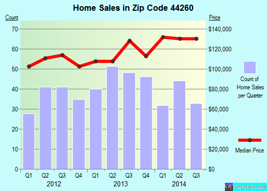
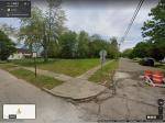
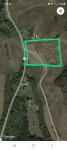
Property valuation of NW Buckeye Street, Mogadore, OH (tax assessments)
Other nearby streets: Buckeye Street  NW Buckeye Street (1)
NW Buckeye Street (2)
NW Iris Avenue (1)
NW Iris Avenue (2)
NW Buckeye Street (1)
NW Buckeye Street (2)
NW Iris Avenue (1)
NW Iris Avenue (2)
NW Buckeye Street (1)
NW Buckeye Street (2)
NW Iris Avenue (1)
NW Iris Avenue (2)
Listed properties vs overall distribution of properties in Mogadore, OH:
Advertisements
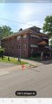
NW Buckeye Street
Mogadore, OH
Find on map >>
Owner: DALE R GHARKY & PATRICIA L GHARKY
Land value: $14,700
Total value for property: $14,700
Assessed land value: $5,150
Assessed total value for property: $5,150
Tax district: Lake Township - Uniontown Police District - Lake LSD
Assessments for tax year: 2012
Property use: Residential Vacant Land
Property class: Residential
Land size: 31,080 square feet
Land type: House Lot
Reason for adjusting the land value: Vacant Land
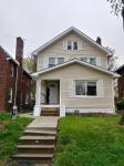
NW Buckeye Street
Mogadore, OH
Find on map >>
Owner: ODEL E JOHNSON & COLEEN M JOHNSON
Land value: $17,200
Total value for property: $17,200
Assessed land value: $6,020
Assessed total value for property: $6,020
Tax district: Lake Township - Uniontown Police District - Lake LSD
Assessments for tax year: 2012
Property use: Residential Vacant Land
Property class: Residential
Land size: 29,600 square feet
Land type: House Lot
Reason for adjusting the land value: Vacant Land
Transfers:
- Date: 06/28/1996
Stated value: $125,000
NW Buckeye Street
Mogadore, OH 44260
Find on map >>
Owner: JOEL J BAKER & JULIE A BAKER
Land value: $700
Total value for property: $700
Assessed land value: $250
Assessed total value for property: $250
Tax district: Lake Township - Uniontown Police District - Lake LSD
Assessments for tax year: 2012
Property use: Residential Vacant Land
Property class: Residential
Land size: 1,680 square feet
Land type: Excess Land
Reason for adjusting the land value: Shape
Transfers:
- Date: 08/19/1997
Stated value: $125,000
NW Buckeye Street
Mogadore, OH
Find on map >>
Owner: STONECREST INCOME &OPPORTUNITY FUND-1 LLC
Land value: $400
Total value for property: $400
Assessed total value for property: $140
Tax district: Lake Township - Uniontown Police District - Lake LSD
Assessments for tax year: 2008
Property use: Residential Vacant Land
Property class: Residential
Land size: 564 square feet
Land type: Excess Land
Reason for adjusting the land value: Shape
Transfers:
- Date: 09/04/2009
Stated value: $35,188
- Date: 11/04/2008
Stated value: $88,000
- Date: 06/25/2004
Stated value: $131,400
- Date: 08/24/1998
Stated value: $97,575
NW Buckeye Street
Mogadore, OH
Find on map >>
Owner: SAMUEL P SCHROCK
Land value: $1,000
Total value for property: $1,000
Assessed land value: $350
Assessed total value for property: $350
Tax district: Lake Township - Uniontown Police District - Lake LSD
Assessments for tax year: 2012
Property use: Residential Vacant Land
Property class: Residential
Land size: 1,260 square feet
Land type: Excess Land
Reason for adjusting the land value: Shape
Transfers:
- Date: 09/27/2004
Stated value: $0
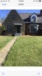
NW Buckeye Street
Mogadore, OH 44260
Find on map >>
Owner: CLOVERLEAF NORTH INC
Land value: $11,300
Total value for property: $11,300
Assessed land value: $3,960
Assessed total value for property: $3,960
Tax district: Lake Township - Uniontown Police District - Lake LSD
Assessments for tax year: 2012
Property use: Residential Vacant Land
Property class: Residential
Land size: 219,107 square feet
Land type: Woods
Reason for adjusting the land value: Open Space
Transfers:
- Date: 02/10/2003
Stated value: $0
NW Buckeye Street
Mogadore, OH 44260
Find on map >>
Owner: CLOVERLEAF NORTH INC
Land value: $9,400
Total value for property: $9,400
Assessed land value: $3,290
Assessed total value for property: $3,290
Tax district: Lake Township - Uniontown Police District - Lake LSD
Assessments for tax year: 2012
Property use: Residential Vacant Land
Property class: Residential
Land size: 206,039 square feet
Land type: Woods (79%), Swamp (21%)
Reason for adjusting the land value: Open Space
Transfers:
- Date: 02/10/2003
Stated value: $0
NW Buckeye Street
Mogadore, OH 44260
Find on map >>
Owner: GARY A SIRLOUIS
Land value: $1,000
Total value for property: $1,000
Assessed land value: $350
Assessed total value for property: $350
Tax district: Lake Township - Uniontown Police District - Lake LSD
Assessments for tax year: 2012
Property use: Residential Vacant Land
Property class: Residential
Land size: 1,800 square feet
Land type: Excess Land
Reason for adjusting the land value: Shape
Transfers:
- Date: 09/26/2002
Stated value: $0
- Date: 08/27/1997
Stated value: $113,151
NW Buckeye Street
Mogadore, OH
Find on map >>
Owner: SAMUEL P SCHROCK
Land value: $1,400
Total value for property: $1,400
Assessed land value: $490
Assessed total value for property: $490
Tax district: Lake Township - Uniontown Police District - Lake LSD
Assessments for tax year: 2012
Property use: Residential Vacant Land
Property class: Residential
Land size: 1,200 square feet
Land type: Excess Land
Reason for adjusting the land value: Shape
Transfers:
- Date: 09/27/2004
Stated value: $0
NW Buckeye Street
Mogadore, OH
Find on map >>
Owner: RICHARD FOLK JR & KAREN M FOLK
Land value: $1,000
Total value for property: $1,000
Assessed land value: $350
Assessed total value for property: $350
Tax district: Lake Township - Uniontown Police District - Lake LSD
Assessments for tax year: 2012
Property use: Residential Vacant Land
Property class: Residential
Land size: 1,800 square feet
Land type: Excess Land
Reason for adjusting the land value: Shape
Transfers:
- Date: 09/13/2002
Stated value: $0
- Date: 10/06/1998
Stated value: $0
- Date: 09/29/1992
Stated value: $89,000
Other nearby streets: Buckeye Street
NW Buckeye Street (1)
NW Buckeye Street (2)
NW Iris Avenue (1)
NW Iris Avenue (2)
NW Buckeye Street (1)
NW Buckeye Street (2)
NW Iris Avenue (1)
NW Iris Avenue (2)

Recent posts about Mogadore, Ohio on our local forum with over 2,400,000 registered users. Mogadore is mentioned 16 times on our forum:
 | Lakemore or Barberton (8 replies) |
| Looking for Family from Mogadore (1 reply) |
| Potential move to Alliance, help (60 replies) |
| Akron, OH, and suburbs: elementary schools that you recommend? (11 replies) |
| Public Housing in Akron? (8 replies) |
| Akron Ohio (12 replies) |
Settings
X

Recently Added Photos
Middletown, OH
Middletown, OH

Cincinnati, OH
Cleveland, OH
Cleveland, OH
Lisbon, OH
Columbus, OH
Parma, OH

Akron, OH
Akron, OH
Cuyahoga Falls, OH
Akron, OH
Request disassociating your name from street-level assessment address

Recent home sales, price trends, and home value evaluator powered by Onboard Informatics
© 2024 Onboard Informatics. Information is deemed reliable but not guaranteed.
© 2024 Onboard Informatics. Information is deemed reliable but not guaranteed.
Some parts © 2024 Advameg, Inc.
Compilation, repackaging, or reproduction prohibited. Users are forewarned that it is incumbent upon them to verify information with the responsible state agency. Advameg, Inc. does not guarantee the data presented is up-to-date nor does it assume responsibility for updating it. Therefore any names, owners or addresses may have changed. Use of any information published here to contact the persons might be prohibited by the law.