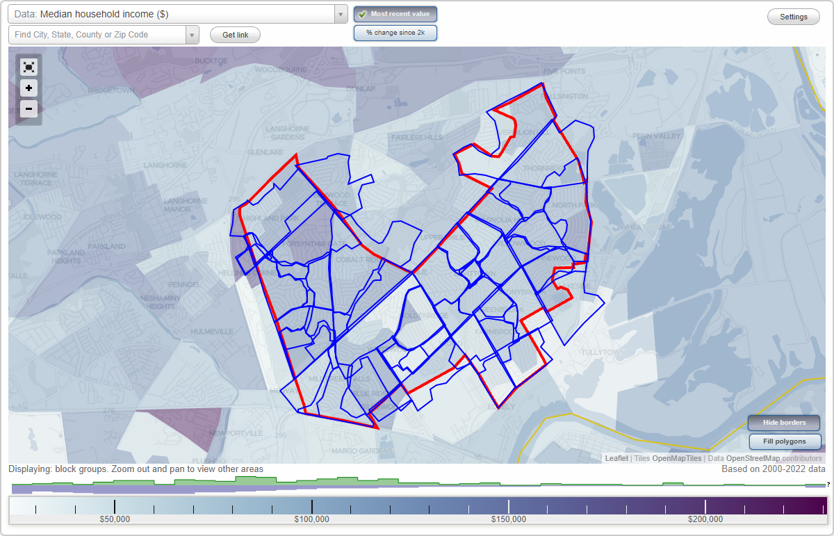
Levittown, Pennsylvania Neighborhood Map - Income, House Prices, Occupations, Boundaries
Settings
X

- City boundary
- Neighborhood boundaries
Business Search - 14 Million verified businesses
Neighborhoods:
Apple Tree Hollow, Birch Valley, Blue Ridge, Cobalt Ridge, Crabtree Hollow, Deep Dale, Deep Dale East, Deep Dale West, Dogwood Hollow, Elderberry Pond, Farmbrook, Forsythia Gate, Goldenridge, Greenbrook, Highland Park, Holly Hill, Indian Creek, Junewood, Juniper Hill, Kenwood, Lakeside, Lower Orchard, Magnolia Hill, Mill Creek Falls, North Park, Oaktree Hollow, Orangewood, Pinewood, Plumbridge, Quincy Hollow, Red Cedar Hill, Red Rose Gate, Snowball Gate, Stonybrook, Thornridge, Twin Oaks, Upper Orchard, Vermilion Hills, Violetwood, Whitewood, Willow Wood, Yellow WoodApple Tree Hollow neighborhood in Levittown statistics: (Find on map)
Area: 0.255 square miles
Population: 1,355
Population density:
Median household income in 2021:
Median rent in in 2021:
Male vs Females
Median age
Average estimated value of detached houses in 2021 (96.3% of all units):
Most popular occupations of males: service occupations (18.0%); production occupations (17.3%); material moving occupations (10.8%); construction, extraction, and maintenance occupations (10.1%); sales and office occupations (7.8%); transportation occupations (5.9%); computer and mathematical occupations (2.7%)
Most popular occupations of females: sales and office occupations (43.4%); service occupations (22.7%); healthcare practitioners and technical occupations (20.3%); management occupations (except farmers) (4.8%); computer and mathematical occupations (2.8%); production occupations (2.8%); education, training, and library occupations (2.0%)
Roads and streets: Appletree Dr; Aster Ln; Autumn Ln; Ailanthus Ln; Azalea Ln; New Falls Rd; Apricot Ln; Aspen Ln; Almond Ln; Alder Ln; Arbor Ln; Ambling Ln; April Ln; Arch Ln; Red Cedar Dr; Appletree Turn; Appletree Pl; Appletree Pass.
Other features: Mill Crk; Black Ditch Crk.
Apple Tree Hollow neighborhood detailed profile
Area: 0.255 square miles
Population: 1,355
Population density:
| Apple Tree Hollow (Appletree Hollow): | 5,313 people per square mile |
| Levittown: | 5,028 people per square mile |
Median household income in 2021:
| Apple Tree Hollow (Appletree Hollow): | $83,001 |
| Levittown: | $90,794 |
Median rent in in 2021:
| Apple Tree Hollow (Appletree Hollow): | $1,324 |
| Levittown: | $1,146 |
Male vs Females
| Males: | 645 |
| Females: | 710 |
Median age
| Males: | 36.8 years |
| Females: | 40.7 years |
Average estimated value of detached houses in 2021 (96.3% of all units):
| Apple Tree Hollow (Appletree Hollow): | $236,288 |
| Pennsylvania: | $284,712 |
Most popular occupations of males: service occupations (18.0%); production occupations (17.3%); material moving occupations (10.8%); construction, extraction, and maintenance occupations (10.1%); sales and office occupations (7.8%); transportation occupations (5.9%); computer and mathematical occupations (2.7%)
Most popular occupations of females: sales and office occupations (43.4%); service occupations (22.7%); healthcare practitioners and technical occupations (20.3%); management occupations (except farmers) (4.8%); computer and mathematical occupations (2.8%); production occupations (2.8%); education, training, and library occupations (2.0%)
Roads and streets: Appletree Dr; Aster Ln; Autumn Ln; Ailanthus Ln; Azalea Ln; New Falls Rd; Apricot Ln; Aspen Ln; Almond Ln; Alder Ln; Arbor Ln; Ambling Ln; April Ln; Arch Ln; Red Cedar Dr; Appletree Turn; Appletree Pl; Appletree Pass.
Other features: Mill Crk; Black Ditch Crk.
Apple Tree Hollow neighborhood detailed profile
Birch Valley neighborhood in Levittown statistics: (Find on map)
Area: 0.247 square miles
Population: 2,080
Population density:
Median household income in 2021:
Median rent in in 2021:
Male vs Females
Median age
Housing prices:
Average estimated value of detached houses in 2021 (64.7% of all units):
Average estimated value of townhouses or other attached units in 2021 (14.2% of all units):
Most popular occupations of males: construction, extraction, and maintenance occupations (20.5%); sales and office occupations (15.5%); transportation occupations (9.7%); production occupations (9.6%); computer and mathematical occupations (7.1%); service occupations (6.5%); business and financial operations occupations (4.6%)
Most popular occupations of females: sales and office occupations (43.0%); education, training, and library occupations (15.6%); healthcare practitioners and technical occupations (11.7%); material moving occupations (9.2%); business and financial operations occupations (5.8%); arts, design, entertainment, sports, and media occupations (5.4%); service occupations (3.7%)
Roads and streets: Birch Dr; Bald Cypress Ln; Penn Valley Rd; Blue Spruce Ln; Black Pine Ln; Briaroot Ln; Buttonwood Ln; Begonia Ln; Burning Bush Ln; Butterfly Ln; Bentwood Ln; Boulder Ln; Barberry Ln; Brentwood Ln.
Birch Valley neighborhood detailed profile
Area: 0.247 square miles
Population: 2,080
Population density:
| Birch Valley: | 8,422 people per square mile |
| Levittown: | 5,028 people per square mile |
Median household income in 2021:
| Birch Valley: | $83,749 |
| Levittown: | $90,794 |
Median rent in in 2021:
| Birch Valley: | $1,064 |
| Levittown: | $1,146 |
Male vs Females
| Males: | 930 |
| Females: | 1,149 |
Median age
| Males: | 44.5 years |
| Females: | 43.1 years |
Housing prices:
Average estimated value of detached houses in 2021 (64.7% of all units):
| Birch Valley: | $258,222 |
| Pennsylvania: | $284,712 |
Average estimated value of townhouses or other attached units in 2021 (14.2% of all units):
| This neighborhood: | $374,222 |
| Pennsylvania: | $229,107 |
Most popular occupations of males: construction, extraction, and maintenance occupations (20.5%); sales and office occupations (15.5%); transportation occupations (9.7%); production occupations (9.6%); computer and mathematical occupations (7.1%); service occupations (6.5%); business and financial operations occupations (4.6%)
Most popular occupations of females: sales and office occupations (43.0%); education, training, and library occupations (15.6%); healthcare practitioners and technical occupations (11.7%); material moving occupations (9.2%); business and financial operations occupations (5.8%); arts, design, entertainment, sports, and media occupations (5.4%); service occupations (3.7%)
Roads and streets: Birch Dr; Bald Cypress Ln; Penn Valley Rd; Blue Spruce Ln; Black Pine Ln; Briaroot Ln; Buttonwood Ln; Begonia Ln; Burning Bush Ln; Butterfly Ln; Bentwood Ln; Boulder Ln; Barberry Ln; Brentwood Ln.
Birch Valley neighborhood detailed profile
Blue Ridge neighborhood in Levittown statistics: (Find on map)
Area: 0.355 square miles
Population: 1,857
Population density:
Median household income in 2021:
Median rent in in 2021:
Male vs Females
Median age
Housing prices:
Average estimated value of detached houses in 2021 (98.7% of all units):
Average estimated value of townhouses or other attached units in 2021 (3.3% of all units):
Average estimated '21 value of housing units in 5-or-more-unit structures (10.4% of all units):
Most popular occupations of males: production occupations (33.0%); education, training, and library occupations (32.3%); business and financial operations occupations (18.9%); management occupations (except farmers) (16.0%); legal occupations (12.5%); farming, fishing, and forestry occupations (12.5%); construction, extraction, and maintenance occupations (11.2%)
Most popular occupations of females: legal occupations (62.3%); arts, design, entertainment, sports, and media occupations (54.5%); sales and office occupations (54.3%); community and social services occupations (35.8%); management occupations (except farmers) (13.6%); service occupations (12.7%); computer and mathematical occupations (7.7%)
Roads and streets: Blue Ridge Dr; Bristol-Emilie Rd (Emilie Rd); Mill Creek Rd; Border Rock Rd; Green Ln; Bristol Oxford Valley Rd; Black Walnut Rd; Bittersweet Rd; Balsam Rd; Basswood Rd; Butternut Rd; Beechtree Rd; Broadleaf Rd; Boston Ivy Rd; Brown Bark Rd; Blue Lake Rd; Blue Ridge Turn; Blue Ridge Way; Blue Ridge Pass.
Blue Ridge neighborhood detailed profile
Area: 0.355 square miles
Population: 1,857
Population density:
| Blue Ridge (Blueridge): | 5,229 people per square mile |
| Levittown: | 5,028 people per square mile |
Median household income in 2021:
| Blue Ridge (Blueridge): | $80,749 |
| Levittown: | $90,794 |
Median rent in in 2021:
| Blue Ridge (Blueridge): | $1,258 |
| Levittown: | $1,146 |
Male vs Females
| Males: | 1,045 |
| Females: | 811 |
Median age
| Males: | 33.2 years |
| Females: | 39.5 years |
Housing prices:
Average estimated value of detached houses in 2021 (98.7% of all units):
| Blue Ridge (Blueridge): | $217,678 |
| Pennsylvania: | $284,712 |
Average estimated value of townhouses or other attached units in 2021 (3.3% of all units):
| This neighborhood: | $235,647 |
| Pennsylvania: | $229,107 |
Average estimated '21 value of housing units in 5-or-more-unit structures (10.4% of all units):
| Blue Ridge (Blueridge): | $164,898 |
| Pennsylvania: | $294,035 |
Most popular occupations of males: production occupations (33.0%); education, training, and library occupations (32.3%); business and financial operations occupations (18.9%); management occupations (except farmers) (16.0%); legal occupations (12.5%); farming, fishing, and forestry occupations (12.5%); construction, extraction, and maintenance occupations (11.2%)
Most popular occupations of females: legal occupations (62.3%); arts, design, entertainment, sports, and media occupations (54.5%); sales and office occupations (54.3%); community and social services occupations (35.8%); management occupations (except farmers) (13.6%); service occupations (12.7%); computer and mathematical occupations (7.7%)
Roads and streets: Blue Ridge Dr; Bristol-Emilie Rd (Emilie Rd); Mill Creek Rd; Border Rock Rd; Green Ln; Bristol Oxford Valley Rd; Black Walnut Rd; Bittersweet Rd; Balsam Rd; Basswood Rd; Butternut Rd; Beechtree Rd; Broadleaf Rd; Boston Ivy Rd; Brown Bark Rd; Blue Lake Rd; Blue Ridge Turn; Blue Ridge Way; Blue Ridge Pass.
Blue Ridge neighborhood detailed profile
Cobalt Ridge neighborhood in Levittown statistics: (Find on map)
Area: 0.918 square miles
Population: 4,872
Population density:
Median household income in 2021:
Median rent in in 2021:
Male vs Females
Median age
Housing prices:
Average estimated value of detached houses in 2021 (81.6% of all units):
Average estimated '21 value of housing units in 5-or-more-unit structures (3.1% of all units):
Most popular occupations of males: sales and office occupations (17.7%); construction, extraction, and maintenance occupations (11.2%); transportation occupations (8.8%); service occupations (8.1%); management occupations (except farmers) (7.7%); healthcare practitioners and technical occupations (5.6%); computer and mathematical occupations (3.8%)
Most popular occupations of females: service occupations (29.0%); sales and office occupations (26.8%); healthcare practitioners and technical occupations (15.0%); education, training, and library occupations (11.3%); management occupations (except farmers) (6.8%); business and financial operations occupations (3.7%); material moving occupations (2.1%)
Roads and streets: Cobalt Ridge Dr S; Woodbourne Rd; Cobalt Cross Rd; Cobalt Ridge Dr N; Cobalt Ridge Dr E; Cleft Rock Rd; Curry Hill Rd; Crystal Rd; Cardinal Rd; Candle Rd; Crown Rd; Canyon Rd; Crestwood Rd; Camellia Rd; Canoebirch Rd; Conifer Rd; Cactus Rd; Candytuft Rd; Calicobush Rd; Cliff Rd; Cameo Rd; Canary Rd; Cinnamon Rd; Cloister Rd; Crystal Pl; Cotton Rd; Canal Rd; Cable Rd; Cameo Pl; Bristol Oxford Valley Rd; Circle Rd; Canna Rd; Coral Rock Rd; Cosmos Rd.
Other features: Queen Anne Crk.
Cobalt Ridge neighborhood detailed profile
Area: 0.918 square miles
Population: 4,872
Population density:
| Cobalt Ridge: | 5,304 people per square mile |
| Levittown: | 5,028 people per square mile |
Median household income in 2021:
| Cobalt Ridge: | $110,873 |
| Levittown: | $90,794 |
Median rent in in 2021:
| Cobalt Ridge: | $1,324 |
| Levittown: | $1,146 |
Male vs Females
| Males: | 2,292 |
| Females: | 2,579 |
Median age
| Males: | 37.7 years |
| Females: | 37.0 years |
Housing prices:
Average estimated value of detached houses in 2021 (81.6% of all units):
| Cobalt Ridge: | $249,814 |
| Pennsylvania: | $284,712 |
Average estimated '21 value of housing units in 5-or-more-unit structures (3.1% of all units):
| Cobalt Ridge: | $164,898 |
| Pennsylvania: | $294,035 |
Most popular occupations of males: sales and office occupations (17.7%); construction, extraction, and maintenance occupations (11.2%); transportation occupations (8.8%); service occupations (8.1%); management occupations (except farmers) (7.7%); healthcare practitioners and technical occupations (5.6%); computer and mathematical occupations (3.8%)
Most popular occupations of females: service occupations (29.0%); sales and office occupations (26.8%); healthcare practitioners and technical occupations (15.0%); education, training, and library occupations (11.3%); management occupations (except farmers) (6.8%); business and financial operations occupations (3.7%); material moving occupations (2.1%)
Roads and streets: Cobalt Ridge Dr S; Woodbourne Rd; Cobalt Cross Rd; Cobalt Ridge Dr N; Cobalt Ridge Dr E; Cleft Rock Rd; Curry Hill Rd; Crystal Rd; Cardinal Rd; Candle Rd; Crown Rd; Canyon Rd; Crestwood Rd; Camellia Rd; Canoebirch Rd; Conifer Rd; Cactus Rd; Candytuft Rd; Calicobush Rd; Cliff Rd; Cameo Rd; Canary Rd; Cinnamon Rd; Cloister Rd; Crystal Pl; Cotton Rd; Canal Rd; Cable Rd; Cameo Pl; Bristol Oxford Valley Rd; Circle Rd; Canna Rd; Coral Rock Rd; Cosmos Rd.
Other features: Queen Anne Crk.
Cobalt Ridge neighborhood detailed profile
Crabtree Hollow neighborhood in Levittown statistics: (Find on map)
Area: 0.277 square miles
Population: 1,145
Population density:
Median household income in 2021:
Median rent in in 2021:
Male vs Females
Median age
Housing prices:
Average estimated value of detached houses in 2021 (100.0% of all units):
Average estimated value of townhouses or other attached units in 2021 (3.9% of all units):
Most popular occupations of males: material moving occupations (13.5%); production occupations (10.0%); arts, design, entertainment, sports, and media occupations (7.9%); computer and mathematical occupations (6.8%); healthcare practitioners and technical occupations (6.2%); management occupations (except farmers) (6.1%); sales and office occupations (5.1%)
Most popular occupations of females: sales and office occupations (49.1%); service occupations (13.2%); education, training, and library occupations (9.4%); production occupations (7.6%); healthcare practitioners and technical occupations (7.2%); business and financial operations occupations (4.4%); arts, design, entertainment, sports, and media occupations (3.6%)
Roads and streets: Crabtree Dr; Levittown Pkwy; Mill Creek Pkwy; Coral Ln; Cherry Ln; Chestnut Ln; Crimson King Ln; Copper Beech Ln; Clover Ln; Crescent Ln; Cranberry Ln; Catalpa Ln; Cornflower Ln; Cypress Ln; Crosswood Ln; Appletree Dr; Crabtree Turn; Crabtree Way; Crabtree Pl.
Other features: Mill Crk; Black Ditch Crk.
Crabtree Hollow neighborhood detailed profile
Area: 0.277 square miles
Population: 1,145
Population density:
| Crabtree Hollow: | 4,141 people per square mile |
| Levittown: | 5,028 people per square mile |
Median household income in 2021:
| Crabtree Hollow: | $86,219 |
| Levittown: | $90,794 |
Median rent in in 2021:
| Crabtree Hollow: | $1,111 |
| Levittown: | $1,146 |
Male vs Females
| Males: | 530 |
| Females: | 614 |
Median age
| Males: | 39.8 years |
| Females: | 45.1 years |
Housing prices:
Average estimated value of detached houses in 2021 (100.0% of all units):
| Crabtree Hollow: | $224,608 |
| Pennsylvania: | $284,712 |
Average estimated value of townhouses or other attached units in 2021 (3.9% of all units):
| This neighborhood: | $176,471 |
| Pennsylvania: | $229,107 |
Most popular occupations of males: material moving occupations (13.5%); production occupations (10.0%); arts, design, entertainment, sports, and media occupations (7.9%); computer and mathematical occupations (6.8%); healthcare practitioners and technical occupations (6.2%); management occupations (except farmers) (6.1%); sales and office occupations (5.1%)
Most popular occupations of females: sales and office occupations (49.1%); service occupations (13.2%); education, training, and library occupations (9.4%); production occupations (7.6%); healthcare practitioners and technical occupations (7.2%); business and financial operations occupations (4.4%); arts, design, entertainment, sports, and media occupations (3.6%)
Roads and streets: Crabtree Dr; Levittown Pkwy; Mill Creek Pkwy; Coral Ln; Cherry Ln; Chestnut Ln; Crimson King Ln; Copper Beech Ln; Clover Ln; Crescent Ln; Cranberry Ln; Catalpa Ln; Cornflower Ln; Cypress Ln; Crosswood Ln; Appletree Dr; Crabtree Turn; Crabtree Way; Crabtree Pl.
Other features: Mill Crk; Black Ditch Crk.
Crabtree Hollow neighborhood detailed profile
Deep Dale neighborhood in Levittown statistics: (Find on map)
Area: 0.116 square miles
Population: 732
Population density:
Median household income in 2021:
Median rent in in 2021:
Male vs Females
Median age
Housing prices:
Average estimated value of detached houses in 2021 (90.3% of all units):
Average estimated value of townhouses or other attached units in 2021 (20.2% of all units):
Most popular occupations of males: management occupations (except farmers) (29.4%); service occupations (14.7%); sales and office occupations (10.9%); transportation occupations (8.1%); construction, extraction, and maintenance occupations (6.3%); material moving occupations (6.0%); business and financial operations occupations (3.6%)
Most popular occupations of females: sales and office occupations (36.8%); service occupations (20.2%); management occupations (except farmers) (10.5%); business and financial operations occupations (8.8%); education, training, and library occupations (8.6%); healthcare practitioners and technical occupations (7.8%); community and social services occupations (2.8%)
Highways in this neighborhood: State Rte 413 (New Rodgers Rd).
Roads and streets: Deep Dale Dr E; Trenton Rd; Deep Dale Dr W; Dolphin Rd; Downhill Rd; Highland Park Dr; Deep Dale Way.
Other features: Mill Crk.
Deep Dale neighborhood detailed profile
Area: 0.116 square miles
Population: 732
Population density:
| Deep Dale: | 6,312 people per square mile |
| Levittown: | 5,028 people per square mile |
Median household income in 2021:
| Deep Dale: | $110,398 |
| Levittown: | $90,794 |
Median rent in in 2021:
| Deep Dale: | $1,523 |
| Levittown: | $1,146 |
Male vs Females
| Males: | 378 |
| Females: | 353 |
Median age
| Males: | 41.5 years |
| Females: | 42.0 years |
Housing prices:
Average estimated value of detached houses in 2021 (90.3% of all units):
| Deep Dale: | $334,225 |
| Pennsylvania: | $284,712 |
Average estimated value of townhouses or other attached units in 2021 (20.2% of all units):
| This neighborhood: | $198,047 |
| Pennsylvania: | $229,107 |
Most popular occupations of males: management occupations (except farmers) (29.4%); service occupations (14.7%); sales and office occupations (10.9%); transportation occupations (8.1%); construction, extraction, and maintenance occupations (6.3%); material moving occupations (6.0%); business and financial operations occupations (3.6%)
Most popular occupations of females: sales and office occupations (36.8%); service occupations (20.2%); management occupations (except farmers) (10.5%); business and financial operations occupations (8.8%); education, training, and library occupations (8.6%); healthcare practitioners and technical occupations (7.8%); community and social services occupations (2.8%)
Highways in this neighborhood: State Rte 413 (New Rodgers Rd).
Roads and streets: Deep Dale Dr E; Trenton Rd; Deep Dale Dr W; Dolphin Rd; Downhill Rd; Highland Park Dr; Deep Dale Way.
Other features: Mill Crk.
Deep Dale neighborhood detailed profile
Deep Dale East neighborhood in Levittown statistics: (Find on map)
Area: 0.061 square miles
Population: 301
Population density:
Median household income in 2021:
Median rent in in 2021:
Male vs Females
Median age
Housing prices:
Average estimated value of detached houses in 2021 (98.3% of all units):
Average estimated value of townhouses or other attached units in 2021 (22.4% of all units):
Most popular occupations of males: management occupations (except farmers) (19.7%); sales and office occupations (15.5%); service occupations (13.2%); construction, extraction, and maintenance occupations (8.4%); transportation occupations (7.0%); business and financial operations occupations (6.9%); production occupations (6.3%)
Most popular occupations of females: sales and office occupations (40.7%); service occupations (26.6%); education, training, and library occupations (10.3%); management occupations (except farmers) (8.4%); healthcare practitioners and technical occupations (5.6%); business and financial operations occupations (3.8%); transportation occupations (3.2%)
Highways in this neighborhood: State Rte 413 (New Rodgers Rd).
Roads and streets: Deep Dale Dr E; Trenton Rd; Downhill Rd; Deep Dale Way.
Deep Dale East neighborhood detailed profile
Area: 0.061 square miles
Population: 301
Population density:
| Deep Dale East: | 4,969 people per square mile |
| Levittown: | 5,028 people per square mile |
Median household income in 2021:
| Deep Dale East: | $110,398 |
| Levittown: | $90,794 |
Median rent in in 2021:
| Deep Dale East: | $1,523 |
| Levittown: | $1,146 |
Male vs Females
| Males: | 133 |
| Females: | 167 |
Median age
| Males: | 41.5 years |
| Females: | 42.0 years |
Housing prices:
Average estimated value of detached houses in 2021 (98.3% of all units):
| Deep Dale East: | $287,358 |
| Pennsylvania: | $284,712 |
Average estimated value of townhouses or other attached units in 2021 (22.4% of all units):
| This neighborhood: | $198,047 |
| Pennsylvania: | $229,107 |
Most popular occupations of males: management occupations (except farmers) (19.7%); sales and office occupations (15.5%); service occupations (13.2%); construction, extraction, and maintenance occupations (8.4%); transportation occupations (7.0%); business and financial operations occupations (6.9%); production occupations (6.3%)
Most popular occupations of females: sales and office occupations (40.7%); service occupations (26.6%); education, training, and library occupations (10.3%); management occupations (except farmers) (8.4%); healthcare practitioners and technical occupations (5.6%); business and financial operations occupations (3.8%); transportation occupations (3.2%)
Highways in this neighborhood: State Rte 413 (New Rodgers Rd).
Roads and streets: Deep Dale Dr E; Trenton Rd; Downhill Rd; Deep Dale Way.
Deep Dale East neighborhood detailed profile
Deep Dale West neighborhood in Levittown statistics: (Find on map)
Area: 0.047 square miles
Population: 374
Population density:
Median household income in 2021:
Median rent in in 2021:
Male vs Females
Median age
Housing prices:
Average estimated value of detached houses in 2021 (81.3% of all units):
Average estimated value of townhouses or other attached units in 2021 (17.9% of all units):
Most popular occupations of males: management occupations (except farmers) (35.4%); service occupations (15.6%); transportation occupations (8.9%); sales and office occupations (8.1%); material moving occupations (5.7%); construction, extraction, and maintenance occupations (5.0%); education, training, and library occupations (3.5%)
Most popular occupations of females: sales and office occupations (34.1%); service occupations (15.9%); business and financial operations occupations (12.3%); management occupations (except farmers) (12.0%); healthcare practitioners and technical occupations (9.2%); education, training, and library occupations (7.3%); community and social services occupations (4.3%)
Highways in this neighborhood: State Rte 413 (New Rodgers Rd).
Roads and streets: Deep Dale Dr W; Dolphin Rd; Trenton Rd.
Deep Dale West neighborhood detailed profile
Area: 0.047 square miles
Population: 374
Population density:
| Deep Dale West: | 8,008 people per square mile |
| Levittown: | 5,028 people per square mile |
Median household income in 2021:
| Deep Dale West: | $110,398 |
| Levittown: | $90,794 |
Median rent in in 2021:
| Deep Dale West: | $1,523 |
| Levittown: | $1,146 |
Male vs Females
| Males: | 215 |
| Females: | 159 |
Median age
| Males: | 41.5 years |
| Females: | 42.0 years |
Housing prices:
Average estimated value of detached houses in 2021 (81.3% of all units):
| Deep Dale West: | $381,813 |
| Pennsylvania: | $284,712 |
Average estimated value of townhouses or other attached units in 2021 (17.9% of all units):
| This neighborhood: | $198,047 |
| Pennsylvania: | $229,107 |
Most popular occupations of males: management occupations (except farmers) (35.4%); service occupations (15.6%); transportation occupations (8.9%); sales and office occupations (8.1%); material moving occupations (5.7%); construction, extraction, and maintenance occupations (5.0%); education, training, and library occupations (3.5%)
Most popular occupations of females: sales and office occupations (34.1%); service occupations (15.9%); business and financial operations occupations (12.3%); management occupations (except farmers) (12.0%); healthcare practitioners and technical occupations (9.2%); education, training, and library occupations (7.3%); community and social services occupations (4.3%)
Highways in this neighborhood: State Rte 413 (New Rodgers Rd).
Roads and streets: Deep Dale Dr W; Dolphin Rd; Trenton Rd.
Deep Dale West neighborhood detailed profile
Dogwood Hollow neighborhood in Levittown statistics: (Find on map)
Area: 0.401 square miles
Population: 1,827
Population density:
Median household income in 2021:
Median rent in in 2021:
Male vs Females
Median age
Housing prices:
Average estimated value of detached houses in 2021 (79.8% of all units):
Average estimated value of townhouses or other attached units in 2021 (9.0% of all units):
Most popular occupations of males: sales and office occupations (25.6%); production occupations (15.9%); service occupations (13.3%); material moving occupations (13.0%); computer and mathematical occupations (11.5%); construction, extraction, and maintenance occupations (8.6%); management occupations (except farmers) (3.6%)
Most popular occupations of females: sales and office occupations (37.4%); service occupations (14.3%); production occupations (13.1%); healthcare practitioners and technical occupations (10.3%); education, training, and library occupations (7.3%); management occupations (except farmers) (6.7%); material moving occupations (3.5%)
Roads and streets: Dogwood Dr; Edgely Rd; Mill Creek Pkwy; Daffodil Ln; Haines Rd; Deepgreen Ln; Dahlia Ln; Disk Ln; Dark Leaf Ln; Dewberry Ln; Daisy Ln; Dogwood Turn; Dogwood Way.
Other features: Black Ditch Crk.
Dogwood Hollow neighborhood detailed profile
Area: 0.401 square miles
Population: 1,827
Population density:
| Dogwood Hollow: | 4,556 people per square mile |
| Levittown: | 5,028 people per square mile |
Median household income in 2021:
| Dogwood Hollow: | $85,017 |
| Levittown: | $90,794 |
Median rent in in 2021:
| Dogwood Hollow: | $1,246 |
| Levittown: | $1,146 |
Male vs Females
| Males: | 905 |
| Females: | 922 |
Median age
| Males: | 37.2 years |
| Females: | 40.7 years |
Housing prices:
Average estimated value of detached houses in 2021 (79.8% of all units):
| Dogwood Hollow: | $233,378 |
| Pennsylvania: | $284,712 |
Average estimated value of townhouses or other attached units in 2021 (9.0% of all units):
| This neighborhood: | $90,365 |
| Pennsylvania: | $229,107 |
Most popular occupations of males: sales and office occupations (25.6%); production occupations (15.9%); service occupations (13.3%); material moving occupations (13.0%); computer and mathematical occupations (11.5%); construction, extraction, and maintenance occupations (8.6%); management occupations (except farmers) (3.6%)
Most popular occupations of females: sales and office occupations (37.4%); service occupations (14.3%); production occupations (13.1%); healthcare practitioners and technical occupations (10.3%); education, training, and library occupations (7.3%); management occupations (except farmers) (6.7%); material moving occupations (3.5%)
Roads and streets: Dogwood Dr; Edgely Rd; Mill Creek Pkwy; Daffodil Ln; Haines Rd; Deepgreen Ln; Dahlia Ln; Disk Ln; Dark Leaf Ln; Dewberry Ln; Daisy Ln; Dogwood Turn; Dogwood Way.
Other features: Black Ditch Crk.
Dogwood Hollow neighborhood detailed profile
Elderberry Pond neighborhood in Levittown statistics: (Find on map)
Area: 0.259 square miles
Population: 1,327
Population density:
Median household income in 2021:
Median rent in in 2021:
Male vs Females
Median age
Housing prices:
Average estimated value of detached houses in 2021 (97.0% of all units):
Average estimated value of townhouses or other attached units in 2021 (4.1% of all units):
Most popular occupations of males: sales and office occupations (18.9%); production occupations (15.9%); transportation occupations (9.8%); service occupations (9.2%); management occupations (except farmers) (7.6%); business and financial operations occupations (5.7%); material moving occupations (3.8%)
Most popular occupations of females: sales and office occupations (44.7%); service occupations (14.2%); business and financial operations occupations (9.3%); healthcare practitioners and technical occupations (7.6%); education, training, and library occupations (4.9%); arts, design, entertainment, sports, and media occupations (3.8%); transportation occupations (3.7%)
Roads and streets: Elderberry Dr; Everturn Ln; Eventide Ln; Edgewood Ln; Elm Ln; Evergreen Ln; Emerald Ln; East Ln; Ember Ln; Mill Creek Pkwy; Easter Ln; Echo Ln; Exit Ln; Eventide Pl; Water Ave; Wood Ln.
Other features: Martins Creek Br.
Elderberry Pond neighborhood detailed profile
Area: 0.259 square miles
Population: 1,327
Population density:
| Elderberry Pond (Elderberry): | 5,128 people per square mile |
| Levittown: | 5,028 people per square mile |
Median household income in 2021:
| Elderberry Pond (Elderberry): | $100,901 |
| Levittown: | $90,794 |
Median rent in in 2021:
| Elderberry Pond (Elderberry): | $1,111 |
| Levittown: | $1,146 |
Male vs Females
| Males: | 573 |
| Females: | 754 |
Median age
| Males: | 40.8 years |
| Females: | 45.3 years |
Housing prices:
Average estimated value of detached houses in 2021 (97.0% of all units):
| Elderberry Pond (Elderberry): | $226,340 |
| Pennsylvania: | $284,712 |
Average estimated value of townhouses or other attached units in 2021 (4.1% of all units):
| This neighborhood: | $176,471 |
| Pennsylvania: | $229,107 |
Most popular occupations of males: sales and office occupations (18.9%); production occupations (15.9%); transportation occupations (9.8%); service occupations (9.2%); management occupations (except farmers) (7.6%); business and financial operations occupations (5.7%); material moving occupations (3.8%)
Most popular occupations of females: sales and office occupations (44.7%); service occupations (14.2%); business and financial operations occupations (9.3%); healthcare practitioners and technical occupations (7.6%); education, training, and library occupations (4.9%); arts, design, entertainment, sports, and media occupations (3.8%); transportation occupations (3.7%)
Roads and streets: Elderberry Dr; Everturn Ln; Eventide Ln; Edgewood Ln; Elm Ln; Evergreen Ln; Emerald Ln; East Ln; Ember Ln; Mill Creek Pkwy; Easter Ln; Echo Ln; Exit Ln; Eventide Pl; Water Ave; Wood Ln.
Other features: Martins Creek Br.
Elderberry Pond neighborhood detailed profile
Farmbrook neighborhood in Levittown statistics: (Find on map)
Area: 0.238 square miles
Population: 1,924
Population density:
Median household income in 2021:
Median rent in in 2021:
Male vs Females
Median age
Average estimated value of detached houses in 2021 (78.8% of all units):
Most popular occupations of males: construction, extraction, and maintenance occupations (24.5%); sales and office occupations (23.2%); production occupations (11.0%); material moving occupations (8.4%); service occupations (7.1%); transportation occupations (6.9%); education, training, and library occupations (6.4%)
Most popular occupations of females: sales and office occupations (32.2%); healthcare practitioners and technical occupations (18.1%); service occupations (17.6%); education, training, and library occupations (13.6%); management occupations (except farmers) (6.6%); construction, extraction, and maintenance occupations (2.2%); legal occupations (2.1%)
Roads and streets: Farmbrook Dr; Haines Rd; Friendly Ln; Forest Ln; Flower Ln; Fireside Ln; Favored Ln; Freedom Ln; Fawn Ln; Fortune Ln; Stonybrook Dr; Short Ln; Mill Creek Pkwy; South Ln.
Farmbrook neighborhood detailed profile
Area: 0.238 square miles
Population: 1,924
Population density:
| Farmbrook: | 8,091 people per square mile |
| Levittown: | 5,028 people per square mile |
Median household income in 2021:
| Farmbrook: | $85,626 |
| Levittown: | $90,794 |
Median rent in in 2021:
| Farmbrook: | $1,089 |
| Levittown: | $1,146 |
Male vs Females
| Males: | 830 |
| Females: | 1,093 |
Median age
| Males: | 40.7 years |
| Females: | 42.7 years |
Average estimated value of detached houses in 2021 (78.8% of all units):
| Farmbrook: | $210,405 |
| Pennsylvania: | $284,712 |
Most popular occupations of males: construction, extraction, and maintenance occupations (24.5%); sales and office occupations (23.2%); production occupations (11.0%); material moving occupations (8.4%); service occupations (7.1%); transportation occupations (6.9%); education, training, and library occupations (6.4%)
Most popular occupations of females: sales and office occupations (32.2%); healthcare practitioners and technical occupations (18.1%); service occupations (17.6%); education, training, and library occupations (13.6%); management occupations (except farmers) (6.6%); construction, extraction, and maintenance occupations (2.2%); legal occupations (2.1%)
Roads and streets: Farmbrook Dr; Haines Rd; Friendly Ln; Forest Ln; Flower Ln; Fireside Ln; Favored Ln; Freedom Ln; Fawn Ln; Fortune Ln; Stonybrook Dr; Short Ln; Mill Creek Pkwy; South Ln.
Farmbrook neighborhood detailed profile
Forsythia Gate neighborhood in Levittown statistics: (Find on map)
Area: 0.671 square miles
Population: 2,838
Population density:
Median household income in 2021:
Median rent in in 2021:
Male vs Females
Median age
Average estimated value of detached houses in 2021 (90.8% of all units):
Most popular occupations of males: sales and office occupations (11.8%); service occupations (11.1%); management occupations (except farmers) (10.4%); construction, extraction, and maintenance occupations (9.7%); business and financial operations occupations (6.8%); healthcare practitioners and technical occupations (6.6%); material moving occupations (6.6%)
Most popular occupations of females: sales and office occupations (27.1%); service occupations (18.3%); education, training, and library occupations (12.1%); healthcare practitioners and technical occupations (11.3%); management occupations (except farmers) (5.5%); production occupations (5.5%); transportation occupations (5.0%)
Roads and streets: Forsythia Dr S; Forsythia Dr N; Trenton Rd; Forsythia Dr E; Fieldstone Rd; Flamehill Rd; Bristol Oxford Valley Rd; Firtree Rd; Fruitree Rd; Four Leaf Rd; Centre St; Fallenrock Rd; Flamingo Rd; Firebush Rd; Fountain Rd; Falcon Rd; Apple St; Nursery St; Foxglove Rd; Roberts Ave; Full Turn Rd; Forsythia Cross; Flagstone Pl; Forsythia Way.
Forsythia Gate neighborhood detailed profile
Area: 0.671 square miles
Population: 2,838
Population density:
| Forsythia Gate: | 4,227 people per square mile |
| Levittown: | 5,028 people per square mile |
Median household income in 2021:
| Forsythia Gate: | $111,910 |
| Levittown: | $90,794 |
Median rent in in 2021:
| Forsythia Gate: | $1,140 |
| Levittown: | $1,146 |
Male vs Females
| Males: | 1,378 |
| Females: | 1,459 |
Median age
| Males: | 43.3 years |
| Females: | 38.3 years |
Average estimated value of detached houses in 2021 (90.8% of all units):
| Forsythia Gate: | $295,680 |
| Pennsylvania: | $284,712 |
Most popular occupations of males: sales and office occupations (11.8%); service occupations (11.1%); management occupations (except farmers) (10.4%); construction, extraction, and maintenance occupations (9.7%); business and financial operations occupations (6.8%); healthcare practitioners and technical occupations (6.6%); material moving occupations (6.6%)
Most popular occupations of females: sales and office occupations (27.1%); service occupations (18.3%); education, training, and library occupations (12.1%); healthcare practitioners and technical occupations (11.3%); management occupations (except farmers) (5.5%); production occupations (5.5%); transportation occupations (5.0%)
Roads and streets: Forsythia Dr S; Forsythia Dr N; Trenton Rd; Forsythia Dr E; Fieldstone Rd; Flamehill Rd; Bristol Oxford Valley Rd; Firtree Rd; Fruitree Rd; Four Leaf Rd; Centre St; Fallenrock Rd; Flamingo Rd; Firebush Rd; Fountain Rd; Falcon Rd; Apple St; Nursery St; Foxglove Rd; Roberts Ave; Full Turn Rd; Forsythia Cross; Flagstone Pl; Forsythia Way.
Forsythia Gate neighborhood detailed profile
Goldenridge neighborhood in Levittown statistics: (Find on map)
Area: 0.335 square miles
Population: 7,330
Population density:
Median household income in 2021:
Median rent in in 2021:
Male vs Females
Median age
Housing prices:
Average estimated value of detached houses in 2021 (96.4% of all units):
Average estimated value of townhouses or other attached units in 2021 (7.8% of all units):
Average estimated '21 value of housing units in 5-or-more-unit structures (0.9% of all units):
Most popular occupations of males: sales and office occupations (22.8%); service occupations (12.5%); production occupations (11.2%); material moving occupations (7.9%); management occupations (except farmers) (6.5%); business and financial operations occupations (6.4%); construction, extraction, and maintenance occupations (5.8%)
Most popular occupations of females: service occupations (32.2%); sales and office occupations (30.9%); healthcare practitioners and technical occupations (11.4%); education, training, and library occupations (8.8%); material moving occupations (3.1%); management occupations (except farmers) (3.0%); legal occupations (3.0%)
Roads and streets: Goldenridge Dr; Edgely Rd; Gable Hill Rd; Goldengate Rd; Gridiron Rd; Gamewood Rd; Goodturn Rd; Gaping Rock Rd; Gentle Rd; Great Oak Rd; Granite Rd; Grasspond Rd; Gatewood Rd; Greenbrier Rd; Grapevine Rd; Geranium Rd; Gingerbush Rd; Gun Rd; Goodrock Rd; Gooseneck Rd; Grand Pine Rd; Goldenridge Way; Orange End Pass; Wildflower Rd.
Goldenridge neighborhood detailed profile
Area: 0.335 square miles
Population: 7,330
Population density:
| Goldenridge: | 21,875 people per square mile |
| Levittown: | 5,028 people per square mile |
Median household income in 2021:
| Goldenridge: | $89,941 |
| Levittown: | $90,794 |
Median rent in in 2021:
| Goldenridge: | $1,836 |
| Levittown: | $1,146 |
Male vs Females
| Males: | 3,579 |
| Females: | 3,751 |
Median age
| Males: | 33.0 years |
| Females: | 40.6 years |
Housing prices:
Average estimated value of detached houses in 2021 (96.4% of all units):
| Goldenridge: | $220,527 |
| Pennsylvania: | $284,712 |
Average estimated value of townhouses or other attached units in 2021 (7.8% of all units):
| This neighborhood: | $237,717 |
| Pennsylvania: | $229,107 |
Average estimated '21 value of housing units in 5-or-more-unit structures (0.9% of all units):
| Goldenridge: | $164,898 |
| Pennsylvania: | $294,035 |
Most popular occupations of males: sales and office occupations (22.8%); service occupations (12.5%); production occupations (11.2%); material moving occupations (7.9%); management occupations (except farmers) (6.5%); business and financial operations occupations (6.4%); construction, extraction, and maintenance occupations (5.8%)
Most popular occupations of females: service occupations (32.2%); sales and office occupations (30.9%); healthcare practitioners and technical occupations (11.4%); education, training, and library occupations (8.8%); material moving occupations (3.1%); management occupations (except farmers) (3.0%); legal occupations (3.0%)
Roads and streets: Goldenridge Dr; Edgely Rd; Gable Hill Rd; Goldengate Rd; Gridiron Rd; Gamewood Rd; Goodturn Rd; Gaping Rock Rd; Gentle Rd; Great Oak Rd; Granite Rd; Grasspond Rd; Gatewood Rd; Greenbrier Rd; Grapevine Rd; Geranium Rd; Gingerbush Rd; Gun Rd; Goodrock Rd; Gooseneck Rd; Grand Pine Rd; Goldenridge Way; Orange End Pass; Wildflower Rd.
Goldenridge neighborhood detailed profile
Greenbrook neighborhood in Levittown statistics: (Find on map)
Area: 0.172 square miles
Population: 789
Population density:
Median household income in 2021:
Median rent in in 2021:
Male vs Females
Median age
Average estimated value of detached houses in 2021 (97.8% of all units):
Most popular occupations of males: construction, extraction, and maintenance occupations (34.8%); sales and office occupations (21.8%); production occupations (13.8%); education, training, and library occupations (8.6%); material moving occupations (6.3%); transportation occupations (5.7%); service occupations (3.4%)
Most popular occupations of females: healthcare practitioners and technical occupations (37.8%); sales and office occupations (23.8%); management occupations (except farmers) (20.3%); service occupations (5.2%); education, training, and library occupations (3.2%); community and social services occupations (2.9%); construction, extraction, and maintenance occupations (2.5%)
Roads and streets: Greenbrook Dr; Mill Creek Pkwy; Graystone Ln; Graceful Ln; Glenwood Ln; Grove Ln; Good Ln; Garden Ln; Stonybrook Dr; Gate Ln; Scholar Ln; Short Ln; Shadow Ln; Oak Tree Turn.
Greenbrook neighborhood detailed profile
Area: 0.172 square miles
Population: 789
Population density:
| Greenbrook: | 4,599 people per square mile |
| Levittown: | 5,028 people per square mile |
Median household income in 2021:
| Greenbrook: | $86,396 |
| Levittown: | $90,794 |
Median rent in in 2021:
| Greenbrook: | $1,102 |
| Levittown: | $1,146 |
Male vs Females
| Males: | 341 |
| Females: | 447 |
Median age
| Males: | 40.4 years |
| Females: | 43.8 years |
Average estimated value of detached houses in 2021 (97.8% of all units):
| Greenbrook: | $199,822 |
| Pennsylvania: | $284,712 |
Most popular occupations of males: construction, extraction, and maintenance occupations (34.8%); sales and office occupations (21.8%); production occupations (13.8%); education, training, and library occupations (8.6%); material moving occupations (6.3%); transportation occupations (5.7%); service occupations (3.4%)
Most popular occupations of females: healthcare practitioners and technical occupations (37.8%); sales and office occupations (23.8%); management occupations (except farmers) (20.3%); service occupations (5.2%); education, training, and library occupations (3.2%); community and social services occupations (2.9%); construction, extraction, and maintenance occupations (2.5%)
Roads and streets: Greenbrook Dr; Mill Creek Pkwy; Graystone Ln; Graceful Ln; Glenwood Ln; Grove Ln; Good Ln; Garden Ln; Stonybrook Dr; Gate Ln; Scholar Ln; Short Ln; Shadow Ln; Oak Tree Turn.
Greenbrook neighborhood detailed profile
Highland Park neighborhood in Levittown statistics: (Find on map)
Area: 0.694 square miles
Population: 2,485
Population density:
Median household income in 2021:
Median rent in in 2021:
Male vs Females
Median age
Housing prices:
Average estimated value of detached houses in 2021 (97.2% of all units):
Average estimated value of townhouses or other attached units in 2021 (29.4% of all units):
Most popular occupations of males: sales and office occupations (17.7%); management occupations (except farmers) (15.5%); service occupations (13.4%); transportation occupations (8.0%); material moving occupations (6.7%); construction, extraction, and maintenance occupations (5.7%); production occupations (4.3%)
Most popular occupations of females: sales and office occupations (34.7%); service occupations (20.7%); management occupations (except farmers) (12.2%); education, training, and library occupations (9.5%); healthcare practitioners and technical occupations (7.9%); business and financial operations occupations (5.3%); computer and mathematical occupations (3.6%)
Limited-access highways (interstate or state) in this neighborhood: .
Highways in this neighborhood: State Rte 413 (New Rodgers Rd); US Hwy 1 Bus (E Lincoln Hwy, State Rte 413).
Roads and streets: Trenton Rd; Harmony Rd; Hollow Rd; Highland Park Dr; Heartwood Rd; Hedge Rd; Harvest Rd; Harrow Rd; Highland Park Way; Homestead Rd; Handy Rd; Hawk Rd; Highland Park Pl; Woodbourne Rd; Harp Rd; Hardy Rd; Hydrangea Rd; Hunt Rd; Hamlet Rd; Hemlock Rd; Haven Rd; Hearth Rd; Hillside Rd; Horn Rd; High Rd; Hale Rd; Hybrid Rd; Hope Rd; Hilltop Rd; Honey Locust Rd; Hyacinth Rd; Harbor Rd; Halfturn Rd; Highland Park Exd; Hook Rd; Hay Rd; Host Rd; Hoe Rd; Heartwood Turn; Hidden Rd.
Other features: Mill Crk.
Highland Park neighborhood detailed profile
Area: 0.694 square miles
Population: 2,485
Population density:
| Highland Park: | 3,583 people per square mile |
| Levittown: | 5,028 people per square mile |
Median household income in 2021:
| Highland Park: | $116,291 |
| Levittown: | $90,794 |
Median rent in in 2021:
| Highland Park: | $1,492 |
| Levittown: | $1,146 |
Male vs Females
| Males: | 1,138 |
| Females: | 1,347 |
Median age
| Males: | 41.4 years |
| Females: | 39.3 years |
Housing prices:
Average estimated value of detached houses in 2021 (97.2% of all units):
| Highland Park: | $280,522 |
| Pennsylvania: | $284,712 |
Average estimated value of townhouses or other attached units in 2021 (29.4% of all units):
| This neighborhood: | $198,047 |
| Pennsylvania: | $229,107 |
Most popular occupations of males: sales and office occupations (17.7%); management occupations (except farmers) (15.5%); service occupations (13.4%); transportation occupations (8.0%); material moving occupations (6.7%); construction, extraction, and maintenance occupations (5.7%); production occupations (4.3%)
Most popular occupations of females: sales and office occupations (34.7%); service occupations (20.7%); management occupations (except farmers) (12.2%); education, training, and library occupations (9.5%); healthcare practitioners and technical occupations (7.9%); business and financial operations occupations (5.3%); computer and mathematical occupations (3.6%)
Limited-access highways (interstate or state) in this neighborhood: .
Highways in this neighborhood: State Rte 413 (New Rodgers Rd); US Hwy 1 Bus (E Lincoln Hwy, State Rte 413).
Roads and streets: Trenton Rd; Harmony Rd; Hollow Rd; Highland Park Dr; Heartwood Rd; Hedge Rd; Harvest Rd; Harrow Rd; Highland Park Way; Homestead Rd; Handy Rd; Hawk Rd; Highland Park Pl; Woodbourne Rd; Harp Rd; Hardy Rd; Hydrangea Rd; Hunt Rd; Hamlet Rd; Hemlock Rd; Haven Rd; Hearth Rd; Hillside Rd; Horn Rd; High Rd; Hale Rd; Hybrid Rd; Hope Rd; Hilltop Rd; Honey Locust Rd; Hyacinth Rd; Harbor Rd; Halfturn Rd; Highland Park Exd; Hook Rd; Hay Rd; Host Rd; Hoe Rd; Heartwood Turn; Hidden Rd.
Other features: Mill Crk.
Highland Park neighborhood detailed profile
Holly Hill neighborhood in Levittown statistics: (Find on map)
Area: 0.237 square miles
Population: 1,323
Population density:
Median household income in 2021:
Median rent in in 2021:
Male vs Females
Median age
Average estimated value of detached houses in 2021 (99.5% of all units):
Most popular occupations of males: production occupations (30.6%); management occupations (except farmers) (26.2%); sales and office occupations (14.0%); construction, extraction, and maintenance occupations (9.4%); arts, design, entertainment, sports, and media occupations (6.0%); material moving occupations (3.6%); service occupations (2.9%)
Most popular occupations of females: sales and office occupations (18.7%); production occupations (15.0%); business and financial operations occupations (13.2%); education, training, and library occupations (13.0%); management occupations (except farmers) (11.4%); healthcare practitioners and technical occupations (10.9%); computer and mathematical occupations (9.7%)
Roads and streets: Holly Dr; Levittown Pkwy; Hawthorne Ln; Huckleberry Ln; Hollyhock Ln; Hickory Ln; Horseshoe Ln; Honeysuckle Ln; New Falls Rd; Heather Ln; Holly Turn; Crabtree Dr; Holly Way; Holly Pass.
Other features: Black Ditch Crk.
Holly Hill neighborhood detailed profile
Area: 0.237 square miles
Population: 1,323
Population density:
| Holly Hill: | 5,574 people per square mile |
| Levittown: | 5,028 people per square mile |
Median household income in 2021:
| Holly Hill: | $83,914 |
| Levittown: | $90,794 |
Median rent in in 2021:
| Holly Hill: | $1,230 |
| Levittown: | $1,146 |
Male vs Females
| Males: | 661 |
| Females: | 662 |
Median age
| Males: | 39.7 years |
| Females: | 43.4 years |
Average estimated value of detached houses in 2021 (99.5% of all units):
| Holly Hill: | $229,184 |
| Pennsylvania: | $284,712 |
Most popular occupations of males: production occupations (30.6%); management occupations (except farmers) (26.2%); sales and office occupations (14.0%); construction, extraction, and maintenance occupations (9.4%); arts, design, entertainment, sports, and media occupations (6.0%); material moving occupations (3.6%); service occupations (2.9%)
Most popular occupations of females: sales and office occupations (18.7%); production occupations (15.0%); business and financial operations occupations (13.2%); education, training, and library occupations (13.0%); management occupations (except farmers) (11.4%); healthcare practitioners and technical occupations (10.9%); computer and mathematical occupations (9.7%)
Roads and streets: Holly Dr; Levittown Pkwy; Hawthorne Ln; Huckleberry Ln; Hollyhock Ln; Hickory Ln; Horseshoe Ln; Honeysuckle Ln; New Falls Rd; Heather Ln; Holly Turn; Crabtree Dr; Holly Way; Holly Pass.
Other features: Black Ditch Crk.
Holly Hill neighborhood detailed profile
Indian Creek neighborhood in Levittown statistics: (Find on map)
Area: 0.726 square miles
Population: 5,953
Population density:
Median household income in 2021:
Median rent in in 2021:
Male vs Females
Median age
Housing prices:
Average estimated value of detached houses in 2021 (96.6% of all units):
Average estimated value of townhouses or other attached units in 2021 (7.6% of all units):
Average estimated '21 value of housing units in 5-or-more-unit structures (6.3% of all units):
Most popular occupations of males: management occupations (except farmers) (20.5%); business and financial operations occupations (14.8%); production occupations (12.0%); transportation occupations (7.8%); construction, extraction, and maintenance occupations (7.0%); service occupations (6.4%); sales and office occupations (6.1%)
Most popular occupations of females: sales and office occupations (47.5%); service occupations (20.4%); healthcare practitioners and technical occupations (6.8%); management occupations (except farmers) (6.3%); computer and mathematical occupations (6.2%); education, training, and library occupations (5.5%); production occupations (2.6%)
Roads and streets: Emilie Rd (Bristol-Emilie Rd); Indian Creek Dr; New Falls Rd; Idlewild Rd; Green Ln; Ivy Hill Rd; Ironwood Rd; Indian Red Rd; Ice Pond Rd; Indigo Rd; Indian Park Rd; Idolstone Rd; Incurve Rd; Indian Creek Entry; Iroquois Rd; Bristol Oxford Valley Rd; Inland Rd; Inwood Rd; Inbrook Rd; Island Rd; Inkberry Rd; Ivory Rock Rd; Cinder Ln; Iris Rd; Inlet Rd; Islet Rd; Gardenia Rd; McIlhenny Rd; Woerner Ave; Indian Creek Pass; Indian Creek Park; Berne Ave; Indigo Turn; Indian Creek Way; Mill Dr; Reedman Ave; Indian Park Turn; Idlewild Pass; Indian Creek Pl; Indian Creek Turn; Innbrook Rd.
Other features: Mill Crk.
Indian Creek neighborhood detailed profile
Area: 0.726 square miles
Population: 5,953
Population density:
| Indian Creek: | 8,205 people per square mile |
| Levittown: | 5,028 people per square mile |
Median household income in 2021:
| Indian Creek: | $88,672 |
| Levittown: | $90,794 |
Median rent in in 2021:
| Indian Creek: | $1,662 |
| Levittown: | $1,146 |
Male vs Females
| Males: | 3,180 |
| Females: | 2,773 |
Median age
| Males: | 33.5 years |
| Females: | 40.0 years |
Housing prices:
Average estimated value of detached houses in 2021 (96.6% of all units):
| Indian Creek: | $224,254 |
| Pennsylvania: | $284,712 |
Average estimated value of townhouses or other attached units in 2021 (7.6% of all units):
| This neighborhood: | $172,150 |
| Pennsylvania: | $229,107 |
Average estimated '21 value of housing units in 5-or-more-unit structures (6.3% of all units):
| Indian Creek: | $164,898 |
| Pennsylvania: | $294,035 |
Most popular occupations of males: management occupations (except farmers) (20.5%); business and financial operations occupations (14.8%); production occupations (12.0%); transportation occupations (7.8%); construction, extraction, and maintenance occupations (7.0%); service occupations (6.4%); sales and office occupations (6.1%)
Most popular occupations of females: sales and office occupations (47.5%); service occupations (20.4%); healthcare practitioners and technical occupations (6.8%); management occupations (except farmers) (6.3%); computer and mathematical occupations (6.2%); education, training, and library occupations (5.5%); production occupations (2.6%)
Roads and streets: Emilie Rd (Bristol-Emilie Rd); Indian Creek Dr; New Falls Rd; Idlewild Rd; Green Ln; Ivy Hill Rd; Ironwood Rd; Indian Red Rd; Ice Pond Rd; Indigo Rd; Indian Park Rd; Idolstone Rd; Incurve Rd; Indian Creek Entry; Iroquois Rd; Bristol Oxford Valley Rd; Inland Rd; Inwood Rd; Inbrook Rd; Island Rd; Inkberry Rd; Ivory Rock Rd; Cinder Ln; Iris Rd; Inlet Rd; Islet Rd; Gardenia Rd; McIlhenny Rd; Woerner Ave; Indian Creek Pass; Indian Creek Park; Berne Ave; Indigo Turn; Indian Creek Way; Mill Dr; Reedman Ave; Indian Park Turn; Idlewild Pass; Indian Creek Pl; Indian Creek Turn; Innbrook Rd.
Other features: Mill Crk.
Indian Creek neighborhood detailed profile
Junewood neighborhood in Levittown statistics: (Find on map)
Area: 0.213 square miles
Population: 1,292
Population density:
Median household income in 2021:
Median rent in in 2021:
Male vs Females
Median age
Housing prices:
Average estimated value of detached houses in 2021 (74.4% of all units):
Average estimated value of townhouses or other attached units in 2021 (10.6% of all units):
Most popular occupations of males: arts, design, entertainment, sports, and media occupations (55.4%); construction, extraction, and maintenance occupations (23.3%); sales and office occupations (20.9%); education, training, and library occupations (10.8%); service occupations (9.2%); production occupations (7.7%); material moving occupations (7.7%)
Most popular occupations of females: sales and office occupations (32.6%); service occupations (20.7%); education, training, and library occupations (17.9%); transportation occupations (15.6%); healthcare practitioners and technical occupations (10.0%); legal occupations (3.2%); construction, extraction, and maintenance occupations (3.2%)
Highways in this neighborhood: Bristol Pike (US Hwy 13).
Roads and streets: Junewood Dr; Haines Rd; Jonquil Ln; Jewel Ln; Jolly Ln; Marion Ave; Jester Ln; Grieb Ave; Edgely Rd; Joy Ln; Jade Ln.
Junewood neighborhood detailed profile
Area: 0.213 square miles
Population: 1,292
Population density:
| Junewood: | 6,061 people per square mile |
| Levittown: | 5,028 people per square mile |
Median household income in 2021:
| Junewood: | $65,602 |
| Levittown: | $90,794 |
Median rent in in 2021:
| Junewood: | $1,093 |
| Levittown: | $1,146 |
Male vs Females
| Males: | 559 |
| Females: | 732 |
Median age
| Males: | 43.6 years |
| Females: | 44.5 years |
Housing prices:
Average estimated value of detached houses in 2021 (74.4% of all units):
| Junewood: | $207,087 |
| Pennsylvania: | $284,712 |
Average estimated value of townhouses or other attached units in 2021 (10.6% of all units):
| This neighborhood: | $90,365 |
| Pennsylvania: | $229,107 |
Most popular occupations of males: arts, design, entertainment, sports, and media occupations (55.4%); construction, extraction, and maintenance occupations (23.3%); sales and office occupations (20.9%); education, training, and library occupations (10.8%); service occupations (9.2%); production occupations (7.7%); material moving occupations (7.7%)
Most popular occupations of females: sales and office occupations (32.6%); service occupations (20.7%); education, training, and library occupations (17.9%); transportation occupations (15.6%); healthcare practitioners and technical occupations (10.0%); legal occupations (3.2%); construction, extraction, and maintenance occupations (3.2%)
Highways in this neighborhood: Bristol Pike (US Hwy 13).
Roads and streets: Junewood Dr; Haines Rd; Jonquil Ln; Jewel Ln; Jolly Ln; Marion Ave; Jester Ln; Grieb Ave; Edgely Rd; Joy Ln; Jade Ln.
Junewood neighborhood detailed profile
Juniper Hill neighborhood in Levittown statistics: (Find on map)
Area: 0.261 square miles
Population: 1,984
Population density:
Median household income in 2021:
Median rent in in 2021:
Male vs Females
Median age
Housing prices:
Average estimated value of detached houses in 2021 (99.3% of all units):
Average estimated '21 value of housing units in 5-or-more-unit structures (0.4% of all units):
Most popular occupations of males: construction, extraction, and maintenance occupations (24.4%); sales and office occupations (20.9%); transportation occupations (8.6%); management occupations (except farmers) (7.2%); material moving occupations (6.8%); computer and mathematical occupations (5.0%); production occupations (5.0%)
Most popular occupations of females: sales and office occupations (43.3%); service occupations (21.7%); healthcare practitioners and technical occupations (9.8%); education, training, and library occupations (6.2%); business and financial operations occupations (5.9%); material moving occupations (5.4%); management occupations (except farmers) (4.2%)
Roads and streets: Juniper Dr; Jump Hill Rd; Jasmine Rd; Jollybrook Rd; Bristol Oxford Valley Rd; Jadewood Rd; New Falls Rd; June Rd.
Juniper Hill neighborhood detailed profile
Area: 0.261 square miles
Population: 1,984
Population density:
| Juniper Hill: | 7,611 people per square mile |
| Levittown: | 5,028 people per square mile |
Median household income in 2021:
| Juniper Hill: | $104,231 |
| Levittown: | $90,794 |
Median rent in in 2021:
| Juniper Hill: | $1,176 |
| Levittown: | $1,146 |
Male vs Females
| Males: | 949 |
| Females: | 1,035 |
Median age
| Males: | 36.8 years |
| Females: | 37.8 years |
Housing prices:
Average estimated value of detached houses in 2021 (99.3% of all units):
| Juniper Hill: | $217,678 |
| Pennsylvania: | $284,712 |
Average estimated '21 value of housing units in 5-or-more-unit structures (0.4% of all units):
| Juniper Hill: | $164,898 |
| Pennsylvania: | $294,035 |
Most popular occupations of males: construction, extraction, and maintenance occupations (24.4%); sales and office occupations (20.9%); transportation occupations (8.6%); management occupations (except farmers) (7.2%); material moving occupations (6.8%); computer and mathematical occupations (5.0%); production occupations (5.0%)
Most popular occupations of females: sales and office occupations (43.3%); service occupations (21.7%); healthcare practitioners and technical occupations (9.8%); education, training, and library occupations (6.2%); business and financial operations occupations (5.9%); material moving occupations (5.4%); management occupations (except farmers) (4.2%)
Roads and streets: Juniper Dr; Jump Hill Rd; Jasmine Rd; Jollybrook Rd; Bristol Oxford Valley Rd; Jadewood Rd; New Falls Rd; June Rd.
Juniper Hill neighborhood detailed profile
Kenwood neighborhood in Levittown statistics: (Find on map)
Area: 0.299 square miles
Population: 3,639
Population density:
Median household income in 2021:
Median rent in in 2021:
Male vs Females
Median age
Average estimated value of detached houses in 2021 (74.1% of all units):
Most popular occupations of males: sales and office occupations (22.7%); construction, extraction, and maintenance occupations (22.2%); education, training, and library occupations (10.7%); service occupations (8.8%); production occupations (8.7%); material moving occupations (7.9%); transportation occupations (5.2%)
Most popular occupations of females: sales and office occupations (32.8%); service occupations (20.3%); education, training, and library occupations (17.5%); healthcare practitioners and technical occupations (11.4%); management occupations (except farmers) (3.3%); construction, extraction, and maintenance occupations (3.2%); legal occupations (3.1%)
Highways in this neighborhood: US Hwy 13 (Bristol Pike).
Roads and streets: Kenwood Dr S; Kenwood Dr N; Kingwood Ln; Kentucky Ln; Kindle Ln; Kraft Ln; Kingapple Ln; Keystone Ln; Haines Rd; Kernel Ln; Kingwood Pl; Key Ln.
Other features: Pennsylvania Cnl.
Kenwood neighborhood detailed profile
Area: 0.299 square miles
Population: 3,639
Population density:
| Kenwood: | 12,151 people per square mile |
| Levittown: | 5,028 people per square mile |
Median household income in 2021:
| Kenwood: | $74,502 |
| Levittown: | $90,794 |
Median rent in in 2021:
| Kenwood: | $1,086 |
| Levittown: | $1,146 |
Male vs Females
| Males: | 1,549 |
| Females: | 2,090 |
Median age
| Males: | 44.4 years |
| Females: | 43.8 years |
Average estimated value of detached houses in 2021 (74.1% of all units):
| Kenwood: | $227,621 |
| Pennsylvania: | $284,712 |
Most popular occupations of males: sales and office occupations (22.7%); construction, extraction, and maintenance occupations (22.2%); education, training, and library occupations (10.7%); service occupations (8.8%); production occupations (8.7%); material moving occupations (7.9%); transportation occupations (5.2%)
Most popular occupations of females: sales and office occupations (32.8%); service occupations (20.3%); education, training, and library occupations (17.5%); healthcare practitioners and technical occupations (11.4%); management occupations (except farmers) (3.3%); construction, extraction, and maintenance occupations (3.2%); legal occupations (3.1%)
Highways in this neighborhood: US Hwy 13 (Bristol Pike).
Roads and streets: Kenwood Dr S; Kenwood Dr N; Kingwood Ln; Kentucky Ln; Kindle Ln; Kraft Ln; Kingapple Ln; Keystone Ln; Haines Rd; Kernel Ln; Kingwood Pl; Key Ln.
Other features: Pennsylvania Cnl.
Kenwood neighborhood detailed profile
Lakeside neighborhood in Levittown statistics: (Find on map)
Area: 0.517 square miles
Population: 2,029
Population density:
Median household income in 2021:
Median rent in in 2021:
Male vs Females
Median age
Housing prices:
Average estimated value of detached houses in 2021 (76.6% of all units):
Average estimated value of townhouses or other attached units in 2021 (5.4% of all units):
Average estimated value of mobile home in 2021 (3.0% of all units):
Most popular occupations of males: sales and office occupations (18.5%); production occupations (14.3%); material moving occupations (11.1%); construction, extraction, and maintenance occupations (9.1%); management occupations (except farmers) (7.1%); service occupations (7.1%); healthcare practitioners and technical occupations (6.9%)
Most popular occupations of females: sales and office occupations (27.3%); service occupations (16.3%); healthcare practitioners and technical occupations (16.0%); business and financial operations occupations (11.7%); management occupations (except farmers) (11.2%); education, training, and library occupations (9.4%); legal occupations (2.7%)
Highways in this neighborhood: US Hwy 13 (Bristol Pike).
Roads and streets: Lakeside Dr; Falls Tullytown Rd; Levittown Pkwy; Bristol Rd; Leisure Ln; Lavender Ln; Lilac Ln; Locust Ln; Laurel Ln; Low Ln; Linden Ln; Little Ln; Leaf Ln.
Other features: Pennsylvania Cnl.
Other features: Martins Creek Br; Martins Creek S Br.
Lakeside neighborhood detailed profile
Area: 0.517 square miles
Population: 2,029
Population density:
| Lakeside: | 3,926 people per square mile |
| Levittown: | 5,028 people per square mile |
Median household income in 2021:
| Lakeside: | $96,255 |
| Levittown: | $90,794 |
Median rent in in 2021:
| Lakeside: | $1,132 |
| Levittown: | $1,146 |
Male vs Females
| Males: | 993 |
| Females: | 1,036 |
Median age
| Males: | 37.7 years |
| Females: | 41.2 years |
Housing prices:
Average estimated value of detached houses in 2021 (76.6% of all units):
| Lakeside: | $245,174 |
| Pennsylvania: | $284,712 |
Average estimated value of townhouses or other attached units in 2021 (5.4% of all units):
| This neighborhood: | $176,471 |
| Pennsylvania: | $229,107 |
Average estimated value of mobile home in 2021 (3.0% of all units):
| Lakeside: | $51,675 |
| Pennsylvania: | $85,730 |
Most popular occupations of males: sales and office occupations (18.5%); production occupations (14.3%); material moving occupations (11.1%); construction, extraction, and maintenance occupations (9.1%); management occupations (except farmers) (7.1%); service occupations (7.1%); healthcare practitioners and technical occupations (6.9%)
Most popular occupations of females: sales and office occupations (27.3%); service occupations (16.3%); healthcare practitioners and technical occupations (16.0%); business and financial operations occupations (11.7%); management occupations (except farmers) (11.2%); education, training, and library occupations (9.4%); legal occupations (2.7%)
Highways in this neighborhood: US Hwy 13 (Bristol Pike).
Roads and streets: Lakeside Dr; Falls Tullytown Rd; Levittown Pkwy; Bristol Rd; Leisure Ln; Lavender Ln; Lilac Ln; Locust Ln; Laurel Ln; Low Ln; Linden Ln; Little Ln; Leaf Ln.
Other features: Pennsylvania Cnl.
Other features: Martins Creek Br; Martins Creek S Br.
Lakeside neighborhood detailed profile
Lower Orchard neighborhood in Levittown statistics: (Find on map)
Area: 0.287 square miles
Population: 1,224
Population density:
Median household income in 2021:
Median rent in in 2021:
Male vs Females
Median age
Housing prices:
Average estimated value of detached houses in 2021 (96.7% of all units):
Average estimated value of townhouses or other attached units in 2021 (3.6% of all units):
Average estimated '21 value of housing units in 5-or-more-unit structures (0.6% of all units):
Most popular occupations of males: arts, design, entertainment, sports, and media occupations (303.9%); education, training, and library occupations (297.9%); life, physical, and social science occupations (65.3%); legal occupations (40.8%); production occupations (18.8%); construction, extraction, and maintenance occupations (18.0%); sales and office occupations (15.2%)
Most popular occupations of females: sales and office occupations (49.4%); service occupations (25.4%); healthcare practitioners and technical occupations (7.3%); management occupations (except farmers) (6.7%); material moving occupations (3.7%); education, training, and library occupations (3.0%); business and financial operations occupations (2.9%)
Roads and streets: Lower Orchard Dr; New Falls Rd; Long Loop Rd; Limewood Rd; Larkspur Rd; Lower Orchard Turn.
Lower Orchard neighborhood detailed profile
Area: 0.287 square miles
Population: 1,224
Population density:
| Lower Orchard: | 4,267 people per square mile |
| Levittown: | 5,028 people per square mile |
Median household income in 2021:
| Lower Orchard: | $86,821 |
| Levittown: | $90,794 |
Median rent in in 2021:
| Lower Orchard: | $1,176 |
| Levittown: | $1,146 |
Male vs Females
| Males: | 654 |
| Females: | 570 |
Median age
| Males: | 33.3 years |
| Females: | 36.4 years |
Housing prices:
Average estimated value of detached houses in 2021 (96.7% of all units):
| Lower Orchard: | $217,678 |
| Pennsylvania: | $284,712 |
Average estimated value of townhouses or other attached units in 2021 (3.6% of all units):
| This neighborhood: | $4,097,993 |
| Pennsylvania: | $229,107 |
Average estimated '21 value of housing units in 5-or-more-unit structures (0.6% of all units):
| Lower Orchard: | $164,898 |
| Pennsylvania: | $294,035 |
Most popular occupations of males: arts, design, entertainment, sports, and media occupations (303.9%); education, training, and library occupations (297.9%); life, physical, and social science occupations (65.3%); legal occupations (40.8%); production occupations (18.8%); construction, extraction, and maintenance occupations (18.0%); sales and office occupations (15.2%)
Most popular occupations of females: sales and office occupations (49.4%); service occupations (25.4%); healthcare practitioners and technical occupations (7.3%); management occupations (except farmers) (6.7%); material moving occupations (3.7%); education, training, and library occupations (3.0%); business and financial operations occupations (2.9%)
Roads and streets: Lower Orchard Dr; New Falls Rd; Long Loop Rd; Limewood Rd; Larkspur Rd; Lower Orchard Turn.
Lower Orchard neighborhood detailed profile
Magnolia Hill neighborhood in Levittown statistics: (Find on map)
Area: 0.267 square miles
Population: 2,042
Population density:
Median household income in 2021:
Median rent in in 2021:
Male vs Females
Median age
Housing prices:
Average estimated value of detached houses in 2021 (89.2% of all units):
Average estimated value of townhouses or other attached units in 2021 (14.2% of all units):
Most popular occupations of males: sales and office occupations (34.4%); construction, extraction, and maintenance occupations (11.2%); production occupations (7.4%); management occupations (except farmers) (5.5%); service occupations (4.7%); material moving occupations (4.3%); computer and mathematical occupations (4.0%)
Most popular occupations of females: sales and office occupations (46.4%); healthcare practitioners and technical occupations (11.0%); education, training, and library occupations (10.8%); material moving occupations (6.3%); service occupations (5.4%); management occupations (except farmers) (5.3%); business and financial operations occupations (4.5%)
Roads and streets: Magnolia Dr; Levittown Pkwy; Mistletoe Ln; Mallow Ln; Meadow Ln; Maple Ln; Morning Glory Ln; Mimosa Ln; Midwood Ln; Mountain Ln; Mockorange Ln; Mulberry Ln; Myrtle Ln; Marigold Cir; Magnolia Turn.
Other features: Mill Crk.
Magnolia Hill neighborhood detailed profile
Area: 0.267 square miles
Population: 2,042
Population density:
| Magnolia Hill: | 7,643 people per square mile |
| Levittown: | 5,028 people per square mile |
Median household income in 2021:
| Magnolia Hill: | $84,643 |
| Levittown: | $90,794 |
Median rent in in 2021:
| Magnolia Hill: | $1,046 |
| Levittown: | $1,146 |
Male vs Females
| Males: | 1,034 |
| Females: | 1,008 |
Median age
| Males: | 40.6 years |
| Females: | 40.7 years |
Housing prices:
Average estimated value of detached houses in 2021 (89.2% of all units):
| Magnolia Hill: | $289,203 |
| Pennsylvania: | $284,712 |
Average estimated value of townhouses or other attached units in 2021 (14.2% of all units):
| This neighborhood: | $374,222 |
| Pennsylvania: | $229,107 |
Most popular occupations of males: sales and office occupations (34.4%); construction, extraction, and maintenance occupations (11.2%); production occupations (7.4%); management occupations (except farmers) (5.5%); service occupations (4.7%); material moving occupations (4.3%); computer and mathematical occupations (4.0%)
Most popular occupations of females: sales and office occupations (46.4%); healthcare practitioners and technical occupations (11.0%); education, training, and library occupations (10.8%); material moving occupations (6.3%); service occupations (5.4%); management occupations (except farmers) (5.3%); business and financial operations occupations (4.5%)
Roads and streets: Magnolia Dr; Levittown Pkwy; Mistletoe Ln; Mallow Ln; Meadow Ln; Maple Ln; Morning Glory Ln; Mimosa Ln; Midwood Ln; Mountain Ln; Mockorange Ln; Mulberry Ln; Myrtle Ln; Marigold Cir; Magnolia Turn.
Other features: Mill Crk.
Magnolia Hill neighborhood detailed profile
Mill Creek Falls neighborhood in Levittown statistics: (Find on map)
Area: 0.332 square miles
Population: 1,789
Population density:
Median household income in 2021:
Median rent in in 2021:
Male vs Females
Median age
Housing prices:
Average estimated value of detached houses in 2021 (33.6% of all units):
Average estimated value of townhouses or other attached units in 2021 (22.2% of all units):
Average estimated '21 value of housing units in 5-or-more-unit structures (54.6% of all units):
Most popular occupations of males: sales and office occupations (23.7%); production occupations (15.6%); transportation occupations (11.8%); management occupations (except farmers) (7.4%); business and financial operations occupations (7.1%); service occupations (5.8%); architecture and engineering occupations (5.1%)
Most popular occupations of females: sales and office occupations (43.6%); service occupations (20.5%); healthcare practitioners and technical occupations (10.5%); production occupations (6.8%); community and social services occupations (6.0%); computer and mathematical occupations (5.7%); management occupations (except farmers) (4.1%)
Limited-access highways (interstate or state) in this neighborhood: I- 276 (Pennsylvania Tpke).
Highways in this neighborhood: .
Roads and streets: Mill Dr; Bristol Oxford Valley Rd; Middle Rd; Mayflower Rd; Micahill Rd; Mintleaf Rd; Macintosh Rd; Margin Rd; Bristol-Emilie Rd (Emilie Rd); Misty Pine Rd; Maroon Rd; Cinder Ln; Merry Turn Rd; Mill Bend Rd; Margin Turn.
Other features: Mill Crk.
Mill Creek Falls neighborhood detailed profile
Area: 0.332 square miles
Population: 1,789
Population density:
| Mill Creek Falls: | 5,388 people per square mile |
| Levittown: | 5,028 people per square mile |
Median household income in 2021:
| Mill Creek Falls: | $69,289 |
| Levittown: | $90,794 |
Median rent in in 2021:
| Mill Creek Falls: | $1,132 |
| Levittown: | $1,146 |
Male vs Females
| Males: | 947 |
| Females: | 842 |
Median age
| Males: | 35.9 years |
| Females: | 40.6 years |
Housing prices:
Average estimated value of detached houses in 2021 (33.6% of all units):
| Mill Creek Falls: | $217,678 |
| Pennsylvania: | $284,712 |
Average estimated value of townhouses or other attached units in 2021 (22.2% of all units):
| This neighborhood: | $172,150 |
| Pennsylvania: | $229,107 |
Average estimated '21 value of housing units in 5-or-more-unit structures (54.6% of all units):
| Mill Creek Falls: | $164,898 |
| Pennsylvania: | $294,035 |
Most popular occupations of males: sales and office occupations (23.7%); production occupations (15.6%); transportation occupations (11.8%); management occupations (except farmers) (7.4%); business and financial operations occupations (7.1%); service occupations (5.8%); architecture and engineering occupations (5.1%)
Most popular occupations of females: sales and office occupations (43.6%); service occupations (20.5%); healthcare practitioners and technical occupations (10.5%); production occupations (6.8%); community and social services occupations (6.0%); computer and mathematical occupations (5.7%); management occupations (except farmers) (4.1%)
Limited-access highways (interstate or state) in this neighborhood: I- 276 (Pennsylvania Tpke).
Highways in this neighborhood: .
Roads and streets: Mill Dr; Bristol Oxford Valley Rd; Middle Rd; Mayflower Rd; Micahill Rd; Mintleaf Rd; Macintosh Rd; Margin Rd; Bristol-Emilie Rd (Emilie Rd); Misty Pine Rd; Maroon Rd; Cinder Ln; Merry Turn Rd; Mill Bend Rd; Margin Turn.
Other features: Mill Crk.
Mill Creek Falls neighborhood detailed profile
North Park neighborhood in Levittown statistics: (Find on map)
Area: 0.551 square miles
Population: 2,891
Population density:
Median household income in 2021:
Median rent in in 2021:
Male vs Females
Median age
Housing prices:
Average estimated value of detached houses in 2021 (93.3% of all units):
Average estimated value of townhouses or other attached units in 2021 (4.9% of all units):
Average estimated value of mobile home in 2021 (2.8% of all units):
Most popular occupations of males: education, training, and library occupations (18.8%); production occupations (11.9%); computer and mathematical occupations (9.8%); material moving occupations (9.7%); sales and office occupations (9.2%); transportation occupations (9.1%); construction, extraction, and maintenance occupations (8.2%)
Most popular occupations of females: sales and office occupations (33.4%); service occupations (21.4%); healthcare practitioners and technical occupations (15.9%); computer and mathematical occupations (7.7%); education, training, and library occupations (7.3%); community and social services occupations (3.3%); business and financial operations occupations (3.1%)
Highways in this neighborhood: US Hwy 13; Bristol Pike (US Hwy 13).
Roads and streets: Northpark Dr; Falls Tullytown Rd; Northturn Ln; Mill Creek Pkwy; Penn Valley Rd; New School Ln; New Pond Ln; Northcourt Ln; Nightingale Ln; Nearwood Ln; Neptune Ln; Nettletree Ln; Nestingrock Ln; Noblewood Ln; Narcissus Ln; Nature Ln; Nickelhill Ln; Newberry Ln; Nutmeg Ln; Needlepine Ln; Nectar Ln; Nasturium Ln; Northpark Way; N Park Pl.
Other features: Martins Creek Br; Martins Creek S Br.
North Park neighborhood detailed profile
Area: 0.551 square miles
Population: 2,891
Population density:
| North Park: | 5,249 people per square mile |
| Levittown: | 5,028 people per square mile |
Median household income in 2021:
| North Park: | $93,382 |
| Levittown: | $90,794 |
Median rent in in 2021:
| North Park: | $1,171 |
| Levittown: | $1,146 |
Male vs Females
| Males: | 1,482 |
| Females: | 1,409 |
Median age
| Males: | 40.0 years |
| Females: | 45.7 years |
Housing prices:
Average estimated value of detached houses in 2021 (93.3% of all units):
| North Park: | $248,051 |
| Pennsylvania: | $284,712 |
Average estimated value of townhouses or other attached units in 2021 (4.9% of all units):
| This neighborhood: | $337,483 |
| Pennsylvania: | $229,107 |
Average estimated value of mobile home in 2021 (2.8% of all units):
| North Park: | $51,675 |
| Pennsylvania: | $85,730 |
Most popular occupations of males: education, training, and library occupations (18.8%); production occupations (11.9%); computer and mathematical occupations (9.8%); material moving occupations (9.7%); sales and office occupations (9.2%); transportation occupations (9.1%); construction, extraction, and maintenance occupations (8.2%)
Most popular occupations of females: sales and office occupations (33.4%); service occupations (21.4%); healthcare practitioners and technical occupations (15.9%); computer and mathematical occupations (7.7%); education, training, and library occupations (7.3%); community and social services occupations (3.3%); business and financial operations occupations (3.1%)
Highways in this neighborhood: US Hwy 13; Bristol Pike (US Hwy 13).
Roads and streets: Northpark Dr; Falls Tullytown Rd; Northturn Ln; Mill Creek Pkwy; Penn Valley Rd; New School Ln; New Pond Ln; Northcourt Ln; Nightingale Ln; Nearwood Ln; Neptune Ln; Nettletree Ln; Nestingrock Ln; Noblewood Ln; Narcissus Ln; Nature Ln; Nickelhill Ln; Newberry Ln; Nutmeg Ln; Needlepine Ln; Nectar Ln; Nasturium Ln; Northpark Way; N Park Pl.
Other features: Martins Creek Br; Martins Creek S Br.
North Park neighborhood detailed profile
Oaktree Hollow neighborhood in Levittown statistics: (Find on map)
Area: 0.341 square miles
Population: 1,159
Population density:
Median household income in 2021:
Median rent in in 2021:
Male vs Females
Median age
Housing prices:
Average estimated value of detached houses in 2021 (99.8% of all units):
Average estimated value of townhouses or other attached units in 2021 (44.0% of all units):
Most popular occupations of males: material moving occupations (22.9%); production occupations (15.0%); sales and office occupations (14.4%); construction, extraction, and maintenance occupations (13.2%); computer and mathematical occupations (12.9%); service occupations (12.3%); transportation occupations (4.5%)
Most popular occupations of females: sales and office occupations (47.3%); production occupations (23.1%); education, training, and library occupations (12.9%); service occupations (11.5%); farming, fishing, and forestry occupations (4.4%); material moving occupations (3.2%); healthcare practitioners and technical occupations (1.2%)
Roads and streets: Mill Creek Pkwy; Oaktree Dr; Outlook Ln; Orchard Ln; Oval Turn Ln; Old Spruce Ln; Orchid Ln; Openwood Ln; Edgely Rd; Crabtree Dr; Crabtree Pass; Oak Tree Turn; Oak Tree Pass.
Other features: Black Ditch Crk; Mill Crk.
Oaktree Hollow neighborhood detailed profile
Area: 0.341 square miles
Population: 1,159
Population density:
| Oaktree Hollow: | 3,404 people per square mile |
| Levittown: | 5,028 people per square mile |
Median household income in 2021:
| Oaktree Hollow: | $88,264 |
| Levittown: | $90,794 |
Median rent in in 2021:
| Oaktree Hollow: | $1,835 |
| Levittown: | $1,146 |
Male vs Females
| Males: | 560 |
| Females: | 599 |
Median age
| Males: | 38.6 years |
| Females: | 42.7 years |
Housing prices:
Average estimated value of detached houses in 2021 (99.8% of all units):
| Oaktree Hollow: | $233,941 |
| Pennsylvania: | $284,712 |
Average estimated value of townhouses or other attached units in 2021 (44.0% of all units):
| This neighborhood: | $237,953 |
| Pennsylvania: | $229,107 |
Most popular occupations of males: material moving occupations (22.9%); production occupations (15.0%); sales and office occupations (14.4%); construction, extraction, and maintenance occupations (13.2%); computer and mathematical occupations (12.9%); service occupations (12.3%); transportation occupations (4.5%)
Most popular occupations of females: sales and office occupations (47.3%); production occupations (23.1%); education, training, and library occupations (12.9%); service occupations (11.5%); farming, fishing, and forestry occupations (4.4%); material moving occupations (3.2%); healthcare practitioners and technical occupations (1.2%)
Roads and streets: Mill Creek Pkwy; Oaktree Dr; Outlook Ln; Orchard Ln; Oval Turn Ln; Old Spruce Ln; Orchid Ln; Openwood Ln; Edgely Rd; Crabtree Dr; Crabtree Pass; Oak Tree Turn; Oak Tree Pass.
Other features: Black Ditch Crk; Mill Crk.
Oaktree Hollow neighborhood detailed profile
Orangewood neighborhood in Levittown statistics: (Find on map)
Area: 0.153 square miles
Population: 2,818
Population density:
Median household income in 2021:
Median rent in in 2021:
Male vs Females
Median age
Housing prices:
Average estimated value of detached houses in 2021 (89.0% of all units):
Average estimated value of townhouses or other attached units in 2021 (10.0% of all units):
Most popular occupations of males: sales and office occupations (24.8%); production occupations (19.7%); service occupations (16.8%); business and financial operations occupations (12.5%); material moving occupations (7.0%); construction, extraction, and maintenance occupations (6.2%); architecture and engineering occupations (5.6%)
Most popular occupations of females: service occupations (43.9%); healthcare practitioners and technical occupations (25.7%); sales and office occupations (11.4%); education, training, and library occupations (6.5%); community and social services occupations (3.5%); legal occupations (3.3%); management occupations (except farmers) (3.0%)
Roads and streets: Mill Creek Rd; Orangewood Dr; Old Brook Rd; Old Pond Rd; Patricia Ln; Elizabeth Ln; Edgely Rd; Timothy Pl (Tymothy Pl); Joseph Pl; Mary Ln; Michael Pl; Oldbrook Rd.
Orangewood neighborhood detailed profile
Area: 0.153 square miles
Population: 2,818
Population density:
| Orangewood: | 18,386 people per square mile |
| Levittown: | 5,028 people per square mile |
Median household income in 2021:
| Orangewood: | $99,790 |
| Levittown: | $90,794 |
Median rent in in 2021:
| Orangewood: | $1,831 |
| Levittown: | $1,146 |
Male vs Females
| Males: | 1,321 |
| Females: | 1,496 |
Median age
| Males: | 37.2 years |
| Females: | 42.6 years |
Housing prices:
Average estimated value of detached houses in 2021 (89.0% of all units):
| Orangewood: | $234,366 |
| Pennsylvania: | $284,712 |
Average estimated value of townhouses or other attached units in 2021 (10.0% of all units):
| This neighborhood: | $237,953 |
| Pennsylvania: | $229,107 |
Most popular occupations of males: sales and office occupations (24.8%); production occupations (19.7%); service occupations (16.8%); business and financial operations occupations (12.5%); material moving occupations (7.0%); construction, extraction, and maintenance occupations (6.2%); architecture and engineering occupations (5.6%)
Most popular occupations of females: service occupations (43.9%); healthcare practitioners and technical occupations (25.7%); sales and office occupations (11.4%); education, training, and library occupations (6.5%); community and social services occupations (3.5%); legal occupations (3.3%); management occupations (except farmers) (3.0%)
Roads and streets: Mill Creek Rd; Orangewood Dr; Old Brook Rd; Old Pond Rd; Patricia Ln; Elizabeth Ln; Edgely Rd; Timothy Pl (Tymothy Pl); Joseph Pl; Mary Ln; Michael Pl; Oldbrook Rd.
Orangewood neighborhood detailed profile
Pinewood neighborhood in Levittown statistics: (Find on map)
Area: 0.292 square miles
Population: 1,589
Population density:
Median household income in 2021:
Median rent in in 2021:
Male vs Females
Median age
Housing prices:
Average estimated value of detached houses in 2021 (85.2% of all units):
Average estimated value of townhouses or other attached units in 2021 (5.4% of all units):
Average estimated value of mobile home in 2021 (2.2% of all units):
Most popular occupations of males: sales and office occupations (17.5%); production occupations (15.5%); material moving occupations (11.5%); healthcare practitioners and technical occupations (8.5%); service occupations (7.7%); construction, extraction, and maintenance occupations (6.6%); management occupations (except farmers) (6.4%)
Most popular occupations of females: sales and office occupations (26.1%); healthcare practitioners and technical occupations (16.8%); service occupations (14.8%); business and financial operations occupations (13.6%); management occupations (except farmers) (11.4%); education, training, and library occupations (9.0%); legal occupations (3.3%)
Highways in this neighborhood: Bristol Pike (US Hwy 13).
Roads and streets: Pinewood Dr; Levittown Pkwy; Pensive Ln; Palm Ln; Pleasant Ln; Peartree Ln; Pond Ln; Primrose Ln; Post Ln; Pebble Ln; Poplar Ln; Peachtree Ln; Park Ln; Falls Tullytown Rd; Mill Creek Pkwy; Penn Ln; Link Ln; Pin Ln.
Other features: Martins Creek Br; Martins Creek S Br.
Pinewood neighborhood detailed profile
Area: 0.292 square miles
Population: 1,589
Population density:
| Pinewood: | 5,439 people per square mile |
| Levittown: | 5,028 people per square mile |
Median household income in 2021:
| Pinewood: | $96,094 |
| Levittown: | $90,794 |
Median rent in in 2021:
| Pinewood: | $1,114 |
| Levittown: | $1,146 |
Male vs Females
| Males: | 778 |
| Females: | 810 |
Median age
| Males: | 38.5 years |
| Females: | 41.2 years |
Housing prices:
Average estimated value of detached houses in 2021 (85.2% of all units):
| Pinewood: | $246,429 |
| Pennsylvania: | $284,712 |
Average estimated value of townhouses or other attached units in 2021 (5.4% of all units):
| This neighborhood: | $176,471 |
| Pennsylvania: | $229,107 |
Average estimated value of mobile home in 2021 (2.2% of all units):
| Pinewood: | $51,675 |
| Pennsylvania: | $85,730 |
Most popular occupations of males: sales and office occupations (17.5%); production occupations (15.5%); material moving occupations (11.5%); healthcare practitioners and technical occupations (8.5%); service occupations (7.7%); construction, extraction, and maintenance occupations (6.6%); management occupations (except farmers) (6.4%)
Most popular occupations of females: sales and office occupations (26.1%); healthcare practitioners and technical occupations (16.8%); service occupations (14.8%); business and financial operations occupations (13.6%); management occupations (except farmers) (11.4%); education, training, and library occupations (9.0%); legal occupations (3.3%)
Highways in this neighborhood: Bristol Pike (US Hwy 13).
Roads and streets: Pinewood Dr; Levittown Pkwy; Pensive Ln; Palm Ln; Pleasant Ln; Peartree Ln; Pond Ln; Primrose Ln; Post Ln; Pebble Ln; Poplar Ln; Peachtree Ln; Park Ln; Falls Tullytown Rd; Mill Creek Pkwy; Penn Ln; Link Ln; Pin Ln.
Other features: Martins Creek Br; Martins Creek S Br.
Pinewood neighborhood detailed profile
Plumbridge neighborhood in Levittown statistics: (Find on map)
Area: 0.324 square miles
Population: 921
Population density:
Median household income in 2021:
Median rent in in 2021:
Male vs Females
Median age
Housing prices:
Average estimated value of detached houses in 2021 (92.2% of all units):
Average estimated value of townhouses or other attached units in 2021 (7.4% of all units):
Average estimated '21 value of housing units in 5-or-more-unit structures (18.4% of all units):
Most popular occupations of males: production occupations (50.8%); architecture and engineering occupations (29.3%); computer and mathematical occupations (14.1%); transportation occupations (13.1%); service occupations (10.4%); construction, extraction, and maintenance occupations (9.5%); arts, design, entertainment, sports, and media occupations (7.4%)
Most popular occupations of females: sales and office occupations (48.6%); service occupations (34.3%); community and social services occupations (10.3%); management occupations (except farmers) (9.5%); healthcare practitioners and technical occupations (6.4%); material moving occupations (2.3%)
Limited-access highways (interstate or state) in this neighborhood: I- 276 (Pennsylvania Tpke).
Highways in this neighborhood: New Rodgers Rd (State Rte 413).
Roads and streets: Plumbridge Dr; Plumtree Rd; Pumpkin Hill Rd; Parkside Cir; Mill Dr; Pine Needle Rd; Prunewood Rd; Peony Rd; Bristol Oxford Valley Rd; Petunia Rd; Peppermint Rd; Plumtree Turn; Plumtree Pass; Plumtree Pl; Plumbridge Way.
Other features: Mill Crk.
Plumbridge neighborhood detailed profile
Area: 0.324 square miles
Population: 921
Population density:
| Plumbridge: | 2,847 people per square mile |
| Levittown: | 5,028 people per square mile |
Median household income in 2021:
| Plumbridge: | $67,993 |
| Levittown: | $90,794 |
Median rent in in 2021:
| Plumbridge: | $1,159 |
| Levittown: | $1,146 |
Male vs Females
| Males: | 556 |
| Females: | 365 |
Median age
| Males: | 33.4 years |
| Females: | 41.0 years |
Housing prices:
Average estimated value of detached houses in 2021 (92.2% of all units):
| Plumbridge: | $217,678 |
| Pennsylvania: | $284,712 |
Average estimated value of townhouses or other attached units in 2021 (7.4% of all units):
| This neighborhood: | $93,757 |
| Pennsylvania: | $229,107 |
Average estimated '21 value of housing units in 5-or-more-unit structures (18.4% of all units):
| Plumbridge: | $64,409 |
| Pennsylvania: | $294,035 |
Most popular occupations of males: production occupations (50.8%); architecture and engineering occupations (29.3%); computer and mathematical occupations (14.1%); transportation occupations (13.1%); service occupations (10.4%); construction, extraction, and maintenance occupations (9.5%); arts, design, entertainment, sports, and media occupations (7.4%)
Most popular occupations of females: sales and office occupations (48.6%); service occupations (34.3%); community and social services occupations (10.3%); management occupations (except farmers) (9.5%); healthcare practitioners and technical occupations (6.4%); material moving occupations (2.3%)
Limited-access highways (interstate or state) in this neighborhood: I- 276 (Pennsylvania Tpke).
Highways in this neighborhood: New Rodgers Rd (State Rte 413).
Roads and streets: Plumbridge Dr; Plumtree Rd; Pumpkin Hill Rd; Parkside Cir; Mill Dr; Pine Needle Rd; Prunewood Rd; Peony Rd; Bristol Oxford Valley Rd; Petunia Rd; Peppermint Rd; Plumtree Turn; Plumtree Pass; Plumtree Pl; Plumbridge Way.
Other features: Mill Crk.
Plumbridge neighborhood detailed profile
Quincy Hollow neighborhood in Levittown statistics: (Find on map)
Area: 0.353 square miles
Population: 4,105
Population density:
Median household income in 2021:
Median rent in in 2021:
Male vs Females
Median age
Housing prices:
Average estimated value of detached houses in 2021 (94.9% of all units):
Average estimated value of townhouses or other attached units in 2021 (3.2% of all units):
Average estimated '21 value of housing units in 5-or-more-unit structures (4.4% of all units):
Most popular occupations of males: construction, extraction, and maintenance occupations (22.2%); sales and office occupations (21.0%); business and financial operations occupations (8.7%); material moving occupations (7.3%); management occupations (except farmers) (6.4%); education, training, and library occupations (6.1%); production occupations (5.3%)
Most popular occupations of females: sales and office occupations (27.5%); service occupations (20.8%); healthcare practitioners and technical occupations (12.1%); education, training, and library occupations (12.0%); computer and mathematical occupations (7.1%); business and financial operations occupations (6.5%); community and social services occupations (5.2%)
Roads and streets: New Falls Rd; Quincy Dr; Queen Lily Rd; Woodbourne Rd (Edgely Rd); Quaker Hill Rd; Quickset Rd; Quarry Rd; Queen Anne Rd; Quiet Rd; Quail Rd; Queens Bridge Rd; Quill Rd; Quarter Turn West Rd; Quarter Turn East Rd; Quartz Rd; Quest Rd; Quakeroak Rd; Quay Rd; Quaint Rd; Quaker Hill Turn.
Other features: Queen Anne Crk.
Quincy Hollow neighborhood detailed profile
Area: 0.353 square miles
Population: 4,105
Population density:
| Quincy Hollow: | 11,638 people per square mile |
| Levittown: | 5,028 people per square mile |
Median household income in 2021:
| Quincy Hollow: | $95,514 |
| Levittown: | $90,794 |
Median rent in in 2021:
| Quincy Hollow: | $1,626 |
| Levittown: | $1,146 |
Male vs Females
| Males: | 2,030 |
| Females: | 2,074 |
Median age
| Males: | 33.6 years |
| Females: | 38.9 years |
Housing prices:
Average estimated value of detached houses in 2021 (94.9% of all units):
| Quincy Hollow: | $246,771 |
| Pennsylvania: | $284,712 |
Average estimated value of townhouses or other attached units in 2021 (3.2% of all units):
| This neighborhood: | $11,806,205 |
| Pennsylvania: | $229,107 |
Average estimated '21 value of housing units in 5-or-more-unit structures (4.4% of all units):
| Quincy Hollow: | $164,898 |
| Pennsylvania: | $294,035 |
Most popular occupations of males: construction, extraction, and maintenance occupations (22.2%); sales and office occupations (21.0%); business and financial operations occupations (8.7%); material moving occupations (7.3%); management occupations (except farmers) (6.4%); education, training, and library occupations (6.1%); production occupations (5.3%)
Most popular occupations of females: sales and office occupations (27.5%); service occupations (20.8%); healthcare practitioners and technical occupations (12.1%); education, training, and library occupations (12.0%); computer and mathematical occupations (7.1%); business and financial operations occupations (6.5%); community and social services occupations (5.2%)
Roads and streets: New Falls Rd; Quincy Dr; Queen Lily Rd; Woodbourne Rd (Edgely Rd); Quaker Hill Rd; Quickset Rd; Quarry Rd; Queen Anne Rd; Quiet Rd; Quail Rd; Queens Bridge Rd; Quill Rd; Quarter Turn West Rd; Quarter Turn East Rd; Quartz Rd; Quest Rd; Quakeroak Rd; Quay Rd; Quaint Rd; Quaker Hill Turn.
Other features: Queen Anne Crk.
Quincy Hollow neighborhood detailed profile
Red Cedar Hill neighborhood in Levittown statistics: (Find on map)
Area: 0.489 square miles
Population: 2,700
Population density:
Median household income in 2021:
Median rent in in 2021:
Male vs Females
Median age
Housing prices:
Average estimated value of detached houses in 2021 (97.6% of all units):
Average estimated value of townhouses or other attached units in 2021 (3.8% of all units):
Most popular occupations of males: sales and office occupations (22.9%); construction, extraction, and maintenance occupations (18.4%); material moving occupations (15.9%); service occupations (15.6%); production occupations (7.6%); computer and mathematical occupations (3.9%); transportation occupations (3.9%)
Most popular occupations of females: sales and office occupations (37.0%); management occupations (except farmers) (14.7%); service occupations (13.8%); farming, fishing, and forestry occupations (13.8%); education, training, and library occupations (6.3%); production occupations (4.8%); business and financial operations occupations (3.1%)
Roads and streets: Red Cedar Dr; Rolling Ln; Ruby Ln; Ridge Ln; Roundwood Ln; Redbrook Ln; Rambler Ln; Russett Ln; Robin Hill Ln; Red Maple Ln; Rose Arbor Ln; River Ln; Ravine Ln; Rustleaf Ln; Rainbow Ln; Roundabout Ln; Ring Ln; Return Ln; New Falls Rd; Edgely Rd; Red Cedar Pass; Oak Tree Pass.
Other features: Mill Crk; Black Ditch Crk.
Red Cedar Hill neighborhood detailed profile
Area: 0.489 square miles
Population: 2,700
Population density:
| Red Cedar Hill: | 5,518 people per square mile |
| Levittown: | 5,028 people per square mile |
Median household income in 2021:
| Red Cedar Hill: | $92,750 |
| Levittown: | $90,794 |
Median rent in in 2021:
| Red Cedar Hill: | $1,324 |
| Levittown: | $1,146 |
Male vs Females
| Males: | 1,358 |
| Females: | 1,341 |
Median age
| Males: | 33.3 years |
| Females: | 37.5 years |
Housing prices:
Average estimated value of detached houses in 2021 (97.6% of all units):
| Red Cedar Hill: | $234,261 |
| Pennsylvania: | $284,712 |
Average estimated value of townhouses or other attached units in 2021 (3.8% of all units):
| This neighborhood: | $237,953 |
| Pennsylvania: | $229,107 |
Most popular occupations of males: sales and office occupations (22.9%); construction, extraction, and maintenance occupations (18.4%); material moving occupations (15.9%); service occupations (15.6%); production occupations (7.6%); computer and mathematical occupations (3.9%); transportation occupations (3.9%)
Most popular occupations of females: sales and office occupations (37.0%); management occupations (except farmers) (14.7%); service occupations (13.8%); farming, fishing, and forestry occupations (13.8%); education, training, and library occupations (6.3%); production occupations (4.8%); business and financial operations occupations (3.1%)
Roads and streets: Red Cedar Dr; Rolling Ln; Ruby Ln; Ridge Ln; Roundwood Ln; Redbrook Ln; Rambler Ln; Russett Ln; Robin Hill Ln; Red Maple Ln; Rose Arbor Ln; River Ln; Ravine Ln; Rustleaf Ln; Rainbow Ln; Roundabout Ln; Ring Ln; Return Ln; New Falls Rd; Edgely Rd; Red Cedar Pass; Oak Tree Pass.
Other features: Mill Crk; Black Ditch Crk.
Red Cedar Hill neighborhood detailed profile
Red Rose Gate neighborhood in Levittown statistics: (Find on map)
Area: 0.301 square miles
Population: 1,968
Population density:
Median household income in 2021:
Male vs Females
Median age
Average estimated value of detached houses in 2021 (98.1% of all units):
Most popular occupations of males: sales and office occupations (23.6%); management occupations (except farmers) (16.2%); construction, extraction, and maintenance occupations (13.3%); production occupations (12.7%); transportation occupations (7.2%); service occupations (6.8%); healthcare practitioners and technical occupations (3.8%)
Most popular occupations of females: healthcare practitioners and technical occupations (22.2%); education, training, and library occupations (19.3%); service occupations (15.7%); architecture and engineering occupations (14.7%); sales and office occupations (11.4%); business and financial operations occupations (4.8%); computer and mathematical occupations (4.6%)
Roads and streets: Red Rose Dr; Bristol Oxford Valley Rd; Forsythia Dr S; Red Rose Way; Frosty Hollow Rd; Red Berry Rd; Roving Rd; Rockwood Rd; Red Ridge Rd; Rose Apple Rd; Rain Lily Rd; Round Hill Rd; Rust Hill Rd; Flagstone Pl.
Other features: Mill Crk.
Red Rose Gate neighborhood detailed profile
Area: 0.301 square miles
Population: 1,968
Population density:
| Red Rose Gate: | 6,537 people per square mile |
| Levittown: | 5,028 people per square mile |
Median household income in 2021:
| Red Rose Gate: | $119,386 |
| Levittown: | $90,794 |
Male vs Females
| Males: | 1,035 |
| Females: | 932 |
Median age
| Males: | 41.6 years |
| Females: | 40.7 years |
Average estimated value of detached houses in 2021 (98.1% of all units):
| Red Rose Gate: | $330,288 |
| Pennsylvania: | $284,712 |
Most popular occupations of males: sales and office occupations (23.6%); management occupations (except farmers) (16.2%); construction, extraction, and maintenance occupations (13.3%); production occupations (12.7%); transportation occupations (7.2%); service occupations (6.8%); healthcare practitioners and technical occupations (3.8%)
Most popular occupations of females: healthcare practitioners and technical occupations (22.2%); education, training, and library occupations (19.3%); service occupations (15.7%); architecture and engineering occupations (14.7%); sales and office occupations (11.4%); business and financial operations occupations (4.8%); computer and mathematical occupations (4.6%)
Roads and streets: Red Rose Dr; Bristol Oxford Valley Rd; Forsythia Dr S; Red Rose Way; Frosty Hollow Rd; Red Berry Rd; Roving Rd; Rockwood Rd; Red Ridge Rd; Rose Apple Rd; Rain Lily Rd; Round Hill Rd; Rust Hill Rd; Flagstone Pl.
Other features: Mill Crk.
Red Rose Gate neighborhood detailed profile
Snowball Gate neighborhood in Levittown statistics: (Find on map)
Area: 0.409 square miles
Population: 3,324
Population density:
Median household income in 2021:
Median rent in in 2021:
Male vs Females
Median age
Housing prices:
Average estimated value of detached houses in 2021 (98.0% of all units):
Average estimated value of townhouses or other attached units in 2021 (16.2% of all units):
Most popular occupations of males: sales and office occupations (16.4%); business and financial operations occupations (12.7%); material moving occupations (12.7%); service occupations (11.5%); construction, extraction, and maintenance occupations (11.2%); management occupations (except farmers) (8.6%); computer and mathematical occupations (8.4%)
Most popular occupations of females: sales and office occupations (33.2%); architecture and engineering occupations (18.0%); education, training, and library occupations (17.4%); healthcare practitioners and technical occupations (16.8%); service occupations (11.7%); production occupations (11.5%); transportation occupations (10.4%)
Highways in this neighborhood: State Rte 413 (New Rodgers Rd).
Roads and streets: Snowball Dr; Frosty Hollow Rd; Sweetgum Rd; Silverspruce Rd; Spinythorn Rd; Scarlet Oak Rd; Seckelpear Rd; Silverbell Rd; Shadywood Rd; Spicebush Rd; Spring Valley Rd; Spindletree Rd; Steeplebush Rd; Smoketree Rd; Sugarplum Rd; Sycamore Rd; Shellflower Rd; Trenton Rd; Sunflower Rd; Flagstone Pl; Forsythia Cross.
Other features: Mill Crk.
Snowball Gate neighborhood detailed profile
Area: 0.409 square miles
Population: 3,324
Population density:
| Snowball Gate: | 8,125 people per square mile |
| Levittown: | 5,028 people per square mile |
Median household income in 2021:
| Snowball Gate: | $88,105 |
| Levittown: | $90,794 |
Median rent in in 2021:
| Snowball Gate: | $1,171 |
| Levittown: | $1,146 |
Male vs Females
| Males: | 1,895 |
| Females: | 1,429 |
Median age
| Males: | 38.3 years |
| Females: | 42.9 years |
Housing prices:
Average estimated value of detached houses in 2021 (98.0% of all units):
| Snowball Gate: | $329,756 |
| Pennsylvania: | $284,712 |
Average estimated value of townhouses or other attached units in 2021 (16.2% of all units):
| This neighborhood: | $198,047 |
| Pennsylvania: | $229,107 |
Most popular occupations of males: sales and office occupations (16.4%); business and financial operations occupations (12.7%); material moving occupations (12.7%); service occupations (11.5%); construction, extraction, and maintenance occupations (11.2%); management occupations (except farmers) (8.6%); computer and mathematical occupations (8.4%)
Most popular occupations of females: sales and office occupations (33.2%); architecture and engineering occupations (18.0%); education, training, and library occupations (17.4%); healthcare practitioners and technical occupations (16.8%); service occupations (11.7%); production occupations (11.5%); transportation occupations (10.4%)
Highways in this neighborhood: State Rte 413 (New Rodgers Rd).
Roads and streets: Snowball Dr; Frosty Hollow Rd; Sweetgum Rd; Silverspruce Rd; Spinythorn Rd; Scarlet Oak Rd; Seckelpear Rd; Silverbell Rd; Shadywood Rd; Spicebush Rd; Spring Valley Rd; Spindletree Rd; Steeplebush Rd; Smoketree Rd; Sugarplum Rd; Sycamore Rd; Shellflower Rd; Trenton Rd; Sunflower Rd; Flagstone Pl; Forsythia Cross.
Other features: Mill Crk.
Snowball Gate neighborhood detailed profile
Stonybrook neighborhood in Levittown statistics: (Find on map)
Area: 0.351 square miles
Population: 3,933
Population density:
Median household income in 2021:
Median rent in in 2021:
Male vs Females
Median age
Housing prices:
Average estimated value of detached houses in 2021 (78.0% of all units):
Average estimated value of townhouses or other attached units in 2021 (3.1% of all units):
Most popular occupations of males: sales and office occupations (24.7%); transportation occupations (16.6%); material moving occupations (15.5%); production occupations (11.1%); service occupations (8.2%); construction, extraction, and maintenance occupations (7.5%); business and financial operations occupations (5.4%)
Most popular occupations of females: sales and office occupations (38.2%); healthcare practitioners and technical occupations (18.9%); service occupations (16.5%); education, training, and library occupations (7.8%); business and financial operations occupations (7.0%); construction, extraction, and maintenance occupations (3.4%); legal occupations (2.9%)
Roads and streets: Stonybrook Dr; Levittown Pkwy; Shepherd Ln; Stream Ln; Silver Birch Ln; Swan Ln; Shelter Ln; Sugarmaple Ln; Spring Ln; Strawberry Ln; Shadetree Ln; Schoolhouse Ln; Serpentine Ln; Summer Ln; Sweetbriar Ln; Sunset Ln; Mill Creek Pkwy; Starlight Ln; Spiral Ln; S Ln; Sexton Ln; Spur Ln; Stem Ln; Scholar Ln; Pinewood Dr.
Stonybrook neighborhood detailed profile
Area: 0.351 square miles
Population: 3,933
Population density:
| Stonybrook: | 11,194 people per square mile |
| Levittown: | 5,028 people per square mile |
Median household income in 2021:
| Stonybrook: | $88,554 |
| Levittown: | $90,794 |
Median rent in in 2021:
| Stonybrook: | $1,102 |
| Levittown: | $1,146 |
Male vs Females
| Males: | 1,872 |
| Females: | 2,061 |
Median age
| Males: | 38.9 years |
| Females: | 42.6 years |
Housing prices:
Average estimated value of detached houses in 2021 (78.0% of all units):
| Stonybrook: | $210,063 |
| Pennsylvania: | $284,712 |
Average estimated value of townhouses or other attached units in 2021 (3.1% of all units):
| This neighborhood: | $176,471 |
| Pennsylvania: | $229,107 |
Most popular occupations of males: sales and office occupations (24.7%); transportation occupations (16.6%); material moving occupations (15.5%); production occupations (11.1%); service occupations (8.2%); construction, extraction, and maintenance occupations (7.5%); business and financial operations occupations (5.4%)
Most popular occupations of females: sales and office occupations (38.2%); healthcare practitioners and technical occupations (18.9%); service occupations (16.5%); education, training, and library occupations (7.8%); business and financial operations occupations (7.0%); construction, extraction, and maintenance occupations (3.4%); legal occupations (2.9%)
Roads and streets: Stonybrook Dr; Levittown Pkwy; Shepherd Ln; Stream Ln; Silver Birch Ln; Swan Ln; Shelter Ln; Sugarmaple Ln; Spring Ln; Strawberry Ln; Shadetree Ln; Schoolhouse Ln; Serpentine Ln; Summer Ln; Sweetbriar Ln; Sunset Ln; Mill Creek Pkwy; Starlight Ln; Spiral Ln; S Ln; Sexton Ln; Spur Ln; Stem Ln; Scholar Ln; Pinewood Dr.
Stonybrook neighborhood detailed profile
Thornridge neighborhood in Levittown statistics: (Find on map)
Area: 0.697 square miles
Population: 2,361
Population density:
Median household income in 2021:
Median rent in in 2021:
Male vs Females
Median age
Housing prices:
Average estimated value of detached houses in 2021 (81.6% of all units):
Average estimated value of townhouses or other attached units in 2021 (8.8% of all units):
Average estimated value of mobile home in 2021 (21.1% of all units):
Most popular occupations of males: sales and office occupations (17.3%); construction, extraction, and maintenance occupations (15.3%); service occupations (15.2%); transportation occupations (8.4%); material moving occupations (7.5%); production occupations (6.7%); management occupations (except farmers) (5.8%)
Most popular occupations of females: sales and office occupations (41.5%); service occupations (14.2%); healthcare practitioners and technical occupations (11.3%); education, training, and library occupations (10.0%); material moving occupations (5.8%); management occupations (except farmers) (4.2%); business and financial operations occupations (4.2%)
Highways in this neighborhood: US Hwy 13.
Roads and streets: Thornridge Dr; Penn Valley Rd; New Falls Rd; Timber Ln; Falls Tullytown Rd; Tulip Ln; Thornyapple Ln; Tall Pine Ln; Thimbleberry Ln; Teaberry Ln; Tanglewood Ln; Thaliabush Ln; Tapered Oak Ln; Twisting Ln; Twin Leaf Ln; Tamarack Ln; Tiger Lily Ln; Thinbark Ln; Timothy Ln; Twig Ln; Top Hill Ln; Tearose Ln; Turn Hill Ln; Turnabout Ln; Rue Ct; Tree Ln; Thornridge Way; Thornridge Pl; Thornridge Pass.
Other features: Martins Crk.
Thornridge neighborhood detailed profile
Area: 0.697 square miles
Population: 2,361
Population density:
| Thornridge: | 3,386 people per square mile |
| Levittown: | 5,028 people per square mile |
Median household income in 2021:
| Thornridge: | $80,217 |
| Levittown: | $90,794 |
Median rent in in 2021:
| Thornridge: | $381 |
| Levittown: | $1,146 |
Male vs Females
| Males: | 1,165 |
| Females: | 1,195 |
Median age
| Males: | 39.0 years |
| Females: | 43.6 years |
Housing prices:
Average estimated value of detached houses in 2021 (81.6% of all units):
| Thornridge: | $249,659 |
| Pennsylvania: | $284,712 |
Average estimated value of townhouses or other attached units in 2021 (8.8% of all units):
| This neighborhood: | $374,222 |
| Pennsylvania: | $229,107 |
Average estimated value of mobile home in 2021 (21.1% of all units):
| Thornridge: | $51,675 |
| Pennsylvania: | $85,730 |
Most popular occupations of males: sales and office occupations (17.3%); construction, extraction, and maintenance occupations (15.3%); service occupations (15.2%); transportation occupations (8.4%); material moving occupations (7.5%); production occupations (6.7%); management occupations (except farmers) (5.8%)
Most popular occupations of females: sales and office occupations (41.5%); service occupations (14.2%); healthcare practitioners and technical occupations (11.3%); education, training, and library occupations (10.0%); material moving occupations (5.8%); management occupations (except farmers) (4.2%); business and financial operations occupations (4.2%)
Highways in this neighborhood: US Hwy 13.
Roads and streets: Thornridge Dr; Penn Valley Rd; New Falls Rd; Timber Ln; Falls Tullytown Rd; Tulip Ln; Thornyapple Ln; Tall Pine Ln; Thimbleberry Ln; Teaberry Ln; Tanglewood Ln; Thaliabush Ln; Tapered Oak Ln; Twisting Ln; Twin Leaf Ln; Tamarack Ln; Tiger Lily Ln; Thinbark Ln; Timothy Ln; Twig Ln; Top Hill Ln; Tearose Ln; Turn Hill Ln; Turnabout Ln; Rue Ct; Tree Ln; Thornridge Way; Thornridge Pl; Thornridge Pass.
Other features: Martins Crk.
Thornridge neighborhood detailed profile
Twin Oaks neighborhood in Levittown statistics: (Find on map)
Area: 0.411 square miles
Population: 2,320
Population density:
Median household income in 2021:
Median rent in in 2021:
Male vs Females
Median age
Housing prices:
Average estimated value of detached houses in 2021 (65.6% of all units):
Average estimated value of townhouses or other attached units in 2021 (15.7% of all units):
Most popular occupations of males: sales and office occupations (18.3%); production occupations (15.7%); transportation occupations (12.5%); service occupations (10.5%); education, training, and library occupations (7.8%); construction, extraction, and maintenance occupations (5.4%); arts, design, entertainment, sports, and media occupations (3.2%)
Most popular occupations of females: sales and office occupations (27.4%); healthcare practitioners and technical occupations (18.1%); service occupations (16.8%); education, training, and library occupations (15.8%); management occupations (except farmers) (8.7%); transportation occupations (4.2%); community and social services occupations (1.5%)
Roads and streets: Terrace Rd; Twin Oak Dr; Woodbourne Rd; Trenton Rd; Turf Rd; Trail Rd; Tweed Rd; Tinder Rd; Towns Rd; Towpath Rd; Tinsel Rd; Trellis Rd; Bristol Oxford Valley Rd; Tulip Tree Rd; Tempo Rd; Thistle Rd; Trim Rd; Oxford Valley; Tawny Rd; Twin Oak Way; Twin Oak Entry Rd; Tarn Rd.
Twin Oaks neighborhood detailed profile
Area: 0.411 square miles
Population: 2,320
Population density:
| Twin Oaks: | 5,649 people per square mile |
| Levittown: | 5,028 people per square mile |
Median household income in 2021:
| Twin Oaks: | $85,533 |
| Levittown: | $90,794 |
Median rent in in 2021:
| Twin Oaks: | $1,070 |
| Levittown: | $1,146 |
Male vs Females
| Males: | 1,067 |
| Females: | 1,252 |
Median age
| Males: | 37.2 years |
| Females: | 37.2 years |
Housing prices:
Average estimated value of detached houses in 2021 (65.6% of all units):
| Twin Oaks: | $281,557 |
| Pennsylvania: | $284,712 |
Average estimated value of townhouses or other attached units in 2021 (15.7% of all units):
| This neighborhood: | $259,063 |
| Pennsylvania: | $229,107 |
Most popular occupations of males: sales and office occupations (18.3%); production occupations (15.7%); transportation occupations (12.5%); service occupations (10.5%); education, training, and library occupations (7.8%); construction, extraction, and maintenance occupations (5.4%); arts, design, entertainment, sports, and media occupations (3.2%)
Most popular occupations of females: sales and office occupations (27.4%); healthcare practitioners and technical occupations (18.1%); service occupations (16.8%); education, training, and library occupations (15.8%); management occupations (except farmers) (8.7%); transportation occupations (4.2%); community and social services occupations (1.5%)
Roads and streets: Terrace Rd; Twin Oak Dr; Woodbourne Rd; Trenton Rd; Turf Rd; Trail Rd; Tweed Rd; Tinder Rd; Towns Rd; Towpath Rd; Tinsel Rd; Trellis Rd; Bristol Oxford Valley Rd; Tulip Tree Rd; Tempo Rd; Thistle Rd; Trim Rd; Oxford Valley; Tawny Rd; Twin Oak Way; Twin Oak Entry Rd; Tarn Rd.
Twin Oaks neighborhood detailed profile
Upper Orchard neighborhood in Levittown statistics: (Find on map)
Area: 0.320 square miles
Population: 1,936
Population density:
Median household income in 2021:
Median rent in in 2021:
Male vs Females
Median age
Housing prices:
Average estimated value of detached houses in 2021 (4.7% of all units):
Average estimated value of townhouses or other attached units in 2021 (15.9% of all units):
Average estimated '21 value of housing units in 5-or-more-unit structures (5.8% of all units):
Most popular occupations of males: management occupations (except farmers) (1718.4%); computer and mathematical occupations (1073.7%); production occupations (966.8%); arts, design, entertainment, sports, and media occupations (909.0%); education, training, and library occupations (899.4%); architecture and engineering occupations (258.4%); legal occupations (142.8%)
Most popular occupations of females: education, training, and library occupations (3248.7%); business and financial operations occupations (1424.0%); computer and mathematical occupations (1416.6%); production occupations (1094.2%); community and social services occupations (961.4%); material moving occupations (490.4%); architecture and engineering occupations (100.4%)
Roads and streets: Upper Orchard Dr; Upland Rd; Unity Turn; Underwood Rd; Umber Rd; Uphill Rd; Eastend Ave; Frosty Hollow Rd; Juniper Dr; Upper Orchard Way; Upper Orchard Pass.
Upper Orchard neighborhood detailed profile
Area: 0.320 square miles
Population: 1,936
Population density:
| Upper Orchard: | 6,050 people per square mile |
| Levittown: | 5,028 people per square mile |
Median household income in 2021:
| Upper Orchard: | $49,491 |
| Levittown: | $90,794 |
Median rent in in 2021:
| Upper Orchard: | $1,159 |
| Levittown: | $1,146 |
Male vs Females
| Males: | 1,114 |
| Females: | 821 |
Median age
| Males: | 32.8 years |
| Females: | 44.3 years |
Housing prices:
Average estimated value of detached houses in 2021 (4.7% of all units):
| Upper Orchard: | $7,184,538 |
| Pennsylvania: | $284,712 |
Average estimated value of townhouses or other attached units in 2021 (15.9% of all units):
| This neighborhood: | $98,518 |
| Pennsylvania: | $229,107 |
Average estimated '21 value of housing units in 5-or-more-unit structures (5.8% of all units):
| Upper Orchard: | $67,299 |
| Pennsylvania: | $294,035 |
Most popular occupations of males: management occupations (except farmers) (1718.4%); computer and mathematical occupations (1073.7%); production occupations (966.8%); arts, design, entertainment, sports, and media occupations (909.0%); education, training, and library occupations (899.4%); architecture and engineering occupations (258.4%); legal occupations (142.8%)
Most popular occupations of females: education, training, and library occupations (3248.7%); business and financial operations occupations (1424.0%); computer and mathematical occupations (1416.6%); production occupations (1094.2%); community and social services occupations (961.4%); material moving occupations (490.4%); architecture and engineering occupations (100.4%)
Roads and streets: Upper Orchard Dr; Upland Rd; Unity Turn; Underwood Rd; Umber Rd; Uphill Rd; Eastend Ave; Frosty Hollow Rd; Juniper Dr; Upper Orchard Way; Upper Orchard Pass.
Upper Orchard neighborhood detailed profile
Vermilion Hills neighborhood in Levittown statistics: (Find on map)
Area: 0.727 square miles
Population: 3,178
Population density:
Median household income in 2021:
Median rent in in 2021:
Male vs Females
Median age
Housing prices:
Average estimated value of detached houses in 2021 (98.1% of all units):
Average estimated value of townhouses or other attached units in 2021 (8.7% of all units):
Average estimated value of mobile home in 2021 (11.6% of all units):
Most popular occupations of males: management occupations (except farmers) (29.0%); sales and office occupations (16.2%); production occupations (13.7%); transportation occupations (10.5%); service occupations (10.4%); computer and mathematical occupations (6.5%); material moving occupations (4.2%)
Most popular occupations of females: sales and office occupations (55.5%); service occupations (10.9%); management occupations (except farmers) (9.6%); business and financial operations occupations (9.4%); healthcare practitioners and technical occupations (5.6%); arts, design, entertainment, sports, and media occupations (2.9%); production occupations (2.2%)
Roads and streets: New Falls Rd; Vermillion Dr; Tyburn Rd; Trenton Rd; Vermont Ln; Village Ln; Vermillion Ln; Viewpoint Ln; Vicar Ln; Vermillion Way; Vividleaf Ln; Viburnum Ln; Valentine Ln; Vine Ln; Viking Ln; Vitaloak Ln; Viaduct Ln; Virga Ave; Valor Ln; Amelia Dr; Orchard Dr; Vase Ln; Victoria Ln; Velvet Ln; Vestry Ln; Venture Ln; Vermont Turn; Village Turn; Beverly Ave; Hillside Ln; W Dr; Vermillion Pl; Village Pass.
Other features: Martins Crk.
Vermilion Hills neighborhood detailed profile
Area: 0.727 square miles
Population: 3,178
Population density:
| Vermilion Hills (Vermillion Hills): | 4,371 people per square mile |
| Levittown: | 5,028 people per square mile |
Median household income in 2021:
| Vermilion Hills (Vermillion Hills): | $78,639 |
| Levittown: | $90,794 |
Median rent in in 2021:
| Vermilion Hills (Vermillion Hills): | $571 |
| Levittown: | $1,146 |
Male vs Females
| Males: | 1,670 |
| Females: | 1,508 |
Median age
| Males: | 41.3 years |
| Females: | 46.3 years |
Housing prices:
Average estimated value of detached houses in 2021 (98.1% of all units):
| Vermilion Hills (Vermillion Hills): | $265,344 |
| Pennsylvania: | $284,712 |
Average estimated value of townhouses or other attached units in 2021 (8.7% of all units):
| This neighborhood: | $374,222 |
| Pennsylvania: | $229,107 |
Average estimated value of mobile home in 2021 (11.6% of all units):
| Vermilion Hills (Vermillion Hills): | $51,675 |
| Pennsylvania: | $85,730 |
Most popular occupations of males: management occupations (except farmers) (29.0%); sales and office occupations (16.2%); production occupations (13.7%); transportation occupations (10.5%); service occupations (10.4%); computer and mathematical occupations (6.5%); material moving occupations (4.2%)
Most popular occupations of females: sales and office occupations (55.5%); service occupations (10.9%); management occupations (except farmers) (9.6%); business and financial operations occupations (9.4%); healthcare practitioners and technical occupations (5.6%); arts, design, entertainment, sports, and media occupations (2.9%); production occupations (2.2%)
Roads and streets: New Falls Rd; Vermillion Dr; Tyburn Rd; Trenton Rd; Vermont Ln; Village Ln; Vermillion Ln; Viewpoint Ln; Vicar Ln; Vermillion Way; Vividleaf Ln; Viburnum Ln; Valentine Ln; Vine Ln; Viking Ln; Vitaloak Ln; Viaduct Ln; Virga Ave; Valor Ln; Amelia Dr; Orchard Dr; Vase Ln; Victoria Ln; Velvet Ln; Vestry Ln; Venture Ln; Vermont Turn; Village Turn; Beverly Ave; Hillside Ln; W Dr; Vermillion Pl; Village Pass.
Other features: Martins Crk.
Vermilion Hills neighborhood detailed profile
Violetwood neighborhood in Levittown statistics: (Find on map)
Area: 0.422 square miles
Population: 2,817
Population density:
Median household income in 2021:
Median rent in in 2021:
Male vs Females
Median age
Housing prices:
Average estimated value of detached houses in 2021 (58.7% of all units):
Average estimated value of townhouses or other attached units in 2021 (5.5% of all units):
Most popular occupations of males: sales and office occupations (36.9%); production occupations (16.7%); service occupations (14.4%); computer and mathematical occupations (10.4%); management occupations (except farmers) (7.5%); construction, extraction, and maintenance occupations (3.7%); material moving occupations (3.4%)
Most popular occupations of females: sales and office occupations (27.6%); healthcare practitioners and technical occupations (19.9%); service occupations (16.1%); management occupations (except farmers) (14.1%); architecture and engineering occupations (4.6%); transportation occupations (4.2%); material moving occupations (3.9%)
Roads and streets: Mill Creek Rd; Violetwood Dr; Verdant Rd; Edgely Rd; Vineyard Rd; Valley Rd; Vista Rd; Violet Rd; Green Ln; Vulcan Rd; Violetwood Turn.
Other features: Black Ditch Crk.
Violetwood neighborhood detailed profile
Area: 0.422 square miles
Population: 2,817
Population density:
| Violetwood: | 6,672 people per square mile |
| Levittown: | 5,028 people per square mile |
Median household income in 2021:
| Violetwood: | $80,570 |
| Levittown: | $90,794 |
Median rent in in 2021:
| Violetwood: | $1,206 |
| Levittown: | $1,146 |
Male vs Females
| Males: | 1,446 |
| Females: | 1,371 |
Median age
| Males: | 34.5 years |
| Females: | 37.9 years |
Housing prices:
Average estimated value of detached houses in 2021 (58.7% of all units):
| Violetwood: | $207,087 |
| Pennsylvania: | $284,712 |
Average estimated value of townhouses or other attached units in 2021 (5.5% of all units):
| This neighborhood: | $90,365 |
| Pennsylvania: | $229,107 |
Most popular occupations of males: sales and office occupations (36.9%); production occupations (16.7%); service occupations (14.4%); computer and mathematical occupations (10.4%); management occupations (except farmers) (7.5%); construction, extraction, and maintenance occupations (3.7%); material moving occupations (3.4%)
Most popular occupations of females: sales and office occupations (27.6%); healthcare practitioners and technical occupations (19.9%); service occupations (16.1%); management occupations (except farmers) (14.1%); architecture and engineering occupations (4.6%); transportation occupations (4.2%); material moving occupations (3.9%)
Roads and streets: Mill Creek Rd; Violetwood Dr; Verdant Rd; Edgely Rd; Vineyard Rd; Valley Rd; Vista Rd; Violet Rd; Green Ln; Vulcan Rd; Violetwood Turn.
Other features: Black Ditch Crk.
Violetwood neighborhood detailed profile
Whitewood neighborhood in Levittown statistics: (Find on map)
Area: 0.175 square miles
Population: 1,210
Population density:
Median household income in 2021:
Median rent in in 2021:
Male vs Females
Median age
Housing prices:
Average estimated value of detached houses in 2021 (86.9% of all units):
Average estimated value of townhouses or other attached units in 2021 (4.1% of all units):
Average estimated '21 value of housing units in 5-or-more-unit structures (7.5% of all units):
Most popular occupations of males: production occupations (27.5%); education, training, and library occupations (19.2%); sales and office occupations (16.0%); management occupations (except farmers) (13.9%); business and financial operations occupations (13.9%); construction, extraction, and maintenance occupations (8.6%); legal occupations (7.5%)
Most popular occupations of females: sales and office occupations (49.2%); legal occupations (45.2%); arts, design, entertainment, sports, and media occupations (39.5%); community and social services occupations (26.9%); management occupations (except farmers) (14.4%); service occupations (10.4%); production occupations (7.4%)
Roads and streets: Wildflower Rd; Whitewood Dr; Woodbine Rd; Winding Rd; Green Ln; Water Oak Rd.
Whitewood neighborhood detailed profile
Area: 0.175 square miles
Population: 1,210
Population density:
| Whitewood: | 6,895 people per square mile |
| Levittown: | 5,028 people per square mile |
Median household income in 2021:
| Whitewood: | $88,720 |
| Levittown: | $90,794 |
Median rent in in 2021:
| Whitewood: | $1,258 |
| Levittown: | $1,146 |
Male vs Females
| Males: | 655 |
| Females: | 554 |
Median age
| Males: | 33.0 years |
| Females: | 41.5 years |
Housing prices:
Average estimated value of detached houses in 2021 (86.9% of all units):
| Whitewood: | $217,678 |
| Pennsylvania: | $284,712 |
Average estimated value of townhouses or other attached units in 2021 (4.1% of all units):
| This neighborhood: | $234,689 |
| Pennsylvania: | $229,107 |
Average estimated '21 value of housing units in 5-or-more-unit structures (7.5% of all units):
| Whitewood: | $164,898 |
| Pennsylvania: | $294,035 |
Most popular occupations of males: production occupations (27.5%); education, training, and library occupations (19.2%); sales and office occupations (16.0%); management occupations (except farmers) (13.9%); business and financial operations occupations (13.9%); construction, extraction, and maintenance occupations (8.6%); legal occupations (7.5%)
Most popular occupations of females: sales and office occupations (49.2%); legal occupations (45.2%); arts, design, entertainment, sports, and media occupations (39.5%); community and social services occupations (26.9%); management occupations (except farmers) (14.4%); service occupations (10.4%); production occupations (7.4%)
Roads and streets: Wildflower Rd; Whitewood Dr; Woodbine Rd; Winding Rd; Green Ln; Water Oak Rd.
Whitewood neighborhood detailed profile
Willow Wood neighborhood in Levittown statistics: (Find on map)
Area: 0.125 square miles
Population: 605
Population density:
Median household income in 2021:
Median rent in in 2021:
Male vs Females
Median age
Housing prices:
Average estimated value of detached houses in 2021 (96.0% of all units):
Average estimated value of townhouses or other attached units in 2021 (4.0% of all units):
Most popular occupations of males: sales and office occupations (21.2%); transportation occupations (12.6%); management occupations (except farmers) (10.0%); service occupations (10.0%); production occupations (9.1%); computer and mathematical occupations (5.0%); healthcare practitioners and technical occupations (4.1%)
Most popular occupations of females: sales and office occupations (47.6%); service occupations (16.3%); healthcare practitioners and technical occupations (7.7%); business and financial operations occupations (6.9%); legal occupations (3.4%); management occupations (except farmers) (3.3%); life, physical, and social science occupations (3.2%)
Roads and streets: Willow Dr; Mill Creek Pkwy; Levittown Pkwy; Wildrose Ln; White Spruce Ln; Wisteria Ln; Walnut Ln; Willowood Turn; Willow Pass; Willow Way; Wood Ln; Water Ave.
Other features: Martins Creek Br.
Willow Wood neighborhood detailed profile
Area: 0.125 square miles
Population: 605
Population density:
| Willow Wood: | 4,845 people per square mile |
| Levittown: | 5,028 people per square mile |
Median household income in 2021:
| Willow Wood: | $91,787 |
| Levittown: | $90,794 |
Median rent in in 2021:
| Willow Wood: | $1,111 |
| Levittown: | $1,146 |
Male vs Females
| Males: | 256 |
| Females: | 349 |
Median age
| Males: | 38.8 years |
| Females: | 44.3 years |
Housing prices:
Average estimated value of detached houses in 2021 (96.0% of all units):
| Willow Wood: | $228,458 |
| Pennsylvania: | $284,712 |
Average estimated value of townhouses or other attached units in 2021 (4.0% of all units):
| This neighborhood: | $176,471 |
| Pennsylvania: | $229,107 |
Most popular occupations of males: sales and office occupations (21.2%); transportation occupations (12.6%); management occupations (except farmers) (10.0%); service occupations (10.0%); production occupations (9.1%); computer and mathematical occupations (5.0%); healthcare practitioners and technical occupations (4.1%)
Most popular occupations of females: sales and office occupations (47.6%); service occupations (16.3%); healthcare practitioners and technical occupations (7.7%); business and financial operations occupations (6.9%); legal occupations (3.4%); management occupations (except farmers) (3.3%); life, physical, and social science occupations (3.2%)
Roads and streets: Willow Dr; Mill Creek Pkwy; Levittown Pkwy; Wildrose Ln; White Spruce Ln; Wisteria Ln; Walnut Ln; Willowood Turn; Willow Pass; Willow Way; Wood Ln; Water Ave.
Other features: Martins Creek Br.
Willow Wood neighborhood detailed profile
Yellow Wood neighborhood in Levittown statistics: (Find on map)
Area: 0.115 square miles
Population: 244
Population density:
Median household income in 2021:
Median rent in in 2021:
Male vs Females
Median age
Housing prices:
Average estimated value of detached houses in 2021 (57.7% of all units):
Average estimated value of townhouses or other attached units in 2021 (20.6% of all units):
Most popular occupations of males: sales and office occupations (24.0%); transportation occupations (19.6%); material moving occupations (14.2%); service occupations (13.8%); construction, extraction, and maintenance occupations (11.2%); production occupations (10.5%); management occupations (except farmers) (10.2%)
Most popular occupations of females: sales and office occupations (31.9%); legal occupations (28.1%); service occupations (24.4%); healthcare practitioners and technical occupations (12.3%); computer and mathematical occupations (12.1%); management occupations (except farmers) (9.1%); business and financial operations occupations (4.3%)
Roads and streets: Mill Creek Rd; Yellowood Dr; Young Birch Rd; Green Ln.
Other features: Black Ditch Crk.
Yellow Wood neighborhood detailed profile
Area: 0.115 square miles
Population: 244
Population density:
| Yellow Wood (Yellowood): | 2,128 people per square mile |
| Levittown: | 5,028 people per square mile |
Median household income in 2021:
| Yellow Wood (Yellowood): | $55,187 |
| Levittown: | $90,794 |
Median rent in in 2021:
| Yellow Wood (Yellowood): | $992 |
| Levittown: | $1,146 |
Male vs Females
| Males: | 135 |
| Females: | 109 |
Median age
| Males: | 35.1 years |
| Females: | 41.4 years |
Housing prices:
Average estimated value of detached houses in 2021 (57.7% of all units):
| Yellow Wood (Yellowood): | $207,087 |
| Pennsylvania: | $284,712 |
Average estimated value of townhouses or other attached units in 2021 (20.6% of all units):
| This neighborhood: | $90,365 |
| Pennsylvania: | $229,107 |
Most popular occupations of males: sales and office occupations (24.0%); transportation occupations (19.6%); material moving occupations (14.2%); service occupations (13.8%); construction, extraction, and maintenance occupations (11.2%); production occupations (10.5%); management occupations (except farmers) (10.2%)
Most popular occupations of females: sales and office occupations (31.9%); legal occupations (28.1%); service occupations (24.4%); healthcare practitioners and technical occupations (12.3%); computer and mathematical occupations (12.1%); management occupations (except farmers) (9.1%); business and financial operations occupations (4.3%)
Roads and streets: Mill Creek Rd; Yellowood Dr; Young Birch Rd; Green Ln.
Other features: Black Ditch Crk.
Yellow Wood neighborhood detailed profile