Monarch Beach neighborhood in Dana Point, California (CA), 92629 detailed profile
Settings
X


Business Search - 14 Million verified businesses
Area: 1.440 square miles
Population: 5,089
Population density:
| Monarch Beach: | 3,533 people per square mile |
| Dana Point: | 4,976 people per square mile |

- 4,22373.7%White
- 5479.5%Hispanic or Latino
- 3105.4%Two or more races
- 1823.2%Native Hawaiian and Other
Pacific Islander - 1863.2%Some other race
- 1412.5%Asian
- 1202.1%Black
- 190.3%American Indian

Distribution of median household income
![Distribution of median household income]()
- 72Less than $10,000
- 383$10,000 to $19,999
- 195$20,000 to $29,999
- 157$30,000 to $39,999
- 193$40,000 to $49,999
- 77$50,000 to $59,999
- 153$60,000 to $74,999
- 171$75,000 to $99,999
- 185$100,000 to $124,999
- 148$125,000 to $149,999
- 239$150,000 to $199,999
- 941$200,000 or more

Distribution of owner-occupied house/condo value
![Distribution of owner-occupied house/condo value]()
- 199Less than $50,000
- 22$50,000 to $99,999
- 98$100,000 to $149,999
- 20$150,000 to $199,999
- 143$300,000 to $399,999
- 115$400,000 to $499,999
- 189$500,000 to $749,999
- 202$750,000 to $999,999
- 1,221$1,000,000 or more

Distribution of rent paid by renters
![Distribution of rent paid by renters]()
- 41$200 to $299
- 3$500 to $599
- 83$700 to $799
- 99$900 to $999
- 163$1,000 to $1,249
- 22$1,250 to $1,499
- 125$1,500 to $1,999
- 805$2,000 or more

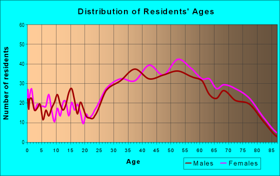
| Males: | 2,583 |
| Females: | 2,505 |
Males:
| This neighborhood: | 53.0 years |
| Whole city: | 48.1 years |
| This neighborhood: | 53.7 years |
| Whole city: | 50.5 years |
Average household size:
| Monarch Beach: | 5.2 people |
| Dana Point: | 2.3 people |
Percentage of family households:
| Monarch Beach: | 38.3% |
| Dana Point: | 42.2% |
| Here: | 62.4% |
| Dana Point: | 52.7% |
Percentage of married-couple families with children (among all households):
| Monarch Beach: | 35.8% |
| Dana Point: | 30.7% |
Percentage of single-mother households (among all households):
| Monarch Beach: | 15.4% |
| Dana Point: | 7.7% |
Percentage of never married males 15 years old and over:
Percentage of never married females 15 years old and over:
| Monarch Beach: | 10.1% |
| Dana Point: | 12.8% |
Percentage of never married females 15 years old and over:
| Monarch Beach: | 8.8% |
| city: | 12.8% |
Percentage of people that speak English not well or not at all:
| Monarch Beach: | 0.5% |
| Dana Point: | 1.2% |
Percentage of people born in this state:
Percentage of people born in another U.S. state:
Percentage of native residents but born outside the U.S.:
Percentage of foreign born residents:
| Here: | 50.4% |
| Dana Point: | 58.2% |
Percentage of people born in another U.S. state:
| Monarch Beach: | 34.6% |
| Dana Point: | 27.5% |
Percentage of native residents but born outside the U.S.:
| Here: | 4.7% |
| city: | 0.9% |
Percentage of foreign born residents:
| Here: | 13.5% |
| Dana Point: | 13.4% |

Owner-occupied
Renter-occupied


- Rooms in owner-occupied houses and condos in Monarch Beach
- 81 room
- 892 rooms
- 373 rooms
- 2184 rooms
- 2295 rooms
- 1696 rooms
- 4047 rooms
- 2148 rooms
- 3379+ rooms

- Rooms in renter-occupied apartments in Monarch Beach
- 1201 room
- 572 rooms
- 1043 rooms
- 1534 rooms
- 2095 rooms
- 1346 rooms
- 1187 rooms
- 1318 rooms
- 719+ rooms
Owner-occupied
Renter-occupied

- Bedrooms in owner-occupied houses and condos in Monarch Beach
- 8no bedroom
- 491 bedroom
- 2642 bedrooms
- 7983 bedrooms
- 4264 bedrooms
- 1255+ bedrooms

- Bedrooms in renter-occupied apartments in Monarch Beach
- 120no bedroom
- 1431 bedroom
- 1972 bedrooms
- 3703 bedrooms
- 3424 bedrooms
- 715+ bedrooms
Average number of cars or other vehicles available in houses/condos:
Average number of cars or other vehicles available in apartments:
| This neighborhood: | 1.8 |
| Dana Point: | 2.1 |
Average number of cars or other vehicles available in apartments:
| Here: | 1.7 |
| city: | 1.7 |
Percentage of units with a mortgage:
| Monarch Beach: | 66.9% |
| Dana Point: | 70.6% |
Average estimated value of detached houses in 2022 (62.5% of all units):
| Monarch Beach: | $1,828,968 |
| Dana Point: | $1,771,468 |

- Year house built in Monarch Beach
- 812020 or later
- 2282010 to 2019
- 1132000 to 2009
- 2831990 to 1999
- 8241980 to 1989
- 1,2101970 to 1979
- 2721960 to 1969
- 2521950 to 1959
- 1431940 to 1949
- 1701939 or earlier

City-data.com crime index for city in 2020 (higher means more crime):
| City: | 92.7 |
| U.S. average: | 219.5 |
Travel time to work (commute)
![Travel time to work (commute)]()
- 37Less than 5 minutes
- 1005 to 9 minutes
- 19910 to 14 minutes
- 26715 to 19 minutes
- 10820 to 24 minutes
- 13825 to 29 minutes
- 26330 to 34 minutes
- 10535 to 39 minutes
- 22940 to 44 minutes
- 13245 to 59 minutes
- 10160 to 89 minutes
- 6690 or more minutes

Means of transportation to work
![Means of transportation to work]()
- 57.5%1,340Drove a car alone
- 6.3%146Carpooled
- 4.5%104Bus
- 2.1%49Taxi
- 1.8%42Motorcycle
- 3.6%85Walked
- 5.4%127Other means
- 34.5%803Worked at home

Time leaving home to go to work
![Time leaving home to go to work]()
- 12212:00 a.m. to 4:59 a.m.
- 515:00 a.m. to 5:29 a.m.
- 1985:30 a.m. to 5:59 a.m.
- 1156:00 a.m. to 6:29 a.m.
- 796:30 a.m. to 6:59 a.m.
- 2407:00 a.m. to 7:29 a.m.
- 2247:30 a.m. to 7:59 a.m.
- 1998:00 a.m. to 8:29 a.m.
- 1108:30 a.m. to 8:59 a.m.
- 2039:00 a.m. to 9:59 a.m.
- 21810:00 a.m. to 10:59 a.m.
- 10911:00 a.m. to 11:59 a.m.
- 7212:00 p.m. to 3:59 p.m.
- 944:00 p.m. to 11:59 p.m.

Occupations of males:
- Percentage of males in management occupations (except farmers):
Here: 21.2% city: 17.4%
- Percentage of males in business and financial operations occupations:
Here: 14.4% city: 10.0%
- Percentage of males in computer and mathematical occupations:
Here: 2.8% city: 3.4%
- Percentage of males in architecture and engineering occupations:
Here: 2.9% city: 3.0%
- Percentage of males in legal occupations:
Here: 4.0% city: 3.9%
- Percentage of males in education, training, and library occupations:
Here: 2.4% city: 3.1%
- Percentage of males in arts, design, entertainment, sports, and media occupations:
Here: 3.0% city: 3.6%
- Percentage of males in healthcare practitioners and technical occupations:
Here: 5.3% city: 2.6%
- Percentage of males in service occupations:
Here: 19.2% city: 13.6%
- Percentage of males in sales and office occupations:
Here: 20.7% city: 20.8%
- Percentage of males in transportation occupations:
Here: 1.6% city: 3.1%
Occupations of females:
- Percentage of females in management occupations (except farmers):
Here: 19.3% city: 14.9%
- Percentage of females in business and financial operations occupations:
Here: 9.3% city: 5.7%
- Percentage of females in life, physical, and social science occupations:
Here: 1.7% city: 1.9%
- Percentage of females in community and social services occupations:
Here: 3.8% city: 2.2%
- Percentage of females in legal occupations:
Here: 4.7% city: 2.1%
- Percentage of females in education, training, and library occupations:
Here: 17.0% city: 13.0%
- Percentage of females in arts, design, entertainment, sports, and media occupations:
Here: 6.0% city: 3.1%
- Percentage of females in healthcare practitioners and technical occupations:
Here: 7.4% city: 8.7%
- Percentage of females in service occupations:
Here: 7.6% city: 15.4%
- Percentage of females in sales and office occupations:
Here: 22.4% city: 27.3%
Percentage of people 16-64 in Armed Forces:
| Monarch Beach: | 0.8% |
| Dana Point: | 0.6% |
Education in this neighborhood (subdivision or community):
- Percentage of people 3 years and older in K-12 schools:
Monarch Beach: 40.7% Dana Point: 14.0%
- Percentage of people 3 years and older in undergraduate colleges:
Monarch Beach: 14.4% Dana Point: 4.4%
- Percentage of people 3 years and older in grad. or professional schools:
Monarch Beach: 3.5% Dana Point: 1.9%
- Percentage of students K-12 enrolled in private schools:
Monarch Beach: 40.5% Dana Point: 16.6%
Percentage of population below poverty level:
| Monarch Beach: | 5.0% |
| Dana Point: | 6.2% |
Percentage of married-couple families with both working:
| Monarch Beach: | 132.3% |
| Dana Point: | 61.9% |

- 62.4%Utility gas
- 27.5%Electricity
- 3.8%Bottled, tank, or LP gas
- 2.3%Solar energy
- 2.0%Other fuel
- 2.0%No fuel used
Highways in this neighborhood:
State Hwy 1 (Monarch Bay Plz, el Camino Real, Pacific Coast Hwy)
Length: 1.57 miles
Directions: N-S, SE-NW
Address range: 32736 to 33999
Directions: N-S, SE-NW
Address range: 32736 to 33999
Roads and streets:
Niguel Rd
Length: 1.14 miles
Directions: E-W, N-S, SE-NW, SW-NE
Address range: 32391 to 33899
Directions: E-W, N-S, SE-NW, SW-NE
Address range: 32391 to 33899
Ritz Cove Dr
Length: 1.11 miles
Directions: E-W, N-S, SE-NW, SW-NE
Address range: 12 to 199
Directions: E-W, N-S, SE-NW, SW-NE
Address range: 12 to 199
Crown Valley Pkwy
Length: 1.06 miles
Directions: E-W, N-S, SE-NW, SW-NE
Address range: 31600 to 32999
Directions: E-W, N-S, SE-NW, SW-NE
Address range: 31600 to 32999
Niguel Shores Dr
Length: 0.99 miles
Directions: E-W, N-S, SE-NW, SW-NE
Address range: 33000 to 34049
Directions: E-W, N-S, SE-NW, SW-NE
Address range: 33000 to 34049
Cam del Avion
Length: 0.78 miles
Directions: E-W, SE-NW
Directions: E-W, SE-NW
Barkentine Blvd (Corniche Dr)
Length: 0.58 miles
Directions: E-W, N-S, SE-NW, SW-NE
Address range: 1 to 99
Directions: E-W, N-S, SE-NW, SW-NE
Address range: 1 to 99
Selva Rd
Length: 0.56 miles
Directions: E-W, N-S, SW-NE
Address range: 33760 to 34399
Directions: E-W, N-S, SW-NE
Address range: 33760 to 34399
Cassis
Length: 0.52 miles
Directions: E-W, N-S, SW-NE
Address range: 1 to 99
Directions: E-W, N-S, SW-NE
Address range: 1 to 99
Atlantic Dr (Atlantic Ave)
Length: 0.50 miles
Directions: E-W, N-S, SE-NW, SW-NE
Address range: 33500 to 33899
Directions: E-W, N-S, SE-NW, SW-NE
Address range: 33500 to 33899
Santa Lucia
Length: 0.50 miles
Directions: E-W, N-S, SE-NW, SW-NE
Address range: 1 to 99
Directions: E-W, N-S, SE-NW, SW-NE
Address range: 1 to 99
S Peak
Length: 0.49 miles
Directions: E-W, N-S, SE-NW, SW-NE
Directions: E-W, N-S, SE-NW, SW-NE
Ports O Call
Length: 0.48 miles
Directions: E-W, SE-NW, SW-NE
Address range: 33900 to 34039
Directions: E-W, SE-NW, SW-NE
Address range: 33900 to 34039
Stonehill Dr
Length: 0.47 miles
Directions: E-W, SE-NW
Directions: E-W, SE-NW
Leeward Dr
Length: 0.47 miles
Directions: E-W, SE-NW, SW-NE
Address range: 23900 to 33798
Directions: E-W, SE-NW, SW-NE
Address range: 23900 to 33798
Cabrillo Isle
Length: 0.43 miles
Directions: N-S, SE-NW, SW-NE
Address range: 33600 to 34099
Directions: N-S, SE-NW, SW-NE
Address range: 33600 to 34099
San Raphael
Length: 0.39 miles
Directions: E-W, N-S, SE-NW, SW-NE
Address range: 1 to 99
Directions: E-W, N-S, SE-NW, SW-NE
Address range: 1 to 99
Windward Dr
Length: 0.33 miles
Directions: E-W, SW-NE
Address range: 24000 to 24299
Directions: E-W, SW-NE
Address range: 24000 to 24299
Los Monteros Dr
Length: 0.32 miles
Directions: E-W, N-S, SE-NW, SW-NE
Address range: 1 to 99
Directions: E-W, N-S, SE-NW, SW-NE
Address range: 1 to 99
Breakers Isle
Length: 0.31 miles
Directions: E-W, N-S, SE-NW, SW-NE
Address range: 1 to 33999
Directions: E-W, N-S, SE-NW, SW-NE
Address range: 1 to 33999
Mariner Dr
Length: 0.30 miles
Directions: E-W, N-S, SE-NW, SW-NE
Address range: 33601 to 33799
Directions: E-W, N-S, SE-NW, SW-NE
Address range: 33601 to 33799
Ritz Carlton Dr
Length: 0.29 miles
Directions: E-W, N-S, SE-NW, SW-NE
Address range: 1 to 99
Directions: E-W, N-S, SE-NW, SW-NE
Address range: 1 to 99
Halyard Dr
Length: 0.28 miles
Directions: N-S, SE-NW
Address range: 33500 to 33799
Directions: N-S, SE-NW
Address range: 33500 to 33799
Windjammer Dr
Length: 0.26 miles
Directions: N-S, SE-NW
Address range: 33501 to 33799
Directions: N-S, SE-NW
Address range: 33501 to 33799
Brigantine Dr
Length: 0.25 miles
Directions: E-W, N-S, SE-NW, SW-NE
Address range: 33500 to 33799
Directions: E-W, N-S, SE-NW, SW-NE
Address range: 33500 to 33799
Private St
Length: 0.25 miles
Directions: N-S, SE-NW, SW-NE
Directions: N-S, SE-NW, SW-NE
Shackleton Isle
Length: 0.24 miles
Directions: E-W, SE-NW
Address range: 33600 to 33949
Directions: E-W, SE-NW
Address range: 33600 to 33949
Windlass Dr
Length: 0.24 miles
Directions: N-S, SE-NW
Address range: 33500 to 33885
Directions: N-S, SE-NW
Address range: 33500 to 33885
Magellan Isle
Length: 0.22 miles
Directions: E-W, SE-NW
Address range: 33600 to 33919
Directions: E-W, SE-NW
Address range: 33600 to 33919
Tirremia Dr
Length: 0.21 miles
Directions: E-W, N-S, SE-NW, SW-NE
Address range: 1 to 99
Directions: E-W, N-S, SE-NW, SW-NE
Address range: 1 to 99
Periwinkle Dr
Length: 0.20 miles
Directions: E-W, N-S, SE-NW, SW-NE
Address range: 33300 to 33599
Directions: E-W, N-S, SE-NW, SW-NE
Address range: 33300 to 33599
Capstan Dr
Length: 0.20 miles
Directions: N-S, SE-NW
Address range: 33500 to 33883
Directions: N-S, SE-NW
Address range: 33500 to 33883
Marlinspike Dr
Length: 0.20 miles
Directions: N-S, SE-NW, SW-NE
Address range: 33500 to 33799
Directions: N-S, SE-NW, SW-NE
Address range: 33500 to 33799
Chelsea Pointe (Chelsea Pt)
Length: 0.19 miles
Directions: E-W, N-S, SE-NW, SW-NE
Address range: 1 to 99
Directions: E-W, N-S, SE-NW, SW-NE
Address range: 1 to 99
Venezia
Length: 0.18 miles
Direction: E-W
Direction: E-W
Dosinia Dr
Length: 0.17 miles
Directions: N-S, SE-NW
Address range: 33368 to 33521
Directions: N-S, SE-NW
Address range: 33368 to 33521
Seven Seas Dr
Length: 0.16 miles
Directions: N-S, SE-NW
Address range: 32768 to 32799
Directions: N-S, SE-NW
Address range: 32768 to 32799
E Nine St
Length: 0.16 miles
Directions: E-W, N-S, SE-NW
Directions: E-W, N-S, SE-NW
Links Pointe
Length: 0.16 miles
Directions: E-W, N-S, SE-NW, SW-NE
Address range: 31299 to 32299
Directions: E-W, N-S, SE-NW, SW-NE
Address range: 31299 to 32299
Costa del Sol
Length: 0.15 miles
Directions: N-S, SE-NW, SW-NE
Address range: 1 to 99
Directions: N-S, SE-NW, SW-NE
Address range: 1 to 99
Nauticus Isle
Length: 0.14 miles
Directions: E-W, N-S, SE-NW
Address range: 33800 to 33999
Directions: E-W, N-S, SE-NW
Address range: 33800 to 33999
Ville Franche
Length: 0.14 miles
Directions: E-W, N-S, SE-NW, SW-NE
Address range: 1 to 99
Directions: E-W, N-S, SE-NW, SW-NE
Address range: 1 to 99
Cockleshell Dr
Length: 0.13 miles
Directions: N-S, SE-NW
Address range: 33300 to 33499
Directions: N-S, SE-NW
Address range: 33300 to 33499
Flying Jib Dr
Length: 0.13 miles
Directions: N-S, SE-NW
Address range: 33600 to 33799
Directions: N-S, SE-NW
Address range: 33600 to 33799
Moonsail Dr
Length: 0.12 miles
Directions: N-S, SW-NE
Address range: 33400 to 33699
Directions: N-S, SW-NE
Address range: 33400 to 33699
Monarch Beach Dr
Length: 0.12 miles
Directions: N-S, SW-NE
Address range: 33600 to 33799
Directions: N-S, SW-NE
Address range: 33600 to 33799
Crossjack Dr
Length: 0.11 miles
Directions: N-S, SE-NW
Address range: 33600 to 33799
Directions: N-S, SE-NW
Address range: 33600 to 33799
Binnacle Dr
Length: 0.11 miles
Directions: N-S, SE-NW, SW-NE
Address range: 33400 to 33699
Directions: N-S, SE-NW, SW-NE
Address range: 33400 to 33699
Atlantis Way
Length: 0.11 miles
Directions: E-W, SE-NW, SW-NE
Address range: 23200 to 23305
Directions: E-W, SE-NW, SW-NE
Address range: 23200 to 23305
Abalone Dr
Length: 0.10 miles
Directions: E-W, SE-NW
Address range: 33400 to 33599
Directions: E-W, SE-NW
Address range: 33400 to 33599
Shoreline Dr
Length: 0.10 miles
Directions: E-W, SE-NW, SW-NE
Address range: 33800 to 33875
Directions: E-W, SE-NW, SW-NE
Address range: 33800 to 33875
Pvt St
Length: 0.10 miles
Direction: SE-NW
Address range: 33800 to 33849
Direction: SE-NW
Address range: 33800 to 33849
E Nine Dr
Length: 0.08 miles
Directions: E-W, N-S, SE-NW, SW-NE
Directions: E-W, N-S, SE-NW, SW-NE
Porto Cervo Dr
Length: 0.08 miles
Directions: E-W, SE-NW
Address range: 1 to 99
Directions: E-W, SE-NW
Address range: 1 to 99
Tampico Bay
Length: 0.08 miles
Directions: N-S, SW-NE
Address range: 23550 to 23699
Directions: N-S, SW-NE
Address range: 23550 to 23699
Sidney Bay
Length: 0.08 miles
Directions: SE-NW, SW-NE
Address range: 23600 to 23699
Directions: SE-NW, SW-NE
Address range: 23600 to 23699
Verrazanno Bay
Length: 0.08 miles
Directions: N-S, SE-NW, SW-NE
Address range: 23500 to 23699
Directions: N-S, SE-NW, SW-NE
Address range: 23500 to 23699
Spinnaker Dr S
Length: 0.08 miles
Directions: N-S, SW-NE
Address range: 33400 to 33599
Directions: N-S, SW-NE
Address range: 33400 to 33599
Gate
Length: 0.07 miles
Directions: E-W, SE-NW
Directions: E-W, SE-NW
Soto Grande Dr
Length: 0.07 miles
Directions: E-W, SE-NW
Address range: 1 to 99
Directions: E-W, SE-NW
Address range: 1 to 99
Taranto Bay
Length: 0.07 miles
Directions: E-W, SE-NW
Address range: 23800 to 23999
Directions: E-W, SE-NW
Address range: 23800 to 23999
Dana Strand Rd
Length: 0.07 miles
Directions: E-W, SW-NE
Address range: 34000 to 34399
Directions: E-W, SW-NE
Address range: 34000 to 34399
Ionian Bay
Length: 0.06 miles
Direction: SW-NE
Address range: 23780 to 23840
Direction: SW-NE
Address range: 23780 to 23840
Cortina
Length: 0.06 miles
Direction: N-S
Address range: 1 to 99
Direction: N-S
Address range: 1 to 99
Pompeii Dr
Length: 0.06 miles
Directions: E-W, SE-NW
Address range: 23200 to 23307
Directions: E-W, SE-NW
Address range: 23200 to 23307
Sextant (Sextant Dr)
Length: 0.05 miles
Direction: N-S
Address range: 33500 to 33599
Direction: N-S
Address range: 33500 to 33599
Perth Bay
Length: 0.05 miles
Directions: E-W, SE-NW, SW-NE
Address range: 23700 to 23799
Directions: E-W, SE-NW, SW-NE
Address range: 23700 to 23799
Hobart Bay
Length: 0.05 miles
Directions: SE-NW, SW-NE
Address range: 23745 to 23820
Directions: SE-NW, SW-NE
Address range: 23745 to 23820
Brisbane Bay
Length: 0.05 miles
Directions: SE-NW, SW-NE
Address range: 23700 to 23771
Directions: SE-NW, SW-NE
Address range: 23700 to 23771
Mercator Isle
Length: 0.05 miles
Directions: E-W, SE-NW
Address range: 33800 to 33899
Directions: E-W, SE-NW
Address range: 33800 to 33899
Guadalmina Dr
Length: 0.05 miles
Directions: N-S, SW-NE
Address range: 1 to 99
Directions: N-S, SW-NE
Address range: 1 to 99
Lumeria Ln
Length: 0.05 miles
Directions: E-W, SW-NE
Address range: 32700 to 32801
Directions: E-W, SW-NE
Address range: 32700 to 32801
Kara Bay
Length: 0.05 miles
Direction: SW-NE
Address range: 23830 to 23860
Direction: SW-NE
Address range: 23830 to 23860
Salvador Bay
Length: 0.05 miles
Directions: SE-NW, SW-NE
Address range: 23700 to 23899
Directions: SE-NW, SW-NE
Address range: 23700 to 23899
Monaco
Length: 0.04 miles
Direction: N-S
Address range: 1 to 99
Direction: N-S
Address range: 1 to 99
Monarch Bay Dr
Length: 0.04 miles
Direction: SW-NE
Direction: SW-NE
Lateen Dr
Length: 0.04 miles
Direction: E-W
Direction: E-W
Barkentine Blvd
Length: 0.04 miles
Direction: SW-NE
Direction: SW-NE
la Cresta Dr
Length: 0.04 miles
Directions: N-S, SE-NW
Address range: 23974 to 23999
Directions: N-S, SE-NW
Address range: 23974 to 23999
Seaward Isle
Length: 0.04 miles
Direction: SW-NE
Address range: 23400 to 23599
Direction: SW-NE
Address range: 23400 to 23599
Andalucia Dr (Andalucia)
Length: 0.03 miles
Directions: E-W, N-S, SW-NE
Address range: 1 to 99
Directions: E-W, N-S, SW-NE
Address range: 1 to 99
Bluehill Bay
Length: 0.03 miles
Direction: SW-NE
Address range: 23800 to 23850
Direction: SW-NE
Address range: 23800 to 23850
Lumeria
Length: 0.03 miles
Direction: SE-NW
Direction: SE-NW
Spinnaker Dr N
Length: 0.03 miles
Directions: N-S, SW-NE
Address range: 33400 to 33499
Directions: N-S, SW-NE
Address range: 33400 to 33499
Bothnia Bay
Length: 0.03 miles
Direction: SW-NE
Address range: 23831 to 23899
Direction: SW-NE
Address range: 23831 to 23899
Padina Cir
Length: 0.03 miles
Direction: SW-NE
Address range: 33300 to 33499
Direction: SW-NE
Address range: 33300 to 33499
Marmara Bay
Length: 0.03 miles
Direction: SW-NE
Address range: 23816 to 23877
Direction: SW-NE
Address range: 23816 to 23877
Timor Bay
Length: 0.02 miles
Direction: SW-NE
Address range: 23700 to 23799
Direction: SW-NE
Address range: 23700 to 23799
Montego Bay
Length: 0.02 miles
Direction: SW-NE
Address range: 23721 to 23762
Direction: SW-NE
Address range: 23721 to 23762
Tasman Bay
Length: 0.02 miles
Direction: E-W
Address range: 23900 to 23999
Direction: E-W
Address range: 23900 to 23999
Coral Bay
Length: 0.02 miles
Direction: SW-NE
Address range: 23865 to 23920
Direction: SW-NE
Address range: 23865 to 23920
Cassandra Bay
Length: 0.02 miles
Direction: SW-NE
Address range: 23800 to 23860
Direction: SW-NE
Address range: 23800 to 23860
Porto Allegro
Length: 0.02 miles
Directions: E-W, SW-NE
Address range: 24200 to 24299
Directions: E-W, SW-NE
Address range: 24200 to 24299
Other features:
Salt Crk
Length: 1.37 miles
Directions: E-W, N-S, SE-NW, SW-NE
Directions: E-W, N-S, SE-NW, SW-NE
Arroyo Salada
Length: 0.38 miles
Directions: E-W, N-S, SE-NW, SW-NE
Directions: E-W, N-S, SE-NW, SW-NE
Stream
Length: 0.29 miles
Directions: E-W, N-S, SE-NW, SW-NE
Directions: E-W, N-S, SE-NW, SW-NE