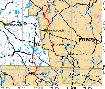
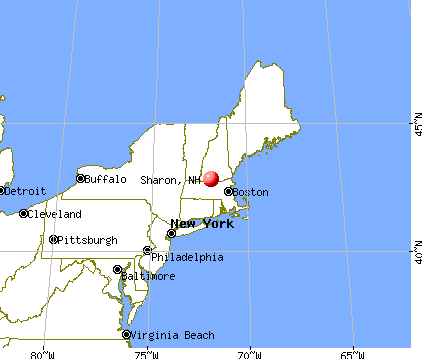
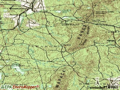
Sharon, New Hampshire
Submit your own pictures of this town and show them to the world
- OSM Map
- General Map
- Google Map
- MSN Map
Population change since 2000: -2.2%
 |
| Males: 184 | |
| Females: 168 |
| Median resident age: | 47.5 years |
| New Hampshire median age: | 43.9 years |
Zip codes: 03458.
| Sharon: | $120,280 |
| NH: | $89,992 |
Estimated per capita income in 2022: $58,788 (it was $29,478 in 2000)
Sharon town income, earnings, and wages data
Estimated median house or condo value in 2022: $470,054 (it was $156,300 in 2000)
| Sharon: | $470,054 |
| NH: | $384,700 |
Mean prices in 2022: all housing units: $411,252; detached houses: $441,251; townhouses or other attached units: $283,002; in 2-unit structures: $347,377; in 3-to-4-unit structures: $666,663; in 5-or-more-unit structures: $275,798; mobile homes: $132,093
Detailed information about poverty and poor residents in Sharon, NH


- 33996.3%White alone
- 72.0%Asian alone
- 41.1%Hispanic
- 10.3%Black alone
- 10.3%Two or more races

Races in Sharon detailed stats: ancestries, foreign born residents, place of birth
 Recent articles from our blog. Our writers, many of them Ph.D. graduates or candidates, create easy-to-read articles on a wide variety of topics.

 | Things To Do in Monadnock Region (3 replies) |
| Hello! Relocating from TX to NH. Any (kind) advice welcome! (23 replies) |
| COL, rents, and salaries in NH (45 replies) |
| Looking at Southern NH...Where would you recommend searching? (15 replies) |
| relocating to lebanon/hanover area (5 replies) |
| How to get here (42 replies) |
Latest news from Sharon, NH collected exclusively by city-data.com from local newspapers, TV, and radio stations
Ancestries: English (25.6%), Irish (20.0%), French (10.0%), Italian (9.4%), French Canadian (6.1%), Polish (4.4%).
Current Local Time: EST time zone
Incorporated in 1791
Elevation: 1185 feet
Land area: 14.6 square miles.
Population density: 24 people per square mile (very low).
7 residents are foreign born
| This town: | 1.9% |
| New Hampshire: | 4.4% |
| Sharon town: | 2.0% ($3,109) |
| New Hampshire: | 2.3% ($2,946) |
Nearest city with pop. 50,000+: Nashua, NH  (23.7 miles , pop. 86,605).
Nearest city with pop. 200,000+: Boston, MA (54.8 miles , pop. 589,141).
Nearest city with pop. 1,000,000+: Bronx, NY (168.1 miles , pop. 1,332,650).
Nearest cities:
), Latitude: 42.80 N, Longitude: 71.94 W
Area code commonly used in this area: 603

Single-family new house construction building permits:
- 2019: 1 building, cost: $200,000
- 2018: 1 building, cost: $200,000
- 2017: 1 building, cost: $200,000
- 2016: 1 building, cost: $200,000
- 2015: 1 building, cost: $200,000
- 2014: 1 building, cost: $200,000
- 2013: 1 building, cost: $250,000
- 2012: 1 building, cost: $180,000
- 2011: 1 building, cost: $300,000
- 2010: 1 building, cost: $211,900
- 2009: 1 building, cost: $225,300
- 2008: 1 building, cost: $220,200
- 2007: 3 buildings, average cost: $203,800
- 2006: 1 building, cost: $194,900
- 2005: 2 buildings, average cost: $177,500
- 2004: 1 building, cost: $77,500
- 2003: 4 buildings, average cost: $153,100
- 2001: 1 building, cost: $101,000
- 2000: 1 building, cost: $105,000
- 1999: 4 buildings, average cost: $109,200
- 1997: 1 building, cost: $125,000


| Here: | 2.3% |
| New Hampshire: | 2.5% |


- Construction (16.7%)
- Health care (14.7%)
- Educational services (13.7%)
- Professional, scientific, technical services (7.8%)
- Computer & electronic products (4.9%)
- Public administration (3.9%)
- Administrative & support & waste management services (3.9%)

- Construction (30.1%)
- Health care (9.7%)
- Educational services (8.8%)
- Professional, scientific, technical services (8.0%)
- Miscellaneous manufacturing (6.2%)
- Computer & electronic products (6.2%)
- Public administration (4.4%)

- Health care (20.9%)
- Educational services (19.8%)
- Professional, scientific, technical services (7.7%)
- Administrative & support & waste management services (5.5%)
- Real estate & rental & leasing (4.4%)
- Computer & electronic products (3.3%)
- Public administration (3.3%)

- Other office and administrative support workers, including supervisors (7.8%)
- Preschool, kindergarten, elementary, and middle school teachers (5.9%)
- Other management occupations, except farmers and farm managers (5.4%)
- Registered nurses (4.9%)
- Construction traders workers except carpenters, electricians, painters, plumbers, and construction laborers (4.9%)
- Operations specialties managers, except financial managers (3.4%)
- Food and beverage serving workers, except waiters and waitresses (3.4%)

- Construction traders workers except carpenters, electricians, painters, plumbers, and construction laborers (8.8%)
- Other management occupations, except farmers and farm managers (8.0%)
- Supervisors, construction and extraction workers (5.3%)
- Top executives (4.4%)
- Lawyers (4.4%)
- Preschool, kindergarten, elementary, and middle school teachers (4.4%)
- Food and beverage serving workers, except waiters and waitresses (4.4%)

- Other office and administrative support workers, including supervisors (13.2%)
- Registered nurses (9.9%)
- Preschool, kindergarten, elementary, and middle school teachers (7.7%)
- Bookkeeping, accounting, and auditing clerks (5.5%)
- Therapists (4.4%)
- Other teachers, instructors, education, training, and library occupations (4.4%)
- Operations specialties managers, except financial managers (3.3%)
Average climate in Sharon, New Hampshire
Based on data reported by over 4,000 weather stations


(lower is better)

Air Quality Index (AQI) level in 2022 was 64.4. This is about average.
| City: | 64.4 |
| U.S.: | 72.6 |

Carbon Monoxide (CO) [ppm] level in 2022 was 0.131. This is significantly better than average. Closest monitor was 5.1 miles away from the city center.
| City: | 0.131 |
| U.S.: | 0.251 |

Nitrogen Dioxide (NO2) [ppb] level in 2008 was 1.51. This is significantly better than average. Closest monitor was 5.1 miles away from the city center.
| City: | 1.51 |
| U.S.: | 5.11 |

Sulfur Dioxide (SO2) [ppb] level in 2022 was 0.411. This is significantly better than average. Closest monitor was 5.1 miles away from the city center.
| City: | 0.411 |
| U.S.: | 1.515 |

Ozone [ppb] level in 2022 was 36.3. This is about average. Closest monitor was 5.1 miles away from the city center.
| City: | 36.3 |
| U.S.: | 33.3 |

Particulate Matter (PM2.5) [µg/m3] level in 2022 was 4.31. This is significantly better than average. Closest monitor was 5.1 miles away from the city center.
| City: | 4.31 |
| U.S.: | 8.11 |
Tornado activity:
Sharon-area historical tornado activity is above New Hampshire state average. It is 23% smaller than the overall U.S. average.
On 6/9/1953, a category F4 (max. wind speeds 207-260 mph) tornado 25.9 miles away from the Sharon town center killed 90 people and injured 1228 people and caused between $50,000,000 and $500,000,000 in damages.
On 6/22/1981, a category F3 (max. wind speeds 158-206 mph) tornado 17.8 miles away from the town center injured 3 people and caused between $5000 and $50,000 in damages.
Earthquake activity:
Sharon-area historical earthquake activity is significantly above New Hampshire state average. It is 71% smaller than the overall U.S. average.On 10/7/1983 at 10:18:46, a magnitude 5.3 (5.1 MB, 5.3 LG, 5.1 ML, Class: Moderate, Intensity: VI - VII) earthquake occurred 144.4 miles away from Sharon center
On 4/20/2002 at 10:50:47, a magnitude 5.3 (5.3 ML, Depth: 3.0 mi) earthquake occurred 147.2 miles away from the city center
On 4/20/2002 at 10:50:47, a magnitude 5.2 (5.2 MB, 4.2 MS, 5.2 MW, 5.0 MW) earthquake occurred 146.4 miles away from Sharon center
On 1/19/1982 at 00:14:42, a magnitude 4.7 (4.5 MB, 4.7 MD, 4.5 LG, Class: Light, Intensity: IV - V) earthquake occurred 51.1 miles away from the city center
On 10/16/2012 at 23:12:25, a magnitude 4.7 (4.7 ML, Depth: 10.0 mi) earthquake occurred 84.9 miles away from the city center
On 10/2/1994 at 11:27:22, a magnitude 3.7 (3.5 LG, 3.7 LG, Depth: 6.2 mi, Class: Light, Intensity: II - III) earthquake occurred 36.0 miles away from Sharon center
Magnitude types: regional Lg-wave magnitude (LG), body-wave magnitude (MB), duration magnitude (MD), local magnitude (ML), surface-wave magnitude (MS), moment magnitude (MW)
Natural disasters:
The number of natural disasters in Hillsborough County (27) is a lot greater than the US average (15).Major Disasters (Presidential) Declared: 17
Emergencies Declared: 10
Causes of natural disasters: Storms: 13, Floods: 11, Winter Storms: 5, Snowstorms: 4, Hurricanes: 3, Snows: 3, Blizzard: 1, Ice Storm: 1, Snowfall: 1, Wind: 1 (Note: some incidents may be assigned to more than one category).
Hospitals and medical centers near Sharon:
- GOOD SHEPHERD REHABILITATION AND NURSING CENTER (Nursing Home, about 4 miles away; JAFFREY, NH)
- MONADNOCK COMMUNITY HOSPITAL Critical Access Hospitals (about 6 miles away; PETERBOROUGH, NH)
- PHEASANT WOOD CARE AND REHABILIATION CENTER (Nursing Home, about 8 miles away; PETERBOROUGH, NH)
- NAUKEAG HOSPITAL CORPORATION (Hospital, about 10 miles away; ASHBURNHAM, MA)
- OPEN ARMS NURSING HOME INC (Nursing Home, about 11 miles away; WINCHENDON, MA)
- WACHUSETT MANOR NURSING HOME (Nursing Home, about 11 miles away; GARDNER, MA)
- CRESTWOOD CARE AND REHABILITATION CENTER (Nursing Home, about 15 miles away; MILFORD, NH)
Colleges/universities with over 2000 students nearest to Sharon:
- Franklin Pierce University (about 7 miles; Rindge, NH; Full-time enrollment: 2,139)
- Mount Wachusett Community College (about 15 miles; Gardner, MA; FT enrollment: 3,143)
- Fitchburg State University (about 17 miles; Fitchburg, MA; FT enrollment: 5,010)
- Keene State College (about 20 miles; Keene, NH; FT enrollment: 5,098)
- Saint Anselm College (about 26 miles; Manchester, NH; FT enrollment: 2,059)
- Mount Washington College (about 27 miles; Manchester, NH; FT enrollment: 2,187)
- Southern New Hampshire University (about 30 miles; Manchester, NH; FT enrollment: 16,552)
Points of interest:
Notable location: Sharon Arts Center (A). Display/hide its location on the map
Cemeteries: North Cemetery (1), Jarmany Hill Cemetery (2). Display/hide their locations on the map
Streams, rivers, and creeks: Town Line Brook (A). Display/hide its location on the map
Birthplace of: Gustavus Swan - Columbus.
Drinking water stations with addresses in Sharon and their reported violations in the past:
SHARON ARTS CENTER (Population served: 25, Groundwater):Past monitoring violations:
- 2 routine major monitoring violations
- One regular monitoring violation
| This town: | 2.4 people |
| New Hampshire: | 2.5 people |
| This town: | 72.9% |
| Whole state: | 66.3% |
| This town: | 9.7% |
| Whole state: | 8.3% |
Likely homosexual households (counted as self-reported same-sex unmarried-partner households)
- Lesbian couples: 0.0% of all households
- Gay men: 2.1% of all households
| This town: | 3.8% |
| Whole state: | 6.5% |
| This town: | 2.0% |
| Whole state: | 2.8% |
For population 15 years and over in Sharon:

- Never married: 11.0%
- Now married: 75.7%
- Separated: 2.6%
- Widowed: 5.1%
- Divorced: 5.5%
For population 25 years and over in Sharon:
- High school or higher: 93.1%
- Bachelor's degree or higher: 45.7%
- Graduate or professional degree: 18.8%
- Unemployed: 1.4%
- Mean travel time to work (commute): 33.6 minutes


| Here: | 9.6 |
| New Hampshire average: | 10.9 |


Graphs represent county-level data. Detailed 2008 Election Results
Religion statistics for Sharon, NH (based on Hillsborough County data)


| Religion | Adherents | Congregations |
|---|---|---|
| Catholic | 124,993 | 40 |
| Evangelical Protestant | 20,588 | 103 |
| Mainline Protestant | 17,794 | 60 |
| Other | 7,365 | 35 |
| Orthodox | 2,990 | 7 |
| Black Protestant | - | 1 |
| None | 226,991 | - |
Food Environment Statistics:
| Hillsborough County: | 1.82 / 10,000 pop. |
| State: | 2.14 / 10,000 pop. |
| Hillsborough County: | 0.12 / 10,000 pop. |
| State: | 0.15 / 10,000 pop. |
| Here: | 1.65 / 10,000 pop. |
| New Hampshire: | 1.78 / 10,000 pop. |
| This county: | 2.67 / 10,000 pop. |
| New Hampshire: | 4.02 / 10,000 pop. |
| Hillsborough County: | 8.23 / 10,000 pop. |
| New Hampshire: | 9.70 / 10,000 pop. |
| Here: | 6.9% |
| State: | 7.6% |
| Hillsborough County: | 24.5% |
| New Hampshire: | 24.4% |
| This county: | 15.1% |
| New Hampshire: | 15.9% |
6.73% of this county's 2021 resident taxpayers lived in other counties in 2020 ($92,767 average adjusted gross income)
| Here: | 6.73% |
| New Hampshire average: | 7.66% |
0.01% of residents moved from foreign countries ($183 average AGI)
Hillsborough County: 0.01% New Hampshire average: 0.01%
Top counties from which taxpayers relocated into this county between 2020 and 2021:
| from Middlesex County, MA | |
| from Rockingham County, NH | |
| from Merrimack County, NH |
6.49% of this county's 2020 resident taxpayers moved to other counties in 2021 ($81,100 average adjusted gross income)
| Here: | 6.49% |
| New Hampshire average: | 6.80% |
0.02% of residents moved to foreign countries ($105 average AGI)
Hillsborough County: 0.02% New Hampshire average: 0.01%
Top counties to which taxpayers relocated from this county between 2020 and 2021:
| to Rockingham County, NH | |
| to Merrimack County, NH | |
| to Middlesex County, MA |
Strongest AM radio stations in Sharon:
- WCRN (830 AM; 50 kW; WORCESTER, MA; Owner: CARTER BROADCASTING CORPORATION)
- WRKO (680 AM; 50 kW; BOSTON, MA; Owner: ENTERCOM BOSTON LICENSE, LLC)
- WEEI (850 AM; 50 kW; BOSTON, MA; Owner: ENTERCOM BOSTON LICENSE, LLC)
- WKOX (1200 AM; 50 kW; FRAMINGHAM, MA; Owner: CAPSTAR TX LIMITED PARTNERSHIP)
- WVNE (760 AM; daytime; 25 kW; LEICESTER, MA; Owner: BLOUNT MASSCOM, INC.)
- WNNZ (640 AM; 50 kW; WESTFIELD, MA; Owner: CLEAR CHANNEL BROADCASTING LICENSES, INC.)
- WBIX (1060 AM; 40 kW; NATICK, MA; Owner: LANGER BROADCASTING CORPORATION)
- WEIM (1280 AM; 5 kW; FITCHBURG, MA; Owner: LIVEAIR COMMUNICATIONS, INC.)
- WWZN (1510 AM; 50 kW; BOSTON, MA; Owner: ROSE CITY RADIO CORPORATION)
- WALE (990 AM; 50 kW; GREENVILLE, RI; Owner: NORTH AMERICAN BROADCASTING CO., INC.)
- WAMG (890 AM; 25 kW; DEDHAM, MA; Owner: MEGA COMMUNICATIONS OF DEDHAM LICENSEE, LLC)
- WBZ (1030 AM; 50 kW; BOSTON, MA; Owner: INFINITY BROADCASTING OPERATIONS, INC.)
- WFGL (960 AM; 2 kW; FITCHBURG, MA; Owner: CSN INTERNATIONAL)
Strongest FM radio stations in Sharon:
- WFEX (92.1 FM; PETERBOROUGH, NH; Owner: FNX BROADCASTING OF NEW HAMPSHIRE LLC)
- WINQ (97.7 FM; WINCHENDON, MA; Owner: SAGA COMMUNICATIONS OF NEW ENGLAND, LLC)
- WGIR-FM (101.1 FM; MANCHESTER, NH; Owner: CAPSTAR TX LIMITED PARTNERSHIP)
- WQLL (96.5 FM; BEDFORD, NH; Owner: SAGA COMMUNICATIONS OF NEW ENGLAND, LLC)
- WLMW (90.7 FM; MANCHESTER, NH; Owner: KNOWLEDGE FOR LIFE)
- WZID (95.7 FM; MANCHESTER, NH; Owner: SAGA COMMUNICATIONS OF NEW ENGLAND, LLC)
- WHDQ (106.1 FM; CLAREMONT, NH; Owner: GREAT NORTHERN RADIO, L.L.C.)
- WTPL (107.7 FM; HILLSBORO, NH; Owner: CONCORD BROADCASTING, L.L.C.)
- WKNE (103.7 FM; KEENE, NH; Owner: SAGA COMMUNICATIONS OF NEW ENGLAND, LLC)
- WEVN (90.7 FM; KEENE, NH; Owner: NEW HAMPSHIRE PUBLIC RADIO, INC.)
- WVPR (89.5 FM; WINDSOR, VT; Owner: VERMONT PUBLIC RADIO)
- WXLO (104.5 FM; FITCHBURG, MA; Owner: CITADEL BROADCASTING COMPANY)
- WAAF (107.3 FM; WORCESTER, MA; Owner: ENTERCOM BOSTON LICENSE, LLC)
- WEQX (102.7 FM; MANCHESTER, VT; Owner: NORTHSHIRE COMMUNICATIONS, INC.)
- W293AB (106.5 FM; KEENE, NH; Owner: GREAT NORTHERN RADIO, L.L.C.)
- WOQL (98.7 FM; WINCHESTER, NH; Owner: SAGA COMMUNICATIONS OF NEW HAMPSHIRE, LLC)
- WJAN (95.1 FM; SUNDERLAND, VT; Owner: 6 JOHNSON ROAD LICENSES, INC.)
- WNNH (99.1 FM; HENNIKER, NH; Owner: TELE-MEDIA COMPANY OF NEW HAMPSHIRE, L.L.C.)
- WJJR (98.1 FM; RUTLAND, VT; Owner: 6 JOHNSON ROAD LICENSES, INC.)
- WZRT (97.1 FM; RUTLAND, VT; Owner: CAPSTAR TX LIMITED PARTNERSHIP)
TV broadcast stations around Sharon:
- WUNI (Channel 27; WORCESTER, MA; Owner: ENTRAVISION HOLDINGS, LLC)
- WUTF (Channel 66; MARLBOROUGH, MA; Owner: TELEFUTURA BOSTON LLC)
- WCVB-TV (Channel 5; BOSTON, MA; Owner: WCVB HEARST-ARGYLE TV, INC.)
- WMFP (Channel 62; LAWRENCE, MA; Owner: WSAH LICENSE, INC.)
- WBZ-TV (Channel 4; BOSTON, MA; Owner: VIACOM INC.)
- WGBX-TV (Channel 44; BOSTON, MA; Owner: WGBH EDUCATIONAL FOUNDATION)
- WYDN (Channel 48; WORCESTER, MA; Owner: EDUCATIONAL PUBLIC TV CORPORATION)
- WSBK-TV (Channel 38; BOSTON, MA; Owner: VIACOM INC.)
- WFXZ-CA (Channel 24; BOSTON, MA; Owner: BOSTON BROADCASTING CORP.)
- WEKW-TV (Channel 52; KEENE, NH; Owner: UNIVERSITY OF NEW HAMPSHIRE)
- WNDS (Channel 50; DERRY, NH; Owner: CTV OF DERRY, INC)
Sharon fatal accident list:
Aug 8, 2009 11:19 PM, Sr-124, Swamp Road, Lat: 42.791211, Lon: -71.949936, Vehicles: 1, Persons: 1, Fatalities: 1
Jul 15, 2006 05:50 PM, Sr-123, Temple Rd, Lat: 42.810840, Lon: -71.912410, Vehicles: 2, Persons: 3, Fatalities: 1
Nov 27, 2004 03:30 AM, Sr-124, Swamp Rd, Vehicles: 1, Persons: 1, Fatalities: 1, Drunk persons involved: 1
Oct 17, 1999 06:15 PM, Sr-124, Vehicles: 1, Persons: 2, Fatalities: 1, Drunk persons involved: 1
Aug 9, 1991 03:15 AM, 42750, Vehicles: 1, Persons: 1, Fatalities: 1, Drunk persons involved: 1
Jul 10, 1990 11:00 PM, Sr124, Vehicles: 1, Persons: 3, Fatalities: 1, Drunk persons involved: 1
- National Bridge Inventory (NBI) Statistics
- 3Number of bridges
- 10ft / 2.7mTotal length
- $9,426,000Total costs
- 407Total average daily traffic
- 15Total average daily truck traffic
- 601Total future (year 2042) average daily traffic

- 78.2%Fuel oil, kerosene, etc.
- 10.1%Bottled, tank, or LP gas
- 5.9%Electricity
- 4.2%Wood
- 1.7%Coal or coke

- 53.3%Fuel oil, kerosene, etc.
- 46.7%Bottled, tank, or LP gas
Sharon compared to New Hampshire state average:
- Unemployed percentage significantly below state average.
- Black race population percentage significantly below state average.
- Hispanic race population percentage significantly below state average.
- Foreign-born population percentage significantly below state average.
- Renting percentage below state average.
- Length of stay since moving in significantly above state average.
- Number of rooms per house significantly below state average.
- House age significantly below state average.
- Percentage of population with a bachelor's degree or higher above state average.

|
Total of 15 patent applications in 2008-2024.