Tremont, Maine

Submit your own pictures of this town and show them to the world
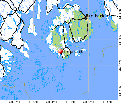
- OSM Map
- General Map
- Google Map
- MSN Map
Population change since 2000: +2.2%
 |
| Males: 748 | |
| Females: 815 |
| Median resident age: | 48.5 years |
| Maine median age: | 43.0 years |
Zip codes: 04653.
| Tremont: | $67,077 |
| ME: | $69,543 |
Estimated per capita income in 2022: $39,431 (it was $19,420 in 2000)
Tremont town income, earnings, and wages data
Estimated median house or condo value in 2022: $362,564 (it was $126,600 in 2000)
| Tremont: | $362,564 |
| ME: | $290,600 |
Mean prices in 2022: all housing units: $379,336; detached houses: $396,802; townhouses or other attached units: $600,716; in 2-unit structures: $274,479; in 3-to-4-unit structures: $212,346; in 5-or-more-unit structures: $146,369; mobile homes: $158,183; occupied boats, rvs, vans, etc.: $16,454
Detailed information about poverty and poor residents in Tremont, ME


- 1,51296.7%White alone
- 171.1%Two or more races
- 151.0%Hispanic
- 90.6%Black alone
- 70.4%Asian alone
- 30.2%American Indian alone

Races in Tremont detailed stats: ancestries, foreign born residents, place of birth
 Recent articles from our blog. Our writers, many of them Ph.D. graduates or candidates, create easy-to-read articles on a wide variety of topics.

 | Photos of Maine (4586 replies) |
| Living on Swan Island (10 replies) |
| Coastal towns north of Camden (26 replies) |
| How Many Posts are about Moving to Maine ? Here is one more! (9 replies) |
| Older folks who have retired to Maine from elsewhere (123 replies) |
| Quiet plans to move to Maine (19 replies) |
Latest news from Tremont, ME collected exclusively by city-data.com from local newspapers, TV, and radio stations
Ancestries: English (25.7%), Irish (14.2%), United States (8.5%), Scottish (8.4%), French (8.0%), German (7.6%).
Current Local Time: EST time zone
Incorporated on 06/03/1848
Elevation: 45 feet
Land area: 16.9 square miles.
Population density: 93 people per square mile (very low).
23 residents are foreign born
| This town: | 1.5% |
| Maine: | 2.9% |
| Tremont town: | 1.0% ($1,211) |
| Maine: | 1.5% ($1,417) |
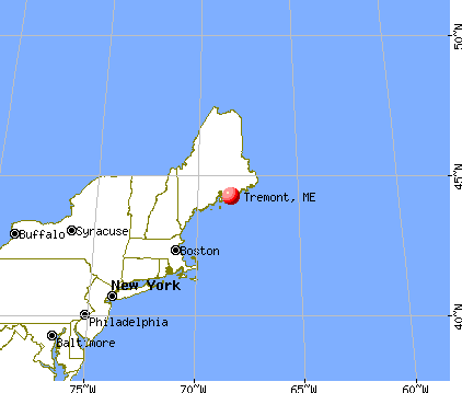
Nearest city with pop. 50,000+: Portland, ME  (103.0 miles , pop. 64,249).
Nearest city with pop. 200,000+: Boston, MA (191.3 miles , pop. 589,141).
Nearest city with pop. 1,000,000+: Bronx, NY (366.2 miles , pop. 1,332,650).
Nearest cities:
), ), )Latitude: 44.25 N, Longitude: 68.37 W
Area code commonly used in this area: 207


Single-family new house construction building permits:
- 2022: 3 buildings, average cost: $111,500
- 2021: 2 buildings, average cost: $111,500
- 2020: 2 buildings, average cost: $111,500
- 2019: 7 buildings, average cost: $148,400
- 2018: 9 buildings, average cost: $396,700
- 2017: 3 buildings, average cost: $250,000
- 2016: 3 buildings, average cost: $250,000
- 2015: 5 buildings, average cost: $240,000
- 2014: 10 buildings, average cost: $240,700
- 2013: 7 buildings, average cost: $176,900
- 2012: 7 buildings, average cost: $156,400
- 2011: 10 buildings, average cost: $210,000
- 2010: 13 buildings, average cost: $165,900
- 2009: 9 buildings, average cost: $150,000
- 2008: 3 buildings, average cost: $182,400
- 2007: 11 buildings, average cost: $181,200
- 2006: 15 buildings, average cost: $168,200
- 2005: 14 buildings, average cost: $149,400
- 2004: 21 buildings, average cost: $138,500
- 2003: 24 buildings, average cost: $132,800
- 2002: 23 buildings, average cost: $130,700
- 2001: 31 buildings, average cost: $121,400
- 2000: 18 buildings, average cost: $118,000
- 1999: 18 buildings, average cost: $124,700
- 1998: 20 buildings, average cost: $117,500
- 1997: 20 buildings, average cost: $87,400


| Here: | 5.3% |
| Maine: | 3.4% |


- Construction (13.8%)
- Agriculture, forestry, fishing & hunting (10.3%)
- Transportation equipment (6.9%)
- Professional, scientific, technical services (6.9%)
- Educational services (5.9%)
- Accommodation & food services (5.7%)
- Administrative & support & waste management services (5.2%)

- Construction (24.5%)
- Agriculture, forestry, fishing & hunting (16.5%)
- Transportation equipment (10.1%)
- Professional, scientific, technical services (5.5%)
- Accommodation & food services (4.6%)
- Public administration (4.3%)
- Administrative & support & waste management services (3.4%)

- Educational services (8.6%)
- Professional, scientific, technical services (8.3%)
- Health care (7.3%)
- Administrative & support & waste management services (7.1%)
- Accommodation & food services (6.8%)
- Food & beverage stores (5.5%)
- Public administration (4.8%)

- Fishing, hunting, and forestry occupations (8.8%)
- Building and grounds cleaning and maintenance occupations (6.1%)
- Carpenters (4.9%)
- Other management occupations, except farmers and farm managers (4.8%)
- Other sales and related occupations, including supervisors (3.9%)
- Other production occupations, including supervisors (3.8%)
- Other office and administrative support workers, including supervisors (3.1%)

- Fishing, hunting, and forestry occupations (15.3%)
- Carpenters (9.6%)
- Supervisors, construction and extraction workers (5.8%)
- Building and grounds cleaning and maintenance occupations (5.3%)
- Other management occupations, except farmers and farm managers (4.6%)
- Material recording, scheduling, dispatching, and distributing workers (3.4%)
- Driver/sales workers and truck drivers (3.1%)

- Building and grounds cleaning and maintenance occupations (7.1%)
- Other office and administrative support workers, including supervisors (6.0%)
- Other sales and related occupations, including supervisors (5.8%)
- Other production occupations, including supervisors (5.3%)
- Other management occupations, except farmers and farm managers (5.0%)
- Information and record clerks, except customer service representatives (5.0%)
- Bookkeeping, accounting, and auditing clerks (5.0%)
Average climate in Tremont, Maine
Based on data reported by over 4,000 weather stations


(lower is better)

Air Quality Index (AQI) level in 2023 was 61.9. This is about average.
| City: | 61.9 |
| U.S.: | 72.6 |

Carbon Monoxide (CO) [ppm] level in 2023 was 0.172. This is significantly better than average. Closest monitor was 9.8 miles away from the city center.
| City: | 0.172 |
| U.S.: | 0.251 |


Sulfur Dioxide (SO2) [ppb] level in 2023 was 0.0636. This is significantly better than average. Closest monitor was 3.2 miles away from the city center.
| City: | 0.0636 |
| U.S.: | 1.5147 |

Ozone [ppb] level in 2023 was 37.0. This is about average. Closest monitor was 3.2 miles away from the city center.
| City: | 37.0 |
| U.S.: | 33.3 |


Particulate Matter (PM2.5) [µg/m3] level in 2023 was 4.90. This is significantly better than average. Closest monitor was 10.1 miles away from the city center.
| City: | 4.90 |
| U.S.: | 8.11 |
Earthquake activity:
Tremont-area historical earthquake activity is significantly above Maine state average. It is 80% smaller than the overall U.S. average.On 10/16/2012 at 23:12:25, a magnitude 4.7 (4.7 ML, Depth: 10.0 mi, Class: Light, Intensity: IV - V) earthquake occurred 122.7 miles away from the city center
On 4/20/2002 at 10:50:47, a magnitude 5.3 (5.3 ML, Depth: 3.0 mi, Class: Moderate, Intensity: VI - VII) earthquake occurred 264.1 miles away from Tremont center
On 4/20/2002 at 10:50:47, a magnitude 5.2 (5.2 MB, 4.2 MS, 5.2 MW, 5.0 MW) earthquake occurred 265.0 miles away from Tremont center
On 1/19/1982 at 00:14:42, a magnitude 4.7 (4.5 MB, 4.7 MD, 4.5 LG) earthquake occurred 169.4 miles away from the city center
On 10/7/1983 at 10:18:46, a magnitude 5.3 (5.1 MB, 5.3 LG, 5.1 ML) earthquake occurred 297.4 miles away from the city center
On 10/3/2006 at 00:07:38, a magnitude 3.7 (3.7 MD, Depth: 6.2 mi, Class: Light, Intensity: II - III) earthquake occurred 13.5 miles away from Tremont center
Magnitude types: regional Lg-wave magnitude (LG), body-wave magnitude (MB), duration magnitude (MD), local magnitude (ML), surface-wave magnitude (MS), moment magnitude (MW)
Natural disasters:
The number of natural disasters in Hancock County (18) is near the US average (15).Major Disasters (Presidential) Declared: 11
Emergencies Declared: 6
Causes of natural disasters: Floods: 9, Storms: 8, Snows: 5, Blizzard: 1, Heavy Rain: 1, Hurricane: 1, Ice Storm: 1, Landslide: 1, Snowfall: 1, Wind: 1, Winter Storm: 1, Other: 2 (Note: some incidents may be assigned to more than one category).

Colleges/universities with over 2000 students nearest to Tremont:
- Husson University (about 46 miles; Bangor, ME; Full-time enrollment: 2,421)
- University of Maine (about 48 miles; Orono, ME; FT enrollment: 8,931)
- University of Maine at Augusta (about 72 miles; Augusta, ME; FT enrollment: 3,204)
- University of Maine at Farmington (about 93 miles; Farmington, ME; FT enrollment: 2,036)
- Southern Maine Community College (about 102 miles; South Portland, ME; FT enrollment: 4,666)
- University of Southern Maine (about 104 miles; Portland, ME; FT enrollment: 6,647)
- Saint Joseph's College of Maine (about 110 miles; Standish, ME; FT enrollment: 2,010)
Points of interest:
Notable locations in Tremont: Bass Harbor Public Landing (A), Bass Harbor Marine (B), Bass Harbor Campground (C), Tremont Volunteer Fire Department - Seal Cove Station (D), Southwest Harbor / Tremont Volunteer Ambulance (E), Tremont Community Center (F), Auto Museum (G), Tremont Volunteer Fire Department Bass Harbor Station (H). Display/hide their locations on the map
Churches in Tremont include: Saint Andrews Church (A), Tremont Congregational Church (B), Olsen Memorial Church (C), Tremont Church (D), Backside Redemption Church (E), Cornerstone Church (F). Display/hide their locations on the map
Cemeteries: Murphy Hill Cemetery (1), Robbins Cemetery (2), Flye Cemetery (3), Norwood Cemetery (4), Pomroy Cemetery (5), Langley Cemetery (6), Hodgdon Cemetery (7). Display/hide their locations on the map
Reservoirs and swamps: Seal Cove Pond (A), Murphy Swamp (B), Mitchell Marsh (C). Display/hide their locations on the map
Streams, rivers, and creeks: Steward Brook (A), Tinker Brook (B), Webster Brook (C), Marshall Brook (D), Duck Cove Brook (E). Display/hide their locations on the map
Beach: Cobble Beach (A). Display/hide its location on the map
Birthplace of: John F. Bickford - Navy Medal of Honor recipient.
| This town: | 2.2 people |
| Maine: | 2.3 people |
| This town: | 60.9% |
| Whole state: | 62.9% |
| This town: | 11.9% |
| Whole state: | 9.4% |
Likely homosexual households (counted as self-reported same-sex unmarried-partner households)
- Lesbian couples: 1.1% of all households
- Gay men: 0.1% of all households
| This town: | 7.4% |
| Whole state: | 10.9% |
| This town: | 3.1% |
| Whole state: | 4.1% |
For population 15 years and over in Tremont:

- Never married: 20.3%
- Now married: 62.1%
- Separated: 1.1%
- Widowed: 3.7%
- Divorced: 12.7%
For population 25 years and over in Tremont:
- High school or higher: 85.4%
- Bachelor's degree or higher: 25.4%
- Graduate or professional degree: 8.7%
- Unemployed: 2.9%
- Mean travel time to work (commute): 22.0 minutes


| Here: | 10.5 |
| Maine average: | 11.2 |


Graphs represent county-level data. Detailed 2008 Election Results
Religion statistics for Tremont, ME (based on Hancock County data)


| Religion | Adherents | Congregations |
|---|---|---|
| Mainline Protestant | 4,691 | 58 |
| Catholic | 2,523 | 9 |
| Evangelical Protestant | 1,288 | 23 |
| Other | 820 | 11 |
| None | 45,096 | - |
Food Environment Statistics:
| Hancock County: | 6.01 / 10,000 pop. |
| Maine: | 2.80 / 10,000 pop. |
| This county: | 1.69 / 10,000 pop. |
| State: | 2.20 / 10,000 pop. |
| Hancock County: | 4.89 / 10,000 pop. |
| Maine: | 5.75 / 10,000 pop. |
| Hancock County: | 21.61 / 10,000 pop. |
| Maine: | 11.02 / 10,000 pop. |
| This county: | 7.4% |
| Maine: | 8.2% |
| Hancock County: | 25.4% |
| State: | 25.0% |
Strongest AM radio stations in Tremont:
- WDEA (1370 AM; 5 kW; ELLSWORTH, ME; Owner: CUMULUS LICENSING CORP.)
- WZON (620 AM; 5 kW; BANGOR, ME; Owner: THE ZONE CORPORATION)
- WABI (910 AM; 5 kW; BANGOR, ME; Owner: CLEAR CHANNEL BROADCASTING LICENSES, INC.)
- WRKO (680 AM; 50 kW; BOSTON, MA; Owner: ENTERCOM BOSTON LICENSE, LLC)
- WSKW (1160 AM; 10 kW; SKOWHEGAN, ME; Owner: MOUNTAIN WIRELESS, INCORPORATED)
- WEEI (850 AM; 50 kW; BOSTON, MA; Owner: ENTERCOM BOSTON LICENSE, LLC)
- WBZ (1030 AM; 50 kW; BOSTON, MA; Owner: INFINITY BROADCASTING OPERATIONS, INC.)
- WCRN (830 AM; 50 kW; WORCESTER, MA; Owner: CARTER BROADCASTING CORPORATION)
- WTME (780 AM; 10 kW; RUMFORD, ME; Owner: MOUNTAIN VALLEY BROADCASTING, INC.)
- WNNZ (640 AM; 50 kW; WESTFIELD, MA; Owner: CLEAR CHANNEL BROADCASTING LICENSES, INC.)
- WKOX (1200 AM; 50 kW; FRAMINGHAM, MA; Owner: CAPSTAR TX LIMITED PARTNERSHIP)
- WALE (990 AM; 50 kW; GREENVILLE, RI; Owner: NORTH AMERICAN BROADCASTING CO., INC.)
- WWZN (1510 AM; 50 kW; BOSTON, MA; Owner: ROSE CITY RADIO CORPORATION)
Strongest FM radio stations in Tremont:
- WERU-FM (89.9 FM; BLUE HILL, ME; Owner: SALT POND COMMUNITY B/C COMPANY)
- WNSX (97.7 FM; WINTER HARBOR, ME; Owner: CLEAR CHANNEL BROADCASTING LICENSES, INC.)
- WFZX (101.7 FM; SEARSPORT, ME; Owner: CLEAR CHANNEL BROADCASTING LICENSES, INC.)
- WWMJ (95.7 FM; ELLSWORTH, ME; Owner: CUMULUS LICENSING CORP.)
- WBFB (104.7 FM; BELFAST, ME; Owner: CLEAR CHANNEL BROADCASTING LICENSES, INC.)
- W217BK (91.3 FM; SOUTHWEST HARBOR, ME; Owner: CALVARY CHAPEL OF TWIN FALLS, INC.)
- WMEP (90.5 FM; CAMDEN, ME; Owner: MAINE PUBLIC BROADCASTING CORP.)
- WQSS (102.5 FM; CAMDEN, ME; Owner: CLEAR CHANNEL BROADCASTING LICENSES, INC.)
- WLKE (99.1 FM; BAR HARBOR, ME; Owner: CLEAR CHANNEL BROADCASTING LICENSES, INC.)
- WKIT-FM (100.3 FM; BREWER, ME; Owner: THE ZONE CORPORATION)
- WBQI (107.7 FM; BAR HARBOR, ME; Owner: MARINER BROADCASTING, L.P.)
- WWBX (97.1 FM; BANGOR, ME; Owner: CLEAR CHANNEL BROADCASTING LICENSES, INC.)
- WMEH (90.9 FM; BANGOR, ME; Owner: MAINE PUBLIC BROADCASTING CORPORATION)
- WEZQ (92.9 FM; BANGOR, ME; Owner: CUMULUS LICENSING CORP.)
- WMCM (103.3 FM; ROCKLAND, ME; Owner: CLEAR CHANNEL BROADCASTING LICENSES, INC.)
Medal of Honor Recipients
Medal of Honor Recipient born in Tremont: John F. Bickford.
- National Bridge Inventory (NBI) Statistics
- 3Number of bridges
- 16ft / 4.6mTotal length
- 4,382Total average daily traffic
- 217Total average daily truck traffic
- 6,418Total future (year 2036) average daily traffic

- 74.0%Fuel oil, kerosene, etc.
- 11.7%Wood
- 8.1%Bottled, tank, or LP gas
- 4.8%Electricity
- 1.3%Other fuel

- 76.9%Fuel oil, kerosene, etc.
- 10.5%Bottled, tank, or LP gas
- 9.1%Electricity
- 3.5%Wood
Tremont compared to Maine state average:
- Unemployed percentage significantly below state average.
- Black race population percentage below state average.
- Hispanic race population percentage below state average.
- Median age above state average.
- Foreign-born population percentage significantly below state average.
- Length of stay since moving in significantly above state average.
- Number of rooms per house significantly below state average.
- House age significantly below state average.
- Number of college students significantly below state average.
State forum archive: