Please register to participate in our discussions with 2 million other members - it's free and quick! Some forums can only be seen by registered members. After you create your account, you'll be able to customize options and access all our 15,000 new posts/day with fewer ads.
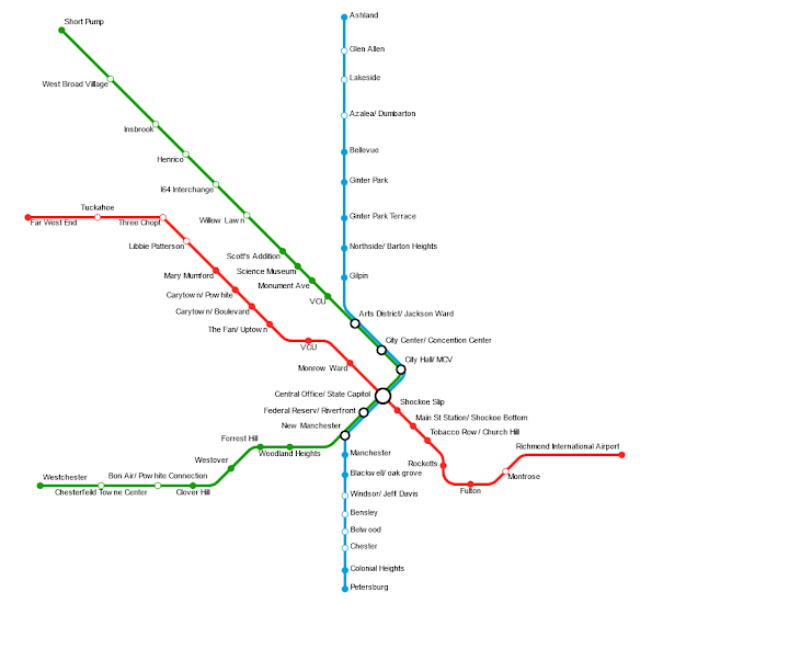
Here is my idea for the Metro Valley in the Charleston/Huntington/Ashland metro area. Uses existing rail. Would connect two cities, while adding suburban stops.
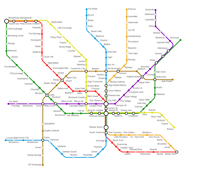
This is a map I doodled up earlier this year of what a potential Northeast Ohio rail network might look like. I tried to base it almost entirely on existing rail rights-of-way (based on Google Maps/satellite view).
Here is my idea for the Metro Valley in the Charleston/Huntington/Ashland metro area. Uses existing rail. Would connect two cities, while adding suburban stops.
Does this fall under commuter rail or inter-city rail?
Quote:
Originally Posted by that412
This is a map I doodled up earlier this year of what a potential Northeast Ohio rail network might look like. I tried to base it almost entirely on existing rail rights-of-way (based on Google Maps/satellite view).
Does this fall under high-speed rail, commuter rail or inter-city rail?
West Trenton line is likely to be built by NJT in 10-12 years. Rest of the maps are a Pipe dream and will never happen in my lifetime.
Please register to post and access all features of our very popular forum. It is free and quick. Over $68,000 in prizes has already been given out to active posters on our forum. Additional giveaways are planned.
Detailed information about all U.S. cities, counties, and zip codes on our site: City-data.com.

 Please register to participate in our discussions with 2 million other members - it's free and quick! Some forums can only be seen by registered members. After you create your account, you'll be able to customize options and access all our 15,000 new posts/day with fewer ads.