Estimated median house or condo value in 2022: $463,403 (it was $180,800 in 2000)
Salisbury:
$463,403
MA:
$534,700
Mean prices in 2022:all housing units: $622,058; detached houses: $620,473; townhouses or other attached units: $508,893; in 2-unit structures: $704,082; in 3-to-4-unit structures: over $1,000,000; in 5-or-more-unit structures: $411,579; mobile homes: $192,916
Median gross rent in 2022: $1,617.
March 2022 cost of living index in Salisbury: 135.5 (high, U.S. average is 100)
The City-Data.com crime index weighs serious crimes and violent crimes more heavily. Higher means more crime, U.S. average is 246.1. It adjusts for the number of visitors and daily workers commuting into cities.
Latest news from Salisbury, MA collected exclusively by city-data.com from local newspapers, TV, and radio stations
Ancestries: Italian (23.3%), Irish (16.5%), English (10.1%), French (6.7%), American (5.5%), Polish (3.0%).
Current Local Time: EST time zone
Incorporated in 1639
Elevation: 25 feet
Land area: 5.90 square miles.
Population density: 826 people per square mile (low).
268 residents are foreign born (3.0% Asia, 1.5% Europe).
This place:
5.1%
Massachusetts:
17.6%
Median real estate property taxes paid for housing units with mortgages in 2022: $3,940 (0.8%) Median real estate property taxes paid for housing units with no mortgage in 2022: $4,646 (1.0%)
Nearest city with pop. 50,000+: Haverhill, MA (13.3 miles , pop. 58,969).
Nearest city with pop. 200,000+: Boston, MA (38.1 miles , pop. 589,141).
Nearest city with pop. 1,000,000+: Bronx, NY (208.5 miles , pop. 1,332,650).
Air Quality Index (AQI) level in 2022 was 64.4. This is about average.
City:
64.4
U.S.:
72.6
Nitrogen Dioxide (NO2) [ppb] level in 2012 was 6.65. This is worse than average.Closest monitor was 2.8 miles away from the city center.
City:
6.65
U.S.:
5.11
Sulfur Dioxide (SO2) [ppb] level in 2022 was 1.48. This is about average.Closest monitor was 2.8 miles away from the city center.
City:
1.48
U.S.:
1.51
Ozone [ppb] level in 2022 was 29.4. This is about average.Closest monitor was 3.7 miles away from the city center.
City:
29.4
U.S.:
33.3
Particulate Matter (PM10) [µg/m3] level in 2022 was 14.4. This is better than average.Closest monitor was 16.9 miles away from the city center.
City:
14.4
U.S.:
19.2
Particulate Matter (PM2.5) [µg/m3] level in 2022 was 6.71. This is better than average.Closest monitor was 14.3 miles away from the city center.
City:
6.71
U.S.:
8.11
Tornado activity:
Salisbury-area historical tornado activity is slightly below Massachusetts state average. It is 53% smaller than the overall U.S. average.
On 6/9/1953, a category F3 (max. wind speeds 158-206 mph) tornado 11.3 miles away from the Salisbury place center injured 5 peopleand causedbetween $5000 and $50,000 in damages.
On 9/29/1974, a category F3 tornado 23.9 miles away from the place center injured one personand causedbetween $50,000 and $500,000 in damages.
Earthquake activity:
Salisbury-area historical earthquake activity is significantly above Massachusetts state average. It is 73% smaller than the overall U.S. average.
On 10/16/2012 at 23:12:25, a magnitude 4.7 (4.7 ML, Depth: 10.0 mi, Class: Light, Intensity: IV - V) earthquake occurred 53.2 miles away from the city center On 4/20/2002 at 10:50:47, a magnitude 5.3 (5.3 ML, Depth: 3.0 mi, Class: Moderate, Intensity: VI - VII) earthquake occurred 184.0 miles away from the city center On 1/19/1982 at 00:14:42, a magnitude 4.7 (4.5 MB, 4.7 MD, 4.5 LG) earthquake occurred 59.7 miles away from Salisbury center On 10/7/1983 at 10:18:46, a magnitude 5.3 (5.1 MB, 5.3 LG, 5.1 ML) earthquake occurred 192.2 miles away from the city center On 4/20/2002 at 10:50:47, a magnitude 5.2 (5.2 MB, 4.2 MS, 5.2 MW, 5.0 MW) earthquake occurred 183.7 miles away from Salisbury center On 8/22/1992 at 12:20:32, a magnitude 4.8 (4.8 MB, 3.8 MS, 4.7 LG, Depth: 6.2 mi) earthquake occurred 259.7 miles away from the city center Magnitude types: regional Lg-wave magnitude (LG), body-wave magnitude (MB), duration magnitude (MD), local magnitude (ML), surface-wave magnitude (MS), moment magnitude (MW)
Natural disasters:
The number of natural disasters in Essex County (33) is a lot greater than the US average (15). Major Disasters (Presidential) Declared: 20 Emergencies Declared: 13
Causes of natural disasters: Floods: 14, Storms: 11, Hurricanes: 6, Snowstorms: 5, Winter Storms: 5, Snows: 3, Blizzards: 2, Fire: 1, Heavy Rain: 1, Snowfall: 1, Water Main Break: 1, Wind: 1 (Note: some incidents may be assigned to more than one category).
Hospitals and medical centers in Salisbury:
GREENLEAF HOUSE NURSING HOME (197 ELM ST)
Other hospitals and medical centers near Salisbury:
HOME HEALTH CARE OF GT NEWBURYPORT (Home Health Center, about 3 miles away; NEWBURYPORT, MA)
FMC OF NEWBURYPORT (Dialysis Facility, about 3 miles away; NEWBURYPORT, MA)
BRIGHAM MANOR CONV HOME (Nursing Home, about 3 miles away; NEWBURYPORT, MA)
KINDRED NURSING AND REHABILITATION-BRIGHAM (Nursing Home, about 3 miles away; NEWBURYPORT, MA)
ANNA JAQUES HOSPITAL Acute Care Hospitals (about 4 miles away; NEWBURYPORT, MA)
ANNA JAQUES HOSPITAL SUBACUTE UNIT (Nursing Home, about 4 miles away; NEWBURYPORT, MA)
PORT HEALTHCARE CENTER (Nursing Home, about 4 miles away; NEWBURYPORT, MA)
Amtrak stations near Salisbury:
12 miles: EXETER (60 LINCOLN ST.) . Services: ticket office.
SALISBURY PUBLIC LIBRARY (Operating income: $176,738; Location: 17 ELM STREET; 31,302 books; 1,394 audio materials; 395 video materials; 1 local licensed databases; 34 state licensed databases; 3 other licensed databases; 105 print serial subscriptions)
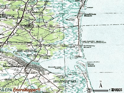
Notable locations in Salisbury: North Pier Light (A), Salisbury Fire Department (B), Salisbury Public Library (C), Salisbury Elementary School Library (D). Display/hide their locations on the map
Rivers and creeks: Little River (A), Shad Creek (B), Fox Island Creek (C), Morrill Creek (D), Dead Creek (E), Allen Creek (F). Display/hide their locations on the map
Birthplace of: Caleb Cushing - Politician, Bob Corkum - Ice hockey player, Hannah Webster Foster - novelist.
Essex County has a predicted average indoor radon screening level greater than 4 pCi/L (pico curies per liter) - Highest Potential
Drinking water stations with addresses in Salisbury and their reported violations in the past:
SALISBURY WATER DEPARTMENT (Population served: 20,000, Groundwater):
Past monitoring violations:
Monitoring and Reporting (DBP) - Between APR-2008 and JUN-2008, Contaminant: Total Haloacetic Acids (HAA5). Follow-up actions: St AO (w/o penalty) issued (AUG-01-2008)
One regular monitoring violation
Drinking water stations with addresses in Salisbury that have no violations reported:
RINGS ISLAND WATER DISTRICT (Population served: 250,Primary Water Source Type: Purch groundwater)
Average household size:
This place:
2.2 people
Massachusetts:
2.5 people
Percentage of family households:
This place:
56.0%
Whole state:
63.0%
Percentage of households with unmarried partners:
This place:
9.5%
Whole state:
7.0%
Likely homosexual households (counted as self-reported same-sex unmarried-partner households)
Lesbian couples: 0.8% of all households
Gay men: 0.5% of all households
29 people in nursing homes in 2000
7 people in residential treatment centers for emotionally disturbed children in 2000
Banks with branches in Salisbury (2011 data):
Institution for Savings in Newburyport and Its Vicinity: Salisbury Branch at 7 Bridge Road, branch established on 2006/10/16. Info updated 2007/07/16: Bank assets: $1,303.4 mil, Deposits: $1,053.1 mil, headquarters in Newburyport, MA, positive income, Mortgage Lending Specialization, 9 total offices
TD Bank, National Association: Crossroads Plaza Branch at 6 Merrill Street, branch established on 1991/12/02. Info updated 2010/10/04: Bank assets: $188,912.6 mil, Deposits: $153,149.8 mil, headquarters in Wilmington, DE, positive income, 1314 total offices, Holding Company: Toronto-Dominion Bank, The
Newburyport Five Cents Savings Bank: Salisbury Branch at Merrill Street And Route 110, branch established on 1971/09/30. Info updated 2012/02/07: Bank assets: $634.6 mil, Deposits: $460.4 mil, headquarters in Newburyport, MA, positive income, Commercial Lending Specialization, 7 total offices, Holding Company: Newburyport Five Cents Bancorp Mhc
Religion statistics for Salisbury, MA (based on Essex County data)
Religion
Adherents
Congregations
Catholic
341,970
55
Mainline Protestant
33,710
140
Evangelical Protestant
20,925
160
Other
15,882
63
Orthodox
11,590
13
Black Protestant
376
3
None
318,706
-
Source: Clifford Grammich, Kirk Hadaway, Richard Houseal, Dale E.Jones, Alexei Krindatch, Richie Stanley and Richard H.Taylor. 2012. 2010 U.S.Religion Census: Religious Congregations & Membership Study. Association of Statisticians of American Religious Bodies. Jones, Dale E., et al. 2002. Congregations and Membership in the United States 2000. Nashville, TN: Glenmary Research Center. Graphs represent county-level data
Aircraft: PFOUTS ALFRED L SKYOTE (Category: Land, Weight: Up to 12,499 Pounds), Engine: CONT MOTOR 0-200 SERIES (100 HP) (Reciprocating) N-Number: 13DX, N13DX, N-13DX, Serial Number: 27, Airworthiness Date: 05/19/1986, Certificate Issue Date: 10/20/2009 Registrant (Individual): Dennis P Dowling, 19 Bridge Rd, Salisbury, MA 01952
Aircraft: CESSNA 180 (Category: Land, Seats: 4, Weight: Up to 12,499 Pounds, Speed: 121 mph), Engine: CONT MOTOR O-470 SERIES (230 HP) (Reciprocating) N-Number: 1521C, N1521C, N-1521C, Serial Number: 30221, Airworthiness Date: 03/09/1956, Certificate Issue Date: 04/15/2015 Registrant (Individual): Glen H Macdougall, 29 Old Elm St, Salisbury, MA 01952
Aircraft: PIPER J3C-65 (Category: Land, Seats: 2, Weight: Up to 12,499 Pounds, Speed: 67 mph), Engine: CONT MOTOR C85 SERIES (85 HP) (Reciprocating) N-Number: 5289X, N5289X, N-5289X, Serial Number: 5233, Year manufactured: 1946, Airworthiness Date: 03/03/1999, Certificate Issue Date: 10/31/2011 Registrant (Individual): Dennis P Dowling, 19 Bridge Rd, Salisbury, MA 01952
Aircraft: CESSNA 210B (Category: Land, Seats: 4, Weight: Up to 12,499 Pounds, Speed: 141 mph), Engine: CONT MOTOR I0-470 SERIES (260 HP) (Reciprocating) N-Number: 9723X, N9723X, N-9723X, Serial Number: 21058023, Year manufactured: 1962, Airworthiness Date: 06/01/1962, Certificate Issue Date: 09/17/2001 Registrant (Individual): Donald R Paquette, 28 Ferry Rd, Salisbury, MA 01952
Aircraft: RAYTHEON AIRCRAFT COMPANY HAWKER 850XP (Category: Land, Engines: 2, Seats: 15, Weight: Up to 12,499 Pounds), Engine: HONEYWELL TFE-731-5BR1H (4750 Pounds of Thrust) (Turbo-fan) N-Number: 676AH, N676AH, N-676AH, Serial Number: 258831, Year manufactured: 2007, Airworthiness Date: 02/10/2007, Certificate Issue Date: 03/21/2007 Registrant (Corporation): Bank Of America Na, C/O Moondance Llc / 9 Fanaras Dr, Salisbury, MA 01952
Home Mortgage Disclosure Act Aggregated Statistics For Year 2009 (Based on 1 full and 1 partial tracts)
A) FHA, FSA/RHS & VA Home Purchase Loans
B) Conventional Home Purchase Loans
C) Refinancings
D) Home Improvement Loans
E) Loans on Dwellings For 5+ Families
F) Non-occupant Loans on < 5 Family Dwellings (A B C & D)
G) Loans On Manufactured Home Dwelling (A B C & D)
Number
Average Value
Number
Average Value
Number
Average Value
Number
Average Value
Number
Average Value
Number
Average Value
Number
Average Value
LOANS ORIGINATED
8
$246,669
42
$183,679
108
$215,937
5
$145,894
1
$2,897,390
41
$236,425
1
$205,300
APPLICATIONS APPROVED, NOT ACCEPTED
1
$366,670
9
$217,803
9
$196,994
1
$455,930
0
$0
4
$217,655
0
$0
APPLICATIONS DENIED
1
$379,540
13
$187,457
54
$253,557
5
$125,736
0
$0
23
$240,401
1
$86,520
APPLICATIONS WITHDRAWN
0
$0
5
$224,596
29
$251,783
0
$0
0
$0
6
$252,107
0
$0
FILES CLOSED FOR INCOMPLETENESS
0
$0
0
$0
9
$190,251
0
$0
0
$0
2
$227,795
0
$0
Aggregated Statistics For Year 2008 (Based on 1 full and 1 partial tracts)
A) FHA, FSA/RHS & VA Home Purchase Loans
B) Conventional Home Purchase Loans
C) Refinancings
D) Home Improvement Loans
E) Loans on Dwellings For 5+ Families
F) Non-occupant Loans on < 5 Family Dwellings (A B C & D)
G) Loans On Manufactured Home Dwelling (A B C & D)
Number
Average Value
Number
Average Value
Number
Average Value
Number
Average Value
Number
Average Value
Number
Average Value
Number
Average Value
LOANS ORIGINATED
4
$277,958
52
$239,182
84
$221,142
11
$67,731
0
$0
43
$250,316
0
$0
APPLICATIONS APPROVED, NOT ACCEPTED
2
$198,220
5
$282,144
10
$219,312
3
$47,047
0
$0
2
$311,720
0
$0
APPLICATIONS DENIED
0
$0
14
$165,125
40
$286,836
6
$21,025
1
$449,590
12
$206,075
1
$97,110
APPLICATIONS WITHDRAWN
0
$0
9
$315,662
14
$246,319
0
$0
0
$0
5
$258,646
0
$0
FILES CLOSED FOR INCOMPLETENESS
0
$0
2
$187,330
3
$345,257
0
$0
0
$0
0
$0
0
$0
Aggregated Statistics For Year 2007 (Based on 1 full and 1 partial tracts)
A) FHA, FSA/RHS & VA Home Purchase Loans
B) Conventional Home Purchase Loans
C) Refinancings
D) Home Improvement Loans
E) Loans on Dwellings For 5+ Families
F) Non-occupant Loans on < 5 Family Dwellings (A B C & D)
G) Loans On Manufactured Home Dwelling (A B C & D)
Number
Average Value
Number
Average Value
Number
Average Value
Number
Average Value
Number
Average Value
Number
Average Value
Number
Average Value
LOANS ORIGINATED
1
$170,850
99
$280,552
109
$224,889
26
$111,837
2
$436,865
52
$287,041
2
$95,425
APPLICATIONS APPROVED, NOT ACCEPTED
0
$0
11
$210,428
23
$209,700
0
$0
0
$0
3
$318,323
2
$75,930
APPLICATIONS DENIED
0
$0
14
$425,336
63
$263,225
14
$115,876
1
$519,530
13
$502,192
0
$0
APPLICATIONS WITHDRAWN
0
$0
6
$254,187
22
$208,379
1
$348,630
0
$0
6
$299,720
0
$0
FILES CLOSED FOR INCOMPLETENESS
0
$0
1
$386,370
3
$196,793
0
$0
0
$0
1
$151,120
0
$0
Aggregated Statistics For Year 2006 (Based on 1 full and 1 partial tracts)
A) FHA, FSA/RHS & VA Home Purchase Loans
B) Conventional Home Purchase Loans
C) Refinancings
D) Home Improvement Loans
E) Loans on Dwellings For 5+ Families
F) Non-occupant Loans on < 5 Family Dwellings (A B C & D)
G) Loans On Manufactured Home Dwelling (A B C & D)
Number
Average Value
Number
Average Value
Number
Average Value
Number
Average Value
Number
Average Value
Number
Average Value
Number
Average Value
LOANS ORIGINATED
0
$0
123
$217,390
117
$236,065
20
$119,573
2
$626,935
53
$237,240
2
$105,935
APPLICATIONS APPROVED, NOT ACCEPTED
0
$0
10
$282,806
34
$238,027
2
$378,445
0
$0
5
$366,222
0
$0
APPLICATIONS DENIED
1
$182,840
18
$246,123
80
$254,309
11
$198,530
1
$679,390
22
$268,139
4
$109,242
APPLICATIONS WITHDRAWN
0
$0
15
$214,703
48
$251,728
1
$64,410
0
$0
11
$277,205
2
$153,070
FILES CLOSED FOR INCOMPLETENESS
0
$0
0
$0
10
$316,073
0
$0
0
$0
2
$414,625
0
$0
Aggregated Statistics For Year 2005 (Based on 1 full and 1 partial tracts)
B) Conventional Home Purchase Loans
C) Refinancings
D) Home Improvement Loans
E) Loans on Dwellings For 5+ Families
F) Non-occupant Loans on < 5 Family Dwellings (A B C & D)
G) Loans On Manufactured Home Dwelling (A B C & D)
Number
Average Value
Number
Average Value
Number
Average Value
Number
Average Value
Number
Average Value
Number
Average Value
LOANS ORIGINATED
114
$215,657
153
$221,802
24
$255,225
2
$899,190
68
$250,419
3
$226,640
APPLICATIONS APPROVED, NOT ACCEPTED
8
$253,834
20
$317,420
2
$56,535
0
$0
5
$272,554
1
$155,660
APPLICATIONS DENIED
17
$328,331
59
$221,144
15
$97,604
0
$0
6
$291,573
0
$0
APPLICATIONS WITHDRAWN
11
$270,572
55
$272,979
6
$117,925
0
$0
8
$277,154
1
$167,300
FILES CLOSED FOR INCOMPLETENESS
3
$180,230
26
$267,610
1
$49,950
0
$0
0
$0
0
$0
Aggregated Statistics For Year 2004 (Based on 1 full and 1 partial tracts)
A) FHA, FSA/RHS & VA Home Purchase Loans
B) Conventional Home Purchase Loans
C) Refinancings
D) Home Improvement Loans
E) Loans on Dwellings For 5+ Families
F) Non-occupant Loans on < 5 Family Dwellings (A B C & D)
G) Loans On Manufactured Home Dwelling (A B C & D)
Number
Average Value
Number
Average Value
Number
Average Value
Number
Average Value
Number
Average Value
Number
Average Value
Number
Average Value
LOANS ORIGINATED
4
$270,350
152
$202,171
168
$207,550
19
$110,645
3
$429,347
63
$197,937
3
$151,533
APPLICATIONS APPROVED, NOT ACCEPTED
1
$244,780
20
$260,873
14
$233,250
2
$40,740
0
$0
5
$337,340
0
$0
APPLICATIONS DENIED
2
$256,800
41
$216,917
75
$230,547
12
$73,540
0
$0
17
$304,922
3
$102,683
APPLICATIONS WITHDRAWN
2
$217,805
10
$226,511
42
$203,605
9
$105,576
0
$0
5
$346,348
0
$0
FILES CLOSED FOR INCOMPLETENESS
0
$0
5
$367,102
22
$211,541
0
$0
0
$0
1
$120,060
0
$0
Aggregated Statistics For Year 2003 (Based on 1 full and 1 partial tracts)
A) FHA, FSA/RHS & VA Home Purchase Loans
B) Conventional Home Purchase Loans
C) Refinancings
D) Home Improvement Loans
E) Loans on Dwellings For 5+ Families
F) Non-occupant Loans on < 5 Family Dwellings (A B C & D)
Number
Average Value
Number
Average Value
Number
Average Value
Number
Average Value
Number
Average Value
Number
Average Value
LOANS ORIGINATED
4
$249,042
82
$216,620
307
$173,198
6
$80,458
8
$344,035
67
$208,190
APPLICATIONS APPROVED, NOT ACCEPTED
0
$0
8
$169,534
33
$147,970
6
$44,930
0
$0
5
$104,104
APPLICATIONS DENIED
0
$0
9
$184,479
90
$193,646
11
$48,537
0
$0
10
$226,532
APPLICATIONS WITHDRAWN
0
$0
5
$132,992
55
$182,619
5
$34,546
0
$0
3
$106,193
FILES CLOSED FOR INCOMPLETENESS
0
$0
2
$213,085
12
$160,681
0
$0
0
$0
2
$133,880
Aggregated Statistics For Year 1999 (Based on 1 partial tract)
A) FHA, FSA/RHS & VA Home Purchase Loans
B) Conventional Home Purchase Loans
C) Refinancings
D) Home Improvement Loans
F) Non-occupant Loans on < 5 Family Dwellings (A B C & D)
Detailed PMIC statistics for the following Tracts:2671.01
, 2671.02
2002 - 2018 National Fire Incident Reporting System (NFIRS) incidents
Based on the data from the years 2002 - 2018 the average number of fires per year is 32. The highest number of fire incidents - 69 took place in 2002, and the least - 5 in 2011. The data has a dropping trend.
When looking into fire subcategories, the most reports belonged to: Outside Fires (41.6%), and Structure Fires (27.7%).
Fire incident types reported to NFIRS in Salisbury, MA
#83 on the list of "Top 101 cities with the largest percentage of people in residential treatment centers for emotionally disturbed children (population 1,000+)"
#21 on the list of "Top 101 counties with the lowest percentage of residents that keep firearms around their homes"
#21 on the list of "Top 101 counties with the most Orthodox adherents"
#23 on the list of "Top 101 counties with the highest carbon monoxide air pollution readings in 2012 (ppm)"
#30 on the list of "Top 101 counties with the most Catholic adherents"
#36 on the list of "Top 101 counties with the most Orthodox congregations (pop. 50,000+)"


 Recent articles from our blog. Our writers, many of them Ph.D. graduates or candidates, create easy-to-read articles on a wide variety of topics.

 (13.3 miles


 Based on the data from the years 2002 - 2018 the average number of fires per year is 32. The highest number of fire incidents - 69 took place in 2002, and the least - 5 in 2011. The data has a dropping trend.
 When looking into fire subcategories, the most reports belonged to: Outside Fires (41.6%), and Structure Fires (27.7%).

