Bridge Statistics for Irondale, Alabama (AL)
Condition, Traffic, Stress, Structural Evaluation, Project Costs
- National Bridge Inventory (NBI) Statistics
- 53Number of bridges
- 1,020ft / 311mTotal length
- $151,398,000Total costs
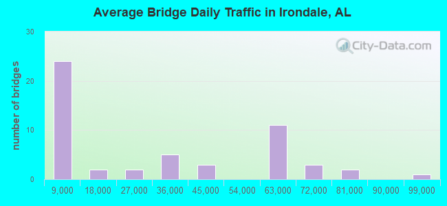
- 1,544,010Total average daily traffic
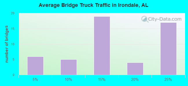
- 235,940Total average daily truck traffic
- National Bridge Inventory (NBI) Registered Bridges for Irondale
- No street view available for this location
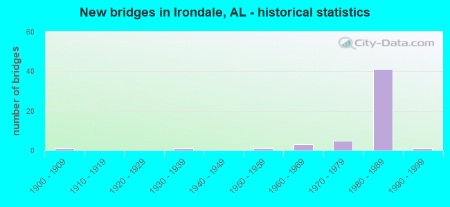
- New bridges - historical statistics
- 11900-1909
- 11930-1939
- 11950-1959
- 31960-1969
- 51970-1979
- 411980-1989
- 11990-1999
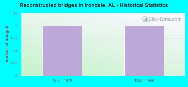
- Reconstructed bridges - Historical Statistics
- 11970-1979
- 11980-1989
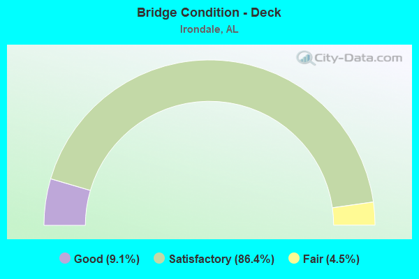
- Bridge Condition - Deck
- 9.1%Good
- 86.4%Satisfactory
- 4.5%Fair
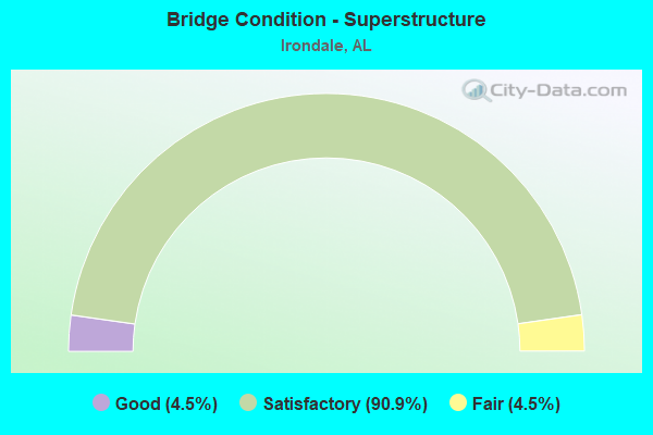
- Bridge Condition - Superstructure
- 4.5%Good
- 90.9%Satisfactory
- 4.5%Fair
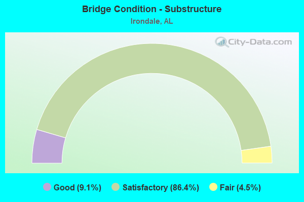
- Bridge Condition - Substructure
- 9.1%Good
- 86.4%Satisfactory
- 4.5%Fair
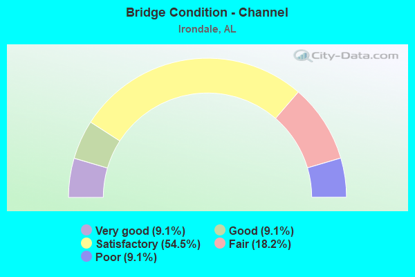
- Bridge Condition - Channel
- 9.1%Very good
- 9.1%Good
- 54.5%Satisfactory
- 18.2%Fair
- 9.1%Poor
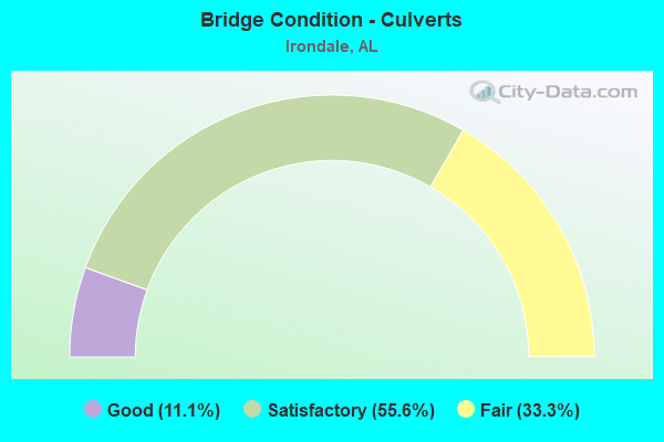
- Bridge Condition - Culverts
- 11.1%Good
- 55.6%Satisfactory
- 33.3%Fair
Find on map >> Show street view
Structure Number: 13172, Location: I 20/ I459 INTERCHANGE (Lat: 33.545278, Lng: -86.641389), Route carried "under" structure: Interstate 20, Year Built: 1984, Structure Length: 0. m, Average Daily Traffic: 70,000 (year 2020), Truck Traffic: 21%, Features Intersected: I 20 * I 459 *, Facility Carried by Structure: RAMP
Minimum Vertical Clearance: 5.03m (16.50ft), Kilometerpoint: 220.501, Lanes on structure: 2, Lanes under structure: 6, Material/Design: Steel, Design/Construction: Stringer/Multi-beam, Length of Maximum Span: 55.5m (182.1ft)
Find on map >> Show street view
Structure Number: 13172, Location: I 20/ I459 INTERCHANGE (Lat: 33.545278, Lng: -86.641389), Route carried "under" structure: Ramp Interstate 20, Year Built: 1984, Structure Length: 0. m, Average Daily Traffic: 7,000 (year 2020), Truck Traffic: 21%, Features Intersected: I 20 * I 459 *, Facility Carried by Structure: RAMP
Minimum Vertical Clearance: 5.87m (19.26ft), Kilometerpoint: 220.503, Lanes on structure: 2, Lanes under structure: 2, Material/Design: Steel, Design/Construction: Stringer/Multi-beam, Length of Maximum Span: 55.5m (182.1ft)