Bridge Statistics for Itasca, Illinois (IL)
Condition, Traffic, Stress, Structural Evaluation, Project Costs
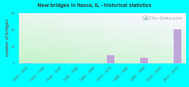
- New bridges - historical statistics
- 11920-1929
- 101970-1979
- 71990-1999
- 412010-2019
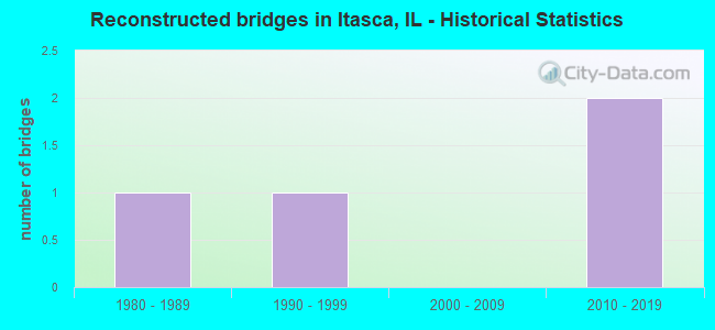
- Reconstructed bridges - Historical Statistics
- 11980-1989
- 11990-1999
- 02000-2009
- 22010-2019
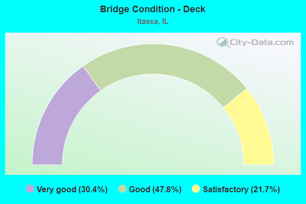
- Bridge Condition - Deck
- 30.4%Very good
- 47.8%Good
- 21.7%Satisfactory
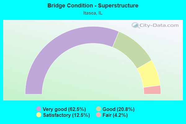
- Bridge Condition - Superstructure
- 62.5%Very good
- 20.8%Good
- 12.5%Satisfactory
- 4.2%Fair
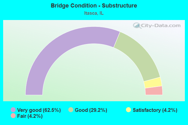
- Bridge Condition - Substructure
- 62.5%Very good
- 29.2%Good
- 4.2%Satisfactory
- 4.2%Fair
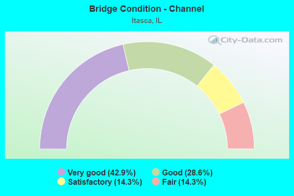
- Bridge Condition - Channel
- 42.9%Very good
- 28.6%Good
- 14.3%Satisfactory
- 14.3%Fair
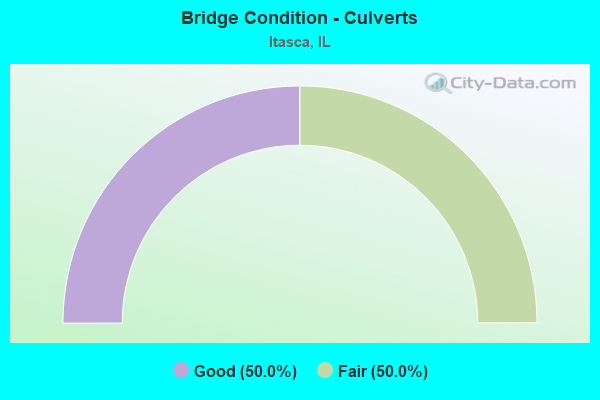
- Bridge Condition - Culverts
- 50.0%Good
- 50.0%Fair
Find on map >> Show street view
Structure Number: 2295, Location: 0.04 M E of IL 53 (Lat: 41.986872, Lng: -88.030764), Route carried "under" structure: Other road , Year Built: 2017, Structure Length: 0. m, Average Daily Traffic: 19,700 (year 2021), Features Intersected: IL-390, Facility Carried by Structure: Rohllwing Rd Ramp
Minimum Vertical Clearance: 5.18m (16.99ft), Kilometerpoint: 0.998, Lanes on structure: 1, Lanes under structure: 2, Toll: On toll road, Material/Design: Steel, Design/Construction: Stringer/Multi-beam, Length of Maximum Span: 47.6m (156.2ft)
Find on map >> Show street view
Structure Number: 229501, Location: 0.8 m E of IL 53 (Lat: 41.988056, Lng: -88.029978), Route carried "under" structure: Other road , Year Built: 2016, Structure Length: 0. m, Average Daily Traffic: 7,000 (year 2020), Features Intersected: Ramps G2 & G3, Facility Carried by Structure: Elgin O'Hare Ramp
Minimum Vertical Clearance: 5.05m (16.57ft), Kilometerpoint: 1.046, Lanes on structure: 1, Lanes under structure: 3, Toll: On toll road, Material/Design: Concrete, Design/Construction: Slab, Length of Maximum Span: 36.0m (118.1ft)
Find on map >> Show street view
Structure Number: 229501, Location: 0.8 m E of IL 53 (Lat: 41.987994, Lng: -88.029872), Route carried "under" structure: Other road , Year Built: 2016, Structure Length: 0. m, Average Daily Traffic: 15,400 (year 2020), Truck Traffic: 1%, Features Intersected: Ramps G2 & G3, Facility Carried by Structure: Elgin O'Hare Ramp
Minimum Vertical Clearance: 5.05m (16.57ft), Kilometerpoint: 1.722, Lanes on structure: 1, Lanes under structure: 3, Toll: On toll road, Material/Design: Concrete, Design/Construction: Slab, Length of Maximum Span: 36.0m (118.1ft)