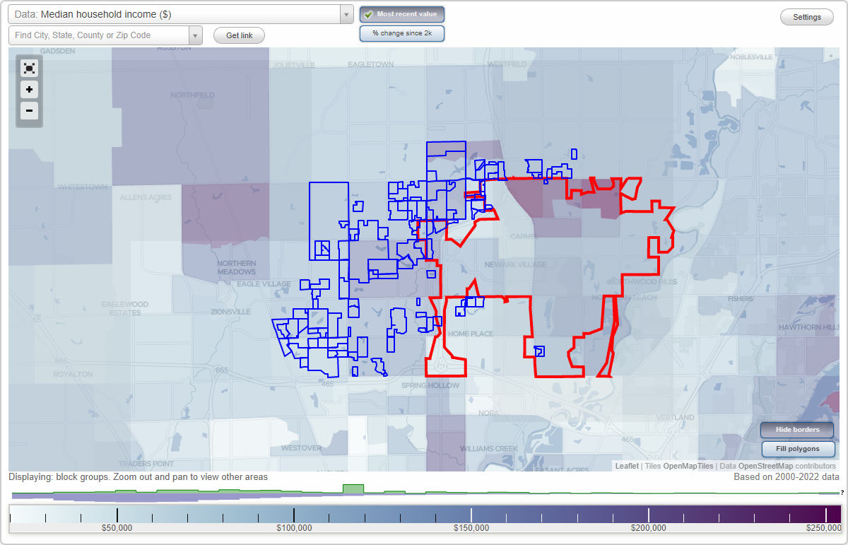
Carmel, Indiana Neighborhood Map - Income, House Prices, Occupations, Boundaries
Settings
X

- City boundary
- Neighborhood boundaries
Business Search - 14 Million verified businesses
Neighborhoods:
Aberdeen Bend, Abney Glen, Annally Downs, Applewood Estates, Ashbrook, Ashbury Park, Autumn Lake, Bainbridge Estates, Ballantrae, Beacon Point, Bella Terra, Bentley Oaks, Bramblewood, Brandywine, Brentwood Village, Bridgewater Club, Bridlebourne, Bridlewood, Brookstone Park of Carmel, Buckhorn, Buckhorn Estates, Camden Walk, Cedar Lake, Chateaux De Moulin, Cheswick Place, Claridge Farm, Clay Springs, Claybridge at Springmill, Crossfields, Deerfield, English Oaks, Estates of Clay West, Greyhound Pass, Guilford Park, Hamilton Wood, Hayden Run, Hayden Run Meadows, High Grove, Hills and Dales, Hunter's Creek Village, Hunters Creek South, Hunters Knoll, Huntersfield, Huntington Chase, King's Mill, Kingsborough, Lakes of Towne Road, Larkspur, Laurel Lakes, Laurel Ridge, Meridian, Oak Tree, Park at Weston Place, Parks at Springmill, Pine Lake Estates, Ponds, Queens Manor, Rohrer Meadows, Rohrer Woods, Saddlebrook at Shelborne, Sandybrook, Setters Run, Shadow Lakes, Shadybrook, Shelborne Green, Spring Arbor, Spring Farms, Spring Lake Estates, Spring Meadows, Spring Mill, Spring Mill Place, Springmill Crossing, Springmill Ponds, Springmill Ridge, Springmill Streams, Springwood, Sutton Place, Taylor Trace, The Westons, Thistlewood, Townhomes at Hunters Creek, Treesdale, Village Farms, Village Park Estates, Village of Mount Carmel, Village of Towne Pointe, Village of West Clay, Villages at Weston Place, Walnut Creek Woods, Waterwood of Carmel, West Carmel Center, Westchase, Westfield Farms, Weston Ridge, Westpark at Springmill, Westwood Estates, Wexley Chase, Williams Mill, Windemere, Windsor Grove, Wood Park, Woods at Williams CreekAberdeen Bend neighborhood in Carmel statistics: (Find on map)
Area: 0.056 square miles
Roads and streets: Birkenstock St; Trumen Ct; Petronia Ct.
Aberdeen Bend neighborhood detailed profile
Area: 0.056 square miles
Roads and streets: Birkenstock St; Trumen Ct; Petronia Ct.
Aberdeen Bend neighborhood detailed profile
Abney Glen neighborhood in Carmel statistics: (Find on map)
Area: 0.058 square miles
Roads and streets: Abney Point Dr.
Abney Glen neighborhood detailed profile
Area: 0.058 square miles
Roads and streets: Abney Point Dr.
Abney Glen neighborhood detailed profile
Annally Downs neighborhood in Carmel statistics: (Find on map)
Area: 0.064 square miles
Roads and streets: Annally Dr; Connaught Dr.
Annally Downs neighborhood detailed profile
Area: 0.064 square miles
Roads and streets: Annally Dr; Connaught Dr.
Annally Downs neighborhood detailed profile
Applewood Estates neighborhood in Carmel statistics: (Find on map)
Area: 0.016 square miles
Population: 33
Population density:
Median household income in 2021:
Median rent in in 2021:
Male vs Females
Median age
Housing prices:
Average estimated value of detached houses in 2021 (73.3% of all units):
Average estimated value of townhouses or other attached units in 2021 (13.3% of all units):
Most popular occupations of males: service occupations (18.5%); business and financial operations occupations (13.3%); management occupations (except farmers) (13.2%); sales and office occupations (13.1%); computer and mathematical occupations (10.1%); construction, extraction, and maintenance occupations (8.1%); architecture and engineering occupations (7.8%)
Most popular occupations of females: service occupations (24.0%); sales and office occupations (20.3%); business and financial operations occupations (19.5%); education, training, and library occupations (7.7%); healthcare practitioners and technical occupations (6.4%); arts, design, entertainment, sports, and media occupations (5.7%); community and social services occupations (4.1%)
Roads and streets: Applewood Cir; Blossom Way.
Applewood Estates neighborhood detailed profile
Area: 0.016 square miles
Population: 33
Population density:
| Applewood Estates: | 2,059 people per square mile |
| Carmel: | 5,658 people per square mile |
Median household income in 2021:
| Applewood Estates: | $81,096 |
| Carmel: | $106,990 |
Median rent in in 2021:
| Applewood Estates: | $926 |
| Carmel: | $1,211 |
Male vs Females
| Males: | 16 |
| Females: | 17 |
Median age
| Males: | 40.8 years |
| Females: | 45.8 years |
Housing prices:
Average estimated value of detached houses in 2021 (73.3% of all units):
| Applewood Estates: | $247,108 |
| Indiana: | $227,058 |
Average estimated value of townhouses or other attached units in 2021 (13.3% of all units):
| This neighborhood: | $390,833 |
| Indiana: | $203,135 |
Most popular occupations of males: service occupations (18.5%); business and financial operations occupations (13.3%); management occupations (except farmers) (13.2%); sales and office occupations (13.1%); computer and mathematical occupations (10.1%); construction, extraction, and maintenance occupations (8.1%); architecture and engineering occupations (7.8%)
Most popular occupations of females: service occupations (24.0%); sales and office occupations (20.3%); business and financial operations occupations (19.5%); education, training, and library occupations (7.7%); healthcare practitioners and technical occupations (6.4%); arts, design, entertainment, sports, and media occupations (5.7%); community and social services occupations (4.1%)
Roads and streets: Applewood Cir; Blossom Way.
Applewood Estates neighborhood detailed profile
Ashbrook neighborhood in Carmel statistics: (Find on map)
Area: 0.138 square miles
Roads and streets: Carwinion Way; Trewithen Ln; Penjerrack Ct; Penzance Pl; Trebah Cir; Caerhays Ct; Bosloe Dr; Bosahan Ct; Trerice Pl.
Other features: Crooked Crk.
Ashbrook neighborhood detailed profile
Area: 0.138 square miles
Roads and streets: Carwinion Way; Trewithen Ln; Penjerrack Ct; Penzance Pl; Trebah Cir; Caerhays Ct; Bosloe Dr; Bosahan Ct; Trerice Pl.
Other features: Crooked Crk.
Ashbrook neighborhood detailed profile
Ashbury Park neighborhood in Carmel statistics: (Find on map)
Area: 0.056 square miles
Roads and streets: Allenhurst Cir; Edison Way; Ashbury Dr; Belford Ct.
Ashbury Park neighborhood detailed profile
Area: 0.056 square miles
Roads and streets: Allenhurst Cir; Edison Way; Ashbury Dr; Belford Ct.
Ashbury Park neighborhood detailed profile
Autumn Lake neighborhood in Carmel statistics: (Find on map)
Area: 0.018 square miles
Roads and streets: Leafy Branch Trl; Seasons Bend.
Autumn Lake neighborhood detailed profile
Area: 0.018 square miles
Roads and streets: Leafy Branch Trl; Seasons Bend.
Autumn Lake neighborhood detailed profile
Bainbridge Estates neighborhood in Carmel statistics: (Find on map)
Area: 0.017 square miles
Bainbridge Estates neighborhood detailed profile
Area: 0.017 square miles
Bainbridge Estates neighborhood detailed profile
Ballantrae neighborhood in Carmel statistics: (Find on map)
Area: 0.007 square miles
Ballantrae neighborhood detailed profile
Area: 0.007 square miles
Ballantrae neighborhood detailed profile
Beacon Point neighborhood in Carmel statistics: (Find on map)
Area: 0.082 square miles
Roads and streets: Beacon Blvd; Beacon Way; Beacon Ct.
Beacon Point neighborhood detailed profile
Area: 0.082 square miles
Roads and streets: Beacon Blvd; Beacon Way; Beacon Ct.
Beacon Point neighborhood detailed profile
Bella Terra neighborhood in Carmel statistics: (Find on map)
Area: 0.012 square miles
Bella Terra neighborhood detailed profile
Area: 0.012 square miles
Bella Terra neighborhood detailed profile
Bentley Oaks neighborhood in Carmel statistics: (Find on map)
Area: 0.027 square miles
Roads and streets: Bentley Way; Silver Spr.
Bentley Oaks neighborhood detailed profile
Area: 0.027 square miles
Roads and streets: Bentley Way; Silver Spr.
Bentley Oaks neighborhood detailed profile
Bramblewood neighborhood in Carmel statistics: (Find on map)
Area: 0.030 square miles
Roads and streets: Sunwood Way; Prairiewood Way; Fallwood Way; Bramblewood Way.
Bramblewood neighborhood detailed profile
Area: 0.030 square miles
Roads and streets: Sunwood Way; Prairiewood Way; Fallwood Way; Bramblewood Way.
Bramblewood neighborhood detailed profile
Brandywine neighborhood in Carmel statistics: (Find on map)
Area: 0.069 square miles
Roads and streets: Shelbourne Ct; Brandywine Cir; Brandywine Ct.
Brandywine neighborhood detailed profile
Area: 0.069 square miles
Roads and streets: Shelbourne Ct; Brandywine Cir; Brandywine Ct.
Brandywine neighborhood detailed profile
Brentwood Village neighborhood in Carmel statistics: (Find on map)
Area: 0.031 square miles
Roads and streets: Deerwood Dr; Fernwood Dr; Lockwood Dr; Eaglewood Ct.
Brentwood Village neighborhood detailed profile
Area: 0.031 square miles
Roads and streets: Deerwood Dr; Fernwood Dr; Lockwood Dr; Eaglewood Ct.
Brentwood Village neighborhood detailed profile
Bridgewater Club neighborhood in Carmel statistics: (Find on map)
Area: 0.031 square miles
Roads and streets: Kampen Cir.
Bridgewater Club neighborhood detailed profile
Area: 0.031 square miles
Roads and streets: Kampen Cir.
Bridgewater Club neighborhood detailed profile
Bridlebourne neighborhood in Carmel statistics: (Find on map)
Area: 0.260 square miles
Roads and streets: Sedgemoor Cir; Hintocks Cir; W Sedgemoor Cir; S Sedgemoor Cir; N Hintock Dr.
Other features: Well Run.
Bridlebourne neighborhood detailed profile
Area: 0.260 square miles
Roads and streets: Sedgemoor Cir; Hintocks Cir; W Sedgemoor Cir; S Sedgemoor Cir; N Hintock Dr.
Other features: Well Run.
Bridlebourne neighborhood detailed profile
Bridlewood neighborhood in Carmel statistics: (Find on map)
Area: 0.118 square miles
Roads and streets: Curry Ln; Horseshoe Dr; Saddlehorn Dr; Bridlewood Dr; Windmill Dr; Bridlewood Ln; Saddlehorn Ct; Bridlewood Cir; Windmill Cir.
Other features: Cool Crk.
Bridlewood neighborhood detailed profile
Area: 0.118 square miles
Roads and streets: Curry Ln; Horseshoe Dr; Saddlehorn Dr; Bridlewood Dr; Windmill Dr; Bridlewood Ln; Saddlehorn Ct; Bridlewood Cir; Windmill Cir.
Other features: Cool Crk.
Bridlewood neighborhood detailed profile
Brookstone Park of Carmel neighborhood in Carmel statistics: (Find on map)
Area: 0.071 square miles
Roads and streets: Baldwin Ln; Brackney Ln; Hinault Way; Holden Ct; Midway Ct; Welford Way.
Brookstone Park of Carmel neighborhood detailed profile
Area: 0.071 square miles
Roads and streets: Baldwin Ln; Brackney Ln; Hinault Way; Holden Ct; Midway Ct; Welford Way.
Brookstone Park of Carmel neighborhood detailed profile
Buckhorn neighborhood in Carmel statistics: (Find on map)
Area: 0.084 square miles
Roads and streets: Stone Dr; Beringer Ln; Wellesley Ln; Jameson Ln; Buckhorn Dr.
Buckhorn neighborhood detailed profile
Area: 0.084 square miles
Roads and streets: Stone Dr; Beringer Ln; Wellesley Ln; Jameson Ln; Buckhorn Dr.
Buckhorn neighborhood detailed profile
Buckhorn Estates neighborhood in Carmel statistics: (Find on map)
Area: 0.060 square miles
Roads and streets: Deer Lake Dr; Doe Run Dr; Fawn View Dr; Brookstone Dr; Staghorn Dr.
Buckhorn Estates neighborhood detailed profile
Area: 0.060 square miles
Roads and streets: Deer Lake Dr; Doe Run Dr; Fawn View Dr; Brookstone Dr; Staghorn Dr.
Buckhorn Estates neighborhood detailed profile
Camden Walk neighborhood in Carmel statistics: (Find on map)
Area: 0.049 square miles
Roads and streets: Turning Leaf Ln; Silver Oaks Dr.
Camden Walk neighborhood detailed profile
Area: 0.049 square miles
Roads and streets: Turning Leaf Ln; Silver Oaks Dr.
Camden Walk neighborhood detailed profile
Cedar Lake neighborhood in Carmel statistics: (Find on map)
Area: 0.029 square miles
Roads and streets: Jeffrey Ct W.
Cedar Lake neighborhood detailed profile
Area: 0.029 square miles
Roads and streets: Jeffrey Ct W.
Cedar Lake neighborhood detailed profile
Chateaux De Moulin neighborhood in Carmel statistics: (Find on map)
Area: 0.015 square miles
Chateaux De Moulin neighborhood detailed profile
Area: 0.015 square miles
Chateaux De Moulin neighborhood detailed profile
Cheswick Place neighborhood in Carmel statistics: (Find on map)
Area: 0.167 square miles
Roads and streets: Broad Mdw (Broad Meadow); Cheswick Blvd; Summer Hill; Twelve Oaks (12 Oaks); Sable Run; Rosemont; Princeton Gate; Frenchman's Creek; Pine Hill Way; Fox Cir (Foxfire Cir); Singletree Ct; N Songletree Ct; Brookstone Dr; Frenchmans Creek.
Cheswick Place neighborhood detailed profile
Claridge Farm neighborhood in Carmel statistics: (Find on map)
Area: 0.256 square miles
Roads and streets: Helford Ln; N Claridge Way; Glendurgan Dr; Pembrooke Cir; Gwynmere Run; Chyverton Cir.
Other features: Will Crk.
Claridge Farm neighborhood detailed profile
Area: 0.256 square miles
Roads and streets: Helford Ln; N Claridge Way; Glendurgan Dr; Pembrooke Cir; Gwynmere Run; Chyverton Cir.
Other features: Will Crk.
Claridge Farm neighborhood detailed profile
Clay Springs neighborhood in Carmel statistics: (Find on map)
Area: 0.063 square miles
Roads and streets: Clay Springs Dr; Angelique Ct; Hyacinth Way; Amethyst Cir; Prairie Rose.
Other features: Will Crk.
Clay Springs neighborhood detailed profile
Area: 0.063 square miles
Roads and streets: Clay Springs Dr; Angelique Ct; Hyacinth Way; Amethyst Cir; Prairie Rose.
Other features: Will Crk.
Clay Springs neighborhood detailed profile
Claybridge at Springmill neighborhood in Carmel statistics: (Find on map)
Area: 0.102 square miles
Roads and streets: Suffolk Ln; Norfolk Ln; Mayfair Ln; Norfolk Cir; Kent Ct.
Other features: Elliot Crk.
Claybridge at Springmill neighborhood detailed profile
Area: 0.102 square miles
Roads and streets: Suffolk Ln; Norfolk Ln; Mayfair Ln; Norfolk Cir; Kent Ct.
Other features: Elliot Crk.
Claybridge at Springmill neighborhood detailed profile
Crossfields neighborhood in Carmel statistics: (Find on map)
Area: 0.121 square miles
Roads and streets: Durbin Dr (Durbin Pl); W 24th (Towne Rd); Crossfields Dr; Crossfields Ct; Scarborough Ln; Durbin Ct.
Crossfields neighborhood detailed profile
Area: 0.121 square miles
Roads and streets: Durbin Dr (Durbin Pl); W 24th (Towne Rd); Crossfields Dr; Crossfields Ct; Scarborough Ln; Durbin Ct.
Crossfields neighborhood detailed profile
Deerfield neighborhood in Carmel statistics: (Find on map)
Area: 0.084 square miles
Roads and streets: Deerfield Cir; Culpepper Dr; Royalton Dr; Brandon Ct.
Deerfield neighborhood detailed profile
Area: 0.084 square miles
Roads and streets: Deerfield Cir; Culpepper Dr; Royalton Dr; Brandon Ct.
Deerfield neighborhood detailed profile
English Oaks neighborhood in Carmel statistics: (Find on map)
Area: 0.032 square miles
Roads and streets: Corsham Cir; English Oaks Dr; Stratton Cir.
English Oaks neighborhood detailed profile
Area: 0.032 square miles
Roads and streets: Corsham Cir; English Oaks Dr; Stratton Cir.
English Oaks neighborhood detailed profile
Estates of Clay West neighborhood in Carmel statistics: (Find on map)
Area: 0.068 square miles
Estates of Clay West neighborhood detailed profile
Area: 0.068 square miles
Estates of Clay West neighborhood detailed profile
Greyhound Pass neighborhood in Carmel statistics: (Find on map)
Area: 0.077 square miles
Highways in this neighborhood: US Hwy 31 (N Meridian St).
Roads and streets: Western Way; E Greyhound Pass (Gray Hound Ct); Jefferson Sq (N Range Line Rd); E 146th St (Gray Rd W, W Gray Rd); Frontage Rd; 146th St; W 146th St; Clay Terrace Blvd.
Greyhound Pass neighborhood detailed profile
Guilford Park neighborhood in Carmel statistics: (Find on map)
Area: 0.054 square miles
Population: 113
Population density:
Median household income in 2021:
Median rent in in 2021:
Male vs Females
Median age
Housing prices:
Average estimated value of detached houses in 2021 (73.1% of all units):
Average estimated value of townhouses or other attached units in 2021 (13.5% of all units):
Most popular occupations of males: service occupations (18.5%); business and financial operations occupations (13.3%); management occupations (except farmers) (13.2%); sales and office occupations (13.1%); computer and mathematical occupations (10.1%); construction, extraction, and maintenance occupations (8.1%); architecture and engineering occupations (7.8%)
Most popular occupations of females: service occupations (24.0%); sales and office occupations (20.3%); business and financial operations occupations (19.5%); education, training, and library occupations (7.7%); healthcare practitioners and technical occupations (6.4%); arts, design, entertainment, sports, and media occupations (5.7%); community and social services occupations (4.1%)
Roads and streets: Senie Ln; McKenzie Pkwy; Perkins St; Scheel Ln; Stansfield Dr; Woodview North Dr.
Guilford Park neighborhood detailed profile
Area: 0.054 square miles
Population: 113
Population density:
| Guilford Park: | 2,104 people per square mile |
| Carmel: | 5,658 people per square mile |
Median household income in 2021:
| Guilford Park: | $81,096 |
| Carmel: | $106,990 |
Median rent in in 2021:
| Guilford Park: | $926 |
| Carmel: | $1,211 |
Male vs Females
| Males: | 55 |
| Females: | 57 |
Median age
| Males: | 40.8 years |
| Females: | 45.8 years |
Housing prices:
Average estimated value of detached houses in 2021 (73.1% of all units):
| Guilford Park: | $247,108 |
| Indiana: | $227,058 |
Average estimated value of townhouses or other attached units in 2021 (13.5% of all units):
| This neighborhood: | $390,833 |
| Indiana: | $203,135 |
Most popular occupations of males: service occupations (18.5%); business and financial operations occupations (13.3%); management occupations (except farmers) (13.2%); sales and office occupations (13.1%); computer and mathematical occupations (10.1%); construction, extraction, and maintenance occupations (8.1%); architecture and engineering occupations (7.8%)
Most popular occupations of females: service occupations (24.0%); sales and office occupations (20.3%); business and financial operations occupations (19.5%); education, training, and library occupations (7.7%); healthcare practitioners and technical occupations (6.4%); arts, design, entertainment, sports, and media occupations (5.7%); community and social services occupations (4.1%)
Roads and streets: Senie Ln; McKenzie Pkwy; Perkins St; Scheel Ln; Stansfield Dr; Woodview North Dr.
Guilford Park neighborhood detailed profile
Hamilton Wood neighborhood in Carmel statistics: (Find on map)
Area: 0.011 square miles
Population: 23
Population density:
Median household income in 2021:
Median rent in in 2021:
Male vs Females
Median age
Housing prices:
Average estimated value of detached houses in 2021 (70.0% of all units):
Average estimated value of townhouses or other attached units in 2021 (10.0% of all units):
Most popular occupations of males: service occupations (18.5%); business and financial operations occupations (13.3%); management occupations (except farmers) (13.2%); sales and office occupations (13.1%); computer and mathematical occupations (10.1%); construction, extraction, and maintenance occupations (8.1%); architecture and engineering occupations (7.8%)
Most popular occupations of females: service occupations (24.0%); sales and office occupations (20.3%); business and financial operations occupations (19.5%); education, training, and library occupations (7.7%); healthcare practitioners and technical occupations (6.4%); arts, design, entertainment, sports, and media occupations (5.7%); community and social services occupations (4.1%)
Hamilton Wood neighborhood detailed profile
Area: 0.011 square miles
Population: 23
Population density:
| Hamilton Wood: | 2,065 people per square mile |
| Carmel: | 5,658 people per square mile |
Median household income in 2021:
| Hamilton Wood: | $81,096 |
| Carmel: | $106,990 |
Median rent in in 2021:
| Hamilton Wood: | $926 |
| Carmel: | $1,211 |
Male vs Females
| Males: | 11 |
| Females: | 11 |
Median age
| Males: | 40.8 years |
| Females: | 45.8 years |
Housing prices:
Average estimated value of detached houses in 2021 (70.0% of all units):
| Hamilton Wood: | $247,108 |
| Indiana: | $227,058 |
Average estimated value of townhouses or other attached units in 2021 (10.0% of all units):
| This neighborhood: | $390,833 |
| Indiana: | $203,135 |
Most popular occupations of males: service occupations (18.5%); business and financial operations occupations (13.3%); management occupations (except farmers) (13.2%); sales and office occupations (13.1%); computer and mathematical occupations (10.1%); construction, extraction, and maintenance occupations (8.1%); architecture and engineering occupations (7.8%)
Most popular occupations of females: service occupations (24.0%); sales and office occupations (20.3%); business and financial operations occupations (19.5%); education, training, and library occupations (7.7%); healthcare practitioners and technical occupations (6.4%); arts, design, entertainment, sports, and media occupations (5.7%); community and social services occupations (4.1%)
Hamilton Wood neighborhood detailed profile
Hayden Run neighborhood in Carmel statistics: (Find on map)
Area: 0.076 square miles
Roads and streets: Wildman Ln; Tuscany Blvd (Tuscany Dr); Reedy Ct.
Hayden Run neighborhood detailed profile
Area: 0.076 square miles
Roads and streets: Wildman Ln; Tuscany Blvd (Tuscany Dr); Reedy Ct.
Hayden Run neighborhood detailed profile
Hayden Run Meadows neighborhood in Carmel statistics: (Find on map)
Area: 2.010 square miles
Roads and streets: W 24th (Towne Rd); W 131st St; W 126th St; Tuscany Blvd (Tuscany Dr); Lorenzo Blvd; Grafton St; Buckland St; Beckwith Dr; Roma Bend; Wildman Ln; Birkenstock St; Sedgwick Ln; Manigault St; Tram Ln; Congress St; St Julian St; Ashworth St; Gwinwett St; Lincolnshire Blvd; Bellshire Ln; Kilkenny Cir; Reedy Ct; Donegal Cir; Tralee Ct; Vanderhorse St; Aberdeen Bend; Woodley St; Trumen Ct; Camillo Ct; Forsythe St; Glebe St; Rhett St; Malcombe St; Petronia Ct; Troupe St; Tantara Bend; Alcott St; Freenza Ct; Forsyte St; Wexley Ct; Pettigru Dr.
Other features: Long Br.
Hayden Run Meadows neighborhood detailed profile
High Grove neighborhood in Carmel statistics: (Find on map)
Area: 0.039 square miles
Roads and streets: Braeburn Dr; Redgold Run; Winesap Way; Bramley Ct.
High Grove neighborhood detailed profile
Area: 0.039 square miles
Roads and streets: Braeburn Dr; Redgold Run; Winesap Way; Bramley Ct.
High Grove neighborhood detailed profile
Hills and Dales neighborhood in Carmel statistics: (Find on map)
Area: 0.052 square miles
Roads and streets: Corral Ct; Wheatfield Ln.
Railroad features: Louisville and Nashville RR.
Hills and Dales neighborhood detailed profile
Area: 0.052 square miles
Roads and streets: Corral Ct; Wheatfield Ln.
Railroad features: Louisville and Nashville RR.
Hills and Dales neighborhood detailed profile
Hunter's Creek Village neighborhood in Carmel statistics: (Find on map)
Area: 0.154 square miles
Roads and streets: Bennett Rd; Saddleback Dr; Oak Ridge Rd; Bennett Ct; Winter Ct; Bridle Cir; Winter Way; Bridle Ct; Howe Dr; E 146th St (Gray Rd W).
Hunter's Creek Village neighborhood detailed profile
Area: 0.154 square miles
Roads and streets: Bennett Rd; Saddleback Dr; Oak Ridge Rd; Bennett Ct; Winter Ct; Bridle Cir; Winter Way; Bridle Ct; Howe Dr; E 146th St (Gray Rd W).
Hunter's Creek Village neighborhood detailed profile
Hunters Creek South neighborhood in Carmel statistics: (Find on map)
Area: 0.089 square miles
Roads and streets: Marana Dr; Nevele Ln; Laredo Dr; Perrin Dr; Langley Dr; Roswell Dr; Scott Dr; Offutt Dr; Langley Ct.
Hunters Creek South neighborhood detailed profile
Area: 0.089 square miles
Roads and streets: Marana Dr; Nevele Ln; Laredo Dr; Perrin Dr; Langley Dr; Roswell Dr; Scott Dr; Offutt Dr; Langley Ct.
Hunters Creek South neighborhood detailed profile
Hunters Knoll neighborhood in Carmel statistics: (Find on map)
Area: 0.026 square miles
Roads and streets: Elgin Dr; Nellis Ct.
Hunters Knoll neighborhood detailed profile
Area: 0.026 square miles
Roads and streets: Elgin Dr; Nellis Ct.
Hunters Knoll neighborhood detailed profile
Huntersfield neighborhood in Carmel statistics: (Find on map)
Area: 0.061 square miles
Roads and streets: Steeplechase Dr; Hounds Xing; Barnstable Dr (Barnstable Rd); Windward Way.
Huntersfield neighborhood detailed profile
Area: 0.061 square miles
Roads and streets: Steeplechase Dr; Hounds Xing; Barnstable Dr (Barnstable Rd); Windward Way.
Huntersfield neighborhood detailed profile
Huntington Chase neighborhood in Carmel statistics: (Find on map)
Area: 0.052 square miles
Roads and streets: Westbury Place Dr; Sutton Place Dr E; Braemer Ct; Greystone Ct; Newbridge Ct; Belmont Ct (Belmont Dr).
Huntington Chase neighborhood detailed profile
Area: 0.052 square miles
Roads and streets: Westbury Place Dr; Sutton Place Dr E; Braemer Ct; Greystone Ct; Newbridge Ct; Belmont Ct (Belmont Dr).
Huntington Chase neighborhood detailed profile
King's Mill neighborhood in Carmel statistics: (Find on map)
Area: 0.174 square miles
Roads and streets: Knight Dr; King's Mill Dr; Winterset Dr; Diamond Dr; Topaz Ln; Onyx Dr; Cameo Dr; Kings Ct; Jewel Ln; Palace Ct; Jasmine Ct (Jasmine Dr); Ruby Ct; Crown Ct.
Other features: Well Run.
King's Mill neighborhood detailed profile
Area: 0.174 square miles
Roads and streets: Knight Dr; King's Mill Dr; Winterset Dr; Diamond Dr; Topaz Ln; Onyx Dr; Cameo Dr; Kings Ct; Jewel Ln; Palace Ct; Jasmine Ct (Jasmine Dr); Ruby Ct; Crown Ct.
Other features: Well Run.
King's Mill neighborhood detailed profile
Kingsborough neighborhood in Carmel statistics: (Find on map)
Area: 0.102 square miles
Roads and streets: Kingsgate Dr; Ivybridge Dr; Newcastle Dr; Kirklees Dr; Pepin Pl; Ledgerwood Way; Wicksworth Way; Welford Way; Trailwind Ct; Saffron Cir.
Kingsborough neighborhood detailed profile
Area: 0.102 square miles
Roads and streets: Kingsgate Dr; Ivybridge Dr; Newcastle Dr; Kirklees Dr; Pepin Pl; Ledgerwood Way; Wicksworth Way; Welford Way; Trailwind Ct; Saffron Cir.
Kingsborough neighborhood detailed profile
Lakes of Towne Road neighborhood in Carmel statistics: (Find on map)
Area: 0.031 square miles
Lakes of Towne Road neighborhood detailed profile
Area: 0.031 square miles
Lakes of Towne Road neighborhood detailed profile
Larkspur neighborhood in Carmel statistics: (Find on map)
Area: 0.030 square miles
Roads and streets: Nicole Ct.
Larkspur neighborhood detailed profile
Area: 0.030 square miles
Roads and streets: Nicole Ct.
Larkspur neighborhood detailed profile
Laurel Lakes neighborhood in Carmel statistics: (Find on map)
Area: 0.254 square miles
Roads and streets: W 24th (Towne Rd); Durbin Dr (Durbin Pl); Winfield Dr; Laurel Lakes Blvd; Crossfields Dr; W 116th St; Ashcroft Pl; Burnham Walk; Hopwood Dr; Derek Dr; Crossfields Ct; Warrenburg Way; Scarborough Ln; Bennington Trce; Gaskin Way; Manington Way; Ellingwood Dr; Durbin Ct.
Laurel Lakes neighborhood detailed profile
Laurel Ridge neighborhood in Carmel statistics: (Find on map)
Area: 0.070 square miles
Laurel Ridge neighborhood detailed profile
Area: 0.070 square miles
Laurel Ridge neighborhood detailed profile
Meridian neighborhood in Carmel statistics: (Find on map)
Area: 0.048 square miles
Population: 101
Population density:
Median household income in 2021:
Median rent in in 2021:
Male vs Females
Median age
Housing prices:
Average estimated value of detached houses in 2021 (73.9% of all units):
Average estimated value of townhouses or other attached units in 2021 (13.0% of all units):
Most popular occupations of males: service occupations (18.5%); business and financial operations occupations (13.3%); management occupations (except farmers) (13.2%); sales and office occupations (13.1%); computer and mathematical occupations (10.1%); construction, extraction, and maintenance occupations (8.1%); architecture and engineering occupations (7.8%)
Most popular occupations of females: service occupations (24.0%); sales and office occupations (20.3%); business and financial operations occupations (19.5%); education, training, and library occupations (7.7%); healthcare practitioners and technical occupations (6.4%); arts, design, entertainment, sports, and media occupations (5.7%); community and social services occupations (4.1%)
Roads and streets: Liverpool Dr; Tottenham Dr; Merecy Ct (Mersey Ct); Humber Ct; Manchester Ct.
Meridian neighborhood detailed profile
Area: 0.048 square miles
Population: 101
Population density:
| Meridian: | 2,094 people per square mile |
| Carmel: | 5,658 people per square mile |
Median household income in 2021:
| Meridian: | $81,096 |
| Carmel: | $106,990 |
Median rent in in 2021:
| Meridian: | $926 |
| Carmel: | $1,211 |
Male vs Females
| Males: | 50 |
| Females: | 51 |
Median age
| Males: | 40.8 years |
| Females: | 45.8 years |
Housing prices:
Average estimated value of detached houses in 2021 (73.9% of all units):
| Meridian: | $247,108 |
| Indiana: | $227,058 |
Average estimated value of townhouses or other attached units in 2021 (13.0% of all units):
| This neighborhood: | $390,833 |
| Indiana: | $203,135 |
Most popular occupations of males: service occupations (18.5%); business and financial operations occupations (13.3%); management occupations (except farmers) (13.2%); sales and office occupations (13.1%); computer and mathematical occupations (10.1%); construction, extraction, and maintenance occupations (8.1%); architecture and engineering occupations (7.8%)
Most popular occupations of females: service occupations (24.0%); sales and office occupations (20.3%); business and financial operations occupations (19.5%); education, training, and library occupations (7.7%); healthcare practitioners and technical occupations (6.4%); arts, design, entertainment, sports, and media occupations (5.7%); community and social services occupations (4.1%)
Roads and streets: Liverpool Dr; Tottenham Dr; Merecy Ct (Mersey Ct); Humber Ct; Manchester Ct.
Meridian neighborhood detailed profile
Oak Tree neighborhood in Carmel statistics: (Find on map)
Area: 0.044 square miles
Oak Tree neighborhood detailed profile
Area: 0.044 square miles
Oak Tree neighborhood detailed profile
Park at Weston Place neighborhood in Carmel statistics: (Find on map)
Area: 0.136 square miles
Roads and streets: Weston Dr; Independence Way; Gettysburg Pl; Consitution Dr; Putnam Pl; Brigade Cir; Vanguard Cir; Marion Ct; Richmond Ct; Freeman Ct.
Park at Weston Place neighborhood detailed profile
Area: 0.136 square miles
Roads and streets: Weston Dr; Independence Way; Gettysburg Pl; Consitution Dr; Putnam Pl; Brigade Cir; Vanguard Cir; Marion Ct; Richmond Ct; Freeman Ct.
Park at Weston Place neighborhood detailed profile
Parks at Springmill neighborhood in Carmel statistics: (Find on map)
Area: 0.139 square miles
Roads and streets: Wyndotte Dr; Clifty Falls Dr; Kingsbury Dr; Dunes Dr; Shakamac Dr; Versailles Dr; Pokagon Dr; Mounds Ct; Winamac Ct; Shades Ct.
Parks at Springmill neighborhood detailed profile
Area: 0.139 square miles
Roads and streets: Wyndotte Dr; Clifty Falls Dr; Kingsbury Dr; Dunes Dr; Shakamac Dr; Versailles Dr; Pokagon Dr; Mounds Ct; Winamac Ct; Shades Ct.
Parks at Springmill neighborhood detailed profile
Pine Lake Estates neighborhood in Carmel statistics: (Find on map)
Area: 0.065 square miles
Roads and streets: Towne Dr; Bay Ct; Towne Ln; Circle Ct; Fairwind Ct.
Pine Lake Estates neighborhood detailed profile
Area: 0.065 square miles
Roads and streets: Towne Dr; Bay Ct; Towne Ln; Circle Ct; Fairwind Ct.
Pine Lake Estates neighborhood detailed profile
Ponds neighborhood in Carmel statistics: (Find on map)
Area: 0.195 square miles
Roads and streets: Twin Oaks Dr; Ponds Pointe Dr; Whisper Wind Dr; Spring Mill Rd (Springmill Rd); Quail Pointe Dr; Morningbird Ct; Misty Pine Ct; Baytree Ct; Thomas Dr; Billy Creek Ct; Lazy Hollow Ln.
Other features: Williams Crk.
Ponds neighborhood detailed profile
Area: 0.195 square miles
Roads and streets: Twin Oaks Dr; Ponds Pointe Dr; Whisper Wind Dr; Spring Mill Rd (Springmill Rd); Quail Pointe Dr; Morningbird Ct; Misty Pine Ct; Baytree Ct; Thomas Dr; Billy Creek Ct; Lazy Hollow Ln.
Other features: Williams Crk.
Ponds neighborhood detailed profile
Queens Manor neighborhood in Carmel statistics: (Find on map)
Area: 0.254 square miles
Roads and streets: Queens Way Cir; Royal Dr; Regal Dr.
Queens Manor neighborhood detailed profile
Area: 0.254 square miles
Roads and streets: Queens Way Cir; Royal Dr; Regal Dr.
Queens Manor neighborhood detailed profile
Rohrer Meadows neighborhood in Carmel statistics: (Find on map)
Area: 0.031 square miles
Roads and streets: Grace Dr; Joanne Ct; George Ct; Jeffrey Ct.
Rohrer Meadows neighborhood detailed profile
Area: 0.031 square miles
Roads and streets: Grace Dr; Joanne Ct; George Ct; Jeffrey Ct.
Rohrer Meadows neighborhood detailed profile
Rohrer Woods neighborhood in Carmel statistics: (Find on map)
Area: 0.270 square miles
Roads and streets: Nevele Ln; Rohrer Rd; Grace Dr; Howe Dr; Saddleback Dr; Bennett Rd; Bennett Ct; Oak Ridge Rd; Winter Ct; Bridle Cir; Cedar Lake Ct; Winter Way; Bridle Ct; Kent Ln; Jeffrey Ct W; Joanne Ct; George Ct; Jeffrey Ct; Oak Ridge Ct; Grace Ct; Meadow Cres.
Rohrer Woods neighborhood detailed profile
Saddlebrook at Shelborne neighborhood in Carmel statistics: (Find on map)
Area: 0.093 square miles
Roads and streets: Whispering Pines Dr.
Saddlebrook at Shelborne neighborhood detailed profile
Area: 0.093 square miles
Roads and streets: Whispering Pines Dr.
Saddlebrook at Shelborne neighborhood detailed profile
Sandybrook neighborhood in Carmel statistics: (Find on map)
Area: 0.025 square miles
Population: 8
Population density:
Median household income in 2021:
Median rent in in 2021:
Male vs Females
Median age
Most popular occupations of males: sales and office occupations (26.7%); management occupations (except farmers) (15.9%); computer and mathematical occupations (11.2%); architecture and engineering occupations (7.6%); service occupations (6.8%); production occupations (6.5%); business and financial operations occupations (6.0%)
Most popular occupations of females: healthcare practitioners and technical occupations (17.3%); education, training, and library occupations (14.5%); service occupations (14.1%); business and financial operations occupations (13.3%); management occupations (except farmers) (11.0%); sales and office occupations (9.0%); community and social services occupations (5.1%)
Roads and streets: Maqua Ct; Apilta Ct; Kindiawa Ct; Apilita Ct.
Sandybrook neighborhood detailed profile
Area: 0.025 square miles
Population: 8
Population density:
| Sandybrook: | 318 people per square mile |
| Carmel: | 5,658 people per square mile |
Median household income in 2021:
| Sandybrook: | $117,361 |
| Carmel: | $106,990 |
Median rent in in 2021:
| Sandybrook: | $1,120 |
| Carmel: | $1,211 |
Male vs Females
| Males: | 4 |
| Females: | 4 |
Median age
| Males: | 41.1 years |
| Females: | 47.8 years |
Most popular occupations of males: sales and office occupations (26.7%); management occupations (except farmers) (15.9%); computer and mathematical occupations (11.2%); architecture and engineering occupations (7.6%); service occupations (6.8%); production occupations (6.5%); business and financial operations occupations (6.0%)
Most popular occupations of females: healthcare practitioners and technical occupations (17.3%); education, training, and library occupations (14.5%); service occupations (14.1%); business and financial operations occupations (13.3%); management occupations (except farmers) (11.0%); sales and office occupations (9.0%); community and social services occupations (5.1%)
Roads and streets: Maqua Ct; Apilta Ct; Kindiawa Ct; Apilita Ct.
Sandybrook neighborhood detailed profile
Setters Run neighborhood in Carmel statistics: (Find on map)
Area: 0.116 square miles
Roads and streets: Brasseur Ln; Ayers Ln; Elyse Ln; E 40 (Setters Rd); Keller Ter; Wentz Dr; Short Ter; Straley Ct; Shine Ct; Updike Cir; Inez Setters Ln.
Setters Run neighborhood detailed profile
Area: 0.116 square miles
Roads and streets: Brasseur Ln; Ayers Ln; Elyse Ln; E 40 (Setters Rd); Keller Ter; Wentz Dr; Short Ter; Straley Ct; Shine Ct; Updike Cir; Inez Setters Ln.
Setters Run neighborhood detailed profile
Shadow Lakes neighborhood in Carmel statistics: (Find on map)
Area: 0.040 square miles
Roads and streets: E Rosemill Dr; Shadow Lakes Dr E; Shadow Lakes Dr N; Shadow Lakes Dr W.
Shadow Lakes neighborhood detailed profile
Area: 0.040 square miles
Roads and streets: E Rosemill Dr; Shadow Lakes Dr E; Shadow Lakes Dr N; Shadow Lakes Dr W.
Shadow Lakes neighborhood detailed profile
Shadybrook neighborhood in Carmel statistics: (Find on map)
Area: 0.031 square miles
Population: 10
Population density:
Median household income in 2021:
Median rent in in 2021:
Male vs Females
Median age
Most popular occupations of males: sales and office occupations (26.7%); management occupations (except farmers) (15.9%); computer and mathematical occupations (11.2%); architecture and engineering occupations (7.6%); service occupations (6.8%); production occupations (6.5%); business and financial operations occupations (6.0%)
Most popular occupations of females: healthcare practitioners and technical occupations (17.3%); education, training, and library occupations (14.5%); service occupations (14.1%); business and financial operations occupations (13.3%); management occupations (except farmers) (11.0%); sales and office occupations (9.0%); community and social services occupations (5.1%)
Roads and streets: Maswa Ct; Maqua Ct; Chester Rd; Chinquapin Ct.
Shadybrook neighborhood detailed profile
Area: 0.031 square miles
Population: 10
Population density:
| Shadybrook: | 318 people per square mile |
| Carmel: | 5,658 people per square mile |
Median household income in 2021:
| Shadybrook: | $117,361 |
| Carmel: | $106,990 |
Median rent in in 2021:
| Shadybrook: | $1,120 |
| Carmel: | $1,211 |
Male vs Females
| Males: | 5 |
| Females: | 5 |
Median age
| Males: | 41.1 years |
| Females: | 47.8 years |
Most popular occupations of males: sales and office occupations (26.7%); management occupations (except farmers) (15.9%); computer and mathematical occupations (11.2%); architecture and engineering occupations (7.6%); service occupations (6.8%); production occupations (6.5%); business and financial operations occupations (6.0%)
Most popular occupations of females: healthcare practitioners and technical occupations (17.3%); education, training, and library occupations (14.5%); service occupations (14.1%); business and financial operations occupations (13.3%); management occupations (except farmers) (11.0%); sales and office occupations (9.0%); community and social services occupations (5.1%)
Roads and streets: Maswa Ct; Maqua Ct; Chester Rd; Chinquapin Ct.
Shadybrook neighborhood detailed profile
Shelborne Green neighborhood in Carmel statistics: (Find on map)
Area: 0.444 square miles
Roads and streets: Inverness Blvd; Innisbrook Blvd; Greentree Dr; W 96th St; Colonial Dr; Muirfield Way; Fairway Dr; Seminole Dr; Jupiter Pass; Cypress Way; Wentworth Ct; Berry Ct; Towne Dr; Avenel Ct; Sawgrass Ct; Glen Abbe Ct; Innsbrook Blvd; Turnberry Ct; Red Bud Ln; Troon Ct; Fergus Ave; Linkside Ct.
Other features: Trail Crk.
Shelborne Green neighborhood detailed profile
Spring Arbor neighborhood in Carmel statistics: (Find on map)
Area: 0.048 square miles
Roads and streets: Bosloe Dr; Tammer Dr; Tammer Blvd; Zuker Ct; Monty Cir; Lattice Ct.
Spring Arbor neighborhood detailed profile
Area: 0.048 square miles
Roads and streets: Bosloe Dr; Tammer Dr; Tammer Blvd; Zuker Ct; Monty Cir; Lattice Ct.
Spring Arbor neighborhood detailed profile
Spring Farms neighborhood in Carmel statistics: (Find on map)
Area: 0.131 square miles
Roads and streets: Spring Farms Dr; Spring Mill Rd (Springmill Rd); W 131st St; Kingsbury Dr (Shoemaker Dr); Shoemaker Dr; W 136th St; Violet Way; Joseph Way; Freehold Ct; Ira Way; Mari Way; Irwin Way; Lois Way.
Other features: Williams Crk.
Spring Farms neighborhood detailed profile
Spring Lake Estates neighborhood in Carmel statistics: (Find on map)
Area: 0.039 square miles
Roads and streets: Pintail Ct; Mallard Ct; Teal Ln.
Spring Lake Estates neighborhood detailed profile
Area: 0.039 square miles
Roads and streets: Pintail Ct; Mallard Ct; Teal Ln.
Spring Lake Estates neighborhood detailed profile
Spring Meadows neighborhood in Carmel statistics: (Find on map)
Area: 0.009 square miles
Roads and streets: E Springmeadow Ln; Meadowcreek Dr; N Meadowcreek Dr.
Spring Meadows neighborhood detailed profile
Area: 0.009 square miles
Roads and streets: E Springmeadow Ln; Meadowcreek Dr; N Meadowcreek Dr.
Spring Meadows neighborhood detailed profile
Spring Mill neighborhood in Carmel statistics: (Find on map)
Area: 1.957 square miles
Roads and streets: Oak Ridge Rd; Adios Pass; W Greyhound Pass; W 146th St (Gray Rd W); E Columbine Ln; Senator Way; E Village Dr; Springmill Blvd; Springmill Ponds Cir; Springmill Ponds Blvd; Sapphire Dr; Haldale Dr; Old Mill Cir; W Tansey Xing; Bennett Dr; E 156th St; W 136th St; Stony Creek Cir; Bloomfield Ln; W Columbine Ln; Park View Rd; Sulky Way; Silverstream Dr; Cyclamen Chase; Worth Ct; Harmony Rd; W Hayde Dr (Haydn Dr); Viburnum Run; Stonemill Cir E; Sedona Dr; Bennett Rd; E Admiral Way S; Romalong Ln; E Laredo Way S; Wildflower Ln; Abbedale Ct; Fox Ln; E 136th St (W Smokey Row Rd); Amkey Way; Memory Ln; Count Fleet Ct; Strauss Dr; Stonemill Cir N; Super Star Dr; Admiral Way N; Stars Pride Ct; Brook Mill Ct; Pondview Dr; Wysteria Way; Goodtime Ct; Carey Ct; E Laredo Way N Dr; N Village Dr; Raymond Ln; Bach Dr; E Rowan Run; Trail Creek Ct; Victory Ct; Laredo Ct; W Admiral Way; Trotter Ct; W Laredo Way S Dr; Angela Ln; W Rowan Ct; Pacer Ct; Marilyn Ct; Redwood Dr; Colby Ct; Millstream Ct; Saben Ct; Stormy Ridge Ct; Brahms Dr; Springmill Cir; Merrimac Dr E; Old Mill Ct; Meadow View Ct; Woodmill Ct; Hill Crest Ct; Forest Ter; Mozart Dr; Rosemoss Xing; Heath Cir; W Rowan Run; Wildflower Ct; Riverwood Way; Song Ct; Clearwater Ct; Sandy Creek Ct; E Amkey Way; John Paul Way; Lakeland Ct; Hickory Ridge Ct; Amkey Ct; Rosemoss Cross; Kings Point Ct; Bloomfield Ct; Smokey Hollow Ct; Painter Ct; Park View Ct; Adios Ct; W May Apple Cir; Handel Dr; Stonemill Cir S; Woods Edge Ct; Dan Patch Ct; Bali Hai Ct; Doubletree Ln; Cornflower Ct; Derby Ct; Westwind Cir; Copeland Dr; Fox Ct; Prairie Creek Ct; Hamp Ct; Roman Ct; Kerry Ct; Dream Ct; Amalfi Dr; Romalong Ct; Millstone Ct; Gershwin Dr; Mercury Ct; S Shower Ct; Blue Sky Ct; Alsong Ct; Sedona Ct; Oakwood Ct; N Shower Ct; Love Ct; Super Star Ct.
Other features: Little Cool Crk.
Spring Mill neighborhood detailed profile
Spring Mill Place neighborhood in Carmel statistics: (Find on map)
Area: 0.062 square miles
Roads and streets: Springmill Ln; Springmill Ct; Spring Ridge Ct.
Spring Mill Place neighborhood detailed profile
Area: 0.062 square miles
Roads and streets: Springmill Ln; Springmill Ct; Spring Ridge Ct.
Spring Mill Place neighborhood detailed profile
Springmill Crossing neighborhood in Carmel statistics: (Find on map)
Area: 0.265 square miles
Roads and streets: Springmill Blvd; Stony Creek Cir; Stonemill Cir E; Silverstream Dr; Stonemill Cir N; Brook Mill Ct; Carey Ct; Trail Creek Ct; Millstream Ct; Stormy Ridge Ct; Springmill Cir; Woodmill Ct; Hill Crest Ct; Forest Ter; Riverwood Way; Clearwater Ct; Sandy Creek Ct; Hickory Ridge Ct; Smokey Hollow Ct; Stonemill Cir S; Woods Edge Ct; Westwind Cir; Prairie Creek Ct; Millstone Ct; Oakwood Ct.
Springmill Crossing neighborhood detailed profile
Springmill Ponds neighborhood in Carmel statistics: (Find on map)
Area: 0.179 square miles
Roads and streets: Springmill Ponds Cir; Springmill Ponds Blvd; Old Mill Cir; Sedona Dr; Pondview Dr; Saben Ct; Old Mill Ct; Doubletree Ln; Sedona Ct.
Springmill Ponds neighborhood detailed profile
Area: 0.179 square miles
Roads and streets: Springmill Ponds Cir; Springmill Ponds Blvd; Old Mill Cir; Sedona Dr; Pondview Dr; Saben Ct; Old Mill Ct; Doubletree Ln; Sedona Ct.
Springmill Ponds neighborhood detailed profile
Springmill Ridge neighborhood in Carmel statistics: (Find on map)
Area: 0.090 square miles
Roads and streets: Portsmouth Dr; Southampton Ct; Leeds Cir; Sheffield Blvd; Dorset Blvd; Portsmouth Ct; Sheffield Ct.
Other features: Williams Crk.
Springmill Ridge neighborhood detailed profile
Area: 0.090 square miles
Roads and streets: Portsmouth Dr; Southampton Ct; Leeds Cir; Sheffield Blvd; Dorset Blvd; Portsmouth Ct; Sheffield Ct.
Other features: Williams Crk.
Springmill Ridge neighborhood detailed profile
Springmill Streams neighborhood in Carmel statistics: (Find on map)
Area: 0.257 square miles
Roads and streets: Brighton Ave; Dorset Blvd; Devon Ln; W 131st St; Nottingham Ct; Hampshire Ct; Brighton Ln; Cornwall Ct; N Brighton Ln; Regent Cir; Brighton Cir; Brighton Ct.
Other features: Almond Ditch; Williams Crk; Henley Crk.
Springmill Streams neighborhood detailed profile
Springwood neighborhood in Carmel statistics: (Find on map)
Area: 0.020 square miles
Springwood neighborhood detailed profile
Area: 0.020 square miles
Springwood neighborhood detailed profile
Sutton Place neighborhood in Carmel statistics: (Find on map)
Area: 0.078 square miles
Roads and streets: Sutton Place Dr S; Royal Blvd; Sutton Ave; Sutton Place Dr; Royal Ct; Royal Pl; Sutton Place Dr E; Royal Cir.
Sutton Place neighborhood detailed profile
Area: 0.078 square miles
Roads and streets: Sutton Place Dr S; Royal Blvd; Sutton Ave; Sutton Place Dr; Royal Ct; Royal Pl; Sutton Place Dr E; Royal Cir.
Sutton Place neighborhood detailed profile
Taylor Trace neighborhood in Carmel statistics: (Find on map)
Area: 0.009 square miles
Roads and streets: Taylor Trace Dr.
Taylor Trace neighborhood detailed profile
Area: 0.009 square miles
Roads and streets: Taylor Trace Dr.
Taylor Trace neighborhood detailed profile
The Westons neighborhood in Carmel statistics: (Find on map)
Area: 0.396 square miles
Roads and streets: Weston Dr; Consitution Dr; Independence Way; Bunker Hill Dr; Cornwallis Ln; Gettysburg Pl; Shelborne Rd (W 36th St); Putnam Pl; Sumter Way; Valley Force Cir; Brigade Cir; Vanguard Cir; Morristown Ct; Patriot Ct; Coles Ct; Trumbull Cir; Yorktown Xing; Minuteman Cir; Pickens Ct; Yorktown Ct; Marion Ct; Cole Ct; Richmond Ct; Freeman Ct; Monitor Ln.
The Westons neighborhood detailed profile
Thistlewood neighborhood in Carmel statistics: (Find on map)
Area: 0.053 square miles
Roads and streets: Thistlewood Dr E; Goldfinch Dr; Thornbird Ln; Thistlewood Dr W; Thistlewood Ct; E 136th St (W Smokey Row Rd); Thistlewood Dr.
Thistlewood neighborhood detailed profile
Area: 0.053 square miles
Roads and streets: Thistlewood Dr E; Goldfinch Dr; Thornbird Ln; Thistlewood Dr W; Thistlewood Ct; E 136th St (W Smokey Row Rd); Thistlewood Dr.
Thistlewood neighborhood detailed profile
Townhomes at Hunters Creek neighborhood in Carmel statistics: (Find on map)
Area: 0.008 square miles
Townhomes at Hunters Creek neighborhood detailed profile
Area: 0.008 square miles
Townhomes at Hunters Creek neighborhood detailed profile
Treesdale neighborhood in Carmel statistics: (Find on map)
Area: 0.041 square miles
Roads and streets: Treesdale Cir.
Treesdale neighborhood detailed profile
Area: 0.041 square miles
Roads and streets: Treesdale Cir.
Treesdale neighborhood detailed profile
Village Farms neighborhood in Carmel statistics: (Find on map)
Area: 0.629 square miles
Roads and streets: W Greyhound Pass; Senator Way; W 146th St (Gray Rd W); Sapphire Dr; Adios Pass; Sulky Way; Worth Ct; E Admiral Way S; Romalong Ln; E Laredo Way S; Abbedale Ct; Fox Ln; Amkey Way; Count Fleet Ct; Super Star Dr; Admiral Way N; Stars Pride Ct; Oak Ridge Rd (E 7th); Goodtime Ct; E Laredo Way N Dr; Raymond Ln; Victory Ct; Laredo Ct; W Admiral Way; Trotter Ct; W Laredo Way S Dr; Pacer Ct; E Amkey Way; Amkey Ct; Kings Point Ct; Adios Ct; Dan Patch Ct; Bali Hai Ct; Derby Ct; Fox Ct; Roman Ct; Kerry Ct; Romalong Ct; Mercury Ct; S Shower Ct; Alsong Ct; N Shower Ct; Super Star Ct.
Village Farms neighborhood detailed profile
Village Park Estates neighborhood in Carmel statistics: (Find on map)
Area: 0.030 square miles
Roads and streets: E Village Park South Dr; E Village Park North Dr; Village Park East Dr; E Village Park Cir; Village Park West Dr.
Village Park Estates neighborhood detailed profile
Area: 0.030 square miles
Roads and streets: E Village Park South Dr; E Village Park North Dr; Village Park East Dr; E Village Park Cir; Village Park West Dr.
Village Park Estates neighborhood detailed profile
Village of Mount Carmel neighborhood in Carmel statistics: (Find on map)
Area: 0.043 square miles
Roads and streets: Adios Pass; Colby Ct; Blue Sky Ct.
Village of Mount Carmel neighborhood detailed profile
Area: 0.043 square miles
Roads and streets: Adios Pass; Colby Ct; Blue Sky Ct.
Village of Mount Carmel neighborhood detailed profile
Village of Towne Pointe neighborhood in Carmel statistics: (Find on map)
Area: 0.048 square miles
Roads and streets: Gatman Ct; President St.
Village of Towne Pointe neighborhood detailed profile
Area: 0.048 square miles
Roads and streets: Gatman Ct; President St.
Village of Towne Pointe neighborhood detailed profile
Village of West Clay neighborhood in Carmel statistics: (Find on map)
Area: 1.161 square miles
Roads and streets: W 131st St; Meeting House Rd; Horseferry Rd; Broughton St; Finchley Rd; Broad St; Rhettsbury St; Fairmount St; Leighton Ct; Glebe St; Shaftesbury Rd; Dumbarton St; Trowbridge High St; Mercer St; Stanhope St; Montcalm St; Halifax St; Frogmore St; Branford St; Grafton St; Birkenhead St; Hoover Rd (W 19th); Tradd St; Grenville St; Blore Heath; Buckland St; Spotswood St; Manigault St; W 126th St; Treaty Line St; Congress St; Burke Dr; Telfair St; Bird Cage Walk; University Cres; Apsley Ln; Ashworth St; Gwinwett St; Mowbray St; Limehouse St; Bellingrath St; W 24th (Towne Rd); Horesham St; Cecil St; Horseguard Close; Vanderhorse St; Derry Ln; Bonaventure Ave; Woodley St; Clay Cir; Berwick Ln; Forsythe St; Rhett St; Chapel Square St; Malcombe St; Troupe St; Hermitage Ln; Hourglass Dr; Currier St; Ives Way; E New Market St; W New Market St; Academy Ln; S New Market St; Edgemont Way; Trowbridge Pass; President St; Queens Troop Close; Milford St; Forsyte St; Pettigru Dr; Blisland St.
Other features: Elliot Crk.
Village of West Clay neighborhood detailed profile
Villages at Weston Place neighborhood in Carmel statistics: (Find on map)
Area: 0.060 square miles
Roads and streets: Cornwallis Ln; Bunker Hill Dr; Morristown Ct; Consitution Dr; Minuteman Cir.
Villages at Weston Place neighborhood detailed profile
Area: 0.060 square miles
Roads and streets: Cornwallis Ln; Bunker Hill Dr; Morristown Ct; Consitution Dr; Minuteman Cir.
Villages at Weston Place neighborhood detailed profile
Walnut Creek Woods neighborhood in Carmel statistics: (Find on map)
Area: 0.049 square miles
Roads and streets: Walnut Creek Ct.
Walnut Creek Woods neighborhood detailed profile
Area: 0.049 square miles
Roads and streets: Walnut Creek Ct.
Walnut Creek Woods neighborhood detailed profile
Waterwood of Carmel neighborhood in Carmel statistics: (Find on map)
Area: 0.055 square miles
Population: 116
Population density:
Median household income in 2021:
Median rent in in 2021:
Male vs Females
Median age
Housing prices:
Average estimated value of detached houses in 2021 (73.6% of all units):
Average estimated value of townhouses or other attached units in 2021 (13.2% of all units):
Most popular occupations of males: service occupations (18.5%); business and financial operations occupations (13.3%); management occupations (except farmers) (13.2%); sales and office occupations (13.1%); computer and mathematical occupations (10.1%); construction, extraction, and maintenance occupations (8.1%); architecture and engineering occupations (7.8%)
Most popular occupations of females: service occupations (24.0%); sales and office occupations (20.3%); business and financial operations occupations (19.5%); education, training, and library occupations (7.7%); healthcare practitioners and technical occupations (6.4%); arts, design, entertainment, sports, and media occupations (5.7%); community and social services occupations (4.1%)
Roads and streets: Beaverbrook Dr; Burr Oak Dr; Waterwood Way; Basswood Ct; Ruckle St; Shag Bark Trl; Blackstone Ct.
Waterwood of Carmel neighborhood detailed profile
Area: 0.055 square miles
Population: 116
Population density:
| Waterwood of Carmel: | 2,093 people per square mile |
| Carmel: | 5,658 people per square mile |
Median household income in 2021:
| Waterwood of Carmel: | $81,096 |
| Carmel: | $106,990 |
Median rent in in 2021:
| Waterwood of Carmel: | $926 |
| Carmel: | $1,211 |
Male vs Females
| Males: | 57 |
| Females: | 58 |
Median age
| Males: | 40.8 years |
| Females: | 45.8 years |
Housing prices:
Average estimated value of detached houses in 2021 (73.6% of all units):
| Waterwood of Carmel: | $247,108 |
| Indiana: | $227,058 |
Average estimated value of townhouses or other attached units in 2021 (13.2% of all units):
| This neighborhood: | $390,833 |
| Indiana: | $203,135 |
Most popular occupations of males: service occupations (18.5%); business and financial operations occupations (13.3%); management occupations (except farmers) (13.2%); sales and office occupations (13.1%); computer and mathematical occupations (10.1%); construction, extraction, and maintenance occupations (8.1%); architecture and engineering occupations (7.8%)
Most popular occupations of females: service occupations (24.0%); sales and office occupations (20.3%); business and financial operations occupations (19.5%); education, training, and library occupations (7.7%); healthcare practitioners and technical occupations (6.4%); arts, design, entertainment, sports, and media occupations (5.7%); community and social services occupations (4.1%)
Roads and streets: Beaverbrook Dr; Burr Oak Dr; Waterwood Way; Basswood Ct; Ruckle St; Shag Bark Trl; Blackstone Ct.
Waterwood of Carmel neighborhood detailed profile
West Carmel Center neighborhood in Carmel statistics: (Find on map)
Area: 0.089 square miles
Highways in this neighborhood: N Michigan Rd (US Hwy 421).
Roads and streets: W 106th St; Retail Pkwy; Commerce Dr.
West Carmel Center neighborhood detailed profile
Area: 0.089 square miles
Highways in this neighborhood: N Michigan Rd (US Hwy 421).
Roads and streets: W 106th St; Retail Pkwy; Commerce Dr.
West Carmel Center neighborhood detailed profile
Westchase neighborhood in Carmel statistics: (Find on map)
Area: 0.024 square miles
Roads and streets: Stonegate Ct.
Westchase neighborhood detailed profile
Area: 0.024 square miles
Roads and streets: Stonegate Ct.
Westchase neighborhood detailed profile
Westfield Farms neighborhood in Carmel statistics: (Find on map)
Area: 0.087 square miles
Roads and streets: Wheatfield Ln; Farmview Ct; Harvest Dr; E 146th St (Gray Rd W); Barley Cir; Harvest Ct; Farmview Ln; Wheatfield Ct.
Railroad features: Louisville and Nashville RR.
Westfield Farms neighborhood detailed profile
Area: 0.087 square miles
Roads and streets: Wheatfield Ln; Farmview Ct; Harvest Dr; E 146th St (Gray Rd W); Barley Cir; Harvest Ct; Farmview Ln; Wheatfield Ct.
Railroad features: Louisville and Nashville RR.
Westfield Farms neighborhood detailed profile
Weston Ridge neighborhood in Carmel statistics: (Find on map)
Area: 0.087 square miles
Roads and streets: Weston Dr; Sumter Way; Valley Force Cir; Patriot Ct; Coles Ct; Trumbull Cir; Yorktown Xing; Pickens Ct; Yorktown Ct.
Weston Ridge neighborhood detailed profile
Area: 0.087 square miles
Roads and streets: Weston Dr; Sumter Way; Valley Force Cir; Patriot Ct; Coles Ct; Trumbull Cir; Yorktown Xing; Pickens Ct; Yorktown Ct.
Weston Ridge neighborhood detailed profile
Westpark at Springmill neighborhood in Carmel statistics: (Find on map)
Area: 0.070 square miles
Roads and streets: Fleetwood Dr; Meridian Crossing Blvd; Clifford Cir; W 131st St; Dorset Blvd; Terrents Ct; Fleetwood Ct; Bolin Ct; Bailey Cir (Bailey Ct); Mary Ellen Ct.
Westpark at Springmill neighborhood detailed profile
Area: 0.070 square miles
Roads and streets: Fleetwood Dr; Meridian Crossing Blvd; Clifford Cir; W 131st St; Dorset Blvd; Terrents Ct; Fleetwood Ct; Bolin Ct; Bailey Cir (Bailey Ct); Mary Ellen Ct.
Westpark at Springmill neighborhood detailed profile
Westwood Estates neighborhood in Carmel statistics: (Find on map)
Area: 0.055 square miles
Roads and streets: Barrel Racer Ln; Renegade Ct; Quarter Horse Ct; Azteca Ln.
Westwood Estates neighborhood detailed profile
Area: 0.055 square miles
Roads and streets: Barrel Racer Ln; Renegade Ct; Quarter Horse Ct; Azteca Ln.
Westwood Estates neighborhood detailed profile
Wexley Chase neighborhood in Carmel statistics: (Find on map)
Area: 0.044 square miles
Roads and streets: Kilkenny Cir; Tram Ln; Tuscany Blvd (Tuscany Dr); Wexley Ct.
Wexley Chase neighborhood detailed profile
Area: 0.044 square miles
Roads and streets: Kilkenny Cir; Tram Ln; Tuscany Blvd (Tuscany Dr); Wexley Ct.
Wexley Chase neighborhood detailed profile
Williams Mill neighborhood in Carmel statistics: (Find on map)
Area: 0.030 square miles
Roads and streets: Burlington Ln; McClaren Ln; Valeside Crsn (Valeside Cres); Parkside Crsn (Parkside Cres).
Williams Mill neighborhood detailed profile
Area: 0.030 square miles
Roads and streets: Burlington Ln; McClaren Ln; Valeside Crsn (Valeside Cres); Parkside Crsn (Parkside Cres).
Williams Mill neighborhood detailed profile
Windemere neighborhood in Carmel statistics: (Find on map)
Area: 0.125 square miles
Roads and streets: Windemere; Bishop Cir; High Grove Dr; Charter Oaks; Hyde Park; Chatham Ct; N Chatham Ct; N Hyde Park; N Windemere Blvd.
Windemere neighborhood detailed profile
Area: 0.125 square miles
Roads and streets: Windemere; Bishop Cir; High Grove Dr; Charter Oaks; Hyde Park; Chatham Ct; N Chatham Ct; N Hyde Park; N Windemere Blvd.
Windemere neighborhood detailed profile
Windsor Grove neighborhood in Carmel statistics: (Find on map)
Area: 0.107 square miles
Roads and streets: Londonberry Blvd; Titan Run; Elizabeth Ct.
Windsor Grove neighborhood detailed profile
Area: 0.107 square miles
Roads and streets: Londonberry Blvd; Titan Run; Elizabeth Ct.
Windsor Grove neighborhood detailed profile
Wood Park neighborhood in Carmel statistics: (Find on map)
Area: 0.049 square miles
Population: 102
Population density:
Median household income in 2021:
Median rent in in 2021:
Male vs Females
Median age
Housing prices:
Average estimated value of detached houses in 2021 (74.5% of all units):
Average estimated value of townhouses or other attached units in 2021 (12.8% of all units):
Most popular occupations of males: service occupations (18.5%); business and financial operations occupations (13.3%); management occupations (except farmers) (13.2%); sales and office occupations (13.1%); computer and mathematical occupations (10.1%); construction, extraction, and maintenance occupations (8.1%); architecture and engineering occupations (7.8%)
Most popular occupations of females: service occupations (24.0%); sales and office occupations (20.3%); business and financial operations occupations (19.5%); education, training, and library occupations (7.7%); healthcare practitioners and technical occupations (6.4%); arts, design, entertainment, sports, and media occupations (5.7%); community and social services occupations (4.1%)
Roads and streets: E Woodview N Dr; Woodview E Dr; Woodview S Dr; Woodview W Dr; Barkwood Ct.
Wood Park neighborhood detailed profile
Area: 0.049 square miles
Population: 102
Population density:
| Wood Park: | 2,103 people per square mile |
| Carmel: | 5,658 people per square mile |
Median household income in 2021:
| Wood Park: | $81,096 |
| Carmel: | $106,990 |
Median rent in in 2021:
| Wood Park: | $926 |
| Carmel: | $1,211 |
Male vs Females
| Males: | 50 |
| Females: | 51 |
Median age
| Males: | 40.8 years |
| Females: | 45.8 years |
Housing prices:
Average estimated value of detached houses in 2021 (74.5% of all units):
| Wood Park: | $247,108 |
| Indiana: | $227,058 |
Average estimated value of townhouses or other attached units in 2021 (12.8% of all units):
| This neighborhood: | $390,833 |
| Indiana: | $203,135 |
Most popular occupations of males: service occupations (18.5%); business and financial operations occupations (13.3%); management occupations (except farmers) (13.2%); sales and office occupations (13.1%); computer and mathematical occupations (10.1%); construction, extraction, and maintenance occupations (8.1%); architecture and engineering occupations (7.8%)
Most popular occupations of females: service occupations (24.0%); sales and office occupations (20.3%); business and financial operations occupations (19.5%); education, training, and library occupations (7.7%); healthcare practitioners and technical occupations (6.4%); arts, design, entertainment, sports, and media occupations (5.7%); community and social services occupations (4.1%)
Roads and streets: E Woodview N Dr; Woodview E Dr; Woodview S Dr; Woodview W Dr; Barkwood Ct.
Wood Park neighborhood detailed profile
Woods at Williams Creek neighborhood in Carmel statistics: (Find on map)
Area: 0.109 square miles
Roads and streets: Salsbury Creek Dr; Foxdale Lake Dr; Coldwater Dr; Bolderwood Ln; Wetherby Lake Dr.
Woods at Williams Creek neighborhood detailed profile
Area: 0.109 square miles
Roads and streets: Salsbury Creek Dr; Foxdale Lake Dr; Coldwater Dr; Bolderwood Ln; Wetherby Lake Dr.
Woods at Williams Creek neighborhood detailed profile