Bridge Statistics for Biloxi, Mississippi (MS)
Condition, Traffic, Stress, Structural Evaluation, Project Costs
- National Bridge Inventory (NBI) Statistics
- 95Number of bridges
- 6,430ft / 1,960mTotal length
- $1,001,477,000Total costs
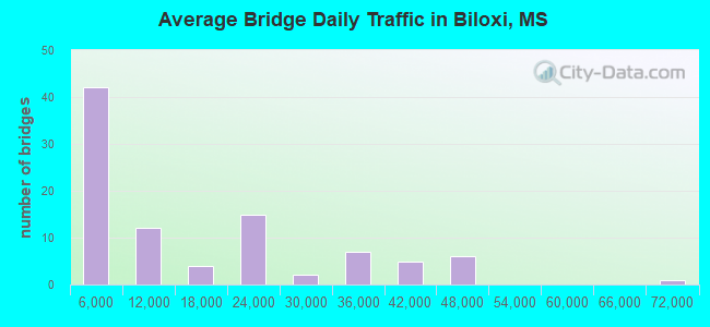
- 1,359,177Total average daily traffic
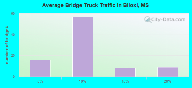
- 108,500Total average daily truck traffic
- National Bridge Inventory (NBI) Registered Bridges for Biloxi
- No street view available for this location
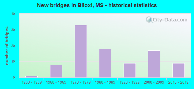
- New bridges - historical statistics
- 11950-1959
- 81960-1969
- 331970-1979
- 181980-1989
- 91990-1999
- 172000-2009
- 92010-2019
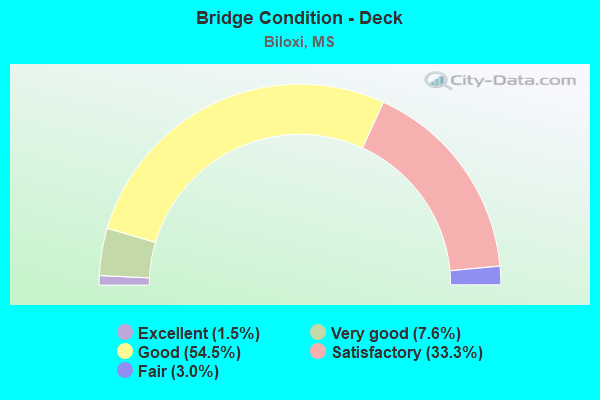
- Bridge Condition - Deck
- 1.5%Excellent
- 7.6%Very good
- 54.5%Good
- 33.3%Satisfactory
- 3.0%Fair
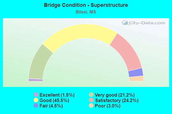
- Bridge Condition - Superstructure
- 1.5%Excellent
- 21.2%Very good
- 45.5%Good
- 24.2%Satisfactory
- 4.5%Fair
- 3.0%Poor
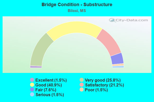
- Bridge Condition - Substructure
- 1.5%Excellent
- 25.8%Very good
- 40.9%Good
- 21.2%Satisfactory
- 7.6%Fair
- 1.5%Poor
- 1.5%Serious
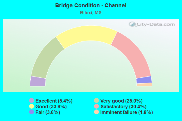
- Bridge Condition - Channel
- 5.4%Excellent
- 25.0%Very good
- 33.9%Good
- 30.4%Satisfactory
- 3.6%Fair
- 1.8%Imminent failure
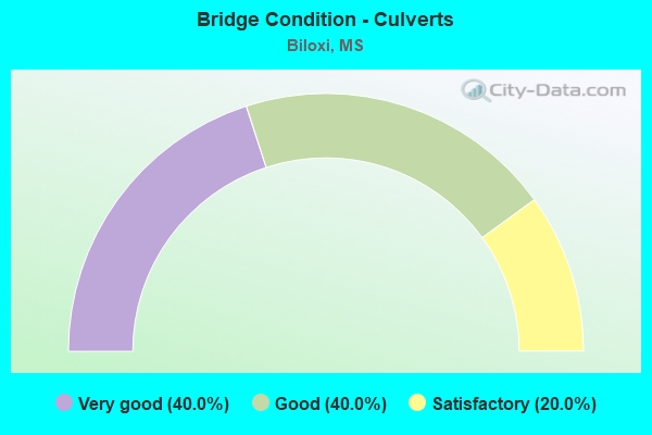
- Bridge Condition - Culverts
- 40.0%Very good
- 40.0%Good
- 20.0%Satisfactory
Find on map >> Show street view
Structure Number: 51001100240038, Location: 0.4 MI S I 10 (Lat: 30.446700, Lng: -88.895111), Route carried "under" structure: Interstate 110, Year Built: 2015, Structure Length: 0. m, Average Daily Traffic: 23,000 (year 2018), Truck Traffic: 10%, Features Intersected: I 110, Facility Carried by Structure: POPS FERRY RD.
Minimum Vertical Clearance: 5.44m (17.85ft), Kilometerpoint: 0.816, Lanes on structure: 5, Lanes under structure: 3, Material/Design: Prestressed concrete, Design/Construction: Stringer/Multi-beam, Length of Maximum Span: 31.7m (104.0ft)
Find on map >> Show street view
Structure Number: 51001100240038, Location: 0.4 MI S I 10 (Lat: 30.446700, Lng: -88.894611), Route carried "under" structure: Ramp Interstate 110, Year Built: 2015, Structure Length: 0. m, Average Daily Traffic: 5,700 (year 2018), Truck Traffic: 10%, Features Intersected: I 110, Facility Carried by Structure: POPS FERRY RD.
Minimum Vertical Clearance: 5.20m (17.06ft), Kilometerpoint: 0.283, Lanes on structure: 5, Lanes under structure: 1, Material/Design: Prestressed concrete, Design/Construction: Stringer/Multi-beam, Length of Maximum Span: 31.7m (104.0ft)