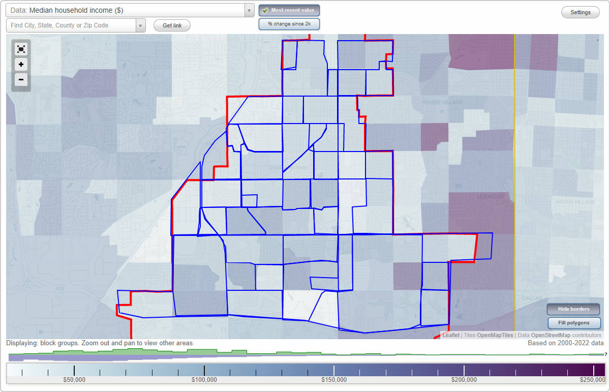
Overland Park, Kansas Neighborhood Map - Income, House Prices, Occupations, Boundaries
Settings
X

- City boundary
- Neighborhood boundaries
Business Search - 14 Million verified businesses
Neighborhoods:
Antioch, Bel Air, Broadmoor, Brookridge, Cherokee Hills, Cherry Hill, Congleton, Downtown, East Overland Park, Elmhurst, Four Winds, Foxhill, Glenwood Estates, Good Neighbors, Grantioch, Historic Overland Park, Louisburg Square, Maple Crest, Maple Hill, Milburn, Milburn West, Moody Hills, Morning View, Nall Hills, Neighborhood 14A, Oak Park, Pinehurst, Prairie View, Regency Park, Santa Fe Hills, South Lake, South Overland Park, Southdale, Southmoor Gardens, Strang Line, Sylvan Grove, Tomahawk Ridge, Wellington West, Westbrooke, Wickford Gardens, Wycliff, Young's ParkAntioch neighborhood in Overland Park statistics: (Find on map)
Area: 0.403 square miles
Roads and streets: W 79th St; Frontage Rd; W 76th Ter; Grandview St; Farley St; W 76th St; Kessler Ln; W 77th Ter; Grant Ln; Kessler St; England St (England Dr); Benson St; W 78th St; W 78th Cir; Mastin Dr; W 77th St; Carter St; Grant Cir; Eby Ave (Eby St); W 75th Ter; W 78th Ter; Slater; Hayes St; 78th St; W 79th Cir; Slater St.
Other features: Turkey Crk.
Antioch neighborhood detailed profile
Bel Air neighborhood in Overland Park statistics: (Find on map)
Area: 0.603 square miles
Roads and streets: Outlook Dr; W 91st St; Somerset Dr; W 94th Ter; W 92nd St; W 87th Ter; Horton St; W 90th Ter; Dearborn St; Beverly Dr (Beverly St); Lamar Ave; W 88th Ter; Maple Dr; W 90th St; W 89th St; W 89th Ter; W 88th St; Riggs Ln; Walmer St; W 92nd Ter; W 93rd Ter; Reeds Rd; W 92nd Pl; Woodson Dr; W 94th St; Riggs St; Reeds Dr; Russell St; W 91st Ter; Maple Cir; Belair Cir.
Bel Air neighborhood detailed profile
Broadmoor neighborhood in Overland Park statistics: (Find on map)
Area: 0.247 square miles
Roads and streets: W 87th St; W 85th St; W 85th Ter; Glenwood St; Riggs St; Walmer St; Travis St; Broadmoor St; Barkley St; Travis Ln; Russell St.
Other features: Indian Crk.
Broadmoor neighborhood detailed profile
Area: 0.247 square miles
Roads and streets: W 87th St; W 85th St; W 85th Ter; Glenwood St; Riggs St; Walmer St; Travis St; Broadmoor St; Barkley St; Travis Ln; Russell St.
Other features: Indian Crk.
Broadmoor neighborhood detailed profile
Brookridge neighborhood in Overland Park statistics: (Find on map)
Area: 0.843 square miles
Population: 2,172
Population density:
Median household income in 2021:
Median rent in in 2021:
Male vs Females
Median age
Housing prices:
Average estimated value of detached houses in 2021 (36.2% of all units):
Average estimated value of townhouses or other attached units in 2021 (50.2% of all units):
Average estimated '21 value of housing units in 5-or-more-unit structures (12.2% of all units):
Most popular occupations of males: sales and office occupations (29.5%); business and financial operations occupations (16.3%); management occupations (except farmers) (11.1%); education, training, and library occupations (10.5%); computer and mathematical occupations (9.5%); transportation occupations (6.2%); architecture and engineering occupations (4.6%)
Most popular occupations of females: sales and office occupations (39.3%); education, training, and library occupations (12.4%); healthcare practitioners and technical occupations (11.1%); production occupations (10.1%); business and financial operations occupations (7.9%); service occupations (6.7%); management occupations (except farmers) (6.5%)
Highways in this neighborhood: Metcalf Ave (US Hwy 169).
Roads and streets: W 103rd St; W 101st St; Hemlock Dr (Hemlock St); Country Club Dr; Hardy St; W 102nd St; W 100th Pl; Lowell Ave; Conser St; Mackey Cir; W 100th Ter; Floyd St; W 101st Ter; Craig Dr; Foster St; Marty St; W 99th Ter; Mackey St; Goodman Dr; W 100th St; Hemlock St; Robinson St; Metcalf Ln; W 102nd Ter; Conser St (Conser); W 102nd Ct; Mackey; Antioch Rd; Craig St.
Other features: Indian Crk.
Brookridge neighborhood detailed profile
Area: 0.843 square miles
Population: 2,172
Population density:
| Brookridge: | 2,577 people per square mile |
| Overland Park: | 3,473 people per square mile |
Median household income in 2021:
| Brookridge: | $88,259 |
| Overland Park: | $89,280 |
Median rent in in 2021:
| Brookridge: | $853 |
| Overland Park: | $1,119 |
Male vs Females
| Males: | 972 |
| Females: | 1,200 |
Median age
| Males: | 37.0 years |
| Females: | 42.8 years |
Housing prices:
Average estimated value of detached houses in 2021 (36.2% of all units):
| Brookridge: | $321,004 |
| Kansas: | $233,625 |
Average estimated value of townhouses or other attached units in 2021 (50.2% of all units):
| This neighborhood: | $150,425 |
| Kansas: | $208,397 |
Average estimated '21 value of housing units in 5-or-more-unit structures (12.2% of all units):
| Brookridge: | $95,374 |
| Kansas: | $250,092 |
Most popular occupations of males: sales and office occupations (29.5%); business and financial operations occupations (16.3%); management occupations (except farmers) (11.1%); education, training, and library occupations (10.5%); computer and mathematical occupations (9.5%); transportation occupations (6.2%); architecture and engineering occupations (4.6%)
Most popular occupations of females: sales and office occupations (39.3%); education, training, and library occupations (12.4%); healthcare practitioners and technical occupations (11.1%); production occupations (10.1%); business and financial operations occupations (7.9%); service occupations (6.7%); management occupations (except farmers) (6.5%)
Highways in this neighborhood: Metcalf Ave (US Hwy 169).
Roads and streets: W 103rd St; W 101st St; Hemlock Dr (Hemlock St); Country Club Dr; Hardy St; W 102nd St; W 100th Pl; Lowell Ave; Conser St; Mackey Cir; W 100th Ter; Floyd St; W 101st Ter; Craig Dr; Foster St; Marty St; W 99th Ter; Mackey St; Goodman Dr; W 100th St; Hemlock St; Robinson St; Metcalf Ln; W 102nd Ter; Conser St (Conser); W 102nd Ct; Mackey; Antioch Rd; Craig St.
Other features: Indian Crk.
Brookridge neighborhood detailed profile
Cherokee Hills neighborhood in Overland Park statistics: (Find on map)
Area: 0.506 square miles
Population: 2,166
Population density:
Median household income in 2021:
Median rent in in 2021:
Male vs Females
Median age
Average estimated value of detached houses in 2021 (86.7% of all units):
Most popular occupations of males: management occupations (except farmers) (20.9%); business and financial operations occupations (12.6%); architecture and engineering occupations (12.0%); service occupations (10.4%); sales and office occupations (9.0%); computer and mathematical occupations (8.0%); education, training, and library occupations (4.1%)
Most popular occupations of females: healthcare practitioners and technical occupations (26.1%); sales and office occupations (19.8%); education, training, and library occupations (15.5%); management occupations (except farmers) (12.9%); service occupations (12.4%); computer and mathematical occupations (3.6%); material moving occupations (3.3%)
Roads and streets: W 93rd St; W 92nd St; W 92nd Ter; W 95th St; Hardy St; Kessler Ln (Kessler St); Antioch Rd; Slater St; Craig St; Lowell Ave; Mackey St; Robinson St; W 94th St; W 92nd Pl; Woodward St; W 91st Ter; W 93rd Ter; Grandview Dr; Hayes Dr; Hadley St; England St; Hemlock Dr (Hemlock St); Grant Ln; Goodman St; W 91st St; W 94th Ter; Hardy Dr.
Cherokee Hills neighborhood detailed profile
Area: 0.506 square miles
Population: 2,166
Population density:
| Cherokee Hills: | 4,280 people per square mile |
| Overland Park: | 3,473 people per square mile |
Median household income in 2021:
| Cherokee Hills: | $85,359 |
| Overland Park: | $89,280 |
Median rent in in 2021:
| Cherokee Hills: | $1,325 |
| Overland Park: | $1,119 |
Male vs Females
| Males: | 1,020 |
| Females: | 1,146 |
Median age
| Males: | 38.9 years |
| Females: | 42.2 years |
Average estimated value of detached houses in 2021 (86.7% of all units):
| Cherokee Hills: | $204,079 |
| Kansas: | $233,625 |
Most popular occupations of males: management occupations (except farmers) (20.9%); business and financial operations occupations (12.6%); architecture and engineering occupations (12.0%); service occupations (10.4%); sales and office occupations (9.0%); computer and mathematical occupations (8.0%); education, training, and library occupations (4.1%)
Most popular occupations of females: healthcare practitioners and technical occupations (26.1%); sales and office occupations (19.8%); education, training, and library occupations (15.5%); management occupations (except farmers) (12.9%); service occupations (12.4%); computer and mathematical occupations (3.6%); material moving occupations (3.3%)
Roads and streets: W 93rd St; W 92nd St; W 92nd Ter; W 95th St; Hardy St; Kessler Ln (Kessler St); Antioch Rd; Slater St; Craig St; Lowell Ave; Mackey St; Robinson St; W 94th St; W 92nd Pl; Woodward St; W 91st Ter; W 93rd Ter; Grandview Dr; Hayes Dr; Hadley St; England St; Hemlock Dr (Hemlock St); Grant Ln; Goodman St; W 91st St; W 94th Ter; Hardy Dr.
Cherokee Hills neighborhood detailed profile
Cherry Hill neighborhood in Overland Park statistics: (Find on map)
Area: 0.238 square miles
Population: 715
Population density:
Median household income in 2021:
Median rent in in 2021:
Male vs Females
Median age
Average estimated value of detached houses in 2021 (100.0% of all units):
Most popular occupations of males: management occupations (except farmers) (26.8%); production occupations (18.8%); service occupations (13.4%); computer and mathematical occupations (12.4%); sales and office occupations (8.8%); business and financial operations occupations (7.3%); healthcare practitioners and technical occupations (6.7%)
Most popular occupations of females: sales and office occupations (38.1%); education, training, and library occupations (18.6%); management occupations (except farmers) (11.2%); production occupations (9.2%); business and financial operations occupations (7.8%); service occupations (7.8%); healthcare practitioners and technical occupations (7.3%)
Roads and streets: W 103rd St; Catalina St; W 100th Pl; W 102nd St; W 100th Ter; W 101st Ter; Delmar Ln (Delmar St); Mission Rd; Fontana Ln.
Cherry Hill neighborhood detailed profile
Area: 0.238 square miles
Population: 715
Population density:
| Cherry Hill: | 3,002 people per square mile |
| Overland Park: | 3,473 people per square mile |
Median household income in 2021:
| Cherry Hill: | $125,159 |
| Overland Park: | $89,280 |
Median rent in in 2021:
| Cherry Hill: | $1,244 |
| Overland Park: | $1,119 |
Male vs Females
| Males: | 383 |
| Females: | 332 |
Median age
| Males: | 37.8 years |
| Females: | 42.7 years |
Average estimated value of detached houses in 2021 (100.0% of all units):
| Cherry Hill: | $384,191 |
| Kansas: | $233,625 |
Most popular occupations of males: management occupations (except farmers) (26.8%); production occupations (18.8%); service occupations (13.4%); computer and mathematical occupations (12.4%); sales and office occupations (8.8%); business and financial operations occupations (7.3%); healthcare practitioners and technical occupations (6.7%)
Most popular occupations of females: sales and office occupations (38.1%); education, training, and library occupations (18.6%); management occupations (except farmers) (11.2%); production occupations (9.2%); business and financial operations occupations (7.8%); service occupations (7.8%); healthcare practitioners and technical occupations (7.3%)
Roads and streets: W 103rd St; Catalina St; W 100th Pl; W 102nd St; W 100th Ter; W 101st Ter; Delmar Ln (Delmar St); Mission Rd; Fontana Ln.
Cherry Hill neighborhood detailed profile
Congleton neighborhood in Overland Park statistics: (Find on map)
Area: 0.524 square miles
Population: 1,083
Population density:
Median household income in 2021:
Median rent in in 2021:
Male vs Females
Median age
Housing prices:
Average estimated value of detached houses in 2021 (27.6% of all units):
Average estimated value of townhouses or other attached units in 2021 (11.1% of all units):
Most popular occupations of males: sales and office occupations (22.9%); management occupations (except farmers) (20.7%); service occupations (12.4%); material moving occupations (10.8%); arts, design, entertainment, sports, and media occupations (8.4%); business and financial operations occupations (7.6%); architecture and engineering occupations (6.0%)
Most popular occupations of females: sales and office occupations (37.9%); business and financial operations occupations (23.7%); management occupations (except farmers) (9.4%); education, training, and library occupations (9.3%); service occupations (8.4%); community and social services occupations (5.9%); architecture and engineering occupations (3.7%)
Limited-access highways (interstate or state) in this neighborhood: US Hwy 56 (I- 35).
Roads and streets: Lenexa Dr; Nieman Rd; S Quivira Rd (Quivira Rd); Bond St; W 93rd St; W 91st St; Cody St; W 87th Ter; W 89th St; W 87th Street Pkwy (W 87th St); Barton St; Flint St; W 90th St; W 88th St.
Congleton neighborhood detailed profile
Area: 0.524 square miles
Population: 1,083
Population density:
| Congleton: | 2,066 people per square mile |
| Overland Park: | 3,473 people per square mile |
Median household income in 2021:
| Congleton: | $68,148 |
| Overland Park: | $89,280 |
Median rent in in 2021:
| Congleton: | $864 |
| Overland Park: | $1,119 |
Male vs Females
| Males: | 577 |
| Females: | 505 |
Median age
| Males: | 39.8 years |
| Females: | 36.6 years |
Housing prices:
Average estimated value of detached houses in 2021 (27.6% of all units):
| Congleton: | $293,543 |
| Kansas: | $233,625 |
Average estimated value of townhouses or other attached units in 2021 (11.1% of all units):
| This neighborhood: | $230,951 |
| Kansas: | $208,397 |
Most popular occupations of males: sales and office occupations (22.9%); management occupations (except farmers) (20.7%); service occupations (12.4%); material moving occupations (10.8%); arts, design, entertainment, sports, and media occupations (8.4%); business and financial operations occupations (7.6%); architecture and engineering occupations (6.0%)
Most popular occupations of females: sales and office occupations (37.9%); business and financial operations occupations (23.7%); management occupations (except farmers) (9.4%); education, training, and library occupations (9.3%); service occupations (8.4%); community and social services occupations (5.9%); architecture and engineering occupations (3.7%)
Limited-access highways (interstate or state) in this neighborhood: US Hwy 56 (I- 35).
Roads and streets: Lenexa Dr; Nieman Rd; S Quivira Rd (Quivira Rd); Bond St; W 93rd St; W 91st St; Cody St; W 87th Ter; W 89th St; W 87th Street Pkwy (W 87th St); Barton St; Flint St; W 90th St; W 88th St.
Congleton neighborhood detailed profile
Downtown neighborhood in Overland Park statistics: (Find on map)
Area: 0.318 square miles
Population: 1,323
Population density:
Median household income in 2021:
Median rent in in 2021:
Male vs Females
Median age
Housing prices:
Average estimated value of detached houses in 2021 (50.7% of all units):
Average estimated value of townhouses or other attached units in 2021 (15.5% of all units):
Most popular occupations of males: management occupations (except farmers) (17.2%); sales and office occupations (17.1%); service occupations (9.8%); computer and mathematical occupations (8.9%); healthcare practitioners and technical occupations (7.6%); transportation occupations (6.5%); education, training, and library occupations (5.1%)
Most popular occupations of females: sales and office occupations (31.4%); service occupations (17.5%); management occupations (except farmers) (10.9%); healthcare practitioners and technical occupations (10.5%); business and financial operations occupations (9.4%); production occupations (9.0%); computer and mathematical occupations (4.7%)
Highways in this neighborhood: US Hwy 169 (Metcalf Ave).
Roads and streets: W 83rd St; W 80th St; Robinson St; Santa Fe Dr (Santa Fe Trail Dr); W 81st St; Overland Park Dr; Hamilton Dr; Marty St; Lowell Ave; Newton St; Valley View Dr; Floyd St; Riley St; W 79th St; Travis St; Broadmoor Ln; Conser St (Conser Pl); W 82nd St; Foster St.
Downtown neighborhood detailed profile
Area: 0.318 square miles
Population: 1,323
Population density:
| Downtown: | 4,158 people per square mile |
| Overland Park: | 3,473 people per square mile |
Median household income in 2021:
| Downtown: | $65,186 |
| Overland Park: | $89,280 |
Median rent in in 2021:
| Downtown: | $906 |
| Overland Park: | $1,119 |
Male vs Females
| Males: | 650 |
| Females: | 672 |
Median age
| Males: | 35.0 years |
| Females: | 40.8 years |
Housing prices:
Average estimated value of detached houses in 2021 (50.7% of all units):
| Downtown: | $202,959 |
| Kansas: | $233,625 |
Average estimated value of townhouses or other attached units in 2021 (15.5% of all units):
| This neighborhood: | $129,036 |
| Kansas: | $208,397 |
Most popular occupations of males: management occupations (except farmers) (17.2%); sales and office occupations (17.1%); service occupations (9.8%); computer and mathematical occupations (8.9%); healthcare practitioners and technical occupations (7.6%); transportation occupations (6.5%); education, training, and library occupations (5.1%)
Most popular occupations of females: sales and office occupations (31.4%); service occupations (17.5%); management occupations (except farmers) (10.9%); healthcare practitioners and technical occupations (10.5%); business and financial operations occupations (9.4%); production occupations (9.0%); computer and mathematical occupations (4.7%)
Highways in this neighborhood: US Hwy 169 (Metcalf Ave).
Roads and streets: W 83rd St; W 80th St; Robinson St; Santa Fe Dr (Santa Fe Trail Dr); W 81st St; Overland Park Dr; Hamilton Dr; Marty St; Lowell Ave; Newton St; Valley View Dr; Floyd St; Riley St; W 79th St; Travis St; Broadmoor Ln; Conser St (Conser Pl); W 82nd St; Foster St.
Downtown neighborhood detailed profile
East Overland Park neighborhood in Overland Park statistics: (Find on map)
Area: 1.938 square miles
Population: 7,191
Population density:
Median household income in 2021:
Median rent in in 2021:
Male vs Females
Median age
Housing prices:
Average estimated value of detached houses in 2021 (57.3% of all units):
Average estimated value of townhouses or other attached units in 2021 (3.8% of all units):
Average estimated '21 value of housing units in 5-or-more-unit structures (24.3% of all units):
Most popular occupations of males: sales and office occupations (20.2%); management occupations (except farmers) (15.9%); service occupations (13.0%); arts, design, entertainment, sports, and media occupations (11.3%); computer and mathematical occupations (11.2%); business and financial operations occupations (7.5%); architecture and engineering occupations (5.4%)
Most popular occupations of females: sales and office occupations (25.5%); service occupations (19.0%); healthcare practitioners and technical occupations (17.6%); legal occupations (10.8%); management occupations (except farmers) (9.7%); education, training, and library occupations (5.4%); production occupations (5.0%)
Roads and streets: Glenwood St; W 91st St; Lamar Ave; W 89th St; Walmer St; Outlook Dr; W 87th St; Broadmoor St; W 95th St; Riggs St; W 83rd St; Somerset Dr; W 94th Ter; W 87th Ter; Woodson Dr; Riggs Ln; W 92nd St; W 85th St; W 90th Ter; W 85th Ter; W 82nd St; W 80th St; W 81st St; Travis Ln; Horton St; Russell St; Travis St; Dearborn St; W 88th Ter; Beverly Dr (Beverly St); W 88th St; Nall Ave; Reeds Rd; W 78th Ter; W 76th Ter; W 77th St; Maple Dr; W 86th Ter; W 80th Ter; W 86th St; W 90th St; W 93rd Ter; W 89th Ter; Barkley Ln (Barkley St); W 84th St; Barkley St; W 92nd Ter; W 82nd Ter; W 79th Ter; W 76th St; W 81st Ter; W 92nd Pl; W 78th St; W 94th St; W 79th St; Reeds Dr; W 91st Ter; Broadmoor Ln; Maple Ln (Maple St); Outlook Ln; Reeds Rd (Reeds Ln); Broadmoor Ct; Glenwood Ct; Maple Cir; Colonial Dr; Riggs Cir; Belair Cir; 83rd St.
Other features: Indian Crk; Brush Crk.
East Overland Park neighborhood detailed profile
Area: 1.938 square miles
Population: 7,191
Population density:
| East Overland Park: | 3,710 people per square mile |
| Overland Park: | 3,473 people per square mile |
Median household income in 2021:
| East Overland Park: | $83,532 |
| Overland Park: | $89,280 |
Median rent in in 2021:
| East Overland Park: | $1,229 |
| Overland Park: | $1,119 |
Male vs Females
| Males: | 4,181 |
| Females: | 3,010 |
Median age
| Males: | 40.3 years |
| Females: | 40.6 years |
Housing prices:
Average estimated value of detached houses in 2021 (57.3% of all units):
| East Overland Park: | $168,599 |
| Kansas: | $233,625 |
Average estimated value of townhouses or other attached units in 2021 (3.8% of all units):
| This neighborhood: | $214,730 |
| Kansas: | $208,397 |
Average estimated '21 value of housing units in 5-or-more-unit structures (24.3% of all units):
| East Overland Park: | $95,374 |
| Kansas: | $250,092 |
Most popular occupations of males: sales and office occupations (20.2%); management occupations (except farmers) (15.9%); service occupations (13.0%); arts, design, entertainment, sports, and media occupations (11.3%); computer and mathematical occupations (11.2%); business and financial operations occupations (7.5%); architecture and engineering occupations (5.4%)
Most popular occupations of females: sales and office occupations (25.5%); service occupations (19.0%); healthcare practitioners and technical occupations (17.6%); legal occupations (10.8%); management occupations (except farmers) (9.7%); education, training, and library occupations (5.4%); production occupations (5.0%)
Roads and streets: Glenwood St; W 91st St; Lamar Ave; W 89th St; Walmer St; Outlook Dr; W 87th St; Broadmoor St; W 95th St; Riggs St; W 83rd St; Somerset Dr; W 94th Ter; W 87th Ter; Woodson Dr; Riggs Ln; W 92nd St; W 85th St; W 90th Ter; W 85th Ter; W 82nd St; W 80th St; W 81st St; Travis Ln; Horton St; Russell St; Travis St; Dearborn St; W 88th Ter; Beverly Dr (Beverly St); W 88th St; Nall Ave; Reeds Rd; W 78th Ter; W 76th Ter; W 77th St; Maple Dr; W 86th Ter; W 80th Ter; W 86th St; W 90th St; W 93rd Ter; W 89th Ter; Barkley Ln (Barkley St); W 84th St; Barkley St; W 92nd Ter; W 82nd Ter; W 79th Ter; W 76th St; W 81st Ter; W 92nd Pl; W 78th St; W 94th St; W 79th St; Reeds Dr; W 91st Ter; Broadmoor Ln; Maple Ln (Maple St); Outlook Ln; Reeds Rd (Reeds Ln); Broadmoor Ct; Glenwood Ct; Maple Cir; Colonial Dr; Riggs Cir; Belair Cir; 83rd St.
Other features: Indian Crk; Brush Crk.
East Overland Park neighborhood detailed profile
Elmhurst neighborhood in Overland Park statistics: (Find on map)
Area: 0.390 square miles
Population: 2,300
Population density:
Median household income in 2021:
Median rent in in 2021:
Male vs Females
Median age
Average estimated value of detached houses in 2021 (28.4% of all units):
Most popular occupations of males: service occupations (24.8%); sales and office occupations (18.0%); transportation occupations (10.6%); management occupations (except farmers) (10.3%); computer and mathematical occupations (8.9%); construction, extraction, and maintenance occupations (6.1%); architecture and engineering occupations (3.8%)
Most popular occupations of females: sales and office occupations (32.6%); management occupations (except farmers) (19.3%); service occupations (16.2%); business and financial operations occupations (10.2%); healthcare practitioners and technical occupations (8.4%); legal occupations (3.9%); material moving occupations (3.1%)
Roads and streets: W 85th St; Elmhurst Dr; W 86th St; Grant St (Grant Ave); England St; Grandview Ln; Kessler St; Santa Fe Trail Dr (Santa Fe Dr, W 87th St); W 83rd Ter; Santa Fe Trail Dr (Santa Fe Dr); Carter St; Hayes St; Grandview Ave; W 83rd St; Benson St; Eby Ave; Knox St; Connell St; Greenbriar St; Grant; England.
Elmhurst neighborhood detailed profile
Area: 0.390 square miles
Population: 2,300
Population density:
| Elmhurst: | 5,893 people per square mile |
| Overland Park: | 3,473 people per square mile |
Median household income in 2021:
| Elmhurst: | $66,730 |
| Overland Park: | $89,280 |
Median rent in in 2021:
| Elmhurst: | $1,084 |
| Overland Park: | $1,119 |
Male vs Females
| Males: | 1,212 |
| Females: | 1,088 |
Median age
| Males: | 33.2 years |
| Females: | 37.7 years |
Average estimated value of detached houses in 2021 (28.4% of all units):
| Elmhurst: | $199,462 |
| Kansas: | $233,625 |
Most popular occupations of males: service occupations (24.8%); sales and office occupations (18.0%); transportation occupations (10.6%); management occupations (except farmers) (10.3%); computer and mathematical occupations (8.9%); construction, extraction, and maintenance occupations (6.1%); architecture and engineering occupations (3.8%)
Most popular occupations of females: sales and office occupations (32.6%); management occupations (except farmers) (19.3%); service occupations (16.2%); business and financial operations occupations (10.2%); healthcare practitioners and technical occupations (8.4%); legal occupations (3.9%); material moving occupations (3.1%)
Roads and streets: W 85th St; Elmhurst Dr; W 86th St; Grant St (Grant Ave); England St; Grandview Ln; Kessler St; Santa Fe Trail Dr (Santa Fe Dr, W 87th St); W 83rd Ter; Santa Fe Trail Dr (Santa Fe Dr); Carter St; Hayes St; Grandview Ave; W 83rd St; Benson St; Eby Ave; Knox St; Connell St; Greenbriar St; Grant; England.
Elmhurst neighborhood detailed profile
Four Winds neighborhood in Overland Park statistics: (Find on map)
Area: 0.115 square miles
Roads and streets: W 80th St; Perry St; W 81st St; Mastin Dr; W 81st Ter; Switzer Rd (Switzer St).
Four Winds neighborhood detailed profile
Area: 0.115 square miles
Roads and streets: W 80th St; Perry St; W 81st St; Mastin Dr; W 81st Ter; Switzer Rd (Switzer St).
Four Winds neighborhood detailed profile
Foxhill neighborhood in Overland Park statistics: (Find on map)
Area: 0.324 square miles
Population: 703
Population density:
Median household income in 2021:
Median rent in in 2021:
Male vs Females
Median age
Average estimated value of detached houses in 2021 (2.0% of all units):
Most popular occupations of males: computer and mathematical occupations (36.2%); service occupations (21.0%); business and financial operations occupations (18.5%); management occupations (except farmers) (3.8%); arts, design, entertainment, sports, and media occupations (3.5%); sales and office occupations (3.3%); construction, extraction, and maintenance occupations (3.3%)
Most popular occupations of females: business and financial operations occupations (37.0%); service occupations (27.0%); sales and office occupations (15.0%); life, physical, and social science occupations (5.9%); management occupations (except farmers) (5.5%); healthcare practitioners and technical occupations (4.2%); legal occupations (3.1%)
Limited-access highways (interstate or state) in this neighborhood: I- 435 (US Hwy 50).
Roads and streets: Wycklow St; Mission Rd; Alhambra St; W 107th St; Indian Creek Pkwy; W 104th Ter (104th Ter); Delmar Ln; Catalina St; Granada; el Monte St; W 104th Ter.
Other features: Indian Crk.
Foxhill neighborhood detailed profile
Area: 0.324 square miles
Population: 703
Population density:
| Foxhill: | 2,170 people per square mile |
| Overland Park: | 3,473 people per square mile |
Median household income in 2021:
| Foxhill: | $131,821 |
| Overland Park: | $89,280 |
Median rent in in 2021:
| Foxhill: | $1,252 |
| Overland Park: | $1,119 |
Male vs Females
| Males: | 304 |
| Females: | 399 |
Median age
| Males: | 41.8 years |
| Females: | 46.4 years |
Average estimated value of detached houses in 2021 (2.0% of all units):
| Foxhill: | $385,249 |
| Kansas: | $233,625 |
Most popular occupations of males: computer and mathematical occupations (36.2%); service occupations (21.0%); business and financial operations occupations (18.5%); management occupations (except farmers) (3.8%); arts, design, entertainment, sports, and media occupations (3.5%); sales and office occupations (3.3%); construction, extraction, and maintenance occupations (3.3%)
Most popular occupations of females: business and financial operations occupations (37.0%); service occupations (27.0%); sales and office occupations (15.0%); life, physical, and social science occupations (5.9%); management occupations (except farmers) (5.5%); healthcare practitioners and technical occupations (4.2%); legal occupations (3.1%)
Limited-access highways (interstate or state) in this neighborhood: I- 435 (US Hwy 50).
Roads and streets: Wycklow St; Mission Rd; Alhambra St; W 107th St; Indian Creek Pkwy; W 104th Ter (104th Ter); Delmar Ln; Catalina St; Granada; el Monte St; W 104th Ter.
Other features: Indian Crk.
Foxhill neighborhood detailed profile
Glenwood Estates neighborhood in Overland Park statistics: (Find on map)
Area: 0.632 square miles
Population: 2,831
Population density:
Median household income in 2021:
Median rent in in 2021:
Male vs Females
Median age
Average estimated value of detached houses in 2021 (77.0% of all units):
Most popular occupations of males: architecture and engineering occupations (13.9%); service occupations (12.2%); management occupations (except farmers) (11.9%); sales and office occupations (9.6%); community and social services occupations (8.7%); transportation occupations (8.5%); construction, extraction, and maintenance occupations (8.1%)
Most popular occupations of females: service occupations (29.4%); sales and office occupations (28.8%); management occupations (except farmers) (20.5%); healthcare practitioners and technical occupations (8.4%); business and financial operations occupations (4.2%); education, training, and library occupations (2.3%); arts, design, entertainment, sports, and media occupations (1.7%)
Roads and streets: W 89th St; W 88th St; W 90th Ter; W 90th St; W 88th Ter; W 91st St; Hemlock St (Hemlock Dr); Grant St; Hadley St; Eby St; W 89th Ter; Antioch Rd; Benson St; W 87th Ter; Slater St; Hardy St; Hadley Pl; Knox Ln; Goodman St; Grandview Dr; England St; Carter Cir; Kessler St; Carter St; Connell St; Craig St; Santa Fe Ln; Grandview St; W 88th Pl.
Glenwood Estates neighborhood detailed profile
Area: 0.632 square miles
Population: 2,831
Population density:
| Glenwood Estates: | 4,479 people per square mile |
| Overland Park: | 3,473 people per square mile |
Median household income in 2021:
| Glenwood Estates: | $89,090 |
| Overland Park: | $89,280 |
Median rent in in 2021:
| Glenwood Estates: | $1,185 |
| Overland Park: | $1,119 |
Male vs Females
| Males: | 1,361 |
| Females: | 1,470 |
Median age
| Males: | 42.6 years |
| Females: | 41.8 years |
Average estimated value of detached houses in 2021 (77.0% of all units):
| Glenwood Estates: | $195,580 |
| Kansas: | $233,625 |
Most popular occupations of males: architecture and engineering occupations (13.9%); service occupations (12.2%); management occupations (except farmers) (11.9%); sales and office occupations (9.6%); community and social services occupations (8.7%); transportation occupations (8.5%); construction, extraction, and maintenance occupations (8.1%)
Most popular occupations of females: service occupations (29.4%); sales and office occupations (28.8%); management occupations (except farmers) (20.5%); healthcare practitioners and technical occupations (8.4%); business and financial operations occupations (4.2%); education, training, and library occupations (2.3%); arts, design, entertainment, sports, and media occupations (1.7%)
Roads and streets: W 89th St; W 88th St; W 90th Ter; W 90th St; W 88th Ter; W 91st St; Hemlock St (Hemlock Dr); Grant St; Hadley St; Eby St; W 89th Ter; Antioch Rd; Benson St; W 87th Ter; Slater St; Hardy St; Hadley Pl; Knox Ln; Goodman St; Grandview Dr; England St; Carter Cir; Kessler St; Carter St; Connell St; Craig St; Santa Fe Ln; Grandview St; W 88th Pl.
Glenwood Estates neighborhood detailed profile
Good Neighbors neighborhood in Overland Park statistics: (Find on map)
Area: 0.375 square miles
Population: 2,141
Population density:
Median household income in 2021:
Median rent in in 2021:
Male vs Females
Median age
Average estimated value of detached houses in 2021 (68.3% of all units):
Most popular occupations of males: service occupations (19.6%); transportation occupations (13.7%); material moving occupations (11.8%); sales and office occupations (11.4%); management occupations (except farmers) (10.9%); construction, extraction, and maintenance occupations (9.7%); business and financial operations occupations (6.0%)
Most popular occupations of females: sales and office occupations (34.4%); service occupations (32.5%); management occupations (except farmers) (12.2%); healthcare practitioners and technical occupations (8.2%); business and financial operations occupations (3.2%); arts, design, entertainment, sports, and media occupations (2.2%); production occupations (2.2%)
Roads and streets: W 89th St; W 91st St; W 88th St; Grant St; W 89th Ter; Farley St; Eby St; W 90th St; W 88th Ter; Benson St; W 90th Ter; Grandview Dr; W 87th Ter; Slater St; Knox Ln; England St; Carter Cir; Kessler St; Carter St; Connell St; Antioch Rd; Santa Fe Ln; Grandview St; W 88th Pl.
Good Neighbors neighborhood detailed profile
Area: 0.375 square miles
Population: 2,141
Population density:
| Good Neighbors: | 5,703 people per square mile |
| Overland Park: | 3,473 people per square mile |
Median household income in 2021:
| Good Neighbors: | $89,996 |
| Overland Park: | $89,280 |
Median rent in in 2021:
| Good Neighbors: | $1,184 |
| Overland Park: | $1,119 |
Male vs Females
| Males: | 924 |
| Females: | 1,216 |
Median age
| Males: | 39.7 years |
| Females: | 40.2 years |
Average estimated value of detached houses in 2021 (68.3% of all units):
| Good Neighbors: | $200,070 |
| Kansas: | $233,625 |
Most popular occupations of males: service occupations (19.6%); transportation occupations (13.7%); material moving occupations (11.8%); sales and office occupations (11.4%); management occupations (except farmers) (10.9%); construction, extraction, and maintenance occupations (9.7%); business and financial operations occupations (6.0%)
Most popular occupations of females: sales and office occupations (34.4%); service occupations (32.5%); management occupations (except farmers) (12.2%); healthcare practitioners and technical occupations (8.2%); business and financial operations occupations (3.2%); arts, design, entertainment, sports, and media occupations (2.2%); production occupations (2.2%)
Roads and streets: W 89th St; W 91st St; W 88th St; Grant St; W 89th Ter; Farley St; Eby St; W 90th St; W 88th Ter; Benson St; W 90th Ter; Grandview Dr; W 87th Ter; Slater St; Knox Ln; England St; Carter Cir; Kessler St; Carter St; Connell St; Antioch Rd; Santa Fe Ln; Grandview St; W 88th Pl.
Good Neighbors neighborhood detailed profile
Grantioch neighborhood in Overland Park statistics: (Find on map)
Area: 0.356 square miles
Population: 1,954
Population density:
Median household income in 2021:
Median rent in in 2021:
Male vs Females
Median age
Housing prices:
Average estimated value of detached houses in 2021 (65.4% of all units):
Average estimated value of townhouses or other attached units in 2021 (21.4% of all units):
Most popular occupations of males: management occupations (except farmers) (27.2%); computer and mathematical occupations (16.3%); service occupations (16.2%); sales and office occupations (10.9%); architecture and engineering occupations (7.3%); business and financial operations occupations (4.0%); healthcare practitioners and technical occupations (3.8%)
Most popular occupations of females: sales and office occupations (26.0%); business and financial operations occupations (17.7%); management occupations (except farmers) (12.8%); computer and mathematical occupations (12.8%); healthcare practitioners and technical occupations (12.6%); service occupations (8.0%); production occupations (5.5%)
Roads and streets: W 82nd St; W 81st St; W 80th St; W 81st Ter; W 82nd Ter; Grant St; Antioch Rd; Grandview St; Eby St (Eby Ave); W 81st Ln; Kessler St; Grandview Ln; England St (England Dr); W 82nd Pl; Grandview.
Grantioch neighborhood detailed profile
Area: 0.356 square miles
Population: 1,954
Population density:
| Grantioch: | 5,495 people per square mile |
| Overland Park: | 3,473 people per square mile |
Median household income in 2021:
| Grantioch: | $65,250 |
| Overland Park: | $89,280 |
Median rent in in 2021:
| Grantioch: | $923 |
| Overland Park: | $1,119 |
Male vs Females
| Males: | 907 |
| Females: | 1,047 |
Median age
| Males: | 34.9 years |
| Females: | 32.3 years |
Housing prices:
Average estimated value of detached houses in 2021 (65.4% of all units):
| Grantioch: | $215,055 |
| Kansas: | $233,625 |
Average estimated value of townhouses or other attached units in 2021 (21.4% of all units):
| This neighborhood: | $128,511 |
| Kansas: | $208,397 |
Most popular occupations of males: management occupations (except farmers) (27.2%); computer and mathematical occupations (16.3%); service occupations (16.2%); sales and office occupations (10.9%); architecture and engineering occupations (7.3%); business and financial operations occupations (4.0%); healthcare practitioners and technical occupations (3.8%)
Most popular occupations of females: sales and office occupations (26.0%); business and financial operations occupations (17.7%); management occupations (except farmers) (12.8%); computer and mathematical occupations (12.8%); healthcare practitioners and technical occupations (12.6%); service occupations (8.0%); production occupations (5.5%)
Roads and streets: W 82nd St; W 81st St; W 80th St; W 81st Ter; W 82nd Ter; Grant St; Antioch Rd; Grandview St; Eby St (Eby Ave); W 81st Ln; Kessler St; Grandview Ln; England St (England Dr); W 82nd Pl; Grandview.
Grantioch neighborhood detailed profile
Historic Overland Park neighborhood in Overland Park statistics: (Find on map)
Area: 0.417 square miles
Population: 2,283
Population density:
Median household income in 2021:
Median rent in in 2021:
Male vs Females
Median age
Housing prices:
Average estimated value of detached houses in 2021 (65.3% of all units):
Average estimated value of townhouses or other attached units in 2021 (21.4% of all units):
Most popular occupations of males: management occupations (except farmers) (27.1%); computer and mathematical occupations (16.3%); service occupations (16.2%); sales and office occupations (10.9%); architecture and engineering occupations (7.2%); business and financial operations occupations (4.0%); healthcare practitioners and technical occupations (3.8%)
Most popular occupations of females: sales and office occupations (26.1%); business and financial operations occupations (17.6%); management occupations (except farmers) (12.7%); computer and mathematical occupations (12.7%); healthcare practitioners and technical occupations (12.6%); service occupations (8.1%); education, training, and library occupations (5.2%)
Roads and streets: W 80th St; W 81st St; Santa Fe Trail Dr (Santa Fe Dr); Hemlock St; W 83rd St; W 79th St; W 82nd St; Greenbriar Dr; Antioch Rd; Lowell Ave; Hadley St; Goodman St; Woodward St; Mackey St; Newton St; Hardy St; Robinson St; Conser St (Conser Pl); Craig St; Foster St; W 80th Ter; W 85th St; W 82nd Ter; Circle St; W 84th St; Woodward (Woodward St).
Historic Overland Park neighborhood detailed profile
Area: 0.417 square miles
Population: 2,283
Population density:
| Historic Overland Park: | 5,473 people per square mile |
| Overland Park: | 3,473 people per square mile |
Median household income in 2021:
| Historic Overland Park: | $68,696 |
| Overland Park: | $89,280 |
Median rent in in 2021:
| Historic Overland Park: | $923 |
| Overland Park: | $1,119 |
Male vs Females
| Males: | 1,059 |
| Females: | 1,223 |
Median age
| Males: | 33.6 years |
| Females: | 41.7 years |
Housing prices:
Average estimated value of detached houses in 2021 (65.3% of all units):
| Historic Overland Park: | $214,931 |
| Kansas: | $233,625 |
Average estimated value of townhouses or other attached units in 2021 (21.4% of all units):
| This neighborhood: | $128,665 |
| Kansas: | $208,397 |
Most popular occupations of males: management occupations (except farmers) (27.1%); computer and mathematical occupations (16.3%); service occupations (16.2%); sales and office occupations (10.9%); architecture and engineering occupations (7.2%); business and financial operations occupations (4.0%); healthcare practitioners and technical occupations (3.8%)
Most popular occupations of females: sales and office occupations (26.1%); business and financial operations occupations (17.6%); management occupations (except farmers) (12.7%); computer and mathematical occupations (12.7%); healthcare practitioners and technical occupations (12.6%); service occupations (8.1%); education, training, and library occupations (5.2%)
Roads and streets: W 80th St; W 81st St; Santa Fe Trail Dr (Santa Fe Dr); Hemlock St; W 83rd St; W 79th St; W 82nd St; Greenbriar Dr; Antioch Rd; Lowell Ave; Hadley St; Goodman St; Woodward St; Mackey St; Newton St; Hardy St; Robinson St; Conser St (Conser Pl); Craig St; Foster St; W 80th Ter; W 85th St; W 82nd Ter; Circle St; W 84th St; Woodward (Woodward St).
Historic Overland Park neighborhood detailed profile
Louisburg Square neighborhood in Overland Park statistics: (Find on map)
Area: 0.062 square miles
Population: 251
Population density:
Median household income in 2021:
Median rent in in 2021:
Male vs Females
Median age
Average estimated value of detached houses in 2021 (31.4% of all units):
Most popular occupations of males: transportation occupations (19.4%); material moving occupations (18.7%); construction, extraction, and maintenance occupations (17.6%); service occupations (16.7%); sales and office occupations (13.0%); business and financial operations occupations (8.9%); education, training, and library occupations (5.3%)
Most popular occupations of females: service occupations (41.0%); sales and office occupations (38.0%); management occupations (except farmers) (12.4%); computer and mathematical occupations (2.2%); education, training, and library occupations (2.2%); arts, design, entertainment, sports, and media occupations (2.2%); healthcare practitioners and technical occupations (1.9%)
Roads and streets: W 91st St; Grant St; Knox Ln; W 89th St; Carter Cir; Connell St; W 89th Ter; Carter St.
Louisburg Square neighborhood detailed profile
Area: 0.062 square miles
Population: 251
Population density:
| Louisburg Square: | 4,025 people per square mile |
| Overland Park: | 3,473 people per square mile |
Median household income in 2021:
| Louisburg Square: | $88,008 |
| Overland Park: | $89,280 |
Median rent in in 2021:
| Louisburg Square: | $1,030 |
| Overland Park: | $1,119 |
Male vs Females
| Males: | 97 |
| Females: | 154 |
Median age
| Males: | 39.1 years |
| Females: | 33.8 years |
Average estimated value of detached houses in 2021 (31.4% of all units):
| Louisburg Square: | $199,462 |
| Kansas: | $233,625 |
Most popular occupations of males: transportation occupations (19.4%); material moving occupations (18.7%); construction, extraction, and maintenance occupations (17.6%); service occupations (16.7%); sales and office occupations (13.0%); business and financial operations occupations (8.9%); education, training, and library occupations (5.3%)
Most popular occupations of females: service occupations (41.0%); sales and office occupations (38.0%); management occupations (except farmers) (12.4%); computer and mathematical occupations (2.2%); education, training, and library occupations (2.2%); arts, design, entertainment, sports, and media occupations (2.2%); healthcare practitioners and technical occupations (1.9%)
Roads and streets: W 91st St; Grant St; Knox Ln; W 89th St; Carter Cir; Connell St; W 89th Ter; Carter St.
Louisburg Square neighborhood detailed profile
Maple Crest neighborhood in Overland Park statistics: (Find on map)
Area: 0.237 square miles
Population: 1,097
Population density:
Median household income in 2021:
Median rent in in 2021:
Male vs Females
Median age
Most popular occupations of males: production occupations (1009.9%); education, training, and library occupations (526.9%); construction, extraction, and maintenance occupations (395.2%); arts, design, entertainment, sports, and media occupations (336.6%); community and social services occupations (234.2%); life, physical, and social science occupations (146.4%); management occupations (except farmers) (27.7%)
Most popular occupations of females: arts, design, entertainment, sports, and media occupations (786.3%); legal occupations (499.4%); production occupations (138.1%); architecture and engineering occupations (127.5%); community and social services occupations (95.6%); sales and office occupations (52.5%); healthcare practitioners and technical occupations (16.0%)
Roads and streets: W 73rd St; W 72nd Ter; Lamar Ave; W 74th St; W 72nd St; Walmer St; Glenwood Ln; Glenwood St; W 71st Ter; Riggs St; W 73rd Ter; Travis Ln; Riggs St (73 St); 73rd St.
Maple Crest neighborhood detailed profile
Area: 0.237 square miles
Population: 1,097
Population density:
| Maple Crest: | 4,632 people per square mile |
| Overland Park: | 3,473 people per square mile |
Median household income in 2021:
| Maple Crest: | $66,771 |
| Overland Park: | $89,280 |
Median rent in in 2021:
| Maple Crest: | $1,115 |
| Overland Park: | $1,119 |
Male vs Females
| Males: | 412 |
| Females: | 684 |
Median age
| Males: | 32.5 years |
| Females: | 36.1 years |
Most popular occupations of males: production occupations (1009.9%); education, training, and library occupations (526.9%); construction, extraction, and maintenance occupations (395.2%); arts, design, entertainment, sports, and media occupations (336.6%); community and social services occupations (234.2%); life, physical, and social science occupations (146.4%); management occupations (except farmers) (27.7%)
Most popular occupations of females: arts, design, entertainment, sports, and media occupations (786.3%); legal occupations (499.4%); production occupations (138.1%); architecture and engineering occupations (127.5%); community and social services occupations (95.6%); sales and office occupations (52.5%); healthcare practitioners and technical occupations (16.0%)
Roads and streets: W 73rd St; W 72nd Ter; Lamar Ave; W 74th St; W 72nd St; Walmer St; Glenwood Ln; Glenwood St; W 71st Ter; Riggs St; W 73rd Ter; Travis Ln; Riggs St (73 St); 73rd St.
Maple Crest neighborhood detailed profile
Maple Hill neighborhood in Overland Park statistics: (Find on map)
Area: 0.428 square miles
Population: 2,573
Population density:
Median household income in 2021:
Median rent in in 2021:
Male vs Females
Median age
Most popular occupations of males: computer and mathematical occupations (31.2%); service occupations (30.1%); sales and office occupations (21.9%); material moving occupations (15.6%); healthcare practitioners and technical occupations (13.4%); production occupations (10.2%); construction, extraction, and maintenance occupations (7.0%)
Most popular occupations of females: service occupations (34.1%); sales and office occupations (26.1%); management occupations (except farmers) (11.9%); community and social services occupations (8.0%); business and financial operations occupations (6.1%); production occupations (5.7%); life, physical, and social science occupations (5.4%)
Roads and streets: Lenexa Dr; Melrose Dr; W 85th St; Switzer Rd (Switzer St); W 84th Ter; Wedd St; W 86th St; W 86th Ter; Perry St; Mastin St; W 84th St; Bluejacket St; W 83rd St; W 83rd Ter; 86th St; W 87th Street Pkwy (W 87th St).
Maple Hill neighborhood detailed profile
Area: 0.428 square miles
Population: 2,573
Population density:
| Maple Hill: | 6,017 people per square mile |
| Overland Park: | 3,473 people per square mile |
Median household income in 2021:
| Maple Hill: | $53,000 |
| Overland Park: | $89,280 |
Median rent in in 2021:
| Maple Hill: | $876 |
| Overland Park: | $1,119 |
Male vs Females
| Males: | 1,269 |
| Females: | 1,303 |
Median age
| Males: | 29.2 years |
| Females: | 44.7 years |
Most popular occupations of males: computer and mathematical occupations (31.2%); service occupations (30.1%); sales and office occupations (21.9%); material moving occupations (15.6%); healthcare practitioners and technical occupations (13.4%); production occupations (10.2%); construction, extraction, and maintenance occupations (7.0%)
Most popular occupations of females: service occupations (34.1%); sales and office occupations (26.1%); management occupations (except farmers) (11.9%); community and social services occupations (8.0%); business and financial operations occupations (6.1%); production occupations (5.7%); life, physical, and social science occupations (5.4%)
Roads and streets: Lenexa Dr; Melrose Dr; W 85th St; Switzer Rd (Switzer St); W 84th Ter; Wedd St; W 86th St; W 86th Ter; Perry St; Mastin St; W 84th St; Bluejacket St; W 83rd St; W 83rd Ter; 86th St; W 87th Street Pkwy (W 87th St).
Maple Hill neighborhood detailed profile
Milburn neighborhood in Overland Park statistics: (Find on map)
Area: 0.666 square miles
Population: 2,340
Population density:
Median household income in 2021:
Median rent in in 2021:
Male vs Females
Median age
Housing prices:
Average estimated value of detached houses in 2021 (99.8% of all units):
Average estimated value of townhouses or other attached units in 2021 (18.9% of all units):
Most popular occupations of males: business and financial operations occupations (17.1%); sales and office occupations (15.0%); transportation occupations (10.3%); production occupations (9.2%); service occupations (8.1%); management occupations (except farmers) (7.9%); architecture and engineering occupations (6.6%)
Most popular occupations of females: sales and office occupations (28.1%); service occupations (19.7%); healthcare practitioners and technical occupations (14.9%); education, training, and library occupations (7.8%); computer and mathematical occupations (7.4%); management occupations (except farmers) (6.4%); business and financial operations occupations (6.3%)
Roads and streets: W 75th St; W 72nd Ter; W 74th St; W 71st St; Conser St; Robinson St; Lowell Ave; Hardy St; Newton Dr; W 72nd St; Lowell Dr; Hadley St; Craig St; Hemlock St; Woodward St; Goodman St; Mackey St; W 74th Ter; Santa Fe Dr; Conser; Mackey; Conser Dr.
Milburn neighborhood detailed profile
Area: 0.666 square miles
Population: 2,340
Population density:
| Milburn: | 3,513 people per square mile |
| Overland Park: | 3,473 people per square mile |
Median household income in 2021:
| Milburn: | $72,399 |
| Overland Park: | $89,280 |
Median rent in in 2021:
| Milburn: | $1,260 |
| Overland Park: | $1,119 |
Male vs Females
| Males: | 1,304 |
| Females: | 1,035 |
Median age
| Males: | 33.1 years |
| Females: | 44.8 years |
Housing prices:
Average estimated value of detached houses in 2021 (99.8% of all units):
| Milburn: | $222,118 |
| Kansas: | $233,625 |
Average estimated value of townhouses or other attached units in 2021 (18.9% of all units):
| This neighborhood: | $214,730 |
| Kansas: | $208,397 |
Most popular occupations of males: business and financial operations occupations (17.1%); sales and office occupations (15.0%); transportation occupations (10.3%); production occupations (9.2%); service occupations (8.1%); management occupations (except farmers) (7.9%); architecture and engineering occupations (6.6%)
Most popular occupations of females: sales and office occupations (28.1%); service occupations (19.7%); healthcare practitioners and technical occupations (14.9%); education, training, and library occupations (7.8%); computer and mathematical occupations (7.4%); management occupations (except farmers) (6.4%); business and financial operations occupations (6.3%)
Roads and streets: W 75th St; W 72nd Ter; W 74th St; W 71st St; Conser St; Robinson St; Lowell Ave; Hardy St; Newton Dr; W 72nd St; Lowell Dr; Hadley St; Craig St; Hemlock St; Woodward St; Goodman St; Mackey St; W 74th Ter; Santa Fe Dr; Conser; Mackey; Conser Dr.
Milburn neighborhood detailed profile
Milburn West neighborhood in Overland Park statistics: (Find on map)
Area: 0.136 square miles
Population: 480
Population density:
Median household income in 2021:
Median rent in in 2021:
Male vs Females
Median age
Housing prices:
Average estimated value of detached houses in 2021 (98.5% of all units):
Average estimated value of townhouses or other attached units in 2021 (2.5% of all units):
Most popular occupations of males: production occupations (22.9%); business and financial operations occupations (13.5%); management occupations (except farmers) (12.9%); sales and office occupations (11.6%); service occupations (9.6%); architecture and engineering occupations (9.2%); construction, extraction, and maintenance occupations (6.4%)
Most popular occupations of females: service occupations (22.4%); healthcare practitioners and technical occupations (16.4%); sales and office occupations (15.0%); education, training, and library occupations (14.3%); computer and mathematical occupations (10.0%); arts, design, entertainment, sports, and media occupations (5.6%); management occupations (except farmers) (4.6%)
Roads and streets: Hadley St; Mackey St; W 69th St; Woodward St; W 69th Ter; Antioch Rd; W 68th Ter; W 70th Ter; W 70th St; Hadley Ln; W 71st St.
Milburn West neighborhood detailed profile
Area: 0.136 square miles
Population: 480
Population density:
| Milburn West: | 3,540 people per square mile |
| Overland Park: | 3,473 people per square mile |
Median household income in 2021:
| Milburn West: | $66,100 |
| Overland Park: | $89,280 |
Median rent in in 2021:
| Milburn West: | $1,061 |
| Overland Park: | $1,119 |
Male vs Females
| Males: | 231 |
| Females: | 248 |
Median age
| Males: | 32.5 years |
| Females: | 35.8 years |
Housing prices:
Average estimated value of detached houses in 2021 (98.5% of all units):
| Milburn West: | $244,103 |
| Kansas: | $233,625 |
Average estimated value of townhouses or other attached units in 2021 (2.5% of all units):
| This neighborhood: | $214,730 |
| Kansas: | $208,397 |
Most popular occupations of males: production occupations (22.9%); business and financial operations occupations (13.5%); management occupations (except farmers) (12.9%); sales and office occupations (11.6%); service occupations (9.6%); architecture and engineering occupations (9.2%); construction, extraction, and maintenance occupations (6.4%)
Most popular occupations of females: service occupations (22.4%); healthcare practitioners and technical occupations (16.4%); sales and office occupations (15.0%); education, training, and library occupations (14.3%); computer and mathematical occupations (10.0%); arts, design, entertainment, sports, and media occupations (5.6%); management occupations (except farmers) (4.6%)
Roads and streets: Hadley St; Mackey St; W 69th St; Woodward St; W 69th Ter; Antioch Rd; W 68th Ter; W 70th Ter; W 70th St; Hadley Ln; W 71st St.
Milburn West neighborhood detailed profile
Moody Hills neighborhood in Overland Park statistics: (Find on map)
Area: 0.274 square miles
Population: 1,196
Population density:
Median household income in 2021:
Median rent in in 2021:
Male vs Females
Median age
Average estimated value of detached houses in 2021 (94.1% of all units):
Most popular occupations of males: service occupations (30.2%); management occupations (except farmers) (23.7%); life, physical, and social science occupations (12.5%); architecture and engineering occupations (9.3%); business and financial operations occupations (7.9%); education, training, and library occupations (6.7%); arts, design, entertainment, sports, and media occupations (5.0%)
Most popular occupations of females: business and financial operations occupations (25.6%); sales and office occupations (18.2%); management occupations (except farmers) (15.0%); service occupations (12.2%); production occupations (10.3%); community and social services occupations (7.9%); computer and mathematical occupations (5.8%)
Roads and streets: Moody Park Dr (W Moody Park Dr); Farley St; Switzer Rd (Switzer St); Wedd St; Hayes Dr; W 92nd Pl; Sturgeon St (Sturgeon Dr); W 93rd St; W 92nd Ter; W 92nd St; Mastin St; Taylor Dr; W 91st Pl; W 94th St; Connell St; W 91st Ter; W 91st St; Wedd Dr; W 95th St.
Moody Hills neighborhood detailed profile
Area: 0.274 square miles
Population: 1,196
Population density:
| Moody Hills: | 4,371 people per square mile |
| Overland Park: | 3,473 people per square mile |
Median household income in 2021:
| Moody Hills: | $88,008 |
| Overland Park: | $89,280 |
Median rent in in 2021:
| Moody Hills: | $1,403 |
| Overland Park: | $1,119 |
Male vs Females
| Males: | 585 |
| Females: | 610 |
Median age
| Males: | 39.1 years |
| Females: | 33.8 years |
Average estimated value of detached houses in 2021 (94.1% of all units):
| Moody Hills: | $199,462 |
| Kansas: | $233,625 |
Most popular occupations of males: service occupations (30.2%); management occupations (except farmers) (23.7%); life, physical, and social science occupations (12.5%); architecture and engineering occupations (9.3%); business and financial operations occupations (7.9%); education, training, and library occupations (6.7%); arts, design, entertainment, sports, and media occupations (5.0%)
Most popular occupations of females: business and financial operations occupations (25.6%); sales and office occupations (18.2%); management occupations (except farmers) (15.0%); service occupations (12.2%); production occupations (10.3%); community and social services occupations (7.9%); computer and mathematical occupations (5.8%)
Roads and streets: Moody Park Dr (W Moody Park Dr); Farley St; Switzer Rd (Switzer St); Wedd St; Hayes Dr; W 92nd Pl; Sturgeon St (Sturgeon Dr); W 93rd St; W 92nd Ter; W 92nd St; Mastin St; Taylor Dr; W 91st Pl; W 94th St; Connell St; W 91st Ter; W 91st St; Wedd Dr; W 95th St.
Moody Hills neighborhood detailed profile
Morning View neighborhood in Overland Park statistics: (Find on map)
Area: 0.550 square miles
Population: 1,344
Population density:
Median household income in 2021:
Median rent in in 2021:
Male vs Females
Median age
Housing prices:
Average estimated value of detached houses in 2021 (33.8% of all units):
Average estimated value of townhouses or other attached units in 2021 (9.7% of all units):
Most popular occupations of males: management occupations (except farmers) (25.0%); sales and office occupations (20.1%); material moving occupations (11.7%); arts, design, entertainment, sports, and media occupations (11.2%); service occupations (8.5%); business and financial operations occupations (7.8%); education, training, and library occupations (6.7%)
Most popular occupations of females: sales and office occupations (35.8%); business and financial operations occupations (28.4%); education, training, and library occupations (11.9%); management occupations (except farmers) (9.3%); community and social services occupations (6.3%); architecture and engineering occupations (4.5%); service occupations (3.7%)
Roads and streets: W 98th Ter; W 99th Ter; W 97th St; Grandview Dr (Grandview St); England Dr (England St); Kessler St; W 97th Ter; Eby St; Hayes Dr (Hayes St); Carter St (Carter Dr); Switzer Rd (Switzer St); W 96th Ter; Knox Dr; Antioch Rd; W 98th St; W 96th St; Wedd St; Slater St; Connell St (Connell Dr); Benson St; W 95th Ter; Slater Ln; Perry Ln; Farley St.
Morning View neighborhood detailed profile
Area: 0.550 square miles
Population: 1,344
Population density:
| Morning View: | 2,445 people per square mile |
| Overland Park: | 3,473 people per square mile |
Median household income in 2021:
| Morning View: | $94,254 |
| Overland Park: | $89,280 |
Median rent in in 2021:
| Morning View: | $849 |
| Overland Park: | $1,119 |
Male vs Females
| Males: | 705 |
| Females: | 639 |
Median age
| Males: | 38.2 years |
| Females: | 40.4 years |
Housing prices:
Average estimated value of detached houses in 2021 (33.8% of all units):
| Morning View: | $295,042 |
| Kansas: | $233,625 |
Average estimated value of townhouses or other attached units in 2021 (9.7% of all units):
| This neighborhood: | $230,951 |
| Kansas: | $208,397 |
Most popular occupations of males: management occupations (except farmers) (25.0%); sales and office occupations (20.1%); material moving occupations (11.7%); arts, design, entertainment, sports, and media occupations (11.2%); service occupations (8.5%); business and financial operations occupations (7.8%); education, training, and library occupations (6.7%)
Most popular occupations of females: sales and office occupations (35.8%); business and financial operations occupations (28.4%); education, training, and library occupations (11.9%); management occupations (except farmers) (9.3%); community and social services occupations (6.3%); architecture and engineering occupations (4.5%); service occupations (3.7%)
Roads and streets: W 98th Ter; W 99th Ter; W 97th St; Grandview Dr (Grandview St); England Dr (England St); Kessler St; W 97th Ter; Eby St; Hayes Dr (Hayes St); Carter St (Carter Dr); Switzer Rd (Switzer St); W 96th Ter; Knox Dr; Antioch Rd; W 98th St; W 96th St; Wedd St; Slater St; Connell St (Connell Dr); Benson St; W 95th Ter; Slater Ln; Perry Ln; Farley St.
Morning View neighborhood detailed profile
Nall Hills neighborhood in Overland Park statistics: (Find on map)
Area: 2.361 square miles
Population: 7,041
Population density:
Median household income in 2021:
Median rent in in 2021:
Male vs Females
Median age
Housing prices:
Average estimated value of detached houses in 2021 (68.6% of all units):
Average estimated value of townhouses or other attached units in 2021 (9.3% of all units):
Average estimated '21 value of housing units in 5-or-more-unit structures (30.3% of all units):
Most popular occupations of males: sales and office occupations (19.7%); business and financial operations occupations (18.6%); management occupations (except farmers) (15.4%); service occupations (13.7%); computer and mathematical occupations (12.1%); education, training, and library occupations (5.3%); production occupations (2.4%)
Most popular occupations of females: sales and office occupations (22.0%); healthcare practitioners and technical occupations (17.3%); education, training, and library occupations (13.5%); service occupations (13.3%); business and financial operations occupations (13.0%); management occupations (except farmers) (11.6%); computer and mathematical occupations (2.6%)
Limited-access highways (interstate or state) in this neighborhood: I- 435 (US Hwy 50).
Highways in this neighborhood: US Hwy 169 (Metcalf Ave).
Roads and streets: Lamar Ave; W 107th St; Nall Ave; W 103rd St; W 99th St; W 101st Ter; W 100th Ter; W 97th St; Glenwood St; Horton St; Walmer St; Woodson Dr; W 102nd St; W 100th St; W 101st St; Indian Creek Dr; W 108th St; Outlook Dr (Outlook St); W 108th Ter; Cedar St; Rosewood Dr (Rosewood St); W 98th Ter; W 96th Ter; Russell St; Briar St; W 101st Pl; W 99th Ter; Riggs St; W 97th Ter; Barkley St; Linden St; Reeds Rd (Reeds Dr); Juniper Ln; Horton Dr; W 96th St; Maple St (Maple Dr); W 95th St; Ash St; Metcalf East Frontage Rd; Dearborn Dr; W 98th Pl; W 98th St; Riggs Dr; W 106th St; W 95th Ter; Rosewood Ln; Linden St (Linden Ln); Ash Dr (Ash St); 106th St; W 109th St; Rosewood St; Juniper Dr; Beverly Dr (Beverly St); 108th St; W 104th St; W 105th St; W 103rd Pl; Birch St; W 103rd Ter; W 102nd Ter; Birch Ave; W 107th Pl; 100th Ter; Beverly St; Walmer Ln (Walmer St); Rosewood; Juniper St; Cedar Dr (Cedar St); Frontage Rd; W 97th Cir; Riggs (Riggs Dr).
Other features: Indian Crk.
Nall Hills neighborhood detailed profile
Area: 2.361 square miles
Population: 7,041
Population density:
| Nall Hills: | 2,983 people per square mile |
| Overland Park: | 3,473 people per square mile |
Median household income in 2021:
| Nall Hills: | $102,926 |
| Overland Park: | $89,280 |
Median rent in in 2021:
| Nall Hills: | $1,244 |
| Overland Park: | $1,119 |
Male vs Females
| Males: | 3,487 |
| Females: | 3,553 |
Median age
| Males: | 39.5 years |
| Females: | 44.3 years |
Housing prices:
Average estimated value of detached houses in 2021 (68.6% of all units):
| Nall Hills: | $337,828 |
| Kansas: | $233,625 |
Average estimated value of townhouses or other attached units in 2021 (9.3% of all units):
| This neighborhood: | $183,182 |
| Kansas: | $208,397 |
Average estimated '21 value of housing units in 5-or-more-unit structures (30.3% of all units):
| Nall Hills: | $95,374 |
| Kansas: | $250,092 |
Most popular occupations of males: sales and office occupations (19.7%); business and financial operations occupations (18.6%); management occupations (except farmers) (15.4%); service occupations (13.7%); computer and mathematical occupations (12.1%); education, training, and library occupations (5.3%); production occupations (2.4%)
Most popular occupations of females: sales and office occupations (22.0%); healthcare practitioners and technical occupations (17.3%); education, training, and library occupations (13.5%); service occupations (13.3%); business and financial operations occupations (13.0%); management occupations (except farmers) (11.6%); computer and mathematical occupations (2.6%)
Limited-access highways (interstate or state) in this neighborhood: I- 435 (US Hwy 50).
Highways in this neighborhood: US Hwy 169 (Metcalf Ave).
Roads and streets: Lamar Ave; W 107th St; Nall Ave; W 103rd St; W 99th St; W 101st Ter; W 100th Ter; W 97th St; Glenwood St; Horton St; Walmer St; Woodson Dr; W 102nd St; W 100th St; W 101st St; Indian Creek Dr; W 108th St; Outlook Dr (Outlook St); W 108th Ter; Cedar St; Rosewood Dr (Rosewood St); W 98th Ter; W 96th Ter; Russell St; Briar St; W 101st Pl; W 99th Ter; Riggs St; W 97th Ter; Barkley St; Linden St; Reeds Rd (Reeds Dr); Juniper Ln; Horton Dr; W 96th St; Maple St (Maple Dr); W 95th St; Ash St; Metcalf East Frontage Rd; Dearborn Dr; W 98th Pl; W 98th St; Riggs Dr; W 106th St; W 95th Ter; Rosewood Ln; Linden St (Linden Ln); Ash Dr (Ash St); 106th St; W 109th St; Rosewood St; Juniper Dr; Beverly Dr (Beverly St); 108th St; W 104th St; W 105th St; W 103rd Pl; Birch St; W 103rd Ter; W 102nd Ter; Birch Ave; W 107th Pl; 100th Ter; Beverly St; Walmer Ln (Walmer St); Rosewood; Juniper St; Cedar Dr (Cedar St); Frontage Rd; W 97th Cir; Riggs (Riggs Dr).
Other features: Indian Crk.
Nall Hills neighborhood detailed profile
Neighborhood 14A neighborhood in Overland Park statistics: (Find on map)
Area: 0.084 square miles
Population: 399
Population density:
Median household income in 2021:
Median rent in in 2021:
Male vs Females
Median age
Housing prices:
Average estimated value of detached houses in 2021 (99.5% of all units):
Average estimated value of townhouses or other attached units in 2021 (13.0% of all units):
Most popular occupations of males: sales and office occupations (14.6%); transportation occupations (14.1%); arts, design, entertainment, sports, and media occupations (9.5%); architecture and engineering occupations (7.1%); material moving occupations (7.1%); computer and mathematical occupations (6.7%); business and financial operations occupations (6.2%)
Most popular occupations of females: sales and office occupations (38.2%); healthcare practitioners and technical occupations (19.6%); service occupations (16.3%); business and financial operations occupations (15.5%); management occupations (except farmers) (7.4%); arts, design, entertainment, sports, and media occupations (3.0%); education, training, and library occupations (1.8%)
Roads and streets: Marty St; Floyd St; Metcalf Ln; W 72nd Ter; W 71st Ter; W 74th St; W 75th St.
Neighborhood 14A neighborhood detailed profile
Area: 0.084 square miles
Population: 399
Population density:
| Neighborhood 14A: | 4,737 people per square mile |
| Overland Park: | 3,473 people per square mile |
Median household income in 2021:
| Neighborhood 14A: | $76,507 |
| Overland Park: | $89,280 |
Median rent in in 2021:
| Neighborhood 14A: | $1,081 |
| Overland Park: | $1,119 |
Male vs Females
| Males: | 227 |
| Females: | 171 |
Median age
| Males: | 33.3 years |
| Females: | 39.2 years |
Housing prices:
Average estimated value of detached houses in 2021 (99.5% of all units):
| Neighborhood 14A: | $173,897 |
| Kansas: | $233,625 |
Average estimated value of townhouses or other attached units in 2021 (13.0% of all units):
| This neighborhood: | $214,730 |
| Kansas: | $208,397 |
Most popular occupations of males: sales and office occupations (14.6%); transportation occupations (14.1%); arts, design, entertainment, sports, and media occupations (9.5%); architecture and engineering occupations (7.1%); material moving occupations (7.1%); computer and mathematical occupations (6.7%); business and financial operations occupations (6.2%)
Most popular occupations of females: sales and office occupations (38.2%); healthcare practitioners and technical occupations (19.6%); service occupations (16.3%); business and financial operations occupations (15.5%); management occupations (except farmers) (7.4%); arts, design, entertainment, sports, and media occupations (3.0%); education, training, and library occupations (1.8%)
Roads and streets: Marty St; Floyd St; Metcalf Ln; W 72nd Ter; W 71st Ter; W 74th St; W 75th St.
Neighborhood 14A neighborhood detailed profile
Oak Park neighborhood in Overland Park statistics: (Find on map)
Area: 1.862 square miles
Population: 3,751
Population density:
Median household income in 2021:
Median rent in in 2021:
Male vs Females
Median age
Housing prices:
Average estimated value of detached houses in 2021 (44.4% of all units):
Average estimated value of townhouses or other attached units in 2021 (19.0% of all units):
Average estimated '21 value of housing units in 5-or-more-unit structures (6.3% of all units):
Most popular occupations of males: sales and office occupations (26.5%); management occupations (except farmers) (22.1%); material moving occupations (10.0%); service occupations (7.2%); arts, design, entertainment, sports, and media occupations (6.5%); healthcare practitioners and technical occupations (5.6%); education, training, and library occupations (4.6%)
Most popular occupations of females: sales and office occupations (27.9%); business and financial operations occupations (17.8%); service occupations (12.4%); education, training, and library occupations (12.3%); healthcare practitioners and technical occupations (9.8%); management occupations (except farmers) (7.9%); community and social services occupations (7.3%)
Limited-access highways (interstate or state) in this neighborhood: US Hwy 50 (I- 435, US Hwy 169); US Hwy 69 (Switzer Byp, Overland Pkwy).
Roads and streets: W 106th St; W 105th St; Bluejacket St; Nieman Rd; Ballentine St; W 103rd St; W 104th St; W 105th Ter; W 99th St; Bond St; Melrose St; Cody St; Goddard St; W 99th Pl; W 101st St; Reeder St; Garnett St; Flint St; Barton St; W 102nd St; W 101st Ter; King St; Larsen St; W 95th St; W 99th Ter; W 97th Cir; W 96th Ter; W 96th St; W 100th St; Bradshaw St; Haskins St; W 96th Pl; W 103rd Ter; Noland Rd; S Quivira Rd (Quivira Rd); W 104th Ter; W 97th St; W 95th Ter; W 102nd Ter; Rosehill Rd; W 107th St; Nieman Pl; W 100th Pl; W 98th St; W 100th Ter; Long St; W 97th Ter; Monrovia St; Gillette St; W 98th Ter; Caenen Lake Rd; Earnshaw St; Hauser St; Reeder Pl; 105th Ter; W 104th Ct; Century Ln (Century); W 102nd Pl; 105th St; Melrose (Melrose St); Flint; Westgate (Westgate St); 95th Ct; 104th Ter; 96th Pl; Oakshire St.
Other features: Flat Rock Crk.
Oak Park neighborhood detailed profile
Area: 1.862 square miles
Population: 3,751
Population density:
| Oak Park: | 2,015 people per square mile |
| Overland Park: | 3,473 people per square mile |
Median household income in 2021:
| Oak Park: | $80,851 |
| Overland Park: | $89,280 |
Median rent in in 2021:
| Oak Park: | $833 |
| Overland Park: | $1,119 |
Male vs Females
| Males: | 1,993 |
| Females: | 1,757 |
Median age
| Males: | 40.6 years |
| Females: | 37.5 years |
Housing prices:
Average estimated value of detached houses in 2021 (44.4% of all units):
| Oak Park: | $269,622 |
| Kansas: | $233,625 |
Average estimated value of townhouses or other attached units in 2021 (19.0% of all units):
| This neighborhood: | $230,359 |
| Kansas: | $208,397 |
Average estimated '21 value of housing units in 5-or-more-unit structures (6.3% of all units):
| Oak Park: | $106,548 |
| Kansas: | $250,092 |
Most popular occupations of males: sales and office occupations (26.5%); management occupations (except farmers) (22.1%); material moving occupations (10.0%); service occupations (7.2%); arts, design, entertainment, sports, and media occupations (6.5%); healthcare practitioners and technical occupations (5.6%); education, training, and library occupations (4.6%)
Most popular occupations of females: sales and office occupations (27.9%); business and financial operations occupations (17.8%); service occupations (12.4%); education, training, and library occupations (12.3%); healthcare practitioners and technical occupations (9.8%); management occupations (except farmers) (7.9%); community and social services occupations (7.3%)
Limited-access highways (interstate or state) in this neighborhood: US Hwy 50 (I- 435, US Hwy 169); US Hwy 69 (Switzer Byp, Overland Pkwy).
Roads and streets: W 106th St; W 105th St; Bluejacket St; Nieman Rd; Ballentine St; W 103rd St; W 104th St; W 105th Ter; W 99th St; Bond St; Melrose St; Cody St; Goddard St; W 99th Pl; W 101st St; Reeder St; Garnett St; Flint St; Barton St; W 102nd St; W 101st Ter; King St; Larsen St; W 95th St; W 99th Ter; W 97th Cir; W 96th Ter; W 96th St; W 100th St; Bradshaw St; Haskins St; W 96th Pl; W 103rd Ter; Noland Rd; S Quivira Rd (Quivira Rd); W 104th Ter; W 97th St; W 95th Ter; W 102nd Ter; Rosehill Rd; W 107th St; Nieman Pl; W 100th Pl; W 98th St; W 100th Ter; Long St; W 97th Ter; Monrovia St; Gillette St; W 98th Ter; Caenen Lake Rd; Earnshaw St; Hauser St; Reeder Pl; 105th Ter; W 104th Ct; Century Ln (Century); W 102nd Pl; 105th St; Melrose (Melrose St); Flint; Westgate (Westgate St); 95th Ct; 104th Ter; 96th Pl; Oakshire St.
Other features: Flat Rock Crk.
Oak Park neighborhood detailed profile
Pinehurst neighborhood in Overland Park statistics: (Find on map)
Area: 0.371 square miles
Population: 1,090
Population density:
Median household income in 2021:
Median rent in in 2021:
Male vs Females
Median age
Housing prices:
Average estimated value of detached houses in 2021 (78.1% of all units):
Average estimated value of townhouses or other attached units in 2021 (44.8% of all units):
Average estimated '21 value of housing units in 5-or-more-unit structures (7.7% of all units):
Most popular occupations of males: sales and office occupations (36.0%); business and financial operations occupations (15.6%); management occupations (except farmers) (15.5%); computer and mathematical occupations (13.1%); transportation occupations (5.7%); architecture and engineering occupations (4.4%); education, training, and library occupations (3.5%)
Most popular occupations of females: sales and office occupations (31.0%); education, training, and library occupations (22.9%); healthcare practitioners and technical occupations (12.8%); business and financial operations occupations (9.4%); management occupations (except farmers) (6.9%); computer and mathematical occupations (6.4%); architecture and engineering occupations (3.8%)
Highways in this neighborhood: Metcalf Ave (US Hwy 169).
Roads and streets: W 101st St; Oakridge Dr; W 101st Ter; Broadmoor St; W 102nd St; W 99th St; W 100th Ter; W 100th St; W 98th St; W 98th Ter; Conser St; Travis Ln; Floyd St; W Broadmoor; Conser St (Conser); W 102nd Ct; W 95th St; Oakridge Cir; Foster St.
Other features: Indian Crk.
Pinehurst neighborhood detailed profile
Area: 0.371 square miles
Population: 1,090
Population density:
| Pinehurst: | 2,941 people per square mile |
| Overland Park: | 3,473 people per square mile |
Median household income in 2021:
| Pinehurst: | $93,607 |
| Overland Park: | $89,280 |
Median rent in in 2021:
| Pinehurst: | $1,735 |
| Overland Park: | $1,119 |
Male vs Females
| Males: | 588 |
| Females: | 502 |
Median age
| Males: | 38.8 years |
| Females: | 44.8 years |
Housing prices:
Average estimated value of detached houses in 2021 (78.1% of all units):
| Pinehurst: | $237,493 |
| Kansas: | $233,625 |
Average estimated value of townhouses or other attached units in 2021 (44.8% of all units):
| This neighborhood: | $150,425 |
| Kansas: | $208,397 |
Average estimated '21 value of housing units in 5-or-more-unit structures (7.7% of all units):
| Pinehurst: | $95,374 |
| Kansas: | $250,092 |
Most popular occupations of males: sales and office occupations (36.0%); business and financial operations occupations (15.6%); management occupations (except farmers) (15.5%); computer and mathematical occupations (13.1%); transportation occupations (5.7%); architecture and engineering occupations (4.4%); education, training, and library occupations (3.5%)
Most popular occupations of females: sales and office occupations (31.0%); education, training, and library occupations (22.9%); healthcare practitioners and technical occupations (12.8%); business and financial operations occupations (9.4%); management occupations (except farmers) (6.9%); computer and mathematical occupations (6.4%); architecture and engineering occupations (3.8%)
Highways in this neighborhood: Metcalf Ave (US Hwy 169).
Roads and streets: W 101st St; Oakridge Dr; W 101st Ter; Broadmoor St; W 102nd St; W 99th St; W 100th Ter; W 100th St; W 98th St; W 98th Ter; Conser St; Travis Ln; Floyd St; W Broadmoor; Conser St (Conser); W 102nd Ct; W 95th St; Oakridge Cir; Foster St.
Other features: Indian Crk.
Pinehurst neighborhood detailed profile
Prairie View neighborhood in Overland Park statistics: (Find on map)
Area: 0.253 square miles
Population: 1,189
Population density:
Median household income in 2021:
Median rent in in 2021:
Male vs Females
Median age
Average estimated value of detached houses in 2021 (98.2% of all units):
Most popular occupations of males: business and financial operations occupations (28.8%); sales and office occupations (27.9%); management occupations (except farmers) (13.5%); transportation occupations (8.5%); computer and mathematical occupations (5.7%); healthcare practitioners and technical occupations (4.2%); architecture and engineering occupations (3.0%)
Most popular occupations of females: sales and office occupations (47.2%); education, training, and library occupations (26.8%); healthcare practitioners and technical occupations (12.9%); management occupations (except farmers) (5.2%); business and financial operations occupations (3.5%); life, physical, and social science occupations (2.2%); service occupations (2.2%)
Roads and streets: W 72nd St; Reeds Rd; Outlook St; Woodson St; W 74th St; Beverly St; Nall Ave; W 73rd St; Horton St; Maple St; Dearborn St; Reeds Ln; Maple Ln (Maple St); Woodson; W 71st St; W 74th Ter.
Prairie View neighborhood detailed profile
Area: 0.253 square miles
Population: 1,189
Population density:
| Prairie View: | 4,699 people per square mile |
| Overland Park: | 3,473 people per square mile |
Median household income in 2021:
| Prairie View: | $88,181 |
| Overland Park: | $89,280 |
Median rent in in 2021:
| Prairie View: | $1,115 |
| Overland Park: | $1,119 |
Male vs Females
| Males: | 502 |
| Females: | 686 |
Median age
| Males: | 36.9 years |
| Females: | 41.1 years |
Average estimated value of detached houses in 2021 (98.2% of all units):
| Prairie View: | $277,446 |
| Kansas: | $233,625 |
Most popular occupations of males: business and financial operations occupations (28.8%); sales and office occupations (27.9%); management occupations (except farmers) (13.5%); transportation occupations (8.5%); computer and mathematical occupations (5.7%); healthcare practitioners and technical occupations (4.2%); architecture and engineering occupations (3.0%)
Most popular occupations of females: sales and office occupations (47.2%); education, training, and library occupations (26.8%); healthcare practitioners and technical occupations (12.9%); management occupations (except farmers) (5.2%); business and financial operations occupations (3.5%); life, physical, and social science occupations (2.2%); service occupations (2.2%)
Roads and streets: W 72nd St; Reeds Rd; Outlook St; Woodson St; W 74th St; Beverly St; Nall Ave; W 73rd St; Horton St; Maple St; Dearborn St; Reeds Ln; Maple Ln (Maple St); Woodson; W 71st St; W 74th Ter.
Prairie View neighborhood detailed profile
Regency Park neighborhood in Overland Park statistics: (Find on map)
Area: 0.235 square miles
Population: 690
Population density:
Median household income in 2021:
Median rent in in 2021:
Male vs Females
Median age
Average estimated value of detached houses in 2021 (100.0% of all units):
Most popular occupations of males: business and financial operations occupations (25.9%); service occupations (25.6%); sales and office occupations (23.0%); education, training, and library occupations (19.8%); computer and mathematical occupations (8.3%); transportation occupations (8.2%); management occupations (except farmers) (7.4%)
Most popular occupations of females: production occupations (27.4%); education, training, and library occupations (26.3%); business and financial operations occupations (24.0%); service occupations (22.3%); healthcare practitioners and technical occupations (18.6%); sales and office occupations (16.2%); arts, design, entertainment, sports, and media occupations (15.0%)
Roads and streets: W 102nd St; W 101st St; W 103rd St; W 102nd Ter; W 100th Ter; Kessler St; Grandview Dr (Grandview St); Antioch Rd; England Dr (England St); W 101st Ter; W 100th St; Benson St; W 102nd Pl; Eby Ct; Connell St (Connell Dr); Grandview Ct; W Benson Ct; Grandview Ln.
Regency Park neighborhood detailed profile
Area: 0.235 square miles
Population: 690
Population density:
| Regency Park: | 2,938 people per square mile |
| Overland Park: | 3,473 people per square mile |
Median household income in 2021:
| Regency Park: | $131,513 |
| Overland Park: | $89,280 |
Median rent in in 2021:
| Regency Park: | $870 |
| Overland Park: | $1,119 |
Male vs Females
| Males: | 369 |
| Females: | 320 |
Median age
| Males: | 30.1 years |
| Females: | 29.7 years |
Average estimated value of detached houses in 2021 (100.0% of all units):
| Regency Park: | $321,815 |
| Kansas: | $233,625 |
Most popular occupations of males: business and financial operations occupations (25.9%); service occupations (25.6%); sales and office occupations (23.0%); education, training, and library occupations (19.8%); computer and mathematical occupations (8.3%); transportation occupations (8.2%); management occupations (except farmers) (7.4%)
Most popular occupations of females: production occupations (27.4%); education, training, and library occupations (26.3%); business and financial operations occupations (24.0%); service occupations (22.3%); healthcare practitioners and technical occupations (18.6%); sales and office occupations (16.2%); arts, design, entertainment, sports, and media occupations (15.0%)
Roads and streets: W 102nd St; W 101st St; W 103rd St; W 102nd Ter; W 100th Ter; Kessler St; Grandview Dr (Grandview St); Antioch Rd; England Dr (England St); W 101st Ter; W 100th St; Benson St; W 102nd Pl; Eby Ct; Connell St (Connell Dr); Grandview Ct; W Benson Ct; Grandview Ln.
Regency Park neighborhood detailed profile
Santa Fe Hills neighborhood in Overland Park statistics: (Find on map)
Area: 0.210 square miles
Population: 815
Population density:
Median household income in 2021:
Median rent in in 2021:
Male vs Females
Median age
Housing prices:
Average estimated value of detached houses in 2021 (38.8% of all units):
Average estimated value of townhouses or other attached units in 2021 (11.2% of all units):
Most popular occupations of males: sales and office occupations (21.9%); healthcare practitioners and technical occupations (13.3%); transportation occupations (10.4%); education, training, and library occupations (10.0%); management occupations (except farmers) (8.8%); service occupations (4.8%); production occupations (4.8%)
Most popular occupations of females: sales and office occupations (33.5%); service occupations (25.3%); production occupations (16.8%); management occupations (except farmers) (7.9%); business and financial operations occupations (7.0%); healthcare practitioners and technical occupations (6.6%); community and social services occupations (1.2%)
Roads and streets: Lowell Ave; W 86th St; W 86th Ter; Santa Fe Ln; W 85th St; W 85th Ter; Goodman St; Hadley St; Shawnee Dr; Craig St; W 87th St; Shawnee Ln; Woodward St; W 83rd St; Mackey St; Lowell St.
Santa Fe Hills neighborhood detailed profile
Area: 0.210 square miles
Population: 815
Population density:
| Santa Fe Hills: | 3,880 people per square mile |
| Overland Park: | 3,473 people per square mile |
Median household income in 2021:
| Santa Fe Hills: | $382,274 |
| Overland Park: | $89,280 |
Median rent in in 2021:
| Santa Fe Hills: | $4,965 |
| Overland Park: | $1,119 |
Male vs Females
| Males: | 405 |
| Females: | 409 |
Median age
| Males: | 192.6 years |
| Females: | 219.2 years |
Housing prices:
Average estimated value of detached houses in 2021 (38.8% of all units):
| Santa Fe Hills: | $213,539 |
| Kansas: | $233,625 |
Average estimated value of townhouses or other attached units in 2021 (11.2% of all units):
| This neighborhood: | $128,511 |
| Kansas: | $208,397 |
Most popular occupations of males: sales and office occupations (21.9%); healthcare practitioners and technical occupations (13.3%); transportation occupations (10.4%); education, training, and library occupations (10.0%); management occupations (except farmers) (8.8%); service occupations (4.8%); production occupations (4.8%)
Most popular occupations of females: sales and office occupations (33.5%); service occupations (25.3%); production occupations (16.8%); management occupations (except farmers) (7.9%); business and financial operations occupations (7.0%); healthcare practitioners and technical occupations (6.6%); community and social services occupations (1.2%)
Roads and streets: Lowell Ave; W 86th St; W 86th Ter; Santa Fe Ln; W 85th St; W 85th Ter; Goodman St; Hadley St; Shawnee Dr; Craig St; W 87th St; Shawnee Ln; Woodward St; W 83rd St; Mackey St; Lowell St.
Santa Fe Hills neighborhood detailed profile
South Lake neighborhood in Overland Park statistics: (Find on map)
Area: 0.387 square miles
Population: 1,470
Population density:
Median household income in 2021:
Median rent in in 2021:
Male vs Females
Median age
Housing prices:
Average estimated value of detached houses in 2021 (37.0% of all units):
Average estimated value of townhouses or other attached units in 2021 (10.4% of all units):
Most popular occupations of males: sales and office occupations (23.0%); healthcare practitioners and technical occupations (14.2%); transportation occupations (11.1%); education, training, and library occupations (10.8%); management occupations (except farmers) (7.3%); production occupations (5.0%); arts, design, entertainment, sports, and media occupations (3.7%)
Most popular occupations of females: sales and office occupations (34.1%); service occupations (26.4%); production occupations (17.9%); management occupations (except farmers) (7.6%); healthcare practitioners and technical occupations (6.3%); business and financial operations occupations (6.2%); community and social services occupations (1.3%)
Highways in this neighborhood: US Hwy 169 (Metcalf Ave).
Roads and streets: Marty St; Riley St; Valley View Dr; W 86th St; Overland Park Dr; Hamilton Dr; W 83rd St; Floyd St; W 85th St; Foster St; W 80th St; W 87th St; W 84th Ter; W 81st St; Newton St; W 84th St.
South Lake neighborhood detailed profile
Area: 0.387 square miles
Population: 1,470
Population density:
| South Lake: | 3,802 people per square mile |
| Overland Park: | 3,473 people per square mile |
Median household income in 2021:
| South Lake: | $70,814 |
| Overland Park: | $89,280 |
Median rent in in 2021:
| South Lake: | $900 |
| Overland Park: | $1,119 |
Male vs Females
| Males: | 734 |
| Females: | 735 |
Median age
| Males: | 37.5 years |
| Females: | 37.0 years |
Housing prices:
Average estimated value of detached houses in 2021 (37.0% of all units):
| South Lake: | $191,569 |
| Kansas: | $233,625 |
Average estimated value of townhouses or other attached units in 2021 (10.4% of all units):
| This neighborhood: | $128,511 |
| Kansas: | $208,397 |
Most popular occupations of males: sales and office occupations (23.0%); healthcare practitioners and technical occupations (14.2%); transportation occupations (11.1%); education, training, and library occupations (10.8%); management occupations (except farmers) (7.3%); production occupations (5.0%); arts, design, entertainment, sports, and media occupations (3.7%)
Most popular occupations of females: sales and office occupations (34.1%); service occupations (26.4%); production occupations (17.9%); management occupations (except farmers) (7.6%); healthcare practitioners and technical occupations (6.3%); business and financial operations occupations (6.2%); community and social services occupations (1.3%)
Highways in this neighborhood: US Hwy 169 (Metcalf Ave).
Roads and streets: Marty St; Riley St; Valley View Dr; W 86th St; Overland Park Dr; Hamilton Dr; W 83rd St; Floyd St; W 85th St; Foster St; W 80th St; W 87th St; W 84th Ter; W 81st St; Newton St; W 84th St.
South Lake neighborhood detailed profile
South Overland Park neighborhood in Overland Park statistics: (Find on map)
Area: 8.367 square miles
Population: 21,986
Population density:
Median household income in 2021:
Median rent in in 2021:
Male vs Females
Median age
Housing prices:
Average estimated value of detached houses in 2021 (58.5% of all units):
Average estimated value of townhouses or other attached units in 2021 (16.5% of all units):
Average estimated '21 value of housing units in 5-or-more-unit structures (19.4% of all units):
Most popular occupations of males: sales and office occupations (22.2%); management occupations (except farmers) (17.1%); business and financial operations occupations (12.9%); service occupations (11.5%); computer and mathematical occupations (8.5%); education, training, and library occupations (5.1%); arts, design, entertainment, sports, and media occupations (3.7%)
Most popular occupations of females: sales and office occupations (26.4%); business and financial operations occupations (14.4%); healthcare practitioners and technical occupations (14.2%); service occupations (11.9%); education, training, and library occupations (11.8%); management occupations (except farmers) (8.7%); production occupations (3.4%)
Limited-access highways (interstate or state) in this neighborhood: US Hwy 169 (US Hwy 50, I- 435); Overland Pkwy (US Hwy 69, Switzer Byp).
Highways in this neighborhood: US Hwy 169 (Metcalf Ave).
Roads and streets: W 103rd St; W 99th St; W 97th St; W 101st St; W 106th St; W 98th Ter; W 101st Ter; W 100th Ter; W 102nd St; W 96th St; W 98th St; W 107th St; W 99th Ter; W 97th Ter; W 100th St; W 95th St; W 96th Ter; W 104th St; W 105th St; Roe Ave; Lamar Ave; Mission Rd; Nall Ave; W 95th Ter; Bluejacket St; Antioch Rd; W 102nd Ter; Ballentine St; Switzer Rd (Switzer St); Nieman Rd; Woodson Dr; Catalina St; Foster St; el Monte St; W 100th Pl; Glenwood St; W 105th Ter; Bond St; Horton St; Grandview Dr (Grandview St); England Dr (England St); Connell St (Connell Dr); Lowell Ave; Walmer St; Knox Dr; Marty St; Kessler St; Benson St; Cody St; W 99th Pl; Wedd St; Melrose St; Hardy St; Hemlock Dr (Hemlock St); Goddard St; Indian Creek Dr; W 104th Ter; Metcalf Ln; Farley St; Reeder St; Delmar Ln (Delmar St); Rosewood Dr (Rosewood St); Garnett St; Flint St; W 108th St; Country Club Dr; Barkley St; Barton St; Outlook Dr (Outlook St); W 108th Ter; Cedar St; Access Rd; W 106th Ter; Conser St; Briar St; W 101st Pl; Eby St; Fontana Ln; Floyd St; Craig Dr; Wycklow St; Riley St; Linden St; Russell St; Delmar St; Buena Vista St; Carter St (Carter Dr); King St; Oakridge Dr; Larsen St; W 97th Cir; Broadmoor St; Hayes Dr (Hayes St); Belinder Rd; Reeds Rd (Reeds Dr); Juniper Ln; Manor Rd; Chadwick St; Horton Dr; Maple St (Maple Dr); Granada St; Canterbury St; Mackey Cir; Windsor St; W 96th Pl; Mastin Dr; Mohawk Dr; Grant St; Ash St; Mastin St; Hadley Dr; Slater St; Howe Dr; Metcalf East Frontage Rd; W 103rd Ter; Indian Creek Pkwy; Granada; Dearborn Dr; W 102nd Pl; Nieman Pl; Farley Ln; Alhambra St; Mackey St; W 98th Pl; Riggs St; Perry Dr; Goodman Dr; Riggs Dr; Taylor Dr (E Taylor Dr); Eby Ct; England St; Rosewood Ln; W 104th Ter (104th Ter); Slater Ln; Linden St (Linden Ln); Ash Dr (Ash St); Aberdeen Dr (Aberdeen St); 106th St; W 109th St; Rosewood St; Juniper Dr; Beverly Dr (Beverly St); Craig St; Travis Ln; Perry Ln; Hemlock St; 108th St; W 103rd Pl; Birch St; Reeder Pl; Robinson St; Grandview Ct; 105th Ter; Birch Ave; W 107th Pl; Hadley St; 100th Ter; W Broadmoor; Pawnee St; Beverly St; Conser St (Conser); W 102nd Ct; Walmer Ln (Walmer St); Rosewood; Juniper St; Mackey; Cedar Dr (Cedar St); Wedd Dr; W 98th Cir; Oakridge Cir; Melrose (Melrose St); Flint; Frontage Rd; Switzer Cir; Aberdeen St; Riggs (Riggs Dr); 95th Ct; 96th Pl; W 106th Cir; W Hardy Dr; W Benson Ct; Oakshire St; Pawnee.
Other features: Indian Crk.
South Overland Park neighborhood detailed profile
Area: 8.367 square miles
Population: 21,986
Population density:
| South Overland Park: | 2,628 people per square mile |
| Overland Park: | 3,473 people per square mile |
Median household income in 2021:
| South Overland Park: | $115,621 |
| Overland Park: | $89,280 |
Median rent in in 2021:
| South Overland Park: | $1,198 |
| Overland Park: | $1,119 |
Male vs Females
| Males: | 10,977 |
| Females: | 11,009 |
Median age
| Males: | 40.1 years |
| Females: | 41.9 years |
Housing prices:
Average estimated value of detached houses in 2021 (58.5% of all units):
| South Overland Park: | $323,851 |
| Kansas: | $233,625 |
Average estimated value of townhouses or other attached units in 2021 (16.5% of all units):
| This neighborhood: | $216,545 |
| Kansas: | $208,397 |
Average estimated '21 value of housing units in 5-or-more-unit structures (19.4% of all units):
| South Overland Park: | $95,374 |
| Kansas: | $250,092 |
Most popular occupations of males: sales and office occupations (22.2%); management occupations (except farmers) (17.1%); business and financial operations occupations (12.9%); service occupations (11.5%); computer and mathematical occupations (8.5%); education, training, and library occupations (5.1%); arts, design, entertainment, sports, and media occupations (3.7%)
Most popular occupations of females: sales and office occupations (26.4%); business and financial operations occupations (14.4%); healthcare practitioners and technical occupations (14.2%); service occupations (11.9%); education, training, and library occupations (11.8%); management occupations (except farmers) (8.7%); production occupations (3.4%)
Limited-access highways (interstate or state) in this neighborhood: US Hwy 169 (US Hwy 50, I- 435); Overland Pkwy (US Hwy 69, Switzer Byp).
Highways in this neighborhood: US Hwy 169 (Metcalf Ave).
Roads and streets: W 103rd St; W 99th St; W 97th St; W 101st St; W 106th St; W 98th Ter; W 101st Ter; W 100th Ter; W 102nd St; W 96th St; W 98th St; W 107th St; W 99th Ter; W 97th Ter; W 100th St; W 95th St; W 96th Ter; W 104th St; W 105th St; Roe Ave; Lamar Ave; Mission Rd; Nall Ave; W 95th Ter; Bluejacket St; Antioch Rd; W 102nd Ter; Ballentine St; Switzer Rd (Switzer St); Nieman Rd; Woodson Dr; Catalina St; Foster St; el Monte St; W 100th Pl; Glenwood St; W 105th Ter; Bond St; Horton St; Grandview Dr (Grandview St); England Dr (England St); Connell St (Connell Dr); Lowell Ave; Walmer St; Knox Dr; Marty St; Kessler St; Benson St; Cody St; W 99th Pl; Wedd St; Melrose St; Hardy St; Hemlock Dr (Hemlock St); Goddard St; Indian Creek Dr; W 104th Ter; Metcalf Ln; Farley St; Reeder St; Delmar Ln (Delmar St); Rosewood Dr (Rosewood St); Garnett St; Flint St; W 108th St; Country Club Dr; Barkley St; Barton St; Outlook Dr (Outlook St); W 108th Ter; Cedar St; Access Rd; W 106th Ter; Conser St; Briar St; W 101st Pl; Eby St; Fontana Ln; Floyd St; Craig Dr; Wycklow St; Riley St; Linden St; Russell St; Delmar St; Buena Vista St; Carter St (Carter Dr); King St; Oakridge Dr; Larsen St; W 97th Cir; Broadmoor St; Hayes Dr (Hayes St); Belinder Rd; Reeds Rd (Reeds Dr); Juniper Ln; Manor Rd; Chadwick St; Horton Dr; Maple St (Maple Dr); Granada St; Canterbury St; Mackey Cir; Windsor St; W 96th Pl; Mastin Dr; Mohawk Dr; Grant St; Ash St; Mastin St; Hadley Dr; Slater St; Howe Dr; Metcalf East Frontage Rd; W 103rd Ter; Indian Creek Pkwy; Granada; Dearborn Dr; W 102nd Pl; Nieman Pl; Farley Ln; Alhambra St; Mackey St; W 98th Pl; Riggs St; Perry Dr; Goodman Dr; Riggs Dr; Taylor Dr (E Taylor Dr); Eby Ct; England St; Rosewood Ln; W 104th Ter (104th Ter); Slater Ln; Linden St (Linden Ln); Ash Dr (Ash St); Aberdeen Dr (Aberdeen St); 106th St; W 109th St; Rosewood St; Juniper Dr; Beverly Dr (Beverly St); Craig St; Travis Ln; Perry Ln; Hemlock St; 108th St; W 103rd Pl; Birch St; Reeder Pl; Robinson St; Grandview Ct; 105th Ter; Birch Ave; W 107th Pl; Hadley St; 100th Ter; W Broadmoor; Pawnee St; Beverly St; Conser St (Conser); W 102nd Ct; Walmer Ln (Walmer St); Rosewood; Juniper St; Mackey; Cedar Dr (Cedar St); Wedd Dr; W 98th Cir; Oakridge Cir; Melrose (Melrose St); Flint; Frontage Rd; Switzer Cir; Aberdeen St; Riggs (Riggs Dr); 95th Ct; 96th Pl; W 106th Cir; W Hardy Dr; W Benson Ct; Oakshire St; Pawnee.
Other features: Indian Crk.
South Overland Park neighborhood detailed profile
Southdale neighborhood in Overland Park statistics: (Find on map)
Area: 0.089 square miles
Population: 214
Population density:
Median household income in 2021:
Median rent in in 2021:
Male vs Females
Median age
Housing prices:
Average estimated value of detached houses in 2021 (30.3% of all units):
Average estimated value of townhouses or other attached units in 2021 (9.2% of all units):
Most popular occupations of males: management occupations (except farmers) (26.0%); sales and office occupations (20.6%); material moving occupations (12.5%); arts, design, entertainment, sports, and media occupations (11.6%); service occupations (8.3%); architecture and engineering occupations (7.5%); business and financial operations occupations (7.0%)
Most popular occupations of females: sales and office occupations (36.1%); business and financial operations occupations (29.2%); education, training, and library occupations (12.1%); management occupations (except farmers) (9.9%); healthcare practitioners and technical occupations (9.1%); community and social services occupations (6.1%); architecture and engineering occupations (4.9%)
Limited-access highways (interstate or state) in this neighborhood: Overland Pkwy (Switzer Byp, US Hwy 69).
Roads and streets: W 95th St; Bluejacket St; Ballentine St; Nieman Rd; Reeder St; W 195th St.
Southdale neighborhood detailed profile
Area: 0.089 square miles
Population: 214
Population density:
| Southdale: | 2,400 people per square mile |
| Overland Park: | 3,473 people per square mile |
Median household income in 2021:
| Southdale: | $79,196 |
| Overland Park: | $89,280 |
Median rent in in 2021:
| Southdale: | $849 |
| Overland Park: | $1,119 |
Male vs Females
| Males: | 112 |
| Females: | 102 |
Median age
| Males: | 44.3 years |
| Females: | 38.3 years |
Housing prices:
Average estimated value of detached houses in 2021 (30.3% of all units):
| Southdale: | $293,543 |
| Kansas: | $233,625 |
Average estimated value of townhouses or other attached units in 2021 (9.2% of all units):
| This neighborhood: | $230,951 |
| Kansas: | $208,397 |
Most popular occupations of males: management occupations (except farmers) (26.0%); sales and office occupations (20.6%); material moving occupations (12.5%); arts, design, entertainment, sports, and media occupations (11.6%); service occupations (8.3%); architecture and engineering occupations (7.5%); business and financial operations occupations (7.0%)
Most popular occupations of females: sales and office occupations (36.1%); business and financial operations occupations (29.2%); education, training, and library occupations (12.1%); management occupations (except farmers) (9.9%); healthcare practitioners and technical occupations (9.1%); community and social services occupations (6.1%); architecture and engineering occupations (4.9%)
Limited-access highways (interstate or state) in this neighborhood: Overland Pkwy (Switzer Byp, US Hwy 69).
Roads and streets: W 95th St; Bluejacket St; Ballentine St; Nieman Rd; Reeder St; W 195th St.
Southdale neighborhood detailed profile
Southmoor Gardens neighborhood in Overland Park statistics: (Find on map)
Area: 0.484 square miles
Population: 1,244
Population density:
Median household income in 2021:
Median rent in in 2021:
Male vs Females
Median age
Average estimated value of detached houses in 2021 (98.7% of all units):
Most popular occupations of males: computer and mathematical occupations (28.3%); management occupations (except farmers) (15.9%); sales and office occupations (13.0%); production occupations (12.9%); service occupations (12.8%); business and financial operations occupations (3.5%); construction, extraction, and maintenance occupations (3.0%)
Most popular occupations of females: sales and office occupations (34.9%); business and financial operations occupations (14.6%); legal occupations (11.1%); service occupations (9.8%); education, training, and library occupations (5.1%); arts, design, entertainment, sports, and media occupations (5.1%); life, physical, and social science occupations (5.0%)
Roads and streets: W 69th St; W 71st St; Lamar Ave; Beverly St; W 67th Ter; Woodson St; Broadmoor St; W 68th St; Russell St; Walmer St; Glenwood St; Horton St; Dearborn St; Barkley St; Riggs St; W 70th St; Reeds Rd; Outlook St.
Southmoor Gardens neighborhood detailed profile
Area: 0.484 square miles
Population: 1,244
Population density:
| Southmoor Gardens: | 2,568 people per square mile |
| Overland Park: | 3,473 people per square mile |
Median household income in 2021:
| Southmoor Gardens: | $109,979 |
| Overland Park: | $89,280 |
Median rent in in 2021:
| Southmoor Gardens: | $1,115 |
| Overland Park: | $1,119 |
Male vs Females
| Males: | 708 |
| Females: | 536 |
Median age
| Males: | 42.2 years |
| Females: | 39.8 years |
Average estimated value of detached houses in 2021 (98.7% of all units):
| Southmoor Gardens: | $221,522 |
| Kansas: | $233,625 |
Most popular occupations of males: computer and mathematical occupations (28.3%); management occupations (except farmers) (15.9%); sales and office occupations (13.0%); production occupations (12.9%); service occupations (12.8%); business and financial operations occupations (3.5%); construction, extraction, and maintenance occupations (3.0%)
Most popular occupations of females: sales and office occupations (34.9%); business and financial operations occupations (14.6%); legal occupations (11.1%); service occupations (9.8%); education, training, and library occupations (5.1%); arts, design, entertainment, sports, and media occupations (5.1%); life, physical, and social science occupations (5.0%)
Roads and streets: W 69th St; W 71st St; Lamar Ave; Beverly St; W 67th Ter; Woodson St; Broadmoor St; W 68th St; Russell St; Walmer St; Glenwood St; Horton St; Dearborn St; Barkley St; Riggs St; W 70th St; Reeds Rd; Outlook St.
Southmoor Gardens neighborhood detailed profile
Strang Line neighborhood in Overland Park statistics: (Find on map)
Area: 0.312 square miles
Population: 1,124
Population density:
Median household income in 2021:
Median rent in in 2021:
Male vs Females
Median age
Housing prices:
Average estimated value of detached houses in 2021 (68.1% of all units):
Average estimated value of townhouses or other attached units in 2021 (14.2% of all units):
Most popular occupations of males: transportation occupations (17.5%); computer and mathematical occupations (15.6%); business and financial operations occupations (14.0%); management occupations (except farmers) (12.9%); service occupations (10.4%); sales and office occupations (5.9%); education, training, and library occupations (5.5%)
Most popular occupations of females: sales and office occupations (38.0%); service occupations (28.2%); business and financial operations occupations (13.2%); arts, design, entertainment, sports, and media occupations (9.2%); management occupations (except farmers) (4.3%); healthcare practitioners and technical occupations (3.3%); computer and mathematical occupations (2.5%)
Roads and streets: W 79th St; W 78th St; W 77th St; W 76th St; Foster St; Lowell Ave; Newton St; Robinson St; Marty St; Floyd St; Santa Fe Dr; Conser St; Conser Pl (Conser St); Hardy St; Riley St.
Strang Line neighborhood detailed profile
Area: 0.312 square miles
Population: 1,124
Population density:
| Strang Line: | 3,605 people per square mile |
| Overland Park: | 3,473 people per square mile |
Median household income in 2021:
| Strang Line: | $66,495 |
| Overland Park: | $89,280 |
Median rent in in 2021:
| Strang Line: | $944 |
| Overland Park: | $1,119 |
Male vs Females
| Males: | 534 |
| Females: | 590 |
Median age
| Males: | 34.5 years |
| Females: | 38.9 years |
Housing prices:
Average estimated value of detached houses in 2021 (68.1% of all units):
| Strang Line: | $183,716 |
| Kansas: | $233,625 |
Average estimated value of townhouses or other attached units in 2021 (14.2% of all units):
| This neighborhood: | $214,575 |
| Kansas: | $208,397 |
Most popular occupations of males: transportation occupations (17.5%); computer and mathematical occupations (15.6%); business and financial operations occupations (14.0%); management occupations (except farmers) (12.9%); service occupations (10.4%); sales and office occupations (5.9%); education, training, and library occupations (5.5%)
Most popular occupations of females: sales and office occupations (38.0%); service occupations (28.2%); business and financial operations occupations (13.2%); arts, design, entertainment, sports, and media occupations (9.2%); management occupations (except farmers) (4.3%); healthcare practitioners and technical occupations (3.3%); computer and mathematical occupations (2.5%)
Roads and streets: W 79th St; W 78th St; W 77th St; W 76th St; Foster St; Lowell Ave; Newton St; Robinson St; Marty St; Floyd St; Santa Fe Dr; Conser St; Conser Pl (Conser St); Hardy St; Riley St.
Strang Line neighborhood detailed profile
Sylvan Grove neighborhood in Overland Park statistics: (Find on map)
Area: 0.484 square miles
Population: 1,416
Population density:
Median household income in 2021:
Median rent in in 2021:
Male vs Females
Median age
Average estimated value of detached houses in 2021 (96.7% of all units):
Most popular occupations of males: service occupations (18.0%); business and financial operations occupations (14.2%); legal occupations (13.7%); management occupations (except farmers) (12.5%); education, training, and library occupations (9.4%); sales and office occupations (8.4%); arts, design, entertainment, sports, and media occupations (7.7%)
Most popular occupations of females: sales and office occupations (39.5%); healthcare practitioners and technical occupations (20.3%); business and financial operations occupations (13.7%); service occupations (9.0%); production occupations (6.2%); arts, design, entertainment, sports, and media occupations (4.0%); material moving occupations (3.0%)
Roads and streets: W 98th Ter; W 97th St; W 99th St; W 96th St; W 98th St; W 97th Ter; W 96th Ter; Access Rd; Foster St; Lowell Ave; W 95th Ter; Hardy St; Hadley Dr; Craig Dr; Riley St; Craig St; Hadley St; W 98th Cir; W Hardy Dr.
Sylvan Grove neighborhood detailed profile
Area: 0.484 square miles
Population: 1,416
Population density:
| Sylvan Grove: | 2,925 people per square mile |
| Overland Park: | 3,473 people per square mile |
Median household income in 2021:
| Sylvan Grove: | $96,574 |
| Overland Park: | $89,280 |
Median rent in in 2021:
| Sylvan Grove: | $870 |
| Overland Park: | $1,119 |
Male vs Females
| Males: | 738 |
| Females: | 678 |
Median age
| Males: | 39.7 years |
| Females: | 45.8 years |
Average estimated value of detached houses in 2021 (96.7% of all units):
| Sylvan Grove: | $296,659 |
| Kansas: | $233,625 |
Most popular occupations of males: service occupations (18.0%); business and financial operations occupations (14.2%); legal occupations (13.7%); management occupations (except farmers) (12.5%); education, training, and library occupations (9.4%); sales and office occupations (8.4%); arts, design, entertainment, sports, and media occupations (7.7%)
Most popular occupations of females: sales and office occupations (39.5%); healthcare practitioners and technical occupations (20.3%); business and financial operations occupations (13.7%); service occupations (9.0%); production occupations (6.2%); arts, design, entertainment, sports, and media occupations (4.0%); material moving occupations (3.0%)
Roads and streets: W 98th Ter; W 97th St; W 99th St; W 96th St; W 98th St; W 97th Ter; W 96th Ter; Access Rd; Foster St; Lowell Ave; W 95th Ter; Hardy St; Hadley Dr; Craig Dr; Riley St; Craig St; Hadley St; W 98th Cir; W Hardy Dr.
Sylvan Grove neighborhood detailed profile
Tomahawk Ridge neighborhood in Overland Park statistics: (Find on map)
Area: 0.256 square miles
Population: 835
Population density:
Median household income in 2021:
Median rent in in 2021:
Male vs Females
Median age
Average estimated value of detached houses in 2021 (75.0% of all units):
Most popular occupations of males: management occupations (except farmers) (47.8%); sales and office occupations (25.7%); business and financial operations occupations (19.8%); community and social services occupations (6.5%); architecture and engineering occupations (5.8%); computer and mathematical occupations (3.4%); construction, extraction, and maintenance occupations (1.3%)
Most popular occupations of females: education, training, and library occupations (33.4%); sales and office occupations (24.3%); management occupations (except farmers) (23.0%); business and financial operations occupations (7.9%); service occupations (6.1%); healthcare practitioners and technical occupations (5.2%); material moving occupations (1.3%)
Highways in this neighborhood: Metcalf Ave (US Hwy 169).
Roads and streets: W 91st St; W 89th St; Newton St; Foster Ln; W 89th Ter; Conser St; W 88th St; W 90th St; W 90th Ter; Riley St; Metcalf Ln.
Tomahawk Ridge neighborhood detailed profile
Area: 0.256 square miles
Population: 835
Population density:
| Tomahawk Ridge: | 3,259 people per square mile |
| Overland Park: | 3,473 people per square mile |
Median household income in 2021:
| Tomahawk Ridge: | $72,697 |
| Overland Park: | $89,280 |
Median rent in in 2021:
| Tomahawk Ridge: | $956 |
| Overland Park: | $1,119 |
Male vs Females
| Males: | 377 |
| Females: | 458 |
Median age
| Males: | 34.6 years |
| Females: | 40.3 years |
Average estimated value of detached houses in 2021 (75.0% of all units):
| Tomahawk Ridge: | $217,933 |
| Kansas: | $233,625 |
Most popular occupations of males: management occupations (except farmers) (47.8%); sales and office occupations (25.7%); business and financial operations occupations (19.8%); community and social services occupations (6.5%); architecture and engineering occupations (5.8%); computer and mathematical occupations (3.4%); construction, extraction, and maintenance occupations (1.3%)
Most popular occupations of females: education, training, and library occupations (33.4%); sales and office occupations (24.3%); management occupations (except farmers) (23.0%); business and financial operations occupations (7.9%); service occupations (6.1%); healthcare practitioners and technical occupations (5.2%); material moving occupations (1.3%)
Highways in this neighborhood: Metcalf Ave (US Hwy 169).
Roads and streets: W 91st St; W 89th St; Newton St; Foster Ln; W 89th Ter; Conser St; W 88th St; W 90th St; W 90th Ter; Riley St; Metcalf Ln.
Tomahawk Ridge neighborhood detailed profile
Wellington West neighborhood in Overland Park statistics: (Find on map)
Area: 0.162 square miles
Limited-access highways (interstate or state) in this neighborhood: Switzer Byp (Overland Pkwy, US Hwy 69).
Roads and streets: Reeder Dr; Goddard St; W 92nd Pl; Westbrooke Dr; Larsen St (Larsen Dr); W 91st Ter; W 91st St; W 92nd St; Westbrooke St.
Wellington West neighborhood detailed profile
Westbrooke neighborhood in Overland Park statistics: (Find on map)
Area: 0.356 square miles
Population: 1,437
Population density:
Median household income in 2021:
Median rent in in 2021:
Male vs Females
Median age
Average estimated value of detached houses in 2021 (31.8% of all units):
Most popular occupations of males: transportation occupations (19.4%); material moving occupations (18.7%); construction, extraction, and maintenance occupations (17.7%); service occupations (16.6%); sales and office occupations (13.1%); business and financial operations occupations (8.9%); education, training, and library occupations (5.3%)
Most popular occupations of females: service occupations (41.0%); sales and office occupations (38.0%); management occupations (except farmers) (12.4%); business and financial operations occupations (8.3%); production occupations (3.8%); community and social services occupations (3.0%); computer and mathematical occupations (2.2%)
Roads and streets: W 88th Ter; W 89th Ter; W 89th St; Switzer Rd (Switzer St); Westbrooke Dr; W 88th St; W 90th Ter; Melrose St; Reeder St; W 90th St; Goddard St; W 91st St; Bluejacket St; Mastin St; Farley St.
Westbrooke neighborhood detailed profile
Area: 0.356 square miles
Population: 1,437
Population density:
| Westbrooke: | 4,039 people per square mile |
| Overland Park: | 3,473 people per square mile |
Median household income in 2021:
| Westbrooke: | $51,838 |
| Overland Park: | $89,280 |
Median rent in in 2021:
| Westbrooke: | $1,029 |
| Overland Park: | $1,119 |
Male vs Females
| Males: | 554 |
| Females: | 882 |
Median age
| Males: | 46.3 years |
| Females: | 32.2 years |
Average estimated value of detached houses in 2021 (31.8% of all units):
| Westbrooke: | $199,462 |
| Kansas: | $233,625 |
Most popular occupations of males: transportation occupations (19.4%); material moving occupations (18.7%); construction, extraction, and maintenance occupations (17.7%); service occupations (16.6%); sales and office occupations (13.1%); business and financial operations occupations (8.9%); education, training, and library occupations (5.3%)
Most popular occupations of females: service occupations (41.0%); sales and office occupations (38.0%); management occupations (except farmers) (12.4%); business and financial operations occupations (8.3%); production occupations (3.8%); community and social services occupations (3.0%); computer and mathematical occupations (2.2%)
Roads and streets: W 88th Ter; W 89th Ter; W 89th St; Switzer Rd (Switzer St); Westbrooke Dr; W 88th St; W 90th Ter; Melrose St; Reeder St; W 90th St; Goddard St; W 91st St; Bluejacket St; Mastin St; Farley St.
Westbrooke neighborhood detailed profile
Wickford Gardens neighborhood in Overland Park statistics: (Find on map)
Area: 0.204 square miles
Population: 1,250
Population density:
Median household income in 2021:
Median rent in in 2021:
Male vs Females
Median age
Average estimated value of detached houses in 2021 (14.1% of all units):
Most popular occupations of males: business and financial operations occupations (23.5%); service occupations (21.8%); architecture and engineering occupations (18.5%); sales and office occupations (10.6%); management occupations (except farmers) (10.4%); material moving occupations (7.7%); community and social services occupations (5.8%)
Most popular occupations of females: management occupations (except farmers) (35.4%); education, training, and library occupations (23.1%); sales and office occupations (15.7%); service occupations (11.0%); healthcare practitioners and technical occupations (6.6%); community and social services occupations (4.7%); production occupations (3.6%)
Highways in this neighborhood: Metcalf Ave (US Hwy 169).
Roads and streets: W 95th St; W 93rd St; Foster St; Robinson St; Newton St; Conser St; W 91st Ter; W 92nd St; W 92nd Ter.
Wickford Gardens neighborhood detailed profile
Area: 0.204 square miles
Population: 1,250
Population density:
| Wickford Gardens: | 6,123 people per square mile |
| Overland Park: | 3,473 people per square mile |
Median household income in 2021:
| Wickford Gardens: | $79,259 |
| Overland Park: | $89,280 |
Median rent in in 2021:
| Wickford Gardens: | $958 |
| Overland Park: | $1,119 |
Male vs Females
| Males: | 672 |
| Females: | 577 |
Median age
| Males: | 35.5 years |
| Females: | 41.4 years |
Average estimated value of detached houses in 2021 (14.1% of all units):
| Wickford Gardens: | $217,933 |
| Kansas: | $233,625 |
Most popular occupations of males: business and financial operations occupations (23.5%); service occupations (21.8%); architecture and engineering occupations (18.5%); sales and office occupations (10.6%); management occupations (except farmers) (10.4%); material moving occupations (7.7%); community and social services occupations (5.8%)
Most popular occupations of females: management occupations (except farmers) (35.4%); education, training, and library occupations (23.1%); sales and office occupations (15.7%); service occupations (11.0%); healthcare practitioners and technical occupations (6.6%); community and social services occupations (4.7%); production occupations (3.6%)
Highways in this neighborhood: Metcalf Ave (US Hwy 169).
Roads and streets: W 95th St; W 93rd St; Foster St; Robinson St; Newton St; Conser St; W 91st Ter; W 92nd St; W 92nd Ter.
Wickford Gardens neighborhood detailed profile
Wycliff neighborhood in Overland Park statistics: (Find on map)
Area: 0.486 square miles
Population: 692
Population density:
Median household income in 2021:
Median rent in in 2021:
Male vs Females
Median age
Housing prices:
Average estimated value of detached houses in 2021 (22.7% of all units):
Average estimated value of townhouses or other attached units in 2021 (39.0% of all units):
Most popular occupations of males: management occupations (except farmers) (24.0%); sales and office occupations (23.9%); material moving occupations (16.1%); architecture and engineering occupations (10.0%); healthcare practitioners and technical occupations (9.2%); service occupations (4.6%); transportation occupations (3.1%)
Most popular occupations of females: sales and office occupations (37.1%); service occupations (35.8%); healthcare practitioners and technical occupations (11.5%); business and financial operations occupations (10.2%); education, training, and library occupations (6.0%); community and social services occupations (5.8%); computer and mathematical occupations (3.5%)
Limited-access highways (interstate or state) in this neighborhood: Overland Pkwy (US Hwy 69, Switzer Byp); US Hwy 50 (US Hwy 169, I- 435).
Roads and streets: W 106th St; W 104th St; W 104th Ter; W 105th Ter; W 106th Ter; W 105th St; Farley St; Mastin St; Grant St; Wedd St; W 103rd St; Benson St; England St; W 103rd Ter; W 106th Cir.
Other features: Indian Crk.
Wycliff neighborhood detailed profile
Area: 0.486 square miles
Population: 692
Population density:
| Wycliff: | 1,424 people per square mile |
| Overland Park: | 3,473 people per square mile |
Median household income in 2021:
| Wycliff: | $75,205 |
| Overland Park: | $89,280 |
Median rent in in 2021:
| Wycliff: | $823 |
| Overland Park: | $1,119 |
Male vs Females
| Males: | 370 |
| Females: | 322 |
Median age
| Males: | 40.7 years |
| Females: | 29.1 years |
Housing prices:
Average estimated value of detached houses in 2021 (22.7% of all units):
| Wycliff: | $293,543 |
| Kansas: | $233,625 |
Average estimated value of townhouses or other attached units in 2021 (39.0% of all units):
| This neighborhood: | $230,951 |
| Kansas: | $208,397 |
Most popular occupations of males: management occupations (except farmers) (24.0%); sales and office occupations (23.9%); material moving occupations (16.1%); architecture and engineering occupations (10.0%); healthcare practitioners and technical occupations (9.2%); service occupations (4.6%); transportation occupations (3.1%)
Most popular occupations of females: sales and office occupations (37.1%); service occupations (35.8%); healthcare practitioners and technical occupations (11.5%); business and financial operations occupations (10.2%); education, training, and library occupations (6.0%); community and social services occupations (5.8%); computer and mathematical occupations (3.5%)
Limited-access highways (interstate or state) in this neighborhood: Overland Pkwy (US Hwy 69, Switzer Byp); US Hwy 50 (US Hwy 169, I- 435).
Roads and streets: W 106th St; W 104th St; W 104th Ter; W 105th Ter; W 106th Ter; W 105th St; Farley St; Mastin St; Grant St; Wedd St; W 103rd St; Benson St; England St; W 103rd Ter; W 106th Cir.
Other features: Indian Crk.
Wycliff neighborhood detailed profile
Young's Park neighborhood in Overland Park statistics: (Find on map)
Area: 0.188 square miles
Population: 356
Population density:
Median household income in 2021:
Median rent in in 2021:
Male vs Females
Median age
Housing prices:
Average estimated value of detached houses in 2021 (100.0% of all units):
Average estimated value of townhouses or other attached units in 2021 (6.4% of all units):
Most popular occupations of males: service occupations (27.7%); arts, design, entertainment, sports, and media occupations (23.4%); business and financial operations occupations (22.1%); transportation occupations (22.1%); sales and office occupations (17.0%); computer and mathematical occupations (10.6%); management occupations (except farmers) (8.5%)
Most popular occupations of females: sales and office occupations (35.7%); business and financial operations occupations (21.1%); management occupations (except farmers) (17.3%); healthcare practitioners and technical occupations (17.3%); education, training, and library occupations (16.3%); service occupations (13.3%); arts, design, entertainment, sports, and media occupations (12.3%)
Roads and streets: Hemlock St; W 78th St; W 77th St; Woodward St; Shady Ln; W 78th Pl.
Young's Park neighborhood detailed profile
Area: 0.188 square miles
Population: 356
Population density:
| Young's Park: | 1,890 people per square mile |
| Overland Park: | 3,473 people per square mile |
Median household income in 2021:
| Young's Park: | $71,111 |
| Overland Park: | $89,280 |
Median rent in in 2021:
| Young's Park: | $1,174 |
| Overland Park: | $1,119 |
Male vs Females
| Males: | 202 |
| Females: | 153 |
Median age
| Males: | 36.7 years |
| Females: | 55.7 years |
Housing prices:
Average estimated value of detached houses in 2021 (100.0% of all units):
| Young's Park: | $177,647 |
| Kansas: | $233,625 |
Average estimated value of townhouses or other attached units in 2021 (6.4% of all units):
| This neighborhood: | $214,730 |
| Kansas: | $208,397 |
Most popular occupations of males: service occupations (27.7%); arts, design, entertainment, sports, and media occupations (23.4%); business and financial operations occupations (22.1%); transportation occupations (22.1%); sales and office occupations (17.0%); computer and mathematical occupations (10.6%); management occupations (except farmers) (8.5%)
Most popular occupations of females: sales and office occupations (35.7%); business and financial operations occupations (21.1%); management occupations (except farmers) (17.3%); healthcare practitioners and technical occupations (17.3%); education, training, and library occupations (16.3%); service occupations (13.3%); arts, design, entertainment, sports, and media occupations (12.3%)
Roads and streets: Hemlock St; W 78th St; W 77th St; Woodward St; Shady Ln; W 78th Pl.
Young's Park neighborhood detailed profile