Please register to participate in our discussions with 2 million other members - it's free and quick! Some forums can only be seen by registered members. After you create your account, you'll be able to customize options and access all our 15,000 new posts/day with fewer ads.
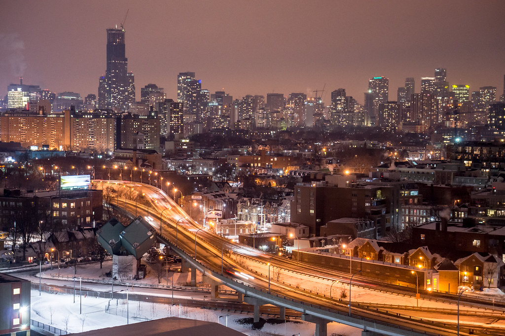
There are few vantage points that are actually able to capture the skyline like from the western edge.
Yes, I believe from where I live (Lakeshore West/Humber Park) it's probably one of the best places to capture the skyline in its entirety from Front all the way up Yonge to Yorkville. I really hate those generic postcard skyline shots of Toronto captured directly from the lakefront. IMHO that view is extremely dull.
In fact on close examination that last skyline shot you posted was captured from a penthouse in my condo
Agreed - the postcard shots from the Toronto Islands are NOT the best place to capture the skyline for depth or breadth - unlike Chicago our skyline is not muscular running parallel to the lake but perpendicular to it ..
Agreed - the postcard shots from the Toronto Islands are NOT the best place to capture the skyline for depth or breadth - unlike Chicago our skyline is not muscular running parallel to the lake but perpendicular to it ..
Its very much true - the spine of the Toronto skyline does not run east/west along the lakeshore. It runs north/south perpendicular to it through the core.. This is where you'll find the most density and even variations in height. Most of the core's buildings are not captured in traditional shots from the T.O islands.
Its very much true - the spine of the Toronto skyline does not run east/west along the lakeshore. It runs north/south perpendicular to it through the core.. This is where you'll find the most density and even variations in height. Most of the core's buildings are not captured in traditional shots from the T.O islands.
Yes those shots from TO islands pretty much capture only the most boring part of city center (aka financial district) and sterile condos/office buildings. The street level activity in that area is somewhat depressing, almost like any other deserted business district in American cities.
Its very much true - the spine of the Toronto skyline does not run east/west along the lakeshore. It runs north/south perpendicular to it through the core.. This is where you'll find the most density and even variations in height. Most of the core's buildings are not captured in traditional shots from the T.O islands.
I was smirking at the Chicago reference .... (but all in good fun) ...
Please register to post and access all features of our very popular forum. It is free and quick. Over $68,000 in prizes has already been given out to active posters on our forum. Additional giveaways are planned.
Detailed information about all U.S. cities, counties, and zip codes on our site: City-data.com.

 Please register to participate in our discussions with 2 million other members - it's free and quick! Some forums can only be seen by registered members. After you create your account, you'll be able to customize options and access all our 15,000 new posts/day with fewer ads.